Redruth

Civil Parish in Cornwall

England

Redruth

Weighing Machine Redruth Station A redundant weighing machine at Redruth Station sits as it always has set into the platform.
Weighing Machine Redruth Station Credit: Tom Jolliffe

Redruth is a civil parish and town located in the county of Cornwall, southwestern England. Situated about 9 miles (14 km) west of Truro, the town lies within the Cornwall and West Devon Mining Landscape, a UNESCO World Heritage Site. With a population of around 14,000 people, Redruth is the largest town in the area and serves as a commercial and recreational center.

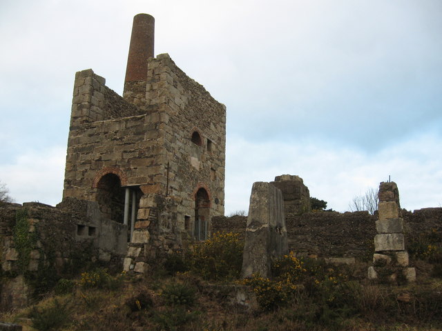
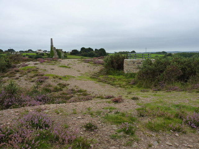
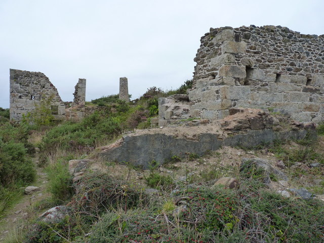
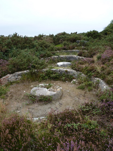
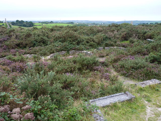
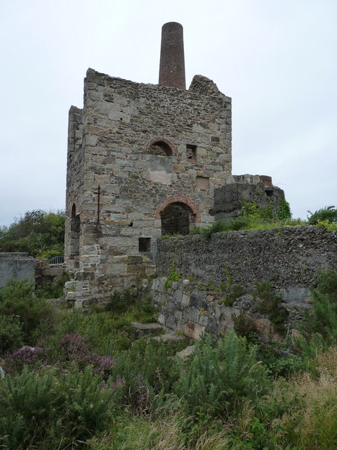
The town's history is deeply rooted in the mining industry, which thrived during the 18th and 19th centuries. Redruth was a booming mining town, known for its copper and tin production. Today, remnants of this heritage can be seen in the town's architecture and landmarks, such as the former mining engine houses and the Cornish Mining World Heritage Site Visitor Center.

Redruth offers a range of amenities and services to its residents and visitors. The town center features a variety of shops, restaurants, and cafes, providing opportunities for retail therapy and dining experiences. Additionally, Redruth is home to a leisure center, which includes a swimming pool and fitness facilities, ensuring recreational activities for all ages.

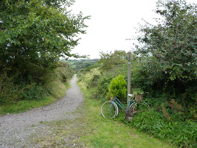
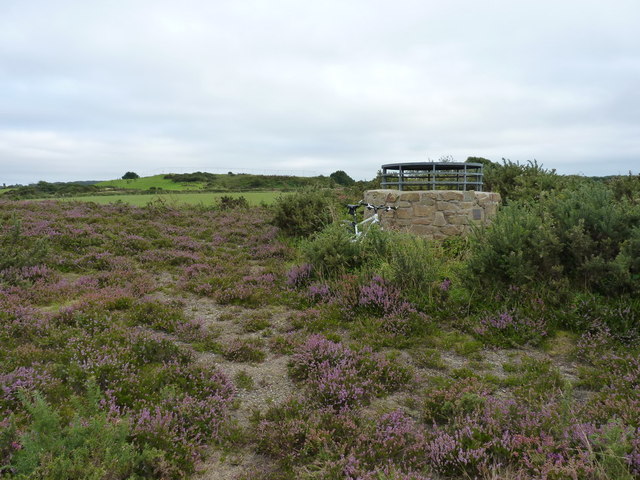
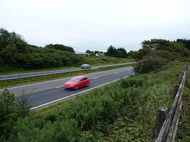
The town's location in the heart of Cornwall makes it an ideal base for exploring the surrounding area. Redruth is within close proximity to beautiful beaches, such as Portreath and Porthtowan, which are popular among surfers and sun-seekers. The nearby countryside also offers scenic walking and cycling routes, allowing visitors to immerse themselves in Cornwall's natural beauty. Redruth is well-connected by road and rail, making it easily accessible for both locals and tourists.

In summary, Redruth is a historic mining town in Cornwall, boasting a rich heritage, convenient amenities, and access to Cornwall's stunning coastline and countryside.

If you have any feedback on the listing, please let us know in the comments section below.
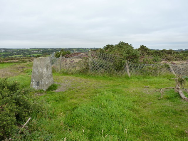
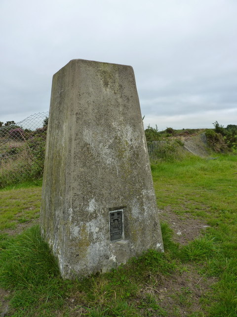
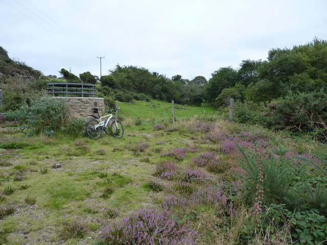
Redruth Images

Images are sourced within 2km of 50.243147/-5.228035 or Grid Reference SW6943. Thanks to Geograph Open Source API. All images are credited.

Weighing Machine Redruth Station A redundant weighing machine at Redruth Station sits as it always has set into the platform.
Weighing Machine Redruth Station
A redundant weighing machine at Redruth Station sits as it always has set into the platform.
Farm at Wheal Prussia On the eastern outskirts of Redruth is this smallholding near the former Wheal Prussia.
This photo was taken from the 1158 Penzance to London Paddington train, having left Redruth at 1231.
Farm at Wheal Prussia
On the eastern outskirts of Redruth is this smallholding near the former Wheal Prussia. This photo was taken from the 1158 Penzance to London Paddington train, having left Redruth at 1231.
Redruth Station and Footbridge
Stamps Engine House, Wheal Peevor
Redruth Railway Station Footbridge The footbridge at Redruth Station was significantly renovated two years ago. The work is holding up well and shows how such investment improves the environment.
Redruth Railway Station Footbridge
The footbridge at Redruth Station was significantly renovated two years ago. The work is holding up well and shows how such investment improves the environment.
Redruth Railway Station Footbridge The renovation of the footbridge two years ago greatly enhanced the appearance of the station. Were these the original colours of the Great Western Railway? Between the house in the background and the end of the canopy on the platform the Pednandrea Stack can be seen marking the industrial history of Redruth. Also see <a href="https://www.geograph.org.uk/photo/1904221">SW7041 : Basset Street and Pednandrea Stack, Redruth</a>
Redruth Railway Station Footbridge
The renovation of the footbridge two years ago greatly enhanced the appearance of the station. Were these the original colours of the Great Western Railway? Between the house in the background and the end of the canopy on the platform the Pednandrea Stack can be seen marking the industrial history of Redruth. Also see SW7041 : Basset Street and Pednandrea Stack, Redruth
Footbridge Redruth Railway Station The colours of the footbridge look a little too bright and cheerful to be true to the original railway company. The Great Western locomotives were painted green and the coaches were brown and cream. Wagons were painted red at one time. Pednandrea Stack can be seen in the background.
Footbridge Redruth Railway Station
The colours of the footbridge look a little too bright and cheerful to be true to the original railway company. The Great Western locomotives were painted green and the coaches were brown and cream. Wagons were painted red at one time. Pednandrea Stack can be seen in the background.
Not my bike, honest... A junction of bridleways, marked by a floral exhibit in the shopping baskets of the step-through bike.
Not my bike, honest...
A junction of bridleways, marked by a floral exhibit in the shopping baskets of the step-through bike.
Capped shaft at Wheal Briggan The Western Whim shaft of the Wheal Briggan workings, capped off in 2005.
Capped shaft at Wheal Briggan
The Western Whim shaft of the Wheal Briggan workings, capped off in 2005.
The North Downs trig A trig point sporting flushbracket S7758, situated immediately adjacent to an infilled shaft south of the Wheal Plenty complex.
The North Downs trig
A trig point sporting flushbracket S7758, situated immediately adjacent to an infilled shaft south of the Wheal Plenty complex.
North Downs trig - closeup The pillar itself is in good condition, as is the flushbracket. Sadly, the 'man with the allen key' has long since helped himself to the brasswork from the top.
North Downs trig - closeup
The pillar itself is in good condition, as is the flushbracket. Sadly, the 'man with the allen key' has long since helped himself to the brasswork from the top.
Capped shaft at Wheal Peevor An unnamed adit shaft of the Wheal Peevor mine, capped by the council in 2005. By (the highly unscientific method of) dropping a stone down it, I deduced that it was too deep to want to fall down, so they did the right thing by capping it off.
Capped shaft at Wheal Peevor
An unnamed adit shaft of the Wheal Peevor mine, capped by the council in 2005. By (the highly unscientific method of) dropping a stone down it, I deduced that it was too deep to want to fall down, so they did the right thing by capping it off.
Capped shaft and chimney at Wheal Peevor
Wheal Peevor - the remains of the calciners Brunton Calciners were an important part of the tin mining and processing system, as they removed a variety of impurities (copper, arsenic, iron) from the concentrate before it was further processed and smelted. Most of this involved huge amounts of heat, and took place in these calciners.
Wheal Peevor - the remains of the calciners
Brunton Calciners were an important part of the tin mining and processing system, as they removed a variety of impurities (copper, arsenic, iron) from the concentrate before it was further processed and smelted. Most of this involved huge amounts of heat, and took place in these calciners.
Buddles at Wheal Peevor mine The remains of three tin 'buddles' in front of the Stamps Engine House; these were separated tin particles from lighter materials, with water as a part of the process.
Buddles at Wheal Peevor mine
The remains of three tin 'buddles' in front of the Stamps Engine House; these were separated tin particles from lighter materials, with water as a part of the process.
Wheal Peevor - 3 buddles from near the calciner ruins The remains of three tin 'buddles' which were used, in conjunction with water, as a mechanism for separating tin particles from rock and waste products, prior to further refining. For a closer view, see <a href="https://www.geograph.org.uk/photo/3190691">SW7044 : Buddles at Wheal Peevor mine</a>
Wheal Peevor - 3 buddles from near the calciner ruins
The remains of three tin 'buddles' which were used, in conjunction with water, as a mechanism for separating tin particles from rock and waste products, prior to further refining. For a closer view, see SW7044 : Buddles at Wheal Peevor mine
Traffic on the A30 The main A30 dual carriageway near Radnor. A fast road; no place to be cycling on a dull evening.
Traffic on the A30
The main A30 dual carriageway near Radnor. A fast road; no place to be cycling on a dull evening.
The stamps engine house The remains of the engine house that ran the tin stamps at Wheal Peevor; the stamps, as the name suggests, were essentially ore crushers, breaking relatively small lumps of ore into finer material (stamp sand) ready for processing in the nearby buddles <a href="https://www.geograph.org.uk/photo/3190691">SW7044 : Buddles at Wheal Peevor mine</a>.
It originally housed a 36" rotative beam engine, installed in 1876, but when the mine was re-activated in 1911, alterations were made; these included the installation of a gas-oil powered engine which ran more equipment, including a machine of 20 Californian stamps.
The stamps engine house
The remains of the engine house that ran the tin stamps at Wheal Peevor; the stamps, as the name suggests, were essentially ore crushers, breaking relatively small lumps of ore into finer material (stamp sand) ready for processing in the nearby buddles SW7044 : Buddles at Wheal Peevor mine. It originally housed a 36" rotative beam engine, installed in 1876, but when the mine was re-activated in 1911, alterations were made; these included the installation of a gas-oil powered engine which ran more equipment, including a machine of 20 Californian stamps.
Show me another place!

Redruth is located at Grid Ref: SW6943 (Lat: 50.243147, Lng: -5.228035)

Unitary Authority: Cornwall

Police Authority: Devon & Cornwall

What 3 Words

///turntable.diner.wipe. Near Redruth, Cornwall

Related Wikis

Treleigh

Treleigh (Cornish: Trelegh) is a hamlet north of Redruth in Cornwall, England, United Kingdom.The ecclesiastical parish of Treleigh was taken out of the...

Highfields Private School

Highfields Private School was a fee paying coeducational independent day school in Redruth, England, catering for pupils aged 4 to 16 years. It closed...

Plain-an-Gwarry

Plain-an-Gwarry (Cornish: Plen an Gwari) is a hamlet in the west of Redruth, Cornwall, England, UK. The name derives from Cornish plen an gwari (meaning...

Gilbert's Coombe

Gilbert's Coombe is a hamlet north of Redruth in west Cornwall, England. It falls within the Redruth North division on Cornwall Council. == References ==

Kresen Kernow

Kresen Kernow (Cornish for Cornwall Centre) in Redruth, United Kingdom is Cornwall's archive centre, home to the world's biggest collection of archive...

Mount Ambrose

Mount Ambrose is a northeastern suburb of Redruth in west Cornwall, England. It falls within Redruth Central division on Cornwall Council,The suburb is...

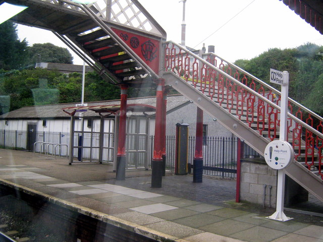
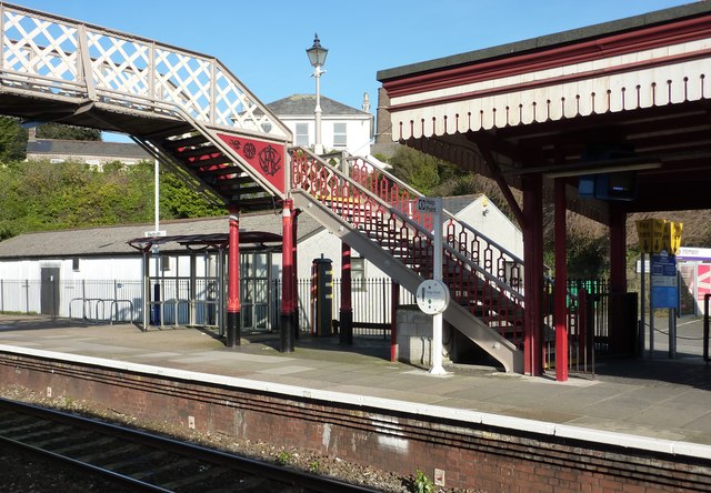
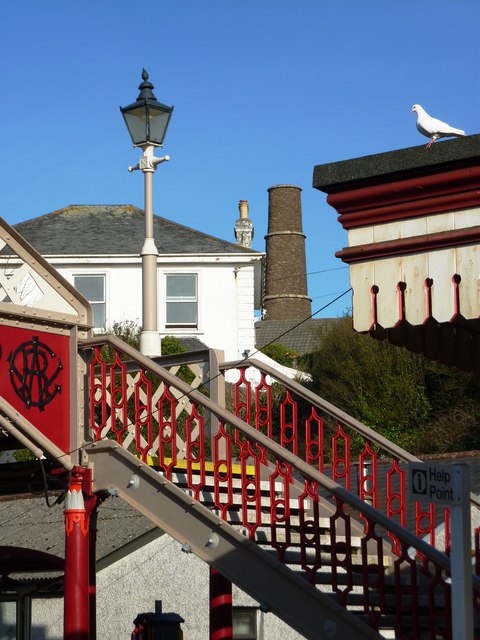
Redruth railway station

Redruth station (Cornish: Redrudh) serves the town of Redruth, Cornwall, United Kingdom, and is situated on the Cornish Main Line between Truro and Camborne...

Mining Exchange

The Mining Exchange is a Grade II listed building in Redruth, Cornwall, UK. It was constructed in 1880 at a cost of £500 to build. It is thought to have...

Related Videos

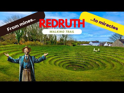
Cornwall Walking Trail - Redruth

This walk starts in the centre of Redruth, before heading to the Gwennap Pit and the Carn Marth quarry. To download a GPS of ...

Globe Vale Holiday Park Redruth Cornwall Camping and Caravan Site

Globe Vale Holiday Park Redruth Cornwall Camping and Caravan Site DJI Mavic pro drone / smart controller. Edited on Corel ...

Globe Vale Holiday Park | Best Campsite In Cornwall | Tour & HONEST Review

Join us as we give a full tour and honest review of Globe Vale Holiday Park in Cornwall. This site has a great reputation and is ...

Globe Vale - Redruth Cornwall

Drone footage over Globe Vale Redruth.

Nearby Amenities

Located within 500m of 50.243147,-5.228035
Crossing
Crossing Island: yes
Lat/Long: 50.2408616/-5.2325872
Bus Stop
Glenleigh
Bus: yes
Naptan AtcoCode: 0800COD41214
Naptan Bearing: E
Naptan CommonName: Glenleigh
Naptan Crossing: Glen Leigh
Naptan NaptanCode: corampgj
Naptan PlusbusZoneRef: CBORNE
Naptan Street: Montague Avenue
Naptan Verified: no
Public Transport: platform
Source: naptan_import
Lat/Long: 50.2410391/-5.2332204
Bus Stop
Glenleigh
Bus: yes
Naptan AtcoCode: 0800COD41215
Naptan Bearing: W
Naptan CommonName: Glenleigh
Naptan Crossing: Glen Leigh
Naptan NaptanCode: corampgt
Naptan PlusbusZoneRef: CBORNE
Naptan Street: Montague Avenue
Naptan Verified: no
Public Transport: platform
Source: naptan_import
Lat/Long: 50.2409886/-5.2333575
Bus Stop
Ambulance Station
Bus: yes
Naptan AtcoCode: 0800COD41217
Naptan Bearing: N
Naptan CommonName: Ambulance Station
Naptan Crossing: Murdoch Close
Naptan NaptanCode: corampma
Naptan PlusbusZoneRef: CBORNE
Naptan Street: Close Hill
Naptan Verified: no
Public Transport: platform
Source: naptan_import
Lat/Long: 50.2400438/-5.2323957
Bus Stop
Strawberry Lane
Bus: yes
Naptan AtcoCode: 0800COD41218
Naptan Bearing: NE
Naptan CommonName: Strawberry Lane
Naptan Crossing: Strawberry Crescent
Naptan NaptanCode: corampmw
Naptan PlusbusZoneRef: CBORNE
Naptan Street: Strawberry Lane
Naptan Verified: no
Public Transport: platform
Source: naptan_import
Lat/Long: 50.2403271/-5.2299741
Bus Stop
Jct of Murdoch Close
Bus: yes
Naptan AtcoCode: 0800COD41219
Naptan Bearing: W
Naptan CommonName: Jct of Murdoch Close
Naptan Crossing: Cardrew Close
Naptan NaptanCode: coramptm
Naptan PlusbusZoneRef: CBORNE
Naptan Street: Murdoch Close
Naptan Verified: no
Public Transport: platform
Source: naptan_import
Lat/Long: 50.2413179/-5.2287652
Bus Stop
Harmony Close
Bench: no
Bus: yes
Description: On lamp post oppoiste Hermony Close, start of parking area
Naptan AtcoCode: 0800COD41220
Naptan Bearing: N
Naptan CommonName: Harmony Close
Naptan NaptanCode: corampjt
Naptan PlusbusZoneRef: CBORNE
Naptan Street: Close Hill
Naptan Verified: no
Public Transport: platform
Shelter: no
Source: naptan_import;survey
Survey Date: 2020-10-20
Lat/Long: 50.241548/-5.2327998
Bus Stop
Harmony Close
Bench: yes
Bus: yes
Description: On the corner with service road heading East
Naptan AtcoCode: 0800COD41221
Naptan Bearing: S
Naptan CommonName: Harmony Close
Naptan NaptanCode: corampjw
Naptan PlusbusZoneRef: CBORNE
Naptan Street: Close Hill
Public Transport: platform
Shelter: yes
Source: naptan_import;survey
Survey Date: 2020-10-20
Lat/Long: 50.2418259/-5.2327222
Bus Stop
Murdoch Close
Bus: yes
Naptan AtcoCode: 0800FWX38429
Naptan Bearing: S
Naptan CommonName: Murdoch Close
Naptan Crossing: Murdoch Close
Naptan NaptanCode: coramptw
Naptan PlusbusZoneRef: CBORNE
Naptan Street: Cardrew Close
Naptan Verified: no
Public Transport: platform
Source: naptan_import
Lat/Long: 50.2411422/-5.2288089
Crossing
Crossing: unmarked
Crossing Markings: no
Kerb: regular
Sloped Curb: no
Lat/Long: 50.2410108/-5.2277313
Noexit: yes
Lat/Long: 50.2410914/-5.2259503
Turning Circle
Lat/Long: 50.2391598/-5.2261435
Noexit: yes
Lat/Long: 50.2404447/-5.2261152
Noexit: yes
Lat/Long: 50.2407861/-5.226016
Turning Circle
Lat/Long: 50.2402457/-5.2333975
Turning Circle
Lat/Long: 50.2399479/-5.231363
Barrier: bollard
Lat/Long: 50.2400854/-5.227243
Barrier: kissing_gate
Lat/Long: 50.2410869/-5.2273328
Crossing
Crossing Island: yes
Lat/Long: 50.241385/-5.2327236
Power: pole
Source: Bing; approxomate
Lat/Long: 50.2457528/-5.2334284
ALDI
Addr City: Redruth
Addr Country: GB
Addr Housename: Avers Roundabout
Addr Postcode: TR15 1FH
Addr Street: Close Hill
Brand: ALDI
Brand Wikidata: Q41171672
Brand Wikipedia: en:Aldi
Contact Website: https://stores.aldi.co.uk/redruth/avers-roundaboutclose-hill
Opening Hours: Mo-Sa 08:00-22:00; Su 10:00-16:00
Shop: supermarket
Lat/Long: 50.2426036/-5.2323766
Post Box
Brand: Royal Mail
Brand Wikidata: Q638098
Collection Times: Mo-Fr 17:00; Sa 09:00; Su off
Drive Through: no
Operator: Royal Mail
Operator Wikidata: Q638098
Post Box Design: type_c
Post Box Mounting: concrete_pillar
Post Box Type: wall
Ref: TR15 14
Royal Cypher: GR
Royal Cypher Wikidata: Q33102273
Source: survey;streetlevel imagery;aerial imagery
Lat/Long: 50.2396083/-5.2321191
Noexit: yes
Lat/Long: 50.2396244/-5.2262226
Noexit: yes
Lat/Long: 50.2399052/-5.2262409
Barrier: motorcycle_barrier
Lat/Long: 50.2418919/-5.2252478
Information: guidepost
Tourism: information
Lat/Long: 50.2417494/-5.2258397
Waste Basket
Lat/Long: 50.2412763/-5.2269005
Barrier: bollard
Lat/Long: 50.2400828/-5.2272673
Barrier: bollard
Lat/Long: 50.2391891/-5.2270272
Barrier: bollard
Lat/Long: 50.2391933/-5.2269971
Information: guidepost
Tourism: information
Lat/Long: 50.238888/-5.2269495
Waste Basket
Lat/Long: 50.2388665/-5.2269441
Waste Basket
Lat/Long: 50.2398564/-5.2237563
Barrier: lift_gate
Lat/Long: 50.2404628/-5.2233017
Generator Method: photovoltaic
Generator Output Electricity: yes
Generator Source: solar
Generator Type: solar_photovoltaic_panel
Location: roof
Power: generator
Lat/Long: 50.2425813/-5.2318139
Generator Method: photovoltaic
Generator Output Electricity: small_installation
Generator Source: solar
Generator Type: solar_photovoltaic_panel
Location: roof
Power: generator
Source: bing
Lat/Long: 50.2446835/-5.2264559
Generator Method: photovoltaic
Generator Output Electricity: small_installation
Generator Source: solar
Generator Type: solar_photovoltaic_panel
Location: roof
Power: generator
Source: bing
Lat/Long: 50.2442409/-5.2237737
Waste Basket
Source: survey;dashcam
Survey Date: 2020-10-20
Lat/Long: 50.240287/-5.2324842
Waste Basket
Source: survey;dashcam
Survey Date: 2020-10-20
Lat/Long: 50.2405271/-5.2323246
Power: pole
Lat/Long: 50.2472203/-5.230258
Power: pole
Lat/Long: 50.2469712/-5.2307307
Power: pole
Lat/Long: 50.2471311/-5.2253911
Power: pole
Lat/Long: 50.247102/-5.2264881
Power: pole
Lat/Long: 50.2467581/-5.2296209
Power: pole
Lat/Long: 50.2470205/-5.2287854
Material: wood
Power: pole
Lat/Long: 50.2470625/-5.227675
Power: pole
Lat/Long: 50.2462658/-5.230325
Power: pole
Lat/Long: 50.2419209/-5.2345642
Location Transition: yes
Power: pole
Lat/Long: 50.2435188/-5.2326599
Power: pole
Lat/Long: 50.2439991/-5.2318672
Power: pole
Lat/Long: 50.2463087/-5.2304994
Power: pole
Lat/Long: 50.2455711/-5.2297698
Power: pole
Lat/Long: 50.2448764/-5.230781
Power: pole
Lat/Long: 50.2455703/-5.2299549
Power: pole
Lat/Long: 50.2462813/-5.2306066
Power: pole
Lat/Long: 50.2464605/-5.2307569
Power: pole
Lat/Long: 50.2469279/-5.2308615
Power: pole
Lat/Long: 50.2469802/-5.2311163
Power: pole
Lat/Long: 50.2469142/-5.2310874
Power: pole
Lat/Long: 50.2468057/-5.2305731
Power: pole
Lat/Long: 50.2465698/-5.2302875
Power: pole
Lat/Long: 50.2464927/-5.2306214
Fire Station
Lat/Long: 50.2399921/-5.2325396
Ambulance Station
Emergency: ambulance_station
Lat/Long: 50.2398034/-5.2324645
Post Office
Close Hill Post Office
Addr Postcode: TR15 1EP
Addr Street: Close Hill
Brand: Post Office
Brand Wikidata: Q1783168
Opening Hours: Mo-Su 06:00-23:00
Operator: Mc Colls
Ref Pol Id: 13145
Source: pol_branch_list_2022‑05‑27
Lat/Long: 50.2395311/-5.2321939
Location Transition: yes
Power: pole
Lat/Long: 50.2431706/-5.2327591
The data included in this document is from www.openstreetmap.org. The data is made available under ODbL.

Have you been to Redruth?

Leave your review of Redruth below (or comments, questions and feedback).