Bawburgh

Civil Parish in Norfolk South Norfolk

England

Bawburgh

Bowthorpe Park Industrial Estate
Bowthorpe Park Industrial Estate Credit: Hugh Venables

Bawburgh is a civil parish located in the county of Norfolk, England. Situated approximately 6 miles west of Norwich, the parish covers an area of around 5.5 square miles. Bawburgh is a rural village with a population of around 500 residents.

The village is known for its picturesque setting, surrounded by beautiful countryside and farmland. The River Yare runs through the parish, offering scenic views and opportunities for outdoor activities such as fishing and boating. Bawburgh is also home to several nature reserves, providing habitats for a variety of wildlife and offering nature enthusiasts ample opportunities for exploration.

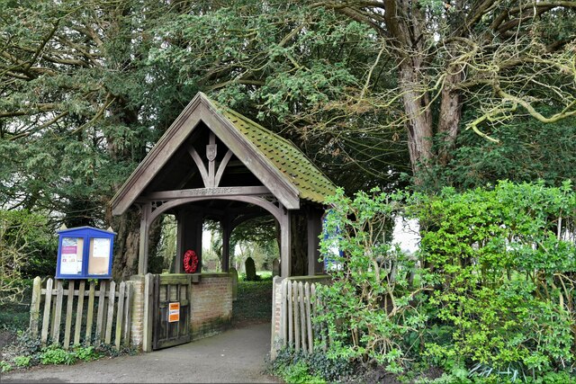
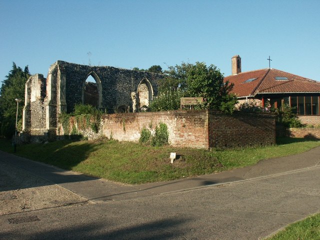
The village itself is rich in history, with evidence of human activity in the area dating back to the Roman period. Bawburgh is particularly renowned for its impressive Roman villa, discovered in the 19th century and now a popular tourist attraction. The village also features a historic church, St. Mary and St. Walstan, which dates back to the 14th century.

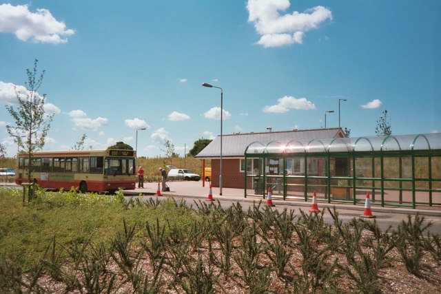
Despite its rural setting, Bawburgh benefits from convenient transport links, with the A47 road running through the parish, connecting the village to Norwich and other nearby towns. The village has a small range of amenities, including a pub, a primary school, and a village hall. Additionally, Bawburgh is within close proximity to larger towns and cities, offering residents easy access to a wider range of services and facilities.

If you have any feedback on the listing, please let us know in the comments section below.
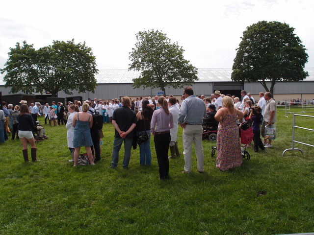
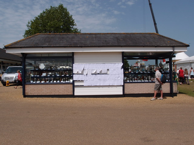
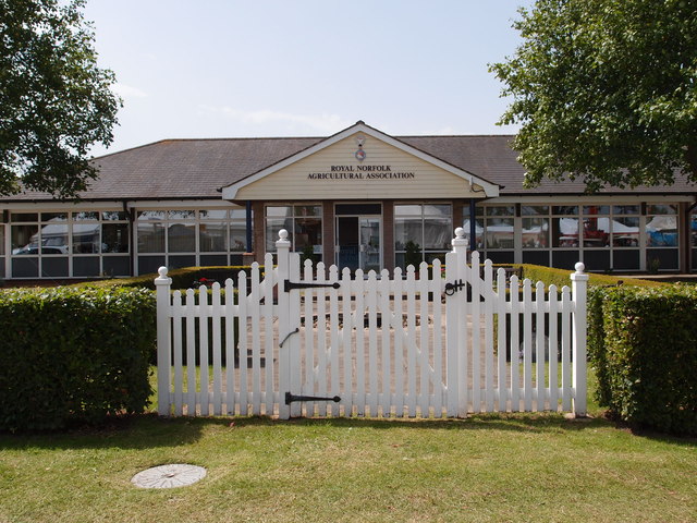
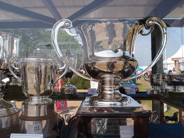
Bawburgh Images

Images are sourced within 2km of 52.634839/1.186714 or Grid Reference TG1508. Thanks to Geograph Open Source API. All images are credited.

Bowthorpe Park Industrial Estate
Bowthorpe water tower
Little Melton,  St. Mary and All Saints Church: Lych gate
Little Melton, St. Mary and All Saints Church: Lych gate
Costessey Park & Ride bus terminal The site has 1100 parking spaces and bus services to Norwich via the University of East Anglia and to the Norfolk and Norwich University Hospital.
Costessey Park & Ride bus terminal
The site has 1100 parking spaces and bus services to Norwich via the University of East Anglia and to the Norfolk and Norwich University Hospital.
Exhibition Hall and Reception area, Royal Norfolk Showground The latest addition to the Royal Norfolk Show ground at Costessey.
A Norfolk show has been held since 1847 it gained its Royal prefix in 1908. From 1953 until 1962 the show moved round the county being held on suitable parkland sites.  The present site at Costessey covers 375 acres.  New exhibition hall and reception areas are the latest additions to the multipurpose site. Average attendance for the two day show hovers around the 100,000 mark.
Exhibition Hall and Reception area, Royal Norfolk Showground
The latest addition to the Royal Norfolk Show ground at Costessey. A Norfolk show has been held since 1847 it gained its Royal prefix in 1908. From 1953 until 1962 the show moved round the county being held on suitable parkland sites. The present site at Costessey covers 375 acres. New exhibition hall and reception areas are the latest additions to the multipurpose site. Average attendance for the two day show hovers around the 100,000 mark.
Triangulation Pillar on the Royal Norfolk Show ground A well maintained Triangulation Pillar in amongst the stall holders for the annual Royal Norfolk Show.
A Norfolk show has been held since 1847 it gained its Royal prefix in 1908. From 1953 until 1962 the show moved round the county being held on suitable parkland sites.  The present site at Costessey covers 375 acres.  New exhibition hall and reception areas are the latest additions to the multi purpose site. Average attendance for the two day show hovers around the 100,000 mark.
Triangulation Pillar on the Royal Norfolk Show ground
A well maintained Triangulation Pillar in amongst the stall holders for the annual Royal Norfolk Show. A Norfolk show has been held since 1847 it gained its Royal prefix in 1908. From 1953 until 1962 the show moved round the county being held on suitable parkland sites. The present site at Costessey covers 375 acres. New exhibition hall and reception areas are the latest additions to the multi purpose site. Average attendance for the two day show hovers around the 100,000 mark.
Triangulation Pillar on the Royal Norfolk Show ground A well maintained Triangulation Pillar. Not sure how many visitors to the show notice it or know what it was used for. Leaning against probably!
Triangulation Pillar on the Royal Norfolk Show ground
A well maintained Triangulation Pillar. Not sure how many visitors to the show notice it or know what it was used for. Leaning against probably!
Flush bracket no S5280 Flush bracket for the Triangulation Pillar on the Royal Norfolk show ground <a href="https://www.geograph.org.uk/photo/3016131">TG1510 : Triangulation Pillar on the Royal Norfolk Show ground</a>
Flush bracket no S5280
Flush bracket for the Triangulation Pillar on the Royal Norfolk show ground TG1510 : Triangulation Pillar on the Royal Norfolk Show ground
Stockman's quarters Overnight accommodation for stock men who attend The Royal Norfolk Show and need to keep an eye on livestock that are being shown over the two day event.
A Norfolk show has been held since 1847 it gained its Royal prefix in 1908. From 1953 until 1962 the show moved round the county being held on suitable parkland sites. The present site Costessey covers 375 acres. New exhibition hall and reception areas are the latest additions to the multipurpose site. Average attendance for the two day show hovers around the 100,000 mark.
Stockman's quarters
Overnight accommodation for stock men who attend The Royal Norfolk Show and need to keep an eye on livestock that are being shown over the two day event. A Norfolk show has been held since 1847 it gained its Royal prefix in 1908. From 1953 until 1962 the show moved round the county being held on suitable parkland sites. The present site Costessey covers 375 acres. New exhibition hall and reception areas are the latest additions to the multipurpose site. Average attendance for the two day show hovers around the 100,000 mark.
Muck spreaders and ploughs Two long standing bits of equipment that will keep a mixed enterprise farmer happy, a plough and a muck spreader. A trade stand showing off the goods available from the  Agri-Hire (group) Ltd.
A Norfolk show has been held since 1847 it gained its Royal prefix in 1908. From 1953 until 1962 the show moved round the county being held on suitable parkland sites. The present site at Costessey covers 375 acres. New exhibition hall and reception areas are the latest additions to the multipurpose site. Average attendance for the two day show hovers around the 100,000 mark.
Muck spreaders and ploughs
Two long standing bits of equipment that will keep a mixed enterprise farmer happy, a plough and a muck spreader. A trade stand showing off the goods available from the Agri-Hire (group) Ltd. A Norfolk show has been held since 1847 it gained its Royal prefix in 1908. From 1953 until 1962 the show moved round the county being held on suitable parkland sites. The present site at Costessey covers 375 acres. New exhibition hall and reception areas are the latest additions to the multipurpose site. Average attendance for the two day show hovers around the 100,000 mark.
Livestock and exhibition buildings Infrastructure on the Royal Norfolk Show ground.
A Norfolk show has been held since 1847 it gained its Royal prefix in 1908. From 1953 until 1962 the show moved round the county being held on suitable parkland sites. The present site Costessey covers 375 acres. New exhibition hall and reception areas are the latest additions to the multipurpose site. Average attendance for the two day show hovers around the 100,000 mark.
Livestock and exhibition buildings
Infrastructure on the Royal Norfolk Show ground. A Norfolk show has been held since 1847 it gained its Royal prefix in 1908. From 1953 until 1962 the show moved round the county being held on suitable parkland sites. The present site Costessey covers 375 acres. New exhibition hall and reception areas are the latest additions to the multipurpose site. Average attendance for the two day show hovers around the 100,000 mark.
Awards presentation A presentation of awards in one of the stock judging arenas at the Royal Norfolk Show ground. 
A Norfolk show has been held since 1847 it gained its Royal prefix in 1908. From 1953 until 1962 the show moved round the county being held on suitable parkland sites. The present site Costessey covers 375 acres. New exhibition hall and reception areas are the latest additions to the multipurpose site. Average attendance for the two day show hovers around the 100,000 mark.
Awards presentation
A presentation of awards in one of the stock judging arenas at the Royal Norfolk Show ground. A Norfolk show has been held since 1847 it gained its Royal prefix in 1908. From 1953 until 1962 the show moved round the county being held on suitable parkland sites. The present site Costessey covers 375 acres. New exhibition hall and reception areas are the latest additions to the multipurpose site. Average attendance for the two day show hovers around the 100,000 mark.
Trophy cabinet More of a trophy house. All the competition winners are posted up on the notice board and the trophies, plates, cups and shields that go with the competitions can be seen either side. 
A Norfolk show has been held since 1847 it gained its Royal prefix in 1908. From 1953 until 1962 the show moved round the county being held on suitable parkland sites. The present site at Costessey covers 375 acres. New exhibition hall and reception areas are the latest additions to the multipurpose site. Average attendance for the two day show hovers around the 100,000 mark.
Trophy cabinet
More of a trophy house. All the competition winners are posted up on the notice board and the trophies, plates, cups and shields that go with the competitions can be seen either side. A Norfolk show has been held since 1847 it gained its Royal prefix in 1908. From 1953 until 1962 the show moved round the county being held on suitable parkland sites. The present site at Costessey covers 375 acres. New exhibition hall and reception areas are the latest additions to the multipurpose site. Average attendance for the two day show hovers around the 100,000 mark.
Royal Norfolk Agricultural Association Headquarters building on the show ground. 
A Norfolk show has been held since 1847 it gained its Royal prefix in 1908. From 1953 until 1962 the show moved round the county being held on suitable parkland sites. The present site Costessey covers 375 acres. New exhibition hall and reception areas are the latest additions to the multipurpose site. Average attendance for the two day show hovers around the 100,000 mark.
Royal Norfolk Agricultural Association
Headquarters building on the show ground. A Norfolk show has been held since 1847 it gained its Royal prefix in 1908. From 1953 until 1962 the show moved round the county being held on suitable parkland sites. The present site Costessey covers 375 acres. New exhibition hall and reception areas are the latest additions to the multipurpose site. Average attendance for the two day show hovers around the 100,000 mark.
A selection of trophies in the trophy room A selection of the trophies and cups that are awarded by the Royal Norfolk Agricultural Association at the annual show <a href="https://www.geograph.org.uk/photo/3016414">TG1410 : Trophy cabinet</a>.
A Norfolk show has been held since 1847, it gained its Royal prefix in 1908. From 1953 until 1962 the show moved round the county being held on suitable parkland sites. The present site at Costessey covers 375 acres. New exhibition hall and reception areas are the latest additions to the multipurpose site. Average attendance for the two-day show hovers around the 100,000 mark.
A selection of trophies in the trophy room
A selection of the trophies and cups that are awarded by the Royal Norfolk Agricultural Association at the annual show TG1410 : Trophy cabinet. A Norfolk show has been held since 1847, it gained its Royal prefix in 1908. From 1953 until 1962 the show moved round the county being held on suitable parkland sites. The present site at Costessey covers 375 acres. New exhibition hall and reception areas are the latest additions to the multipurpose site. Average attendance for the two-day show hovers around the 100,000 mark.
Bandstand at the Royal Norfolk Showground Lively music played by many school bands and orchestras are a feature of this popular form of entertainment.
A Norfolk show has been held since 1847 it gained its Royal prefix in 1908. From 1953 until 1962 the show moved round the county being held on suitable parkland sites. The present site at Costessey covers 375 acres. New exhibition hall and reception areas are the latest additions to the multipurpose site. Average attendance for the two day show hovers around the 100,000 mark.
Bandstand at the Royal Norfolk Showground
Lively music played by many school bands and orchestras are a feature of this popular form of entertainment. A Norfolk show has been held since 1847 it gained its Royal prefix in 1908. From 1953 until 1962 the show moved round the county being held on suitable parkland sites. The present site at Costessey covers 375 acres. New exhibition hall and reception areas are the latest additions to the multipurpose site. Average attendance for the two day show hovers around the 100,000 mark.
Commentary box and stands at the Royal Norfolk Show ground The 2012 Royal Norfolk Show was bathed in hot sunshine and a very high humidity. Whereas the Midlands and the North of England suffered violent thunderstorms with torrential rain and hail. The Royal Highland show appears to have been a mud bath <a href="https://www.geograph.org.uk/photo/3013743">NT1472 : 2012: year of mud</a>
A Norfolk show has been held since 1847 it gained its Royal prefix in 1908. From 1962 until 1953 the show moved round the county being held on suitable parkland sites. The present site at Costessey covers 375 acres. New exhibition hall and reception areas are the latest additions to the multipurpose site. Average attendance for the two day show hovers around the 100,000 mark.
Commentary box and stands at the Royal Norfolk Show ground
The 2012 Royal Norfolk Show was bathed in hot sunshine and a very high humidity. Whereas the Midlands and the North of England suffered violent thunderstorms with torrential rain and hail. The Royal Highland show appears to have been a mud bath NT1472 : 2012: year of mud A Norfolk show has been held since 1847 it gained its Royal prefix in 1908. From 1962 until 1953 the show moved round the county being held on suitable parkland sites. The present site at Costessey covers 375 acres. New exhibition hall and reception areas are the latest additions to the multipurpose site. Average attendance for the two day show hovers around the 100,000 mark.
Show me another place!

Bawburgh is located at Grid Ref: TG1508 (Lat: 52.634839, Lng: 1.186714)

Administrative County: Norfolk

District: South Norfolk

Police Authority: Norfolk

What 3 Words

///subject.gliders.loudness. Near Bowthorpe, Norfolk

Nearby Locations

Bawburgh Bawburgh

Related Wikis

Bawburgh

Bawburgh () is a village and civil parish in the South Norfolk district of Norfolk, England, lying in the valley of the River Yare about 5 miles (8.0 km...
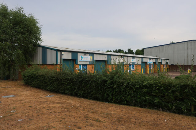
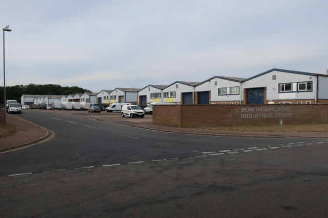
Bowthorpe

Bowthorpe is a suburban village to the west of Norwich, in the county of Norfolk, England. == Geography == Bowthorpe is primarily a residential area, but...

Easton College

Easton College is a college of further and higher education in Norfolk, United Kingdom. It is located on a 200-hectare (490-acre) campus in the village...

Little Melton

Little Melton is a village on the outskirts of Norwich in the South Norfolk district of Norfolk, England. It covers an area of 2.75 km2 (1.06 sq mi) and...

Earlham Institute

Earlham Institute (EI, formerly The Genome Analysis Centre (TGAC)) is a life science research institute located at the Norwich Research Park (NRP), Norwich...

Bowthorpe Marsh

Bowthorpe Marsh is a 5.9-hectare (15-acre) Local Nature Reserve in Norwich in Norfolk. It is owned and managed by Norwich City Council.This site adjacent...

Ormiston Victory Academy

Ormiston Victory Academy (formerly Costessey High School) is a secondary school and sixth form located in Costessey, Norfolk, England. The academy has...

Norwich CBS F.C.

Norwich CBS Football Club is a football club based in Norwich, England. They are currently members of the Eastern Counties League Division One North and...

Nearby Amenities

Located within 500m of 52.634839,1.186714
Bawburgh
Description: The carved sign depicts St Walstan
Man Made: village_sign
Material: wood
Place: village
Wikidata: Q1785668
Wikipedia: en:Bawburgh
Lat/Long: 52.6322959/1.1841943
Kings Head, adj
Naptan AtcoCode: 2900B121
Naptan Bearing: SE
Naptan BusStopType: CUS
Naptan CommonName: Kings Head
Naptan Indicator: adj
Naptan Landmark: public house
Naptan Locality: Bawburgh
Naptan NaptanCode: nfoadpwa
Naptan ShortCommonName: Kings Head
Naptan Street: Harts Lane
Naptan Verified: no
Source: naptan_import
Lat/Long: 52.6341733/1.1835679
Church Street, adj
Naptan AtcoCode: 2900B122
Naptan Bearing: N
Naptan BusStopType: CUS
Naptan CommonName: Church Street
Naptan Indicator: adj
Naptan Landmark: village green
Naptan Locality: Bawburgh
Naptan NaptanCode: nfoadpwd
Naptan Street: Stocks Hill
Naptan Verified: no
Source: naptan_import
Lat/Long: 52.6323636/1.1843086
Church Street, opp
Naptan AtcoCode: 2900B123
Naptan Bearing: SW
Naptan BusStopType: CUS
Naptan CommonName: Church Street
Naptan Indicator: opp
Naptan Landmark: Hockering Lane
Naptan Locality: Bawburgh
Naptan NaptanCode: nfoadpwg
Naptan Street: Stocks Hill
Naptan Verified: no
Source: naptan_import
Lat/Long: 52.6323878/1.1844138
Kings Head, opp
Naptan AtcoCode: 2900B124
Naptan Bearing: NW
Naptan BusStopType: CUS
Naptan CommonName: Kings Head
Naptan Indicator: opp
Naptan Landmark: Kings Head public house
Naptan Locality: Bawburgh
Naptan NaptanCode: nfoadpwj
Naptan Street: Harts Lane
Naptan Verified: no
Source: naptan_import
Lat/Long: 52.6338789/1.1838126
Turning Circle
Lat/Long: 52.6321208/1.1896873
Give Way
Lat/Long: 52.6321832/1.1842713
Grit Bin
Source: bing
Lat/Long: 52.6326535/1.1845007
Give Way
Lat/Long: 52.6322643/1.1840554
Turning Circle
Lat/Long: 52.6320927/1.1888099
Barrier: bollard
Lat/Long: 52.6340221/1.1837628
Power: pole
Lat/Long: 52.6353109/1.1841665
Power: pole
Lat/Long: 52.6366342/1.1850582
Power: pole
Lat/Long: 52.6378859/1.1861102
Power: pole
Lat/Long: 52.639123/1.1871687
Location Transition: yes
Power: pole
Transformer: distribution
Lat/Long: 52.6307716/1.1847009
Location Transition: yes
Power: pole
Transformer: distribution
Lat/Long: 52.6311957/1.1844206
Power: pole
Lat/Long: 52.6312071/1.184611
Location Transition: yes
Power: pole
Lat/Long: 52.631711/1.1859937
Give Way
Lat/Long: 52.632463/1.1843133
Give Way
Lat/Long: 52.6335248/1.184649
Waste Basket
Lat/Long: 52.6330792/1.1846297
Entrance: yes
Lat/Long: 52.6311443/1.1840021
Bench
Lat/Long: 52.6312047/1.1840101
Entrance: main
Lat/Long: 52.6312363/1.1840001
Bicycle Parking
Bicycle Parking: wall_loops
Capacity: 5
Covered: no
Lat/Long: 52.6313129/1.18399
Post Box
Collection Times: Mo-Fr 16:45; Sa 08:45
Operator: Royal Mail
Post Box Mounting: pier
Post Box Type: lamp
Ref: NR9 900
Royal Cypher: EIIR
Royal Cypher Wikidata: Q33102113
Lat/Long: 52.6331345/1.1846457
Information: board
Lat/Long: 52.6330515/1.1846216
Defibrillator
Addr Postcode: NR9 3LL
Defibrillator Location: On exterior wall of Bawburgh Village Hall, just to the left of the main entrance.
Emergency: defibrillator
Ref GB The Circuit: 5EE9F6E7-660F-4FA2-A03B-B12B00C342D9
Lat/Long: 52.6312253/1.1840003
Turning Loop
Lat/Long: 52.6376245/1.1816338
Generator Method: photovoltaic
Generator Output Electricity: yes
Generator Solar Modules: 12
Generator Source: solar
Generator Type: solar_photovoltaic_panel
Location: roof
Power: generator
Lat/Long: 52.6323694/1.1857161
Generator Method: photovoltaic
Generator Output Electricity: yes
Generator Solar Modules: 8
Generator Source: solar
Generator Type: solar_photovoltaic_panel
Location: roof
Power: generator
Lat/Long: 52.6323645/1.1862619
Generator Method: photovoltaic
Generator Output Electricity: yes
Generator Solar Modules: 21
Generator Source: solar
Generator Type: solar_photovoltaic_panel
Location: roof
Power: generator
Lat/Long: 52.6323014/1.1865871
Generator Method: photovoltaic
Generator Output Electricity: yes
Generator Solar Modules: 14
Generator Source: solar
Generator Type: solar_photovoltaic_panel
Location: roof
Power: generator
Lat/Long: 52.6323014/1.186681
Generator Method: photovoltaic
Generator Output Electricity: yes
Generator Solar Modules: 18
Generator Source: solar
Generator Type: solar_photovoltaic_panel
Location: roof
Power: generator
Lat/Long: 52.6327674/1.1890675
Generator Method: photovoltaic
Generator Output Electricity: yes
Generator Solar Modules: 18
Generator Source: solar
Generator Type: solar_photovoltaic_panel
Location: roof
Power: generator
Lat/Long: 52.6327711/1.1892526
Generator Method: photovoltaic
Generator Output Electricity: yes
Generator Solar Modules: 12
Generator Source: solar
Generator Type: solar_photovoltaic_panel
Location: roof
Power: generator
Lat/Long: 52.6326575/1.1895597
Generator Method: photovoltaic
Generator Output Electricity: yes
Generator Solar Modules: 12
Generator Source: solar
Generator Type: solar_photovoltaic_panel
Location: roof
Power: generator
Lat/Long: 52.63266/1.1896656
Generator Method: photovoltaic
Generator Output Electricity: yes
Generator Solar Modules: 14
Generator Source: solar
Generator Type: solar_photovoltaic_panel
Location: roof
Power: generator
Lat/Long: 52.6326645/1.18984
Generator Method: photovoltaic
Generator Output Electricity: yes
Generator Solar Modules: 16
Generator Source: solar
Generator Type: solar_photovoltaic_panel
Location: roof
Power: generator
Lat/Long: 52.6324732/1.1901042
Generator Method: photovoltaic
Generator Output Electricity: yes
Generator Solar Modules: 20
Generator Source: solar
Generator Type: solar_photovoltaic_panel
Location: roof
Power: generator
Lat/Long: 52.6323173/1.1897354
Generator Method: photovoltaic
Generator Output Electricity: yes
Generator Solar Modules: 20
Generator Source: solar
Generator Type: solar_photovoltaic_panel
Location: roof
Power: generator
Lat/Long: 52.6323132/1.1895744
Generator Method: photovoltaic
Generator Output Electricity: yes
Generator Solar Modules: 20
Generator Source: solar
Generator Type: solar_photovoltaic_panel
Location: roof
Power: generator
Lat/Long: 52.6323075/1.1894189
Generator Method: photovoltaic
Generator Output Electricity: yes
Generator Solar Modules: 21
Generator Source: solar
Generator Type: solar_photovoltaic_panel
Location: roof
Power: generator
Lat/Long: 52.6321928/1.1892385
Generator Method: photovoltaic
Generator Output Electricity: yes
Generator Solar Modules: 20
Generator Source: solar
Generator Type: solar_photovoltaic_panel
Location: roof
Power: generator
Lat/Long: 52.6325452/1.1881435
Generator Method: photovoltaic
Generator Output Electricity: yes
Generator Solar Modules: 16
Generator Source: solar
Generator Type: solar_photovoltaic_panel
Location: roof
Power: generator
Lat/Long: 52.6318928/1.1891714
Generator Method: photovoltaic
Generator Output Electricity: yes
Generator Solar Modules: 13
Generator Source: solar
Generator Type: solar_photovoltaic_panel
Location: roof
Power: generator
Lat/Long: 52.6318818/1.1887215
Generator Method: photovoltaic
Generator Output Electricity: yes
Generator Solar Modules: 14
Generator Source: solar
Generator Type: solar_photovoltaic_panel
Location: roof
Power: generator
Lat/Long: 52.6318867/1.1888731
Waste Basket
Waste: dog_excrement
Lat/Long: 52.6326755/1.1845394
The data included in this document is from www.openstreetmap.org. The data is made available under ODbL.

Have you been to Bawburgh?

Leave your review of Bawburgh below (or comments, questions and feedback).