Allington

Civil Parish in Lincolnshire South Kesteven

England

Allington

Holy Trinity church, Allington From the south east.
Holy Trinity church, Allington Credit: Julian P Guffogg

Allington is a civil parish located in the county of Lincolnshire, England. It falls within the administrative district of South Kesteven and is situated approximately 5 miles southwest of Grantham. The parish covers an area of around 1,200 acres and has a population of approximately 200 residents.

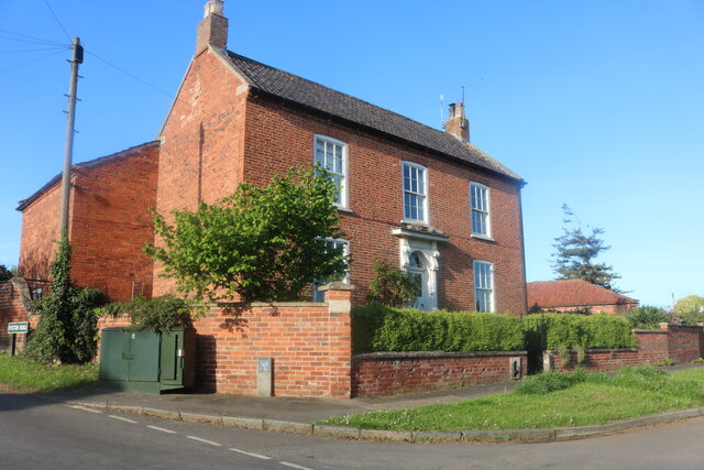
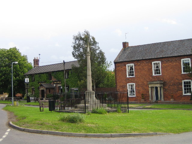
Allington is a charming village known for its picturesque countryside and historic buildings. The village is characterized by its traditional stone houses and cottages, many of which date back several centuries. One of the notable landmarks in Allington is the Grade I listed Allington Manor, a magnificent manor house built in the 15th century. The manor has been well-preserved and serves as a reminder of the village's rich history.

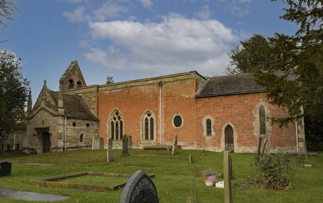
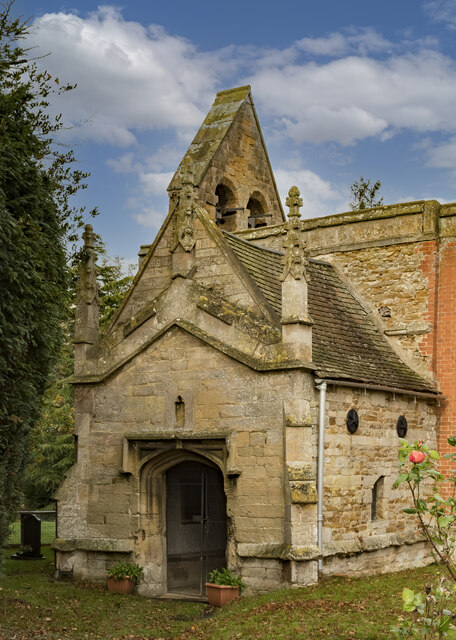
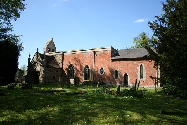
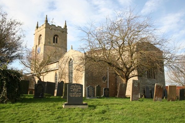
The village also boasts a beautiful church, the Church of St. John the Baptist, which was built in the Norman period. The church features stunning architectural elements and houses several interesting historical artifacts. Allington also has a primary school, providing education to the local children.

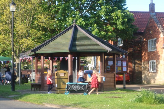
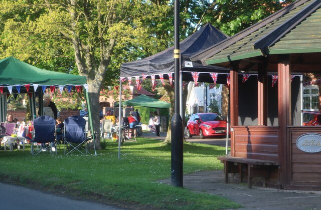
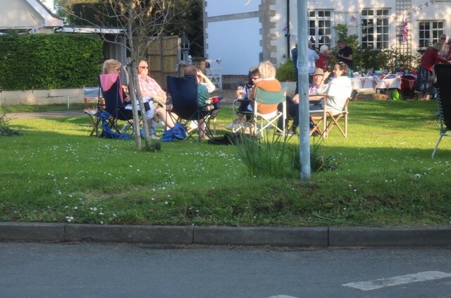
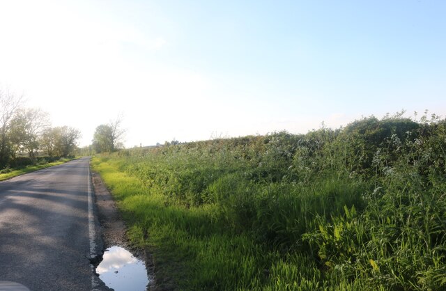
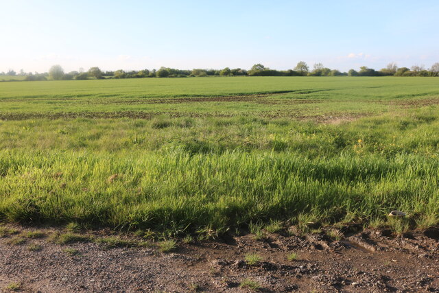
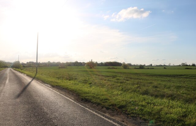
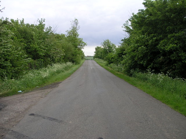
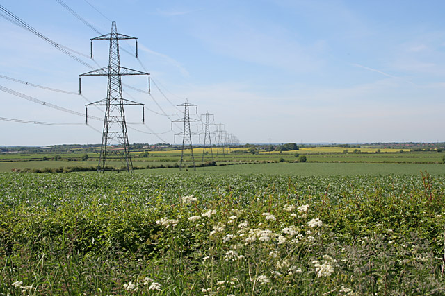
Allington has a strong sense of community, with various local events and activities taking place throughout the year. The village is surrounded by open fields and farmland, offering residents and visitors ample opportunities for countryside walks and outdoor pursuits.

Overall, Allington is a charming and historic village in Lincolnshire, known for its picturesque scenery, traditional architecture, and strong community spirit.

If you have any feedback on the listing, please let us know in the comments section below.

Allington Images

Images are sourced within 2km of 52.954909/-0.727359 or Grid Reference SK8540. Thanks to Geograph Open Source API. All images are credited.

Holy Trinity church, Allington From the south east.
Holy Trinity church, Allington
From the south east.
South Porch, Holy Trinity church, Allington The porch is located at the west end.
South Porch, Holy Trinity church, Allington
The porch is located at the west end.
Reset Mass dial, Holy Trinity church, Allington The stone was inverted.
Reset Mass dial, Holy Trinity church, Allington
The stone was inverted.
Sign for Bottom Street, Allington Well I thought it was funny.
Sign for Bottom Street, Allington
Well I thought it was funny.
Bottom Street, Allington
House on The Green, Allington
Coronation party on The Green, Allington
Gonerby Lane leading to Allington
Field by Gonerby Lane, Allington
Gonerby Lane, Allington
Foston Service Station  On the Great North Road
Foston Service Station
On the Great North Road
The Village Green, Allington
Holy Trinity church, West Allington, Lincs. A patchwork of medieval stone and 18th century brick, Holy Trinity has a Norman south doorway and a north arcade of c1200 and all sorts of stonework said to have come from the demolished church of East Allington. A fascinating archaeological conundrum.
Holy Trinity church, West Allington, Lincs.
A patchwork of medieval stone and 18th century brick, Holy Trinity has a Norman south doorway and a north arcade of c1200 and all sorts of stonework said to have come from the demolished church of East Allington. A fascinating archaeological conundrum.
Trees and Road This view looking south looks straight over the village of Allington and beyond.
Trees and Road
This view looking south looks straight over the village of Allington and beyond.
Cowlady Lane, Allington This is a public right of way leading to the Viking Way long distance footpath. Off Bottesford Road and adjacent to the Old Vicarage.
Cowlady Lane, Allington
This is a public right of way leading to the Viking Way long distance footpath. Off Bottesford Road and adjacent to the Old Vicarage.
Miles of pylons Looking north west from Bottesford Road. The square boundary is just beyond the fourth pylon. This electricity supply line comes from Cottam Power Station in <a href="https://www.geograph.org.uk/gridref/SK8179">SK8179</a>, one of the many power stations along the River Trent ( <span class="nowrap"><a title="http://www.edfenergy.com/html/showPage.do?name=edfenergy.about.energy.cottam.til" rel="nofollow ugc noopener" href="http://www.edfenergy.com/html/showPage.do?name=edfenergy.about.energy.cottam.til">Link</a><img style="margin-left:2px;" alt="External link" title="External link - shift click to open in new window" src="https://s1.geograph.org.uk/img/external.png" width="10" height="10"/></span> for information).
Miles of pylons
Looking north west from Bottesford Road. The square boundary is just beyond the fourth pylon. This electricity supply line comes from Cottam Power Station in SK8179, one of the many power stations along the River Trent ( LinkExternal link for information).
Show me another place!

Allington is located at Grid Ref: SK8540 (Lat: 52.954909, Lng: -0.727359)

Administrative County: Lincolnshire

District: South Kesteven

Police Authority: Lincolnshire

What 3 Words

///segmented.camped.tools. Near Great Gonerby, Lincolnshire

Related Wikis

Nearby Amenities

Located within 500m of 52.954909,-0.727359
Allington
Is In: Lincolnshire, England, UK
Is In County: Lincolnshire
Place: village
Lat/Long: 52.9529688/-0.7242715
Created By: Merkaartor 0.12
Lat/Long: 52.956839/-0.7248129
Created By: Merkaartor 0.12
Lat/Long: 52.953407/-0.7218109
Created By: Merkaartor 0.12
Lat/Long: 52.953648/-0.7240099
Created By: Merkaartor 0.12
Lat/Long: 52.9536023/-0.7246041
Created By: Merkaartor 0.12
Lat/Long: 52.9535633/-0.7255903
Created By: Merkaartor 0.12
Lat/Long: 52.9525089/-0.7227999
Bus Stop
The Green
Bus: yes
Naptan AtcoCode: 2700LAP02961
Naptan Bearing: N
Naptan BusStopType: CUS
Naptan CommonName: The Green
Naptan Indicator: opp
Naptan Landmark: The Green
Naptan NaptanCode: linawdgd
Naptan Street: Main Street
Naptan Verified: no
Public Transport: platform
Source: naptan_import
Lat/Long: 52.9529417/-0.7259513
Bus Stop
The Green
Bus: yes
Naptan AtcoCode: 2700LATG2780
Naptan Bearing: S
Naptan CommonName: The Green
Naptan Indicator: adj
Naptan Landmark: The Green
Naptan NaptanCode: linatpgd
Naptan Street: Main Street
Naptan Verified: no
Public Transport: platform
Source: naptan_import
Lat/Long: 52.9529579/-0.7257871
Bench
Ele: 25.0000000
Lat/Long: 52.9534033/-0.7254967
Pub
Welby Arms
Addr City: Grantham
Addr Postcode: NG32 2EA
Addr Street: The Green
Addr Suburb: Allington
Description Floor: stone
Ele: 25
Fhrs Authority: South Kesteven
Fhrs Id: 238044
Fhrs Local Authority Id: 3667
Food: yes
Outdoor Seating: yes
Real Ale: John Smiths, 5 guests
Real Fire: yes
Lat/Long: 52.9527699/-0.7256684
Bench
Backrest: yes
Mapillary: 189080409616124
Survey Date: 2017-06-01
Lat/Long: 52.951811/-0.7244315
Description: War Memorial
Historic: memorial
Lat/Long: 52.9525543/-0.7261562
Post Box
Lat/Long: 52.9526534/-0.7262094
Allington Village Stores
Shop: convenience
Lat/Long: 52.9527762/-0.7263113
Generator Method: photovoltaic
Generator Output Electricity: yes
Generator Source: solar
Generator Type: solar_photovoltaic_panel
Location: roof
Power: generator
Lat/Long: 52.9510859/-0.725201
Generator Method: photovoltaic
Generator Output Electricity: yes
Generator Source: solar
Generator Type: solar_photovoltaic_panel
Location: roof
Power: generator
Lat/Long: 52.9533402/-0.7273602
Generator Method: photovoltaic
Generator Output Electricity: yes
Generator Source: solar
Generator Type: solar_photovoltaic_panel
Location: roof
Power: generator
Lat/Long: 52.95207/-0.7291734
Generator Method: photovoltaic
Generator Output Electricity: yes
Generator Source: solar
Generator Type: solar_photovoltaic_panel
Location: roof
Power: generator
Lat/Long: 52.9537991/-0.7296615
Generator Method: photovoltaic
Generator Output Electricity: yes
Generator Source: solar
Generator Type: solar_photovoltaic_panel
Location: roof
Power: generator
Lat/Long: 52.9510006/-0.7283364
Generator Method: photovoltaic
Generator Output Electricity: yes
Generator Source: solar
Generator Type: solar_photovoltaic_panel
Location: roof
Power: generator
Lat/Long: 52.9521722/-0.7304098
Generator Method: photovoltaic
Generator Output Electricity: yes
Generator Source: solar
Generator Type: solar_photovoltaic_panel
Location: roof
Power: generator
Lat/Long: 52.9527733/-0.7272984
Generator Method: photovoltaic
Generator Output Electricity: yes
Generator Source: solar
Generator Type: solar_photovoltaic_panel
Location: roof
Power: generator
Lat/Long: 52.9550324/-0.7282399
Generator Method: photovoltaic
Generator Output Electricity: yes
Generator Source: solar
Generator Type: solar_photovoltaic_panel
Location: roof
Power: generator
Lat/Long: 52.9550098/-0.7281299
Generator Method: photovoltaic
Generator Output Electricity: yes
Generator Source: solar
Generator Type: solar_photovoltaic_panel
Location: roof
Power: generator
Lat/Long: 52.9545395/-0.7260056
Generator Method: photovoltaic
Generator Output Electricity: yes
Generator Source: solar
Generator Type: solar_photovoltaic_panel
Location: roof
Power: generator
Lat/Long: 52.953389/-0.7245304
Generator Method: photovoltaic
Generator Output Electricity: yes
Generator Source: solar
Generator Type: solar_photovoltaic_panel
Location: roof
Power: generator
Lat/Long: 52.9532129/-0.7236801
Generator Source: solar
Location: roof
Power: generator
Lat/Long: 52.9528435/-0.7226495
Allington Manor
Addr City: Grantham
Addr Housename: Old Manor House
Addr Postcode: NG32 2DH
Addr Street: Bottesford Road
Addr Suburb: Allington
Tourism: hotel
Lat/Long: 52.951912/-0.7272971
The data included in this document is from www.openstreetmap.org. The data is made available under ODbL.

Have you been to Allington?

Leave your review of Allington below (or comments, questions and feedback).