Trelái

Community in Glamorgan

Wales

Trelái

Ordnance Survey Cut Mark This OS cut mark can be found on No491 Cowbridge Road West. It marks a point 58.577m above mean sea level.
Ordnance Survey Cut Mark Credit: Adrian Dust

Trelái, also known as Ely, is a community located in the county of Glamorgan, Wales. Situated on the western outskirts of Cardiff, it is part of the City of Cardiff unitary authority.

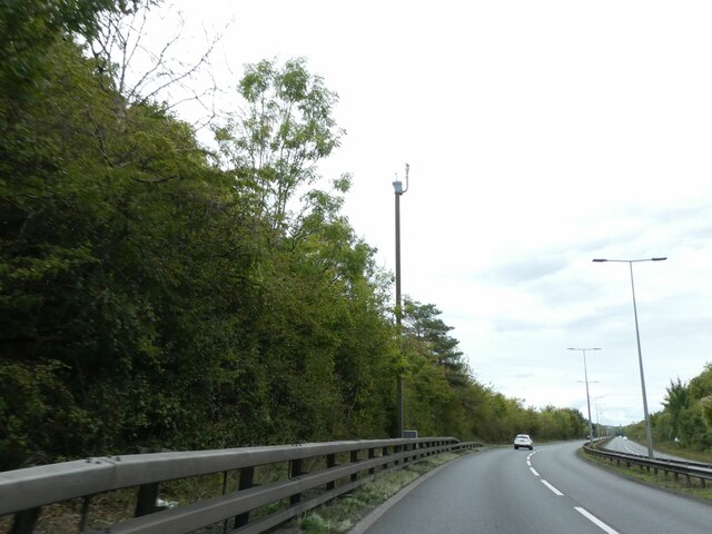
Trelái covers an area of approximately 4 square kilometers and is a densely populated community, with a mix of residential, commercial, and industrial areas. The community is well-connected to the rest of Cardiff and surrounding areas through a network of roads and public transportation, including several bus routes that serve the area.

The community has a rich history, with evidence of human habitation dating back thousands of years. In more recent years, Trelái has undergone significant urban development, with the construction of housing estates and commercial centers. The area has a diverse population, with a mix of cultural backgrounds and ethnicities.

Trelái offers a range of amenities and facilities to its residents, including schools, healthcare services, shopping centers, and recreational spaces. It is home to several parks and green areas, providing opportunities for outdoor activities and leisure.

Despite its urban character, Trelái also benefits from its proximity to natural landscapes, such as the nearby River Ely and surrounding countryside. This allows residents to enjoy a balance between urban conveniences and access to nature.

Overall, Trelái is a vibrant and dynamic community that offers a mix of residential, commercial, and recreational opportunities for its residents.

If you have any feedback on the listing, please let us know in the comments section below.
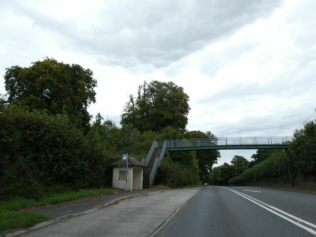
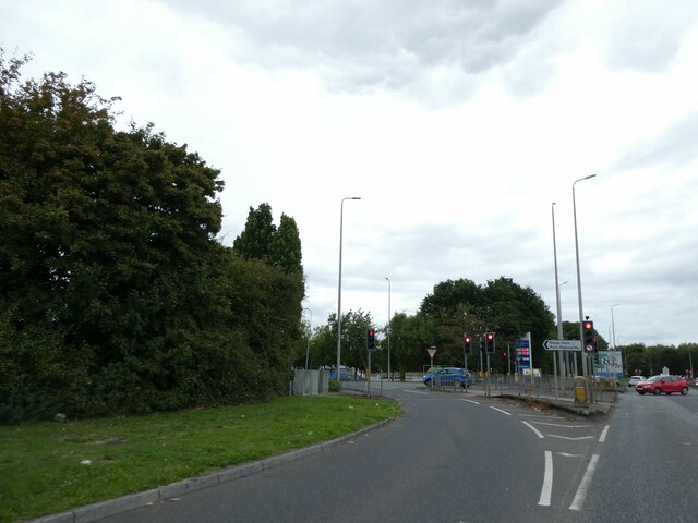
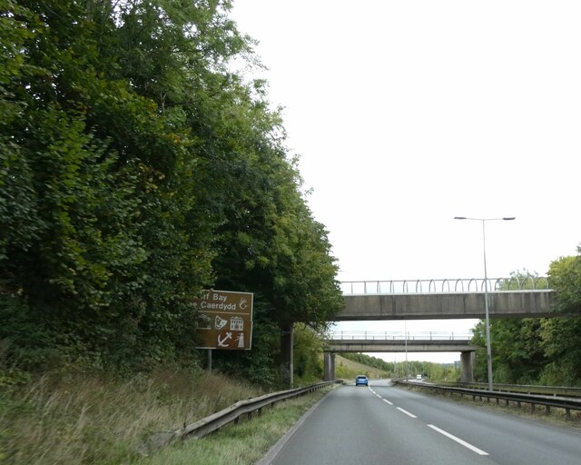
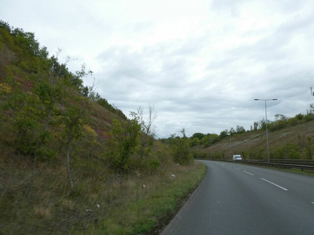
Trelái Images

Images are sourced within 2km of 51.471661/-3.268831 or Grid Reference ST1175. Thanks to Geograph Open Source API. All images are credited.

Ordnance Survey Cut Mark This OS cut mark can be found on No491 Cowbridge Road West. It marks a point 58.577m above mean sea level.
Ordnance Survey Cut Mark
This OS cut mark can be found on No491 Cowbridge Road West. It marks a point 58.577m above mean sea level.
Ordnance Survey Cut Mark This OS cut mark can be found on the SW angle of the cemetery wall on Cowbridge Road West. It marks a point 65.556m above mean sea level.
Ordnance Survey Cut Mark
This OS cut mark can be found on the SW angle of the cemetery wall on Cowbridge Road West. It marks a point 65.556m above mean sea level.
Parish Church of St George, St. Georges-super-Ely This is a Grade II listed building and is one of the smallest cruciform churches in Wales. The church was restored in 1838, 1857 and again in 1886.
Sadly, the church is no longer in regular use, though the burial ground is still being used judging by the dates of recent internments.
Parish Church of St George, St. Georges-super-Ely
This is a Grade II listed building and is one of the smallest cruciform churches in Wales. The church was restored in 1838, 1857 and again in 1886. Sadly, the church is no longer in regular use, though the burial ground is still being used judging by the dates of recent internments.
The A4232 at Culverhouse Cross
Rebuilding The Vulcan Hotel (2) The public house from Adamstown, Cardiff will be restored to its state in 1915. It is due to be completed in 2023 and will be a licensed premises.
Rebuilding The Vulcan Hotel (2)
The public house from Adamstown, Cardiff will be restored to its state in 1915. It is due to be completed in 2023 and will be a licensed premises.
Ordnance Survey Cut Mark This OS cut mark can be found on NW angle of St Michael's Church. It marks a point 34.211m above mean sea level.
Ordnance Survey Cut Mark
This OS cut mark can be found on NW angle of St Michael's Church. It marks a point 34.211m above mean sea level.
Ordnance Survey Flush Bracket (G3716) This OS Flush Bracket can be found on the wall SE side of Tumbledown. It marks a point 129.527m above mean sea level.
Ordnance Survey Flush Bracket (G3716)
This OS Flush Bracket can be found on the wall SE side of Tumbledown. It marks a point 129.527m above mean sea level.
Ordnance Survey Cut Mark This OS cut mark can be found on the wall SE side of Tumbledown. It marks a point 114.489m above mean sea level.
Ordnance Survey Cut Mark
This OS cut mark can be found on the wall SE side of Tumbledown. It marks a point 114.489m above mean sea level.
Ordnance Survey Cut Mark This OS cut mark can be found on the wall SW side of Tumbledown. It marks a point 103.919m above mean sea level.
Ordnance Survey Cut Mark
This OS cut mark can be found on the wall SW side of Tumbledown. It marks a point 103.919m above mean sea level.
Tesco superstore, Culverhouse
Footbridge over A48 at Downs. serving bus stop
Slip road off A48 for eastbound traffic entering Culverhouse retail park
Footbridge and road bridge over A4232 east of Culverhouse Cross
A4232 in cutting near Caerau
Traffic camera on A4232 near Caerau
War memorial, St Fagan's churchyard
Hayshed and wagon, St Fagan's museum Described in <a href="https://www.geograph.org.uk/photo/4723925">ST1177 : Hayshed at St Fagan's Museum of Welsh Life</a>
Hayshed and wagon, St Fagan's museum
Oakdale Workman's Institute at St Fagan's museum These images are from <span class="nowrap"><a title="http://www.milestonesociety.co.uk/" rel="nofollow ugc noopener" href="http://www.milestonesociety.co.uk/">Link</a><img style="margin-left:2px;" alt="External link" title="External link - shift click to open in new window" src="https://s1.geograph.org.uk/img/external.png" width="10" height="10"/></span>
Oakdale Workman's Institute at St Fagan's museum
These images are from LinkExternal link
Show me another place!

Trelái is located at Grid Ref: ST1175 (Lat: 51.471661, Lng: -3.268831)

Unitary Authority: Cardiff

Police Authority: South Wales

Also known as: Ely

What 3 Words

///corn.woven.update. Near Wenvoe, Vale of Glamorgan

Nearby Locations

Trelái Ely

Related Wikis

Western Cemetery (Cardiff)

Western Cemetery is a major cemetery located in the western suburb of Ely, Cardiff, Wales. It is located near the Culverhouse Cross roundabout on the A48...

Michaelston-super-Ely

Michaelston-super-Ely (Welsh: Llanfihangel-ar-Elai; meaning: llan church + Mihangel Saint Michael + Elai River Ely) is a village, to the west of the city...

Culverhouse Cross

Culverhouse Cross (Welsh: Croes Cwrlwys) is a district straddling the boundary between Cardiff and the Vale of Glamorgan, Wales, in the community of Wenvoe...

Copthorne Hotel, Cardiff

Copthorne Hotel Cardiff‍—‌Caerdydd is a four star hotel (formerly five star) in Culverhouse Cross, a western suburb of Cardiff, capital of Wales. The hotel...

Nearby Amenities

Located within 500m of 51.471661,-3.268831
Traffic Signals
Lat/Long: 51.4677799/-3.2672481
Traffic Calming: cushion
Lat/Long: 51.4727269/-3.269499
Traffic Calming: cushion
Lat/Long: 51.4709328/-3.2685463
Traffic Signals
Traffic Signals Direction: forward
Lat/Long: 51.467177/-3.269014
Pub
The Culverhouse
Created By: Potlatch 0.6c
Lat/Long: 51.4695032/-3.2625646
Traffic Calming: hump
Lat/Long: 51.4724156/-3.2625577
Traffic Calming: cushion
Lat/Long: 51.4714908/-3.2617981
Pub
The Wanderers
Created By: Potlatch 0.7b
Lat/Long: 51.4749862/-3.2670407
Spar
Addr City: Cardiff
Addr Housenumber: 105-107
Addr Postcode: CF5 4SY
Addr Street: Michaelston Road
Brand: Spar
Brand Wikidata: Q610492
Fhrs Id: 968746
Opening Hours: Mo-Sa 06:00-22:00; Su 07:00-22:00
Phone: +44 29 2059 7766
Shop: convenience
Website: https://www.spar.co.uk/store-locator/afb10532-spar-culverhouse-cross/
Lat/Long: 51.4738261/-3.2697571
Speed Camera
Lat/Long: 51.4698106/-3.2627342
Bus Stop
Cowbridge Road
Mapillary: 1726769301046358
Survey Date: 2021-06-27
Lat/Long: 51.4675349/-3.2680155
Traffic Signals
Lat/Long: 51.4676897/-3.2671419
Noexit: yes
Lat/Long: 51.4752557/-3.2644987
Traffic Calming: cushion
Lat/Long: 51.4743763/-3.2682666
In 'n' Out
Addr City: Cardiff
Addr Postcode: CF5 5TG
Addr Street: Cowbridge Road West
Opening Hours: Mo-Fr 08:30-17:30; Sa 08:00-17:00
Phone: +44 29 2067 9249
Shop: car_repair
Source: survey
Website: https://www.inoautocentres.co.uk/locations/cardiff
Lat/Long: 51.4676336/-3.2665999
Traffic Calming: cushion
Lat/Long: 51.472342/-3.2627842
Traffic Calming: cushion
Lat/Long: 51.4726404/-3.2632841
Traffic Calming: cushion
Lat/Long: 51.4739048/-3.2674295
Traffic Calming: cushion
Lat/Long: 51.4730054/-3.264751
Traffic Calming: hump
Lat/Long: 51.4730654/-3.2626943
Traffic Calming: cushion
Lat/Long: 51.4733098/-3.2660652
Traffic Calming: cushion
Lat/Long: 51.4718824/-3.2622065
Traffic Calming: cushion
Lat/Long: 51.4739378/-3.2694277
Traffic Calming: cushion
Lat/Long: 51.4744596/-3.2689805
Crossing
Crossing: zebra
Lat/Long: 51.4741637/-3.2693673
Traffic Calming: cushion
Lat/Long: 51.4695649/-3.2683211
Traffic Calming: cushion
Lat/Long: 51.4679761/-3.2685787
Traffic Calming: cushion
Lat/Long: 51.4688804/-3.2683473
Traffic Calming: cushion
Lat/Long: 51.4701692/-3.2684166
Traffic Calming: cushion
Lat/Long: 51.4721006/-3.2691964
Check Date: 2022-05-02
Traffic Calming: cushion
Lat/Long: 51.4715756/-3.2688357
Traffic Calming: cushion
Lat/Long: 51.473092/-3.2695654
Direction: 215
Generator Method: photovoltaic
Generator Output Electricity: yes
Generator Solar Modules: 7
Generator Source: solar
Generator Type: solar_photovoltaic_panel
Location: roof
Power: generator
Lat/Long: 51.4735839/-3.2664
Direction: 190
Generator Method: photovoltaic
Generator Output Electricity: yes
Generator Solar Modules: 12
Generator Source: solar
Generator Type: solar_photovoltaic_panel
Location: roof
Power: generator
Lat/Long: 51.4757809/-3.2660647
Direction: 124
Generator Method: photovoltaic
Generator Output Electricity: yes
Generator Solar Modules: 4
Generator Source: solar
Generator Type: solar_photovoltaic_panel
Location: roof
Power: generator
Lat/Long: 51.4735572/-3.2662896
Direction: SSE
Generator Method: photovoltaic
Generator Output Electricity: yes
Generator Solar Modules: 9
Generator Source: solar
Generator Type: solar_photovoltaic_panel
Location: roof
Power: generator
Lat/Long: 51.4738749/-3.265341
Direction: 215
Generator Method: photovoltaic
Generator Output Electricity: yes
Generator Solar Modules: 6
Generator Source: solar
Generator Type: solar_photovoltaic_panel
Location: roof
Power: generator
Lat/Long: 51.4735633/-3.2663556
Direction: SSE
Generator Method: photovoltaic
Generator Output Electricity: yes
Generator Solar Modules: 9
Generator Source: solar
Generator Type: solar_photovoltaic_panel
Location: roof
Power: generator
Lat/Long: 51.4738996/-3.2652803
Crossing
Crossing: traffic_signals
Crossing Ref: pelican
Lat/Long: 51.467797/-3.2668957
Crossing
Crossing: traffic_signals
Crossing Ref: pelican
Lat/Long: 51.4678399/-3.2670899
Direction: 275
Generator Method: photovoltaic
Generator Output Electricity: yes
Generator Solar Modules: 10
Generator Source: solar
Generator Type: solar_photovoltaic_panel
Location: roof
Power: generator
Lat/Long: 51.4753971/-3.2705626
Direction: 275
Generator Method: photovoltaic
Generator Output Electricity: yes
Generator Solar Modules: 10
Generator Source: solar
Generator Type: solar_photovoltaic_panel
Location: roof
Power: generator
Lat/Long: 51.4750116/-3.2706508
Direction: 195
Generator Method: photovoltaic
Generator Output Electricity: yes
Generator Solar Modules: 12
Generator Source: solar
Generator Type: solar_photovoltaic_panel
Location: roof
Power: generator
Lat/Long: 51.4737181/-3.2720285
Direction: 105
Generator Method: photovoltaic
Generator Output Electricity: yes
Generator Solar Modules: 4
Generator Source: solar
Generator Type: solar_photovoltaic_panel
Location: roof
Power: generator
Lat/Long: 51.4699397/-3.270506
Direction: 105
Generator Method: photovoltaic
Generator Output Electricity: yes
Generator Solar Modules: 11
Generator Source: solar
Generator Type: solar_photovoltaic_panel
Location: roof
Power: generator
Lat/Long: 51.4699854/-3.2704808
Direction: 190
Generator Method: photovoltaic
Generator Output Electricity: yes
Generator Solar Modules: 8
Generator Source: solar
Generator Type: solar_photovoltaic_panel
Location: roof
Power: generator
Lat/Long: 51.4693432/-3.2704631
Direction: 175
Generator Method: photovoltaic
Generator Output Electricity: yes
Generator Solar Modules: 16
Generator Source: solar
Generator Type: solar_photovoltaic_panel
Location: roof
Power: generator
Lat/Long: 51.4720265/-3.2759408
Direction: WSW
Generator Method: photovoltaic
Generator Output Electricity: yes
Generator Solar Modules: 14
Generator Source: solar
Generator Type: solar_photovoltaic_panel
Location: roof
Power: generator
Lat/Long: 51.4698517/-3.2723175
Direction: 125
Generator Method: photovoltaic
Generator Output Electricity: yes
Generator Solar Modules: 15
Generator Source: solar
Generator Type: solar_photovoltaic_panel
Location: roof
Power: generator
Lat/Long: 51.4686343/-3.2717069
Direction: 235
Generator Method: photovoltaic
Generator Output Electricity: yes
Generator Solar Modules: 7
Generator Source: solar
Generator Type: solar_photovoltaic_panel
Location: roof
Power: generator
Lat/Long: 51.4715777/-3.2635339
Direction: WSW
Generator Method: photovoltaic
Generator Output Electricity: yes
Generator Solar Modules: 16
Generator Source: solar
Generator Type: solar_photovoltaic_panel
Location: roof
Power: generator
Lat/Long: 51.4748071/-3.2679401
Direction: 190
Generator Method: photovoltaic
Generator Output Electricity: yes
Generator Solar Modules: 17
Generator Source: solar
Generator Type: solar_photovoltaic_panel
Location: roof
Power: generator
Lat/Long: 51.4682066/-3.2692131
Direction: W
Generator Method: photovoltaic
Generator Output Electricity: yes
Generator Solar Modules: 8
Generator Source: solar
Generator Type: solar_photovoltaic_panel
Location: roof
Power: generator
Lat/Long: 51.469117/-3.2685922
Direction: E
Generator Method: photovoltaic
Generator Output Electricity: yes
Generator Solar Modules: 8
Generator Source: solar
Generator Type: solar_photovoltaic_panel
Location: roof
Power: generator
Lat/Long: 51.4691172/-3.2685345
Direction: SSW
Generator Method: photovoltaic
Generator Output Electricity: yes
Generator Solar Modules: 18
Generator Source: solar
Generator Type: solar_photovoltaic_panel
Location: roof
Power: generator
Lat/Long: 51.4703816/-3.2713401
Direction: 190
Generator Method: photovoltaic
Generator Output Electricity: yes
Generator Solar Modules: 15
Generator Source: solar
Generator Type: solar_photovoltaic_panel
Location: roof
Power: generator
Lat/Long: 51.4696151/-3.269999
Direction: 190
Generator Method: photovoltaic
Generator Output Electricity: yes
Generator Solar Modules: 18
Generator Source: solar
Generator Type: solar_photovoltaic_panel
Location: roof
Power: generator
Lat/Long: 51.4696276/-3.2700909
Direction: 190
Generator Method: photovoltaic
Generator Output Electricity: yes
Generator Solar Modules: 12
Generator Source: solar
Generator Type: solar_photovoltaic_panel
Location: roof
Power: generator
Lat/Long: 51.4693603/-3.2705241
Direction: SSE
Generator Method: photovoltaic
Generator Output Electricity: yes
Generator Solar Modules: 15
Generator Source: solar
Generator Type: solar_photovoltaic_panel
Location: roof
Power: generator
Lat/Long: 51.4695316/-3.2712054
Direction: 100
Generator Method: photovoltaic
Generator Output Electricity: yes
Generator Solar Modules: 14
Generator Source: solar
Generator Type: solar_photovoltaic_panel
Location: roof
Power: generator
Lat/Long: 51.4687041/-3.2710662
Direction: SW
Generator Method: photovoltaic
Generator Output Electricity: yes
Generator Solar Modules: 9
Generator Source: solar
Generator Type: solar_photovoltaic_panel
Location: roof
Power: generator
Lat/Long: 51.4698505/-3.2752431
Direction: 165
Generator Method: photovoltaic
Generator Output Electricity: yes
Generator Solar Modules: 10
Generator Source: solar
Generator Type: solar_photovoltaic_panel
Location: roof
Power: generator
Lat/Long: 51.4727595/-3.2755968
Direction: SSW
Generator Method: photovoltaic
Generator Output Electricity: yes
Generator Solar Modules: 12
Generator Source: solar
Generator Type: solar_photovoltaic_panel
Location: roof
Power: generator
Lat/Long: 51.4739822/-3.271712
Direction: SE
Generator Method: photovoltaic
Generator Output Electricity: yes
Generator Solar Modules: 12
Generator Source: solar
Generator Type: solar_photovoltaic_panel
Location: roof
Power: generator
Lat/Long: 51.4689535/-3.2632409
Post Box
Check Date: 2018-01-09
Mapillary: 1075892189481016
Operator: Royal Mail
Operator Wikidata: Q638098
Post Box Type: pillar
Lat/Long: 51.4685306/-3.2649775
Post Box
Check Date: 2019-10-15
Operator: Royal Mail
Operator Wikidata: Q638098
Post Box Type: pillar
Source: streetlevel imagery
Lat/Long: 51.4738764/-3.2696756
Post Box
Operator: Royal Mail
Operator Wikidata: Q638098
Post Box Type: pillar
Source: bing;aerial imagery
Lat/Long: 51.4694364/-3.2706632
Glan Ely News
Addr City: Cardiff
Addr Housenumber: 111
Addr Postcode: CF5 4SY
Addr Street: Michaelston Road
Fhrs Id: 1028102
Shop: newsagent
Lat/Long: 51.4739592/-3.2697205
Fast Food
mansang
Addr City: Cardiff
Addr Housenumber: 115
Addr Postcode: CF5 4SY
Addr Street: Michaelston Road
Cuisine: chinese;fish_and_chips
Fhrs Id: 968441
Lat/Long: 51.474054/-3.2696945
Post Office
Michaelston Road Post Office
Addr City: Cardiff
Addr Housenumber: 111
Addr Postcode: CF5 4SY
Addr Street: Michaelston Road
Brand: Post Office
Brand Wikidata: Q1783168
Opening Hours: Mo-Fr 09:30-17:00; Sa 09:30-14:00
Ref Pol Id: 147959
Lat/Long: 51.4739432/-3.2697249
David Lucas Bookmaker
Addr City: Cardiff
Addr Housenumber: 109
Addr Postcode: CF5 4SY
Addr Street: Michaelston Road
Shop: bookmaker
Lat/Long: 51.4738958/-3.2697379
The Market Garden Florist
Addr City: Cardiff
Addr Housenumber: 113
Addr Postcode: CF5 4SY
Addr Street: Michaelston Road
Contact Facebook: themarketgardencardiff
Email: info@floristcardiff.com
Phone: +44 29 2059 3889
Shop: florist
Website: https://www.floristcardiff.com/
Lat/Long: 51.474009/-3.2697069
Cafe
The Range Coffee Shop
Addr City: Cardiff
Addr Postcode: CF5 4UG
Addr Street: Patreane Way
Cuisine: coffee_shop
Fhrs Id: 1376162
Note: location approximate
Source: fhrs
Lat/Long: 51.4674437/-3.2700106
Bus Stop
Llanover Rd
Bench: yes
Bus: yes
Lit: yes
Public Transport: platform
Shelter: yes
Lat/Long: 51.4717685/-3.2688928
Bus Stop
Llanover Rd
Bench: no
Bus: yes
Lit: yes
Public Transport: platform
Shelter: no
Lat/Long: 51.4715579/-3.2688981
Bus Stop
Llanover Road
Bench: yes
Bus: yes
Lit: yes
Public Transport: platform
Shelter: yes
Lat/Long: 51.468418/-3.2683757
Bus Stop
Llanover Rd
Bench: no
Bus: yes
Lit: yes
Public Transport: platform
Shelter: no
Lat/Long: 51.4687175/-3.2684422
Traffic Signals
Traffic Signals: signal
Traffic Signals Direction: forward
Lat/Long: 51.4673703/-3.2687214
Traffic Signals
Traffic Signals: signal
Traffic Signals Direction: forward
Lat/Long: 51.4671956/-3.2684946
Cycleway: asl
Direction: forward
Lat/Long: 51.4672058/-3.2684675
Crossing
Crossing: uncontrolled
Lat/Long: 51.467204/-3.2689837
Crossing
Crossing: uncontrolled
Lat/Long: 51.467232/-3.2688173
Crossing
Crossing: uncontrolled
Lat/Long: 51.4673442/-3.2687103
Crossing
Crossing: uncontrolled
Lat/Long: 51.467762/-3.2695727
The data included in this document is from www.openstreetmap.org. The data is made available under ODbL.

Have you been to Trelái?

Leave your review of Trelái below (or comments, questions and feedback).