Wood End

Settlement in Herefordshire

England

Wood End

Farmland near Alder's End Farmland near Alder's End above the village of Tarrington.
Farmland near Alder's End Credit: Philip Halling

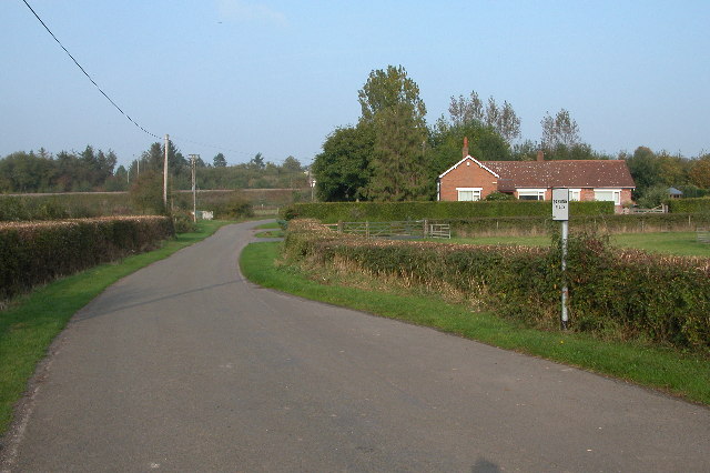
Wood End is a small rural village located in the county of Herefordshire, England. Situated approximately 10 miles northeast of Hereford city, it is nestled amidst picturesque countryside and offers residents a tranquil and idyllic setting.

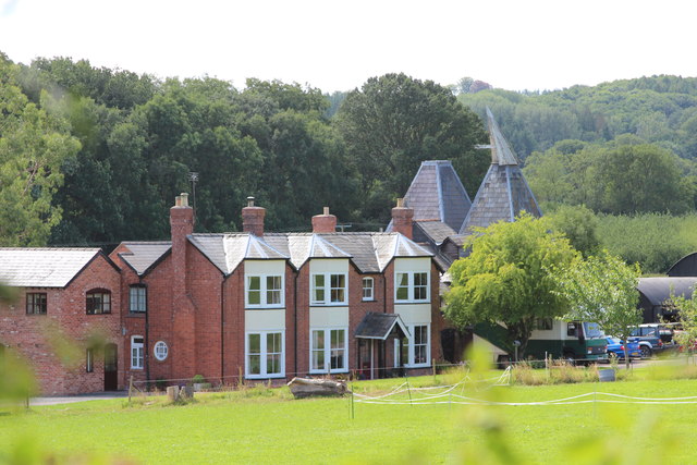
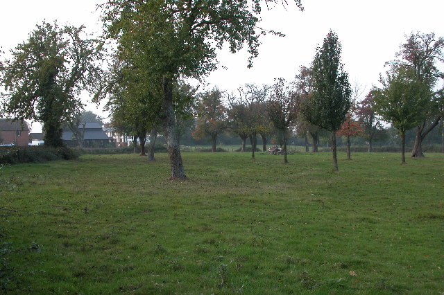
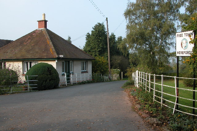
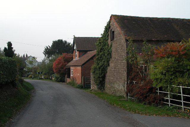
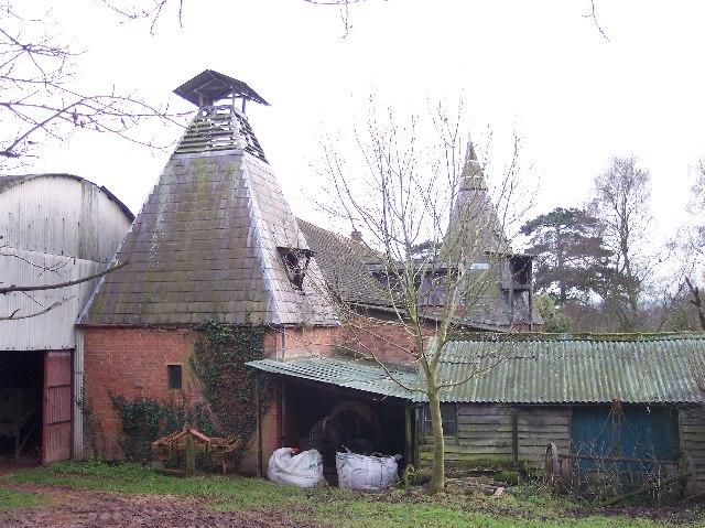
The village is characterized by its charming collection of traditional cottages and farmhouses, many of which date back several centuries. These historic buildings are constructed from local materials, predominantly timber and stone, which adds to the area's rustic charm. The overall aesthetic of Wood End is one of natural beauty and untouched rural landscapes.

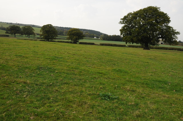
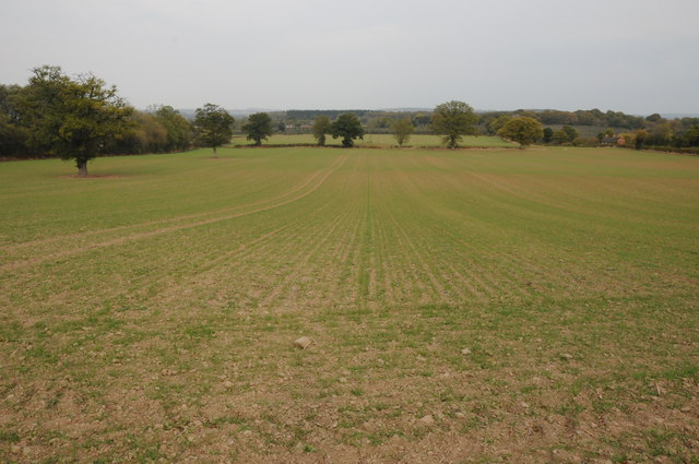
The village is home to a close-knit community, with a population of around 200 residents. The local economy primarily revolves around agriculture and farming, with several working farms still operating in the area. This agricultural heritage is evident in the rolling fields and pastures that surround the village, which provide a stunning backdrop for countryside walks and outdoor pursuits.

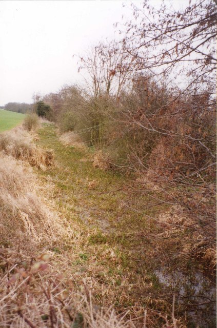
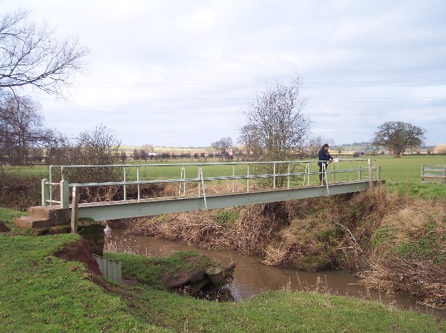
Wood End benefits from its proximity to the Wye Valley Area of Outstanding Natural Beauty, which is just a short distance to the west. This allows residents and visitors to enjoy an array of outdoor activities, including hiking, cycling, and fishing in the nearby River Wye.

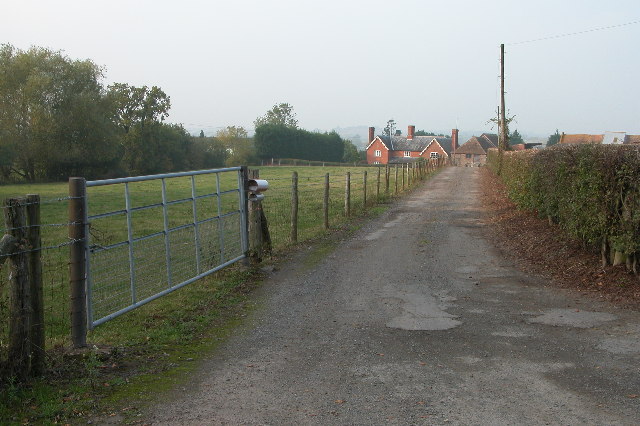
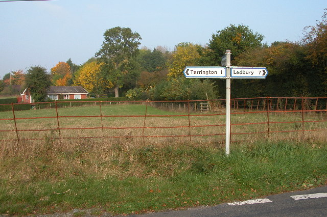
Although the village itself does not have many amenities, the nearby town of Hereford offers a wider range of services, including shops, schools, and healthcare facilities. Wood End is well-connected to the surrounding areas via a network of country roads, making it easily accessible to both residents and visitors alike.

Overall, Wood End is a picturesque and peaceful village, offering a rural lifestyle and a strong sense of community, making it an attractive place to reside for those seeking a slower pace of life in the heart of Herefordshire.

If you have any feedback on the listing, please let us know in the comments section below.

Wood End Images

Images are sourced within 2km of 52.067218/-2.5328395 or Grid Reference SO6341. Thanks to Geograph Open Source API. All images are credited.

Farmland near Alder's End Farmland near Alder's End above the village of Tarrington.
Farmland near Alder's End
Farmland near Alder's End above the village of Tarrington.
Arable land at Durlow Common A recently planted field of winter cereals at Durlow Common.
Arable land at Durlow Common
A recently planted field of winter cereals at Durlow Common.
Oast House at Merryvale Farm, Trumpet Two square kiln oast house.
Oast House at Merryvale Farm, Trumpet
Two square kiln oast house.
Gateway to Canon Frome Court This grand entrance leads to the church as well as the Georgian mansion, which has served as a County Secondary School but is now flats.  Note that the car park for the church is a narrow right turn just before the gates leading into the curtilage of the house, beyond which tourists are not welcome!
Gateway to Canon Frome Court
This grand entrance leads to the church as well as the Georgian mansion, which has served as a County Secondary School but is now flats. Note that the car park for the church is a narrow right turn just before the gates leading into the curtilage of the house, beyond which tourists are not welcome!
Disused Canal, Canon Frome This was taken looking SE from the road bridge.
Disused Canal, Canon Frome
This was taken looking SE from the road bridge.
Ashperton Church Ashperton church is dedicated to St Bartholomew.
Ashperton Church
Ashperton church is dedicated to St Bartholomew.
Moat at Ashperton Site of Ashperton Castle and moat, the motte (on the right) is now completely overgrown with trees. A licence was granted to William de Grandison to crenelate in 1292.
Moat at Ashperton
Site of Ashperton Castle and moat, the motte (on the right) is now completely overgrown with trees. A licence was granted to William de Grandison to crenelate in 1292.
Lower Town, near Ashperton Driveway to farm at Lower Town, near Ashperton.
Lower Town, near Ashperton
Driveway to farm at Lower Town, near Ashperton.
Orchard at Wood End near Ashperton
Road junction near Tarrington Road junction on quiet country lanes between Tarrington and Ashperton.
Road junction near Tarrington
Road junction on quiet country lanes between Tarrington and Ashperton.
Free Town Herefords Entrance to a farm at Free Town in Little Tarrington. Home of one of the very top Hereford cattle breeders.
<span class="nowrap"><a title="http://www.free-town.co.uk/beef/info.html" rel="nofollow ugc noopener" href="http://www.free-town.co.uk/beef/info.html">Link</a><img style="margin-left:2px;" alt="External link" title="External link - shift click to open in new window" src="https://s1.geograph.org.uk/img/external.png" width="10" height="10"/></span>
<span class="nowrap"><a title="http://www.herefordtimes.com/news/features/farming/3598934.Two_famous_herds_triumph_at_National_Hereford_Show/" rel="nofollow ugc noopener" href="http://www.herefordtimes.com/news/features/farming/3598934.Two_famous_herds_triumph_at_National_Hereford_Show/">Link</a><img style="margin-left:2px;" alt="External link" title="External link - shift click to open in new window" src="https://s1.geograph.org.uk/img/external.png" width="10" height="10"/></span>
Free Town Herefords
Entrance to a farm at Free Town in Little Tarrington. Home of one of the very top Hereford cattle breeders. LinkExternal link LinkExternal link
Little Tarrington Road through the small village of Little Tarrington.
Little Tarrington
Road through the small village of Little Tarrington.
Passing Place on the lane to Little Tarrington In the background is an embankment carrying the Hereford to Worcester railway line.
Passing Place on the lane to Little Tarrington
In the background is an embankment carrying the Hereford to Worcester railway line.
Tarrington Church The church is dedicated to St Philip & St James, much of the church is Norman, however, the tower dates from the 15th century.
Tarrington Church
The church is dedicated to St Philip & St James, much of the church is Norman, however, the tower dates from the 15th century.
The Hereford to Worcester railway This is a view eastwards towards Ledbury from the road bridge near the Trumpet.
The Hereford to Worcester railway
This is a view eastwards towards Ledbury from the road bridge near the Trumpet.
Footbridge Over the River Frome Just down stream from where the river Lodon joins it.
Footbridge Over the River Frome
Just down stream from where the river Lodon joins it.
Moat at Freetown Farm Now an ornamental feature, but when built would have provided some security as well as providing the farmstead with high status. Recognized as a historic site on the Herefordshire County's Sites and Monuments Record.
Moat at Freetown Farm
Now an ornamental feature, but when built would have provided some security as well as providing the farmstead with high status. Recognized as a historic site on the Herefordshire County's Sites and Monuments Record.
Two Styles of Oast Houses, Freetown I think the round oast house is earlier, but the square one must be simpler to construct.
Two Styles of Oast Houses, Freetown
I think the round oast house is earlier, but the square one must be simpler to construct.
Show me another place!

Wood End is located at Grid Ref: SO6341 (Lat: 52.067218, Lng: -2.5328395)

Unitary Authority: County of Herefordshire

Police Authority: West Mercia

What 3 Words

///gong.cage.pranced. Near Ocle Pychard, Herefordshire

Nearby Locations

Wood End

Related Wikis

Ashperton

Ashperton is a small village, parish and former manor about twelve miles east of the City of Hereford, in Herefordshire, England. The village is on the...

Ashperton railway station

Ashperton railway station was a railway station serving the village of Ashperton in Herefordshire, England. It was located on what is now known as the...

Alder's End

Alder's End is a small village in Herefordshire, England. It is about 8 miles (13 km) east of Hereford and is near the A438 road. The village falls within...

Tarrington

Tarrington is a small village in Herefordshire, England located halfway between Ledbury and Hereford on the A438 road. == The village == The village has...

Nearby Amenities

Located within 500m of 52.067218,-2.5328395
Post Box
Collection Times: Mo-Fr 09:30; Sa 09:30
Post Box Mounting: wooden_post
Post Box Type: lamp
Ref: HR8 476
Royal Cypher: ER
Lat/Long: 52.0665147/-2.5330134
Power: pole
Source: bing
Lat/Long: 52.0713358/-2.5353447
Power: pole
Source: bing
Lat/Long: 52.0705584/-2.5350858
Wood End Poultry
Power: pole
Source: bing
Transformer: distribution
Voltage Primary: 11000
Lat/Long: 52.0689591/-2.5305475
Power: pole
Source: bing
Lat/Long: 52.0698247/-2.5348297
Power: pole
Source: bing
Lat/Long: 52.0697703/-2.5341497
Power: pole
Source: bing
Lat/Long: 52.0696722/-2.5330903
Power: pole
Source: bing
Lat/Long: 52.0696063/-2.5323325
Power: pole
Source: bing
Lat/Long: 52.0695494/-2.5316928
Power: pole
Source: bing
Lat/Long: 52.0694867/-2.5309901
Information: board
Tourism: information
Lat/Long: 52.0664943/-2.5330207
Power: pole
Lat/Long: 52.0679187/-2.5397126
Little Tarrington Cottages
Power: pole
Transformer: distribution
Voltage Primary: 11000
Lat/Long: 52.067636/-2.5397864
Power: pole
Lat/Long: 52.0682089/-2.5396375
Power: pole
Lat/Long: 52.0689674/-2.5394511
Power: pole
Lat/Long: 52.068624/-2.5336871
Wood End
Power: pole
Transformer: distribution
Voltage Primary: 11000
Lat/Long: 52.0680668/-2.5331863
Power: pole
Lat/Long: 52.0692172/-2.5342617
Poppinger
Power: pole
Transformer: distribution
Voltage Primary: 11000
Lat/Long: 52.0641123/-2.5294445
The data included in this document is from www.openstreetmap.org. The data is made available under ODbL.

Have you been to Wood End?

Leave your review of Wood End below (or comments, questions and feedback).