Whitehaughs

Settlement in Yorkshire

England

Whitehaughs

The 643, Lindley Moor Road
The 643, Lindley Moor Road Credit: Ian S

Whitehaughs is a small village located in the picturesque region of Yorkshire, England. Situated amidst rolling hills and lush green landscapes, this charming village offers a peaceful and idyllic setting for its residents and visitors alike.

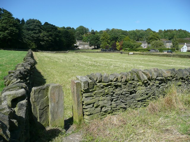
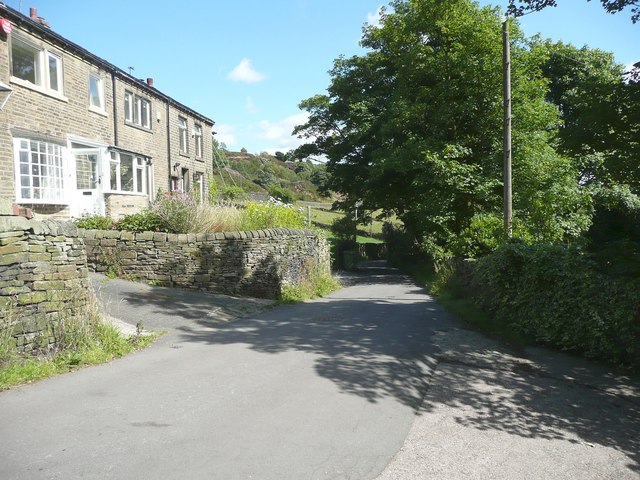
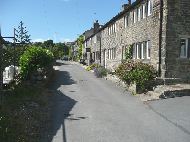
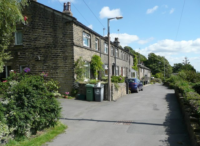
With a population of approximately 500, Whitehaughs maintains a close-knit community where neighbors know each other by name. The village is characterized by its traditional stone houses and quaint cottages, which add to its rustic charm. Walking through its narrow streets, one can admire the beautiful gardens that bloom with colorful flowers during the spring and summer months.

Within the village, there is a local pub that serves as a focal point for social gatherings and a place to enjoy a pint of traditional Yorkshire ale. Additionally, the village hall hosts various community events and activities, such as fundraisers, art exhibitions, and local gatherings.

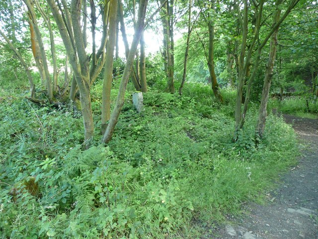
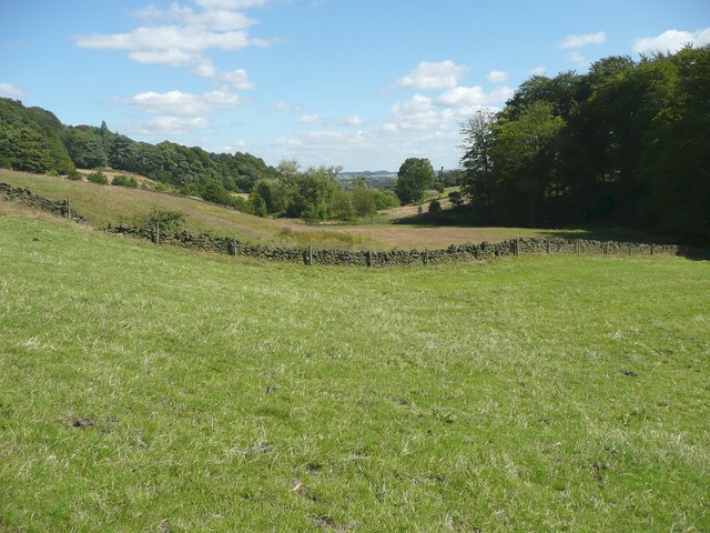
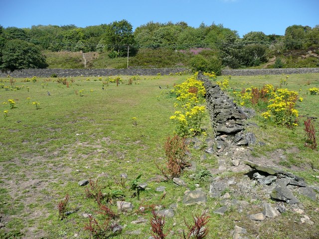
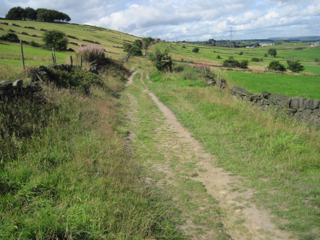
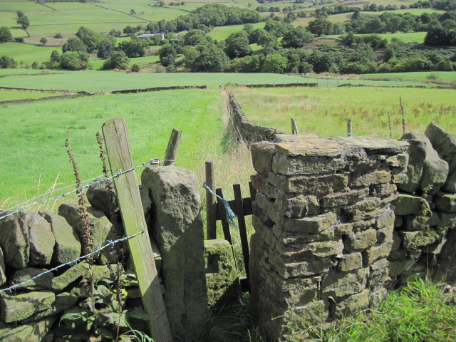
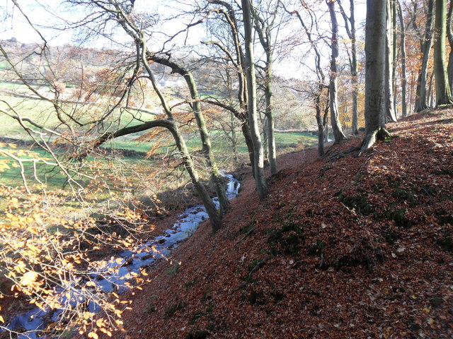
Surrounded by stunning countryside, Whitehaughs offers ample opportunities for outdoor enthusiasts. The nearby moors and forests provide ample hiking and cycling trails, allowing visitors to explore the natural beauty of the area. The village is also conveniently located near several historic landmarks, such as ancient ruins and stately homes, which attract history enthusiasts and tourists.

Overall, Whitehaughs presents a tranquil retreat from the bustling city life, offering a serene and picturesque haven for those seeking a slower pace of living and a chance to immerse themselves in the natural beauty and warmth of Yorkshire.

If you have any feedback on the listing, please let us know in the comments section below.
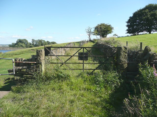
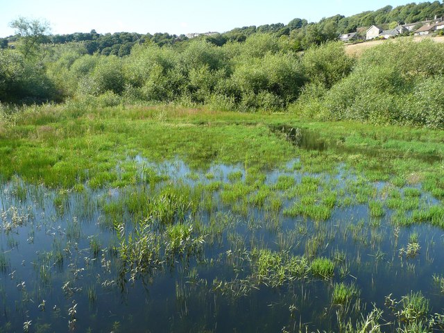
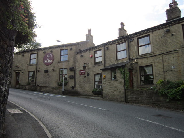
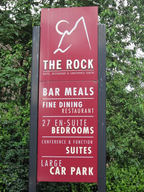
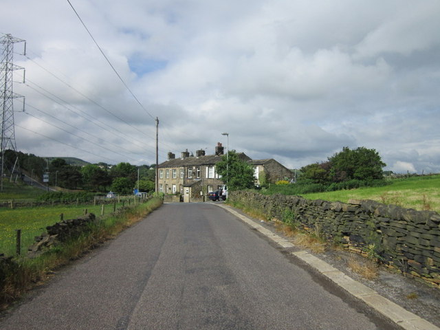
Whitehaughs Images

Images are sourced within 2km of 53.667366/-1.8349931 or Grid Reference SE1119. Thanks to Geograph Open Source API. All images are credited.

The 643, Lindley Moor Road
The A640, New Hey Road, goes over the M62
Site of Hirst Mill Cottages, Longwood There were two cottages here until the 1950s. Now all that is left is what looks like a gravestone.
Site of Hirst Mill Cottages, Longwood
There were two cottages here until the 1950s. Now all that is left is what looks like a gravestone.
The valley of Longwood Brook
Footpath into the valley from Snow Lea, Longwood The houses are along Lamb Hall Road at Snow Lea.
Footpath into the valley from Snow Lea, Longwood
The houses are along Lamb Hall Road at Snow Lea.
Lamb Hall Road at Snow Lea
Gate on the lane to Leys Farm , Longwood Now only used as a footpath; vehicle access is from Holmfield Road to the south-east.
Gate on the lane to Leys Farm , Longwood
Now only used as a footpath; vehicle access is from Holmfield Road to the south-east.
The upper part of Longwood Compensation Reservoir The maps are a little misleading, showing the walled path crossing a large expanse of water as if on a bridge. The path is on a causeway, and the upper part of the reservoir is connected to the main part by a culvert, and is quite shallow with much vegetation.
The upper part of Longwood Compensation Reservoir
The maps are a little misleading, showing the walled path crossing a large expanse of water as if on a bridge. The path is on a causeway, and the upper part of the reservoir is connected to the main part by a culvert, and is quite shallow with much vegetation.
Stoops, Lamb Hall Road, Longwood
Footpath off Lamb Hall Road, Longwood The ragwort is bright and cheerful, but should really have been cut down, along with the docks.
Footpath off Lamb Hall Road, Longwood
The ragwort is bright and cheerful, but should really have been cut down, along with the docks.
Turley Cote Lane
Turley Cote Lane
Footpath towards Shavey Clough
Longwood Brook, near Outlane Looking along Longwood Brook, leads to reservoir at Longwood Edge.
Longwood Brook, near Outlane
Looking along Longwood Brook, leads to reservoir at Longwood Edge.
The Rock public house, Holywell Green
New Road towards Lea Green
M62 eastbound passes under the A640 at Junction 23
Show me another place!

Whitehaughs is located at Grid Ref: SE1119 (Lat: 53.667366, Lng: -1.8349931)

Division: West Riding

Unitary Authority: Calderdale

Police Authority: West Yorkshire

What 3 Words

///remark.boxer.sprint. Near Elland, West Yorkshire

Related Wikis

Nearby Amenities

Located within 500m of 53.667366,-1.8349931
Power: tower
Lat/Long: 53.668411/-1.8318147
Power: tower
Lat/Long: 53.6684654/-1.8350096
Power: tower
Lat/Long: 53.6685079/-1.8378067
Bus Stop
Blackley New Road Motorway Junction
Local Ref: 45020301
Naptan AtcoCode: 450020301
Naptan Bearing: SE
Naptan CommonName: Blackley New Road Motorway Junction
Naptan Crossing: Adj Ainley Top Roundabout
Naptan Indicator: Stop 45020301
Naptan Landmark: Lay By adjacent Junc 24 M62
Naptan PlusbusZoneRef: LEEDS
Naptan ShortCommonName: Motorway Junction
Naptan Street: Blackley New Road
Naptan Verified: no
Shelter: no
Source: naptan_import
Lat/Long: 53.6690833/-1.829631
Bus Stop
Blackley New Road Motorway Junction
Check Date Shelter: 2023-01-28
Local Ref: 45020302
Naptan AtcoCode: 450020302
Naptan Bearing: W
Naptan CommonName: Blackley New Road Motorway Junction
Naptan Crossing: Halifax Road Ainley Top Roundabout
Naptan Indicator: Stop 45020302
Naptan Landmark: In Lay By adjacent to Junc 24 M62
Naptan PlusbusZoneRef: LEEDS
Naptan ShortCommonName: Motorway Junction
Naptan Street: Blackley New Road
Naptan Verified: no
Shelter: no
Source: naptan_import
Timetable: yes
Lat/Long: 53.6687683/-1.8294052
Bus Stop
Lindley Moor Road Action Flat Road
Local Ref: 45022740
Naptan AtcoCode: 450022740
Naptan Bearing: NE
Naptan CommonName: Lindley Moor Road Action Flat Road
Naptan Crossing: Adj Action Flat Lane
Naptan Indicator: Stop 45022740
Naptan Landmark: Warren House Farm
Naptan Notes: OSR taken place 071205
Naptan PlusbusZoneRef: LEEDS
Naptan ShortCommonName: Acton Flat Lane
Naptan Street: Lindley Moor Road
Naptan Verified: no
Source: naptan_import
Lat/Long: 53.6695121/-1.8342004
Bus Stop
Weather Hill Road Briarlyn Avenue
Local Ref: 45022778
Naptan AtcoCode: 450022778
Naptan Bearing: N
Naptan CommonName: Weather Hill Road Briarlyn Avenue
Naptan Crossing: Briarlyn Avenue
Naptan Indicator: Stop 45022778
Naptan PlusbusZoneRef: LEEDS
Naptan ShortCommonName: Briarlyn Avenue
Naptan Street: Weather Hill Road
Naptan Verified: no
Source: naptan_import
Lat/Long: 53.6636294/-1.8310907
Bus Stop
Weather Hill Road Briarlyn Avenue
Local Ref: 45022779
Naptan AtcoCode: 450022779
Naptan Bearing: S
Naptan CommonName: Weather Hill Road Briarlyn Avenue
Naptan Crossing: Briarlyn Avenue
Naptan Indicator: Stop 45022779
Naptan Notes: OSR taken place 061205
Naptan PlusbusZoneRef: LEEDS
Naptan ShortCommonName: Briarlyn Avenue
Naptan Street: Weather Hill Road
Naptan Verified: no
Source: naptan_import
Lat/Long: 53.6636022/-1.8309244
Bus Stop
Weather Hill Road Birchington Avenue
Local Ref: 45022780
Naptan AtcoCode: 450022780
Naptan Bearing: S
Naptan CommonName: Weather Hill Road Birchington Avenue
Naptan Crossing: Birchington Avenue
Naptan Indicator: Stop 45022780
Naptan PlusbusZoneRef: LEEDS
Naptan ShortCommonName: Birchington Avenue
Naptan Street: Weather Hill Road
Naptan Verified: no
Source: naptan_import
Lat/Long: 53.6655979/-1.8311737
Bus Stop
Weather Hill Road Birchington Avenue
Local Ref: 45022781
Naptan AtcoCode: 450022781
Naptan Bearing: N
Naptan CommonName: Weather Hill Road Birchington Avenue
Naptan Crossing: Birchington Avenue
Naptan Indicator: Stop 45022781
Naptan Notes: OSR taken place 061205
Naptan PlusbusZoneRef: LEEDS
Naptan ShortCommonName: Birchington Avenue
Naptan Street: Weather Hill Road
Naptan Verified: no
Source: naptan_import
Lat/Long: 53.6658322/-1.8315511
Bus Stop
Weather Hill Road Weatherhill Crescent
Local Ref: 45022782
Naptan AtcoCode: 450022782
Naptan Bearing: NW
Naptan CommonName: Weather Hill Road Weatherhill Crescent
Naptan Crossing: Weather Hill Crescent
Naptan Indicator: Stop 45022782
Naptan PlusbusZoneRef: LEEDS
Naptan ShortCommonName: Weather Hill Cres
Naptan Street: Weather Hill Road
Naptan Verified: no
Source: naptan_import
Lat/Long: 53.6670111/-1.8325604
Bus Stop
Weather Hill Road Weatherhill Crescent
Local Ref: 45022783
Naptan AtcoCode: 450022783
Naptan Bearing: SE
Naptan CommonName: Weather Hill Road Weatherhill Crescent
Naptan Crossing: Alderstone Rise
Naptan Indicator: Stop 45022783
Naptan PlusbusZoneRef: LEEDS
Naptan ShortCommonName: Alderstone Rise
Naptan Street: Weather Hill Road
Naptan Verified: no
Source: naptan_import
Lat/Long: 53.6670648/-1.832424
Bus Stop
Yew Tree Road Birchington Drive
Local Ref: 45022785
Naptan AtcoCode: 450022785
Naptan Bearing: SW
Naptan CommonName: Yew Tree Road Birchington Drive
Naptan Crossing: Birchington Drive
Naptan Indicator: Stop 45022785
Naptan PlusbusZoneRef: LEEDS
Naptan ShortCommonName: Birchington Drive
Naptan Street: Yew Tree Road
Naptan Verified: no
Source: naptan_import
Lat/Long: 53.6673102/-1.8280036
Bus Stop
Yew Tree Road Birchington Drive
Local Ref: 45022786
Naptan AtcoCode: 450022786
Naptan Bearing: NE
Naptan CommonName: Yew Tree Road Birchington Drive
Naptan Crossing: Birvhington Drive
Naptan Indicator: Stop 45022786
Naptan PlusbusZoneRef: LEEDS
Naptan ShortCommonName: Birchington Drive
Naptan Street: Yew Tree Road
Naptan Verified: no
Source: naptan_import
Lat/Long: 53.6674629/-1.827897
Bus Stop
Lindley Avenue Yew Tree Road
Local Ref: 45022789
Naptan AtcoCode: 450022789
Naptan Bearing: NW
Naptan CommonName: Lindley Avenue Yew Tree Road
Naptan Crossing: Yew Tree Road
Naptan Indicator: Stop 45022789
Naptan PlusbusZoneRef: LEEDS
Naptan ShortCommonName: Yew Tree Road
Naptan Street: Lindley Avenue
Naptan Verified: no
Source: naptan_import
Lat/Long: 53.6668105/-1.8305483
Bus Stop
Ainley Road Lindley Avenue
Local Ref: 45022790
Naptan AtcoCode: 450022790
Naptan Bearing: W
Naptan CommonName: Ainley Road Lindley Avenue
Naptan Crossing: Lindley Avenue
Naptan Indicator: Stop 45022790
Naptan PlusbusZoneRef: LEEDS
Naptan ShortCommonName: Lindley Avenue
Naptan Street: Ainley Road
Naptan Verified: no
Source: naptan_import
Lat/Long: 53.6677469/-1.8317099
Bus Stop
Ainley Road Lindley Avenue
Local Ref: 45025575
Naptan AtcoCode: 450025575
Naptan Bearing: E
Naptan CommonName: Ainley Road Lindley Avenue
Naptan Crossing: Lindley Avenue
Naptan Indicator: Stop 45025575
Naptan PlusbusZoneRef: LEEDS
Naptan ShortCommonName: Lindley Avenue
Naptan Street: Ainley Road
Naptan Verified: no
Source: naptan_import
Lat/Long: 53.6678191/-1.8319216
Bus Stop
Lindley Moor Road Cedar Court Hotel
Local Ref: 45027920
Naptan AtcoCode: 450027920
Naptan Bearing: W
Naptan CommonName: Lindley Moor Road Cedar Court Hotel
Naptan Crossing: Adj Warren House Lane
Naptan Indicator: Stop 45027920
Naptan Landmark: Cedar Court Hotel
Naptan PlusbusZoneRef: LEEDS
Naptan ShortCommonName: Cedar Court Hotel
Naptan Street: Lindley Moor Road
Naptan Verified: no
Shelter: no
Source: naptan_import
Lat/Long: 53.6700381/-1.8310954
Lindley Moor Road
Local Ref: 45051222
Naptan AtcoCode: 450051222
Naptan Bearing: SW
Naptan BusStopType: CUS
Naptan CommonName: Lindley Moor Road
Naptan Indicator: Stop 45051222
Naptan PlusbusZoneRef: LEEDS
Naptan ShortCommonName: Warren House Farm
Naptan Street: Lindley Moor Road
Naptan Verified: no
Source: naptan_import
Lat/Long: 53.6694311/-1.8341099
Lindley Avenue Yew Tree Road
Local Ref: 45051223
Naptan AtcoCode: 450051223
Naptan Bearing: SE
Naptan BusStopType: CUS
Naptan CommonName: Lindley Avenue Yew Tree Road
Naptan Indicator: Stop 45051223
Naptan PlusbusZoneRef: LEEDS
Naptan ShortCommonName: Yew Tree Road
Naptan Street: Lindley Avenue
Naptan Verified: no
Source: naptan_import
Lat/Long: 53.6668373/-1.8304422
Traffic Signals
Traffic Signals: signal
Traffic Signals Direction: both
Lat/Long: 53.6673735/-1.8390856
Noexit: yes
Lat/Long: 53.6679532/-1.8308537
Mini Roundabout
Direction: clockwise
Lat/Long: 53.6707334/-1.8303886
Post Box
Operator: Royal Mail
Lat/Long: 53.6668985/-1.8323565
Phone
Check Date: 2023-10-15
Emergency: phone
Ref: 1891A
Lat/Long: 53.6707625/-1.8359009
Barrier: stile
Lat/Long: 53.665999/-1.8385265
Parking
Access: yes
Parking: layby
Lat/Long: 53.6687952/-1.8294846
Power: tower
Source: Bing
Lat/Long: 53.6697886/-1.8385158
Phone
Emergency: phone
Ref: 1891B
Lat/Long: 53.6704671/-1.8355913
Power: tower
Lat/Long: 53.6641483/-1.8363533
Power: tower
Lat/Long: 53.6671482/-1.8381893
Power: tower
Lat/Long: 53.6684841/-1.8373098
Power: tower
Lat/Long: 53.6685536/-1.8382294
Generator Method: photovoltaic
Generator Output Electricity: yes
Generator Source: solar
Generator Type: solar_photovoltaic_panel
Location: roof
Power: generator
Lat/Long: 53.6677569/-1.8326822
Generator Method: photovoltaic
Generator Output Electricity: yes
Generator Source: solar
Generator Type: solar_photovoltaic_panel
Location: roof
Power: generator
Lat/Long: 53.6667481/-1.8330683
Generator Method: photovoltaic
Generator Output Electricity: yes
Generator Source: solar
Generator Type: solar_photovoltaic_panel
Location: roof
Power: generator
Lat/Long: 53.6661013/-1.8337764
Generator Method: photovoltaic
Generator Output Electricity: yes
Generator Source: solar
Generator Type: solar_photovoltaic_panel
Location: roof
Power: generator
Lat/Long: 53.6658793/-1.8317984
Generator Method: photovoltaic
Generator Output Electricity: yes
Generator Source: solar
Generator Type: solar_photovoltaic_panel
Location: roof
Power: generator
Lat/Long: 53.6658841/-1.8317743
Generator Method: photovoltaic
Generator Output Electricity: yes
Generator Source: solar
Generator Type: solar_photovoltaic_panel
Location: roof
Power: generator
Lat/Long: 53.6657652/-1.830358
Generator Method: photovoltaic
Generator Output Electricity: yes
Generator Source: solar
Generator Type: solar_photovoltaic_panel
Location: roof
Power: generator
Lat/Long: 53.6657843/-1.8303258
Generator Method: photovoltaic
Generator Output Electricity: yes
Generator Source: solar
Generator Type: solar_photovoltaic_panel
Location: roof
Power: generator
Lat/Long: 53.6665932/-1.8312082
Generator Method: photovoltaic
Generator Output Electricity: yes
Generator Source: solar
Generator Type: solar_photovoltaic_panel
Location: roof
Power: generator
Lat/Long: 53.6637008/-1.8316964
Generator Method: photovoltaic
Generator Output Electricity: yes
Generator Source: solar
Generator Type: solar_photovoltaic_panel
Location: roof
Power: generator
Lat/Long: 53.6636992/-1.8317742
Generator Method: photovoltaic
Generator Output Electricity: yes
Generator Source: solar
Generator Type: solar_photovoltaic_panel
Location: roof
Power: generator
Lat/Long: 53.6640345/-1.8315059
Generator Method: photovoltaic
Generator Output Electricity: yes
Generator Source: solar
Generator Type: solar_photovoltaic_panel
Location: roof
Power: generator
Lat/Long: 53.6633321/-1.8316856
Generator Method: photovoltaic
Generator Output Electricity: yes
Generator Source: solar
Generator Type: solar_photovoltaic_panel
Location: roof
Power: generator
Lat/Long: 53.6638247/-1.8322462
Turning Circle
Lat/Long: 53.6641106/-1.8401001
Noexit: yes
Lat/Long: 53.6648859/-1.8382564
Noexit: yes
Lat/Long: 53.6651759/-1.8383102
Crossing
Lat/Long: 53.671284/-1.8326767
Access: no
Barrier: stile
Bicycle: no
Foot: yes
Horse: no
Motor Vehicle: no
Lat/Long: 53.6698048/-1.8390805
Noexit: yes
Lat/Long: 53.6658287/-1.8385255
Booth: K6
Covered: booth
Man Made: telephone_box
Lat/Long: 53.6664605/-1.8422718
The data included in this document is from www.openstreetmap.org. The data is made available under ODbL.

Have you been to Whitehaughs?

Leave your review of Whitehaughs below (or comments, questions and feedback).