Knowles Mill

Heritage Site in Worcestershire Wyre Forest

England

Knowles Mill

Car park off Dry Mill Lane This is a new car park for people walking in the Wyre Forest and is the recommended car park for visitors to Knowles Mill. A fellow collaborator has kindly confirmed my position and view direction.
Car park off Dry Mill Lane Credit: Chris Allen

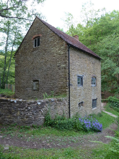
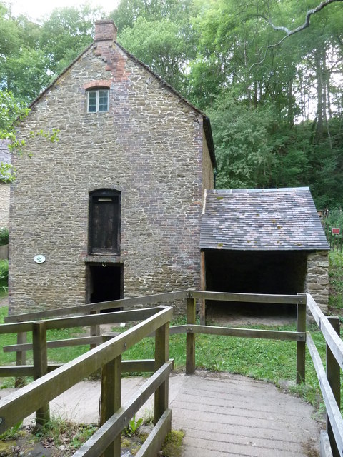
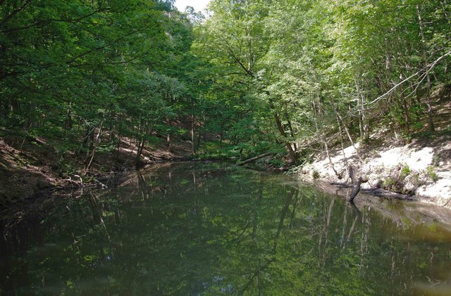
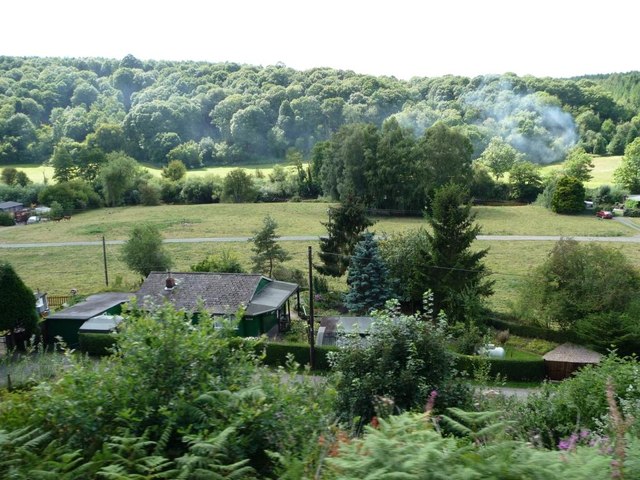
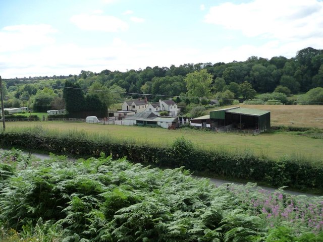
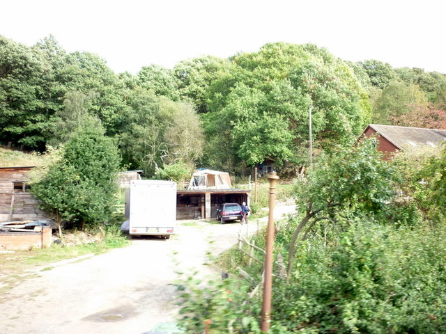
Knowles Mill, located in Worcestershire, England, is a historic heritage site with a rich history dating back to the 18th century. It is a picturesque watermill situated on the banks of the River Stour, near the village of Bewdley.

The mill was originally constructed in 1775 and served as a vital part of the local community, grinding corn into flour for the surrounding area. Over the years, Knowles Mill underwent several modifications and improvements, adapting to changing technologies and demands. It played a significant role in supporting the agricultural industry in Worcestershire during the Industrial Revolution.

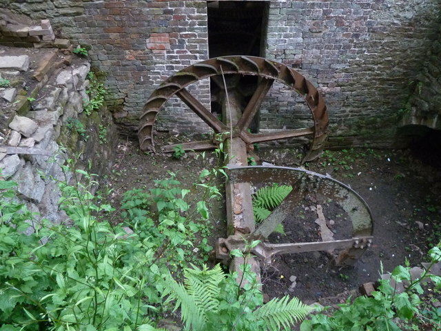
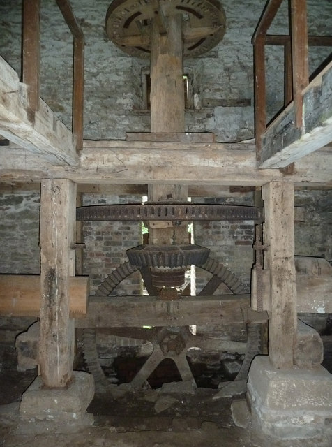
The mill's distinctive red-brick structure and traditional waterwheel are iconic features of the site. The waterwheel, powered by the river's flow, would turn the millstones to grind the corn. Visitors to Knowles Mill can witness this fascinating process firsthand, as the mill has been meticulously restored and is still operational.

Today, Knowles Mill serves as a popular tourist attraction and educational site, offering visitors a glimpse into the region's industrial heritage. Guided tours provide insight into the inner workings of the mill, showcasing the machinery, tools, and techniques used in traditional milling. Interpretive displays and exhibits further enhance the visitor experience, providing historical context and highlighting the mill's significance in local history.

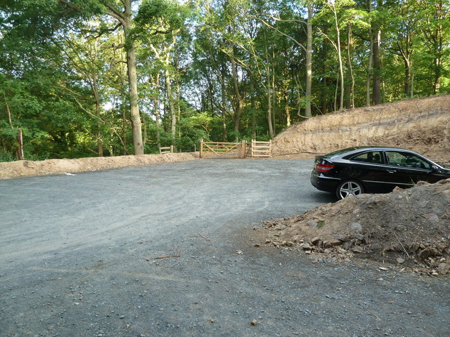
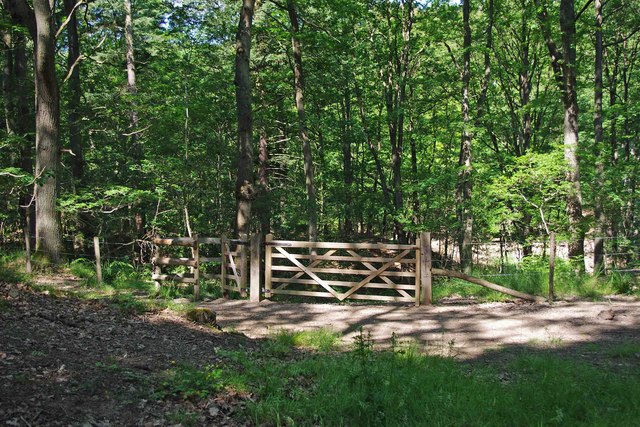
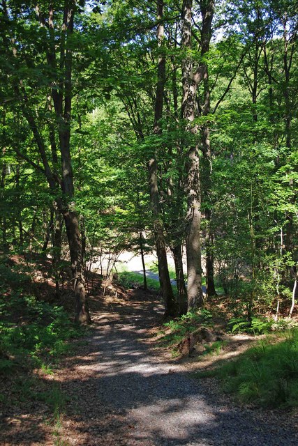
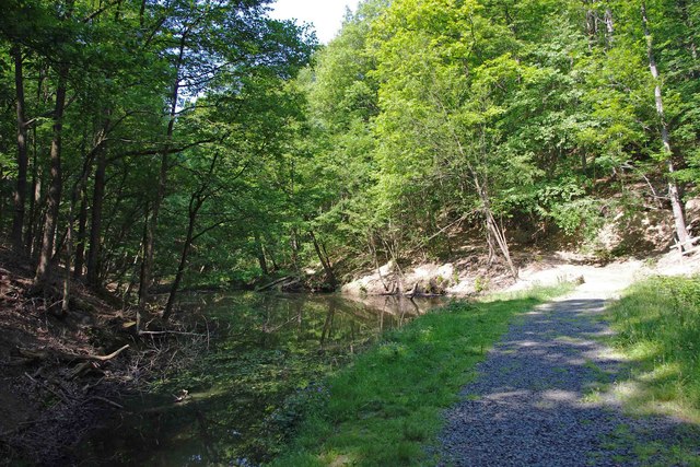
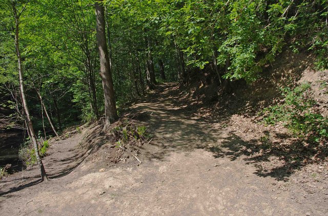
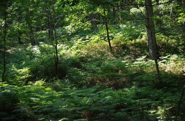
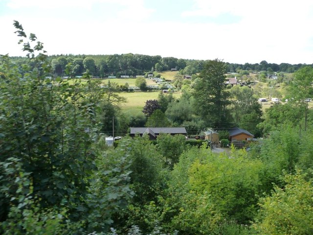
The surrounding landscape of Knowles Mill is also worth exploring, with its picturesque countryside and scenic views of the River Stour. It offers a tranquil setting for nature walks and picnics, making it an ideal destination for families and nature enthusiasts alike.

In summary, Knowles Mill in Worcestershire is a beautifully preserved heritage site, offering visitors an immersive experience into the region's milling history. Its historical significance, stunning architecture, and idyllic surroundings make it a must-visit destination for those interested in the industrial heritage of Worcestershire.

If you have any feedback on the listing, please let us know in the comments section below.

Knowles Mill Images

Images are sourced within 2km of 52.3867/-2.3509 or Grid Reference SO7676. Thanks to Geograph Open Source API. All images are credited.

Car park off Dry Mill Lane This is a new car park for people walking in the Wyre Forest and is the recommended car park for visitors to Knowles Mill. A fellow collaborator has kindly confirmed my position and view direction.
Car park off Dry Mill Lane
This is a new car park for people walking in the Wyre Forest and is the recommended car park for visitors to Knowles Mill. A fellow collaborator has kindly confirmed my position and view direction.
Knowles Mill Preserved derelict flour mill on the Dowles Brook in the Wyre Forest. The remains of the overshot waterwheel are behind the curved wall in the foreground and the tail race is in a tunnel.
Knowles Mill
Preserved derelict flour mill on the Dowles Brook in the Wyre Forest. The remains of the overshot waterwheel are behind the curved wall in the foreground and the tail race is in a tunnel.
Knowles Mill - the remains of the waterwheel This was an overshot waterwheel with the leat coming in at high level on the left and the portal of the tail race tunnel visible to the right.
Knowles Mill - the remains of the waterwheel
This was an overshot waterwheel with the leat coming in at high level on the left and the portal of the tail race tunnel visible to the right.
Knowles Mill - machinery A nineteenth century watermill that went out of use in 1891 when it was damaged by a flood following a big freeze. It is the only recognisable mill in the Wyre Forest.

This somewhat sharpened (really!) shot shows the pit wheel, wallower, great spur wheel and crown wheel. There is a surviving stone nut and quant on the right with a bed stone on the floor above. The other stone nut and the other stones have gone. There is a fragmented French burr stone on the ground inside.
Knowles Mill - machinery
A nineteenth century watermill that went out of use in 1891 when it was damaged by a flood following a big freeze. It is the only recognisable mill in the Wyre Forest. This somewhat sharpened (really!) shot shows the pit wheel, wallower, great spur wheel and crown wheel. There is a surviving stone nut and quant on the right with a bed stone on the floor above. The other stone nut and the other stones have gone. There is a fragmented French burr stone on the ground inside.
Knowles Mill Nineteenth century watermill that has been out of use since 1891 and is now preserved by the National Trust. The bridge in the foreground crosses the Dowles Brook.
Knowles Mill
Nineteenth century watermill that has been out of use since 1891 and is now preserved by the National Trust. The bridge in the foreground crosses the Dowles Brook.
Gated entrance to track in Wyre Forest near Bewdley There is both a kissing gate here, and a gate wide enough to let a vehicle pass through. On the other side is a track, with a rough stone surface, which makes a steep descent down to a pond and a steam.

<a href="https://www.geograph.org.uk/photo/2487006">SO7676 : Track to pond in Wyre Forest, near Bewdley</a>.
<a href="https://www.geograph.org.uk/photo/2487032">SO7676 : Pond and track in the Wyre Forest near Bewdley</a>.
Gated entrance to track in Wyre Forest near Bewdley
There is both a kissing gate here, and a gate wide enough to let a vehicle pass through. On the other side is a track, with a rough stone surface, which makes a steep descent down to a pond and a steam. SO7676 : Track to pond in Wyre Forest, near Bewdley. SO7676 : Pond and track in the Wyre Forest near Bewdley.
Track to pond in Wyre Forest, near Bewdley The pond is at the bottom of the track, but not visible in this photograph.

<a href="https://www.geograph.org.uk/photo/2486986">SO7676 : Gated entrance to track in Wyre Forest near Bewdley</a>.
<a href="https://www.geograph.org.uk/photo/2487032">SO7676 : Pond and track in the Wyre Forest near Bewdley</a>.
Track to pond in Wyre Forest, near Bewdley
The pond is at the bottom of the track, but not visible in this photograph. SO7676 : Gated entrance to track in Wyre Forest near Bewdley. SO7676 : Pond and track in the Wyre Forest near Bewdley.
Pond and track in the Wyre Forest near Bewdley The pond is on the left but difficult to see, as its surface is reflecting the trees which hang overhead. It is one of several which are linked by a small stream, and appears to be either artificial or enlarged from the original.

<a href="https://www.geograph.org.uk/photo/2486986">SO7676 : Gated entrance to track in Wyre Forest near Bewdley</a>.
<a href="https://www.geograph.org.uk/photo/2487006">SO7676 : Track to pond in Wyre Forest, near Bewdley</a>.
<a href="https://www.geograph.org.uk/photo/2487054">SO7676 : Pond in Wyre Forest near Bewdley</a>.
Pond and track in the Wyre Forest near Bewdley
The pond is on the left but difficult to see, as its surface is reflecting the trees which hang overhead. It is one of several which are linked by a small stream, and appears to be either artificial or enlarged from the original. SO7676 : Gated entrance to track in Wyre Forest near Bewdley. SO7676 : Track to pond in Wyre Forest, near Bewdley. SO7676 : Pond in Wyre Forest near Bewdley.
Pond in Wyre Forest near Bewdley The pond may be artificial or artificially enlarged. It lies on a stream which runs through the forest.

<a href="https://www.geograph.org.uk/photo/2487032">SO7676 : Pond and track in the Wyre Forest near Bewdley</a>.
Pond in Wyre Forest near Bewdley
The pond may be artificial or artificially enlarged. It lies on a stream which runs through the forest. SO7676 : Pond and track in the Wyre Forest near Bewdley.
Junction of two paths in the Wyre Forest near Bewdley The lower path runs alongside a pond. The other path climbs steeply.

<a href="https://www.geograph.org.uk/photo/2487054">SO7676 : Pond in Wyre Forest near Bewdley</a>.
Junction of two paths in the Wyre Forest near Bewdley
The lower path runs alongside a pond. The other path climbs steeply. SO7676 : Pond in Wyre Forest near Bewdley.
Ferns in the Wyre Forest near Bewdley Ferns were flourishing in this area.
Ferns in the Wyre Forest near Bewdley
Ferns were flourishing in this area.
Holiday homes along the Severn Valley Wooden chalets on this side, a square of park homes or static caravans on the far side. Seen from a south-bound Severn Valley Railway train.
Holiday homes along the Severn Valley
Wooden chalets on this side, a square of park homes or static caravans on the far side. Seen from a south-bound Severn Valley Railway train.
Wooden bungalow, Northwood Lane The riverside bungalows were built in the 1930s and earlier, before strict planning controls, as holiday homes and weekend retreats for anglers from the West Midlands. Seen from a south-bound Severn Valley Railway train.
Wooden bungalow, Northwood Lane
The riverside bungalows were built in the 1930s and earlier, before strict planning controls, as holiday homes and weekend retreats for anglers from the West Midlands. Seen from a south-bound Severn Valley Railway train.
Farm buildings off Northwood Road Seen from a south-bound Severn Valley Railway train.
Farm buildings off Northwood Road
Seen from a south-bound Severn Valley Railway train.
Footpath in the Wyre Forest near Buttonoak The footpath here follows a fire break in the woodland but which may well actually be the route of the Elan Valley pipeline carrying water to Brum. Anyway, it is steep!
Footpath in the Wyre Forest near Buttonoak
The footpath here follows a fire break in the woodland but which may well actually be the route of the Elan Valley pipeline carrying water to Brum. Anyway, it is steep!
Northwood Halt Taken from the Severn Valley Railway.
Northwood Halt
Taken from the Severn Valley Railway.
Buildings off Northwood Lane Taken from the Severn Valley Railway.
Buildings off Northwood Lane
Taken from the Severn Valley Railway.
Bus stop at Hales Park
Show me another place!

Knowles Mill is located at Grid Ref: SO7676 (Lat: 52.3867, Lng: -2.3509)

Administrative County: Worcestershire

District: Wyre Forest

Police Authority: West Mercia

What 3 Words

///original.ivory.zones. Near Bewdley, Worcestershire

Related Wikis

Knowles Mill

Knowles Mill is the remains of an eighteenth-century water-powered grain mill, located in the Wyre Forest in Worcestershire, England. The mill has been...
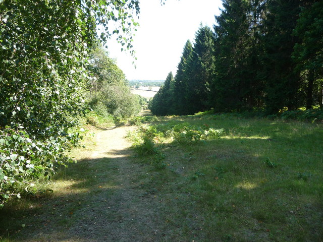
Wyre Forest

Wyre Forest is a large, semi-natural (partially unmanaged) woodland and forest measuring 26.34 square kilometres (10.17 sq mi) which straddles the borders...

Dowles

Dowles is a hamlet in the civil parish of Upper Arley, in the Wyre Forest district, in the county of Worcestershire, England. It is about 3 miles from...

Button Oak

Button Oak is a small village in the English county of Shropshire, England. It is 3 miles north west of Bewdley. Button Oak is very similar to nearby...

Dowles Brook

Dowles Brook flows through the heart of the Wyre Forest, into the former civil parish of Dowles and into the River Severn. == History == In 1902, ornithologist...

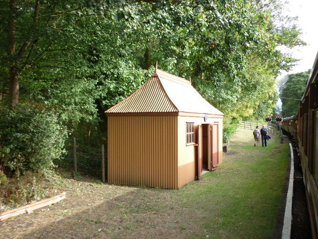
Northwood Halt railway station

Northwood Halt is an unstaffed request stop on the Severn Valley Railway in Worcestershire, situated a little to the north of Bewdley on the outskirts...

Pound Green

Pound Green is a hamlet in Upper Arley, Worcestershire, England. It has a number of tourist landmarks such as Ye Olde New Inn and a village hall that also...

A456 road

Known as the Hagley Road in Birmingham, the A456 is a main road in England running between Central Birmingham and Woofferton, Shropshire, south of Ludlow...

Nearby Amenities

Located within 500m of 52.3867,-2.3509
Barrier: kissing_gate
Source: survey
Lat/Long: 52.3872923/-2.3542631
Barrier: kissing_gate
Source: survey
Lat/Long: 52.3864132/-2.3555908
Barrier: kissing_gate
Source: survey
Lat/Long: 52.3870462/-2.35506
Barrier: kissing_gate
Source: survey
Lat/Long: 52.3869747/-2.355344
Barrier: kissing_gate
Foot: yes
Lat/Long: 52.3853843/-2.3562519
Fixme: continue
Lat/Long: 52.3849683/-2.3464575
Barrier: stile
Foot: yes
Lat/Long: 52.3868013/-2.3511955
Building: yes
Lat/Long: 52.387368/-2.3554718
Barrier: bollard
Lat/Long: 52.3864723/-2.3555077
The data included in this document is from www.openstreetmap.org. The data is made available under ODbL.

Have you been to Knowles Mill?

Leave your review of Knowles Mill below (or comments, questions and feedback).