King Barrow

Heritage Site in Wiltshire

England

King Barrow

Old Milepost by Imber Road, Warminster parish Cast iron post by the UC road, in parish of WARMINSTER (WEST WILTSHIRE District), Imber road, Warminster; 200m West of church, next to bus stop on verge, on Southeast side of road. C&M Classical iron casting, erected by the Warminster turnpike trust in the 19th century. 

Inscription reads:-
WARMINSTER
TOWN.HALL
1
MILE
IMBER
5
MILES

Grade II listed. 
List Entry Number: 1036219 <span class="nowrap"><a title="https://historicengland.org.uk/listing/the-list/list-entry/1036219" rel="nofollow ugc noopener" href="https://historicengland.org.uk/listing/the-list/list-entry/1036219">Link</a><img style="margin-left:2px;" alt="External link" title="External link - shift click to open in new window" src="https://s1.geograph.org.uk/img/external.png" width="10" height="10"/></span>

Milestone Society National ID: WI_WMIM01.
Old Milepost by Imber Road, Warminster parish Credit: Andy Bown

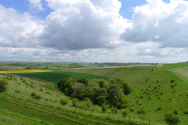
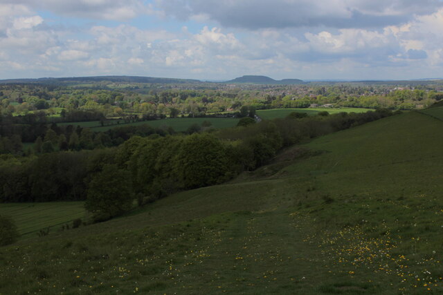
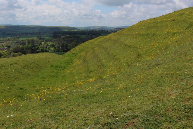
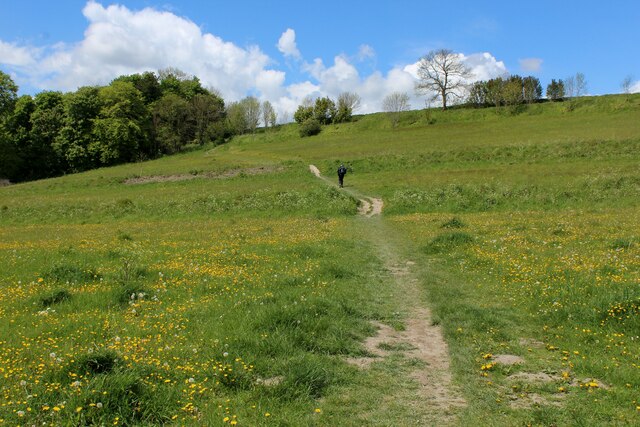
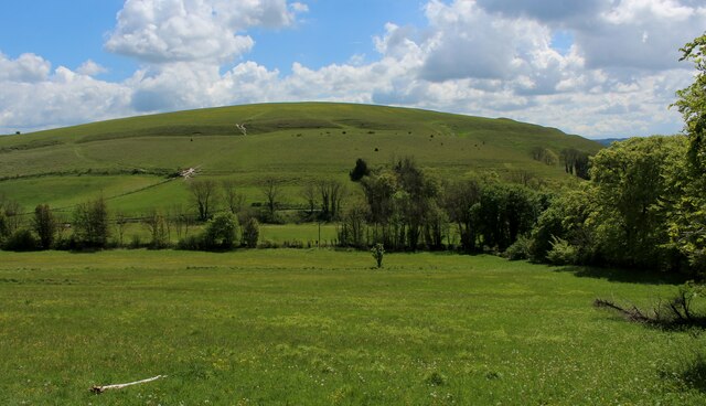
King Barrow, located in Wiltshire, England, is a significant heritage site that holds historical and archaeological importance. This ancient burial mound, also known as a barrow, dates back to the Neolithic period, around 2400 BC. It stands as a testament to the rich cultural and religious practices of the early inhabitants of the region.

The King Barrow is a circular earth mound, approximately 40 meters in diameter and 3 meters high. It is made up of layers of soil, chalk, and stones, which were meticulously piled to create this monument. The burial chamber, believed to have once contained the remains of a prominent individual, lies at the center of the mound. Unfortunately, due to centuries of looting and excavation, the original contents of the chamber have long been removed.

Despite the absence of its original artifacts, the site remains remarkable due to its architectural and historical significance. The construction techniques employed in building the King Barrow highlight the advanced engineering skills of the Neolithic people. It also suggests the importance placed on honoring the deceased and the belief in an afterlife.

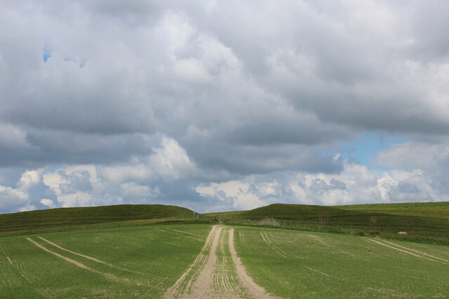
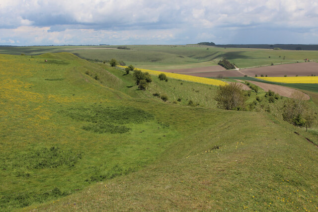
Today, King Barrow serves as a popular destination for locals and tourists interested in exploring the region's ancient past. Visitors can marvel at the structure's impressive preservation and imagine the rituals and ceremonies that took place thousands of years ago. The site is well-maintained and offers informative signs to guide visitors through its historical context and significance. King Barrow stands as a tangible link to the ancient origins of Wiltshire, providing a glimpse into the lives and beliefs of our early ancestors.

If you have any feedback on the listing, please let us know in the comments section below.
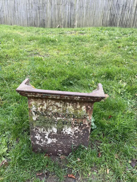
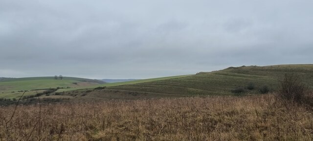
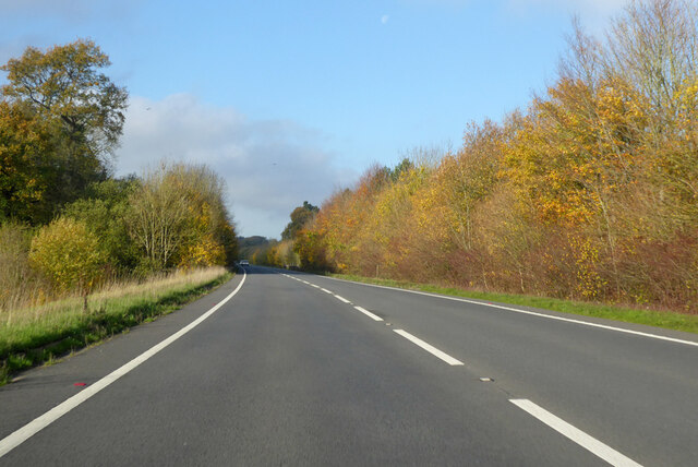
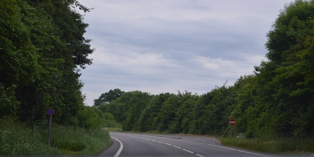
King Barrow Images

Images are sourced within 2km of 51.198/-2.15 or Grid Reference ST8944. Thanks to Geograph Open Source API. All images are credited.

Old Milepost by Imber Road, Warminster parish Cast iron post by the UC road, in parish of WARMINSTER (WEST WILTSHIRE District), Imber road, Warminster; 200m West of church, next to bus stop on verge, on Southeast side of road. C&M Classical iron casting, erected by the Warminster turnpike trust in the 19th century. 

Inscription reads:-
WARMINSTER
TOWN.HALL
1
MILE
IMBER
5
MILES

Grade II listed. 
List Entry Number: 1036219 <span class="nowrap"><a title="https://historicengland.org.uk/listing/the-list/list-entry/1036219" rel="nofollow ugc noopener" href="https://historicengland.org.uk/listing/the-list/list-entry/1036219">Link</a><img style="margin-left:2px;" alt="External link" title="External link - shift click to open in new window" src="https://s1.geograph.org.uk/img/external.png" width="10" height="10"/></span>

Milestone Society National ID: WI_WMIM01.
Old Milepost by Imber Road, Warminster parish
Cast iron post by the UC road, in parish of WARMINSTER (WEST WILTSHIRE District), Imber road, Warminster; 200m West of church, next to bus stop on verge, on Southeast side of road. C&M Classical iron casting, erected by the Warminster turnpike trust in the 19th century. Inscription reads:- WARMINSTER TOWN.HALL 1 MILE IMBER 5 MILES Grade II listed. List Entry Number: 1036219 LinkExternal link Milestone Society National ID: WI_WMIM01.
Battlesbury Hill, Wiltshire Battlesbury Hill is the site of an Iron Age bivallate hill fort near the town of Warminster.
Battlesbury Hill, Wiltshire
Battlesbury Hill is the site of an Iron Age bivallate hill fort near the town of Warminster.
A36 towards Bath Bypassing Warminster.
A36 towards Bath
Bypassing Warminster.
A36 The A36 is the principal route from Bristol and Wales to the central south coast. It runs 65 miles from Totton to Bath, via Salisbury.
<span class="nowrap"><a title="http://www.sabre-roads.org.uk/wiki/index.php?title=A36" rel="nofollow ugc noopener" href="http://www.sabre-roads.org.uk/wiki/index.php?title=A36">Link</a><img style="margin-left:2px;" alt="External link" title="External link - shift click to open in new window" src="https://s1.geograph.org.uk/img/external.png" width="10" height="10"/></span>
A36
The A36 is the principal route from Bristol and Wales to the central south coast. It runs 65 miles from Totton to Bath, via Salisbury. LinkExternal link
Norton Bavant, lay-by On A36 southbound. The road has been gritted, and snow is not forecast to stay.
Norton Bavant, lay-by
On A36 southbound. The road has been gritted, and snow is not forecast to stay.
Recreation ground at Norton Bavant
Old Milepost by the B3414, Warminster Road, Norton Bavant Cast iron post by the B3414, in parish of Norton Bavant (West Wiltshire District), Warminster Road; 800m East of entrance to Bishopstrow Farm, by the road, on Southwest side of road. C&M Classical iron casting, erected by the Warminster turnpike trust in the 19th century. 

Inscription reads:-
SALISBURY
19
WARMINSTER
2

Grade II listed.  
List Entry Number: 1364340 <span class="nowrap"><a title="https://historicengland.org.uk/listing/the-list/list-entry/1364340" rel="nofollow ugc noopener" href="https://historicengland.org.uk/listing/the-list/list-entry/1364340">Link</a><img style="margin-left:2px;" alt="External link" title="External link - shift click to open in new window" src="https://s1.geograph.org.uk/img/external.png" width="10" height="10"/></span>

Milestone Society National ID: WI_SAWM19
Old Milepost by the B3414, Warminster Road, Norton Bavant
Cast iron post by the B3414, in parish of Norton Bavant (West Wiltshire District), Warminster Road; 800m East of entrance to Bishopstrow Farm, by the road, on Southwest side of road. C&M Classical iron casting, erected by the Warminster turnpike trust in the 19th century. Inscription reads:- SALISBURY 19 WARMINSTER 2 Grade II listed. List Entry Number: 1364340 LinkExternal link Milestone Society National ID: WI_SAWM19
On the rampart at the south end of Scratchbury Hill A 'univallate' iron age hillfort. The single rampart is nevertheless an impressive structure. Looking over the village of Norton Bavant in the Wylye valley
On the rampart at the south end of Scratchbury Hill
A 'univallate' iron age hillfort. The single rampart is nevertheless an impressive structure. Looking over the village of Norton Bavant in the Wylye valley
'The Copse' from Scratchbury Hill
Bridleway descending towards Norton Plantation
Wessex Ridgeway approaching Scratchbury Camp Heading east over an arable field towards the earthen ramparts of Scratchbury Camp, an Iron Age Hillfort on the edge of Salisbury Plain
Wessex Ridgeway approaching Scratchbury Camp
Heading east over an arable field towards the earthen ramparts of Scratchbury Camp, an Iron Age Hillfort on the edge of Salisbury Plain
Ramparts and Fortifications on Scratchbury Hill The eastern side of Scratchbury Camp, an Iron Age Hillfort dating to around 100BC on the edge of Salisbury Plain.
The Wessex Ridgeway circumnavigates the ramparts to the north.
<a href="https://www.geograph.org.uk/photo/6845280">ST9144 : More Ramparts and Fortifications on Scratchbury Hill</a>
<a href="https://www.geograph.org.uk/photo/6845739">ST9144 : Northern Edge of Scratchbury Camp</a>
Ramparts and Fortifications on Scratchbury Hill
The eastern side of Scratchbury Camp, an Iron Age Hillfort dating to around 100BC on the edge of Salisbury Plain. The Wessex Ridgeway circumnavigates the ramparts to the north. ST9144 : More Ramparts and Fortifications on Scratchbury Hill ST9144 : Northern Edge of Scratchbury Camp
More Ramparts and Fortifications on Scratchbury Hill Section of embankments that encircle Scratchbury Camp - an Iron Age Hillfort on the edge of Salisbury Plain
<a href="https://www.geograph.org.uk/photo/6845276">ST9144 : Ramparts and Fortifications on Scratchbury Hill</a>
<a href="https://www.geograph.org.uk/photo/6845739">ST9144 : Northern Edge of Scratchbury Camp</a>
More Ramparts and Fortifications on Scratchbury Hill
Section of embankments that encircle Scratchbury Camp - an Iron Age Hillfort on the edge of Salisbury Plain ST9144 : Ramparts and Fortifications on Scratchbury Hill ST9144 : Northern Edge of Scratchbury Camp
View from Scratchbury Camp Looking over farmland on the edge of Salisbury Plain
View from Scratchbury Camp
Looking over farmland on the edge of Salisbury Plain
Northern Edge of Scratchbury Camp Section of the Iron Age Hillfort, dating from around 100BC, of Scratchbury Camp on the edge of Salisbury Plain.
The Wessex Ridgeway long distance footpath adopts these ramparts.
<a href="https://www.geograph.org.uk/photo/6845276">ST9144 : Ramparts and Fortifications on Scratchbury Hill</a>
<a href="https://www.geograph.org.uk/photo/6845280">ST9144 : More Ramparts and Fortifications on Scratchbury Hill</a>
Northern Edge of Scratchbury Camp
Section of the Iron Age Hillfort, dating from around 100BC, of Scratchbury Camp on the edge of Salisbury Plain. The Wessex Ridgeway long distance footpath adopts these ramparts. ST9144 : Ramparts and Fortifications on Scratchbury Hill ST9144 : More Ramparts and Fortifications on Scratchbury Hill
Access Lane to North Farm Follows a dry valley below the northern flanks of Scratchbury Hill.
The Wessex Ridgeway long distance footpath is indicated by the fingerpost.
Access Lane to North Farm
Follows a dry valley below the northern flanks of Scratchbury Hill. The Wessex Ridgeway long distance footpath is indicated by the fingerpost.
Wessex Ridgeway ascending Middle Hill from the East The long distance footpath ascends the eastern flank of Middle Hill, crossing Strip Lynchets in the process - medieval lines of ploughed land, seen as grassed over ridges in the photograph
Wessex Ridgeway ascending Middle Hill from the East
The long distance footpath ascends the eastern flank of Middle Hill, crossing Strip Lynchets in the process - medieval lines of ploughed land, seen as grassed over ridges in the photograph
View towards Scratchbury Hill Looking south east from the flanks of Middle Hill
View towards Scratchbury Hill
Looking south east from the flanks of Middle Hill
Show me another place!

King Barrow is located at Grid Ref: ST8944 (Lat: 51.198, Lng: -2.15)

Unitary Authority: Wiltshire

Police Authority: Wiltshire

What 3 Words

///refreshed.matchbox.trudges. Near Bishopstrow, Wiltshire

Related Wikis

Bishopstrow House

Bishopstrow Hotel & Spa is a late-Georgian English country house standing near the B3414 (Salisbury road) in the parish of Bishopstrow, about a mile east...

Bishopstrow

Bishopstrow is a small village and civil parish in Wiltshire, England, on the southeastern edge of the town of Warminster. The village is about 1.5 miles...

Battlesbury Barracks

Battlesbury Barracks is a British Army installation in Warminster, Wiltshire, England. It is the permanent base of the Royal Dragoon Guards, serving as...

Kingdown School

Kingdown School is a mixed secondary school and sixth form in Warminster, Wiltshire, England for students aged 11 to 18. Since 1 August 2011, the school...

St John's Church, Warminster

St John's Church, in full the Church of St John the Evangelist, is a Church of England church in the Boreham area in the south-east of the town of Warminster...

Battlesbury Camp

Battlesbury Camp is the site of an Iron Age bivallate hill fort on Battlesbury Hill near the town of Warminster in Wiltshire, South West England. Excavations...

Scratchbury Camp

Scratchbury Camp is the site of an Iron Age univallate hillfort on Scratchbury Hill, overlooking the Wylye valley about 1 km northeast of the village of...

Warminster Garrison

Warminster Garrison is a military garrison of the British Army, on the edge of Salisbury Plain in Wiltshire, England. == History == The history of Warminster...

Nearby Amenities

Located within 500m of 51.198,-2.15
Crossing
Crossing: unmarked
Crossing Markings: no
Kerb: lowered
Source: seen on journey
Lat/Long: 51.1991279/-2.1562308
Crossing
Crossing: uncontrolled
Crossing Ref: zebra
Kerb: lowered
Source: seen on journey
Lat/Long: 51.1989792/-2.1561418
Crossing
Crossing: unmarked
Crossing Markings: no
Kerb: lowered
Source: Bing
Lat/Long: 51.1971368/-2.1559603
Post Box
Operator: Royal Mail
Operator Wikidata: Q638098
Post Box Type: lamp
Ref: BA12 110D
Royal Cypher: EIIR
Royal Cypher Wikidata: Q33102113
Lat/Long: 51.1989994/-2.1562164
The Bishopstrow Hotel & Spa
Addr Housename: Bishopstrow House
Addr Postcode: BA12 9HH
Addr Street: Warminster
Tourism: hotel
Website: https://www.bishopstrow.co.uk/
Wikidata: Q26646151
Lat/Long: 51.1978367/-2.1483046
The data included in this document is from www.openstreetmap.org. The data is made available under ODbL.

Have you been to King Barrow?

Leave your review of King Barrow below (or comments, questions and feedback).