New Street

Settlement in Herefordshire

England

New Street

Towards Titley Junction The view across the fields of the old railway junction station.
Towards Titley Junction Credit: Mike Parker

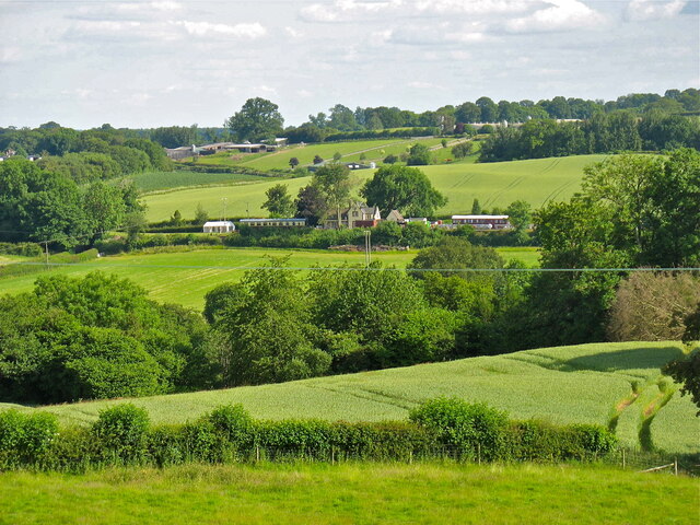
New Street is a charming and historic street located in the county of Herefordshire, England. Situated in the heart of the market town of Hereford, it serves as a bustling hub of activity and a focal point for both locals and visitors alike.

Lined with a mix of traditional timber-framed buildings and more modern structures, New Street seamlessly blends the old with the new, creating a unique architectural landscape that reflects the town's rich history. The street's cobbled pavement and narrow layout add to its character, evoking a sense of stepping back in time.

New Street is renowned for its vibrant atmosphere, with a diverse range of shops, boutiques, and eateries that cater to every taste. From independent retailers offering unique handmade crafts and antiques to well-known high street brands, there is something for everyone. The street is also home to several charming cafes and restaurants, serving up a variety of delicious local and international cuisines.

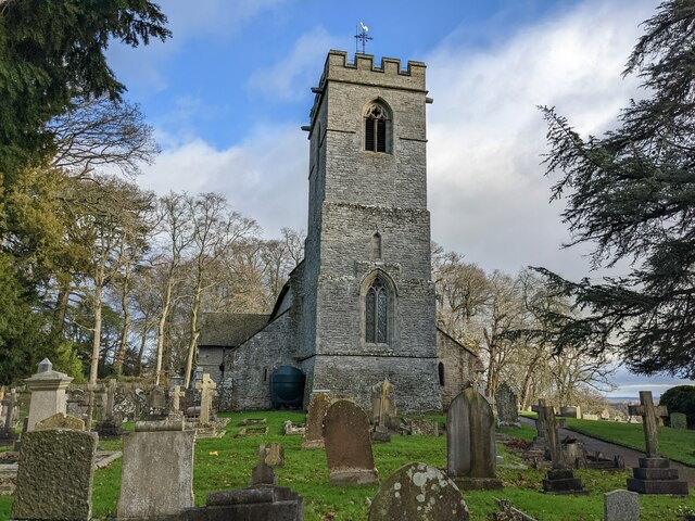
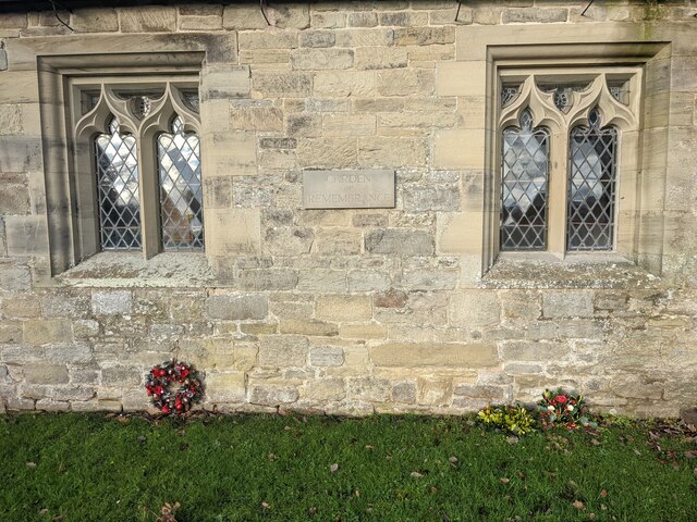
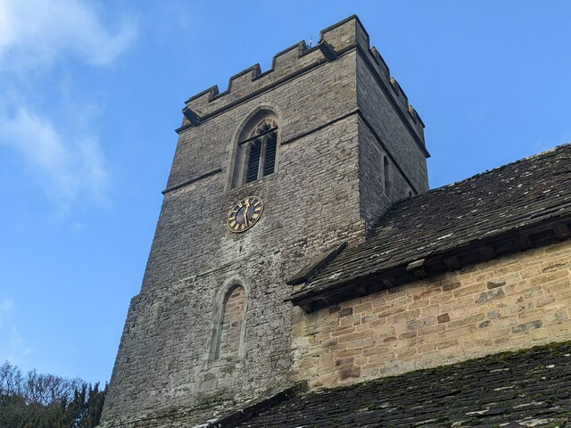
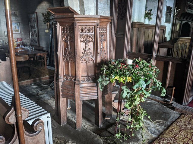
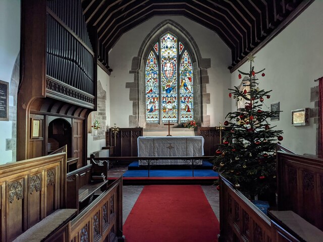
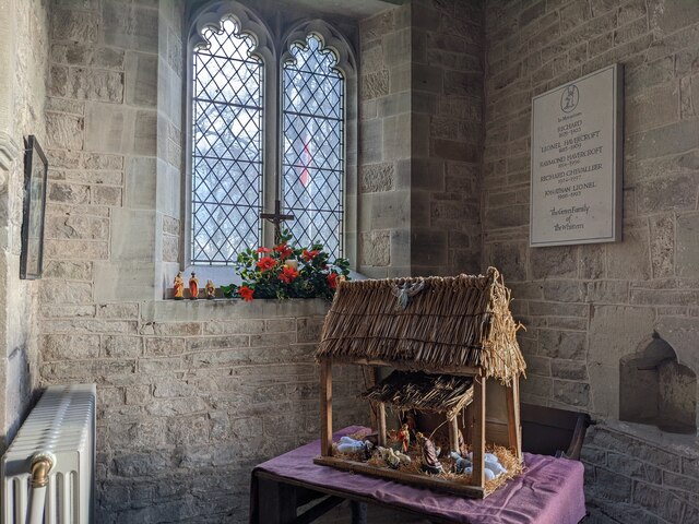
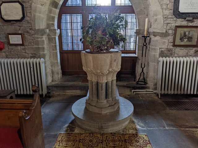
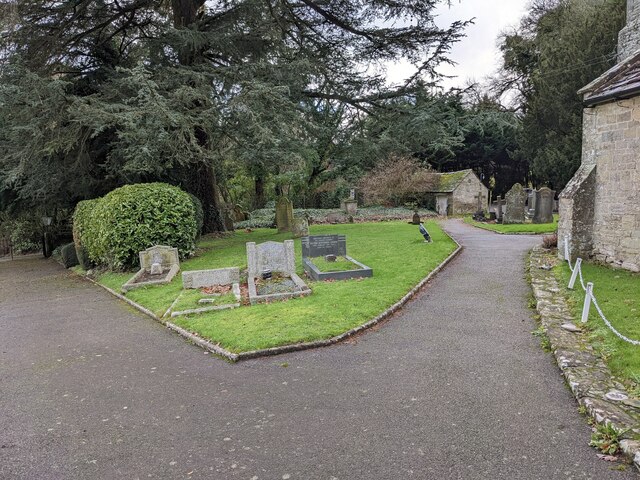
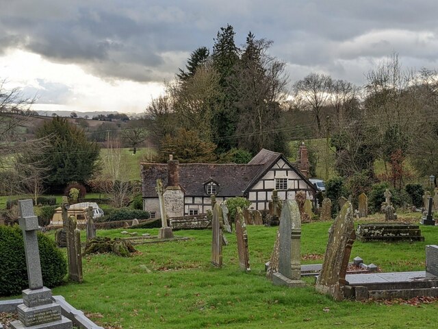
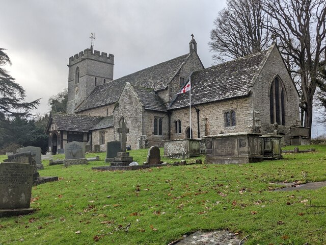
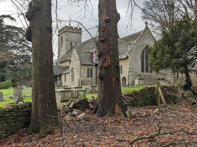
Aside from its commercial offerings, New Street is also home to several notable landmarks and attractions. St. Peter's Church, a picturesque medieval church with stunning stained glass windows, is a prominent feature at the end of the street. Additionally, the Hereford Museum and Art Gallery is located nearby, showcasing a fascinating collection of local history and art.

Overall, New Street in Herefordshire is a vibrant and historic street that encapsulates the essence of the town. With its mix of architectural beauty, diverse range of shops, and cultural attractions, it is a must-visit destination for anyone exploring the area.

If you have any feedback on the listing, please let us know in the comments section below.

New Street Images

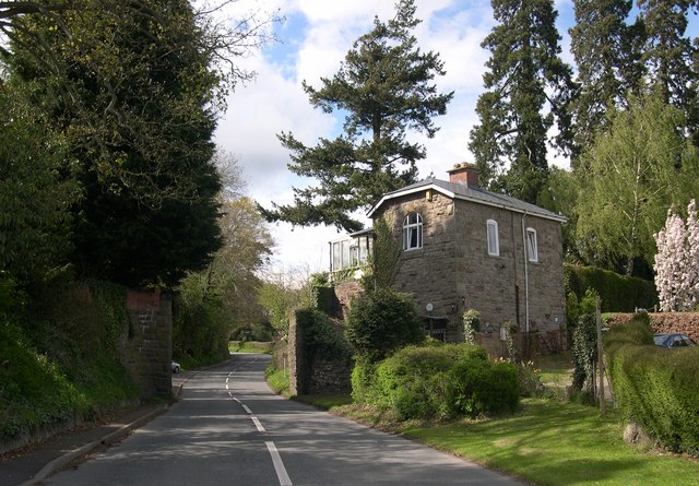
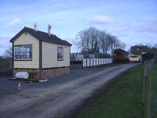
Images are sourced within 2km of 52.20478/-2.9727804 or Grid Reference SO3356. Thanks to Geograph Open Source API. All images are credited.

Towards Titley Junction The view across the fields of the old railway junction station.
Towards Titley Junction
The view across the fields of the old railway junction station.
St. Michael and All Angels Church (Lyonshall) Here is the parish church in Lyonshall, which has origins in the late twelfth century. The building dates from the mid to late thirteenth century, which consists of a nave, chancel and north aisle. The south aisle was added to the plan in the mid-fourteenth century, and the west bell tower was rebuilt in 1822. The structure was altered from 1872 to 73 by G. F. Bodley and was grade II* listed in October 1967. The building is on a knoll that has decent views of the countryside, and is west from the ruins of Lyonshall Castle.
St. Michael and All Angels Church (Lyonshall)
Here is the parish church in Lyonshall, which has origins in the late twelfth century. The building dates from the mid to late thirteenth century, which consists of a nave, chancel and north aisle. The south aisle was added to the plan in the mid-fourteenth century, and the west bell tower was rebuilt in 1822. The structure was altered from 1872 to 73 by G. F. Bodley and was grade II* listed in October 1967. The building is on a knoll that has decent views of the countryside, and is west from the ruins of Lyonshall Castle.
The Garden of Remembrance (Lyonshall) Here is the garden of remembrance west of the south porch at Lyonshall parish church, with a Christmas wreath and mistletoe at the garden.
The Garden of Remembrance (Lyonshall)
Here is the garden of remembrance west of the south porch at Lyonshall parish church, with a Christmas wreath and mistletoe at the garden.
St. Michael and All Angels Church (Bell tower | Lyonshall) The west bell tower at Lyonshall parish church turns two centuries old this year (2022), since it was rebuilt in 1822 as part of a restoration.
St. Michael and All Angels Church (Bell tower | Lyonshall)
The west bell tower at Lyonshall parish church turns two centuries old this year (2022), since it was rebuilt in 1822 as part of a restoration.
St. Michael and All Angels Church (Pulpit | Lyonshall) The pulpit in the east end of the nave possibly dates from 1872, the year G. F. Bodley restored the church.
St. Michael and All Angels Church (Pulpit | Lyonshall)
The pulpit in the east end of the nave possibly dates from 1872, the year G. F. Bodley restored the church.
Christmas tree inside St. Michael and All Angels Church (Lyonshall) This tree was in the east end of the nave when I visited.
Christmas tree inside St. Michael and All Angels Church (Lyonshall)
This tree was in the east end of the nave when I visited.
St. Michael and All Angels Church (Chancel | Lyonshall) There was a Christmas tree in the chancel on my visit, and it has nice decorations on it.
St. Michael and All Angels Church (Chancel | Lyonshall)
There was a Christmas tree in the chancel on my visit, and it has nice decorations on it.
Christmas tree inside St. Michael and All Angels Church (Lyonshall) There was a Christmas tree in the chancel on my visit, and it has nice decorations on it.
Christmas tree inside St. Michael and All Angels Church (Lyonshall)
There was a Christmas tree in the chancel on my visit, and it has nice decorations on it.
Christmas display inside St. Michael and All Angels Church (Lyonshall) This Christmas display was placed in the east end of the chancel on my visit.
Christmas display inside St. Michael and All Angels Church (Lyonshall)
This Christmas display was placed in the east end of the chancel on my visit.
Christmas display inside St. Michael and All Angels Church (Lyonshall) This Christmas display was placed in the east end of the chancel on my visit.
Christmas display inside St. Michael and All Angels Church (Lyonshall)
This Christmas display was placed in the east end of the chancel on my visit.
St. Michael and All Angels Church (Font | Lyonshall) The font in the west end of the nave dates from the mid-thirteenth century.
St. Michael and All Angels Church (Font | Lyonshall)
The font in the west end of the nave dates from the mid-thirteenth century.
St. Michael and All Angels Church (War memorial | Lyonshall) This war memorial plaque is in the south wall of the south aisle, built in memory of the people in Lyonshall parish that gave their lives in the two World Wars.
St. Michael and All Angels Church (War memorial | Lyonshall)
This war memorial plaque is in the south wall of the south aisle, built in memory of the people in Lyonshall parish that gave their lives in the two World Wars.
Churchyard at St. Michael and All Angels Church (Lyonshall) Taken outside the south porch, this view looks at the west section of the churchyard.
Churchyard at St. Michael and All Angels Church (Lyonshall)
Taken outside the south porch, this view looks at the west section of the churchyard.
The Old Weymouth Arms (Lyonshall) This timber-frame building is opposite St. Michael parish church, and this dates from the fifteenth century. A cross-wing was added in the seventeenth century, and the structure was altered in the twentieth century. The building housed a public house called the Weymouth Arms, which closed some centuries ago. The building, now known as Wharf House, was grade II listed in August 1953.
The Old Weymouth Arms (Lyonshall)
This timber-frame building is opposite St. Michael parish church, and this dates from the fifteenth century. A cross-wing was added in the seventeenth century, and the structure was altered in the twentieth century. The building housed a public house called the Weymouth Arms, which closed some centuries ago. The building, now known as Wharf House, was grade II listed in August 1953.
St. Michael and All Angels Church (Lyonshall) Here is the parish church in Lyonshall, which has origins in the late twelfth century. The building dates from the mid to late thirteenth century, which consists of a nave, chancel and north aisle. The south aisle was added to the plan in the mid-fourteenth century, and the west bell tower was rebuilt in 1822. The structure was altered from 1872 to 73 by G. F. Bodley and was grade II* listed in October 1967. The building is on a knoll that has decent views of the countryside, and is west from the ruins of Lyonshall Castle. The flag of England (St. George's Cross) was waving on my visit, and my previous visit to the church (15th August 2019) had the United Kingdom "Union Jack" flag waving. <a href="https://www.geograph.org.uk/photo/6347766">SO3356 : St. Michael & All Angels Church (Lyonshall)</a>
St. Michael and All Angels Church (Lyonshall)
Here is the parish church in Lyonshall, which has origins in the late twelfth century. The building dates from the mid to late thirteenth century, which consists of a nave, chancel and north aisle. The south aisle was added to the plan in the mid-fourteenth century, and the west bell tower was rebuilt in 1822. The structure was altered from 1872 to 73 by G. F. Bodley and was grade II* listed in October 1967. The building is on a knoll that has decent views of the countryside, and is west from the ruins of Lyonshall Castle. The flag of England (St. George's Cross) was waving on my visit, and my previous visit to the church (15th August 2019) had the United Kingdom "Union Jack" flag waving. SO3356 : St. Michael & All Angels Church (Lyonshall)
Sign at Lyonshall Castle This sign is placed at the south end of the moat at Lyonshall Castle.
Sign at Lyonshall Castle
This sign is placed at the south end of the moat at Lyonshall Castle.
Lyonshall Castle (Moat) Here is the moat at Lyonshall Castle, which was filled with water on my last visit in August 2019.
Lyonshall Castle (Moat)
Here is the moat at Lyonshall Castle, which was filled with water on my last visit in August 2019.
St. Michael and All Angels Church (Lyonshall) Here is the parish church in Lyonshall, which has origins in the late twelfth century. The building dates from the mid to late thirteenth century, which consists of a nave, chancel and north aisle. The south aisle was added to the plan in the mid-fourteenth century, and the west bell tower was rebuilt in 1822. The structure was altered from 1872 to 73 by G. F. Bodley and was grade II* listed in October 1967. The building is on a knoll that has decent views of the countryside, and is west from the ruins of Lyonshall Castle.
St. Michael and All Angels Church (Lyonshall)
Here is the parish church in Lyonshall, which has origins in the late twelfth century. The building dates from the mid to late thirteenth century, which consists of a nave, chancel and north aisle. The south aisle was added to the plan in the mid-fourteenth century, and the west bell tower was rebuilt in 1822. The structure was altered from 1872 to 73 by G. F. Bodley and was grade II* listed in October 1967. The building is on a knoll that has decent views of the countryside, and is west from the ruins of Lyonshall Castle.
Show me another place!

New Street is located at Grid Ref: SO3356 (Lat: 52.20478, Lng: -2.9727804)

Unitary Authority: County of Herefordshire

Police Authority: West Merica

What 3 Words

///keyboard.rings.tinny. Near Kington, Herefordshire

Nearby Locations

New Street

Related Wikis

Lyonshall railway station

Lyonshall railway station was a station in Lyonshall, Herefordshire, England. The station was opened in 1874 and closed in 1940. It is located on the A480...

Lyonshall

Lyonshall is a historic village and civil parish in Herefordshire, England. The civil parish includes the hamlet of Penrhos. According to the 2001 Census...

Titley Junction railway station

Titley Junction railway station was a station in Titley, Herefordshire, England. The station was located nearly two miles south of Titley village. The...

Holme Marsh

Holme Marsh (Originally Holmes) is a village in Herefordshire, England on the A480 road. It is near the Welsh border and the small town of Kington. A...

Nearby Amenities

Located within 500m of 52.20478,-2.9727804
Power: pole
Source: bing
Lat/Long: 52.2032886/-2.9703185
Power: pole
Source: bing
Lat/Long: 52.2026097/-2.9705089
Material: wood
Power: pole
Source: bing
Lat/Long: 52.2017496/-2.9706783
Material: wood
Power: pole
Source: bing
Lat/Long: 52.2009987/-2.9708791
Barrier: swing_gate
Lat/Long: 52.2047104/-2.9728854
Barrier: swing_gate
Lat/Long: 52.2047059/-2.9733704
Information: guidepost
Tourism: information
Lat/Long: 52.2056999/-2.9781089
Man Made: beehive
Lat/Long: 52.2057323/-2.9793228
Information: guidepost
Tourism: information
Lat/Long: 52.2049241/-2.9775622
Information: guidepost
Tourism: information
Lat/Long: 52.2036559/-2.9772125
Information: guidepost
Tourism: information
Lat/Long: 52.2026909/-2.9774541
Barrier: stile
Material: wood
Stile: stepover
Lat/Long: 52.2026156/-2.9790493
Barrier: stile
Description: 2021: quite a large drop to East of this stile. This descent is also stingy-nettle laden.
Material: wood
Stile: stepover
Lat/Long: 52.2035885/-2.9772823
Information: guidepost
Tourism: information
Lat/Long: 52.2047191/-2.9728454
Bridge Support: yes
Lat/Long: 52.204708/-2.9731466
Barrier: swing_gate
Lat/Long: 52.2035318/-2.9760549
Barrier: swing_gate
Lat/Long: 52.2036897/-2.9768268
Information: route_marker
Tourism: information
Lat/Long: 52.2059366/-2.978692
The data included in this document is from www.openstreetmap.org. The data is made available under ODbL.

Have you been to New Street?

Leave your review of New Street below (or comments, questions and feedback).