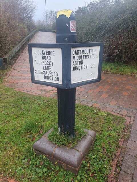
Nechells Green

Settlement in Warwickshire

England

Nechells Green

Modern Milepost, Birmingham and Fazeley Canal Milestone at the foot of the access path from Richard Street by Aston Locks on the Birmingham and Fazeley Canal.

Inscription: 400m Avenue / Road / 600m Rocky / Lane / 2.5km Salford / Junction //
Dartmouth / Middleway 150m / Aston / Junction 325m

Milestone Society National ID: tbc
Modern Milepost, Birmingham and Fazeley Canal Credit: Billy Hufton

Nechells Green is a small village located in the county of Warwickshire, England. Situated approximately 7 miles east of Birmingham city center, it falls within the Birmingham metropolitan area. Nechells Green is a vibrant community with a rich history and a population of around 1,500 residents.

The village is known for its picturesque countryside, characterized by rolling hills, lush green fields, and scenic walking trails. It offers a peaceful and tranquil environment, making it an ideal place for nature lovers and those seeking an escape from the hustle and bustle of city life.

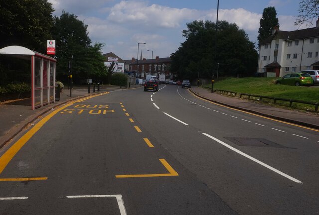
Nechells Green is well-connected to the surrounding areas through various transport links. The village is served by several bus routes, providing easy access to nearby towns and cities. The A47 road also runs through the village, connecting it to the wider road network.

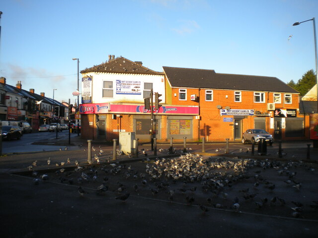
Local amenities in Nechells Green include a primary school, a village hall, and a small number of shops and businesses that cater to the needs of the community. For more extensive shopping and entertainment options, residents can easily access the nearby towns of Birmingham and Coventry.

The village hosts a range of community events throughout the year, including fairs, festivals, and sporting activities. These events bring the community together and provide opportunities for socializing and building connections.

Overall, Nechells Green offers a peaceful and picturesque setting, combined with convenient access to nearby urban centers, making it an attractive place to live for those seeking a balance between rural charm and urban amenities.

If you have any feedback on the listing, please let us know in the comments section below.

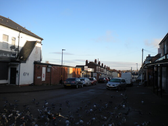
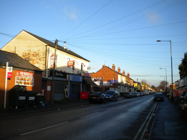
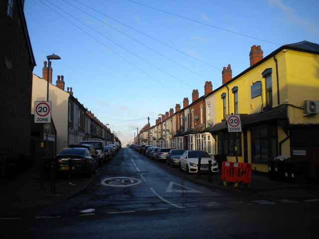
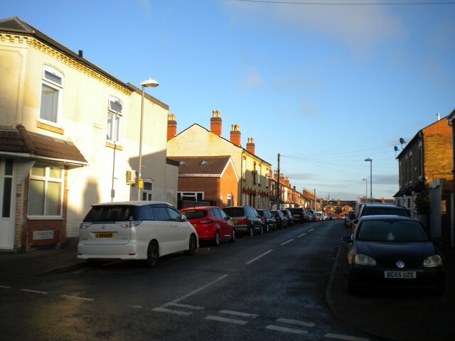
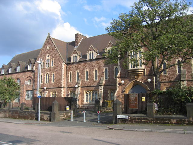
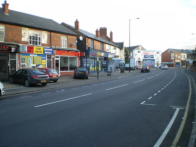
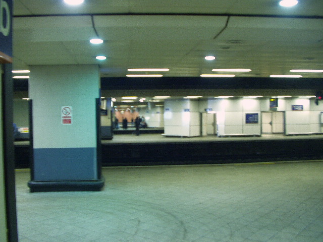
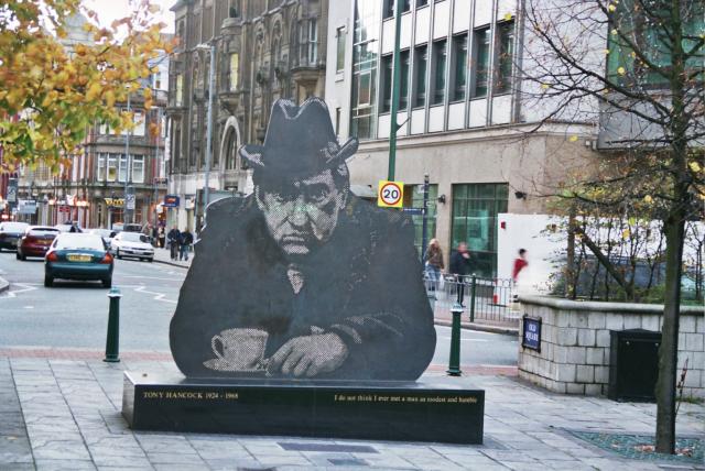
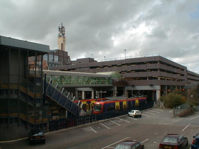
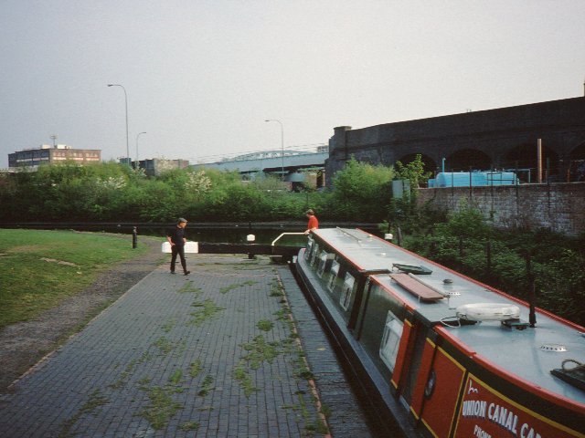
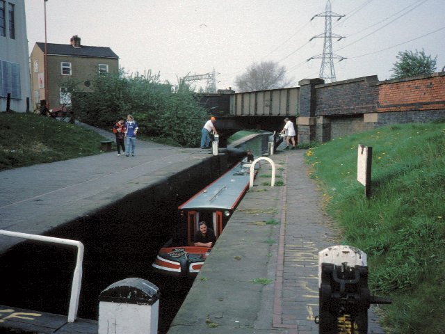
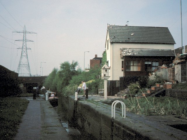
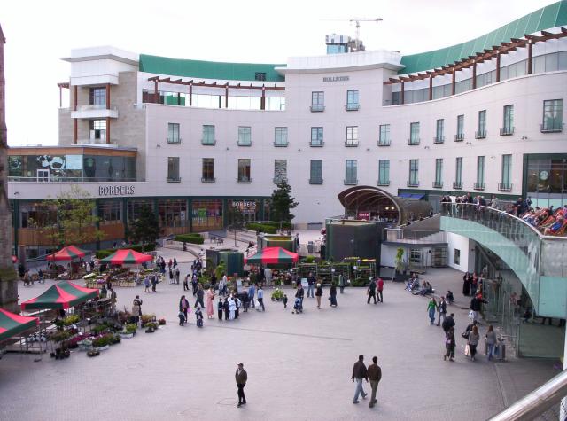
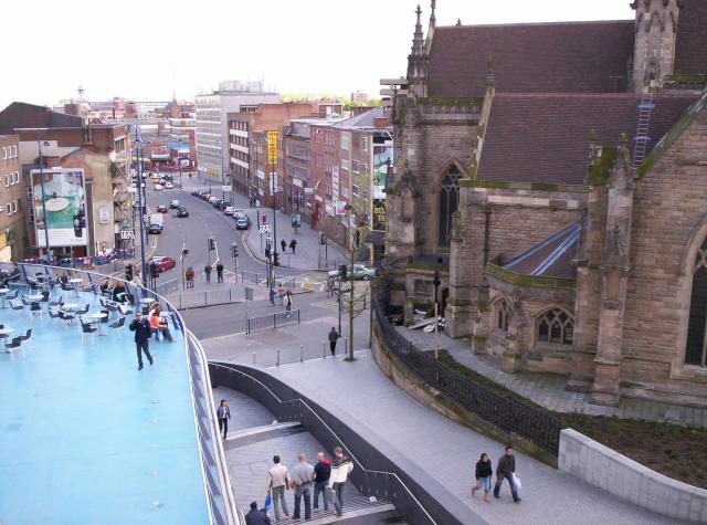
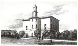
Nechells Green Images

Images are sourced within 2km of 52.489206/-1.8797531 or Grid Reference SP0887. Thanks to Geograph Open Source API. All images are credited.

Modern Milepost, Birmingham and Fazeley Canal Milestone at the foot of the access path from Richard Street by Aston Locks on the Birmingham and Fazeley Canal.

Inscription: 400m Avenue / Road / 600m Rocky / Lane / 2.5km Salford / Junction //
Dartmouth / Middleway 150m / Aston / Junction 325m

Milestone Society National ID: tbc
Modern Milepost, Birmingham and Fazeley Canal
Milestone at the foot of the access path from Richard Street by Aston Locks on the Birmingham and Fazeley Canal. Inscription: 400m Avenue / Road / 600m Rocky / Lane / 2.5km Salford / Junction // Dartmouth / Middleway 150m / Aston / Junction 325m Milestone Society National ID: tbc
Washwood Heath Road at Sandway  Gardens, Birmingham
Washwood Heath Road at Sandway Gardens, Birmingham
Flock of pigeons, Gowan Road, Saltley A sizeable gathering of feral pigeons (rock doves) pecks around the turning area at the closed off end of Gowan Road, where it formerly met Highfield Road and Alum Rock Road.
Flock of pigeons, Gowan Road, Saltley
A sizeable gathering of feral pigeons (rock doves) pecks around the turning area at the closed off end of Gowan Road, where it formerly met Highfield Road and Alum Rock Road.
West end of Gowan Road, Saltley With part of a large flock of feral pigeons (rock doves) milling around the turning area.
West end of Gowan Road, Saltley
With part of a large flock of feral pigeons (rock doves) milling around the turning area.
Highfield Road, Saltley Looking towards Washwood Heath from near its junction with Alum Rock Road.
Highfield Road, Saltley
Looking towards Washwood Heath from near its junction with Alum Rock Road.
Havelock Road, Saltley Off Highfield Road.
Havelock Road, Saltley
Off Highfield Road.
Cradock Road, Saltley Off Havelock Road.
Cradock Road, Saltley
Off Havelock Road.
St Peter's College buildings St Peter's College of Education was founded by Charles Bowyer Adderley, K.C.M.G., first Lord Norton, in 1852.  Today these buildings from the college are managed by the St Peter's Housing association providing social housing for rent including, sheltered housing for the elderly.
St Peter's College buildings
St Peter's College of Education was founded by Charles Bowyer Adderley, K.C.M.G., first Lord Norton, in 1852. Today these buildings from the college are managed by the St Peter's Housing association providing social housing for rent including, sheltered housing for the elderly.
Parade of shops on Washwood Heath Road
Under-station passage The Eastern labyrinth of passages underneath Birmingham New Street station
Under-station passage
The Eastern labyrinth of passages underneath Birmingham New Street station
Birmingham New Street A pseudo-regressive image of Birmingham's main station
Birmingham New Street
A pseudo-regressive image of Birmingham's main station
Birmingham City Centre Tony Hancock Memorial in the Old Square, Corporation Street.  

The memorial stands on the filled in island that once had pedestrian underpasses and public toilets, that gave pedestrian access to the various roads off this island.  All changed during the city redevelopment and removal of elevated roads.
Birmingham City Centre
Tony Hancock Memorial in the Old Square, Corporation Street. The memorial stands on the filled in island that once had pedestrian underpasses and public toilets, that gave pedestrian access to the various roads off this island. All changed during the city redevelopment and removal of elevated roads.
Birmingham Snow Hill Birmingham Snow Hill station, or more precisely the car park above it.  In the middle foreground is the current Birmingham terminus of the Midland Metro.  On the skyline is the Birmingham BT Tower.
Birmingham Snow Hill
Birmingham Snow Hill station, or more precisely the car park above it. In the middle foreground is the current Birmingham terminus of the Midland Metro. On the skyline is the Birmingham BT Tower.
Bordesley The canal used to go straight ahead here through another lock and on towards the railway viaduct in the distance. When the Birmingham Middle ring road was built in the 1990s the canal was diverted to the left with dog-leg to use a brand new lock so as to make space for the road
Bordesley
The canal used to go straight ahead here through another lock and on towards the railway viaduct in the distance. When the Birmingham Middle ring road was built in the 1990s the canal was diverted to the left with dog-leg to use a brand new lock so as to make space for the road
Garrison Locks The top lock of the Garrison Locks, hidden away in the midst of Bordesley.  This is still technically part of the Grand Union/Birmingham & Warwick Canal although resembling much of the rest of the BCN.
Garrison Locks
The top lock of the Garrison Locks, hidden away in the midst of Bordesley. This is still technically part of the Grand Union/Birmingham & Warwick Canal although resembling much of the rest of the BCN.
Garrison Locks Lock No 63, hidden away only a short way from Adderley Park.
Garrison Locks
Lock No 63, hidden away only a short way from Adderley Park.
The Bullring, Birmingham Part of the Bullring shopping centre in Birmingham, recently rebuilt. The shell-like café right of centre has been praised by architectural commentators. At the very left edge of the image, part of St Martin's church is visible.
The Bullring, Birmingham
Part of the Bullring shopping centre in Birmingham, recently rebuilt. The shell-like café right of centre has been praised by architectural commentators. At the very left edge of the image, part of St Martin's church is visible.
View south from the Bullring, Birmingham The church is St Martin's.
View south from the Bullring, Birmingham
The church is St Martin's.
Show me another place!

Nechells Green is located at Grid Ref: SP0887 (Lat: 52.489206, Lng: -1.8797531)

Unitary Authority: Birmingham

Police Authority: West Midlands

What 3 Words

///stored.design.opens. Near Aston, West Midlands

Related Wikis

Duddeston

Duddeston is an inner-city area of the Nechells ward of central Birmingham, England. It was part of the Birmingham Duddeston constituency until that ceased...

St Matthew's Church, Duddeston and Nechells

St Matthew's Church, Duddeston and Nechells is a Grade II listed parish church in the Church of England in Birmingham. == History == The church was designed...

Heartlands Academy

Heartlands Academy is a coeducational secondary school located in the Nechells area of Birmingham, West Midlands, England.Heartlands Academy offers GCSEs...

Ashted

Ashted (alternatively spelt Ashstead and Ashtead) is an area of Birmingham in the United Kingdom, within the ward of Nechells. The area is located approximately...

King Solomon International Business School

King Solomon International Business School is a Primary, Secondary and Sixth Form school located in Birmingham, England, on the old site of Waterlinks...

St James the Less' Church, Ashted

St James the Less’ Church, Ashted was a former Church of England parish church in Ashted, Birmingham. == History == The church was originally the family...

Aston University Engineering Academy

Aston University Engineering Academy is a university technical college (UTC) that opened in September 2012 in the Gosta Green area of Birmingham, West...

St Lawrence's Church, Duddeston

St Lawrence's Church, Dartmouth Street, Duddeston is a former Church of England parish church in Birmingham. == History == The foundation stone was laid...

Nearby Amenities

Located within 500m of 52.489206,-1.8797531
Traffic Signals
Crossing: traffic_signals
Ref: E0500
Source: OpenStreetCam;estimate
Lat/Long: 52.4863572/-1.8824406
Traffic Signals
Crossing: traffic_signals
Ref: E0500
Source: OpenStreetCam;estimate
Lat/Long: 52.4865845/-1.8830651
Towpath Access Point: foot
Lat/Long: 52.485532/-1.8825133
Seamark Type: gate
Waterway: lock_gate
Lat/Long: 52.4863496/-1.8841122
Seamark Type: gate
Waterway: lock_gate
Lat/Long: 52.4861623/-1.8839174
Crossing
Crossing: uncontrolled
Lat/Long: 52.4879692/-1.8742766
Crossing
Crossing: unmarked
Tactile Paving: yes
Lat/Long: 52.4870013/-1.8809323
Parking
Source: survey
Lat/Long: 52.4912144/-1.8848866
Fuel
Addr City: Birmingham
Addr Postcode: B7 4DA
Addr Street: Great Lister Street
Lat/Long: 52.4896597/-1.8838192
Nightclub
Vauxhall Sports and Social Club
Source: survey
Lat/Long: 52.4869746/-1.8770077
Towpath Access Point: bicycle
Lat/Long: 52.4909313/-1.8864351
Bus Stop
Vauxhall Rd / Hilden Rd
NaPTANAreaCode: 43000241501
Asset Ref: 607414
Bus: yes
Naptan AtcoCode: 43000241501
Naptan Bearing: S
Naptan BusStopType: MKD
Naptan CommonName: Hilden Rd
Naptan Indicator: opp
Naptan NaptanCode: nwmamgam
Naptan PlusbusZoneRef: BHAMNWS
Naptan Status: ACT
Naptan StopType: BCT
Naptan Street: VAUXHALL RD
Naptan Towards: Birmingham
Public Transport: platform
Route Ref: 14
Shelter: yes
Shelter Ref: 607414
Source: WMCA
Lat/Long: 52.4870183/-1.8751015
Bus Stop
Vauxhall Rd / Hilden Rd
NaPTANAreaCode: 43000241502
Asset Ref: 607413E
Bus: yes
Layby: yes
Naptan AtcoCode: 43000241502
Naptan Bearing: N
Naptan BusStopType: MKD
Naptan CommonName: Hilden Rd
Naptan Indicator: adj
Naptan NaptanCode: nwmamgap
Naptan PlusbusZoneRef: BHAMNWS
Naptan Status: ACT
Naptan StopType: BCT
Naptan Street: VAUXHALL RD
Naptan Towards: Saltley
Public Transport: platform
Route Ref: 14
Shelter: yes
Shelter Ref: 607413
Source: WMCA
Lat/Long: 52.4867871/-1.8754848
Bus Stop
Great Francis St / Duddeston Rail Sta
NaPTANAreaCode: 43000241602
Bus: yes
Naptan AtcoCode: 43000241602
Naptan Bearing: E
Naptan BusStopType: MKD
Naptan CommonName: Duddeston Rail Sta
Naptan Indicator: opp
Naptan Landmark: The Rocket
Naptan NaptanCode: nwmamgaw
Naptan PlusbusZoneRef: BHAMNWS
Naptan Status: ACT
Naptan StopType: BCT
Naptan Street: GREAT FRANCIS ST
Naptan Towards: Saltley
Public Transport: platform
Route Ref: 14
Shelter: yes
Shelter Ref: 607415
Source: WMCA
Lat/Long: 52.4888682/-1.8730849
Bus Stop
Lister St / The Gosta Green
Bus: yes
Naptan AtcoCode: 43000242101
Naptan Bearing: SW
Naptan BusStopType: MKD
Naptan CommonName: The Gosta Green
Naptan Indicator: adj
Naptan NaptanCode: nwmamgdm
Naptan PlusbusZoneRef: BHAMNWS
Naptan Status: ACT
Naptan StopType: BCT
Naptan Street: LISTER ST
Naptan Towards: Birmingham
Public Transport: platform
Route Ref: 66
Shelter: no
Source: WMCA
Lat/Long: 52.4880993/-1.8868584
Bus Stop
Great Lister St / Fletchers
NaPTANAreaCode: 43000242201
Asset Ref: 507438
Bus: yes
Naptan AtcoCode: 43000242201
Naptan Bearing: E
Naptan BusStopType: MKD
Naptan CommonName: Fletchers
Naptan Indicator: opp
Naptan NaptanCode: nwmamgdt
Naptan PlusbusZoneRef: BHAMNWS
Naptan Status: ACT
Naptan StopType: BCT
Naptan Street: GREAT LISTER ST
Naptan Towards: Nechells
Public Transport: platform
Route Ref: 66
Shelter: yes
Shelter Ref: 507438
Source: WMCA
Lat/Long: 52.4894104/-1.8846824
Bus Stop
Great Lister St / Fletchers
NaPTANAreaCode: 43000242202
Asset Ref: 507439
Bus: yes
Naptan AtcoCode: 43000242202
Naptan Bearing: W
Naptan BusStopType: MKD
Naptan CommonName: Fletchers
Naptan Indicator: adj
Naptan NaptanCode: nwmamgdw
Naptan PlusbusZoneRef: BHAMNWS
Naptan Status: ACT
Naptan StopType: BCT
Naptan Street: GREAT LISTER ST
Naptan Towards: Birmingham
Public Transport: platform
Route Ref: 66
Shelter: yes
Shelter Ref: 507439
Source: WMCA
Lat/Long: 52.489284/-1.884829
Bus Stop
Great Lister St / Proctor St
NaPTANAreaCode: 43000242301
Bus: yes
Naptan AtcoCode: 43000242301
Naptan Bearing: SW
Naptan BusStopType: MKD
Naptan CommonName: Proctor St
Naptan Indicator: opp
Naptan NaptanCode: nwmamgja
Naptan PlusbusZoneRef: BHAMNWS
Naptan Status: ACT
Naptan StopType: BCT
Naptan Street: GREAT LISTER ST
Naptan Towards: Birmingham
Naptan Verified: no
Public Transport: platform
Route Ref: 66
Shelter: yes
Shelter Ref: 507440
Source: WMCA
Lat/Long: 52.4897947/-1.8823102
Bus Stop
Great Lister St / Proctor St
NaPTANAreaCode: 43000242302
Bus: yes
Naptan AtcoCode: 43000242302
Naptan Bearing: NE
Naptan BusStopType: MKD
Naptan CommonName: Proctor St
Naptan Indicator: adj
Naptan NaptanCode: nwmamgjd
Naptan PlusbusZoneRef: BHAMNWS
Naptan Status: ACT
Naptan StopType: BCT
Naptan Street: GREAT LISTER ST
Naptan Towards: Nechells
Naptan Verified: no
Public Transport: platform
Route Ref: 66
Shelter: yes
Shelter Ref: 507441
Source: WMCA
Lat/Long: 52.4900803/-1.881306
Bus Stop
Nechells Parkway / Windsor St South
NaPTANAreaCode: 43000242401
Asset Ref: 607423
Bus: yes
Layby: yes
Naptan AtcoCode: 43000242401
Naptan Bearing: SW
Naptan BusStopType: MKD
Naptan CommonName: Windsor St South
Naptan Indicator: adj
Naptan NaptanCode: nwmamgjg
Naptan PlusbusZoneRef: BHAMNWS
Naptan Status: ACT
Naptan StopType: BCT
Naptan Street: NECHELLS PARKWAY
Naptan Towards: Birmingham
Public Transport: platform
Route Ref: 55;55A;56;70;72;94
Shelter: yes
Shelter Ref: 607423
Source: WMCA
Towards: Birmingham
Lat/Long: 52.4880029/-1.8802795
Bus Stop
Nechells Parkway / Windsor St South
NaPTANAreaCode: 43000242402
Bus: yes
Naptan AtcoCode: 43000242402
Naptan Bearing: NE
Naptan BusStopType: MKD
Naptan CommonName: Windsor St South
Naptan Indicator: opp
Naptan NaptanCode: nwmamgjm
Naptan PlusbusZoneRef: BHAMNWS
Naptan Status: ACT
Naptan StopType: BCT
Naptan Street: NECHELLS PARKWAY
Naptan Towards: Saltley
Naptan Verified: no
Public Transport: platform
Route Ref: 55;55A;56;70;72;94
Shelter: yes
Shelter Ref: 607424
Source: WMCA
Lat/Long: 52.4882728/-1.8805894
Bus Stop
Nechells Parkway / Nechells Health Centre
NaPTANAreaCode: 43000242502
Bus: yes
Naptan AtcoCode: 43000242502
Naptan Bearing: NE
Naptan BusStopType: MKD
Naptan CommonName: Nechells Health Centre
Naptan Indicator: adj
Naptan NaptanCode: nwmamgjp
Naptan PlusbusZoneRef: BHAMNWS
Naptan Status: ACT
Naptan StopType: BCT
Naptan Street: NECHELLS PARKWAY
Naptan Towards: Saltley
Naptan Verified: no
Public Transport: platform
Route Ref: 55;55A;56;70;72;94
Shelter: yes
Shelter Ref: 607421
Source: WMCA
Lat/Long: 52.4909498/-1.8777267
Bus Stop
Nechells Parkway / Nechells Health Centre
NaPTANAreaCode: 43000242503
Bus: yes
Naptan AtcoCode: 43000242503
Naptan Bearing: SW
Naptan BusStopType: MKD
Naptan CommonName: Nechells Health Centre
Naptan Indicator: opp
Naptan NaptanCode: nwmamgjt
Naptan PlusbusZoneRef: BHAMNWS
Naptan Status: ACT
Naptan StopType: BCT
Naptan Street: NECHELLS PARKWAY
Naptan Towards: Birmingham
Naptan Verified: no
Public Transport: platform
Route Ref: 55;55A;56;70;72;94
Shelter: yes
Shelter Ref: 607422
Source: WMCA
Lat/Long: 52.4908672/-1.8770418
Bus Stop
Oliver St / Denby Close
Bus: yes
Naptan AtcoCode: 43000243801
Naptan Bearing: SE
Naptan BusStopType: MKD
Naptan CommonName: Denby Close
Naptan Indicator: opp
Naptan Landmark: The NACE Centre
Naptan NaptanCode: nwmdtjdg
Naptan PlusbusZoneRef: BHAMNWS
Naptan Status: ACT
Naptan StopType: BCT
Naptan Street: OLIVER ST
Naptan Towards: Saltley, Erdington
Naptan Verified: no
Public Transport: platform
Route Ref: 8C;53;66
Source: WMCA
Lat/Long: 52.4926469/-1.8757778
Bus Stop
Oliver St / Denby Close
Bus: yes
Naptan AtcoCode: 43000243802
Naptan Bearing: NW
Naptan BusStopType: MKD
Naptan CommonName: Denby Close
Naptan Indicator: adj
Naptan Landmark: The NACE Centre
Naptan NaptanCode: nwmdtjdj
Naptan PlusbusZoneRef: BHAMNWS
Naptan Status: ACT
Naptan StopType: BCT
Naptan Street: OLIVER ST
Naptan Towards: Birmingham
Public Transport: platform
Route Ref: 8A;53;66
Shelter: no
Source: WMCA
Lat/Long: 52.492439/-1.8755178
Bus Stop
Rupert St / Hyssop Close
Bus: yes
Naptan AtcoCode: 43000243901
Naptan Bearing: NE
Naptan BusStopType: MKD
Naptan CommonName: Hyssop Close
Naptan Indicator: after
Naptan NaptanCode: nwmdtjdm
Naptan PlusbusZoneRef: BHAMNWS
Naptan Status: ACT
Naptan StopType: BCT
Naptan Street: RUPERT ST
Naptan Towards: Erdington
Naptan Verified: no
Public Transport: platform
Route Ref: 66
Source: WMCA
Lat/Long: 52.4922718/-1.8782091
Bus Stop
Rupert St / Hyssop Close
Bus: yes
Naptan AtcoCode: 43000243902
Naptan Bearing: SW
Naptan BusStopType: MKD
Naptan CommonName: Hyssop Close
Naptan Indicator: before
Naptan NaptanCode: nwmtjgja
Naptan PlusbusZoneRef: BHAMNWS
Naptan Status: ACT
Naptan StopType: BCT
Naptan Street: RUPERT ST
Naptan Towards: Birmingham
Naptan Verified: no
Public Transport: platform
Route Ref: 66
Source: WMCA
Lat/Long: 52.4921907/-1.878062
Bus Stop
Rupert St / Nechells Sports Centre
Bus: yes
Naptan AtcoCode: 43000244001
Naptan Bearing: NE
Naptan BusStopType: MKD
Naptan CommonName: Nechells Sports Centre
Naptan NaptanCode: nwmgdwmg
Naptan PlusbusZoneRef: BHAMNWS
Naptan Status: ACT
Naptan StopType: BCT
Naptan Street: RUPERT ST
Naptan Towards: Erdington
Naptan Verified: no
Public Transport: platform
Route Ref: 66
Source: WMCA
Lat/Long: 52.4907273/-1.879966
Bus Stop
Rupert St / Nechells Sports Centre
Bus: yes
Naptan AtcoCode: 43000244002
Naptan Bearing: SW
Naptan BusStopType: CUS
Naptan CommonName: Nechells Sports Centre
Naptan NaptanCode: nwmtjgjd
Naptan PlusbusZoneRef: BHAMNWS
Naptan Status: ACT
Naptan StopType: BCT
Naptan Street: RUPERT ST
Naptan Towards: Birmingham
Naptan Verified: no
Public Transport: platform
Route Ref: 66
Source: WMCA
Lat/Long: 52.4905602/-1.8800304
Give Way
Source: bing
Lat/Long: 52.4877324/-1.884411
Power: substation
Ref: 55125
Source: su
Lat/Long: 52.4867735/-1.8854475
Man Made: surveillance
Source: survey
Lat/Long: 52.4868564/-1.8856455
Man Made: surveillance
Source: survey
Lat/Long: 52.4871991/-1.8851449
Bench
Lat/Long: 52.4878595/-1.8856356
Waterway: turning_point
Lat/Long: 52.487674/-1.8855411
Addr City: Birmingham
Addr Housenumber: 1
Addr Postcode: B7 4LA
Addr Street: Finstall Close
Source: survey
Lat/Long: 52.4872672/-1.8789767
Addr City: Birmingham
Addr Housenumber: 35
Addr Postcode: B7 4LA
Addr Street: Finstall Close
Source: survey
Lat/Long: 52.4872203/-1.8789573
Addr City: Birmingham
Addr Housenumber: 33
Addr Postcode: B7 4LA
Addr Street: Finstall Close
Source: survey
Lat/Long: 52.4873685/-1.8778638
Addr City: Birmingham
Addr Housenumber: 73
Addr Postcode: B7 4LA
Addr Street: Finstall Close
Source: survey
Lat/Long: 52.48732/-1.87785
Barrier: bollard
Bollard: fixed
Source: survey
Lat/Long: 52.4876645/-1.8810527
Barrier: bollard
Bollard: fixed
Source: survey
Lat/Long: 52.4876485/-1.8806259
Bench
Source: survey
Lat/Long: 52.488068/-1.8802178
Communication Mobile Phone: yes
Man Made: tower
Operator: EE
Operator Wikidata: Q5322942
Tower Type: communication
Lat/Long: 52.4857188/-1.8820377
Communication Mobile Phone: yes
Man Made: tower
Operator: O2
Operator Wikidata: Q7072245
Ref: 037728
Tower Type: communication
Lat/Long: 52.4859/-1.8821818
Brand: National Grid
Brand Wikidata: Q1465461
Operator: National Grid Electricity Distribution
Operator Old: Western Power Distribution
Operator Wikidata: Q7988183
Owner: National Grid Electricity Distribution (West Midlands) Plc
Owner Wikidata: Q114397791
Power: substation
Source: survey
Lat/Long: 52.4861123/-1.881131
Give Way
Source: bing
Lat/Long: 52.4876294/-1.8839062
Traffic Signals
Source: survey
Lat/Long: 52.4893178/-1.879599
Traffic Signals
Source: survey
Lat/Long: 52.4893589/-1.8798692
Vauxhall
Place: village
Source: local_knowledge
Lat/Long: 52.4854672/-1.875952
Post Office
Vauxhall Post Office
Addr City: Birmingham
Addr Housenumber: 37-39
Addr Postcode: B7 4LG
Addr Street: Revesby Walk
Opening Hours: Mo,Tu 08:30-17:30; We-Sa 09:00-17:30
Ref Pol Id: 14514
Lat/Long: 52.4868136/-1.8762318
Brand: National Grid
Brand Wikidata: Q1465461
Operator: National Grid Electricity Distribution Plc
Operator Old: Western Power Distribution
Operator Wikidata: Q7988183
Owner: National Grid Electricity Distribution (West Midlands) Plc
Owner Wikidata: Q114397791
Power: substation
Source: visual survey; estimate
Lat/Long: 52.4929116/-1.8770038
Shop: hairdresser
Source: survey
Lat/Long: 52.4930615/-1.8763387
J C Motors
Addr City: Birmingham
Addr Postcode: B7 4DA
Addr Street: Great Lister Street
Shop: car_repair
Source: survey
Lat/Long: 52.49001/-1.8842242
Brand: National Grid
Brand Wikidata: Q1465461
Operator: National Grid Electricity Distribution Plc
Operator Old: Western Power Distribution
Operator Wikidata: Q7988183
Owner: National Grid Electricity Distribution (West Midlands) Plc
Owner Wikidata: Q114397791
Power: substation
Source: visual survey; estimate
Lat/Long: 52.49285/-1.883669
Fast Food
Source: survey
Lat/Long: 52.48679/-1.8763539
Fast Food
Source: survey
Lat/Long: 52.4870318/-1.8756813
Man Made: surveillance
Source: survey
Lat/Long: 52.4871142/-1.8749713
Shop: alcohol
Source: survey
Lat/Long: 52.4869606/-1.8765267
Towpath Access Point: bicycle
Lat/Long: 52.4924103/-1.884723
Towpath Access Point: foot
Lat/Long: 52.489163/-1.887055
48sheetart: yes
Man Made: billboard
Operator: Clearchannel
Ref: 40404
Sheets: 48
Lat/Long: 52.4852468/-1.8814632
48sheetart: yes
Man Made: billboard
Operator: Clearchannel
Ref: 40403
Sheets: 48
Lat/Long: 52.4853026/-1.8815223
48sheetart: yes
Man Made: billboard
Operator: Clearchannel
Ref: 40402
Sheets: 48
Lat/Long: 52.4854544/-1.8817203
48sheetart: yes
Man Made: billboard
Operator: Clearchannel
Ref: 40401
Sheets: 96
Lat/Long: 52.485528/-1.8817602
Bicycle Parking
Nisa Supermarket
Bcc Ref: 536
Bicycle Parking: stands
Capacity: 4
Covered: no
Lat/Long: 52.4927441/-1.877512
Bicycle Parking
Nechells Community Sports Centre
Bcc Ref: 534
Bicycle Parking: stands
Capacity: 20
Covered: no
Lat/Long: 52.4909162/-1.8803043
Bicycle Parking
Nechells Community Sports Centre
Bcc Ref: 535
Bicycle Parking: stands
Capacity: 8
Covered: no
Lat/Long: 52.49102/-1.8799146
Crossing
Crossing: unmarked
Tactile Paving: no
Lat/Long: 52.4851096/-1.8813428
Give Way
Source: bing
Lat/Long: 52.4850801/-1.8813757
Traffic Signals
Crossing: traffic_signals
Ref: E0500
Source: survey
Lat/Long: 52.4859091/-1.8826791
Bicycle Parking
auea
Capacity: 8
Private: yes
Lat/Long: 52.4887205/-1.8861818
Entrance: yes
Source: survey
Lat/Long: 52.4879329/-1.8866556
Crossing
Crossing: traffic_signals
Crossing Ref: pelican
Lat/Long: 52.4908993/-1.8777673
Bicycle Parking
Bicycle Parking: stands
Capacity: 40
Covered: yes
Note: In under-building car park
Private: yes
Lat/Long: 52.488793/-1.8870652
Source: survey
Tourism: artwork
Lat/Long: 52.4878914/-1.8797812
Charging Station
Saren Engineering Electric Charge Point
Access: customers
Fuel Electricity: yes
Operator: Saren Engineering
Ref: 12107702W
Source: survey
Lat/Long: 52.4896246/-1.8831486
White Curl
PMSA Ref: WMbiBIxx122
Artist Name: Suzu Gregory
Artwork Material: mild steel, painted white
Artwork Type: sculpture
Source: survey
Start Date: 1993
Tourism: artwork
Url: http://www.pmsa.org.uk/pmsa-database/5975/
Lat/Long: 52.4905712/-1.8859096
Crossing
Crossing: traffic_signals
Ref: E0511
Source: survey
Tactile Paving: yes
Lat/Long: 52.4889183/-1.8850469
Traffic Signals
Crossing: traffic_signals
Ref: E0511
Source: survey
Lat/Long: 52.4889429/-1.885296
Traffic Signals
Ref: E0511
Source: survey
Lat/Long: 52.4890327/-1.8855863
Traffic Signals
Ref: E0511
Source: survey
Lat/Long: 52.4892391/-1.8850722
Traffic Signals
Ref: E0511
Source: survey
Lat/Long: 52.489277/-1.8853373
Man Made: tower
Source: visual survey;bing
Tower Type: lighting
Lat/Long: 52.4884077/-1.8726729
Resource
Office: company
Lat/Long: 52.486546/-1.88393
Motorway Junction
Lister Street
Ref: 14
Lat/Long: 52.4891872/-1.8852703
Motorway Junction
Lister Street
Ref: 14
Lat/Long: 52.4891283/-1.8854457
Barrier: bollard
Lat/Long: 52.4910008/-1.8800291
Barrier: bollard
Lat/Long: 52.4909886/-1.8800006
Barrier: bollard
Lat/Long: 52.4909741/-1.8799707
Give Way
Source: bing
Lat/Long: 52.4900669/-1.8806114
Traffic Calming: bump
Lat/Long: 52.4904201/-1.879971
Traffic Calming: bump
Lat/Long: 52.4903818/-1.8796252
Traffic Calming: bump
Lat/Long: 52.4904275/-1.8793487
Barrier: bollard
Lat/Long: 52.4903848/-1.8797346
Barrier: bollard
Lat/Long: 52.4904021/-1.8797426
Crossing
Crossing: traffic_signals
Crossing Ref: pelican
Lat/Long: 52.4908138/-1.8775701
Atm
Lat/Long: 52.4866098/-1.8769138
Barrier: bollard
Lat/Long: 52.4867848/-1.8770172
Barrier: bollard
Lat/Long: 52.4865351/-1.8769234
Barrier: bollard
Lat/Long: 52.4865471/-1.8769279
Barrier: bollard
Lat/Long: 52.4865815/-1.8769411
Barrier: bollard
Lat/Long: 52.4866448/-1.8769639
Barrier: bollard
Lat/Long: 52.4865706/-1.8769369
Barrier: bollard
Lat/Long: 52.4866716/-1.8769747
Barrier: bollard
Lat/Long: 52.4866839/-1.8769793
Barrier: bollard
Lat/Long: 52.4866964/-1.876984
Barrier: bollard
Lat/Long: 52.4867075/-1.8769882
Barrier: bollard
Lat/Long: 52.4867193/-1.8769926
Barrier: bollard
Lat/Long: 52.486822/-1.8770312
Barrier: bollard
Lat/Long: 52.4865586/-1.8769322
Barrier: bollard
Lat/Long: 52.4866027/-1.8769488
Barrier: bollard
Lat/Long: 52.486592/-1.8769449
Barrier: bollard
Lat/Long: 52.4866148/-1.8769532
Barrier: bollard
Lat/Long: 52.4866604/-1.8769703
Barrier: bollard
Lat/Long: 52.4867367/-1.8769991
Barrier: bollard
Lat/Long: 52.4867543/-1.877006
Barrier: bollard
Lat/Long: 52.4868049/-1.8770247
Barrier: bollard
Lat/Long: 52.486772/-1.8770124
Barrier: bollard
Lat/Long: 52.48663/-1.8769586
Man Made: street_cabinet
Street Cabinet: telecom
Lat/Long: 52.4865148/-1.8769189
Man Made: street_cabinet
Street Cabinet: telecom
Lat/Long: 52.4864996/-1.8769139
Post Office
Bloomsbury Post Office
Brand: Post Office
Brand Wikidata: Q1783168
Opening Hours: Mo-Fr 08:30-18:00; Sa 09:00-18:00
Operator: Nisa Local
Ref Pol Id: 5192
Website: https://www.postoffice.co.uk/branch-finder/1792016/bloomsbury
Lat/Long: 52.4927885/-1.8773446
Post Box
Ref: B7 71
Lat/Long: 52.4927916/-1.8775206
Grit Bin
Lat/Long: 52.492752/-1.8775408
Crossing
Crossing: zebra
Lat/Long: 52.4928351/-1.876381
Fast Food
Village Kebab & Pizza House
Cuisine: fish_and_chips
Drive Through: no
Takeaway: yes
Lat/Long: 52.4929762/-1.8763827
Crossing
Source: survey
Lat/Long: 52.4889667/-1.8853152
Traffic Signals
Source: survey
Lat/Long: 52.4890479/-1.8799107
Traffic Signals
Source: survey
Lat/Long: 52.4892955/-1.8799052
Traffic Signals
Source: survey
Lat/Long: 52.4892978/-1.8794985
Give Way
Source: bing
Lat/Long: 52.4896778/-1.8829148
Give Way
Source: bing
Lat/Long: 52.4897611/-1.8829899
Give Way
Source: bing
Lat/Long: 52.4894312/-1.8841405
Give Way
Source: bing
Lat/Long: 52.4895194/-1.8842049
Give Way
Source: bing
Lat/Long: 52.4896435/-1.8854481
Give Way
Source: bing
Lat/Long: 52.4917487/-1.8845536
Give Way
Lat/Long: 52.4910962/-1.8853328
Give Way
Lat/Long: 52.491044/-1.8854267
Give Way
Source: bing
Lat/Long: 52.4904593/-1.8835947
Give Way
Source: bing
Lat/Long: 52.4905165/-1.8834847
Give Way
Source: bing
Lat/Long: 52.4901278/-1.8810788
Source: survey
Traffic Calming: table
Lat/Long: 52.4871454/-1.8861696
Grit Bin
Source: survey
Lat/Long: 52.4873259/-1.8862661
Fire Hydrant
Emergency: fire_hydrant
Fire Hydrant Type: underground
Operator: WMFS
Source: survey
Lat/Long: 52.489541/-1.884148
Addr City: Birmingham
Addr Housename: Barnes House
Addr Housenumber: 239-242
Addr Postcode: B7 4BS
Addr Street: Great Lister Street
Lat/Long: 52.490044/-1.8818815
Fire Hydrant
Emergency: fire_hydrant
Fire Hydrant Type: underground
Operator: WMFS
Source: survey
Lat/Long: 52.490155/-1.8810513
Man Made: street_cabinet
Operator: bcc
Source: survey
Street Cabinet: traffic_signals
Lat/Long: 52.4890183/-1.8854984
Fire Hydrant
Emergency: fire_hydrant
Fire Hydrant Diameter: 100
Fire Hydrant Type: underground
Operator: WMFS
Source: survey
Lat/Long: 52.4888003/-1.8852792
Fire Hydrant
Emergency: fire_hydrant
Fire Hydrant Diameter: 100
Fire Hydrant Type: underground
Operator: WMFS
Source: survey
Lat/Long: 52.488371/-1.8849535
Fire Hydrant
Emergency: fire_hydrant
Fire Hydrant Type: underground
Operator: WMFS
Source: survey
Lat/Long: 52.4899037/-1.8817795
Fire Hydrant
Emergency: fire_hydrant
Fire Hydrant Diameter: 100
Fire Hydrant Type: underground
Operator: WMFS
Source: survey
Lat/Long: 52.4878011/-1.8844819
Fire Hydrant
Emergency: fire_hydrant
Fire Hydrant Diameter: 100
Fire Hydrant Type: underground
Operator: WMFS
Source: survey
Lat/Long: 52.4870552/-1.8839041
Bicycle Parking
Bicycle Parking: stands
Capacity: 10
Lat/Long: 52.4886079/-1.8857548
Fire Hydrant
Emergency: fire_hydrant
Fire Hydrant Type: underground
Operator: WMFS
Source: survey
Lat/Long: 52.4856371/-1.8834378
Noexit: yes
Lat/Long: 52.4911811/-1.8772379
Man Made: street_cabinet
Source: survey
Utility: telecom
Lat/Long: 52.4856734/-1.8819948
Crossing
Crossing: unmarked
Tactile Paving: no
Lat/Long: 52.4851673/-1.881422
Barrier: block
Lat/Long: 52.4851566/-1.8812571
Source: survey
Lat/Long: 52.4848713/-1.8812349
Fire Hydrant
Emergency: fire_hydrant
Fire Hydrant Type: underground
Operator: WMFS
Source: survey
Lat/Long: 52.4880282/-1.8830314
Man Made: surveillance
Source: survey
Lat/Long: 52.4877767/-1.88095
Fire Hydrant
Emergency: fire_hydrant
Fire Hydrant Type: underground
Operator: WMFS
Source: survey
Lat/Long: 52.487802/-1.8837851
Motorway Junction
Ashted Circus
Ref: 15
Lat/Long: 52.4863394/-1.8828182
Motorway Junction
Ashted Circus
Ref: 15
Lat/Long: 52.4860911/-1.8828732
Traffic Signals
Crossing: traffic_signals
Ref: E0500
Source: OpenStreetCam;estimate
Lat/Long: 52.486098/-1.8832006
Cycleway: asl
Source: OpenStreetCam;estimate
Lat/Long: 52.4863394/-1.8824722
Give Way
Source: bing
Lat/Long: 52.4860217/-1.8824306
Crossing
Crossing: traffic_signals
Crossing Ref: toucan
Lat/Long: 52.486181/-1.8823997
Traffic Signals
Crossing: traffic_signals
Ref: E0500
Lat/Long: 52.4862291/-1.8823864
Crossing
Crossing: traffic_signals
Crossing Ref: toucan
Source: OpenStreetCam;estimate
Lat/Long: 52.4863129/-1.8825158
Crossing
Crossing: traffic_signals
Crossing Ref: toucan
Source: OpenStreetCam;estimate
Lat/Long: 52.4863428/-1.8831289
Crossing
Crossing: traffic_signals
Crossing Ref: toucan
Source: OpenStreetCam;estimate
Lat/Long: 52.4861299/-1.8831502
Crossing
Crossing: traffic_signals
Crossing Ref: toucan
Source: OpenStreetCam;estimate
Lat/Long: 52.4859368/-1.8831226
Crossing
Crossing: traffic_signals
Crossing Ref: toucan
Source: OpenStreetCam;estimate
Lat/Long: 52.4859407/-1.8827106
Crossing
Crossing: traffic_signals
Crossing Ref: toucan
Source: OpenStreetCam;estimate
Lat/Long: 52.4860854/-1.8826
Crossing
Crossing: traffic_signals
Crossing Ref: toucan
Source: OpenStreetCam;estimate
Lat/Long: 52.4864837/-1.8825764
Crossing
Crossing: traffic_signals
Crossing Ref: toucan
Source: OpenStreetCam;estimate
Lat/Long: 52.4865106/-1.8829905
Post Box
Ref: B7 389
Lat/Long: 52.4868561/-1.8770804
Post Box
Post Box Type: pillar
Ref: B7 1074
Royal Cypher: GR
Royal Cypher Wikidata: Q33102273
Lat/Long: 52.4891183/-1.8723868
Barrier: lift_gate
Lat/Long: 52.4914007/-1.8852753
Addr City: Birmingham
Addr Housename: Humber Tower
Addr Postcode: B7 4JX
Addr Street: Francis Street
Lat/Long: 52.4876134/-1.8788445
Addr City: Birmingham
Addr Housename: Trent Tower
Addr Postcode: B7 4JT
Addr Street: Duddeston Manor Road
Lat/Long: 52.4877783/-1.8778145
Addr City: Birmingham
Addr Housename: Dovey Tower
Addr Postcode: B7 4LF
Addr Street: Duddeston Manor Road
Lat/Long: 52.4867069/-1.8774658
Source: bing
Traffic Calming: bump
Lat/Long: 52.4913559/-1.8778092
Source: bing
Traffic Calming: bump
Lat/Long: 52.4915102/-1.8783174
Crossing
Crossing: unmarked
Crossing Island: no
Crossing Markings: no
Tactile Paving: yes
Lat/Long: 52.4878173/-1.883846
Generator Method: photovoltaic
Generator Output Electricity: yes
Generator Source: solar
Generator Type: solar_photovoltaic_panel
Location: roof
Power: generator
Lat/Long: 52.4889412/-1.8758418
Generator Method: photovoltaic
Generator Output Electricity: yes
Generator Source: solar
Generator Type: solar_photovoltaic_panel
Location: roof
Power: generator
Lat/Long: 52.488942/-1.8757251
Generator Method: photovoltaic
Generator Output Electricity: yes
Generator Source: solar
Generator Type: solar_photovoltaic_panel
Location: roof
Power: generator
Lat/Long: 52.4889469/-1.8756232
Kindergarten
St Pauls Nursery
Lat/Long: 52.4887591/-1.8748574
Generator Method: photovoltaic
Generator Output Electricity: yes
Generator Source: solar
Generator Type: solar_photovoltaic_panel
Location: roof
Power: generator
Lat/Long: 52.4889494/-1.8752946
Addr City: Birmingham
Addr Postcode: B7 4AS
Addr Street: Dartmouth Middleway
Lat/Long: 52.4897023/-1.8870682
Bicycle Rental
Engineering Academy
Capacity: 18
Email: support@beryl.cc
Fee: yes
Network: West Midlands Cycle Hire
Network Regional: Starley
Official Name: Engineering Academy
Operator: Beryl
Operator Wikidata: Q106575369
Payment App: yes
Payment Cash: no
Payment Credit Cards: no
Payment Cryptocurrencies: no
Payment Debit Cards: no
Payment Electronic Purses: no
Phone: +44 20 3003 5044
Ref Gbfs: beryl_west_midlands:2825
Ref Wmch: 74
Rental: city_bike;ebike
Source: tfwm/serco
Website: https://beryl.cc/scheme/west-midlands
Lat/Long: 52.4889398/-1.8858311
Waterbury Bathroom Accessories Limited
Addr City: Birmingham
Addr Housenumber: 40
Addr Postcode: B7 4LS
Addr Street: Great Lister Street
Office: company
Lat/Long: 52.4893524/-1.8837515
JMK HK Ltd
Addr City: Birmingham
Addr Housenumber: Unit 3a
Addr Postcode: B7 4LY
Addr Street: Heneage Street
Office: company
Website: https://www.tool2hire.co.uk
Lat/Long: 52.4879688/-1.8819214
Synapse Information
Office: company
Phone: +44121 250 5675
Website: https://www.synapseinformation.com
Lat/Long: 52.488601/-1.8868944
Social Facility
Aston & Nechells Foodbank
Addr City: Birmingham
Addr Housenumber: 63
Addr Postcode: B7 4JH
Addr Street: Wardlow Road
Email: info@astonnechells.foodbank.org.uk
Network: Trussell Trust
Parliamentary Constituency: Birmingham, Ladywood
Phone: 01213590801
Social Facility: food_bank
Social Facility For: underprivileged
Source: give_food
Url: https://www.givefood.org.uk/needs/at/aston-nechells/
Lat/Long: 52.490492/-1.8769643
Fire Hydrant
Emergency: fire_hydrant
Fire Hydrant Type: underground
Opening Hours: WMFS
Source: survey
Lat/Long: 52.4856526/-1.882605
Tactile Paving: yes
Lat/Long: 52.4856763/-1.8826076
Enforcement: Clean Air Zone
Man Made: surveillance
Source: survey
Surveillance: public
Surveillance Quantity: 1
Surveillance Type: ALPR
Surveillance Zone: traffic
Lat/Long: 52.4855048/-1.8836752
Enforcement: Clean Air Zone
Man Made: surveillance
Source: survey
Surveillance: public
Surveillance Quantity: 1
Surveillance Type: ALPR
Surveillance Zone: traffic
Lat/Long: 52.4860715/-1.8835692
Cycleway: asl
Lat/Long: 52.486065/-1.8832728
Generator Method: photovoltaic
Generator Output Electricity: yes
Generator Source: solar
Generator Type: solar_photovoltaic_panel
Location: roof
Power: generator
Lat/Long: 52.4921015/-1.8775185
Telephone
Booth: KX100
Covered: booth
Operator: British Telecom
Lat/Long: 52.4881148/-1.8775383
The data included in this document is from www.openstreetmap.org. The data is made available under ODbL.

Have you been to Nechells Green?

Leave your review of Nechells Green below (or comments, questions and feedback).