Manor Farm

Settlement in Lincolnshire South Kesteven

England

Manor Farm

Entering Ingoldsby past Ingoldsby Academy
Entering Ingoldsby past Ingoldsby Academy Credit: Tim Heaton

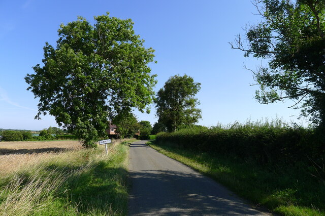
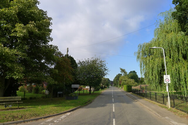
Manor Farm is a quaint rural village located in the picturesque county of Lincolnshire, England. Situated amidst the rolling green hills and fertile agricultural fields, this charming settlement offers a peaceful and idyllic countryside setting.

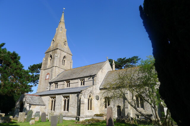
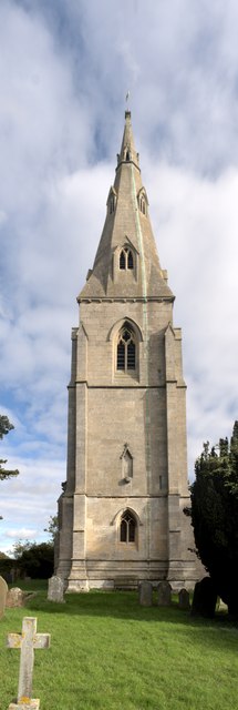
The village is characterized by its collection of traditional stone houses and historic buildings, giving it a distinctive and timeless appeal. The centerpiece of Manor Farm is the titular manor house, a magnificent structure dating back several centuries. Its elegant architecture and well-manicured gardens provide a glimpse into the region's rich history.

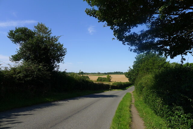
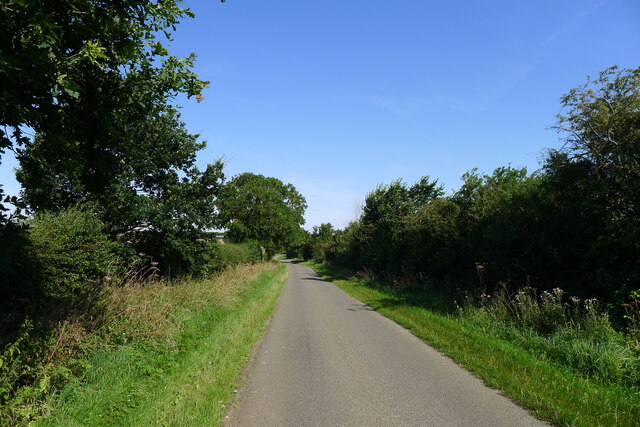
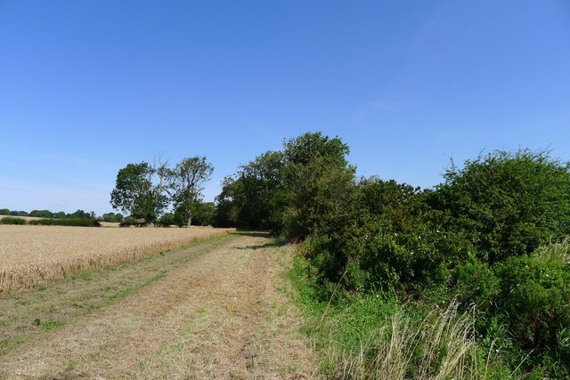
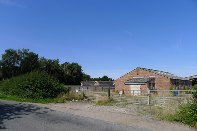
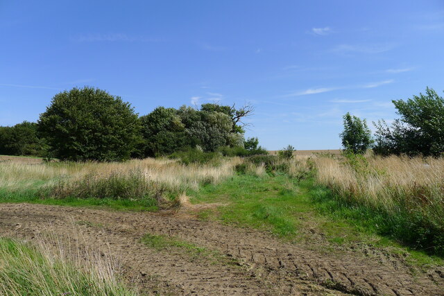
The surrounding landscape is predominantly agricultural, with vast fields of crops and grazing pastures for livestock. The fertile soil and favorable climate make Manor Farm a prime location for farming, and the villagers take great pride in their agricultural heritage. Local farmers primarily cultivate grains, vegetables, and fruits, contributing to the region's thriving agricultural industry.

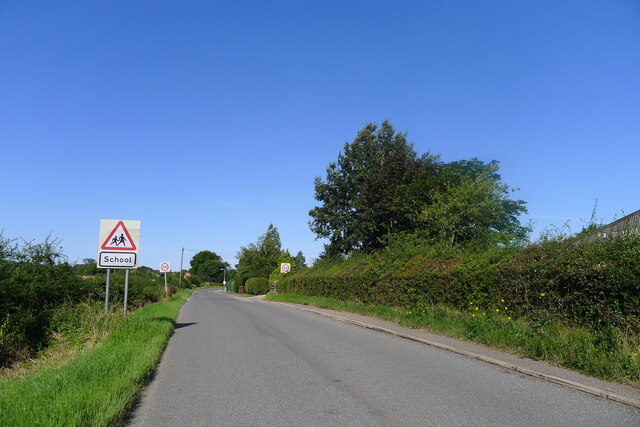
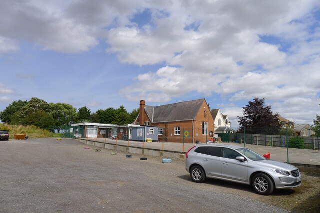
In addition to its natural beauty, Manor Farm offers a close-knit community. Residents often gather for social events and community celebrations, fostering a strong sense of camaraderie and belonging. The village boasts a primary school, a village hall, and a few small shops, providing essential services to its inhabitants.

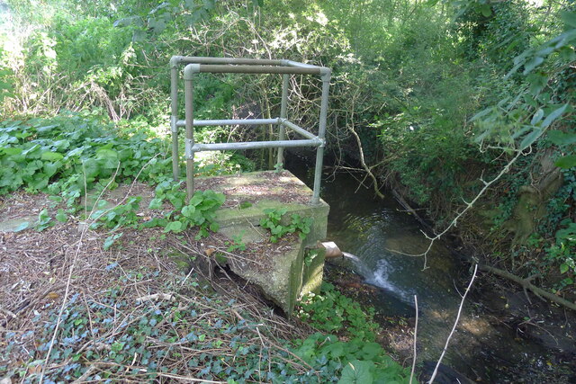
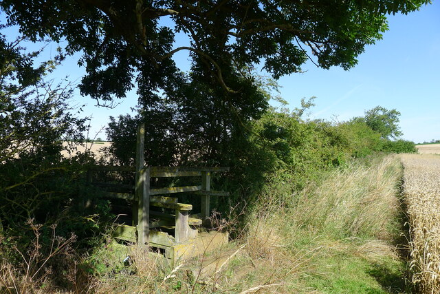
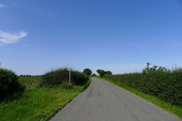
For those seeking outdoor activities, Manor Farm offers plenty of opportunities. The surrounding countryside is crisscrossed with public footpaths and bridleways, making it ideal for leisurely walks, cycling, or horseback riding. The nearby River Witham also provides an excellent spot for fishing and boating enthusiasts.

In summary, Manor Farm, Lincolnshire, is a charming village that embodies the essence of rural England. Its stunning natural surroundings, historical significance, and tight-knit community make it a truly special place to live or visit.

If you have any feedback on the listing, please let us know in the comments section below.

Manor Farm Images

Images are sourced within 2km of 52.857992/-0.47123825 or Grid Reference TF0330. Thanks to Geograph Open Source API. All images are credited.

Entering Ingoldsby past Ingoldsby Academy
Ingoldsby Academy Primary school with nursery facility
Ingoldsby Academy
Primary school with nursery facility
Sewage works outfall into the East Glen River Work was being undertaken at the sewage works, which might explain the high flow from the outfall
Sewage works outfall into the East Glen River
Work was being undertaken at the sewage works, which might explain the high flow from the outfall
Ingoldsby Road leaving Lenton
Church of St Peter, Lenton Listed Grade I, from the 13th century <span class="nowrap"><a title="https://historicengland.org.uk/listing/the-list/list-entry/1253206" rel="nofollow ugc noopener" href="https://historicengland.org.uk/listing/the-list/list-entry/1253206">Link</a><img style="margin-left:2px;" alt="External link" title="External link - shift click to open in new window" src="https://s1.geograph.org.uk/img/external.png" width="10" height="10"/></span>
Church of St Peter, Lenton
Listed Grade I, from the 13th century LinkExternal link
Leaving Lenton and entering Hanby
King Street leading through Hanby After last appearing as a visible road outside Hanthorpe, almost 6 miles to the south-east <a href="https://www.geograph.org.uk/photo/5681655">TF0823 : Clipsey Gap Lane, part of King street</a>, the Roman road 'King Street' reappears on its route north-west towards Ancaster.
King Street leading through Hanby
After last appearing as a visible road outside Hanthorpe, almost 6 miles to the south-east TF0823 : Clipsey Gap Lane, part of King street, the Roman road 'King Street' reappears on its route north-west towards Ancaster.
Wheat field by the East Glen River The river - barely a trickle in this headwater - is hidden amongst the shrubs on the right.
Wheat field by the East Glen River
The river - barely a trickle in this headwater - is hidden amongst the shrubs on the right.
Footbridge over the East Glen River Carrying the footpath from Hanby to Ingoldsby. The bridge is quite substantial, whereas the path is poorly marked.
Footbridge over the East Glen River
Carrying the footpath from Hanby to Ingoldsby. The bridge is quite substantial, whereas the path is poorly marked.
Footpath to Lenton The Roman road, King Street, is believed to have run across here (see OS map), but there is no visible sign of it in the neighbouring fields.
Footpath to Lenton
The Roman road, King Street, is believed to have run across here (see OS map), but there is no visible sign of it in the neighbouring fields.
Grange Farm
Grange Farm
End of Bridleway The bridleway from Keisby Road ends here, behind a poultry farm slurry pond, at the site of the former RAF Folkingham Airfield.
End of Bridleway
The bridleway from Keisby Road ends here, behind a poultry farm slurry pond, at the site of the former RAF Folkingham Airfield.
Entering Ingoldsby on Main Street Ingoldsby =  ‘Farmstead or village of a man called Ingjaldr’ <span class="nowrap"><a title="https://www.oxfordreference.com/view/10.1093/acref/9780199609086.001.0001/acref-9780199609086" rel="nofollow ugc noopener" href="https://www.oxfordreference.com/view/10.1093/acref/9780199609086.001.0001/acref-9780199609086">Link</a><img style="margin-left:2px;" alt="External link" title="External link - shift click to open in new window" src="https://s1.geograph.org.uk/img/external.png" width="10" height="10"/></span>
Entering Ingoldsby on Main Street
Ingoldsby = ‘Farmstead or village of a man called Ingjaldr’ LinkExternal link
St Peter's Church, Lenton: the tower The tower of the church dates from the 14th century, and is typical of the period.

This is a grade I listed building: <span class="nowrap"><a title="https://historicengland.org.uk/listing/the-list/list-entry/1253206?section=official-list-entry" rel="nofollow ugc noopener" href="https://historicengland.org.uk/listing/the-list/list-entry/1253206?section=official-list-entry">Link</a><img style="margin-left:2px;" alt="External link" title="External link - shift click to open in new window" src="https://s1.geograph.org.uk/img/external.png" width="10" height="10"/></span> .
St Peter's Church, Lenton: the tower
The tower of the church dates from the 14th century, and is typical of the period. This is a grade I listed building: LinkExternal link .
St Peter's Church, Lenton: the font Angels round the font.  These are part of the Millennium art project created by  the late Roger Heaton.  It has been erected again for the 24th anniversary.

The octagonal font is 15th century.  The church is grade I listed - see <span class="nowrap"><a title="https://historicengland.org.uk/listing/the-list/list-entry/1253206?section=official-list-entry" rel="nofollow ugc noopener" href="https://historicengland.org.uk/listing/the-list/list-entry/1253206?section=official-list-entry">Link</a><img style="margin-left:2px;" alt="External link" title="External link - shift click to open in new window" src="https://s1.geograph.org.uk/img/external.png" width="10" height="10"/></span> .
St Peter's Church, Lenton: the font
Angels round the font. These are part of the Millennium art project created by the late Roger Heaton. It has been erected again for the 24th anniversary. The octagonal font is 15th century. The church is grade I listed - see LinkExternal link .
St Peter's Church, Lenton: chancel arch Decorated with angels, the chancel arch dates from the 14th century.
This is a Grade I listed church - <span class="nowrap"><a title="https://historicengland.org.uk/listing/the-list/list-entry/1253206?section=official-list-entry" rel="nofollow ugc noopener" href="https://historicengland.org.uk/listing/the-list/list-entry/1253206?section=official-list-entry">Link</a><img style="margin-left:2px;" alt="External link" title="External link - shift click to open in new window" src="https://s1.geograph.org.uk/img/external.png" width="10" height="10"/></span>.
St Peter's Church, Lenton: chancel arch
Decorated with angels, the chancel arch dates from the 14th century. This is a Grade I listed church - LinkExternal link.
St Peter's Church, Lenton: a flight of angels The Artists Roger and Liz Heaton created the display of angel images for the Millennium .
St Peter's Church, Lenton: a flight of angels
The Artists Roger and Liz Heaton created the display of angel images for the Millennium .
St Peter's Church, Lenton: the ring of angels Part of the display of Millennium Angels.
St Peter's Church, Lenton: the ring of angels
Part of the display of Millennium Angels.
Show me another place!

Manor Farm is located at Grid Ref: TF0330 (Lat: 52.857992, Lng: -0.47123825)

Division: Parts of Kesteven

Administrative County: Lincolnshire

District: South Kesteven

Police Authority: Lincolnshire

What 3 Words

///cheetahs.emerge.wonderfully. Near Corby Glen, Lincolnshire

Nearby Locations

Manor Farm

Related Wikis

Lenton, Lincolnshire

Lenton is a village in the civil parish of Lenton, Keisby and Osgodby, in the district of South Kesteven, Lincolnshire, England. It is situated approximately...

Lenton, Keisby and Osgodby

Lenton, Keisby and Osgodby is a civil parish in South Kesteven, Lincolnshire, England. The population of the civil parish at the 2011 census was 187....

Keisby

Keisby is a hamlet in the civil parish of Lenton, Keisby and Osgodby, in the South Kesteven district, in Lincolnshire, England. It is situated 6 miles...
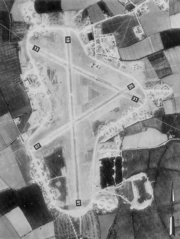
RAF Folkingham

Royal Air Force Folkingham or RAF Folkingham is a former Royal Air Force station located south west of Folkingham, Lincolnshire and about 29 miles (47...

Nearby Amenities

Located within 500m of 52.857992,-0.47123825
Manor Farm
Place: farm
Source: Bing
Lat/Long: 52.8579853/-0.4710166
New House Farm
Place: farm
Source: Bing
Lat/Long: 52.8609091/-0.4711339
Manor Farm
Place: farm
Source: Bing
Lat/Long: 52.8610894/-0.4728957
Lavington House
Place: isolated_dwelling
Lat/Long: 52.8578093/-0.4700778
Manor Farm Cottages
Place: isolated_dwelling
Lat/Long: 52.8584254/-0.4720136
The data included in this document is from www.openstreetmap.org. The data is made available under ODbL.

Have you been to Manor Farm?

Leave your review of Manor Farm below (or comments, questions and feedback).