Lumsdale

Settlement in Derbyshire Derbyshire Dales

England

Lumsdale

Sandy Lane heading to Sandy Lane Farm
Sandy Lane heading to Sandy Lane Farm Credit: Neil Theasby

Lumsdale is a picturesque valley located in Derbyshire, England. Situated just outside the town of Matlock, it is renowned for its historical significance and natural beauty. Lumsdale is a designated conservation area due to its well-preserved industrial heritage and stunning landscape.

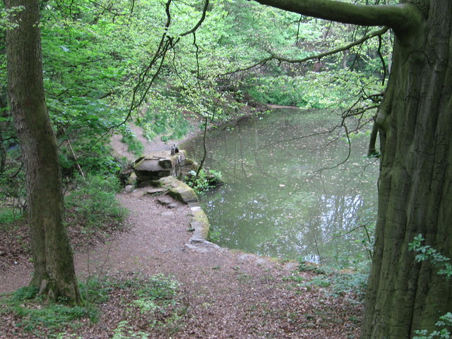
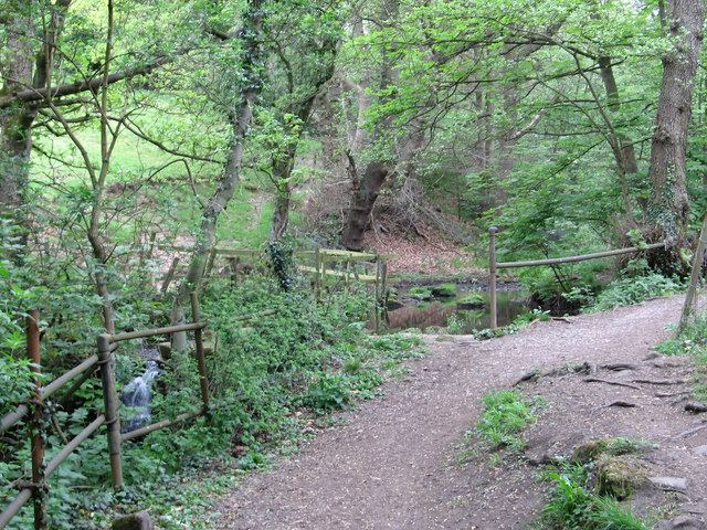
The valley is home to a series of old mills, dating back to the 17th century, which were once used for the production of textiles and paper. These mills were powered by the cascading waters of Bentley Brook, creating a unique and idyllic setting. The remains of these mills, along with their weirs, ponds, and waterfalls, can still be seen and explored today.

Visitors to Lumsdale can embark on a tranquil walk through the valley, following the well-maintained footpaths that wind around the mills and water features. The surrounding woodland provides a peaceful backdrop, with a variety of flora and fauna adding to the area's charm.

Lumsdale offers a glimpse into the region's industrial past, with informative signposts along the way explaining the history and significance of each mill. The site is popular with history enthusiasts, nature lovers, and photographers alike, with plenty of opportunities for capturing the beauty of the valley.

In addition to its historical value, Lumsdale is also a haven for wildlife. The brook and surrounding woodland provide a habitat for various species, including otters, kingfishers, and dippers. Birdwatchers will find plenty to see and hear, while those with an interest in botany can enjoy the diverse range of plants that thrive in the area.

Overall, Lumsdale is a captivating destination that seamlessly combines history, nature, and tranquility, offering visitors a unique and memorable experience.

If you have any feedback on the listing, please let us know in the comments section below.
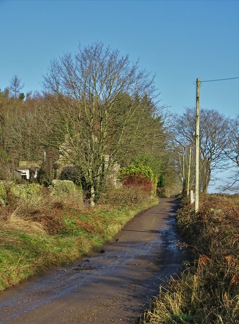
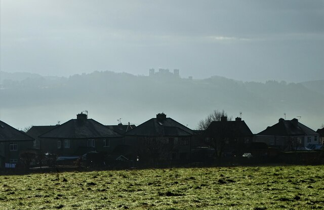
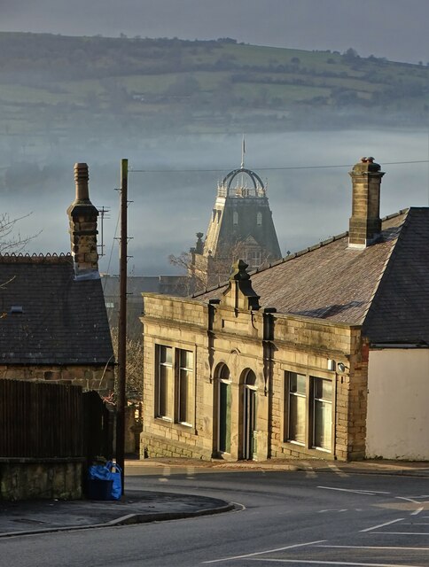
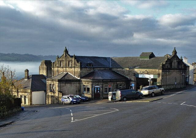
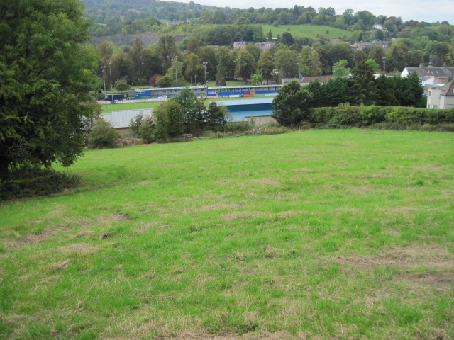
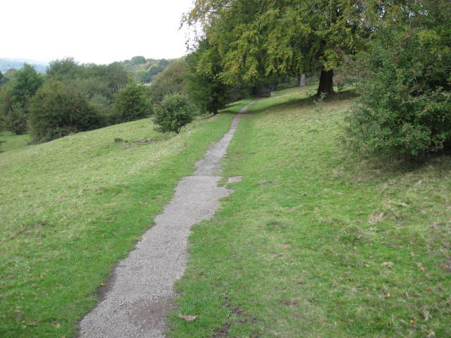
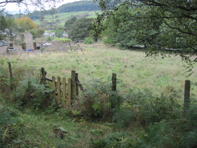
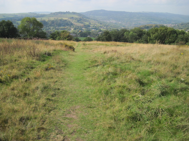
Lumsdale Images

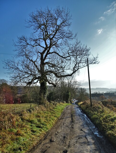
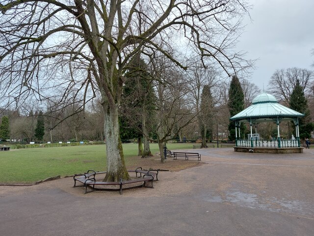
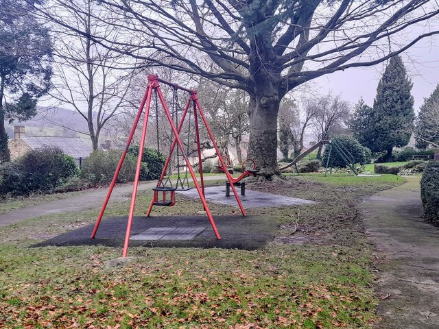
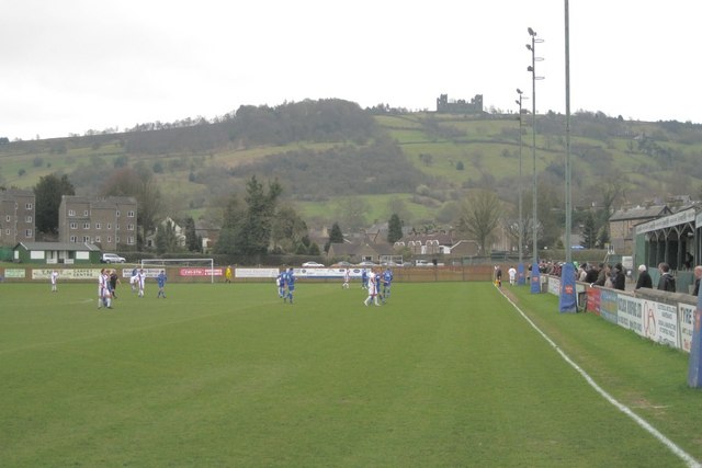
Images are sourced within 2km of 53.141737/-1.5343295 or Grid Reference SK3160. Thanks to Geograph Open Source API. All images are credited.

Sandy Lane heading to Sandy Lane Farm
View to Riber Castle Over the rooftops of Gritstone Road. Riber Castle can be seen through misty air as a high pressure weather system settles over England.
View to Riber Castle
Over the rooftops of Gritstone Road. Riber Castle can be seen through misty air as a high pressure weather system settles over England.
View to the tower of Smedley's Hydro Seen from Wellington Street. Smedley's Hydro was a hydropathic facility developed in the second half of the nineteenth century. In the 1950's the old building was taken over by Derbyshire County Council, becoming the organisations administrative hub. The mist in the valley was related to a high pressure weather system settling over the north of England. The illuminated building on the corner was part of the old Matlock tram depot.
View to the tower of Smedley's Hydro
Seen from Wellington Street. Smedley's Hydro was a hydropathic facility developed in the second half of the nineteenth century. In the 1950's the old building was taken over by Derbyshire County Council, becoming the organisations administrative hub. The mist in the valley was related to a high pressure weather system settling over the north of England. The illuminated building on the corner was part of the old Matlock tram depot.
Former tram depot on Matlock Bank
Sandy Lane heading to Chesterfield Road The surface of this lane is dreadful. Speaking from personal experience, it is inadvisable to drive low-slung saloon cars along it.
Sandy Lane heading to Chesterfield Road
The surface of this lane is dreadful. Speaking from personal experience, it is inadvisable to drive low-slung saloon cars along it.
Hall Leys Park, Matlock
The Newsroom micropub A micropub in an old newsagents shop.
The Newsroom micropub
A micropub in an old newsagents shop.
Children's play area in Sparrow Park
New fire station under construction The 1950s fire station, pictured in <a href="https://www.geograph.org.uk/photo/2024536">SK3060 : Matlock fire station</a>, has been demolished, to be replaced by something more modern.
New fire station under construction
The 1950s fire station, pictured in SK3060 : Matlock fire station, has been demolished, to be replaced by something more modern.
An interlude in the match Matlock Town Football Club ground, Causeway Lane A615. There is a cricket ground to the east. On the skyline is Riber Castle on the southern edge of SK3059.
An interlude in the match
Matlock Town Football Club ground, Causeway Lane A615. There is a cricket ground to the east. On the skyline is Riber Castle on the southern edge of SK3059.
The east stand, Matlock Town Football Club By Causeway Lane, A615.
The east stand, Matlock Town Football Club
By Causeway Lane, A615.
Matlock - Methodist & United Reformed Church On Oak Road.
Matlock - Methodist & United Reformed Church
On Oak Road.
Tansley - upper mill pond
Tansley - footpath and weir above lower mill pond
Towards Matlock Town FC ground
Footpath towards Lumsdale
Footpath towards Chesterfield Road
Footpath towards Tansley Knoll
Show me another place!

Lumsdale is located at Grid Ref: SK3160 (Lat: 53.141737, Lng: -1.5343295)

Administrative County: Derbyshire

District: Derbyshire Dales

Police Authority: Derbyshire

What 3 Words

///coach.choice.spray. Near Matlock, Derbyshire

Related Wikis

Lumsdale Valley

Lumsdale Valley is a steep-sided wooded gorge in the Peak District near Matlock, Derbyshire, in England. It is the location of a series of historic water...

Bentley Brook

Bentley Brook is a stream in Derbyshire, England. It rises on Matlock Moor, flowing south through Cuckoostone Dale, under the A632, into Lumsdale, gathering...

Highfields School, Matlock

Highfields School is a coeducational secondary school and sixth form located in Matlock, Derbyshire, England. At the time of its September 2012 Ofsted...
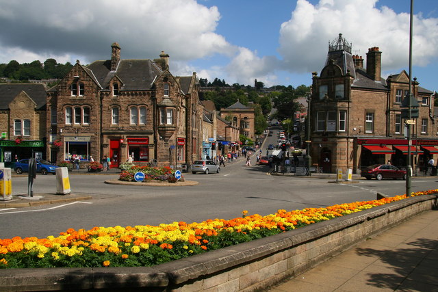
Matlock, Derbyshire

Matlock is the county town of Derbyshire, England. It is in the south-eastern part of the Peak District, with the National Park directly to the west....

Nearby Amenities

Located within 500m of 53.141737,-1.5343295
Lumsdale Falls
Waterway: waterfall
Lat/Long: 53.1418911/-1.5330667
Bus Stop
Bus: yes
Naptan AtcoCode: 1000DMAL2088
Naptan NaptanCode: dbsatpdm
Public Transport: platform
Lat/Long: 53.1428052/-1.5379288
Post Box
Operator: Royal Mail
Operator Wikidata: Q638098
Ref: DE4 1375
Lat/Long: 53.1435142/-1.5408706
Bus Stop
Bus: yes
Naptan AtcoCode: 1000DMAL2385
Naptan NaptanCode: dbsatpdp
Public Transport: platform
Lat/Long: 53.1434957/-1.5407493
Bench
Lat/Long: 53.1434806/-1.5406761
Post Box
Brand: Royal Mail
Brand Wikidata: Q638098
Brand Wikipedia: en:Royal Mail
Operator: Royal Mail
Operator Wikidata: Q638098
Ref: DE4 999
Lat/Long: 53.1393327/-1.5373528
Ele: 185.6588135
Lat/Long: 53.1448308/-1.5353662
Passing Place
Passing Place: right
Lat/Long: 53.1406086/-1.5341184
Parking
Ele: 138.0000000
Lat/Long: 53.1388273/-1.5353083
Ele: 163.0000000
Lat/Long: 53.1408416/-1.539425
Ele: 172.0000000
Lat/Long: 53.1410962/-1.5386918
Ele: 180.0000000
Lat/Long: 53.1415051/-1.5376338
Ele: 154.0
Lat/Long: 53.1402721/-1.5389592
Ele: 157
Lat/Long: 53.1403687/-1.5384602
Ele: 157.0000000
Lat/Long: 53.1404363/-1.5389541
Ele: 135.0000000
Lat/Long: 53.1387753/-1.534627
Ele: 136.0000000
Lat/Long: 53.1390154/-1.5345318
Ele: 139.0000000
Lat/Long: 53.1391616/-1.5346058
Ele: 145
Lat/Long: 53.1392405/-1.5347125
Ele: 147
Lat/Long: 53.1392519/-1.5349813
Ele: 153.0000000
Lat/Long: 53.1395241/-1.5357915
Ele: 156
Lat/Long: 53.1400917/-1.5376058
Ele: 139.0000000
Lat/Long: 53.1387629/-1.5351474
Bench
Ele: 182.0000000
Lat/Long: 53.1420841/-1.53608
Ele: 181
Lat/Long: 53.1416363/-1.5360888
Ele: 181
Lat/Long: 53.141527/-1.5362811
Ele: 147.0000000
Lat/Long: 53.1416202/-1.5335268
Ele: 147.0000000
Lat/Long: 53.1417/-1.5332818
Ele: 156.0000000
Lat/Long: 53.1417761/-1.533416
Ele: 154.0000000
Lat/Long: 53.1417573/-1.5334301
Ele: 153.0000000
Lat/Long: 53.1416955/-1.5333909
Ele: 147.0000000
Lat/Long: 53.1416457/-1.5334754
Ele: 163
Lat/Long: 53.1422152/-1.5336773
Ele: 157.0000000
Lat/Long: 53.1418366/-1.5333557
Ele: 156.0000000
Lat/Long: 53.1418164/-1.5333244
Ele: 146.0000000
Lat/Long: 53.1415301/-1.5336379
Ele: 142.0000000
Lat/Long: 53.1414543/-1.5336734
Ele: 143.0000000
Lat/Long: 53.1414686/-1.533667
Ele: 147
Lat/Long: 53.1401526/-1.5316861
Ele: 146
Lat/Long: 53.1402064/-1.531773
Ele: 158.0000000
Lat/Long: 53.1390662/-1.528451
Barrier: kissing_gate
Ele: 158
Lat/Long: 53.1391256/-1.5285935
Barrier: kissing_gate
Ele: 154
Lat/Long: 53.1393817/-1.5295511
Barrier: stile
Ele: 153
Material: stone
Stile: squeezer
Lat/Long: 53.1397944/-1.5305714
Barrier: stile
Steps: 1
Stile: stepover
Lat/Long: 53.1405988/-1.5340153
Barrier: stile
Ele: 146.0000000
Material: stone
Stile: squeezer
Lat/Long: 53.1403705/-1.5321718
Ele: 138
Lat/Long: 53.1404567/-1.5334335
Ele: 136
Note: No bridge, just step over
Lat/Long: 53.1397053/-1.5341052
Ele: 143
Lat/Long: 53.1404992/-1.534638
Bench
Lat/Long: 53.142107/-1.5363888
Barrier: stile
Stile: squeezer
Lat/Long: 53.1424061/-1.5388908
Entrance: yes
Lat/Long: 53.1419387/-1.5332729
Barrier: stile
Material: stone
Steps: 2
Stile: stepover
Lat/Long: 53.1424414/-1.5328687
Bench
Lat/Long: 53.143009/-1.53301
Bench
Lat/Long: 53.14291/-1.5329711
Information: board
Tourism: information
Lat/Long: 53.1441174/-1.533918
Bailey's Tump
Date: 1939 - 1945
Description: WW2 Anti-Aircraft Remains
Historic: battlefield
Image: http://www.derbyshireheritage.co.uk/Menu/Townsandvillages/Matlock/Bailey's%20Tump.jpg
Website: https://www.derbyshireheritage.co.uk/Menu/Townsandvillages/Matlock/baileys-tump.php
Lat/Long: 53.1429602/-1.5393389
Tourism: information
Lat/Long: 53.1430744/-1.5391257
Entrance: yes
Lat/Long: 53.1419943/-1.5332633
Ford: stepping_stones
Lat/Long: 53.1448335/-1.5333515
Entrance: yes
Lat/Long: 53.1420186/-1.533106
Barrier: stile
Stile: squeezer
Lat/Long: 53.1418825/-1.5341075
Parking
Access: private
Lat/Long: 53.1396639/-1.5330766
Ele: 165
Lat/Long: 53.1409539/-1.539254
Evince Concepts
Office: company
Lat/Long: 53.139105/-1.5331427
Anthony Wassell Glass
Addr Unit: 18
Office: company
Lat/Long: 53.1391741/-1.5333358
Peak Inks
Addr Unit: 17
Office: company
Lat/Long: 53.1391178/-1.533081
Barrier: kissing_gate
Lat/Long: 53.1397868/-1.530553
Barrier: entrance
Source: survey;gps
Lat/Long: 53.1412263/-1.5339064
The cotton spinning and bleaching mills
Board Type: history
Information: board
Tourism: information
Lat/Long: 53.1412598/-1.5338961
Waterway: waterfall
Lat/Long: 53.1417467/-1.5331716
Entrance: yes
Source: survey;gps
Lat/Long: 53.1419697/-1.5332056
Middle and Lower Ponds - the source of the power
Board Type: history
Information: board
Tourism: information
Lat/Long: 53.1430332/-1.5330337
Barrier: entrance
Source: survey;gps
Lat/Long: 53.1430471/-1.5330607
Barrier: stile
Material: stone
Source: survey;gps
Stile: squeezer
Lat/Long: 53.1430984/-1.5330671
The Mighty Bentley Brook
Board Type: history
Information: board
Tourism: information
Lat/Long: 53.1452966/-1.5342279
Barrier: stile
Historic: ruins
Material: stone
Source: survey;gps
Stile: squeezer
Lat/Long: 53.1406164/-1.5340642
Entrance: yes
Lat/Long: 53.1419577/-1.5331784
Mills and Waterfalls -complex histories
Board Type: history
Information: board
Tourism: information
Lat/Long: 53.1420421/-1.533095
Bar
Bentley Brook Brewery
Addr City: Matlock
Addr Postcode: DE4 5EX
Addr Street: Lumsdale
Craft: brewery
Fhrs Id: 1626661
Opening Hours: Fr 17:00-20:00; Sa 11:00-17:00
Website: https://www.bentleybrook.co.uk/
Lat/Long: 53.1392001/-1.5331338
Generator Method: photovoltaic
Generator Output Electricity: yes
Generator Source: solar
Generator Type: solar_photovoltaic_panel
Location: roof
Power: generator
Lat/Long: 53.1382736/-1.5380898
Generator Method: photovoltaic
Generator Output Electricity: yes
Generator Source: solar
Generator Type: solar_photovoltaic_panel
Location: roof
Power: generator
Lat/Long: 53.1390347/-1.5362525
Generator Method: photovoltaic
Generator Output Electricity: yes
Generator Source: solar
Generator Type: solar_photovoltaic_panel
Location: roof
Power: generator
Lat/Long: 53.1391183/-1.5365019
Generator Method: photovoltaic
Generator Output Electricity: yes
Generator Source: solar
Generator Type: solar_photovoltaic_panel
Location: roof
Power: generator
Lat/Long: 53.1382752/-1.5357858
Generator Method: photovoltaic
Generator Output Electricity: yes
Generator Source: solar
Generator Type: solar_photovoltaic_panel
Location: roof
Power: generator
Lat/Long: 53.138013/-1.5365395
Generator Method: photovoltaic
Generator Output Electricity: yes
Generator Source: solar
Generator Type: solar_photovoltaic_panel
Location: roof
Power: generator
Lat/Long: 53.1444925/-1.5393844
Generator Method: photovoltaic
Generator Output Electricity: yes
Generator Source: solar
Generator Type: solar_photovoltaic_panel
Location: roof
Power: generator
Lat/Long: 53.1445745/-1.5391832
Generator Method: photovoltaic
Generator Output Electricity: yes
Generator Source: solar
Generator Type: solar_photovoltaic_panel
Location: roof
Power: generator
Lat/Long: 53.1448158/-1.537185
Generator Method: photovoltaic
Generator Output Electricity: yes
Generator Source: solar
Generator Type: solar_photovoltaic_panel
Location: roof
Power: generator
Lat/Long: 53.1432312/-1.5370348
Generator Method: photovoltaic
Generator Output Electricity: yes
Generator Source: solar
Generator Type: solar_photovoltaic_panel
Location: roof
Power: generator
Lat/Long: 53.1431121/-1.5369945
Generator Method: photovoltaic
Generator Output Electricity: yes
Generator Source: solar
Generator Type: solar_photovoltaic_panel
Location: roof
Power: generator
Lat/Long: 53.1429818/-1.537413
Generator Method: photovoltaic
Generator Output Electricity: yes
Generator Source: solar
Generator Type: solar_photovoltaic_panel
Location: roof
Power: generator
Lat/Long: 53.142977/-1.53748
Generator Method: photovoltaic
Generator Output Electricity: yes
Generator Source: solar
Generator Type: solar_photovoltaic_panel
Location: roof
Power: generator
Lat/Long: 53.1411107/-1.5383276
Generator Method: photovoltaic
Generator Output Electricity: yes
Generator Source: solar
Generator Type: solar_photovoltaic_panel
Location: roof
Power: generator
Lat/Long: 53.1406537/-1.5363723
Generator Method: photovoltaic
Generator Output Electricity: yes
Generator Source: solar
Generator Type: solar_photovoltaic_panel
Location: roof
Power: generator
Lat/Long: 53.1396127/-1.5381559
Generator Method: photovoltaic
Generator Output Electricity: yes
Generator Source: solar
Generator Type: solar_photovoltaic_panel
Location: roof
Power: generator
Lat/Long: 53.139587/-1.5380835
Generator Method: photovoltaic
Generator Output Electricity: yes
Generator Source: solar
Generator Type: solar_photovoltaic_panel
Location: roof
Power: generator
Lat/Long: 53.1395741/-1.5369811
Generator Method: photovoltaic
Generator Output Electricity: yes
Generator Source: solar
Generator Type: solar_photovoltaic_panel
Location: roof
Power: generator
Lat/Long: 53.1395307/-1.5368416
Generator Method: photovoltaic
Generator Output Electricity: yes
Generator Source: solar
Generator Type: solar_photovoltaic_panel
Location: roof
Power: generator
Lat/Long: 53.1394374/-1.5365412
Generator Method: photovoltaic
Generator Output Electricity: yes
Generator Source: solar
Generator Type: solar_photovoltaic_panel
Location: roof
Power: generator
Lat/Long: 53.1390544/-1.5374854
Generator Method: photovoltaic
Generator Output Electricity: yes
Generator Source: solar
Generator Type: solar_photovoltaic_panel
Location: roof
Power: generator
Lat/Long: 53.1393666/-1.5387621
Passing Place
Passing Place: left
Lat/Long: 53.1412537/-1.5340229
Historic: ruins
Ruins: well
Lat/Long: 53.1408293/-1.5341068
The data included in this document is from www.openstreetmap.org. The data is made available under ODbL.

Have you been to Lumsdale?

Leave your review of Lumsdale below (or comments, questions and feedback).