Lulworth Cove

Settlement in Dorset

England

Lulworth Cove

South West Coast Path, Lulworth Cove The South West Coast Path at Lulworth Cove, on Dorset's Jurassic coastline.
South West Coast Path, Lulworth Cove Credit: Malc McDonald

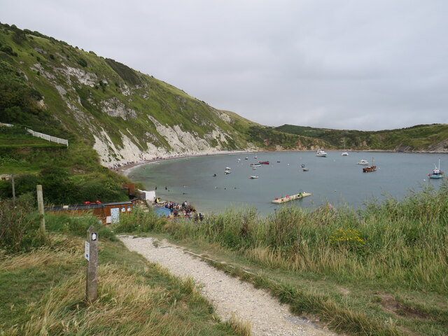
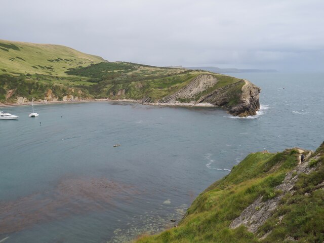
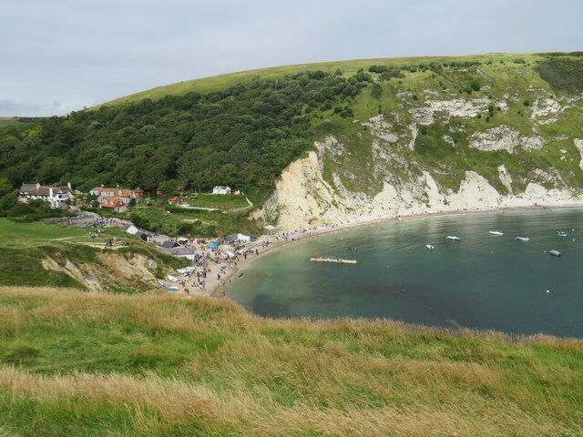
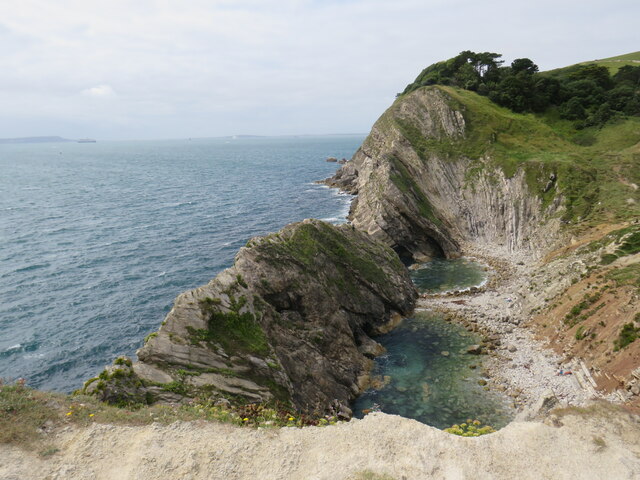
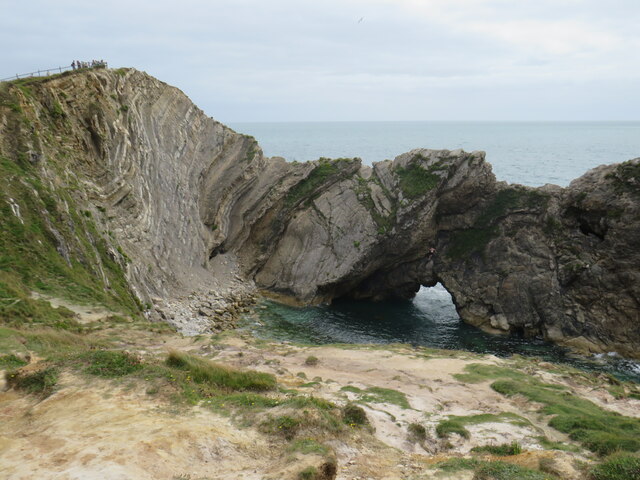
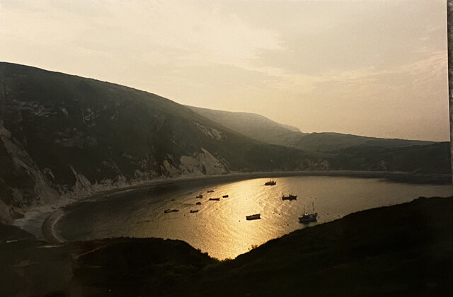
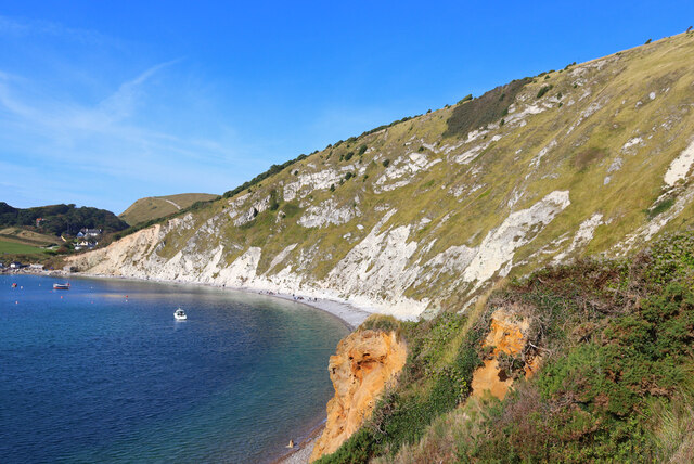
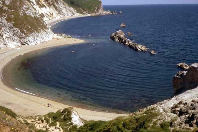
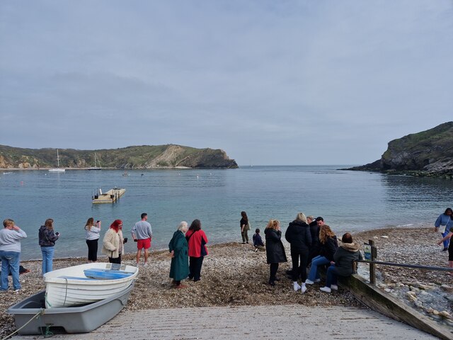
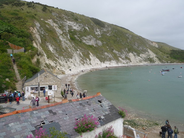
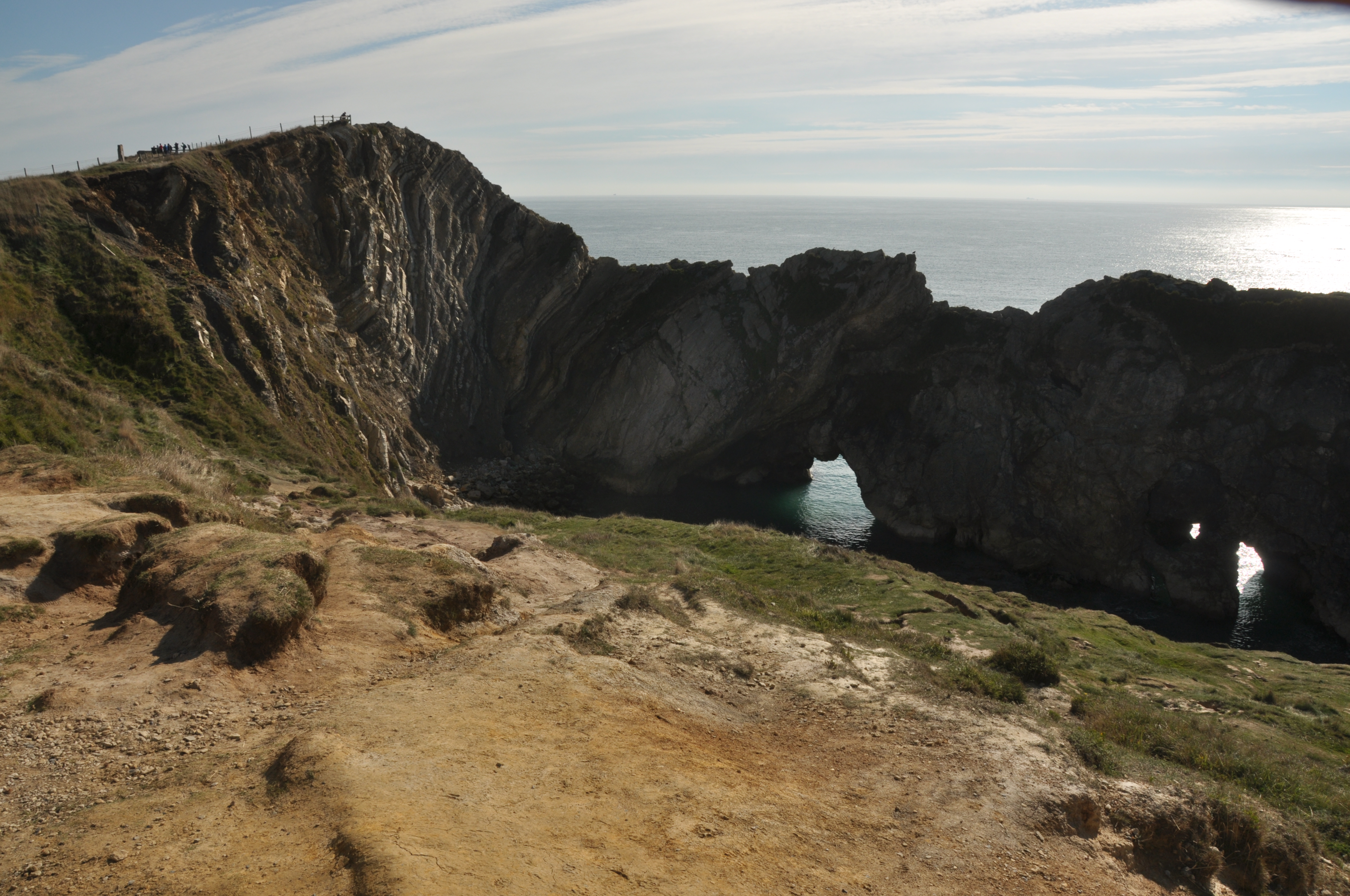
Lulworth Cove is a captivating natural wonder located on the Jurassic Coast in Dorset, England. It is a horseshoe-shaped bay formed by the erosive forces of the sea and the soft layers of limestone and clay that make up the surrounding cliffs. The cove is widely recognized for its stunning beauty and geological significance, making it a popular tourist destination.

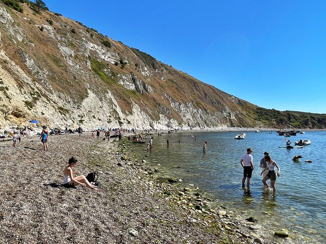
The pristine turquoise waters of Lulworth Cove, combined with the picturesque white pebble beach, create a breathtaking scene. The crystal-clear sea invites visitors to swim, snorkel, or simply relax on the shore. The beach is flanked by towering cliffs, providing a dramatic backdrop to the tranquil cove.

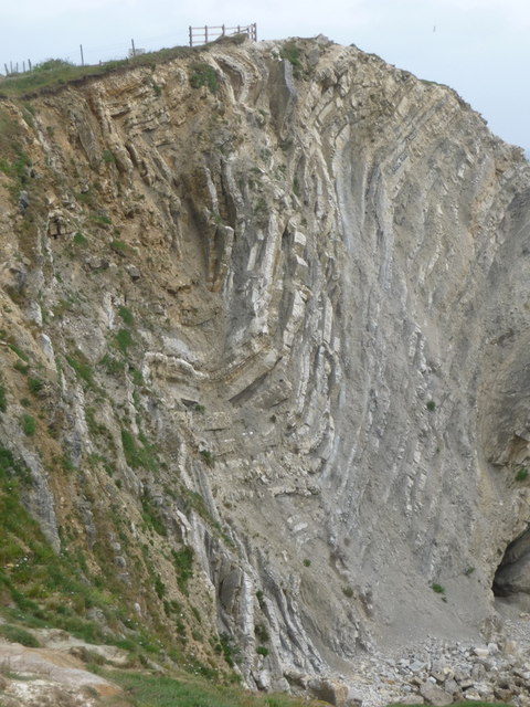
Beyond its aesthetic appeal, Lulworth Cove is also a geological treasure trove. The area is part of the Jurassic Coast, a UNESCO World Heritage Site known for its rich fossil record. Fossils dating back millions of years can often be found embedded in the cliffs or washed up on the shore, attracting both amateur and professional paleontologists.

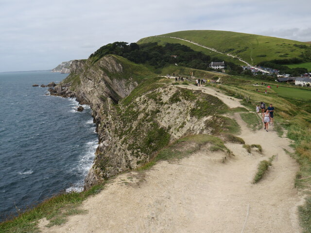
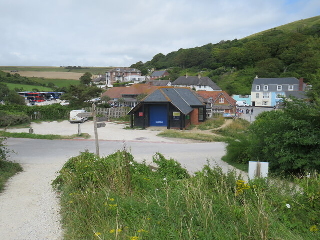
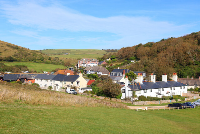
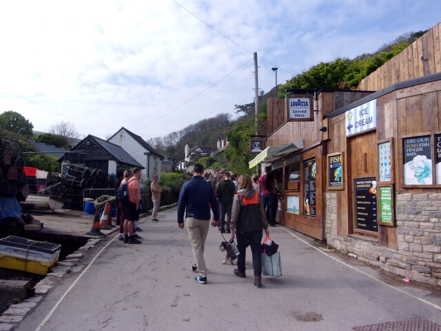
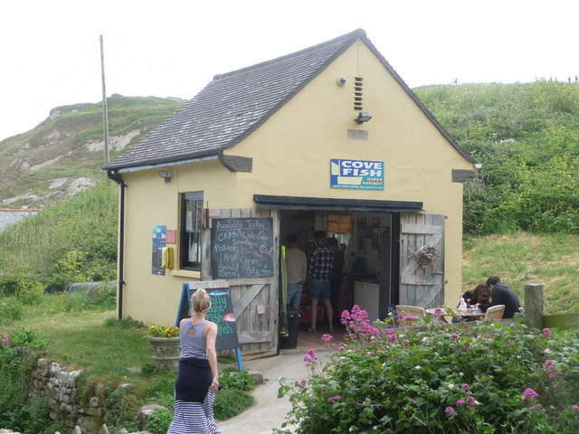
The cove itself is surrounded by the charming village of West Lulworth. Visitors can explore the quaint streets lined with thatched cottages, traditional pubs, and local shops selling souvenirs and refreshments. For those seeking adventure, the area offers various hiking trails along the cliffs, providing breathtaking panoramic views of the coastline.

Overall, Lulworth Cove is a captivating destination that combines natural beauty, geological significance, and a charming village atmosphere. It offers a unique and unforgettable experience for nature lovers, history enthusiasts, and anyone seeking an escape to the stunning coastal landscapes of Dorset.

If you have any feedback on the listing, please let us know in the comments section below.

Lulworth Cove Images

Images are sourced within 2km of 50.620268/-2.2528776 or Grid Reference SY8280. Thanks to Geograph Open Source API. All images are credited.

South West Coast Path, Lulworth Cove The South West Coast Path at Lulworth Cove, on Dorset's Jurassic coastline.
South West Coast Path, Lulworth Cove
The South West Coast Path at Lulworth Cove, on Dorset's Jurassic coastline.
Coastline at Lulworth Cove A view of Dorset's Jurassic coastline at Lulworth Cove.

The white scar on the hill in the background is a path, which forms part of the route of the South West Coast Path.
Coastline at Lulworth Cove
A view of Dorset's Jurassic coastline at Lulworth Cove. The white scar on the hill in the background is a path, which forms part of the route of the South West Coast Path.
Mouth of Lulworth Cove The mouth of Lulworth Cove, on Dorset's Jurassic coastline.
Mouth of Lulworth Cove
The mouth of Lulworth Cove, on Dorset's Jurassic coastline.
Lulworth Cove A view over part of Lulworth Cove, on Dorset's Jurassic coastline.
Lulworth Cove
A view over part of Lulworth Cove, on Dorset's Jurassic coastline.
Stair Hole, Lulworth Cove Stair Hole, adjacent to Lulworth Cove on Dorset's Jurassic coastline.  In the distance to the left of the image is the Isle of Portland.
Stair Hole, Lulworth Cove
Stair Hole, adjacent to Lulworth Cove on Dorset's Jurassic coastline. In the distance to the left of the image is the Isle of Portland.
Stair Hole, Lulworth Cove Stair Hole adjacent to Lulworth Cove on Dorset's Jurassic coastline.
Stair Hole, Lulworth Cove
Stair Hole adjacent to Lulworth Cove on Dorset's Jurassic coastline.
South West Coast Path, Lulworth Cove The South West Coast Path at Lulworth Cove in Dorset.
South West Coast Path, Lulworth Cove
The South West Coast Path at Lulworth Cove in Dorset.
South West Coast Path, Lulworth Cove The South West Coast Path at Lulworth Cove, in Dorset.
South West Coast Path, Lulworth Cove
The South West Coast Path at Lulworth Cove, in Dorset.
Lulworth Cove at dawn
West Lulworth Houses in West Lulworth.
West Lulworth
Houses in West Lulworth.
Lulworth Cove Cliffs at Lulworth.
Lulworth Cove
Cliffs at Lulworth.
Lulworth Cove
Lulworth Cove
Lulworth Cove Fairly quiet autumn day.
Lulworth Cove
Fairly quiet autumn day.
Lulworth Cove: late April 2023
Mayday Bank holiday weekend visitors at Lulworth
West Lulworth: Cove Fish A tiny building for a detached shop; it has a 1955 date stone in the gable looks as if it is a former telephone exchange. The shop has a frozen counter and is not a fish-and-chip outlet.
West Lulworth: Cove Fish
A tiny building for a detached shop; it has a 1955 date stone in the gable looks as if it is a former telephone exchange. The shop has a frozen counter and is not a fish-and-chip outlet.
West Lulworth: view over a boathouse roof Looking across the back of the Cove over the roof of a boathouse which looks as if it could do with some repairs. Opposite it at the bottom of the road from the village is the Old Boathouse, now a refreshment shop.
West Lulworth: view over a boathouse roof
Looking across the back of the Cove over the roof of a boathouse which looks as if it could do with some repairs. Opposite it at the bottom of the road from the village is the Old Boathouse, now a refreshment shop.
West Lulworth: the Lulworth Crumple A well-known geological phenomenon at Stair Hole, just by the Cove.
West Lulworth: the Lulworth Crumple
A well-known geological phenomenon at Stair Hole, just by the Cove.
Show me another place!

Lulworth Cove is located at Grid Ref: SY8280 (Lat: 50.620268, Lng: -2.2528776)

Unitary Authority: Dorset

Police Authority: Dorset

What 3 Words

///airless.noses.headliner. Near Wool, Dorset

Related Wikis

Lulworth

Lulworth is the popular name for an area on the coast of Dorset, South West England notable for its castle and cove. However, there is no actual place...

Stair Hole

Stair Hole is a small cove located just west of Lulworth Cove in Dorset, southern England. The folded limestone strata known as the Lulworth crumple are...
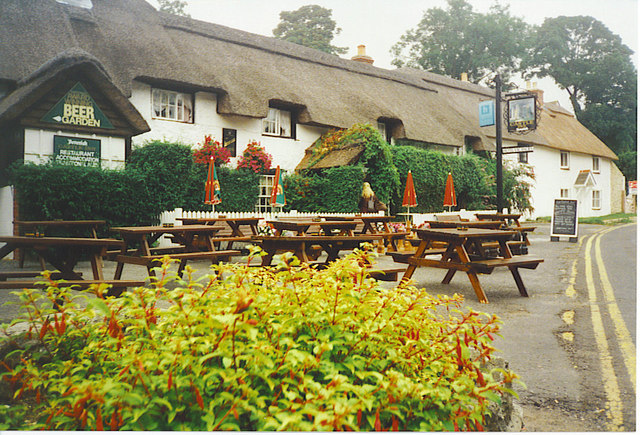
Castle Inn

The Castle Inn is a public house in West Lulworth, Dorset, England, which dates from the 16th century. It was originally called The Green Man, and later...

Lulworth Cove

Lulworth Cove is a cove near the village of West Lulworth, on the Jurassic Coast in Dorset, southern England. The cove is one of the world's finest examples...

Dungy Head

Dungy Head is a coastal promontory located west of Lulworth Cove on the Jurassic Coast in Dorset, England. It forms the eastern end of St Oswald's Bay...

Hambury Tout

Hambury Tout is a large chalk hill by the coast near Lulworth, Dorset, England. It overlooks Lulworth Cove to the west. Hambury Tout is the site of an...
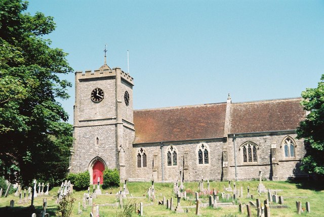
West Lulworth

West Lulworth is a village and civil parish in the English county of Dorset, situated on the English Channel beside Lulworth Cove. In the 2011 census the...

Fossil Forest, Dorset

The Fossil Forest is the remains of an ancient submerged forest from Jurassic times, located to the east of Lulworth Cove on the Isle of Purbeck in Dorset...

Related Videos

Hiking 20 miles through an active military shooting range

It's the bank holiday, and I feel like giving myself a challenge. I've headed to Dorset to walk along the Jurassic Coast the problem ...

DURDLE DOOR | DORSET | THE JURASSIC COAST |UK[TRAVEL BEEPS]

durdledoor #dorset #Travelbeeps #familytime #malayalam #couplegoals #positivevibes #trending #travelvlog Durdle Door ...

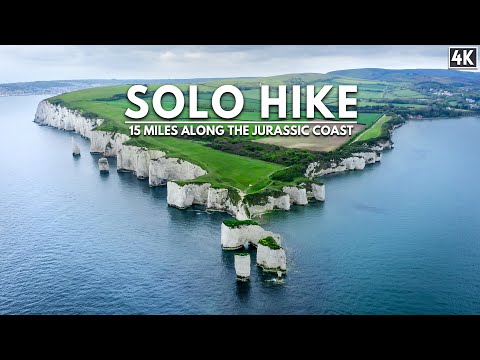
Solo Hiking 15 Miles along The Jurassic Coast (Beautiful 4K Cinematic)

This is the most scenic hike I have ever been on. The Jurassic coast, Old Harrys Rock and the Dancing ledge, Dorset - they're all ...

Walking The Jurassic Coast

In this video, we attempt to walk the entire length of England's Jurassic Coast, a stunning 155km/95 mile coastal path starting from ...

Nearby Amenities

Located within 500m of 50.620268,-2.2528776
Source: PGS
Lat/Long: 50.6183607/-2.2587375
Source: PGS
Lat/Long: 50.6181497/-2.2578577
Source: PGS
Lat/Long: 50.6179659/-2.2569029
Source: PGS
Lat/Long: 50.6179764/-2.2550439
Source: PGS
Lat/Long: 50.6178681/-2.2535037
Source: PGS
Lat/Long: 50.6175783/-2.2517457
Source: PGS
Lat/Long: 50.6173814/-2.2509728
Source: PGS
Lat/Long: 50.6173553/-2.2503378
Source: PGS
Lat/Long: 50.617034/-2.2498233
Source: PGS
Lat/Long: 50.6169512/-2.2489093
Source: PGS
Lat/Long: 50.616915/-2.2485874
Source: PGS
Lat/Long: 50.6169912/-2.2480951
Source: PGS
Lat/Long: 50.6172239/-2.2488241
Source: PGS
Lat/Long: 50.6176596/-2.2490923
Source: PGS
Lat/Long: 50.6178222/-2.249503
Source: PGS
Lat/Long: 50.6179953/-2.2496019
Source: PGS
Lat/Long: 50.618532/-2.249604
Source: PGS
Lat/Long: 50.6188985/-2.2491888
Source: PGS
Lat/Long: 50.6191186/-2.2486598
Source: PGS
Lat/Long: 50.6192523/-2.2481744
Turning Circle
Lat/Long: 50.6235953/-2.2482811
Telephone
Booth: K6
Covered: booth
Note: Has a notice saying it will be removed soon. Notice has been there a long time.
Operator: BT
Operator Wikidata: Q593786
Phone: +44 1929 400364
Lat/Long: 50.6244494/-2.251111
Telephone
Booth: K6
Covered: booth
Operator: BT
Operator Wikidata: Q593786
Phone: +44 1929 400220
Ref GB Uprn: 10024746822
Lat/Long: 50.6201078/-2.2527521
Bus Stop
Lulworth Cove
Bus: yes
Naptan AtcoCode: 1200DOB20317
Naptan Bearing: NE
Naptan CommonName: Lulworth Cove
Naptan Indicator: NE-bound
Naptan NaptanCode: dorapwmw
Naptan Verified: no
Public Transport: platform
Lat/Long: 50.62013/-2.2531879
Camera Direction: 325
Camera Type: fixed
Height: 5
Man Made: surveillance
Surveillance: public
Surveillance Type: camera
Lat/Long: 50.6197427/-2.252146
Camera Type: dome
Height: 3
Man Made: surveillance
Surveillance: public
Surveillance Type: camera
Lat/Long: 50.6185752/-2.2498812
Height: 5
Man Made: surveillance
Surveillance: public
Surveillance Type: camera
Lat/Long: 50.6197313/-2.25207
Height: 5
Man Made: surveillance
Surveillance: public
Surveillance Type: camera
Lat/Long: 50.6196994/-2.2519827
Camera Type: dome
Height: 1.5
Man Made: surveillance
Surveillance: public
Surveillance Type: camera
Lat/Long: 50.6195704/-2.2509898
Camera Type: dome
Height: 3
Man Made: surveillance
Surveillance: public
Surveillance Type: camera
Lat/Long: 50.6189475/-2.2502382
Height: 3
Man Made: surveillance
Surveillance: public
Surveillance Type: camera
Lat/Long: 50.6197691/-2.2519323
Post Box
Collection Times: Mo-Fr 17:00; Sa 09:30
Operator: Royal Mail
Operator Wikidata: Q638098
Post Box Type: pillar
Ref: BH20 212
Ref GB Uprn: 10015454960
Royal Cypher: GR
Royal Cypher Wikidata: Q33102273
Source: survey
Lat/Long: 50.6197367/-2.2524563
Parking
Lat/Long: 50.6192398/-2.2514692
Turning Circle
Direction: clockwise
Lat/Long: 50.6198394/-2.2522888
Camera Mount: ceiling
Camera Type: fixed
Man Made: surveillance
Surveillance: public
Surveillance Type: camera
Lat/Long: 50.6198285/-2.2525962
Camera Mount: ceiling
Camera Type: fixed
Man Made: surveillance
Surveillance: public
Surveillance Type: camera
Lat/Long: 50.6198826/-2.2525085
Fire Hydrant
Emergency: fire_hydrant
Fire Hydrant Diameter: 90
Fire Hydrant Type: underground
Ref: 13194
Source: GPS
Lat/Long: 50.624086/-2.2512427
Camera Type: dome
Height: 3
Man Made: surveillance
Surveillance: public
Surveillance Type: camera
Lat/Long: 50.6196959/-2.2573264
Camera Type: dome
Height: 3
Man Made: surveillance
Surveillance: public
Surveillance Type: camera
Lat/Long: 50.619732/-2.2574011
Seamark Name: Lulworth Cove
Seamark Type: anchorage
Lat/Long: 50.6181776/-2.2468551
Noexit: yes
Lat/Long: 50.6203814/-2.2527066
Man Made: pumping_station
Lat/Long: 50.6188016/-2.2498995
Barrier: bollard
Source: bing
Lat/Long: 50.6195637/-2.2512858
Stair Hole
Place: locality
Tourism: attraction
Wheelchair: no
Wikidata: Q2329156
Wikipedia: en:Stair Hole
Lat/Long: 50.6180947/-2.2527388
Camera Type: dome
Height: 5
Man Made: surveillance
Surveillance: public
Surveillance Type: camera
Lat/Long: 50.6197308/-2.2521568
Fire Hydrant
Emergency: fire_hydrant
Fire Hydrant Type: underground
Source: GPS+GLONASS
Lat/Long: 50.623616/-2.248364
Toilets
Fee: no
Lat/Long: 50.6191841/-2.2505386
Post Box
Collection Times: Mo-Fr 17:00; Sa 08:00
Operator: Royal Mail
Operator Wikidata: Q638098
Post Box Type: pillar
Ref: BH20 106
Royal Cypher: GR
Royal Cypher Wikidata: Q33102273
Source: GPS+GLONASS
Lat/Long: 50.6244555/-2.251199
Bench
Backrest: yes
Source: survey
Lat/Long: 50.6244488/-2.2511716
Barrier: bollard
Lat/Long: 50.6197985/-2.2524597
Toilets
Fee: no
Wheelchair: yes
Lat/Long: 50.6195468/-2.2527795
Vending Machine
Check Date: 2022-09-05
Vending: parking_tickets
Lat/Long: 50.6199983/-2.2555339
Vending Machine
Check Date: 2022-09-05
Vending: parking_tickets
Lat/Long: 50.6206866/-2.2552496
Camera Direction: 5
Camera Type: fixed
Height: 3
Man Made: surveillance
Surveillance: public
Surveillance Type: camera
Lat/Long: 50.6186173/-2.2500927
Camera Direction: 125
Camera Type: fixed
Height: 5
Man Made: surveillance
Surveillance: public
Surveillance Type: camera
Lat/Long: 50.6187101/-2.2499687
Camera Direction: 92
Camera Type: fixed
Height: 3
Man Made: surveillance
Surveillance: public
Surveillance Type: camera
Lat/Long: 50.6246546/-2.2516014
Height: 3
Man Made: surveillance
Surveillance: indoor
Surveillance Type: camera
Lat/Long: 50.62468/-2.2516038
Fire Hydrant
Emergency: fire_hydrant
Fire Hydrant Diameter: 75
Fire Hydrant Type: underground
Ref: 3999
Source: GPS+GLONASS
Lat/Long: 50.6197749/-2.2566558
Hambury Bottom
Location Transition: yes
Material: wood
Poles: bipole
Power: pole
Ref: 53502164
Source: GPS+GLONASS
Transformer: distribution
Voltage Primary: 11000
Voltage Secondary: 400
Voltage Tertiary: 230
Lat/Long: 50.6198005/-2.2549804
Power: switch
Lat/Long: 50.6237142/-2.2502107
Tourism: viewpoint
Lat/Long: 50.6200568/-2.2485094
Barrier: stile
Lat/Long: 50.6202409/-2.2486269
Tourism: viewpoint
Lat/Long: 50.6178093/-2.2513873
Bench
Backrest: no
Lat/Long: 50.6222867/-2.2528961
Bench
Lat/Long: 50.618609/-2.2502141
Bench
Backrest: no
Lat/Long: 50.6227137/-2.2526621
Waste Basket
Lat/Long: 50.6206494/-2.2554417
Cafe
Boatshed Cafe
Lat/Long: 50.618573/-2.2499561
Turning Circle
Lat/Long: 50.6193993/-2.25292
Bench
Backrest: no
Lat/Long: 50.6218901/-2.2530552
Tourism: viewpoint
Lat/Long: 50.6185541/-2.2524556
Barrier: swing_gate
Bicycle: dismount
Material: metal
Motor Vehicle Conditional: no @ (May 15-Sep 30 10:00-18:00)
Lat/Long: 50.6197949/-2.2521324
Motorcycle Parking
Covered: no
Lat/Long: 50.6200434/-2.2534791
Waste Basket
Lat/Long: 50.6244495/-2.2511393
Natural: cave_entrance
Lat/Long: 50.617817/-2.2520676
Natural: cave_entrance
Lat/Long: 50.6179334/-2.2525921
Natural: cave_entrance
Lat/Long: 50.6177246/-2.2526897
Natural: cave_entrance
Lat/Long: 50.6179205/-2.2525025
Natural: cave_entrance
Lat/Long: 50.6177945/-2.2516116
Camera Mount: wall
Camera Type: dome
Man Made: surveillance
Surveillance: public
Surveillance Type: camera
Lat/Long: 50.6195074/-2.2526276
Defibrillator
Defibrillator Location: outside Lulworth Coastguard Station, Britwell Drive, Lulworth Cove
Emergency: defibrillator
Indoor: no
Lat/Long: 50.6193689/-2.2527183
Entrance: yes
Lat/Long: 50.6194299/-2.2526542
Bench
Backrest: yes
Source: survey;gps
Lat/Long: 50.6238798/-2.2513946
Dungy Head
Ele: 61
Natural: peak
Wikidata: Q5315237
Wikipedia: en:Dungy Head
Lat/Long: 50.6188248/-2.2563882
Natural: cave_entrance
Lat/Long: 50.6176733/-2.2520983
The data included in this document is from www.openstreetmap.org. The data is made available under ODbL.

Have you been to Lulworth Cove?

Leave your review of Lulworth Cove below (or comments, questions and feedback).