Lower Blandford St Mary

Settlement in Dorset

England

Lower Blandford St Mary

Red Lion Yard Yard at the back of the former Red Lion Inn on Market Place.
Red Lion Yard Credit: Ian Capper

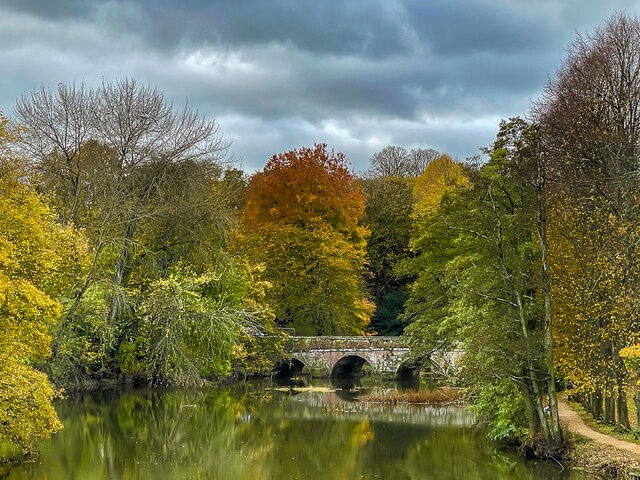
Lower Blandford St Mary is a small village located in the county of Dorset, England. Situated on the banks of the River Stour, it lies approximately 2 miles northeast of the market town of Blandford Forum.

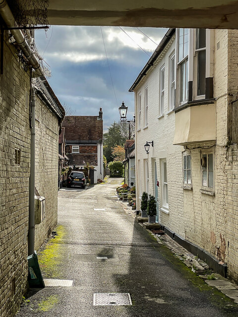
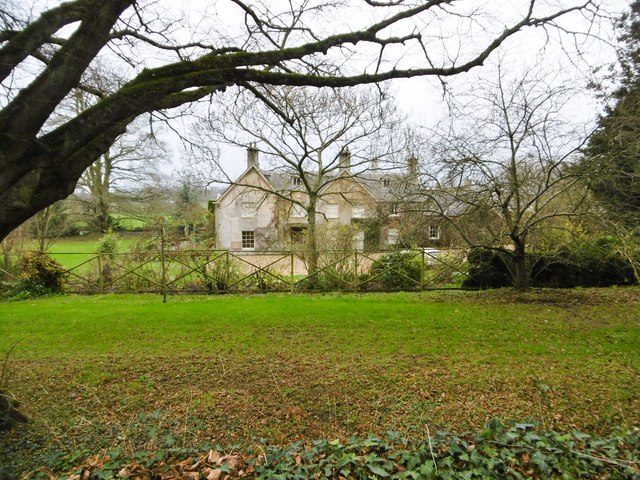
The village is known for its picturesque setting, surrounded by rolling green hills and scenic countryside. It is a popular destination for those seeking a peaceful and tranquil atmosphere. The River Stour, which flows through the village, adds to its charm and offers opportunities for boating and fishing.

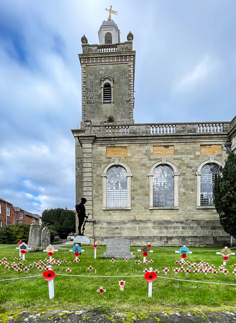
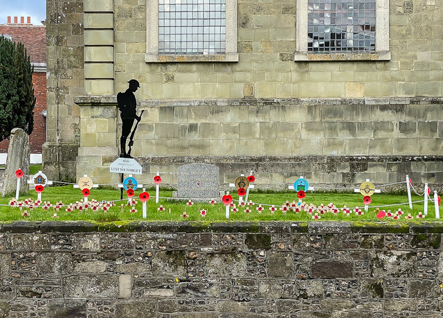
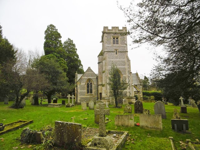
Lower Blandford St Mary has a rich history dating back several centuries. There are several historic buildings and landmarks, including the Grade II listed St. Mary the Virgin Church, which dates back to the 13th century. The church's architecture is a blend of Norman and Gothic styles.

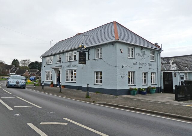
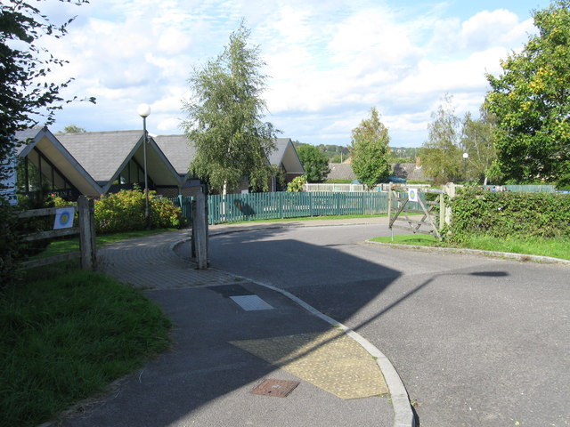
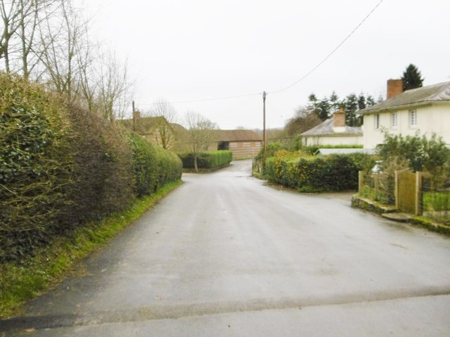
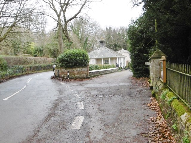
Despite its small size, the village boasts a strong sense of community. It has a local primary school, providing education for the village's children, and a village hall that hosts various events and activities throughout the year. The village also has a pub, offering a place for locals and visitors to relax and socialize.

The surrounding area offers plenty of opportunities for outdoor activities, including hiking, cycling, and exploring the nearby Cranborne Chase Area of Outstanding Natural Beauty. The village is also conveniently located for access to larger towns and cities, with Blandford Forum and the city of Salisbury both a short drive away.

If you have any feedback on the listing, please let us know in the comments section below.

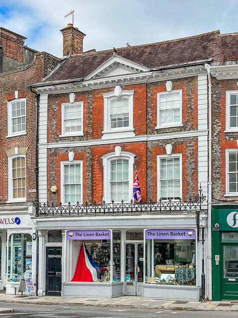
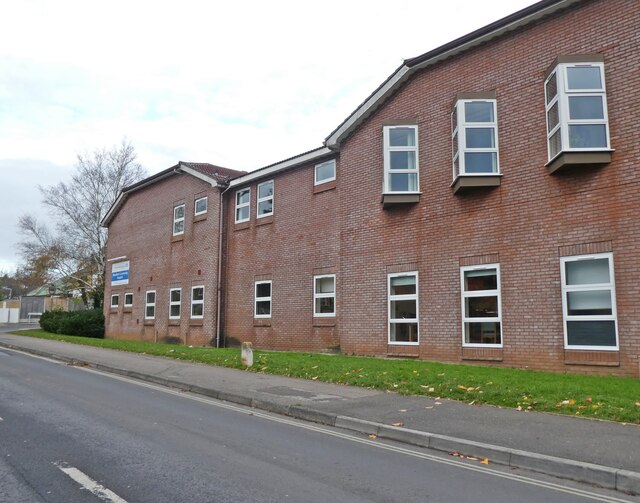
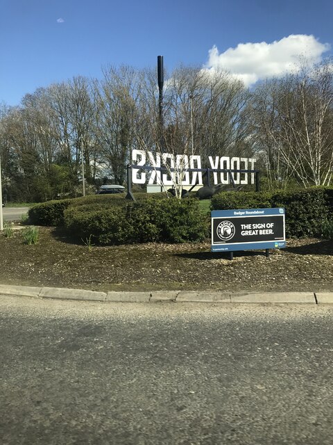
Lower Blandford St Mary Images

Images are sourced within 2km of 50.846974/-2.1547447 or Grid Reference ST8905. Thanks to Geograph Open Source API. All images are credited.

Red Lion Yard Yard at the back of the former Red Lion Inn on Market Place.
Red Lion Yard
Yard at the back of the former Red Lion Inn on Market Place.
River Stour River Stour at Blandford Forum, viewed from Mortain Bridge footbridge, with the 1783 Blandford Bridge in the background.
River Stour
River Stour at Blandford Forum, viewed from Mortain Bridge footbridge, with the 1783 Blandford Bridge in the background.
Remembrance display Remembrance display in front of the early 18th Century Church of St Peter and St Paul.
Remembrance display
Remembrance display in front of the early 18th Century Church of St Peter and St Paul.
Remembrance display Remembrance display in front of the early 18th Century Church of St Peter and St Paul.
Remembrance display
Remembrance display in front of the early 18th Century Church of St Peter and St Paul.
Legion House Mid 18th Century house in Church Lane, now occupied by the British Legion.  Grade I listed - see <span class="nowrap"><a title="www.historicengland.org.uk/listing/the-list/list-entry/1152976" rel="nofollow ugc noopener" href="http://www.historicengland.org.uk/listing/the-list/list-entry/1152976">Link</a><img style="margin-left:2px;" alt="External link" title="External link - shift click to open in new window" src="https://s1.geograph.org.uk/img/external.png" width="10" height="10"/></span>.  The gate and railings are separately grade II listed - see <span class="nowrap"><a title="www.historicengland.org.uk/listing/the-list/list-entry/1108652" rel="nofollow ugc noopener" href="http://www.historicengland.org.uk/listing/the-list/list-entry/1108652">Link</a><img style="margin-left:2px;" alt="External link" title="External link - shift click to open in new window" src="https://s1.geograph.org.uk/img/external.png" width="10" height="10"/></span>.
Legion House
Mid 18th Century house in Church Lane, now occupied by the British Legion. Grade I listed - see LinkExternal link. The gate and railings are separately grade II listed - see LinkExternal link.
1 Market Place 18th Century building in Market Place.  Grade II* listed - see <span class="nowrap"><a title="www.historicengland.org.uk/listing/the-list/list-entry/1108683" rel="nofollow ugc noopener" href="http://www.historicengland.org.uk/listing/the-list/list-entry/1108683">Link</a><img style="margin-left:2px;" alt="External link" title="External link - shift click to open in new window" src="https://s1.geograph.org.uk/img/external.png" width="10" height="10"/></span>.
1 Market Place
18th Century building in Market Place. Grade II* listed - see LinkExternal link.
Blandford Community Hospital
Badger  Roundabout A350/A354
Badger Roundabout A350/A354
Benchmark on #35 Salisbury Road, Blandford Forum Ordnance Survey benchmark on commercial building. More information can be found here: <span class="nowrap"><a title="https://www.bench-marks.org.uk/bm33527" rel="nofollow ugc noopener" href="https://www.bench-marks.org.uk/bm33527">Link</a><img style="margin-left:2px;" alt="External link" title="External link - shift click to open in new window" src="https://s1.geograph.org.uk/img/external.png" width="10" height="10"/></span>
Benchmark on #35 Salisbury Road, Blandford Forum
Ordnance Survey benchmark on commercial building. More information can be found here: LinkExternal link
The Charlton Inn,  Charlton Marshall
The Charlton Inn, Charlton Marshall
Southover Close
Southover Close
Entrance to Blandford St Mary CE Primary School
Southover Close
Southover Close
Langton Long, All Saints C19 parish church, listed by Historic England (Grade II): <span class="nowrap"><a title="http://www.britishlistedbuildings.co.uk/en-103723-church-of-all-saints-langton-long-blandf" rel="nofollow ugc noopener" href="http://www.britishlistedbuildings.co.uk/en-103723-church-of-all-saints-langton-long-blandf">Link</a><img style="margin-left:2px;" alt="External link" title="External link - shift click to open in new window" src="https://s1.geograph.org.uk/img/external.png" width="10" height="10"/></span>
Langton Long, All Saints
C19 parish church, listed by Historic England (Grade II): LinkExternal link
Langton Long, former rectory C18/19 former rectory, behind the parish church <a href="https://www.geograph.org.uk/photo/4766217">ST8905 : Langton Long, All Saints</a>; listed by Historic England <span class="nowrap"><a title="http://www.imagesofengland.org.uk/Details/Default.aspx?id=103722&mode=adv" rel="nofollow ugc noopener" href="http://www.imagesofengland.org.uk/Details/Default.aspx?id=103722&mode=adv">Link</a><img style="margin-left:2px;" alt="External link" title="External link - shift click to open in new window" src="https://s1.geograph.org.uk/img/external.png" width="10" height="10"/></span>
Langton Long, former rectory
C18/19 former rectory, behind the parish church ST8905 : Langton Long, All Saints; listed by Historic England LinkExternal link
Langton Long, Langton Farm
Langton Long, South Lodge Former lodge to Langton House, now private; early C19, listed by Historic England: <span class="nowrap"><a title="http://www.imagesofengland.org.uk/Details/Default.aspx?id=103724&mode=adv" rel="nofollow ugc noopener" href="http://www.imagesofengland.org.uk/Details/Default.aspx?id=103724&mode=adv">Link</a><img style="margin-left:2px;" alt="External link" title="External link - shift click to open in new window" src="https://s1.geograph.org.uk/img/external.png" width="10" height="10"/></span>
Langton Long, South Lodge
Former lodge to Langton House, now private; early C19, listed by Historic England: LinkExternal link
Lay-by on A354, Blandford Forum by-pass There is a tourist information sign on this small lay-by, advertising North Dorset
Lay-by on A354, Blandford Forum by-pass
There is a tourist information sign on this small lay-by, advertising North Dorset
Show me another place!

Lower Blandford St Mary is located at Grid Ref: ST8905 (Lat: 50.846974, Lng: -2.1547447)

Unitary Authority: Dorset

Police Authority: Dorset

Also known as: Lower Blandford

What 3 Words

///songbirds.vibe.respected. Near Blandford Forum, Dorset

Related Wikis

Blandford St Mary

Blandford St Mary is a village and civil parish in the North Dorset district of Dorset, England. The village is on the south bank of the River Stour, immediately...

A354 road

The A354 is a primary route in England which runs from Salisbury in Wiltshire to Easton on the Isle of Portland in Dorset, a total distance of 51 miles...

Langton Long Blandford

Langton Long, Blandford is a small village and civil parish in the county of Dorset in southern England. It is sited by the River Stour, approximately...

Pump House, Blandford Forum

The Pump House, Blandford Forum, Dorset, England, is an 18th-century water source erected in 1760 in commemoration of a fire which almost destroyed the...

Nearby Amenities

Located within 500m of 50.846974,-2.1547447
Lower Blandford St Mary
Place: hamlet
Lat/Long: 50.847698/-2.1559945
Material: wood
Power: pole
Source: bing
Lat/Long: 50.844517/-2.1569692
Material: wood
Power: pole
Source: bing
Lat/Long: 50.8456763/-2.1587639
Material: wood
Power: pole
Source: bing
Lat/Long: 50.8457252/-2.1570901
Material: wood
Power: pole
Source: bing
Lat/Long: 50.8458432/-2.158306
Material: wood
Power: pole
Source: bing
Lat/Long: 50.8458567/-2.1531959
Material: wood
Power: pole
Source: bing
Lat/Long: 50.8459288/-2.1513107
Material: wood
Power: pole
Source: bing
Lat/Long: 50.8459795/-2.1494121
Material: wood
Power: pole
Source: bing
Lat/Long: 50.8469394/-2.1594348
Material: wood
Power: pole
Source: bing
Lat/Long: 50.8475877/-2.1601718
Material: wood
Power: pole
Source: bing
Lat/Long: 50.8483291/-2.1606676
Material: wood
Power: pole
Source: bing
Lat/Long: 50.8483687/-2.1604929
Material: wood
Power: pole
Source: bing
Lat/Long: 50.8484961/-2.1601389
Material: wood
Power: pole
Source: bing
Lat/Long: 50.8487629/-2.1603253
Material: wood
Power: pole
Source: bing
Lat/Long: 50.8487652/-2.160212
Power: pole
Source: bing
Lat/Long: 50.8488708/-2.1602871
Power: pole
Source: bing
Lat/Long: 50.8488729/-2.1601737
Material: wood
Power: pole
Source: bing
Lat/Long: 50.8425448/-2.1548417
Material: wood
Power: pole
Source: bing
Lat/Long: 50.843229/-2.1555866
Material: wood
Power: pole
Source: bing
Lat/Long: 50.8472976/-2.1499872
Material: wood
Power: pole
Source: bing
Lat/Long: 50.8485762/-2.1498489
Material: wood
Power: pole
Source: bing
Lat/Long: 50.8489254/-2.1490356
Material: wood
Power: pole
Source: bing
Lat/Long: 50.8492592/-2.1507056
Material: wood
Power: pole
Source: bing
Lat/Long: 50.8505892/-2.152316
Material: wood
Power: pole
Source: bing
Lat/Long: 50.8512858/-2.1531537
Mini Roundabout
Direction: clockwise
Lat/Long: 50.8497157/-2.16012
Bus Stop
Blandford St Mary Church
Bench: no
Bus: yes
Naptan AtcoCode: 1200POA10401
Naptan Bearing: NW
Naptan BusStopType: CUS
Naptan CommonName: Blandford St Mary Church
Naptan Indicator: NW-bound
Naptan NaptanCode: dorawapj
Naptan Street: Bournemouth Road
Naptan Verified: no
Public Transport: platform
Shelter: no
Lat/Long: 50.8467398/-2.1561752
Bus Stop
Blandford St Mary Church
Bus: yes
Naptan AtcoCode: 1200POA10400
Naptan Bearing: SE
Naptan CommonName: St Marys Hill
Naptan Indicator: SE-bound
Naptan NaptanCode: dorawajt
Naptan Street: Bournemouth Road
Naptan Verified: no
Public Transport: platform
Lat/Long: 50.8481049/-2.1577195
Badgers
Tourism: artwork
Lat/Long: 50.8490125/-2.1594193
Post Box
Brand: Royal Mail
Brand Wikidata: Q638098
Collection Times: Mo-Fr 10:30; Sa 10:30
Operator: Royal Mail
Operator Wikidata: Q638098
Post Box Mounting: brick_wall
Post Box Type: wall
Ref: DT11 112
Ref GB Uprn: 10015294724
Royal Cypher: EIIR
Royal Cypher Wikidata: Q33102113
Lat/Long: 50.8468117/-2.1548525
Communication Mobile Phone: yes
Man Made: mast
Tower Type: communication
Lat/Long: 50.849041/-2.1590994
Communication Mobile Phone: yes
Man Made: mast
Tower Type: communication
Lat/Long: 50.8492693/-2.1596027
Power: pole
Source: bing
Lat/Long: 50.8499929/-2.1515715
Power: pole
Source: bing
Lat/Long: 50.8467228/-2.1597952
Power: pole
Source: bing
Lat/Long: 50.8458015/-2.1551254
The data included in this document is from www.openstreetmap.org. The data is made available under ODbL.

Have you been to Lower Blandford St Mary?

Leave your review of Lower Blandford St Mary below (or comments, questions and feedback).