Low Seaton

Settlement in Cumberland Allerdale

England

Low Seaton

A596 Calva Brow from Workington Bridge
A596 Calva Brow from Workington Bridge Credit: Colin Pyle

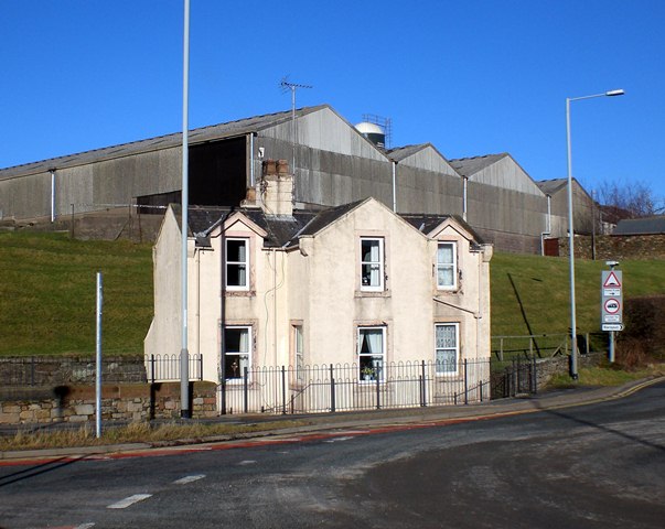
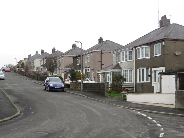
Low Seaton is a small village located in the county of Cumberland in northwest England. It is situated on the coast of the Irish Sea, just south of the larger town of Workington. With a population of around 500 residents, Low Seaton is known for its peaceful and picturesque setting.

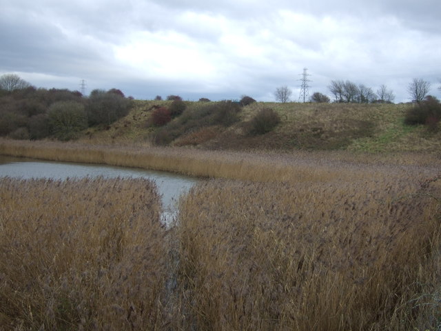
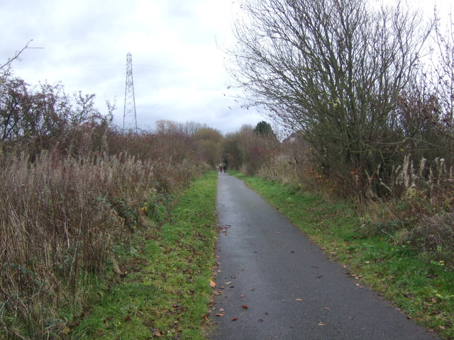
The village is surrounded by beautiful countryside, offering stunning views of the rugged coastline and the nearby Lake District National Park. The area is popular with nature lovers, hikers, and birdwatchers, as it provides ample opportunities for outdoor activities and exploration.

Low Seaton's history can be traced back to the medieval period, and it has retained its traditional charm with a number of historic buildings and cottages still standing. The village is also home to a quaint church, which adds to its overall charm.

Despite its small size, Low Seaton offers a range of amenities to its residents. These include a local pub, a primary school, a village hall, and a small convenience store. The village enjoys a close-knit community spirit, with various events and activities organized throughout the year.

Furthermore, Low Seaton benefits from its proximity to the larger town of Workington, which provides additional amenities such as shops, supermarkets, and leisure facilities. The village also benefits from good transportation links, with regular bus services connecting it to nearby towns and cities.

In summary, Low Seaton is a picturesque village located on the coast of the Irish Sea. With its stunning natural surroundings, historic buildings, and strong community spirit, it offers a peaceful and idyllic place to live or visit.

If you have any feedback on the listing, please let us know in the comments section below.
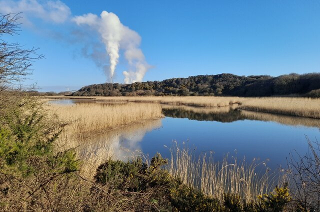
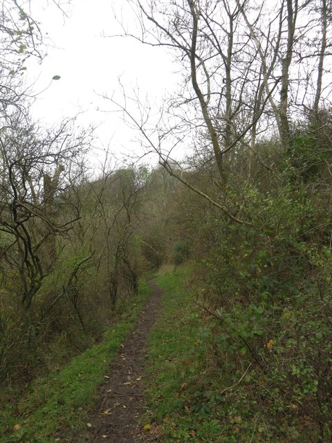
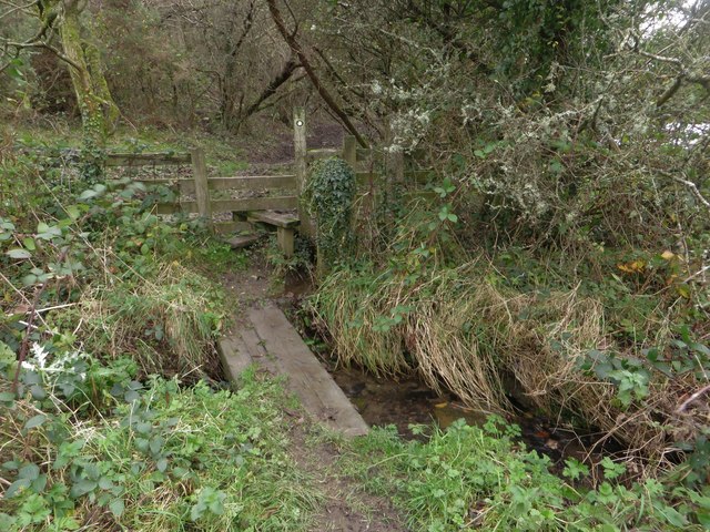
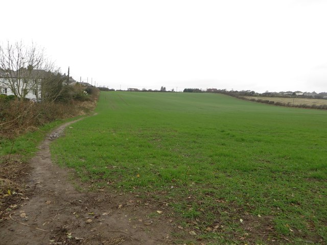
Low Seaton Images

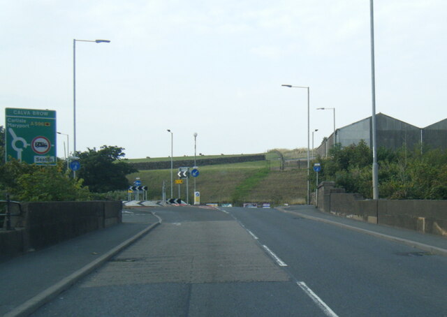
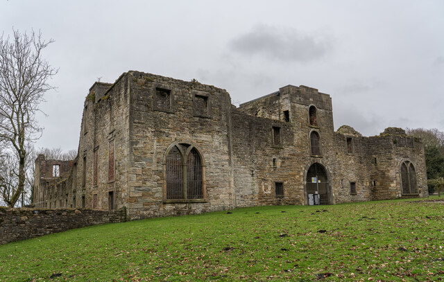
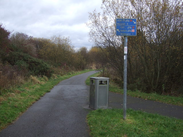
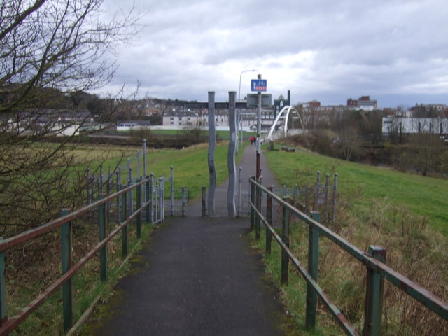
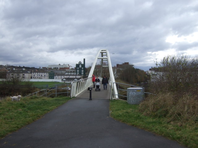
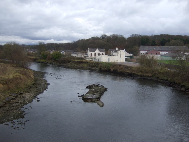
Images are sourced within 2km of 54.658223/-3.5197658 or Grid Reference NY0230. Thanks to Geograph Open Source API. All images are credited.

A596 Calva Brow from Workington Bridge
Workington Hall (Ruin), Cumbria The present house dates back to around 1404 and was built as a fortified tower house. In 1568, Mary, Queen of Scots wrote a letter from Workington Hall to Queen Elizabeth I of England. After the defeat of her forces at the Battle of Langside and disguised as an ordinary woman, Mary crossed the Solway Firth and landed at Workington. She spent her first night in England as an honoured guest at Workington Hall. On 18 May 1568, Mary was escorted to Carlisle Castle after spending a day at Cockermouth. 

<span class="nowrap"><a title="https://en.wikipedia.org/wiki/Workington_Hall" rel="nofollow ugc noopener" href="https://en.wikipedia.org/wiki/Workington_Hall">Link</a><img style="margin-left:2px;" alt="External link" title="External link - shift click to open in new window" src="https://s1.geograph.org.uk/img/external.png" width="10" height="10"/></span>
Workington Hall (Ruin), Cumbria
The present house dates back to around 1404 and was built as a fortified tower house. In 1568, Mary, Queen of Scots wrote a letter from Workington Hall to Queen Elizabeth I of England. After the defeat of her forces at the Battle of Langside and disguised as an ordinary woman, Mary crossed the Solway Firth and landed at Workington. She spent her first night in England as an honoured guest at Workington Hall. On 18 May 1568, Mary was escorted to Carlisle Castle after spending a day at Cockermouth. LinkExternal link
Old Milestone by Stainburn road, 75m west of junction with Moor Road The Milestone is located in wall on the North of the road.  Parish of Workington (Allerdale District). Carved stone post, Carlisle red stone design, erected by the Cockermouth & Workington turnpike trust in the 19th Century.  

Inscription reads:-   
Cockermouth / 7 / Workington / 1 

Milestone Society National ID: CU_CMWO07
Old Milestone by Stainburn road, 75m west of junction with Moor Road
The Milestone is located in wall on the North of the road.  Parish of Workington (Allerdale District). Carved stone post, Carlisle red stone design, erected by the Cockermouth & Workington turnpike trust in the 19th Century.   Inscription reads:- Cockermouth / 7 / Workington / 1 Milestone Society National ID: CU_CMWO07
Cleator & Workington Junction Railway at Calva Junction, Workington, 1951 View northward, towards Siddick - left, Seaton - right. In spite of appearances, passenger services along here, i.e. just north of Workington Central, ceased from 13/4/31, but freight continued until May 1964; to the great Naval Armaments Depot at Broughton Moor not until June 1992.
Cleator & Workington Junction Railway at Calva Junction, Workington, 1951
View northward, towards Siddick - left, Seaton - right. In spite of appearances, passenger services along here, i.e. just north of Workington Central, ceased from 13/4/31, but freight continued until May 1964; to the great Naval Armaments Depot at Broughton Moor not until June 1992.
Tollhouse by the A596, Calva Brow, Workington Tollhouse by the A596, in parish of Workington (Allerdale District), Toll Bar House, Calva Brow.

Demolished in 2015.

To be surveyed

Milestone Society National ID: CB.WOR
Tollhouse by the A596, Calva Brow, Workington
Tollhouse by the A596, in parish of Workington (Allerdale District), Toll Bar House, Calva Brow. Demolished in 2015. To be surveyed Milestone Society National ID: CB.WOR
Siddick Ponds Nature Reserve View from National Cycle Route 72.
Siddick Ponds Nature Reserve
View from National Cycle Route 72.
National Cycle Route 72 towards Workington On a disused railway.
National Cycle Route 72 towards Workington
On a disused railway.
Millennium milepost, National Cycle Route 71 / 72 At the junction of the two cycle routes and also the junction of the two disused railways which they both use the track bed of.
Millennium milepost, National Cycle Route 71 / 72
At the junction of the two cycle routes and also the junction of the two disused railways which they both use the track bed of.
Cycle path junction, National Cycle Route 71 / 72
National Cycle Route 72 towards Workington
Approaching Navvy's Bridge on National Cycle Route 72 Towards Workington.
Approaching Navvy's Bridge on National Cycle Route 72
Towards Workington.
River Derwent, Workington From Navvy's Bridge on National Cycle Route 72.
River Derwent, Workington
From Navvy's Bridge on National Cycle Route 72.
Siddick Pond Nature Reserve Siddick Ponds is a Site of Special Scientific Interest (SSSI) and Local Nature Reserve (LNR) and one of Cumbria’s most important bird sites.

The combination of extensive reedbed and two large ponds – one freshwater, the other brackish (a mix of fresh and saltwater) – contributes to the variety of species using the site and is unique in Cumbria, attracting a distinctive community of birds throughout the year.
Siddick Pond Nature Reserve
Siddick Ponds is a Site of Special Scientific Interest (SSSI) and Local Nature Reserve (LNR) and one of Cumbria’s most important bird sites. The combination of extensive reedbed and two large ponds – one freshwater, the other brackish (a mix of fresh and saltwater) – contributes to the variety of species using the site and is unique in Cumbria, attracting a distinctive community of birds throughout the year.
Footpath towards Barepot A muddy footpath across a wooded hillside between Low Seaton and Barepot.
Footpath towards Barepot
A muddy footpath across a wooded hillside between Low Seaton and Barepot.
Footbridge over Gale Brook An old railway sleeper has been used to form a footbridge over Gale Brook.
Footbridge over Gale Brook
An old railway sleeper has been used to form a footbridge over Gale Brook.
Arable field on the edge of Hawk Hill An arable field sown with a winter cereal crop on the edge of Hawk Hill.
Arable field on the edge of Hawk Hill
An arable field sown with a winter cereal crop on the edge of Hawk Hill.
Coronation Avenue, Hawk Hill A quiet residential street of semi detached, houses.
Coronation Avenue, Hawk Hill
A quiet residential street of semi detached, houses.
Princess Avenue, Hawk Hill A quiet residential street in the village on the north bank of the River Derwent.
Princess Avenue, Hawk Hill
A quiet residential street in the village on the north bank of the River Derwent.
Show me another place!

Low Seaton is located at Grid Ref: NY0230 (Lat: 54.658223, Lng: -3.5197658)

Administrative County: Cumbria

District: Allerdale

Police Authority: Cumbria

What 3 Words

///difficult.blanking.postcard. Near Workington, Cumbria

Nearby Locations

Scarbank Wood Low Seaton

Related Wikis

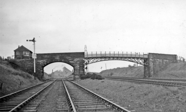
Seaton railway station (Cumbria)

Seaton railway station served the village of Seaton, near Workington in Cumberland (now in Cumbria), England.The station was opened by the Cleator and...

Seaton, Cumbria

Seaton is a large village and civil parish in Cumbria, England. Historically part of Cumberland, near the Lake District National Park in England. It is...

Stainburn, Cumbria

Stainburn is a settlement and former civil parish about 7 miles from Whitehaven, now in the parish of Workington, in the county of Cumbria, England. In...

Barker Crossing

Barker Crossing was a pedestrian footbridge in Workington, Cumbria, England that crossed the River Derwent, and linked the north and south sides of the...

Nearby Amenities

Located within 500m of 54.658223,-3.5197658
Seaton
Is In: Cumbria, England, UK
Place: village
Source: npe
Lat/Long: 54.6602893/-3.5241723
Seaton
Abandoned Railway: station
Railway: site
Source: npe
Wikidata: Q23018771
Lat/Long: 54.6621192/-3.5233651
Bus Stop
Junction to Jackson Street
Local Ref: AT
Naptan AtcoCode: 090002470304
Naptan Bearing: W
Naptan CommonName: Junction to Jackson Street
Naptan Indicator: at
Naptan Landmark: Junction to Jackson Street
Naptan NaptanCode: cumagmam
Naptan Street: Main Street
Naptan Verified: no
Source: naptan_import
Lat/Long: 54.6590401/-3.5266002
Bus Stop
Doctors Surgery
Naptan AtcoCode: 090002470308
Naptan Bearing: S
Naptan CommonName: Doctors Surgery
Naptan Indicator: opp
Naptan Landmark: shops
Naptan NaptanCode: cumagmaw
Naptan Street: Main Road
Naptan Verified: no
Source: naptan_import
Lat/Long: 54.6614389/-3.5251972
Bus Stop
St Pauls Church
Naptan AtcoCode: 090002470310
Naptan Bearing: N
Naptan CommonName: St Pauls Church
Naptan Indicator: o/s
Naptan Landmark: St Pauls Church
Naptan NaptanCode: cumagmda
Naptan Street: Causeway Road
Naptan Verified: no
Source: naptan_import
Lat/Long: 54.66117/-3.5230521
Bus Stop
Causeway Road at Kelsick Park
Naptan AtcoCode: 090002470311
Naptan Bearing: S
Naptan CommonName: Causeway Road at Kelsick Park
Naptan Indicator: opp
Naptan Landmark: junction to Kelsick Park
Naptan NaptanCode: cumagmdg
Naptan Street: Causeway Road
Naptan Verified: no
Source: naptan_import
Lat/Long: 54.6605321/-3.5223151
Bus Stop
The Pack Horse (S bound)
Bench: no
Covered: no
Naptan AtcoCode: 090002470317
Naptan Bearing: S
Naptan CommonName: The Pack Horse (S bound)
Naptan Indicator: opp
Naptan Landmark: The Pack Horse
Naptan NaptanCode: cumagmdp
Naptan Street: Low Seaton
Naptan Verified: no
Shelter: no
Source: naptan_import
Lat/Long: 54.6584277/-3.5202675
Turning Circle
Lat/Long: 54.6611858/-3.5179104
Turning Circle
Lat/Long: 54.6583047/-3.5255077
Turning Circle
Lat/Long: 54.6568913/-3.5269333
Turning Circle
Lat/Long: 54.6564041/-3.5258121
Top Kutz
Phone: +44 1900 601088
Shop: hairdresser
Lat/Long: 54.6611751/-3.5252356
Post Box
Post Box Type: pillar
Ref: CA14 9
Lat/Long: 54.6583954/-3.5204618
Power: pole
Lat/Long: 54.655771/-3.5157752
Power: pole
Lat/Long: 54.6550758/-3.5146889
Barrier: kissing_gate
Lat/Long: 54.6619037/-3.5179029
Generator Method: photovoltaic
Generator Orientation: south_east
Generator Output Electricity: yes
Generator Solar Modules: 10
Generator Source: solar
Generator Type: solar_photovoltaic_panel
Location: roof
Power: generator
Lat/Long: 54.6584889/-3.5266643
Generator Method: photovoltaic
Generator Orientation: south_west
Generator Output Electricity: yes
Generator Solar Modules: 16
Generator Source: solar
Generator Type: solar_photovoltaic_panel
Location: roof
Power: generator
Lat/Long: 54.6571139/-3.5263514
Generator Method: photovoltaic
Generator Orientation: east
Generator Output Electricity: yes
Generator Solar Modules: 12
Generator Source: solar
Generator Type: solar_photovoltaic_panel
Location: roof
Power: generator
Lat/Long: 54.6578794/-3.5254886
Generator Method: photovoltaic
Generator Orientation: west
Generator Output Electricity: yes
Generator Solar Modules: 14
Generator Source: solar
Generator Type: solar_photovoltaic_panel
Location: roof
Power: generator
Lat/Long: 54.6584137/-3.5248049
Generator Method: photovoltaic
Generator Orientation: south
Generator Output Electricity: yes
Generator Solar Modules: 16
Generator Source: solar
Generator Type: solar_photovoltaic_panel
Location: roof
Power: generator
Lat/Long: 54.6575272/-3.5246666
Generator Method: photovoltaic
Generator Orientation: south
Generator Output Electricity: yes
Generator Solar Modules: 12
Generator Source: solar
Generator Type: solar_photovoltaic_panel
Location: roof
Power: generator
Lat/Long: 54.6570172/-3.5244705
Generator Method: photovoltaic
Generator Orientation: south_west
Generator Output Electricity: yes
Generator Solar Modules: 8
Generator Source: solar
Generator Type: solar_photovoltaic_panel
Location: roof
Power: generator
Lat/Long: 54.6583013/-3.5205423
Generator Method: photovoltaic
Generator Orientation: south_east
Generator Output Electricity: yes
Generator Solar Modules: 19
Generator Source: solar
Generator Type: solar_photovoltaic_panel
Location: roof
Power: generator
Lat/Long: 54.6583127/-3.5191337
Generator Method: photovoltaic
Generator Orientation: south_east
Generator Output Electricity: yes
Generator Solar Modules: 14
Generator Source: solar
Generator Type: solar_photovoltaic_panel
Location: roof
Power: generator
Lat/Long: 54.6586917/-3.5185104
Generator Method: photovoltaic
Generator Orientation: south_east
Generator Output Electricity: yes
Generator Solar Modules: 15
Generator Source: solar
Generator Type: solar_photovoltaic_panel
Location: roof
Power: generator
Lat/Long: 54.6605945/-3.5155865
Generator Method: photovoltaic
Generator Orientation: south_east
Generator Output Electricity: yes
Generator Solar Modules: 16
Generator Source: solar
Generator Type: solar_photovoltaic_panel
Location: roof
Power: generator
Lat/Long: 54.659176/-3.5226348
Generator Method: photovoltaic
Generator Orientation: south_east
Generator Output Electricity: yes
Generator Solar Modules: 12
Generator Source: solar
Generator Type: solar_photovoltaic_panel
Location: roof
Power: generator
Lat/Long: 54.6591326/-3.5229426
Generator Method: photovoltaic
Generator Orientation: south_west
Generator Output Electricity: yes
Generator Solar Modules: 12
Generator Source: solar
Generator Type: solar_photovoltaic_panel
Location: roof
Power: generator
Lat/Long: 54.6591005/-3.5221559
Generator Method: photovoltaic
Generator Orientation: north_east
Generator Output Electricity: yes
Generator Solar Modules: 4
Generator Source: solar
Generator Type: solar_photovoltaic_panel
Location: roof
Power: generator
Lat/Long: 54.6591048/-3.5220845
Generator Method: photovoltaic
Generator Orientation: south_west
Generator Output Electricity: yes
Generator Solar Modules: 12
Generator Source: solar
Generator Type: solar_photovoltaic_panel
Location: roof
Power: generator
Lat/Long: 54.6593829/-3.5221487
Generator Method: photovoltaic
Generator Orientation: south_west
Generator Output Electricity: yes
Generator Solar Modules: 6
Generator Source: solar
Generator Type: solar_photovoltaic_panel
Location: roof
Power: generator
Lat/Long: 54.6597234/-3.5220782
Generator Method: photovoltaic
Generator Orientation: west
Generator Output Electricity: yes
Generator Solar Modules: 14
Generator Source: solar
Generator Type: solar_photovoltaic_panel
Location: roof
Power: generator
Lat/Long: 54.6600973/-3.5238474
Generator Method: photovoltaic
Generator Orientation: south_east
Generator Output Electricity: yes
Generator Solar Modules: 16
Generator Source: solar
Generator Type: solar_photovoltaic_panel
Location: roof
Power: generator
Lat/Long: 54.6597543/-3.5270215
Generator Method: photovoltaic
Generator Orientation: south_east
Generator Output Electricity: yes
Generator Solar Modules: 8
Generator Source: solar
Generator Type: solar_photovoltaic_panel
Location: roof
Power: generator
Lat/Long: 54.6612843/-3.5239059
Generator Method: photovoltaic
Generator Orientation: north_west
Generator Output Electricity: yes
Generator Solar Modules: 4
Generator Source: solar
Generator Type: solar_photovoltaic_panel
Location: roof
Power: generator
Lat/Long: 54.6613226/-3.5239706
Generator Method: photovoltaic
Generator Orientation: south_west
Generator Output Electricity: yes
Generator Solar Modules: 9
Generator Source: solar
Generator Type: solar_photovoltaic_panel
Location: roof
Power: generator
Lat/Long: 54.66266/-3.5198379
Power: pole
Lat/Long: 54.6561063/-3.5162932
Power: pole
Lat/Long: 54.6564877/-3.5169133
Power: pole
Lat/Long: 54.6571322/-3.5162498
Power: pole
Lat/Long: 54.6579332/-3.5154355
Power: pole
Lat/Long: 54.6585107/-3.5148505
Power: pole
Lat/Long: 54.6591253/-3.5142429
Power: pole
Lat/Long: 54.6603411/-3.514431
Power: pole
Lat/Long: 54.6608959/-3.5145095
Power: pole
Lat/Long: 54.6613645/-3.5145591
The data included in this document is from www.openstreetmap.org. The data is made available under ODbL.

Have you been to Low Seaton?

Leave your review of Low Seaton below (or comments, questions and feedback).