Low Pittington

Settlement in Durham

England

Low Pittington

Fatfield House Farm
Fatfield House Farm Credit: David Robinson

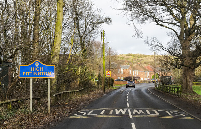
Low Pittington is a small village located in County Durham, in the northeast of England. Situated approximately 6 miles east of Durham City, it is nestled in a rural area surrounded by picturesque countryside. The village is part of the civil parish of Pittington and lies on the B1283 road.

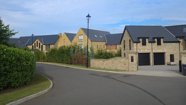
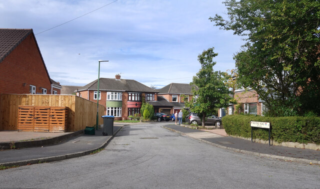
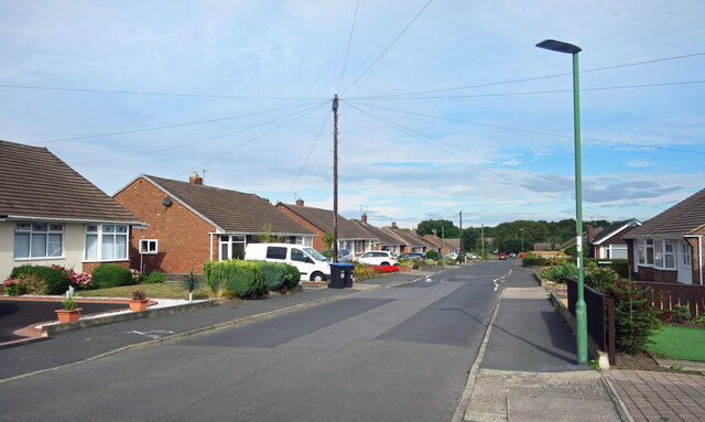
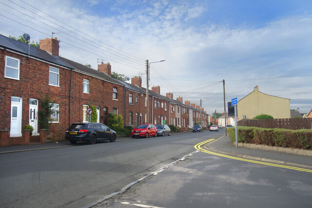
Low Pittington is known for its charming and peaceful atmosphere, offering residents and visitors an idyllic setting away from the hustle and bustle of city life. The village is characterized by a mix of traditional stone-built cottages and newer residential developments, creating a diverse and harmonious community.

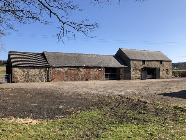
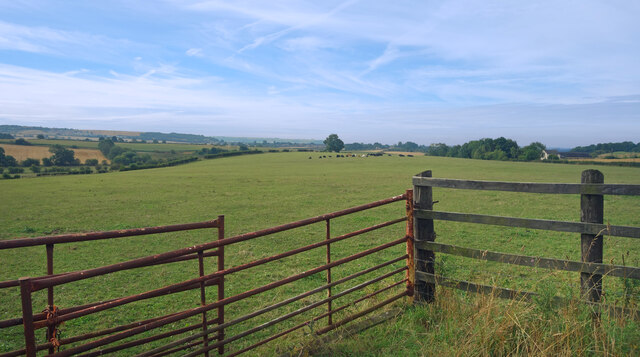
Historically, Low Pittington was primarily an agricultural village, with farming playing a significant role in the local economy. Today, however, the village has evolved into a residential area, with many residents commuting to nearby towns and cities for work.

Despite its small size, Low Pittington boasts a tight-knit community spirit, with various community activities and events organized throughout the year. The village is home to a local pub, providing a social hub for residents to gather and enjoy a drink or a meal.

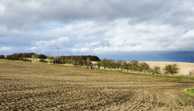
Surrounded by stunning natural beauty, Low Pittington offers ample opportunities for outdoor activities, including walking, cycling, and exploring the nearby countryside. The village also benefits from its proximity to Durham City, with its rich history and cultural attractions just a short drive away.

Overall, Low Pittington is a charming and tranquil village that offers a peaceful retreat in the heart of County Durham.

If you have any feedback on the listing, please let us know in the comments section below.

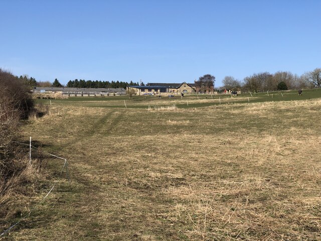
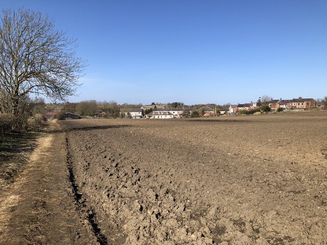
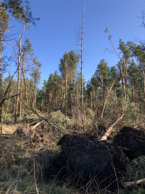
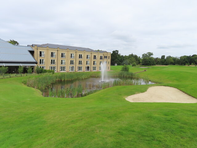
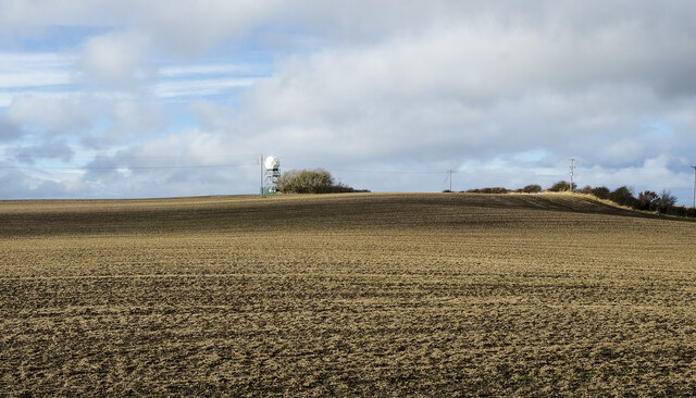
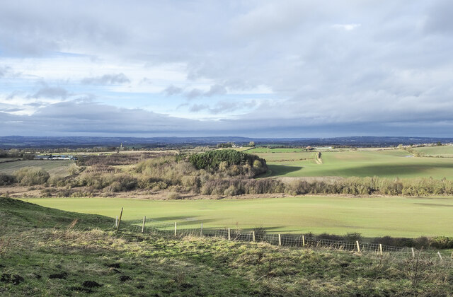
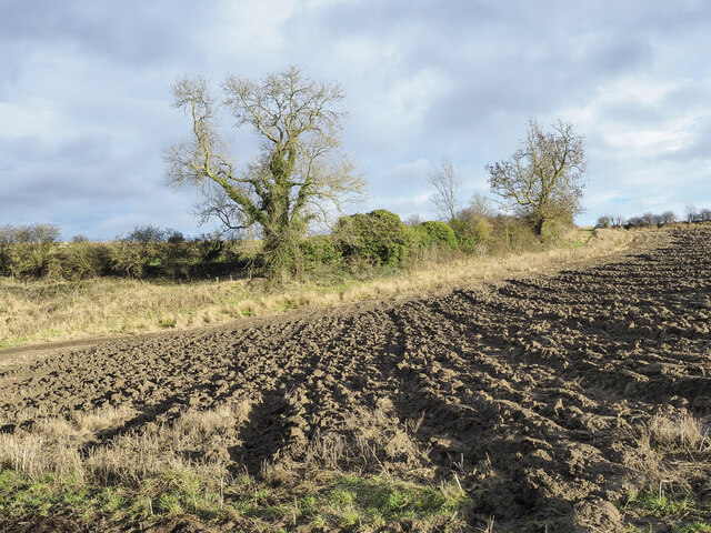
Low Pittington Images

Images are sourced within 2km of 54.79696/-1.4928043 or Grid Reference NZ3244. Thanks to Geograph Open Source API. All images are credited.

Fatfield House Farm
Fatfield House Farm
Low Pittington The smaller of the two Pittington villages (High Pittington being the other). The village was served by a station on the early Durham - Sunderland railway.
Low Pittington
The smaller of the two Pittington villages (High Pittington being the other). The village was served by a station on the early Durham - Sunderland railway.
Storm Damage In Pittington Woods Fallen trees in woodland plantation following a series of storms in Late 2021 / early 2022.
Storm Damage In Pittington Woods
Fallen trees in woodland plantation following a series of storms in Late 2021 / early 2022.
Farm Buildings, Littletown Farm
New Housing, Ramside Park A recent development on the eastern edge of suburban Durham.
New Housing, Ramside Park
A recent development on the eastern edge of suburban Durham.
Farmland beside Pittington Lane
Wantage Road (nos 60 - 84) The Wantage Road address continued along a short cul de sac off Wantage Road itself.
Wantage Road (nos 60 - 84)
The Wantage Road address continued along a short cul de sac off Wantage Road itself.
Wantage Road, Carrville
Broomside Lane, Carrville
War Memorial at St Lawrence's church, Pittington Grade II listed war memorial from 1920 in the churchyard of the Grade I listed Norman parish church.
War Memorial at St Lawrence's church, Pittington
Grade II listed war memorial from 1920 in the churchyard of the Grade I listed Norman parish church.
Grounds of Ramside Hall View from hotel bedroom. Ground to the right is a golf course.
Grounds of Ramside Hall
View from hotel bedroom. Ground to the right is a golf course.
"Treehouse" chalet, Ramside Hall Hotel The hotel is building chalets in woodland along a track at the top of the grounds and golf course. Each has three bedrooms, the largest sleeping twelve people.
"Treehouse" chalet, Ramside Hall Hotel
The hotel is building chalets in woodland along a track at the top of the grounds and golf course. Each has three bedrooms, the largest sleeping twelve people.
Golf course, spa, fountain at Ramside Hall Hotel
Earthen field near to High Moorsley Perhaps there are tinges of green on the brown earth, the suggestion of an emerging crop.
The 'golf ball' on a low tower is something of a weather station where there's also a small reservoir.
Earthen field near to High Moorsley
Perhaps there are tinges of green on the brown earth, the suggestion of an emerging crop. The 'golf ball' on a low tower is something of a weather station where there's also a small reservoir.
Roughly grassed slope The slope descends from the minor road passing through High Moorsley.
Roughly grassed slope
The slope descends from the minor road passing through High Moorsley.
Corner of ploughed field The northern corner of the field where increasingly short passages of the plough have been made.
Corner of ploughed field
The northern corner of the field where increasingly short passages of the plough have been made.
Road entering High Pittington This is Hallgarth Lane entering the village from the south. The blue and yellow road sign is in the style very common in County Durham.
Road entering High Pittington
This is Hallgarth Lane entering the village from the south. The blue and yellow road sign is in the style very common in County Durham.
Walking party heading for High Moorsley High Moorsley is a small settlement south-west of Hetton-le-Hole. Close to it there's a local high point, with a trig point.
Walking party heading for High Moorsley
High Moorsley is a small settlement south-west of Hetton-le-Hole. Close to it there's a local high point, with a trig point.
Show me another place!

Low Pittington is located at Grid Ref: NZ3244 (Lat: 54.79696, Lng: -1.4928043)

Unitary Authority: County Durham

Police Authority: Durham

What 3 Words

///snowboard.picked.wealth. Near Pittington, Co. Durham

Nearby Locations

Pittington Low Pittington

Related Wikis

Pittington railway station

Pittington railway station served the village of Pittington, County Durham, England, from 1837 to 1960 on the Durham and Sunderland Railway. == History... ==

Pittington Hill

Pittington Hill is a Site of Special Scientific Interest in County Durham, England. It lies adjacent to the village of Pittington, some 6 km north-east...

Pittington

Pittington is a village and civil parish in County Durham, in England. It is situated a few miles north-east of Durham. The population as taken at the...

Hallgarth

Hallgarth is a small village in County Durham, England, to the east of Durham. It is in the parish of Pittington and is described there. == References ==

High Moorsley

High Moorsley is a small village 1 mile (1.6 km) south-west of Hetton-le-Hole in the City of Sunderland, north east England. It is the site of the first...

Rainton Gate

Rainton Gate is a village in County Durham, in England. It is situated between Durham and Houghton-le-Spring, next to West Rainton. == References ==

Belmont Junction railway station (Durham)

Belmont Junction railway station was a railway station that served the civil parish of Belmont in County Durham, North East England, from 1844 to 1857...

West Rainton

West Rainton is a village in the civil parish of West Rainton and Leamside, in County Durham, England. It is situated between Durham and Houghton-le-Spring...

Related Videos

vlog#10 part 2

welcome to my channel,please subscribe likes and share...

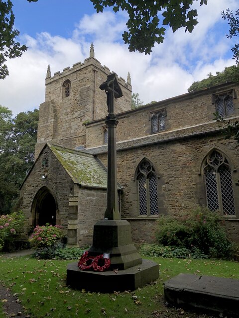
St Laurence Church Pittington Durahm #countryside #walking

St Laurence is over 1000 years old and is quite medieval. It dates back to the 12th centaury , so before Durham Cathedral was ...

Walking in the Air - Performed by The Singergy Collective

Performed by The Singergy Collective, led by Sinead Livingston On Sat 9th Dec 2023 at St. Mary's Church, West Rainton, Durham ...

vlog#13 jungle tour

PLEASE, subscribe LIKES & share..

Nearby Amenities

Located within 500m of 54.79696,-1.4928043
Post Box
Post Box Type: lamp
Ref: DH6 31
Lat/Long: 54.7969165/-1.4923582
Bus Stop
Blacksmiths Arms
Bench: yes
Naptan AtcoCode: 13005346A
Naptan Bearing: N
Naptan CommonName: Blacksmiths Arms
Naptan Indicator: north bound
Naptan Landmark: Landmark not known
Naptan NaptanCode: durdjtgp
Naptan Notes: opp 1b- Station Rd- Low Pittington
Naptan Street: Station Road
Naptan Verified: no
Shelter: yes
Source: naptan_import
Lat/Long: 54.797881/-1.4972585
Bus Stop
Blacksmiths Arms
Bench: no
Naptan AtcoCode: 13005346E
Naptan Bearing: S
Naptan CommonName: Blacksmiths Arms
Naptan Indicator: south bound
Naptan Landmark: Landmark not known
Naptan NaptanCode: durdjtgt
Naptan Notes: 1b- Station Road- Low Pittington
Naptan Street: Station Road
Shelter: no
Source: naptan_import
Lat/Long: 54.7977996/-1.497135
Bus Stop
Front Street
Bench: no
Naptan AtcoCode: 13005347C
Naptan Bearing: E
Naptan CommonName: Front Street
Naptan Indicator: east bound
Naptan Landmark: Landmark not known
Naptan NaptanCode: durdjtgw
Naptan Notes: W of Paddock House- Front Street- Low Pittington
Naptan Street: Front Street
Shelter: yes
Source: naptan_import
Lat/Long: 54.7972956/-1.4958775
Bus Stop
Front Street
Bench: yes
Naptan AtcoCode: 13005347G
Naptan Bearing: W
Naptan CommonName: Front Street
Naptan Indicator: west bound
Naptan Landmark: Landmark not known
Naptan NaptanCode: durdjtja
Naptan Notes: Stables- opposite 8 Front Street- Low Pittington
Naptan Street: Front Street
Shelter: yes
Source: naptan_import
Lat/Long: 54.7971105/-1.4948364
Bus Stop
Wellington Street
Bench: yes
Naptan AtcoCode: 13005348D
Naptan Bearing: SE
Naptan CommonName: Wellington Street
Naptan Indicator: south east bound
Naptan Landmark: Landmark not known
Naptan NaptanCode: durdjtjd
Naptan Notes: opp 8- st. johns road- Pittington
Naptan Street: St Johns Road
Shelter: yes
Source: naptan_import
Lat/Long: 54.7931628/-1.4896636
Bus Stop
Wellington Street
Naptan AtcoCode: 13005348H
Naptan Bearing: NW
Naptan CommonName: Wellington Street
Naptan Indicator: north west bound
Naptan Landmark: Landmark not known
Naptan NaptanCode: durdjtjg
Naptan Notes: church- st. johns road- Pittington
Naptan Street: St Johns Road
Shelter: yes
Source: naptan_import
Lat/Long: 54.7932951/-1.490161
Bus Stop
MOORSLEY ROAD-STATION HOUSES-W/B
Fixme: Verify bus stop exists - looks dubious and doesn't match current NAPTAN data
Local Ref: W
Naptan AtcoCode: 410000031046
Naptan Bearing: W
Naptan CommonName: MOORSLEY ROAD-STATION HOUSES-W/B
Naptan Indicator: W
Naptan Landmark: OPPOSITE PITTINGTON STATION HOUSES
Naptan NaptanCode: twrgjgtp
Naptan Street: MOORSLEY ROAD
Naptan Verified: no
Source: naptan_import
Lat/Long: 54.8001715/-1.4969656
Bus Stop
MOORSLEY ROAD-STATION HOUSES-E/B
Local Ref: E
Naptan AtcoCode: 410000031047
Naptan Bearing: E
Naptan CommonName: MOORSLEY ROAD-STATION HOUSES-E/B
Naptan Indicator: E
Naptan Landmark: OUTSIDE PITTINGTON STATION HOUSES
Naptan NaptanCode: twrgjgtw
Naptan Street: MOORSLEY ROAD
Naptan Verified: no
Source: naptan_import
Lat/Long: 54.8002158/-1.496825
Barrier: kissing_gate
Lat/Long: 54.7973823/-1.4863939
Pittington
Historic Railway: station
Railway: site
Source: OS 1:25k
Wikidata: Q105555803
Wikipedia: en:Pittington railway station
Lat/Long: 54.7987114/-1.4967109
Barrier: stile
Lat/Long: 54.8000758/-1.4948125
Barrier: stile
Lat/Long: 54.7961787/-1.4975859
Power: pole
Lat/Long: 54.7965504/-1.4976593
Power: pole
Lat/Long: 54.7966446/-1.499017
Power: pole
Lat/Long: 54.7967221/-1.5005277
Tourism: viewpoint
Lat/Long: 54.7961607/-1.4871414
Bench
Lat/Long: 54.7960398/-1.4870696
Barrier: kissing_gate
Lat/Long: 54.7970999/-1.4896979
Barrier: stile
Lat/Long: 54.7971789/-1.496321
Barrier: stile
Lat/Long: 54.7964145/-1.497401
Barrier: stile
Foot: yes
Note: Also gate for track
Stile: stepover
Lat/Long: 54.7977238/-1.4959699
Addr Housename: Laurel Arch
Lat/Long: 54.796845/-1.490415
Addr Housename: Rowan Lea
Lat/Long: 54.7969076/-1.490749
Addr Housename: Stengarth
Lat/Long: 54.7972169/-1.4908066
Addr Housename: Eboracum
Lat/Long: 54.7972068/-1.4911299
Addr Housename: The Byre, Glenmoor Farm
Lat/Long: 54.797145/-1.4917213
Addr Housename: The Farmhouse
Lat/Long: 54.7971333/-1.4920686
Bench
Lat/Long: 54.7971055/-1.49553
Bench
Lat/Long: 54.7971148/-1.4955991
Defibrillator
Defibrillator Location: outside The Blacksmiths pub
Emergency: defibrillator
Indoor: no
Lat/Long: 54.7974583/-1.4971243
Bench
Lat/Long: 54.7975106/-1.4974612
Generator Method: photovoltaic
Generator Orientation: 170
Generator Output Electricity: yes
Generator Solar Modules: 16
Generator Source: solar
Generator Type: solar_photovoltaic_panel
Location: roof
Power: generator
Lat/Long: 54.7973328/-1.4955139
Generator Method: photovoltaic
Generator Orientation: 170
Generator Output Electricity: yes
Generator Solar Modules: 19
Generator Source: solar
Generator Type: solar_photovoltaic_panel
Location: roof
Power: generator
Lat/Long: 54.7972841/-1.4930718
Generator Method: photovoltaic
Generator Orientation: 360
Generator Output Electricity: yes
Generator Solar Modules: 10
Generator Source: solar
Generator Type: solar_photovoltaic_panel
Location: roof
Power: generator
Lat/Long: 54.7972586/-1.4908536
Generator Method: photovoltaic
Generator Orientation: 170
Generator Output Electricity: yes
Generator Source: solar
Generator Type: solar_photovoltaic_panel
Location: roof
Power: generator
Lat/Long: 54.7972076/-1.4902742
Generator Method: photovoltaic
Generator Orientation: 170
Generator Output Electricity: yes
Generator Source: solar
Generator Type: solar_photovoltaic_panel
Location: roof
Power: generator
Lat/Long: 54.7972184/-1.4898169
Generator Method: photovoltaic
Generator Orientation: 170
Generator Output Electricity: yes
Generator Source: solar
Generator Type: solar_photovoltaic_panel
Location: roof
Power: generator
Lat/Long: 54.7967855/-1.4913793
Generator Method: photovoltaic
Generator Orientation: 170
Generator Output Electricity: yes
Generator Source: solar
Generator Type: solar_photovoltaic_panel
Location: roof
Power: generator
Lat/Long: 54.796763/-1.4917696
Generator Method: photovoltaic
Generator Orientation: 170
Generator Output Electricity: yes
Generator Solar Modules: 10
Generator Source: solar
Generator Type: solar_photovoltaic_panel
Location: roof
Power: generator
Lat/Long: 54.7967371/-1.4925253
Grit Bin
Operator: Durham County Council
Operator Type: government
Operator Wikidata: Q5316492
Ref: DU023
Lat/Long: 54.79693/-1.4922631
Waste Basket
Waste: dog_excrement
Lat/Long: 54.7970321/-1.4921464
Addr Housename: Beacon Hill
Survey Date: 2021-02-13
Lat/Long: 54.7969494/-1.4891504
Addr City: Durham
Addr Housename: Melhourne House
Addr Housenumber: 17
Addr Postcode: DH6 1BE
Addr Street: High Street
Addr Village: Low Pittington
Survey Date: 2021-02-13
Lat/Long: 54.7972022/-1.4892362
Barrier: kissing_gate
Lat/Long: 54.7938635/-1.4897633
Waste Basket
Waste: dog_excrement
Lat/Long: 54.793372/-1.4910132
Entrance: main
Lat/Long: 54.7931669/-1.4906743
Waste Basket
Lat/Long: 54.7933202/-1.4901884
Bench
Lat/Long: 54.7932668/-1.4896788
Bench
Lat/Long: 54.7932931/-1.4897136
Bench
Lat/Long: 54.7933225/-1.4897512
Waste Basket
Lat/Long: 54.7932197/-1.4897284
Addr City: Durham
Addr Housenumber: 1
Addr Postcode: DH6 1BJ
Addr Street: Station Road
Addr Village: Low Pittington
Survey Date: 2021-02-13
Lat/Long: 54.7980562/-1.4969354
Addr City: Durham
Addr Housenumber: 1a
Addr Postcode: DH6 1BJ
Addr Street: Station Road
Addr Village: Low Pittington
Survey Date: 2021-02-13
Lat/Long: 54.7979307/-1.4969545
Addr Housename: Storey House
Addr Street: Station Road
Survey Date: 2021-02-13
Lat/Long: 54.7978674/-1.4969735
Addr Housename: Blacksmiths Cottage
Addr Street: Station Road
Survey Date: 2021-02-13
Lat/Long: 54.7977809/-1.4969881
Addr City: Durham
Addr Housenumber: 3
Addr Postcode: DH6 1BJ
Addr Street: Station Road
Addr Village: Low Pittington
Survey Date: 2021-02-13
Lat/Long: 54.7976683/-1.497012
Addr City: Durham
Addr Housenumber: 4
Addr Postcode: DH6 1BQ
Addr Street: Front Street
Addr Village: Low Pittington
Survey Date: 2021-02-13
Lat/Long: 54.7972597/-1.4952396
Addr City: Durham
Addr Housenumber: 5
Addr Postcode: DH6 1BQ
Addr Street: Front Street
Addr Village: Low Pittington
Survey Date: 2021-02-13
Lat/Long: 54.7972541/-1.4951587
Addr City: Durham
Addr Housenumber: 6
Addr Postcode: DH6 1BQ
Addr Street: Front Street
Addr Village: Low Pittington
Note: House number assumed, none displayed
Survey Date: 2021-02-13
Lat/Long: 54.7972586/-1.4950725
Addr City: Durham
Addr Housenumber: 7
Addr Postcode: DH6 1BQ
Addr Street: Front Street
Addr Village: Low Pittington
Survey Date: 2021-02-13
Lat/Long: 54.7972612/-1.4950011
Addr City: Durham
Addr Housenumber: 8
Addr Postcode: DH6 1BQ
Addr Street: Front Street
Addr Village: Low Pittington
Note: House number assumed, none displayed
Survey Date: 2021-02-13
Lat/Long: 54.7972517/-1.4947846
Addr City: Durham
Addr Housenumber: 9
Addr Postcode: DH6 1BQ
Addr Street: Front Street
Addr Village: Low Pittington
Survey Date: 2021-02-13
Lat/Long: 54.7972486/-1.4946944
Addr City: Durham
Addr Housenumber: 10
Addr Postcode: DH6 1BQ
Addr Street: Front Street
Addr Village: Low Pittington
Survey Date: 2021-02-13
Lat/Long: 54.7972432/-1.494613
Addr City: Durham
Addr Housenumber: 11
Addr Postcode: DH6 1BQ
Addr Street: Front Street
Addr Village: Low Pittington
Survey Date: 2021-02-13
Lat/Long: 54.7972373/-1.4945395
Addr City: Durham
Addr Housenumber: 3
Addr Postcode: DH6 1BH
Addr Street: Pioneer Cottages
Addr Village: Low Pittington
Survey Date: 2021-02-13
Lat/Long: 54.797099/-1.4944927
Addr City: Durham
Addr Housenumber: 2
Addr Postcode: DH6 1BH
Addr Street: Pioneer Cottages
Addr Village: Low Pittington
Note: House number assumed, none displayed
Survey Date: 2021-02-13
Lat/Long: 54.7970956/-1.4944057
Addr City: Durham
Addr Housenumber: 12
Addr Postcode: DH6 1BQ
Addr Street: Front Street
Addr Village: Low Pittington
Survey Date: 2021-02-13
Lat/Long: 54.7972449/-1.4943284
Addr City: Durham
Addr Housenumber: 1
Addr Postcode: DH6 1BH
Addr Street: Pioneer Cottages
Addr Village: Low Pittington
Survey Date: 2021-02-13
Lat/Long: 54.797097/-1.4943195
Addr City: Durham
Addr Housenumber: 14
Addr Postcode: DH6 1BQ
Addr Street: Front Street
Addr Village: Low Pittington
Survey Date: 2021-02-13
Lat/Long: 54.7972434/-1.4941837
Addr City: Durham
Addr Housenumber: 15
Addr Postcode: DH6 1BQ
Addr Street: Front Street
Addr Village: Low Pittington
Survey Date: 2021-02-13
Lat/Long: 54.7972376/-1.4940787
Addr City: Durham
Addr Housenumber: 1
Addr Postcode: DH6 1BG
Addr Street: Coronation Crescent
Addr Village: Low Pittington
Note: House number assumed, none displayed
Survey Date: 2021-02-13
Lat/Long: 54.797064/-1.4936409
Addr City: Durham
Addr Housenumber: 2
Addr Postcode: DH6 1BG
Addr Street: Coronation Crescent
Addr Village: Low Pittington
Survey Date: 2021-02-13
Lat/Long: 54.7970433/-1.4935609
Addr City: Durham
Addr Housenumber: 3
Addr Postcode: DH6 1BG
Addr Street: Coronation Crescent
Addr Village: Low Pittington
Survey Date: 2021-02-13
Lat/Long: 54.7970223/-1.4934772
Addr City: Durham
Addr Housenumber: 4
Addr Postcode: DH6 1BG
Addr Street: Coronation Crescent
Addr Village: Low Pittington
Survey Date: 2021-02-13
Lat/Long: 54.796998/-1.4934068
Addr City: Durham
Addr Housenumber: 5
Addr Postcode: DH6 1BG
Addr Street: Coronation Crescent
Addr Village: Low Pittington
Survey Date: 2021-02-13
Lat/Long: 54.7969754/-1.4933532
Addr City: Durham
Addr Housenumber: 17
Addr Postcode: DH6 1BQ
Addr Street: Front Street
Addr Village: Low Pittington
Survey Date: 2021-02-13
Lat/Long: 54.7972605/-1.4933444
Addr City: Durham
Addr Housenumber: 6
Addr Postcode: DH6 1BG
Addr Street: Coronation Crescent
Addr Village: Low Pittington
Survey Date: 2021-02-13
Lat/Long: 54.7969339/-1.4932308
Addr City: Durham
Addr Housenumber: 7
Addr Postcode: DH6 1BG
Addr Street: Coronation Crescent
Addr Village: Low Pittington
Survey Date: 2021-02-13
Lat/Long: 54.7968976/-1.493126
Addr City: Durham
Addr Housenumber: 8
Addr Postcode: DH6 1BG
Addr Street: Coronation Crescent
Addr Village: Low Pittington
Note: House number assumed, none displayed
Survey Date: 2021-02-13
Lat/Long: 54.7968518/-1.4930798
Addr City: Durham
Addr Housenumber: 9
Addr Postcode: DH6 1BG
Addr Street: Coronation Crescent
Addr Village: Low Pittington
Survey Date: 2021-02-13
Lat/Long: 54.7968167/-1.4930376
Addr City: Durham
Addr Housenumber: 10
Addr Postcode: DH6 1BG
Addr Street: Coronation Crescent
Addr Village: Low Pittington
Survey Date: 2021-02-13
Lat/Long: 54.7967701/-1.4929847
Addr Housename: Cornmill Barn
Survey Date: 2021-02-13
Lat/Long: 54.7966247/-1.4923174
Addr Housename: Glenville
Survey Date: 2021-02-13
Lat/Long: 54.7968534/-1.4911575
Addr Housename: Lochfield
Survey Date: 2021-02-13
Lat/Long: 54.7972172/-1.4906875
Addr Housename: Laurel Arch
Survey Date: 2021-02-13
Lat/Long: 54.7969141/-1.4906203
Addr City: Durham
Addr Housename: Vale Cottage
Addr Housenumber: 13
Addr Postcode: DH6 1BE
Addr Street: High Street
Addr Village: Low Pittington
Survey Date: 2021-02-13
Lat/Long: 54.7972134/-1.4904888
Addr City: Durham
Addr Housename: Rickaby House
Addr Housenumber: 23
Addr Postcode: DH6 1BE
Addr Street: High Street
Addr Village: Low Pittington
Survey Date: 2021-02-13
Lat/Long: 54.7969165/-1.4902208
Addr Housename: Conyers House
Survey Date: 2021-02-13
Lat/Long: 54.7972274/-1.4902837
Addr Housename: Hillside
Survey Date: 2021-02-13
Lat/Long: 54.7969408/-1.4900299
Addr Housename: Orchard House
Survey Date: 2021-02-13
Lat/Long: 54.7972549/-1.4899634
Addr Housename: Viking House
Survey Date: 2021-02-13
Lat/Long: 54.7967879/-1.4897429
Addr Housename: Rose Cottage
Survey Date: 2021-02-13
Lat/Long: 54.7972453/-1.48947
Addr Housename: Pear tree House
Survey Date: 2021-02-13
Lat/Long: 54.7971829/-1.4891164
Addr City: Durham
Addr Housenumber: 3
Addr Postcode: DH6 1BA
Addr Street: St Lawrence Road
Addr Village: High Pittington
Source Postcode: CodePoint Open
Survey Date: 2021-02-13
Lat/Long: 54.7931903/-1.4885595
Addr City: Durham
Addr Housenumber: 4
Addr Postcode: DH6 1BA
Addr Street: St Lawrence Road
Addr Village: High Pittington
Source Postcode: CodePoint Open
Survey Date: 2021-02-13
Lat/Long: 54.7932276/-1.4884714
Addr City: Durham
Addr Housenumber: 5
Addr Postcode: DH6 1BA
Addr Street: St Lawrence Road
Addr Village: High Pittington
Source Postcode: CodePoint Open
Survey Date: 2021-02-13
Lat/Long: 54.793276/-1.4883518
Addr City: Durham
Addr Housenumber: 6
Addr Postcode: DH6 1BA
Addr Street: St Lawrence Road
Addr Village: High Pittington
Source Postcode: CodePoint Open
Survey Date: 2021-02-13
Lat/Long: 54.7933164/-1.4882896
Addr City: Durham
Addr Housenumber: 7
Addr Postcode: DH6 1BA
Addr Street: St Lawrence Road
Addr Village: High Pittington
Source Postcode: CodePoint Open
Survey Date: 2021-02-13
Lat/Long: 54.7933713/-1.4881451
Addr City: Durham
Addr Housenumber: 8
Addr Postcode: DH6 1BA
Addr Street: St Lawrence Road
Addr Village: High Pittington
Source Postcode: CodePoint Open
Survey Date: 2021-02-13
Lat/Long: 54.793412/-1.4880615
Addr City: Durham
Addr Housenumber: 1
Addr Postcode: DH6 1BB
Addr Street: Hillside Grove
Addr Village: High Pittington
Note: House number assumed, none displayed
Source Postcode: CodePoint Open
Survey Date: 2021-02-13
Lat/Long: 54.7935312/-1.4882831
Addr City: Durham
Addr Housenumber: 2
Addr Postcode: DH6 1BB
Addr Street: Hillside Grove
Addr Village: High Pittington
Source Postcode: CodePoint Open
Survey Date: 2021-02-13
Lat/Long: 54.7935446/-1.4883991
Addr City: Durham
Addr Housenumber: 3
Addr Postcode: DH6 1BB
Addr Street: Hillside Grove
Addr Village: High Pittington
Note: House number assumed, none displayed
Source Postcode: CodePoint Open
Survey Date: 2021-02-13
Lat/Long: 54.7935164/-1.4885603
Addr City: Durham
Addr Housenumber: 4
Addr Postcode: DH6 1BB
Addr Street: Hillside Grove
Addr Village: High Pittington
Source Postcode: CodePoint Open
Survey Date: 2021-02-13
Lat/Long: 54.7935365/-1.4886848
Addr City: Durham
Addr Housenumber: 5
Addr Postcode: DH6 1BB
Addr Street: Hillside Grove
Addr Village: High Pittington
Source Postcode: CodePoint Open
Survey Date: 2021-02-13
Lat/Long: 54.7935497/-1.4887958
Addr City: Durham
Addr Housenumber: 6
Addr Postcode: DH6 1BB
Addr Street: Hillside Grove
Addr Village: High Pittington
Source Postcode: CodePoint Open
Survey Date: 2021-02-13
Lat/Long: 54.7935657/-1.4889162
Addr City: Durham
Addr Housenumber: 7
Addr Postcode: DH6 1BB
Addr Street: Hillside Grove
Addr Village: High Pittington
Source Postcode: CodePoint Open
Survey Date: 2021-02-13
Lat/Long: 54.7936341/-1.4890188
Addr City: Durham
Addr Housenumber: 8
Addr Postcode: DH6 1BB
Addr Street: Hillside Grove
Addr Village: High Pittington
Source Postcode: CodePoint Open
Survey Date: 2021-02-13
Lat/Long: 54.7936575/-1.4891481
Addr City: Durham
Addr Housenumber: 91
Addr Postcode: DH6 1BD
Addr Street: Elemore Street
Addr Village: High Pittington
Source Postcode: CodePoint Open
Survey Date: 2021-02-13
Lat/Long: 54.7936978/-1.489247
Addr City: Durham
Addr Housenumber: 90
Addr Postcode: DH6 1BD
Addr Street: Elemore Street
Addr Village: High Pittington
Source Postcode: CodePoint Open
Survey Date: 2021-02-13
Lat/Long: 54.793709/-1.4893472
Addr City: Durham
Addr Housenumber: 87
Addr Postcode: DH6 1BD
Addr Street: Elemore Street
Addr Village: High Pittington
Source Postcode: CodePoint Open
Survey Date: 2021-02-13
Lat/Long: 54.793741/-1.489587
Addr City: Durham
Addr Housenumber: 86
Addr Postcode: DH6 1BD
Addr Street: Elemore Street
Addr Village: High Pittington
Source Postcode: CodePoint Open
Survey Date: 2021-02-13
Lat/Long: 54.7937474/-1.4896732
Addr City: Durham
Addr Housenumber: 1
Addr Postcode: DH6 1AX
Addr Street: St John's Road
Addr Village: High Pittington
Source Postcode: CodePoint Open
Survey Date: 2021-02-13
Lat/Long: 54.7936113/-1.4906827
Addr City: Durham
Addr Housenumber: 2
Addr Postcode: DH6 1AX
Addr Street: St John's Road
Addr Village: High Pittington
Source Postcode: CodePoint Open
Survey Date: 2021-02-13
Lat/Long: 54.7935238/-1.4905716
Addr City: Durham
Addr Housenumber: 5
Addr Postcode: DH6 1AX
Addr Street: St John's Road
Addr Village: High Pittington
Source Postcode: CodePoint Open
Survey Date: 2021-02-13
Lat/Long: 54.7930793/-1.4903224
Addr City: Durham
Addr Housenumber: 4
Addr Postcode: DH6 1AX
Addr Street: St John's Road
Addr Village: High Pittington
Source Postcode: CodePoint Open
Survey Date: 2021-02-13
Lat/Long: 54.7933364/-1.4907197
Addr City: Durham
Addr Housenumber: 3
Addr Postcode: DH6 1AX
Addr Street: St John's Road
Addr Village: High Pittington
Source Postcode: CodePoint Open
Survey Date: 2021-02-13
Lat/Long: 54.793394/-1.4906159
Addr City: Durham
Addr Housenumber: 2
Addr Postcode: DH6 1AZ
Addr Street: Wellington Street
Addr Village: High Pittington
Source Postcode: CodePoint Open
Survey Date: 2021-02-13
Lat/Long: 54.7935793/-1.4901337
Addr City: Durham
Addr Housenumber: 3
Addr Postcode: DH6 1AZ
Addr Street: Wellington Street
Addr Village: High Pittington
Source Postcode: CodePoint Open
Survey Date: 2021-02-13
Lat/Long: 54.7935124/-1.4900116
Addr City: Durham
Addr Housenumber: 4
Addr Postcode: DH6 1AZ
Addr Street: Wellington Street
Addr Village: High Pittington
Source Postcode: CodePoint Open
Survey Date: 2021-02-13
Lat/Long: 54.79353/-1.4898031
Addr City: Durham
Addr Housenumber: 5
Addr Postcode: DH6 1AZ
Addr Street: Wellington Street
Addr Village: High Pittington
Source Postcode: CodePoint Open
Survey Date: 2021-02-13
Lat/Long: 54.7934901/-1.48973
Addr City: Durham
Addr Housenumber: 6
Addr Postcode: DH6 1AX
Addr Street: St John's Road
Addr Village: High Pittington
Source Postcode: CodePoint Open
Survey Date: 2021-02-13
Lat/Long: 54.7931361/-1.4901979
Addr City: Durham
Addr Housenumber: 6
Addr Postcode: DH6 1AZ
Addr Street: Wellington Street
Addr Village: High Pittington
Source Postcode: CodePoint Open
Survey Date: 2021-02-13
Lat/Long: 54.7934267/-1.4895935
Addr City: Durham
Addr Housenumber: 7
Addr Postcode: DH6 1AZ
Addr Street: Wellington Street
Addr Village: High Pittington
Source Postcode: CodePoint Open
Survey Date: 2021-02-13
Lat/Long: 54.7933684/-1.4895062
Addr City: Durham
Addr Housenumber: 7
Addr Postcode: DH6 1AX
Addr Street: St John's Road
Addr Village: High Pittington
Source Postcode: CodePoint Open
Survey Date: 2021-02-13
Lat/Long: 54.7930986/-1.4899797
Addr City: Durham
Addr Housenumber: 8
Addr Postcode: DH6 1AX
Addr Street: St John's Road
Addr Village: High Pittington
Source Postcode: CodePoint Open
Survey Date: 2021-02-13
Lat/Long: 54.7930398/-1.489901
Addr City: Durham
Addr Housenumber: 8
Addr Postcode: DH6 1AZ
Addr Street: Wellington Street
Addr Village: High Pittington
Note: House number assumed, none displayed
Source Postcode: CodePoint Open
Survey Date: 2021-02-13
Lat/Long: 54.7933022/-1.489396
Addr City: Durham
Addr Housenumber: 9
Addr Postcode: DH6 1AZ
Addr Street: Wellington Street
Addr Village: High Pittington
Source Postcode: CodePoint Open
Survey Date: 2021-02-13
Lat/Long: 54.7932394/-1.4893012
Addr City: Durham
Addr Housenumber: 9
Addr Postcode: DH6 1AX
Addr Street: St John's Road
Addr Village: High Pittington
Source Postcode: CodePoint Open
Survey Date: 2021-02-13
Lat/Long: 54.7929735/-1.4897602
Addr City: Durham
Addr Housenumber: 10
Addr Postcode: DH6 1AZ
Addr Street: Wellington Street
Addr Village: High Pittington
Source Postcode: CodePoint Open
Survey Date: 2021-02-13
Lat/Long: 54.7931619/-1.4892276
Addr City: Durham
Addr Housenumber: 10
Addr Postcode: DH6 1AX
Addr Street: St John's Road
Addr Village: High Pittington
Source Postcode: CodePoint Open
Survey Date: 2021-02-13
Lat/Long: 54.7928942/-1.4896498
Addr City: Durham
Addr Housenumber: 11
Addr Postcode: DH6 1AZ
Addr Street: Wellington Street
Addr Village: High Pittington
Source Postcode: CodePoint Open
Survey Date: 2021-02-13
Lat/Long: 54.7931223/-1.4891702
Addr City: Durham
Addr Housenumber: 12
Addr Postcode: DH6 1AZ
Addr Street: Wellington Street
Addr Village: High Pittington
Source Postcode: CodePoint Open
Survey Date: 2021-02-13
Lat/Long: 54.7929673/-1.4892192
Power: pole
Lat/Long: 54.7971859/-1.4963313
Power: pole
Lat/Long: 54.7971424/-1.496397
Power: pole
Lat/Long: 54.7963919/-1.4966244
Waste Basket
Waste: dog_excrement
Lat/Long: 54.7962443/-1.4975806
Power: pole
Lat/Long: 54.8003068/-1.4950083
Power: pole
Lat/Long: 54.7993537/-1.4949694
Power: pole
Lat/Long: 54.7988148/-1.4933319
Power: pole
Lat/Long: 54.7983007/-1.4917414
Power: pole
Lat/Long: 54.7979142/-1.4905559
Power: pole
Lat/Long: 54.7979374/-1.4895849
Power: pole
Lat/Long: 54.797983/-1.488402
Power: pole
Lat/Long: 54.7980178/-1.4873412
Power: pole
Lat/Long: 54.7980503/-1.4861932
Power: pole
Lat/Long: 54.7963537/-1.4963635
Information: guidepost
Tourism: information
Wikidata: Q26453341
Wikimedia Commons: File:Old Direction Sign - Signpost by Front Street, Pittington (geograph 6044683).jpg
Lat/Long: 54.7970831/-1.4929236
Priority: backward
Traffic Calming: chicane
Lat/Long: 54.7943632/-1.4911245
Traffic Calming: bump
Lat/Long: 54.7935568/-1.4903815
Traffic Calming: bump
Lat/Long: 54.7929947/-1.4895581
Waste Basket
Lat/Long: 54.7970846/-1.4929723
Fixme: Clarify length of steps
Lat/Long: 54.7937284/-1.4875424
Waste Basket
Lat/Long: 54.7978395/-1.497257
The data included in this document is from www.openstreetmap.org. The data is made available under ODbL.

Have you been to Low Pittington?

Leave your review of Low Pittington below (or comments, questions and feedback).