Lord's Wood

Settlement in Hampshire Winchester

England

Lord's Wood

River Itchen near Eastleigh Different branches of the river reunited again.
River Itchen near Eastleigh Credit: Bill Boaden

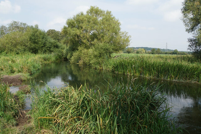
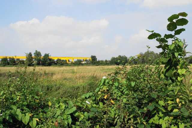
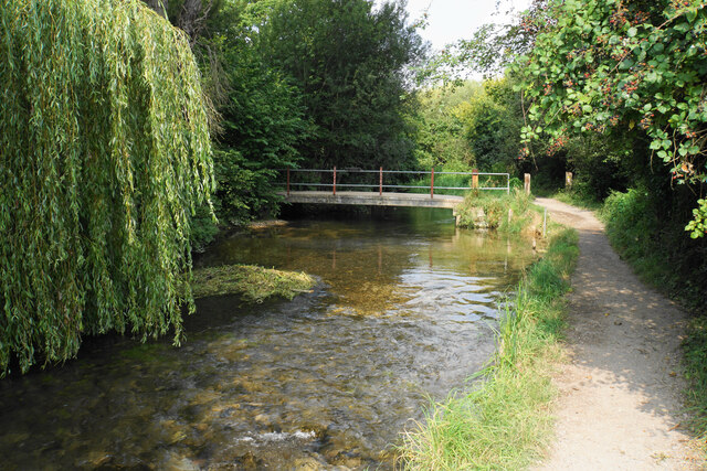
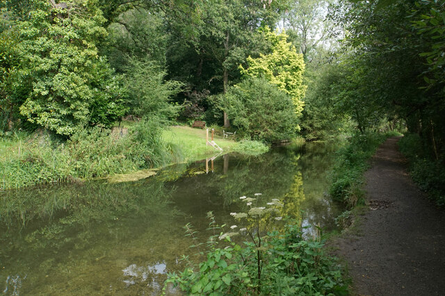
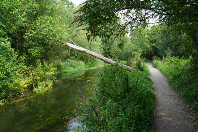
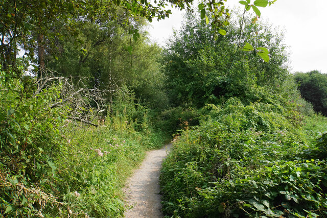
Lord's Wood is a picturesque woodland located in the county of Hampshire, England. Covering an area of approximately 100 acres, it is renowned for its natural beauty and tranquil atmosphere. The wood is situated near the village of Burley, within the New Forest National Park, making it a popular destination for nature enthusiasts and hikers.

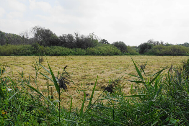
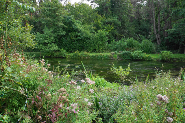
Lord's Wood is characterized by its diverse range of tree species, including oak, beech, and birch, which create a lush and vibrant canopy above. The forest floor is adorned with a rich undergrowth of ferns, bluebells, and wildflowers, providing a haven for various wildlife species. Visitors to the wood can often spot deer, foxes, and a wide variety of bird species, making it a haven for wildlife enthusiasts and birdwatchers.

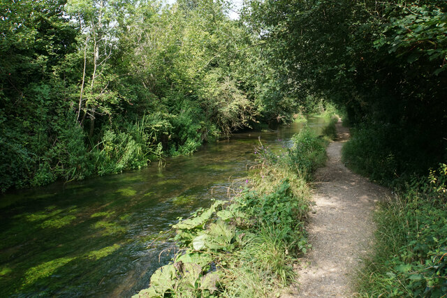
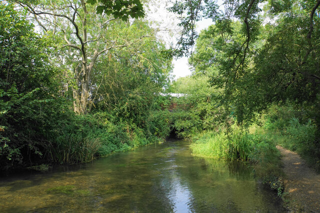
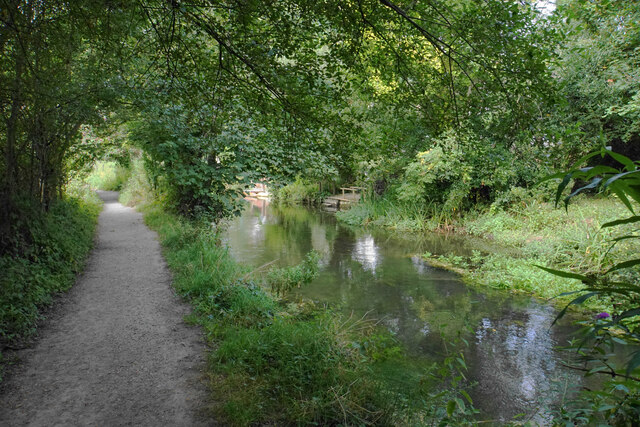
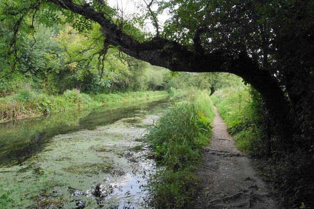
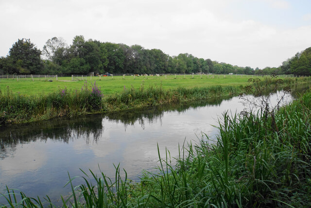
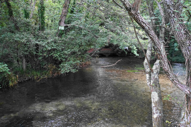
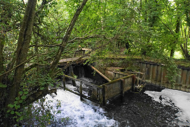
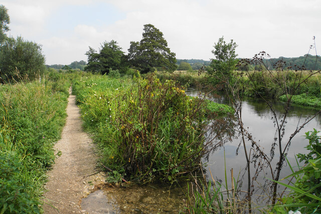
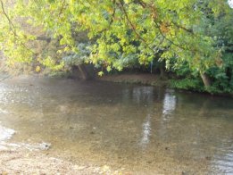
The wood offers numerous walking trails and paths, catering to different levels of fitness and interests. These trails provide an opportunity for visitors to explore the wood's natural wonders, offering breathtaking views and the chance to immerse oneself in the peaceful ambiance of the forest. Additionally, Lord's Wood is intersected by a small stream, adding to its charm and providing a refreshing spot for visitors to relax and enjoy the sounds of nature.

Lord's Wood is managed by the Forestry Commission, ensuring its preservation and maintaining its natural beauty for future generations to enjoy. The wood serves as an important ecological and recreational resource, attracting both local residents and tourists alike who seek solace in its serene and enchanting surroundings.

If you have any feedback on the listing, please let us know in the comments section below.

Lord's Wood Images

Images are sourced within 2km of 50.988154/-1.3284496 or Grid Reference SU4721. Thanks to Geograph Open Source API. All images are credited.

River Itchen near Eastleigh Different branches of the river reunited again.
River Itchen near Eastleigh
Different branches of the river reunited again.
Unused field near Eastleigh Viewed from the Itchen Way. Beyond the field are Eastleigh railway sidings.
Unused field near Eastleigh
Viewed from the Itchen Way. Beyond the field are Eastleigh railway sidings.
The Itchen Way A typical chalk stream view but there are railway sidings just the other side of the trees to the left.
The Itchen Way
A typical chalk stream view but there are railway sidings just the other side of the trees to the left.
River Itchen near Eastleigh In the trees ahead is the railway bridge carrying the main line between London and Southampton.
River Itchen near Eastleigh
In the trees ahead is the railway bridge carrying the main line between London and Southampton.
Footbridge over the Itchen The path on this side is the Itchen Way and the Itchen Navigation Heritage Trail. For a short stretch it is also part of the Water Vole Way.
Footbridge over the Itchen
The path on this side is the Itchen Way and the Itchen Navigation Heritage Trail. For a short stretch it is also part of the Water Vole Way.
River Itchen at Allbrook The Itchen Way and Itchen Navigation Heritage Trail run by the side of this branch of the river. The other side of the river is the bottom of quite substantial private gardens.
River Itchen at Allbrook
The Itchen Way and Itchen Navigation Heritage Trail run by the side of this branch of the river. The other side of the river is the bottom of quite substantial private gardens.
Squirrel bridge over the Itchen The tree trunk has been placed to allow wildlife to cross the river.
Squirrel bridge over the Itchen
The tree trunk has been placed to allow wildlife to cross the river.
The Itchen Way near Allbrook The river is to the left but for a short stretch it cannot be seen. The path is on the opposite side of the river from the built-up area.
The Itchen Way near Allbrook
The river is to the left but for a short stretch it cannot be seen. The path is on the opposite side of the river from the built-up area.
River Itchen near Allbrook On the other side are the backs of gardens on Allbrook Hill.
River Itchen near Allbrook
On the other side are the backs of gardens on Allbrook Hill.
Civil engineering depot in Allbrook A site operated by BAM Nuttall, viewed from across the River Itchen.
Civil engineering depot in Allbrook
A site operated by BAM Nuttall, viewed from across the River Itchen.
Sheep at Springbridge Farm Viewed from the Itchen Way. I think they are supposed to be in the field behind the trees but a few have got into the scrubby land in the foreground.
Sheep at Springbridge Farm
Viewed from the Itchen Way. I think they are supposed to be in the field behind the trees but a few have got into the scrubby land in the foreground.
The Itchen Way by the Itchen Navigation
Grass cut for silage Low-lying land in the Itchen Valley viewed from the Itchen Way.
Grass cut for silage
Low-lying land in the Itchen Valley viewed from the Itchen Way.
River Itchen from the Itchen Way The Itchen Way runs next to the Itchen Navigation, and both branches of the river run parallel to each other for a short stretch, with the path between them. I was unable to get a picture of both branches.
River Itchen from the Itchen Way
The Itchen Way runs next to the Itchen Navigation, and both branches of the river run parallel to each other for a short stretch, with the path between them. I was unable to get a picture of both branches.
Alpacas by the Itchen Navigation Farmland near Otterbourne Manor.
Alpacas by the Itchen Navigation
Farmland near Otterbourne Manor.
River Itchen at Brambridge The river has just emerged from a bridge under Kiln Lane which can be seen in the background.
River Itchen at Brambridge
The river has just emerged from a bridge under Kiln Lane which can be seen in the background.
Brambridge Lock A disused lock but there are still sluice gates and a lot of extra wooden construction.
Brambridge Lock
A disused lock but there are still sluice gates and a lot of extra wooden construction.
The Itchen Way by the Itchen Navigation The level of the river is surprisingly high for a summer month, and the path is eroding a little in the foreground.
The Itchen Way by the Itchen Navigation
The level of the river is surprisingly high for a summer month, and the path is eroding a little in the foreground.
Show me another place!

Lord's Wood is located at Grid Ref: SU4721 (Lat: 50.988154, Lng: -1.3284496)

Administrative County: Hampshire

District: Winchester

Police Authority: Hampshire

What 3 Words

///actors.deck.oasis. Near Colden Common, Hampshire

Nearby Locations

Brambridge Lord's Wood

Related Wikis

St Mary's Church, Bishopstoke

The Church of St Mary's is an Anglican Church in Bishopstoke, Hampshire. St Mary's was designed by Edward Prioleau Warren and built during 1890/91 by Wheeler...

Colden Common

Colden Common is a civil parish in the Winchester District of Hampshire, England, approximately 5 miles south of the city of Winchester, covering an area...

Twyford Moors

Twyford Moors is a hamlet in the civil parish of Colden Common in the City of Winchester district of Hampshire, England. It is 1+1⁄4 miles (2.0 km) south...

Bishopstoke

Bishopstoke is a village and civil parish in the Eastleigh district of Hampshire, England. It is recorded as "Stoke" as early as 948 AD when King Eadred...

Otterbourne

Otterbourne is a village in Hampshire, England. It is located approximately four miles (6.4 km) south of Winchester and eight miles (13 km) north of Southampton...

Boyatt Wood

Boyatt Wood is a small residential area and civil parish north-west of Eastleigh in Hampshire named locally after the wooded area to the south of Boyatt...

Allbrook

Allbrook is a settlement and civil parish in the Borough of Eastleigh in Hampshire, England. == Governance == Before 1974 the area formed part of the municipal...

Crestwood Community School

Crestwood Community School (known as Crestwood College prior to its name change in August 2017) is a coeducational secondary school, located in Eastleigh...

Nearby Amenities

Located within 500m of 50.988154,-1.3284496
Power: tower
Ref: 4YC 43
Source Ref: extrapolation
Lat/Long: 50.9844914/-1.3276556
Barrier: stile
Lat/Long: 50.9874886/-1.3252468
Barrier: stile
Lat/Long: 50.987841/-1.3267862
Post Box
Brand: Royal Mail
Brand Wikidata: Q638098
Brand Wikipedia: en:Royal Mail
Collection Plate: CP7
Collection Times: Mo-Fr 15:00; Sa 07:30
Operator: Royal Mail
Operator Wikidata: Q638098
Post Box Type: lamp
Ref: SO50 712
Royal Cypher: EIIR
Royal Cypher Wikidata: Q33102113
Lat/Long: 50.9855685/-1.3263453
Barrier: kissing_gate
Foot: yes
Lat/Long: 50.9915071/-1.3246303
Lord's Wood
Place: hamlet
Lat/Long: 50.9882444/-1.3283251
Highbridge
Place: village
Wikidata: Q11709775
Lat/Long: 50.9909371/-1.3337901
The data included in this document is from www.openstreetmap.org. The data is made available under ODbL.

Have you been to Lord's Wood?

Leave your review of Lord's Wood below (or comments, questions and feedback).