Gwibnant

Settlement in Flintshire

Wales

Gwibnant

Drybridge Lodge, Rhewl Mostyn The carriage drive for Mostyn Hall has the public road dive under in the tunnel
Drybridge Lodge, Rhewl Mostyn Credit: Kevin Waterhouse

Gwibnant is a small village located in the county of Flintshire, Wales. Situated in the northern part of the country, it lies approximately 3 miles south of the town of Holywell. The village is nestled within a picturesque rural landscape, surrounded by rolling hills and farmland.

Gwibnant can trace its history back to medieval times, with some evidence of settlement dating back to the 13th century. The village has retained much of its traditional character, with several well-preserved historic buildings and a close-knit community.

The village is primarily residential, with a population of around 300 people. Despite its small size, Gwibnant boasts a strong sense of community spirit. Local amenities include a village hall, a primary school, and a village pub, which serves as a popular gathering spot for residents.

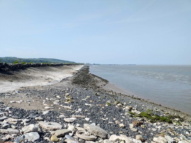
Nature enthusiasts will find plenty to explore in the surrounding area. Gwibnant is located close to the Clwydian Range, an Area of Outstanding Natural Beauty, offering stunning walks and panoramic views. Additionally, the nearby River Dee provides opportunities for fishing and boating.

The village benefits from its proximity to larger towns such as Holywell and Mold, where residents can access a wider range of services and amenities. Gwibnant's rural location also ensures a tranquil and peaceful setting, making it an attractive place to live for those seeking a slower pace of life.

If you have any feedback on the listing, please let us know in the comments section below.
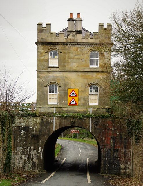
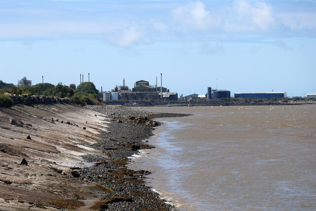
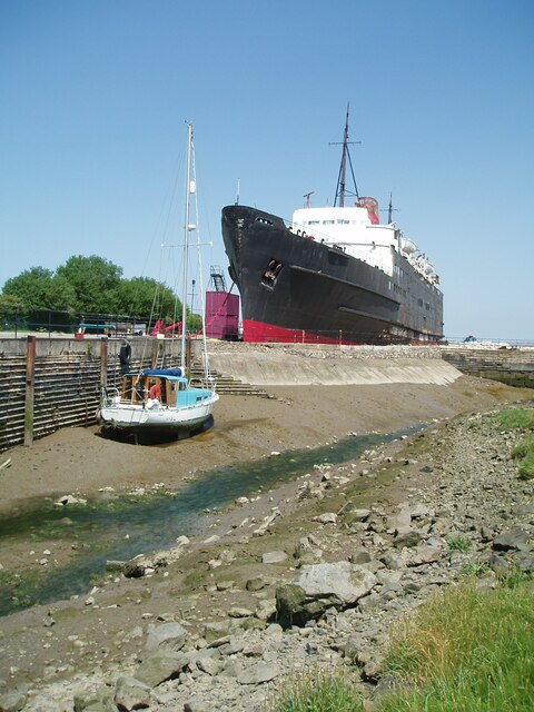
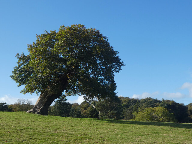
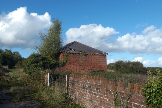
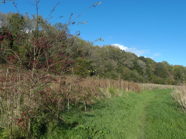
Gwibnant Images

Images are sourced within 2km of 53.303787/-3.2485715 or Grid Reference SJ1679. Thanks to Geograph Open Source API. All images are credited.

Drybridge Lodge, Rhewl Mostyn The carriage drive for Mostyn Hall has the public road dive under in the tunnel
Drybridge Lodge, Rhewl Mostyn
The carriage drive for Mostyn Hall has the public road dive under in the tunnel
Industry at Mostyn Seen from Llanerch-y-mor by the beached Duke of Lancaster.
Industry at Mostyn
Seen from Llanerch-y-mor by the beached Duke of Lancaster.
Mostyn Industrial Estate
Nant y Bi, Llanerch y Mor The TSS Duke of Lancaster corrodes in the background.
Nant y Bi, Llanerch y Mor
The TSS Duke of Lancaster corrodes in the background.
Derwen ar ogwydd / A leaning oak
Gwaith brics addurniadol / Decorative brickwork
"Hardd yw brigau coedydd Mostyn" The title of this image is from an old Welsh folk song, and simply means "pretty are the branches of Mostyn".  Although the lyrics treat Conwy, Nefyn and Mostyn as being of equivalent beauty, they reserve superlative praise for the beauty of Dyffryn Meifod.
"Hardd yw brigau coedydd Mostyn"
The title of this image is from an old Welsh folk song, and simply means "pretty are the branches of Mostyn". Although the lyrics treat Conwy, Nefyn and Mostyn as being of equivalent beauty, they reserve superlative praise for the beauty of Dyffryn Meifod.
TSS Duke of Lancaster A former Irish Sea ferry and cruise ship, beached to be a fun ship on a retail park but unloved in this view
TSS Duke of Lancaster
A former Irish Sea ferry and cruise ship, beached to be a fun ship on a retail park but unloved in this view
TSS Duke of Lancaster The port side of the former ferry and cruise ship
TSS Duke of Lancaster
The port side of the former ferry and cruise ship
TSS Duke of Lancaster at Llannerch-y-Mor The former railway steamer passenger ship TSS Duke of Lancaster was launched on 1 December 1955 and was in operation from 1956 to 1979 when she started her new life as "the Fun Ship" here at Llannerch-y-Mor. She has had various owners over the years, all seemingly having legal battles with the local councils. For her full story see the Wikipedia link below.

Wikipedia <span class="nowrap"><a title="https://en.wikipedia.org/wiki/TSS_Duke_of_Lancaster_(1955)" rel="nofollow ugc noopener" href="https://en.wikipedia.org/wiki/TSS_Duke_of_Lancaster_(1955)">Link</a><img style="margin-left:2px;" alt="External link" title="External link - shift click to open in new window" src="https://s1.geograph.org.uk/img/external.png" width="10" height="10"/></span>
TSS Duke of Lancaster at Llannerch-y-Mor
The former railway steamer passenger ship TSS Duke of Lancaster was launched on 1 December 1955 and was in operation from 1956 to 1979 when she started her new life as "the Fun Ship" here at Llannerch-y-Mor. She has had various owners over the years, all seemingly having legal battles with the local councils. For her full story see the Wikipedia link below. Wikipedia LinkExternal link
The Wales Coast Path at Llannerch-y-Mor The Wales Coast Path continues here up the steps on the right and passes the TSS Duke of Lancaster along the dyke towards Greenfield Docks.

The former railway steamer passenger ship TSS Duke of Lancaster was launched on 1 December 1955 and was in operation from 1956 to 1979 when she started her new life as "the Fun Ship" here at Llanerch-y-Mor. She has had various owners over the years, all seemingly having legal battles with the local councils. For her full story see the Wikipedia link below.

Wikipedia <span class="nowrap"><a title="https://en.wikipedia.org/wiki/TSS_Duke_of_Lancaster_(1955)" rel="nofollow ugc noopener" href="https://en.wikipedia.org/wiki/TSS_Duke_of_Lancaster_(1955)">Link</a><img style="margin-left:2px;" alt="External link" title="External link - shift click to open in new window" src="https://s1.geograph.org.uk/img/external.png" width="10" height="10"/></span>
The Wales Coast Path at Llannerch-y-Mor
The Wales Coast Path continues here up the steps on the right and passes the TSS Duke of Lancaster along the dyke towards Greenfield Docks. The former railway steamer passenger ship TSS Duke of Lancaster was launched on 1 December 1955 and was in operation from 1956 to 1979 when she started her new life as "the Fun Ship" here at Llanerch-y-Mor. She has had various owners over the years, all seemingly having legal battles with the local councils. For her full story see the Wikipedia link below. Wikipedia LinkExternal link
The Wales Coast Path approaching the Duke of Lancaster The Wales Coast Path heading northwest the TSS Duke of Lancaster at Llannerch-y-Mor.

The former railway steamer passenger ship TSS Duke of Lancaster was launched on 1 December 1955 and was in operation from 1956 to 1979 when she started her new life as "the Fun Ship" here at Llanerch-y-Mor. She has had various owners over the years, all seemingly having legal battles with the local councils. For her full story see the Wikipedia link below.

Wikipedia <span class="nowrap"><a title="https://en.wikipedia.org/wiki/TSS_Duke_of_Lancaster_(1955)" rel="nofollow ugc noopener" href="https://en.wikipedia.org/wiki/TSS_Duke_of_Lancaster_(1955)">Link</a><img style="margin-left:2px;" alt="External link" title="External link - shift click to open in new window" src="https://s1.geograph.org.uk/img/external.png" width="10" height="10"/></span>
The Wales Coast Path approaching the Duke of Lancaster
The Wales Coast Path heading northwest the TSS Duke of Lancaster at Llannerch-y-Mor. The former railway steamer passenger ship TSS Duke of Lancaster was launched on 1 December 1955 and was in operation from 1956 to 1979 when she started her new life as "the Fun Ship" here at Llanerch-y-Mor. She has had various owners over the years, all seemingly having legal battles with the local councils. For her full story see the Wikipedia link below. Wikipedia LinkExternal link
The Wales Coast Path at Llanerch-y-mor Heading southeast along the Wales Coast Path at Llannerch-y-mor.
The Wales Coast Path at Llanerch-y-mor
Heading southeast along the Wales Coast Path at Llannerch-y-mor.
The Wales Coast Path at Llannerch-y-mor Heading towards the TSS Duke of Lancaster moored at Llannerch-y-mor.
The Wales Coast Path at Llannerch-y-mor
Heading towards the TSS Duke of Lancaster moored at Llannerch-y-mor.
The Wales Coast Path at Llannerch-y-mor Looking northwest along the Wales Coast Path at Llannerch-y-mor.
The Wales Coast Path at Llannerch-y-mor
Looking northwest along the Wales Coast Path at Llannerch-y-mor.
The Coast at Llannerch-y-mor Looking northwest along the coast at Llannerch-y-mor.
The Coast at Llannerch-y-mor
Looking northwest along the coast at Llannerch-y-mor.
Show me another place!

Gwibnant is located at Grid Ref: SJ1679 (Lat: 53.303787, Lng: -3.2485715)

Unitary Authority: Flintshire

Police Authority: North Wales

What 3 Words

///crew.congas.annual. Near Mostyn, Flintshire

Related Wikis

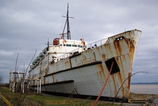
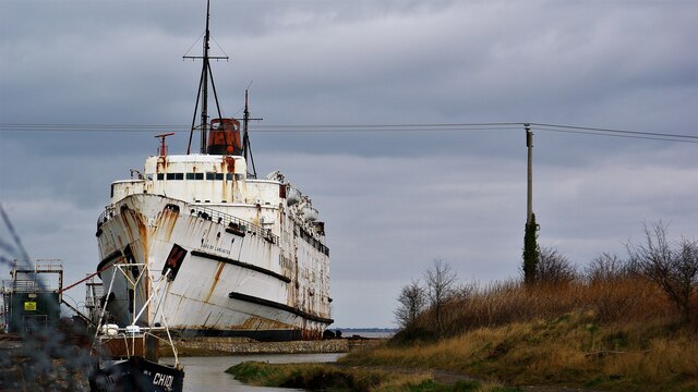
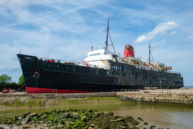
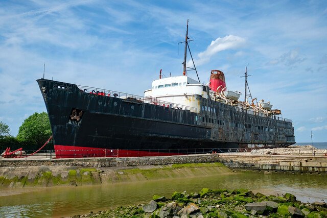
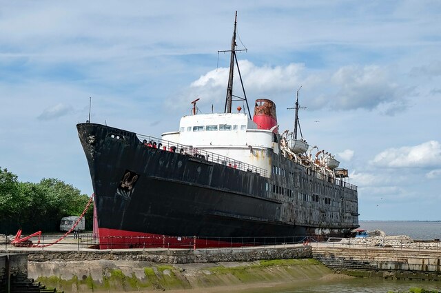
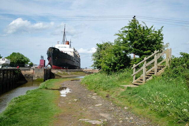
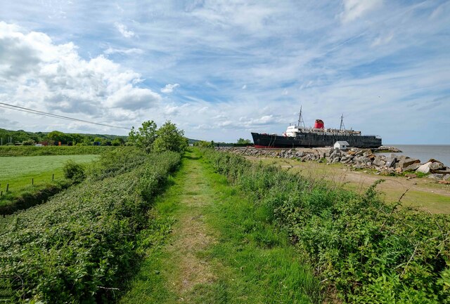
TSS Duke of Lancaster (1955)

TSS Duke of Lancaster is a former railway steamer passenger ship that operated in Europe from 1956 to 1979, and is beached near Mostyn Docks, on the River...
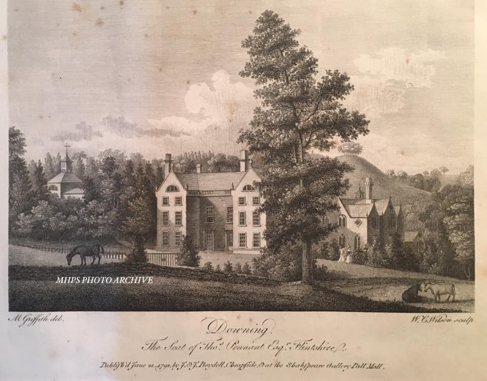
Downing Hall

Downing Hall was built in 1627 by the Pennant family near Whitford, Flintshire. It was later the home of Thomas Pennant, the naturalist, traveller and...
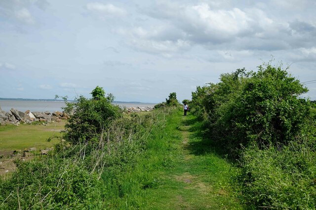
Mostyn

Mostyn is a village and community in Flintshire, Wales, and electoral ward lying on the estuary of the River Dee, located near the town of Holywell. It...

Mostyn Colliery

Mostyn Colliery was a coal mine in Flintshire, North Wales, that was owned in the later part of its operating life by the influential Mostyn family. The...

Mostyn railway station

Mostyn railway station was located roughly 1 km (0.62 mi) north west of Mostyn, a village in Flintshire, Wales. == History == Situated on the A548 it was...

Mostyn Hall

Mostyn Hall is a large house standing in 25 acres (10 hectares) of garden near the village of Mostyn, Flintshire, Wales. It is designated by Cadw as a...

Church of St Beuno and St Mary

The Church of St Beuno and St Mary is a Grade I listed church in Whitford, overlooking the estuary of the river Dee. The church has a well preserved late...

Whitford, Flintshire

Whitford (Welsh: Chwitffordd) is a village, community and an electoral ward near Holywell in Flintshire, northeast Wales. The population of both the community...

Nearby Amenities

Located within 500m of 53.303787,-3.2485715
Speed Camera
Maxspeed: 40 mph
Lat/Long: 53.3058402/-3.2461655
Place Of Worship
Religion: christian
Lat/Long: 53.3063566/-3.2506324
Disused Amenity: post_office
Lat/Long: 53.3077173/-3.2499644
Bus Stop
Glan-y-don, A548 / Mostyn Garage
Bus: yes
Naptan AtcoCode: 5120AWF80827
Naptan Bearing: SE
Naptan CommonName: Mostyn Garage
Naptan Indicator: o/s
Naptan Landmark: Mostyn Garage
Naptan LocalityName: Glan-y-don
Naptan NaptanCode: fliatdp
Naptan Street: A548
Public Transport: platform
Source: naptan_import
Lat/Long: 53.305701/-3.245459
Street Lamp
Lat/Long: 53.3053863/-3.2518184
Street Lamp
Lat/Long: 53.3063979/-3.2511704
Street Lamp
Lat/Long: 53.3043/-3.249979
Post Box
Collection Times: Mo-Fr 16:15; Sa 10:45
Operator: Royal Mail
Post Box Type: wall
Ref: CH8 48
Royal Cypher: GVIR
Royal Cypher Wikidata: Q33102169
Source: survey
Survey Date: 2014-03-24
Lat/Long: 53.3077337/-3.2499097
Post Box
Collection Times: Mo-Fr 09:00; Sa 07:00
Operator: Royal Mail
Post Box Type: lamp
Ref: CH8 56D
Royal Cypher: EIIR
Royal Cypher Wikidata: Q33102113
Lat/Long: 53.3041862/-3.2493164
Street Lamp
Lat/Long: 53.3029252/-3.2467225
Street Lamp
Lat/Long: 53.3059192/-3.2504758
Street Lamp
Lat/Long: 53.3056097/-3.2496551
Power: pole
Lat/Long: 53.2995489/-3.2501494
Power: pole
Lat/Long: 53.3000639/-3.2517466
Power: pole
Lat/Long: 53.3005271/-3.2529133
Street Lamp
Lat/Long: 53.3060464/-3.2516153
Street Lamp
Lat/Long: 53.3028621/-3.2486683
Street Lamp
Lat/Long: 53.3047894/-3.2508471
Street Lamp
Lat/Long: 53.3059642/-3.251089
Street Lamp
Lat/Long: 53.306134/-3.2508882
Street Lamp
Lat/Long: 53.3058005/-3.2501319
Street Lamp
Lat/Long: 53.3053667/-3.2490941
Street Lamp
Lat/Long: 53.3067519/-3.2512505
Street Lamp
Lat/Long: 53.3076479/-3.2511863
Barrier: yes
Lat/Long: 53.3042991/-3.2452668
Barrier: yes
Lat/Long: 53.30333/-3.2458169
Direction: ESE
Generator Method: photovoltaic
Generator Output Electricity: yes
Generator Solar Modules: 14
Generator Source: solar
Generator Type: solar_photovoltaic_panel
Location: roof
Power: generator
Lat/Long: 53.3053039/-3.2485789
Direction: ESE
Generator Method: photovoltaic
Generator Output Electricity: yes
Generator Solar Modules: 10
Generator Source: solar
Generator Type: solar_photovoltaic_panel
Location: roof
Power: generator
Lat/Long: 53.3052702/-3.2484052
Direction: ESE
Generator Method: photovoltaic
Generator Output Electricity: yes
Generator Solar Modules: 10
Generator Source: solar
Generator Type: solar_photovoltaic_panel
Location: roof
Power: generator
Lat/Long: 53.3049448/-3.2482758
Direction: ESE
Generator Method: photovoltaic
Generator Output Electricity: yes
Generator Solar Modules: 16
Generator Source: solar
Generator Type: solar_photovoltaic_panel
Location: roof
Power: generator
Lat/Long: 53.3048627/-3.2481048
Direction: ESE
Generator Method: photovoltaic
Generator Output Electricity: yes
Generator Solar Modules: 14
Generator Source: solar
Generator Type: solar_photovoltaic_panel
Location: roof
Power: generator
Lat/Long: 53.3045377/-3.2474282
Direction: ESE
Generator Method: photovoltaic
Generator Output Electricity: yes
Generator Solar Modules: 10
Generator Source: solar
Generator Type: solar_photovoltaic_panel
Location: roof
Power: generator
Lat/Long: 53.3044945/-3.2472673
Direction: ESE
Generator Method: photovoltaic
Generator Output Electricity: yes
Generator Solar Modules: 10
Generator Source: solar
Generator Type: solar_photovoltaic_panel
Location: roof
Power: generator
Lat/Long: 53.3044191/-3.2469696
Direction: ESE
Generator Method: photovoltaic
Generator Output Electricity: yes
Generator Solar Modules: 10
Generator Source: solar
Generator Type: solar_photovoltaic_panel
Location: roof
Power: generator
Lat/Long: 53.3042941/-3.2479325
Direction: ESE
Generator Method: photovoltaic
Generator Output Electricity: yes
Generator Solar Modules: 10
Generator Source: solar
Generator Type: solar_photovoltaic_panel
Location: roof
Power: generator
Lat/Long: 53.3041515/-3.2473263
Direction: ESE
Generator Method: photovoltaic
Generator Output Electricity: yes
Generator Solar Modules: 14
Generator Source: solar
Generator Type: solar_photovoltaic_panel
Location: roof
Power: generator
Lat/Long: 53.3041082/-3.2471547
Direction: SSW
Generator Method: photovoltaic
Generator Output Electricity: yes
Generator Solar Modules: 4
Generator Source: solar
Generator Type: solar_photovoltaic_panel
Location: roof
Power: generator
Lat/Long: 53.3035801/-3.2500139
Direction: SSW
Generator Method: photovoltaic
Generator Output Electricity: yes
Generator Solar Modules: 6
Generator Source: solar
Generator Type: solar_photovoltaic_panel
Location: roof
Power: generator
Lat/Long: 53.3036065/-3.2500783
Direction: SSW
Generator Method: photovoltaic
Generator Output Electricity: yes
Generator Solar Modules: 7
Generator Source: solar
Generator Type: solar_photovoltaic_panel
Location: roof
Power: generator
Lat/Long: 53.303871/-3.2494801
Direction: SSW
Generator Method: photovoltaic
Generator Output Electricity: yes
Generator Solar Modules: 10
Generator Source: solar
Generator Type: solar_photovoltaic_panel
Location: roof
Power: generator
Lat/Long: 53.3046627/-3.2486594
Direction: SSW
Generator Method: photovoltaic
Generator Output Electricity: yes
Generator Solar Modules: 10
Generator Source: solar
Generator Type: solar_photovoltaic_panel
Location: roof
Power: generator
Lat/Long: 53.3045826/-3.2483804
Direction: SSW
Generator Method: photovoltaic
Generator Output Electricity: yes
Generator Solar Modules: 16
Generator Source: solar
Generator Type: solar_photovoltaic_panel
Location: roof
Power: generator
Lat/Long: 53.304557/-3.2482651
Direction: ESE
Generator Method: photovoltaic
Generator Output Electricity: yes
Generator Solar Modules: 10
Generator Source: solar
Generator Type: solar_photovoltaic_panel
Location: roof
Power: generator
Lat/Long: 53.3039896/-3.2485896
Direction: SSW
Generator Method: photovoltaic
Generator Output Electricity: yes
Generator Solar Modules: 5
Generator Source: solar
Generator Type: solar_photovoltaic_panel
Location: roof
Power: generator
Lat/Long: 53.3042685/-3.2484341
Direction: SSW
Generator Method: photovoltaic
Generator Output Electricity: yes
Generator Solar Modules: 5
Generator Source: solar
Generator Type: solar_photovoltaic_panel
Location: roof
Power: generator
Lat/Long: 53.3042933/-3.248418
Direction: SSW
Generator Method: photovoltaic
Generator Output Electricity: yes
Generator Solar Modules: 10
Generator Source: solar
Generator Type: solar_photovoltaic_panel
Location: roof
Power: generator
Lat/Long: 53.3043053/-3.2485192
Direction: SSW
Generator Method: photovoltaic
Generator Output Electricity: yes
Generator Solar Modules: 16
Generator Source: solar
Generator Type: solar_photovoltaic_panel
Location: roof
Power: generator
Lat/Long: 53.3043566/-3.2486567
Direction: SSW
Generator Method: photovoltaic
Generator Output Electricity: yes
Generator Solar Modules: 10
Generator Source: solar
Generator Type: solar_photovoltaic_panel
Location: roof
Power: generator
Lat/Long: 53.3044191/-3.2489893
Direction: 190
Generator Method: photovoltaic
Generator Output Electricity: yes
Generator Solar Modules: 14
Generator Source: solar
Generator Type: solar_photovoltaic_panel
Location: roof
Power: generator
Lat/Long: 53.3050506/-3.2500166
Direction: SSW
Generator Method: photovoltaic
Generator Output Electricity: yes
Generator Solar Modules: 10
Generator Source: solar
Generator Type: solar_photovoltaic_panel
Location: roof
Power: generator
Lat/Long: 53.306219/-3.2530287
Direction: SW
Generator Method: photovoltaic
Generator Output Electricity: yes
Generator Solar Modules: 9
Generator Source: solar
Generator Type: solar_photovoltaic_panel
Location: roof
Power: generator
Lat/Long: 53.3067271/-3.2531816
Direction: SW
Generator Method: photovoltaic
Generator Output Electricity: yes
Generator Solar Modules: 8
Generator Source: solar
Generator Type: solar_photovoltaic_panel
Location: roof
Power: generator
Lat/Long: 53.3069146/-3.2535383
Direction: SW
Generator Method: photovoltaic
Generator Output Electricity: yes
Generator Solar Modules: 10
Generator Source: solar
Generator Type: solar_photovoltaic_panel
Location: roof
Power: generator
Lat/Long: 53.3070059/-3.2537395
Direction: 195
Generator Method: photovoltaic
Generator Output Electricity: yes
Generator Solar Modules: 10
Generator Source: solar
Generator Type: solar_photovoltaic_panel
Location: roof
Power: generator
Lat/Long: 53.3065572/-3.254402
Bus Stop
Glan-y-don, Hafod-y-Ddol Road / Penrho
Bus: yes
Naptan AtcoCode: 5120AWF80822
Naptan Bearing: NW
Naptan CommonName: Penrho
Naptan Crossing: Penrho
Naptan Indicator: after
Naptan LocalityName: Glan-y-don
Naptan NaptanCode: fliatdg
Naptan Street: Hafod-y-Ddol Road
Public Transport: platform
Source: naptan_import
Lat/Long: 53.3039265/-3.2491459
Bus Stop
Glan-y-don, A548 / Mostyn Garage
Bus: yes
Naptan AtcoCode: 5120WDB22417
Naptan Bearing: NW
Naptan CommonName: Mostyn Garage
Naptan Indicator: opp
Naptan Landmark: Mostyn Garage
Naptan LocalityName: Glan-y-don
Naptan NaptanCode: flimjgm
Naptan Street: A548
Public Transport: platform
Source: naptan_import
Lat/Long: 53.3056268/-3.2455787
Bus Stop
Glan-y-don, Ffordd Penant / Ffordd Penant Lower
Bus: yes
Naptan AtcoCode: 5120AWF80824
Naptan Bearing: NW
Naptan CommonName: Ffordd Penant Lower
Naptan Indicator: opp 216
Naptan LocalityName: Glan-y-don
Naptan NaptanCode: fliataw
Naptan Street: Ffordd Penant
Public Transport: platform
Source: naptan_import
Lat/Long: 53.3051722/-3.2512232
Bus Stop
Glan-y-don, Hafod-y-Ddol Road / Penrho
Bus: yes
Naptan AtcoCode: 5120WDB46581
Naptan Bearing: SE
Naptan CommonName: Penrho
Naptan Crossing: Penrho
Naptan Indicator: before
Naptan LocalityName: Glan-y-don
Naptan NaptanCode: flijgtm
Naptan Street: Hafod-y-Ddol Road
Public Transport: platform
Source: naptan_import
Lat/Long: 53.303995/-3.2489761
Bus Stop
Glan-y-don, Ffordd Penant / Ffordd Penant Lower
Bus: yes
Naptan AtcoCode: 5120WDB22418
Naptan Bearing: SE
Naptan CommonName: Ffordd Penant Lower
Naptan Indicator: o/s 216
Naptan LocalityName: Glan-y-don
Naptan NaptanCode: flimjgp
Naptan Street: Ffordd Penant
Public Transport: platform
Source: naptan_import
Lat/Long: 53.3052551/-3.2510283
Bus Stop
Glan-y-don, A548 / Glan-y-don Inn
Bus: yes
Naptan AtcoCode: 5120WDB46568
Naptan Bearing: NW
Naptan CommonName: Glan-y-don Inn
Naptan Indicator: o/s former
Naptan Landmark: Glan-y-don Inn
Naptan LocalityName: Glan-y-don
Naptan NaptanCode: flijgta
Naptan ShortCommonName: Glan-y-don Post Office
Naptan Street: A548
Public Transport: platform
Source: naptan_import
Lat/Long: 53.3079765/-3.2504048
Bus Stop
Glan-y-don, A458 / Glan-y-don Inn
Bus: yes
Naptan AtcoCode: 5120AWF80828
Naptan Bearing: SE
Naptan CommonName: Glan-y-don Inn
Naptan Indicator: opp former
Naptan Landmark: Glan-y-don Inn PH
Naptan LocalityName: Glan-y-don
Naptan NaptanCode: fliatda
Naptan ShortCommonName: Glan-y-don Post Office
Naptan Street: A458
Public Transport: platform
Source: naptan_import
Lat/Long: 53.308015/-3.2501619
The data included in this document is from www.openstreetmap.org. The data is made available under ODbL.

Have you been to Gwibnant?

Leave your review of Gwibnant below (or comments, questions and feedback).