Griffin's Hill

Settlement in Worcestershire

England

Griffin's Hill

Kings Norton Boys' School
Kings Norton Boys' School Credit: Paul Collins

Griffin's Hill is a picturesque village located in the county of Worcestershire, England. Situated at the foot of the Malvern Hills, this charming settlement offers stunning panoramic views of the surrounding countryside. With a population of around 500 residents, it exudes a close-knit community atmosphere that is typical of rural English villages.

The village is known for its rich history, dating back to medieval times. Griffin's Hill is named after the mythical creature, the griffin, which is said to have been spotted in the area centuries ago. This legend has become an integral part of the village's identity, with several local businesses and landmarks adopting the griffin as their emblem.

The architecture of Griffin's Hill is a delightful mix of traditional and modern buildings. The village boasts beautiful thatched-roof cottages, stone houses, and well-manicured gardens that add to its idyllic charm. The village center is a hub of activity, with a range of shops, cafes, and pubs serving both locals and visitors alike.

Nature enthusiasts are drawn to Griffin's Hill for its proximity to the Malvern Hills, a designated Area of Outstanding Natural Beauty. The hills provide ample opportunities for hiking, cycling, and bird-watching, allowing visitors to immerse themselves in the breathtaking scenery.

Overall, Griffin's Hill is a hidden gem in Worcestershire, offering a serene and picturesque environment that appeals to those seeking a peaceful getaway or a taste of English village life. Its rich history, stunning landscapes, and welcoming community make it a must-visit destination for locals and tourists alike.

If you have any feedback on the listing, please let us know in the comments section below.

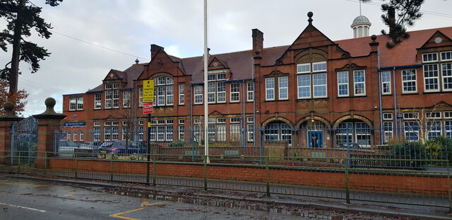
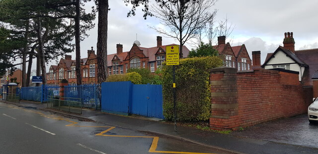
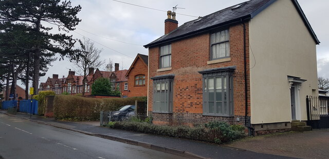
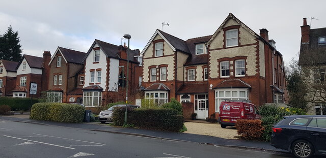
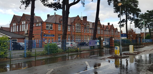
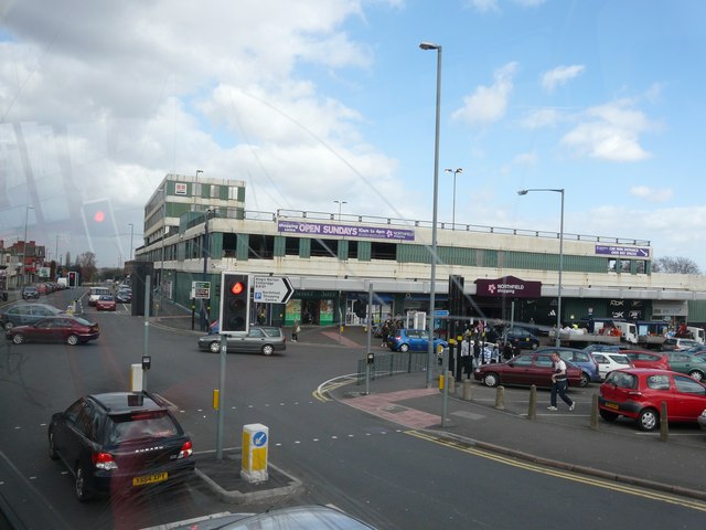
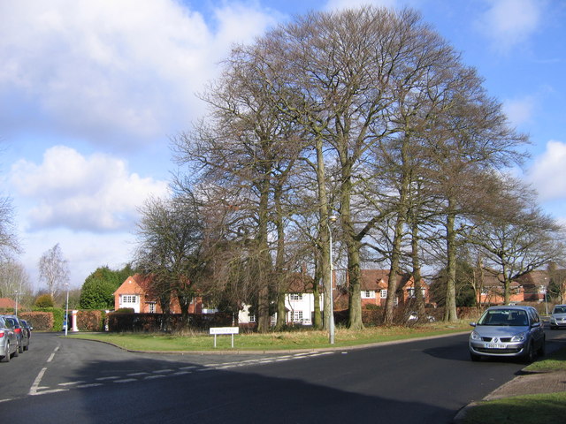
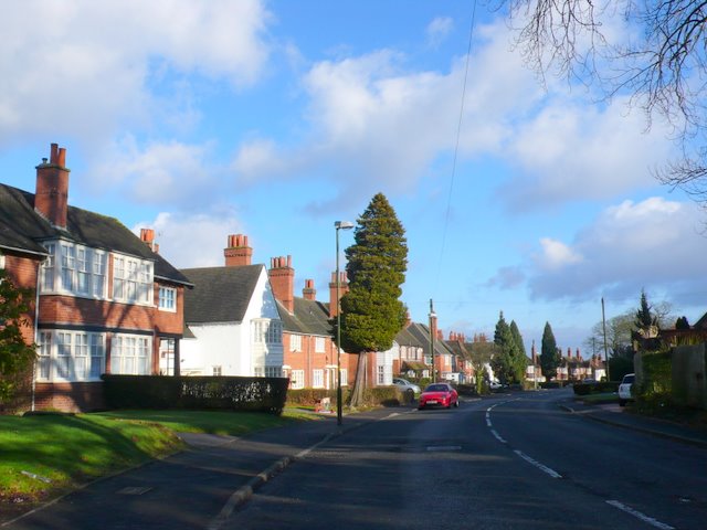
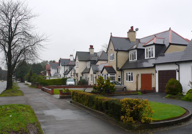
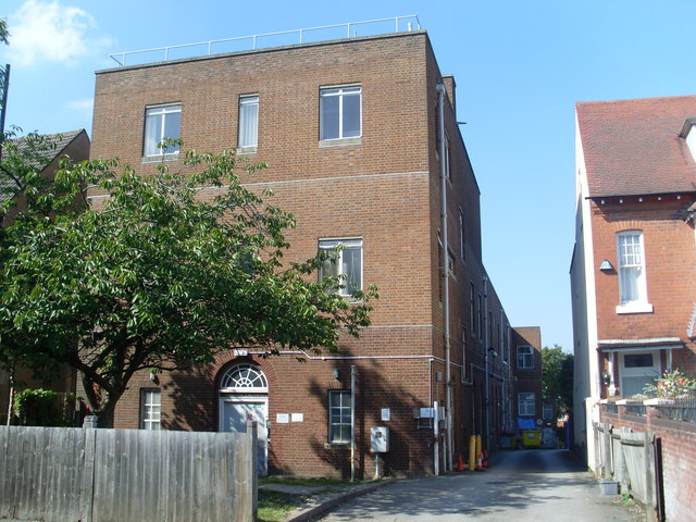
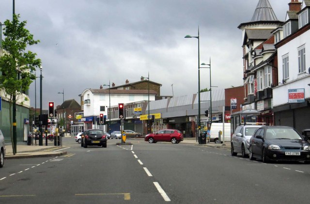
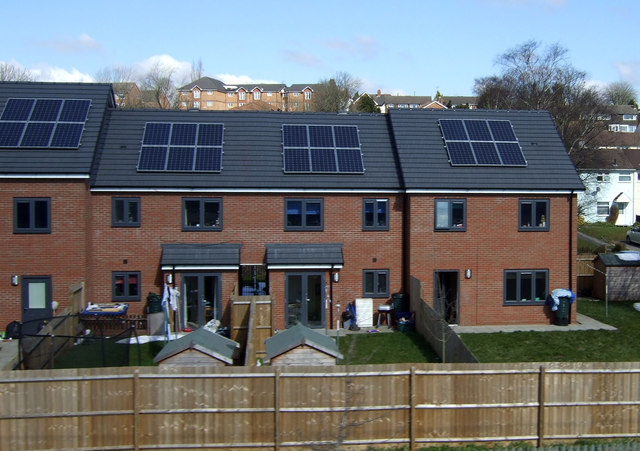
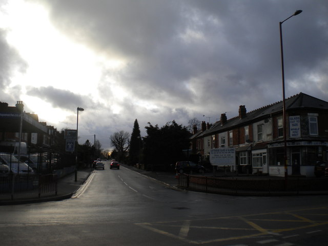
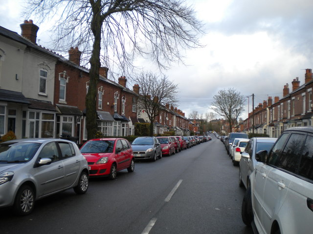
Griffin's Hill Images

Images are sourced within 2km of 52.429878/-1.9501861 or Grid Reference SP0381. Thanks to Geograph Open Source API. All images are credited.

Kings Norton Boys' School
Kings Norton Boys' School The school was built on a greenfield site sometime between 1903 and 1914. It has been much extended since then. There is an OS cut benchmark on the brick pillar at the end of wall.
Kings Norton Boys' School
The school was built on a greenfield site sometime between 1903 and 1914. It has been much extended since then. There is an OS cut benchmark on the brick pillar at the end of wall.
Semi-detached cottages, Northfield Road These semis pre-date most of the other buildings in the vicinity and are shown on the 1884 OS 1/2500 map. The look to have been sensitively renovated.
Semi-detached cottages, Northfield Road
These semis pre-date most of the other buildings in the vicinity and are shown on the 1884 OS 1/2500 map. The look to have been sensitively renovated.
Houses in Northfield Road These attractive houses were built just before the first world war.
Houses in Northfield Road
These attractive houses were built just before the first world war.
Kings Norton Boys' School Pictured just after a heavy downpour.
Kings Norton Boys' School
Pictured just after a heavy downpour.
Northfield shopping centre as seen from the No. 63 bus
Northfield - Innage Road
Northfield Rd This is a long curving road of 1930's semi detached houses that runs off and then parallel to Middleton Hall Rd
Northfield Rd
This is a long curving road of 1930's semi detached houses that runs off and then parallel to Middleton Hall Rd
Bunbury Rd Northfield. This is a long residential road of large modern detached houses. It is also the B4121 and it runs west from Northfield to Cotteridge.
Bunbury Rd Northfield.
This is a long residential road of large modern detached houses. It is also the B4121 and it runs west from Northfield to Cotteridge.
Telephone Exchange, King's Norton Located at 56 Northfield Road, this TE would appear to date from the 1930s. It serves King's Norton plus Cotteridge, Hawkesley, Lifford and West Heath nearby. KINg's Norton numbers were provided by this TE until the late 1960s. Now, it has 0121-433, 451, 458, 459 and 486 xxxx numbers. The postcode of this TE is B30 1JH.
Telephone Exchange, King's Norton
Located at 56 Northfield Road, this TE would appear to date from the 1930s. It serves King's Norton plus Cotteridge, Hawkesley, Lifford and West Heath nearby. KINg's Norton numbers were provided by this TE until the late 1960s. Now, it has 0121-433, 451, 458, 459 and 486 xxxx numbers. The postcode of this TE is B30 1JH.
Bristol Road South in Northfield
Houses on Ingoldsby Road
Flats on Overbury Road Northfield
New Houses Being Built Longfellow Road Northfield
Royal Mail Kings Norton Delivery Office, Watford Road, Cotteridge Like the railway station, this delivery office is actually in Cotteridge but takes its name from the rather more upmarket area a little way south.
Royal Mail Kings Norton Delivery Office, Watford Road, Cotteridge
Like the railway station, this delivery office is actually in Cotteridge but takes its name from the rather more upmarket area a little way south.
Royal Mail Kings Norton Delivery Office, Watford Road, Cotteridge (detail) The stone above the front door, indicating a build date of 1939 in the reign of King George VI.
Royal Mail Kings Norton Delivery Office, Watford Road, Cotteridge (detail)
The stone above the front door, indicating a build date of 1939 in the reign of King George VI.
East end of Northfield Road, Cotteridge Seen from Watford Road.
East end of Northfield Road, Cotteridge
Seen from Watford Road.
Rowheath Road, Cotteridge Seen from near the junction with Watford Road.
Rowheath Road, Cotteridge
Seen from near the junction with Watford Road.
Show me another place!

Griffin's Hill is located at Grid Ref: SP0381 (Lat: 52.429878, Lng: -1.9501861)

Unitary Authority: Birmingham

Police Authority: West Midlands

What 3 Words

///proof.decide.boats. Near Bartley Green, West Midlands

Related Wikis

Woodbrooke Quaker Study Centre

Woodbrooke Study Centre is a Quaker college in Selly Oak, Birmingham, England. The only Quaker Study Centre in Europe, it was founded by George Cadbury...

BBC Drama Village

The BBC Drama Village is a television production facility run by the BBC. It is operated by their BBC Birmingham branch and based largely at the Selly...

Church of the Holy Prince Lazar, Birmingham

The Serbian Orthodox Church of the Holy Prince Lazar (Serbian: Српска православна црква Светог кнеза Лазара, romanized: Srpska pravoslavna crkva Svetog...

Fircroft College

Fircroft College is a specialist adult residential college based in Selly Oak, Birmingham, England. The college was founded by George Cadbury Junior, son...

Nearby Amenities

Located within 500m of 52.429878,-1.9501861
Speed Camera
Lat/Long: 52.432006/-1.9483596
Crossing
Crossing Markings: no
Crossing Signals: no
Tactile Paving: yes
Lat/Long: 52.4298734/-1.9501329
Turning Circle
Source: bing
Lat/Long: 52.4259737/-1.9472088
Turning Circle
Source: bing
Lat/Long: 52.4273386/-1.945606
Crossing
Crossing: unmarked
Crossing Island: no
Kerb: flush
Tactile Paving: no
Lat/Long: 52.429024/-1.9477088
Turning Circle
Lat/Long: 52.4273689/-1.9478908
Turning Circle
Lat/Long: 52.4271583/-1.9495928
Post Box
Check Date: 2021-04-21
Collection Times: Mo-Fr 09:00, Sa 07:00
Ref: B29 613
Royal Cypher: GR
Royal Cypher Wikidata: Q33102273
Lat/Long: 52.4302315/-1.9508372
Post Box
Collection Times: Mo-Fr 09:00, Sa 07:00
Ref: B29 189
Royal Cypher: GVIR
Royal Cypher Wikidata: Q33102169
Lat/Long: 52.4328694/-1.9516028
Telephone
Booth: KX100
Covered: booth
Lat/Long: 52.4287295/-1.9559299
Post Box
Post Box Type: pillar
Ref: B29 1289
Royal Cypher: EIIR
Lat/Long: 52.428641/-1.9561145
Crossing
Button Operated: yes
Check Date Crossing: 2021-04-14
Crossing: traffic_signals
Crossing Island: no
Crossing Ref: pelican
Tactile Paving: yes
Traffic Signals Sound: yes
Traffic Signals Vibration: yes
Lat/Long: 52.4295818/-1.949313
Waterway: weir
Lat/Long: 52.4293159/-1.9449168
Shop: convenience
Lat/Long: 52.4284972/-1.9562496
Waterway: weir
Lat/Long: 52.4288662/-1.9479444
Parking
Lat/Long: 52.4337017/-1.9479582
Parking
Access: private
Lat/Long: 52.4323267/-1.9488986
Bus Stop
Bristol Rd / Witherford Way
NaPTANAreaCode: 43000352202
Asset Ref: 610401
Bench: yes
Bus: yes
Electronic Information Board: yes
Naptan AtcoCode: 43000352202
Naptan Bearing: NE
Naptan BusStopType: MKD
Naptan CommonName: Witherford Way
Naptan Indicator: adj
Naptan NaptanCode: nwmatpad
Naptan PlusbusZoneRef: BHAMNWS
Naptan Status: ACT
Naptan StopType: BCT
Naptan Street: BRISTOL RD
Naptan Towards: Birmingham
Public Transport: platform
Route Ref: 63;98
Shelter: yes
Shelter Ref: 610401
Source: WMCA
Tactile Paving: no
Towards: Birmingham
Lat/Long: 52.4317847/-1.9490402
Bus Stop
Bristol Rd / Witherford Way
NaPTANAreaCode: 43000352203
Asset Ref: 610444
Bench: yes
Bin: no
Bus: yes
Naptan AtcoCode: 43000352203
Naptan Bearing: SW
Naptan BusStopType: MKD
Naptan CommonName: Witherford Way
Naptan Indicator: opp
Naptan NaptanCode: nwmatpag
Naptan PlusbusZoneRef: BHAMNWS
Naptan Status: ACT
Naptan StopType: BCT
Naptan Street: BRISTOL RD
Naptan Towards: Northfield
Public Transport: platform
Route Ref: 63;98
Shelter: yes
Shelter Ref: 610444
Source: WMCA
Tactile Paving: no
Towards: Northfield
Lat/Long: 52.4315137/-1.9488089
Bus Stop
Bristol Road South / Bournville Lane
NaPTANAreaCode: 43000352302
Asset Ref: 610402
Bus: yes
Naptan AtcoCode: 43000352302
Naptan Bearing: NE
Naptan BusStopType: MKD
Naptan CommonName: Bournville Lane
Naptan Indicator: opp
Naptan NaptanCode: nwmatpam
Naptan PlusbusZoneRef: BHAMNWS
Naptan Status: ACT
Naptan StopType: BCT
Naptan Street: BRISTOL ROAD SOUTH
Naptan Towards: Birmingham
Public Transport: platform
Route Ref: 63;98;144;X61
Shelter: yes
Shelter Ref: 610402
Source: WMCA
Towards: Birmingham
Lat/Long: 52.4298028/-1.9511031
Bus Stop
Bristol Road South / Bournville Lane
NaPTANAreaCode: 43000352303
Asset Ref: 610403
Bench: yes
Bus: yes
Naptan AtcoCode: 43000352303
Naptan Bearing: SW
Naptan BusStopType: MKD
Naptan CommonName: Bournville Lane
Naptan Indicator: adj
Naptan NaptanCode: nwmatpap
Naptan PlusbusZoneRef: BHAMNWS
Naptan Status: ACT
Naptan StopType: BCT
Naptan Street: BRISTOL ROAD SOUTH
Naptan Towards: Northfield
Public Transport: platform
Route Ref: 63;98;144;X61
Shelter: yes
Shelter Ref: 610403
Source: WMCA
Towards: Northfield
Lat/Long: 52.428519/-1.9518769
Bus Stop
Bristol Road South / Griffins Brook Lane
NaPTANAreaCode: 43000353103
Asset Ref: 610405
Bus: yes
Naptan AtcoCode: 43000353103
Naptan Bearing: NE
Naptan BusStopType: MKD
Naptan CommonName: Griffins Brook Lane
Naptan Indicator: opp
Naptan NaptanCode: nwmatpda
Naptan PlusbusZoneRef: BHAMNWS
Naptan Status: ACT
Naptan StopType: BCT
Naptan Street: BRISTOL ROAD SOUTH
Naptan Towards: Birmingham
Public Transport: platform
Route Ref: 63;98;X61
Shelter: yes
Shelter Ref: 610405
Source: WMCA
Towards: Birmingham
Lat/Long: 52.4268607/-1.954064
Bus Stop
Woodbrooke Rd / Cadbury School
NaPTANAreaCode: 43000357501
Asset Ref: 609419
Bus: yes
Naptan AtcoCode: 43000357501
Naptan Bearing: SW
Naptan BusStopType: MKD
Naptan CommonName: Cadbury School
Naptan Indicator: adj
Naptan NaptanCode: nwmgjwdg
Naptan PlusbusZoneRef: BHAMNWS
Naptan Status: ACT
Naptan StopType: BCT
Naptan Street: WOODBROOKE RD
Naptan Towards: Northfield
Public Transport: platform
Route Ref: 27
Shelter: yes
Shelter Ref: 610419
Source: WMCA
Towards: Druids Heath
Lat/Long: 52.4282319/-1.9448438
Bus Stop
Woodbrooke Rd / Cadbury School
NaPTANAreaCode: 43000357502
Asset Ref: 609420
Bus: yes
Naptan AtcoCode: 43000357502
Naptan Bearing: NE
Naptan BusStopType: MKD
Naptan CommonName: Cadbury School
Naptan Indicator: opp
Naptan NaptanCode: nwmgjwdj
Naptan PlusbusZoneRef: BHAMNWS
Naptan Status: ACT
Naptan StopType: BCT
Naptan Street: WOODBROOKE RD
Naptan Towards: Kings Heath
Public Transport: platform
Route Ref: 27
Shelter: yes
Shelter Ref: 610420
Source: WMCA
Towards: Kings Heath
Lat/Long: 52.4284306/-1.9444752
Bus Stop
Swarthmore Rd / Tugford Rd
Bus: yes
Naptan AtcoCode: 43000338202
Naptan Bearing: W
Naptan BusStopType: MKD
Naptan CommonName: Tugford Rd
Naptan Indicator: adj
Naptan NaptanCode: nwmatgpm
Naptan PlusbusZoneRef: BHAMNWS
Naptan Status: ACT
Naptan StopType: BCT
Naptan Street: SWARTHMORE RD
Naptan Towards: Northfield
Public Transport: platform
Route Ref: 48
Shelter: no
Source: WMCA
Towards: Northfield
Lat/Long: 52.4302498/-1.9562779
Bus Stop
Swarthmore Rd / Middle Park Rd
Bus: yes
Naptan AtcoCode: 43000338601
Naptan Bearing: NE
Naptan BusStopType: MKD
Naptan CommonName: Middle Park Rd
Naptan Indicator: before
Naptan NaptanCode: nwmtjagp
Naptan PlusbusZoneRef: BHAMNWS
Naptan Status: ACT
Naptan StopType: BCT
Naptan Street: SWARTHMORE RD
Naptan Towards: Weoley Castle
Public Transport: platform
Route Ref: 48
Shelter: no
Source: WMCA
Lat/Long: 52.4313178/-1.9540072
Swarthmore Rd / Middle Park Rd
Naptan AtcoCode: 43000338602
Naptan Bearing: SW
Naptan BusStopType: CUS
Naptan CommonName: Middle Park Rd
Naptan Indicator: after
Naptan NaptanCode: nwmtjagt
Naptan PlusbusZoneRef: BHAMNWS
Naptan Status: ACT
Naptan StopType: BCT
Naptan Street: SWARTHMORE RD
Naptan Towards: Northfield
Note: And opposite side
Physically Present: no
Route Ref: 48
Source: WMCA
Lat/Long: 52.4312728/-1.9539337
Post Box
Collection Times: Mo-Fr 09:00, Sa 07:00
Ref: B30 622
Royal Cypher: GR
Royal Cypher Wikidata: Q33102273
Lat/Long: 52.4279273/-1.9453005
Crossing
Crossing: uncontrolled
Crossing Ref: zebra
Lat/Long: 52.4284798/-1.9439512
Addr City: Birmingham
Addr Housenumber: 216
Addr Street: Bournville Lane
Lat/Long: 52.4276366/-1.9445407
Waterway: weir
Lat/Long: 52.4293714/-1.9473797
Bench
Backrest: yes
Check Date: 2021-04-14
Lat/Long: 52.4309825/-1.9435307
Grit Bin
Lat/Long: 52.4295198/-1.9508286
Crossing
Crossing: unmarked
Crossing Island: yes
Tactile Paving: yes
Lat/Long: 52.4278032/-1.9450605
Bench
Backrest: yes
Lat/Long: 52.428117/-1.9453387
Addr City: Birmingham
Addr Housenumber: 102
Addr Street: Kingfisher Way
Lat/Long: 52.431138/-1.9440271
Addr City: Birmingham
Addr Housenumber: 104
Addr Street: Kingfisher Way
Lat/Long: 52.4312782/-1.9440135
Addr City: Birmingham
Addr Housenumber: 100
Addr Street: Kingfisher Way
Lat/Long: 52.4311099/-1.9437801
Addr City: Birmingham
Addr Housenumber: 92
Addr Street: Kingfisher Way
Lat/Long: 52.4314772/-1.9438877
Addr City: Birmingham
Addr Housenumber: 94
Addr Street: Kingfisher Way
Lat/Long: 52.4315409/-1.9437217
Addr City: Birmingham
Addr Housenumber: 96
Addr Street: Kingfisher Way
Lat/Long: 52.4313854/-1.9437002
Addr City: Birmingham
Addr Housenumber: 98
Addr Street: Kingfisher Way
Lat/Long: 52.4312429/-1.9436449
Addr City: Birmingham
Addr Housenumber: 90
Addr Street: Kingfisher Way
Lat/Long: 52.4316346/-1.9439
Grit Bin
Lat/Long: 52.4300959/-1.943683
Grit Bin
Lat/Long: 52.4302478/-1.943159
Crossing
Crossing Island: yes
Lat/Long: 52.4302328/-1.9510257
Speed Camera
Lat/Long: 52.4320731/-1.9486473
Crossing
Bicycle: yes
Crossing: traffic_signals
Crossing Ref: toucan
Source: BCC_CycleData
Lat/Long: 52.4288342/-1.9516787
Crossing
Bicycle: yes
Crossing: traffic_signals
Crossing Ref: toucan
Source: BCC_CycleData
Lat/Long: 52.4288664/-1.9519516
Give Way
Lat/Long: 52.4291954/-1.9513556
Give Way
Lat/Long: 52.4293381/-1.9514135
Give Way
Lat/Long: 52.4293853/-1.9511455
Give Way
Lat/Long: 52.4295093/-1.9512244
Charging Station
Bournville Village Trust Electric Charge Point
Access: customers
Capacity: 2
Operator: Bournville Village Trust
Ref: APT-0296-0011/13W
Source: National Charge Point Register
Lat/Long: 52.4298756/-1.949374
Entrance: main
Lat/Long: 52.4313148/-1.9481421
Crossing
Crossing: traffic_signals
Crossing Ref: pelican
Mapillary: 301359164913040
Source: BING;BCC_CycleData
Survey Date: 2019-03-14
Tactile Paving: yes
Lat/Long: 52.4265139/-1.95408
Crossing
Crossing: traffic_signals
Crossing Ref: pelican
Source: BING;BCC_CycleData
Lat/Long: 52.4265496/-1.9543328
Man Made: monitoring_station
Monitoring Traffic: yes
Operator: bcc
Traffic Scoot Node Ref: E1330
Traffic Scoot Region Ref: D3
Traffic Sensor: loop
Traffic Sensor Ref: N34182C
Lat/Long: 52.4315217/-1.948867
Give Way
Lat/Long: 52.429256/-1.95118
Give Way
Lat/Long: 52.429884/-1.9505107
Give Way
Lat/Long: 52.4300999/-1.9507186
Give Way
Lat/Long: 52.431346/-1.9490972
Give Way
Lat/Long: 52.4314548/-1.9489926
Give Way
Lat/Long: 52.4314662/-1.9492099
Give Way
Lat/Long: 52.431539/-1.9492381
Give Way
Lat/Long: 52.4316167/-1.949061
Give Way
Lat/Long: 52.4336504/-1.9467775
Give Way
Lat/Long: 52.4337183/-1.9469129
Give Way
Lat/Long: 52.4338009/-1.9466105
Give Way
Lat/Long: 52.4338463/-1.9467969
Man Made: monitoring_station
Monitoring Traffic: yes
Operator: bcc
Traffic Scoot Node Ref: E1245
Traffic Sensor: loop
Traffic Sensor Ref: N35111F
Lat/Long: 52.427086/-1.9534913
Grit Bin
Lat/Long: 52.4298767/-1.9511342
Fast Food
Magnificos
Addr City: Birmingham
Addr Housenumber: 5
Addr Postcode: B29 4PX
Addr Street: Tugford Road
Cuisine: pizza;burger;kebab;fish_and_chips
Delivery: yes
Opening Hours: Mo-Su 11:00-23:00
Smoking: no
Takeaway: only
Lat/Long: 52.4285098/-1.956461
Barrier: cycle_barrier
Bicycle: dismount
Cycle Barrier: chicane
Lat/Long: 52.4267289/-1.9535682
Barrier: cycle_barrier
Bicycle: yes
Cycle Barrier: chicane
Lat/Long: 52.4280133/-1.9504931
Addr City: Birmingham
Addr Postcode: B31 2FT
Addr Street: Bristol Road South
Lat/Long: 52.4289835/-1.9528145
Addr City: Birmingham
Addr Postcode: B31 2FS
Addr Street: Bristol Road South
Lat/Long: 52.4290391/-1.9528145
Crossing
Crossing: unmarked
Lat/Long: 52.4297826/-1.9496287
Generator Method: photovoltaic
Generator Output Electricity: yes
Generator Solar Modules: 20
Generator Source: solar
Generator Type: solar_photovoltaic_panel
Location: roof
Power: generator
Lat/Long: 52.4315053/-1.9435072
Generator Method: photovoltaic
Generator Output Electricity: yes
Generator Solar Modules: 20
Generator Source: solar
Generator Type: solar_photovoltaic_panel
Location: roof
Power: generator
Lat/Long: 52.4312387/-1.9440544
Waste Basket
Waste: dog_excrement
Lat/Long: 52.4293284/-1.9440569
Bench
Backrest: yes
Lat/Long: 52.4291339/-1.9469321
Bench
Backrest: no
Lat/Long: 52.4290421/-1.9466332
Bench
Backrest: yes
Lat/Long: 52.4293554/-1.9471262
Bench
Backrest: yes
Lat/Long: 52.4292354/-1.94585
Bench
Backrest: yes
Lat/Long: 52.4294804/-1.9448298
Bench
Lat/Long: 52.4294417/-1.9434294
Advertising: board
Lat/Long: 52.4314996/-1.9495099
Bench
Lat/Long: 52.4296304/-1.9466577
Bench
Lat/Long: 52.4296411/-1.9464719
Bench
Lat/Long: 52.4296503/-1.946177
Bench
Lat/Long: 52.429668/-1.9458032
Bench
Lat/Long: 52.429675/-1.9455234
John Henry Barlow
Historic: memorial
Memorial: blue_plaque
Openplaques Id: 20523
Lat/Long: 52.4334532/-1.946476
Waterway: weir
Lat/Long: 52.4305233/-1.9491498
Ford: stepping_stones
Lat/Long: 52.4300541/-1.9484052
Waterway: weir
Lat/Long: 52.4291925/-1.947197
Waterway: weir
Lat/Long: 52.4291648/-1.9458501
Waterway: weir
Lat/Long: 52.4294588/-1.9445403
Advertising: board
Lat/Long: 52.4286362/-1.9560659
The data included in this document is from www.openstreetmap.org. The data is made available under ODbL.

Have you been to Griffin's Hill?

Leave your review of Griffin's Hill below (or comments, questions and feedback).