Giants Grave

Settlement in Glamorgan

Wales

Giants Grave
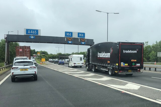
Traffic congestion at the M4/A465 junction
Traffic congestion at the M4/A465 junction Credit: Eirian Evans

The requested URL returned error: 429 Too Many Requests

If you have any feedback on the listing, please let us know in the comments section below.

Giants Grave Images

Images are sourced within 2km of 51.638181/-3.8279924 or Grid Reference SS7394. Thanks to Geograph Open Source API. All images are credited.

Traffic congestion at the M4/A465 junction
The Former Bethesda Chapel, Briton Ferry
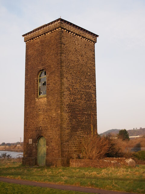
Brunel Tower, Briton Ferry Docks The tower housed a hydraulic accumulator, which operated the lock gate, cranes and other machinery.
Brunel Tower, Briton Ferry Docks
The tower housed a hydraulic accumulator, which operated the lock gate, cranes and other machinery.
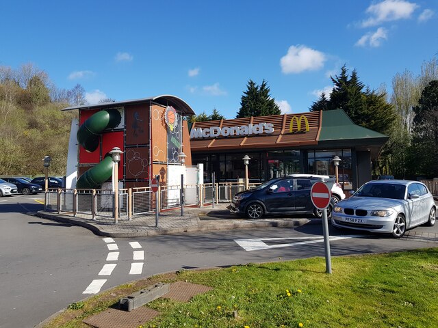
McDonald's fast food off the A465 at Pen-yr-Heol
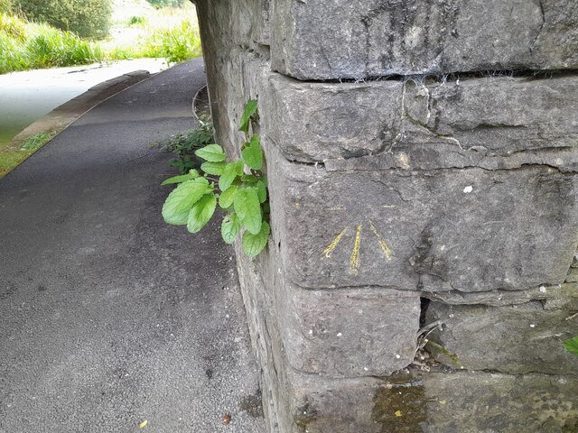
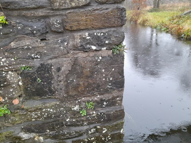
Ordnance Survey Cut Mark This OS cut mark can be found on the SW buttress of the bridge. It marks a point 66.971m above mean sea level.
Ordnance Survey Cut Mark
This OS cut mark can be found on the SW buttress of the bridge. It marks a point 66.971m above mean sea level.
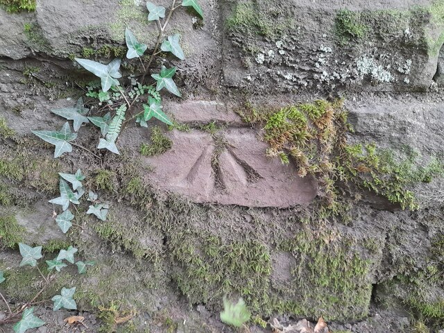
Ordnance Survey Cut Mark This damaged OS cut mark can be found on the bridge on the Neath Canal. It marks a point 24.3ft above mean sea level.
Ordnance Survey Cut Mark
This damaged OS cut mark can be found on the bridge on the Neath Canal. It marks a point 24.3ft above mean sea level.
Ordnance Survey Rivet This OS rivet can be found on the north angle, SE side of old lock gates. It marks a point 20.1ft above mean sea level.
Ordnance Survey Rivet
This OS rivet can be found on the north angle, SE side of old lock gates. It marks a point 20.1ft above mean sea level.
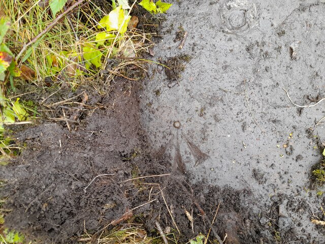
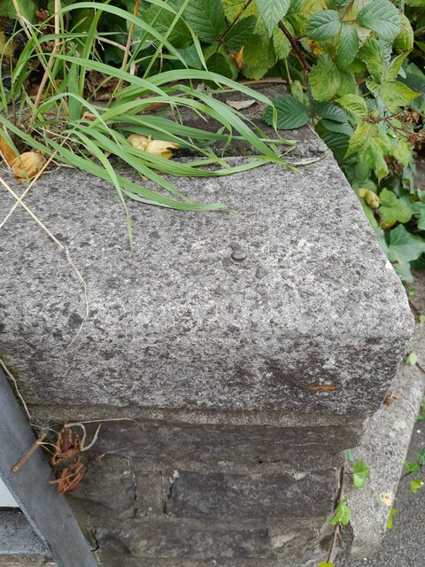
Ordnance Survey Rivet This OS rivet can be found on the wall at the junction of Herbert Road. It marks a point 34.574m above mean sea level.
Ordnance Survey Rivet
This OS rivet can be found on the wall at the junction of Herbert Road. It marks a point 34.574m above mean sea level.
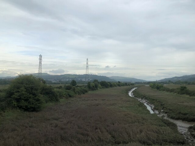
Wetland area beside River Neath
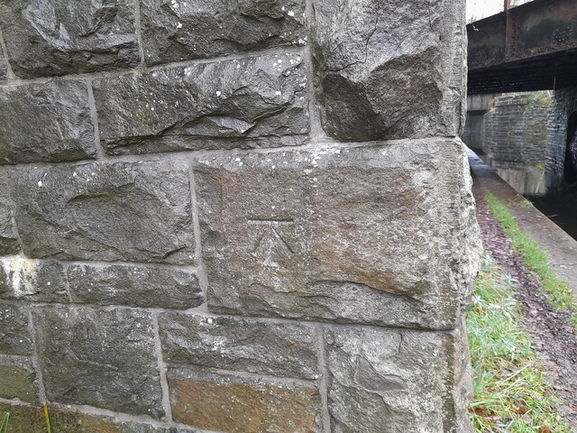
Ordnance Survey Cut Mark This OS cut mark can be found on buttress of the railway bridge over the canal. It marks a point 7.257m above mean sea level.
Ordnance Survey Cut Mark
This OS cut mark can be found on buttress of the railway bridge over the canal. It marks a point 7.257m above mean sea level.
Ordnance Survey Cut Mark This OS cut mark can be found on the footbridge over the canal. It marks a point 7.041m above mean sea level.
Ordnance Survey Cut Mark
This OS cut mark can be found on the footbridge over the canal. It marks a point 7.041m above mean sea level.
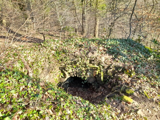
Air Shaft in Forest
Air Shaft in Forest
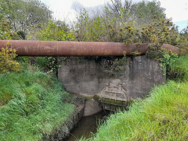
Culvert
Culvert
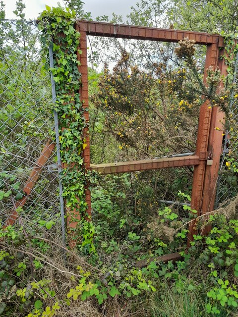
Gateway to Overgrown Culvert
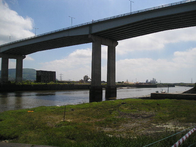
M4 over River Neath This is the M4 motorway going over the River Neath near Briton Ferry.
M4 over River Neath
This is the M4 motorway going over the River Neath near Briton Ferry.
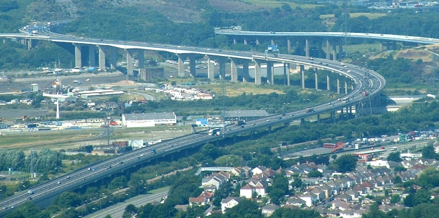
M4 River Neath Crossing Elevated section from the SE
M4 River Neath Crossing
Elevated section from the SE
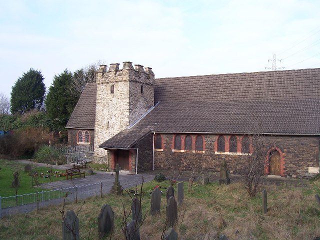
Llansawel Church The Church of Saint Mary the Virgin, Llansawel. Now over-shadowed by the A48 road bridge over the river Neath.
Llansawel Church
The Church of Saint Mary the Virgin, Llansawel. Now over-shadowed by the A48 road bridge over the river Neath.
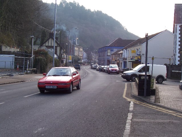
Neath Road, Briton Ferry The A474 Neath Road (looking southwards), follows a north-south route through the square, along the eastern edge of Briton Ferry.
Neath Road, Briton Ferry
The A474 Neath Road (looking southwards), follows a north-south route through the square, along the eastern edge of Briton Ferry.
Show me another place!

Giants Grave is located at Grid Ref: SS7394 (Lat: 51.638181, Lng: -3.8279924)

Unitary Authority: Neath Port Talbot

Police Authority: South Wales

What 3 Words

///stared.liver.shots. Near Briton Ferry, Neath Port Talbot

Related Wikis

Briton Ferry

Briton Ferry (Welsh: Llansawel) is a town and community in the county borough of Neath Port Talbot, Wales. The Welsh name may indicate that the church...

Briton Ferry railway station

Briton Ferry railway station is a minor station in the village of Briton Ferry, south Wales. It is 206 miles 40 chains (332.3 km) from the zero point at...

Court Sart railway station

Court Sart railway station served the town of Briton Ferry, Wales, from 1895 to 1935 on the Rhondda and Swansea Bay Railway. == History == The station...

Briton Ferry East railway station

Briton Ferry East railway station served the town of Briton Ferry, in the historical county of Glamorganshire, Wales, from 1895 to 1935 on the Rhondda...

Nearby Amenities

Located within 500m of 51.638181,-3.8279924
Briton Ferry
Is In: West Glamorgan, Wales
Name Cy: Llansawel
Name En: Briton Ferry
Place: town
Postal Code: SA11
Wikidata: Q1858117
Lat/Long: 51.6360419/-3.8216718
Ncn Milepost: mills
Source: survey
Sustrans Ref: MP274
Lat/Long: 51.6406787/-3.8325081
Chases
Shop: convenience
Lat/Long: 51.6387546/-3.8219498
Community Centre
Lat/Long: 51.6362881/-3.8224921
Telephone
Booth: KX100
Covered: booth
Lat/Long: 51.6371427/-3.8243772
Power: tower
Lat/Long: 51.6395846/-3.831929
Power: pole
Lat/Long: 51.6340696/-3.827719
Power: tower
Lat/Long: 51.6338467/-3.8282393
Power: pole
Lat/Long: 51.6352998/-3.8284003
Power: pole
Lat/Long: 51.6367281/-3.8279043
Power: tower
Lat/Long: 51.6372699/-3.8273384
Power: pole
Lat/Long: 51.6370545/-3.827223
Power: pole
Lat/Long: 51.6353181/-3.8285263
Power: pole
Lat/Long: 51.636024/-3.8280891
Power: pole
Lat/Long: 51.6373307/-3.8274966
Power: tower
Lat/Long: 51.6354356/-3.8287004
Power: pole
Lat/Long: 51.6368381/-3.8279741
Power: pole
Lat/Long: 51.636044/-3.8279014
Power: pole
Lat/Long: 51.6360889/-3.8285076
Power: pole
Lat/Long: 51.6370244/-3.8274108
Power: pole
Lat/Long: 51.6373542/-3.8276307
Power: pole
Lat/Long: 51.6360107/-3.8284003
Power: tower
Lat/Long: 51.6388587/-3.832973
Power: pole
Lat/Long: 51.633785/-3.8275659
Power: pole
Lat/Long: 51.633825/-3.828443
Power: pole
Lat/Long: 51.6345525/-3.8287514
Power: tower
Lat/Long: 51.6422065/-3.8273513
Power: tower
Lat/Long: 51.6404721/-3.827869
Power: tower
Lat/Long: 51.6395033/-3.828156
Power: pole
Lat/Long: 51.6386926/-3.8281319
Power: pole
Lat/Long: 51.6392103/-3.830291
Power: pole
Lat/Long: 51.6397804/-3.8324019
Power: pole
Lat/Long: 51.6397313/-3.8317877
Power: pole
Lat/Long: 51.6393851/-3.8302857
Power: pole
Lat/Long: 51.6388599/-3.8280568
Direction: 265
Generator Method: photovoltaic
Generator Output Electricity: yes
Generator Solar Modules: 8
Generator Source: solar
Generator Type: solar_photovoltaic_panel
Location: roof
Power: generator
Lat/Long: 51.6396939/-3.8240348
Direction: 85
Generator Method: photovoltaic
Generator Output Electricity: yes
Generator Solar Modules: 6
Generator Source: solar
Generator Type: solar_photovoltaic_panel
Location: roof
Power: generator
Lat/Long: 51.6396972/-3.823965
Direction: ESE
Generator Method: photovoltaic
Generator Output Electricity: yes
Generator Solar Modules: 14
Generator Source: solar
Generator Type: solar_photovoltaic_panel
Location: roof
Power: generator
Lat/Long: 51.6419714/-3.8252371
Direction: 125
Generator Method: photovoltaic
Generator Output Electricity: yes
Generator Solar Modules: 14
Generator Source: solar
Generator Type: solar_photovoltaic_panel
Location: roof
Power: generator
Lat/Long: 51.6421016/-3.8251036
Direction: SSE
Generator Method: photovoltaic
Generator Output Electricity: yes
Generator Solar Modules: 10
Generator Source: solar
Generator Type: solar_photovoltaic_panel
Location: roof
Power: generator
Lat/Long: 51.6423043/-3.8258064
Direction: SSE
Generator Method: photovoltaic
Generator Output Electricity: yes
Generator Solar Modules: 10
Generator Source: solar
Generator Type: solar_photovoltaic_panel
Location: roof
Power: generator
Lat/Long: 51.6422735/-3.8259177
Direction: 175
Generator Method: photovoltaic
Generator Output Electricity: yes
Generator Solar Modules: 14
Generator Source: solar
Generator Type: solar_photovoltaic_panel
Location: roof
Power: generator
Lat/Long: 51.6367866/-3.8221277
Direction: 185
Generator Method: photovoltaic
Generator Output Electricity: yes
Generator Solar Modules: 12
Generator Source: solar
Generator Type: solar_photovoltaic_panel
Location: roof
Power: generator
Lat/Long: 51.6368182/-3.8223249
Direction: S
Generator Method: photovoltaic
Generator Output Electricity: yes
Generator Solar Modules: 16
Generator Source: solar
Generator Type: solar_photovoltaic_panel
Location: roof
Power: generator
Lat/Long: 51.6359476/-3.8221324
Post Box
Post Box Type: wall
Royal Cypher: GR
Royal Cypher Wikidata: Q33102273
Lat/Long: 51.6383724/-3.825255
The data included in this document is from www.openstreetmap.org. The data is made available under ODbL.

Have you been to Giants Grave?

Leave your review of Giants Grave below (or comments, questions and feedback).