Fox Hills

Settlement in Somerset

England

Fox Hills

Pit Wheel in Radstock The Pit Wheel monument in Radstock, photographed from the end of the Greenway, across Bath New Road A367.
The Colliers Way NCN24 starts by the wheel.
Pit Wheel in Radstock Credit: Kevin Pearson

Fox Hills is a charming village located in the county of Somerset, England. Nestled amidst the rolling hills of the Somerset countryside, it offers a picturesque and idyllic setting for residents and visitors alike. The village is situated just a few miles from the larger town of Taunton, providing easy access to amenities and services.

The defining feature of Fox Hills is its stunning natural beauty. Surrounded by lush green fields, meandering streams, and ancient woodlands, it is a haven for nature lovers and outdoor enthusiasts. The village is also known for its breathtaking views, with panoramic vistas of the Somerset Levels and the Blackdown Hills.

Despite its rural setting, Fox Hills boasts a close-knit and vibrant community. Friendly locals create a warm and welcoming atmosphere, making it an ideal place to settle down or visit. The village is home to a range of amenities, including a community center, a primary school, and a quaint village pub serving delicious local fare.

For those seeking recreational activities, Fox Hills offers ample opportunities. The surrounding countryside is crisscrossed with walking and cycling trails, allowing residents and visitors to explore the area's natural wonders. Nearby attractions such as Hestercombe Gardens and Wiveliscombe Open Air Pool provide further options for leisure and relaxation.

In summary, Fox Hills, Somerset is a picturesque village that combines natural beauty with a strong sense of community. With its stunning countryside, friendly locals, and range of amenities, it is a hidden gem in the heart of Somerset.

If you have any feedback on the listing, please let us know in the comments section below.
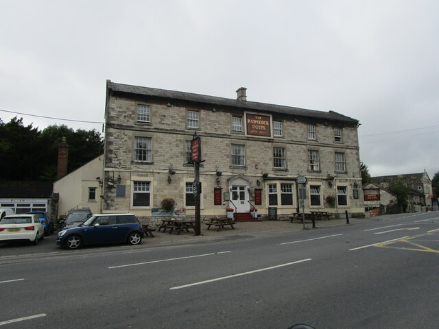
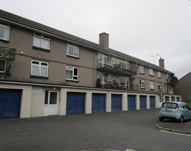
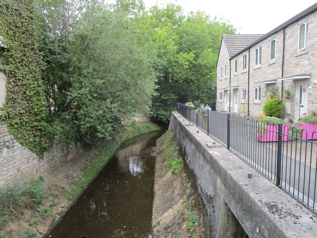
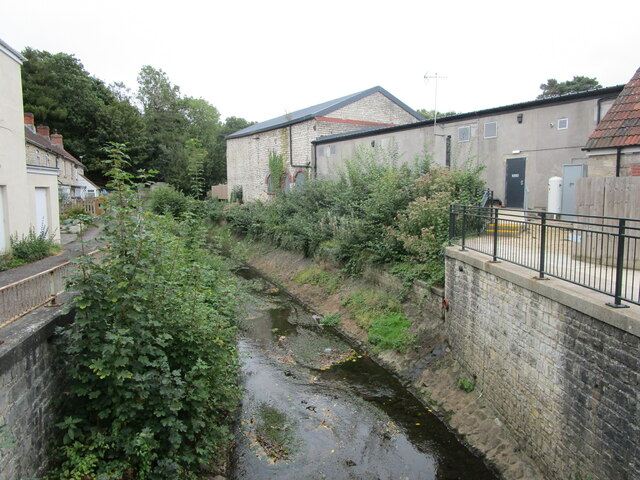
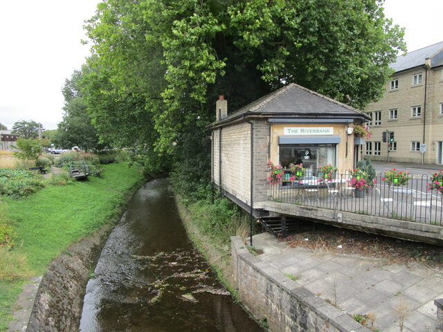
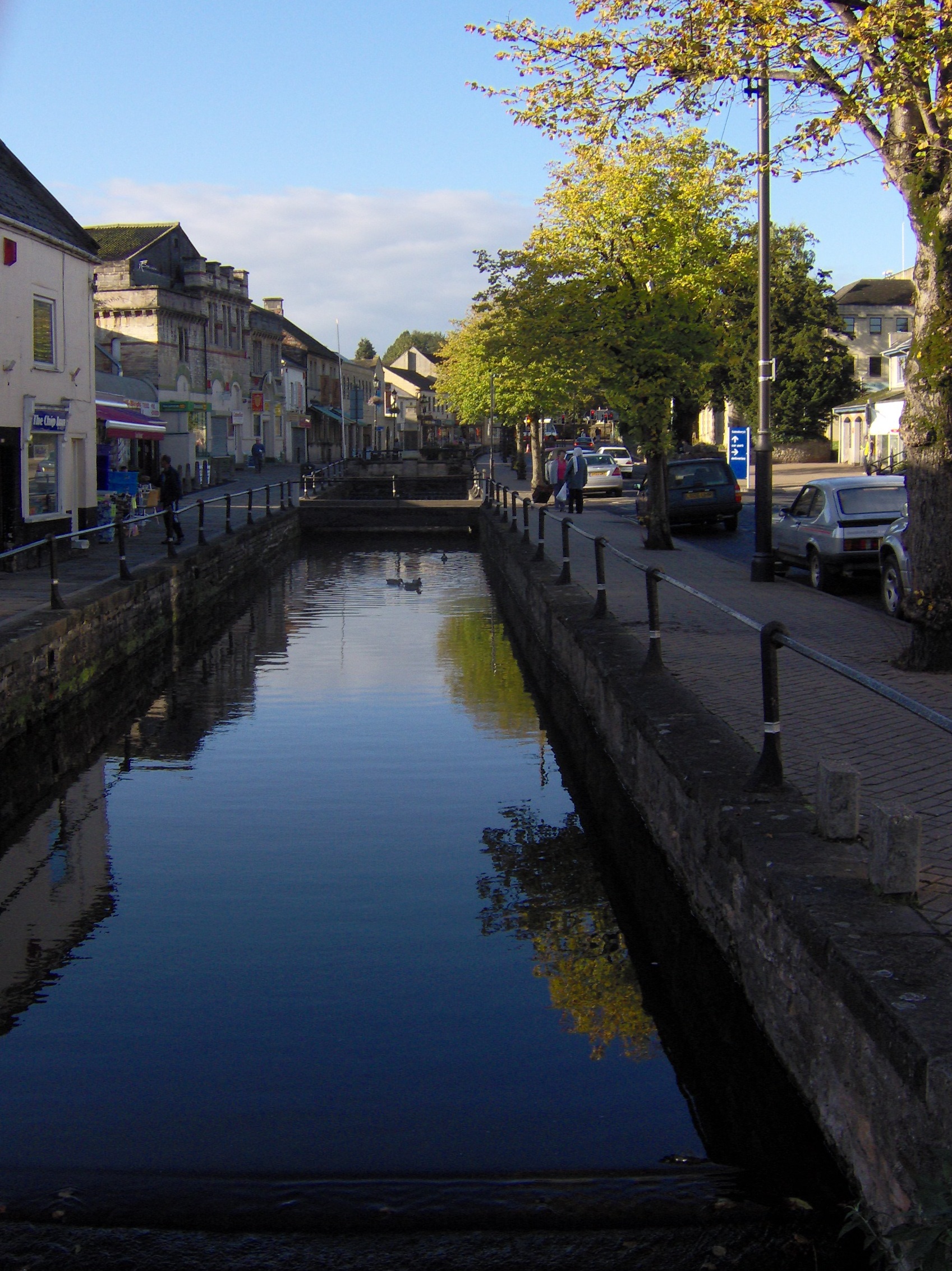
Fox Hills Images

Images are sourced within 2km of 51.288847/-2.4459394 or Grid Reference ST6854. Thanks to Geograph Open Source API. All images are credited.

Pit Wheel in Radstock The Pit Wheel monument in Radstock, photographed from the end of the Greenway, across Bath New Road A367.
The Colliers Way NCN24 starts by the wheel.
Pit Wheel in Radstock
The Pit Wheel monument in Radstock, photographed from the end of the Greenway, across Bath New Road A367. The Colliers Way NCN24 starts by the wheel.
Abandoned Co-op supermarket, Radstock The largest building in the centre of Radstock, now abandoned and replaced by a smaller store nearby.
Abandoned Co-op supermarket, Radstock
The largest building in the centre of Radstock, now abandoned and replaced by a smaller store nearby.
The Waldegrave Arms Hotel, Radstock Early nineteenth century hotel <span class="nowrap"><a title="https://historicengland.org.uk/listing/the-list/list-entry/1115174" rel="nofollow ugc noopener" href="https://historicengland.org.uk/listing/the-list/list-entry/1115174">Link</a><img style="margin-left:2px;" alt="External link" title="External link - shift click to open in new window" src="https://s1.geograph.org.uk/img/external.png" width="10" height="10"/></span>
The Waldegrave Arms Hotel, Radstock
Early nineteenth century hotel LinkExternal link
Flats, Waterloo Road, Radstock
Radstock Museum The former Radstock Market Hall dating from 1897 <span class="nowrap"><a title="https://historicengland.org.uk/listing/the-list/list-entry/1136837" rel="nofollow ugc noopener" href="https://historicengland.org.uk/listing/the-list/list-entry/1136837">Link</a><img style="margin-left:2px;" alt="External link" title="External link - shift click to open in new window" src="https://s1.geograph.org.uk/img/external.png" width="10" height="10"/></span>
Radstock Museum
The former Radstock Market Hall dating from 1897 LinkExternal link
Radstock Museum The former Radstock Market Hall of 1897 <span class="nowrap"><a title="https://historicengland.org.uk/listing/the-list/list-entry/1136837" rel="nofollow ugc noopener" href="https://historicengland.org.uk/listing/the-list/list-entry/1136837">Link</a><img style="margin-left:2px;" alt="External link" title="External link - shift click to open in new window" src="https://s1.geograph.org.uk/img/external.png" width="10" height="10"/></span>
Radstock Museum
The former Radstock Market Hall of 1897 LinkExternal link
Abandoned car park, Radstock Served the now closed Co-op supermarket.
Abandoned car park, Radstock
Served the now closed Co-op supermarket.
No more trolleys The large Co-op supermarket in Radstock has closed and been replaced by a smaller store elsewhere in the town.
No more trolleys
The large Co-op supermarket in Radstock has closed and been replaced by a smaller store elsewhere in the town.
Hope House health Centre, Radstock, under construction
National cycle route No. 24 in Radstock
The Wellow Brook at Radstock Heavily engineered. Looking upstream.
The Wellow Brook at Radstock
Heavily engineered. Looking upstream.
The Wellow Brook at Radstock Heavily engineered. Looking downstream.
The Wellow Brook at Radstock
Heavily engineered. Looking downstream.
Former industrial buildings, Radstock Now in retail use.
Former industrial buildings, Radstock
Now in retail use.
Fosseway Press, Radstock Long established printing company.
Fosseway Press, Radstock
Long established printing company.
Victoria Hall, Radstock Built as a Working Men's Institute in 1866 but turned in to council offices in 1902. Now a community arts centre.
Victoria Hall, Radstock
Built as a Working Men's Institute in 1866 but turned in to council offices in 1902. Now a community arts centre.
The beginning of Wells Road, Radstock
Barber on the corner of Fortescue Road, Radstock
The Wellow Brook at Radstock
Show me another place!

Fox Hills is located at Grid Ref: ST6854 (Lat: 51.288847, Lng: -2.4459394)

Unitary Authority: Bath and North East Somerset

Police Authority: Avon and Somerset

What 3 Words

///lyrics.serious.chase. Near Radstock, Somerset

Related Wikis

Westfield, Somerset

Westfield is a settlement lying on the Fosse Way between Radstock and Midsomer Norton in Somerset, England. In 2011 it was raised to the status of a civil...

Kilmersdon Road Quarry

Kilmersdon Road Quarry (grid reference ST689542) is a 0.43 hectare geological Site of Special Scientific Interest between the village of Haydon and the...

River Somer

The River Somer is a small river in Somerset, England. == Course == The river rises at Chilcompton and flows to Midsomer Norton where it joins the Wellow...

Radstock Town F.C.

Radstock Town Football Club is a football club based in Radstock, Somerset, England. It is a member of the Western League Division One and plays at the...

Radstock West railway station

Radstock West railway station was a station on the Bristol and North Somerset Railway in the county of Bath and North East Somerset in England. == History... ==

Norton Radstock College

Norton Radstock College was a further education college in Westfield, Somerset serving Midsomer Norton, Radstock, Westfield, Keynsham and surrounding districts...

Radstock North railway station

Radstock North railway station was a station on the Somerset and Dorset Joint Railway in the county of Somerset in England. == History == Opened as Radstock...

Radstock

Radstock is a town and civil parish on the northern slope of the Mendip Hills in Somerset, England, about 9 miles (14 km) south-west of Bath and 8 miles...

Nearby Amenities

Located within 500m of 51.288847,-2.4459394
Mini Roundabout
Direction: clockwise
Lat/Long: 51.292685/-2.4478043
Crossing
Crossing: traffic_signals
Crossing Ref: pelican
Lat/Long: 51.2921605/-2.4480936
Radstock
Place: town
Postal Code: BA3 3
Wikidata: Q1234765
Lat/Long: 51.2919489/-2.4476231
Mini Roundabout
Direction: clockwise
Lat/Long: 51.2925357/-2.447955
Barrier: bollard
Bollard: fixed
Lat/Long: 51.2923793/-2.4457015
Crossing
Crossing Island: yes
Lat/Long: 51.2926433/-2.4476345
Leisure: playground
Wheelchair: no
Lat/Long: 51.2887561/-2.4389366
Atm
Lat/Long: 51.2924085/-2.4491052
Pharmacy
Clement Pharmacy
Addr City: Radstock
Addr Housenumber: 7
Addr Postcode: BA3 3PL
Addr Street: The Street
Fhrs Id: 761397
Healthcare: pharmacy
Website: https://www.nhs.uk/services/pharmacy/clement-pharmacy/FFQ25
Wheelchair: yes
Lat/Long: 51.291792/-2.4478099
Fast Food
New Lido Chef
Addr Housenumber: 13
Addr Postcode: BA3 3PJ
Addr Street: Fortescue Road
Cuisine: chinese
Fhrs Id: 204228
Website: http://www.lidochefradstock.co.uk/
Lat/Long: 51.2921356/-2.4471829
Phil Day Traditional Family Butchers
Addr City: Radstock
Addr Housenumber: 112
Addr Postcode: BA3 3PL
Addr Street: The Street
Disused Fhrs Id: 914593
Facebook: https://www.facebook.com/Phildaybutcher/
Shop: butcher
Wheelchair: no
Lat/Long: 51.2916942/-2.4477551
Post Box
Lat/Long: 51.2914176/-2.4469297
Crossing
Crossing: uncontrolled
Crossing Ref: zebra
Traffic Calming: table
Lat/Long: 51.2924582/-2.4492434
Hair Razors
Shop: hairdresser
Wheelchair: no
Lat/Long: 51.2922307/-2.4478606
Restaurant
Castello
Addr City: Radstock
Addr Postcode: BA3 3PL
Addr Street: The Street
Cuisine: italian
Fhrs Id: 892266
Not Addr Postcode: BA3 3PZ
Source Addr Postcode: code-point_open
Lat/Long: 51.2919898/-2.4479191
Fast Food
Rice & Spice
Addr Postcode: BA3 3PH
Addr Street: Fortescue Road
Cuisine: indian
Fhrs Id: 909471
Fixme: rough location
Website: https://www.riceandspice-radstock.co.uk/
Lat/Long: 51.2921032/-2.4475227
Shop: doityourself
Wheelchair: yes
Lat/Long: 51.2919489/-2.4473135
Mini Roundabout
Lat/Long: 51.2918888/-2.4481323
Entrance: yes
Lat/Long: 51.2923468/-2.4481455
Crossing
Crossing: traffic_signals
Crossing Ref: pelican
Fixme: check crossing was "bicycle=no" which impacted road routing.
Segregated: no
Lat/Long: 51.2926534/-2.4484087
Atm
Lat/Long: 51.2920313/-2.4471046
Bicycle Parking
Bicycle Parking: stands
Capacity: 4
Covered: no
Lat/Long: 51.2924301/-2.4493406
Cafe
Swallow Cafe
Addr Postcode: BA3 3QG
Fhrs Id: 704035
Website: http://www.radstockchurches.org.uk/stnicholas.php
Lat/Long: 51.2896154/-2.448072
Barrier: bollard
Lat/Long: 51.2927611/-2.4449512
Bicycle Parking
Capacity: 6
Lat/Long: 51.2930486/-2.4479391
Barrier: kissing_gate
Lat/Long: 51.2898032/-2.4392774
Barrier: stile
Lat/Long: 51.2897662/-2.4389006
Barrier: cycle_barrier
Lat/Long: 51.2904007/-2.4406492
Crossing
Crossing: traffic_signals
Crossing Ref: toucan
Lat/Long: 51.292968/-2.4478452
Crossing
Crossing: traffic_signals
Crossing Ref: toucan
Lat/Long: 51.2929026/-2.4477337
Barrier: kissing_gate
Lat/Long: 51.2882541/-2.4390714
Crossing
Crossing: traffic_signals
Lat/Long: 51.2925926/-2.4473118
Crossing
Crossing: uncontrolled
Crossing Ref: zebra
Kerb: lowered
Tactile Paving: yes
Lat/Long: 51.2914346/-2.4475649
Crossing
Crossing: uncontrolled
Crossing Ref: zebra
Kerb: lowered
Tactile Paving: yes
Lat/Long: 51.2912919/-2.4469247
Barrier: stile
Lat/Long: 51.2879517/-2.4412052
Southfield
Place: suburb
Source Ref: NPE
Lat/Long: 51.288894/-2.4399647
Fox Hills
Place: suburb
Source Ref: NPE
Lat/Long: 51.2875806/-2.4439327
Barrier: bollard
Lat/Long: 51.2910602/-2.447631
Barrier: bollard
Lat/Long: 51.2911754/-2.4473371
Crossing
Crossing: unmarked
Crossing Island: yes
Lat/Long: 51.2916231/-2.4460011
Kindergarten
Radstock Childrens Centre Nursery
Addr Postcode: BA3 3QH
Disused Fhrs Id: 554685
Fixme: rough location. Is it in the school grounds?
Website: https://www.bathnes.gov.uk/services/children-young-people-and-families/childrens-centres/radstock-childrens-centre-nursery
Lat/Long: 51.2893114/-2.4458142
Fast Food
Quarter Panda
Addr Housenumber: 3a
Addr Postcode: BA3 3PH
Addr Street: Fortescue Road
Cuisine: burger
Fhrs Id: 1199468
Fixme: rough location
Website: https://www.quarterpanda.co.uk/
Lat/Long: 51.292045/-2.44741
Colliery Wheel
Historic: monument
Lat/Long: 51.2929434/-2.4475452
Dentist
Wells Hill Dental Surgery
Lat/Long: 51.2916558/-2.4484271
Co-Operative Funeralcare
Shop: yes
Lat/Long: 51.2916409/-2.4485605
The Loft
Addr Postcode: BA3 3AA
Addr Street: County Bridge
Shop: musical_instrument
Lat/Long: 51.2928648/-2.4479665
Cafe
Athena
Addr Postcode: BA3 3AA
Addr Street: County Bridge
Cuisine: greek
Facebook: https://www.facebook.com/people/Athena-GREEK-Restaurant-Radstock/100048665485243/
Fhrs Id: 1515163
Lat/Long: 51.2929057/-2.4479669
Bench
Lat/Long: 51.2928605/-2.4474275
Bench
Lat/Long: 51.2928499/-2.4474647
Waste Basket
Lat/Long: 51.2928393/-2.4475143
Bench
Lat/Long: 51.2928414/-2.4475707
Bench
Lat/Long: 51.2929098/-2.447379
Bicycle Parking
Lat/Long: 51.2929536/-2.4473654
Waste Basket
Lat/Long: 51.2929663/-2.4472898
Entrance: yes
Lat/Long: 51.2924575/-2.449112
Crossing
Crossing: uncontrolled
Crossing Ref: zebra
Lat/Long: 51.2925192/-2.4496888
Crossing
Crossing: uncontrolled
Crossing Ref: zebra
Lat/Long: 51.29249/-2.4494754
Bus Stop
Victoria Hall (B)
Bus: yes
Naptan AtcoCode: 0180BAC30834
Naptan Bearing: E
Naptan CommonName: Victoria Hall
Naptan Indicator: Stop B
Naptan NaptanCode: bthdgdg
Naptan Street: The Street
Naptan Verified: no
Public Transport: platform
Wheelchair: limited
Lat/Long: 51.2914394/-2.4465283
Bus Stop
Victoria Hall (A)
Bus: yes
Naptan AtcoCode: 0180BAC30835
Naptan Bearing: W
Naptan CommonName: Victoria Hall
Naptan Indicator: Stop A
Naptan NaptanCode: bthdgda
Naptan Street: The Street
Naptan Verified: no
Public Transport: platform
Lat/Long: 51.2912715/-2.4466272
Bench
Lat/Long: 51.2914085/-2.4469556
Waste Basket
Lat/Long: 51.2914097/-2.446972
Waste Basket
Lat/Long: 51.2912224/-2.4468164
Bench
Lat/Long: 51.2912203/-2.4468331
Waste Basket
Lat/Long: 51.2913885/-2.4468892
Entrance: yes
Lat/Long: 51.2912135/-2.4474694
Cottle's
Addr Housenumber: 12
Addr Postcode: BA3 3PJ
Addr Street: Fortescue Road
Fhrs Id: 205401
Fixme: rough locaton
Shop: bakery
Lat/Long: 51.2921766/-2.4472513
Premier Express
Addr Housenumber: 11
Addr Postcode: BA3 3PJ
Addr Street: Fortescue Road
Brand: Premier Express
Brand Wikidata: Q7240340
Fhrs Id: 688879
Shop: convenience
Website: https://www.premier-stores.co.uk/our-stores/pkt-convenience-store
Lat/Long: 51.2922135/-2.4473183
Club
St Nicholas Pre-school
Addr Postcode: BA3 3QH
Fhrs Id: 204802
Lat/Long: 51.2897235/-2.4456098
Power: pole
Lat/Long: 51.2881047/-2.4471759
Power: pole
Lat/Long: 51.2875682/-2.4462974
Power: pole
Lat/Long: 51.2866908/-2.4449778
Power: pole
Lat/Long: 51.2863677/-2.4444722
Power: pole
Lat/Long: 51.2856457/-2.4437353
Power: pole
Lat/Long: 51.2851281/-2.4432403
Power: pole
Lat/Long: 51.2882292/-2.4475609
Power: pole
Lat/Long: 51.2878751/-2.4470252
Power: pole
Lat/Long: 51.2874515/-2.4463603
Power: pole
Lat/Long: 51.2865695/-2.4450607
Power: pole
Lat/Long: 51.286305/-2.4446636
Power: pole
Lat/Long: 51.2853674/-2.4438853
Power: pole
Lat/Long: 51.2846985/-2.4432356
Social Facility
Manor Farm House Residential Home
Addr Postcode: BA3 3QG
Fhrs Id: 204330
Social Facility: assisted_living
Website: https://www.avalonresidentialhome.co.uk/manor-farm-residential-home/
Lat/Long: 51.2906674/-2.4470748
Kindergarten
Radstock Children's Centre
Addr Postcode: BA3 3PR
Disused Fhrs Id: 205089
Lat/Long: 51.2911393/-2.4476048
Historic: memorial
Memorial: war_memorial
Wheelchair: yes
Lat/Long: 51.2928288/-2.4468003
BL&Tea
Addr Postcode: BA3 3JX
Craft: caterer
Fhrs Id: 987018
Website: http://bltea.co.uk/
Lat/Long: 51.2917848/-2.4424314
Bicycle Parking
Bicycle Parking: stands
Capacity: 4
Covered: no
Lat/Long: 51.2916206/-2.4457617
Snapfitness
Addr Housenumber: Unit 3
Addr Postcode: BA3 3PT
Addr Street: Old Furniture Site
Leisure: fitness_centre
Opening Hours: PH,Mo-Su 00:00-24:00
Phone: +07384812702
Website: https://www.snapfitness.co.uk/
Lat/Long: 51.2917213/-2.445647
DJS Wealth Advisor
Office: financial_advisor
Website: https://www.djswealthadviser.co.uk/
Lat/Long: 51.2912635/-2.4460411
Graham Long & Co.
Office: accountant
Lat/Long: 51.2912568/-2.4461832
Disused Office: yes
Lat/Long: 51.291245/-2.4463388
Telephone
Booth: K6
Covered: booth
Man Made: telephone_box
Lat/Long: 51.2910962/-2.4471107
Bench
Lat/Long: 51.2911125/-2.4471127
Waste Basket
Lat/Long: 51.2911285/-2.4471155
Bench
Lat/Long: 51.2893437/-2.4469415
Waste Basket
Lat/Long: 51.2893706/-2.4469764
Barrier: kissing_gate
Lat/Long: 51.2886526/-2.450304
Waterway: weir
Lat/Long: 51.28842/-2.4505295
Fast Food
Subway
Addr Housenumber: Unit 1
Addr Postcode: BA3 3PT
Addr Street: Old Furniture Site
Brand: Subway
Brand Wikidata: Q244457
Brand Wikipedia: en:Subway (restaurant)
Contact Website: https://restaurants.subway.com/united-kingdom/en/radstock/unit-1-colliers-yard-frome-road
Cuisine: sandwich
Fhrs Id: 1050905
Opening Hours: Mo-Sa 06:30-21:00; Su 09:00-20:00
Takeaway: yes
Wheelchair: yes
Lat/Long: 51.2916307/-2.4458267
Power: pole
Lat/Long: 51.28875/-2.44813
Power: pole
Lat/Long: 51.2887207/-2.4482694
Power: pole
Lat/Long: 51.2886427/-2.4482131
Power: pole
Lat/Long: 51.2886829/-2.4480696
Proper Job
Addr Housenumber: Unit 4
Addr Postcode: BA3 3PT
Addr Street: Colliers Yard
Fhrs Id: 1062089
Shop: doityourself
Website: https://www.properjob.biz/stores/proper-job-radstock/
Lat/Long: 51.2917298/-2.4455292
Cafe
No. 10 Cafe
Addr Housenumber: 10
Addr Postcode: BA3 3PJ
Addr Street: Fortescue Road
Facebook: https://www.facebook.com/No10-Cafe-1064232067111727/
Fhrs Id: 1098984
Lat/Long: 51.2922505/-2.4473839
Drinking Water
Lat/Long: 51.2899294/-2.4490665
Social Facility
Radstock Foodies Club
Addr Housename: Radstock Library
Addr Postcode: BA3 3PR
Addr Street: The Street
Fhrs Id: 1519073
Social Facility: food_bank
Lat/Long: 51.2911906/-2.4476041
Running On Hempty Ltd
Addr Housenumber: 9
Addr Postcode: BA3 3PJ
Addr Street: Fortescue Road
Facebook: https://hemptyonline.co.uk/
Fhrs Id: 1209915
Shop: Cannabidiol
Lat/Long: 51.2922856/-2.4474419
Access: no
Barrier: bollard
Bicycle: yes
Foot: yes
Lat/Long: 51.2882955/-2.4421165
Social Facility
Somer Valley Foodbank (Radstock)
Addr Housename: St Nicholas Church Centre
Addr Postcode: BA3 3QG
Addr Street: Church Street
Fhrs Id: 1365997
Social Facility: food_bank
Lat/Long: 51.2899968/-2.4477354
Radstock West
Historic Railway: station
Railway: site
Wikidata: Q27964213
Wikipedia: en:Radstock West railway station
Lat/Long: 51.2924088/-2.4472752
Radstock North
Historic Railway: station
Railway: site
Wikidata: Q7281700
Wikipedia: en:Radstock North railway station
Lat/Long: 51.2928701/-2.4468592
Railway: switch
Lat/Long: 51.2914116/-2.4442574
Co-operative - Radstock
Addr Housenumber: Unit 1
Addr Street: Marcroft Court
Fhrs Id: 1264858
Shop: supermarket
Lat/Long: 51.2915606/-2.4462396
Veterinary
Radstock Veterinary Centre
Addr City: Radstock
Addr Housenumber: Unit 2
Addr Postcode: BA3 3PT
Addr Street: Colliers Yard
Lat/Long: 51.2917008/-2.4457363
Defibrillator
Booth: K6
Covered: booth
Defibrillator Location: inside old red phone box in Radstock Memorial Gardens
Emergency: defibrillator
Man Made: telephone_box
Lat/Long: 51.2928619/-2.4476463
Bicycle Parking
Access: private
Bicycle Parking: shed
Capacity: 6
Covered: yes
Operator: Falco
Ref: 401
Website: https://rentals.falco.co.uk/
Lat/Long: 51.2912335/-2.4473515
The data included in this document is from www.openstreetmap.org. The data is made available under ODbL.

Have you been to Fox Hills?

Leave your review of Fox Hills below (or comments, questions and feedback).