Down End

Settlement in Oxfordshire Cherwell

England

Down End

Hook Norton Brewery The Victorian tower of Hook Norton is the only brewery still driven by steam. On the ground floor of the brewery is a fine 25 horsepower steam engine, supplying through a series of belts, cogs and shafts some of the motive power the brewery needs to produce its beer.
Hook Norton Brewery Credit: Alan Simkins

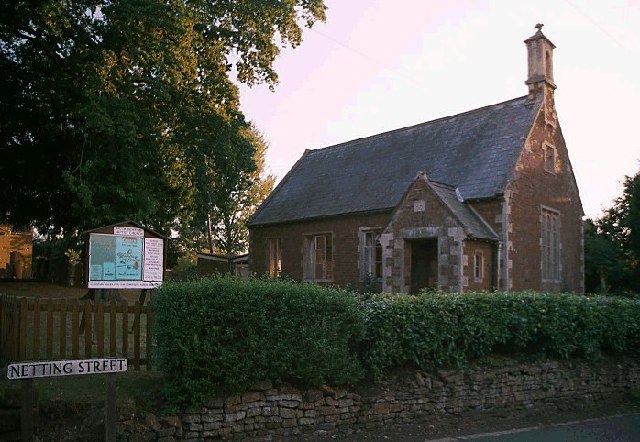
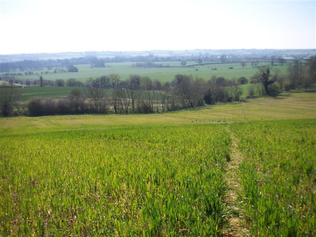
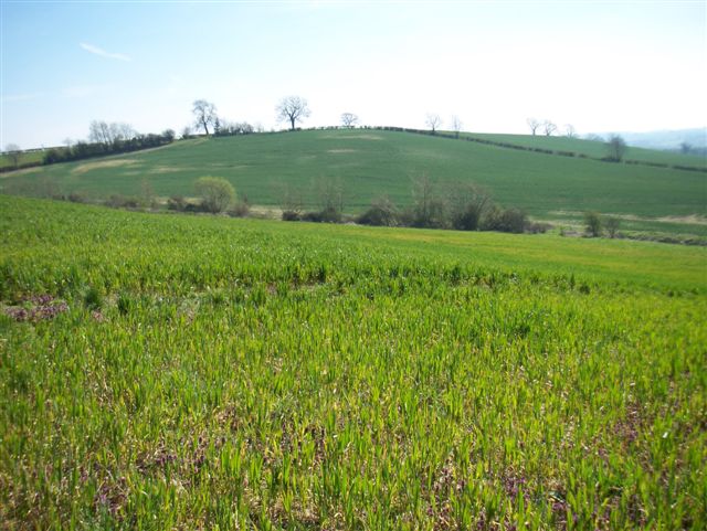
Down End is a small village located in the county of Oxfordshire, England. Situated in the southern part of the county, it lies approximately 12 miles west of the city of Oxford. The village is nestled within the beautiful countryside, surrounded by rolling hills and picturesque landscapes.

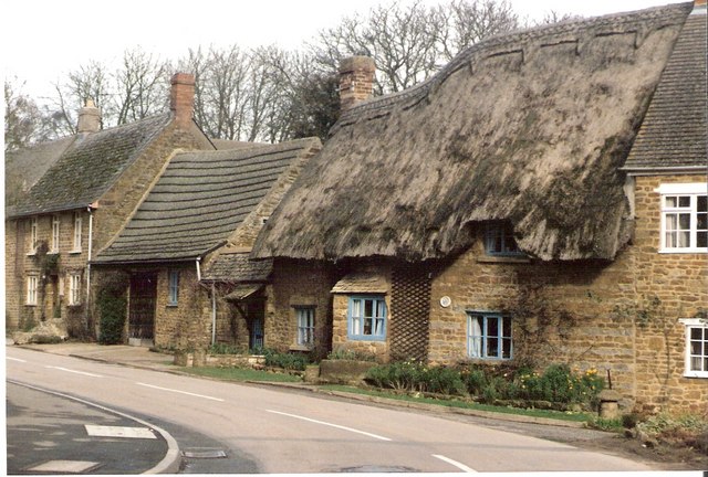
With a population of around 500, Down End is a close-knit community known for its peaceful and idyllic setting. The village is primarily residential, with a scattering of traditional cottages and houses. The architecture reflects the charm and character of the region, with many buildings dating back several centuries.

Down End benefits from its proximity to the nearby market town of Witney, which provides residents with a range of amenities, including shops, schools, and recreational facilities. The village itself, however, offers a tranquil escape from the hustle and bustle of urban life.

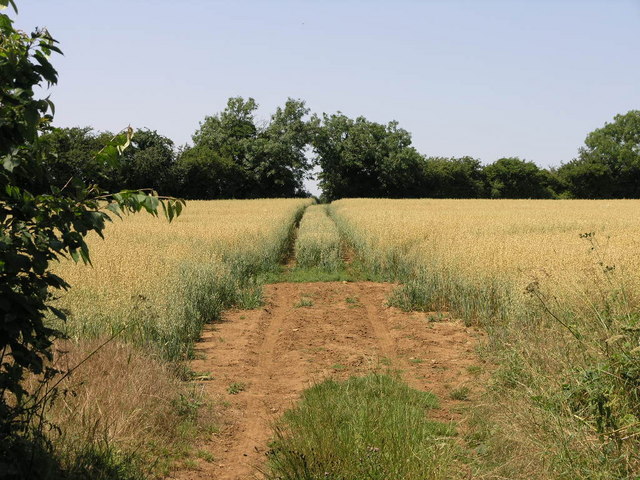
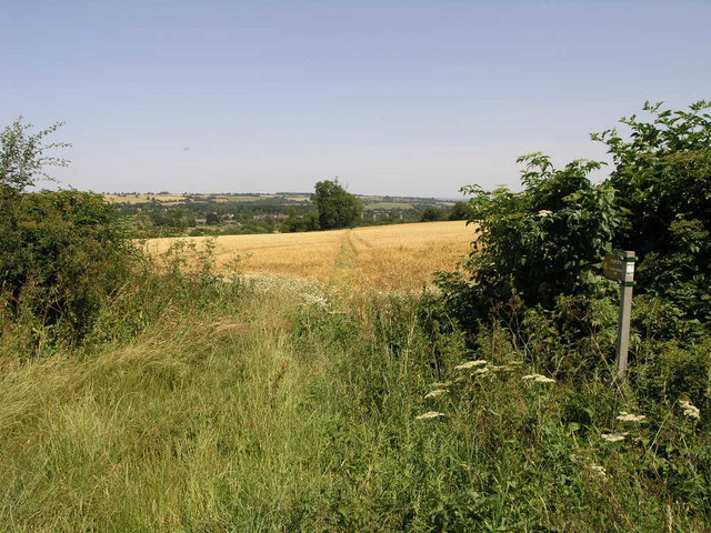
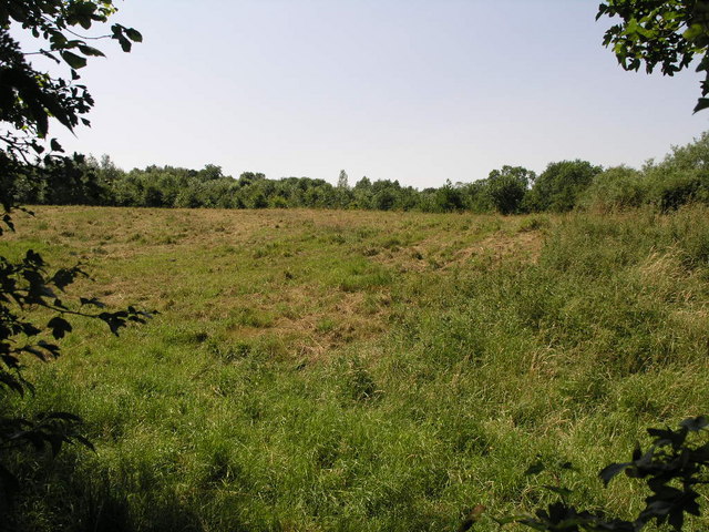
Nature enthusiasts will appreciate the abundance of walking and cycling routes in and around Down End, allowing residents and visitors to explore the stunning countryside. The village is also home to a number of small farms, contributing to its rural atmosphere.

Overall, Down End is a picturesque and peaceful village in Oxfordshire, offering a serene lifestyle for its residents. Its scenic beauty, coupled with its close proximity to amenities and recreational opportunities, make it an attractive destination for those seeking a tranquil rural setting.

If you have any feedback on the listing, please let us know in the comments section below.
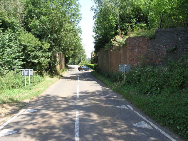
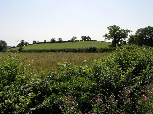
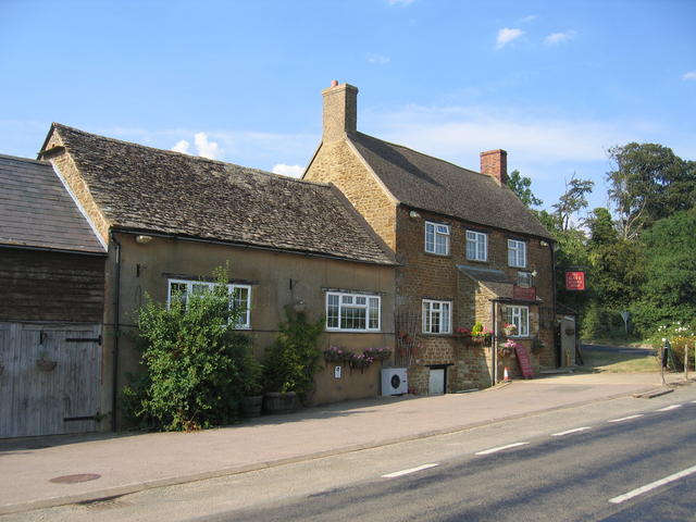
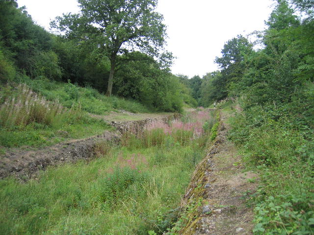
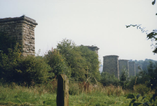
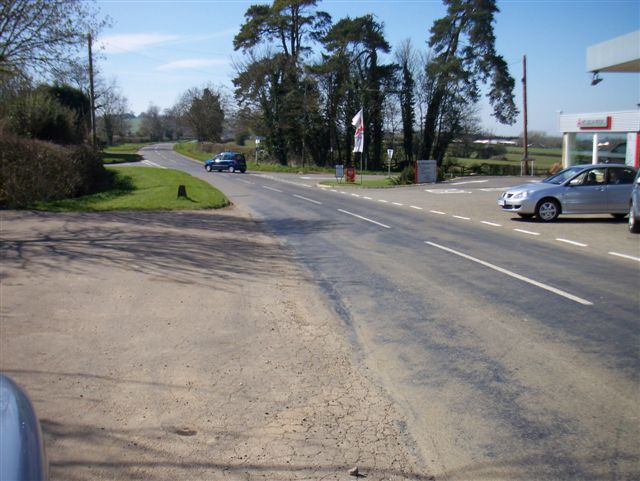
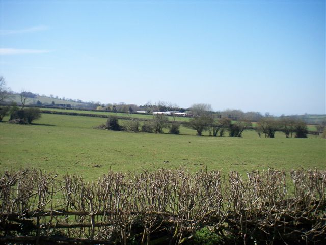
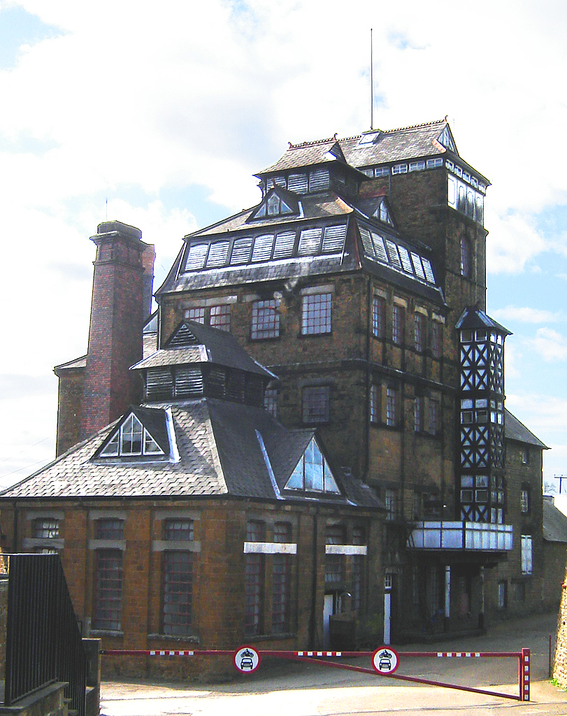
Down End Images

Images are sourced within 2km of 51.995696/-1.4827013 or Grid Reference SP3533. Thanks to Geograph Open Source API. All images are credited.

Hook Norton Brewery The Victorian tower of Hook Norton is the only brewery still driven by steam. On the ground floor of the brewery is a fine 25 horsepower steam engine, supplying through a series of belts, cogs and shafts some of the motive power the brewery needs to produce its beer.
Hook Norton Brewery
The Victorian tower of Hook Norton is the only brewery still driven by steam. On the ground floor of the brewery is a fine 25 horsepower steam engine, supplying through a series of belts, cogs and shafts some of the motive power the brewery needs to produce its beer.
Hook Norton The village as seen from a hot air balloon.  The pillars in the distance carried a viaduct for the Cheltenham and Banbury Railway.
Hook Norton
The village as seen from a hot air balloon. The pillars in the distance carried a viaduct for the Cheltenham and Banbury Railway.
Scotland End, Hook Norton
St Peters Church Hook Norton
The Baptist Church Hall, Hook Norton
Bridleway to Whichford This well marked bridleway leads to Whichford Hill.
Bridleway to Whichford
This well marked bridleway leads to Whichford Hill.
Footpath to Southrop This well marked footpath leads to Southrop, a suburb of Hook Norton.
Footpath to Southrop
This well marked footpath leads to Southrop, a suburb of Hook Norton.
Lost Footpath The footpath that runs across this field is not very well marked or walked for that matter.  It joins with another path from the same road and then leads on to Church End.
Lost Footpath
The footpath that runs across this field is not very well marked or walked for that matter. It joins with another path from the same road and then leads on to Church End.
East End Railway This former bridge once carried the railway from Hook Norton towards the east.  The former station was just to the right.
East End Railway
This former bridge once carried the railway from Hook Norton towards the east. The former station was just to the right.
Butter Hill Just to the other side of Butter Hill is Manor Farm.
Butter Hill
Just to the other side of Butter Hill is Manor Farm.
The Gate Hangs High An unusually named pub, shown on the OS map at the crossroads north of Hook Norton.
The Gate Hangs High
An unusually named pub, shown on the OS map at the crossroads north of Hook Norton.
Hook Norton Cutting
Hook Norton Cutting
Hook Norton Viaduct Only the piers remain of the disused railway viaduct of the former Banbury & Cheltenham Railway
Hook Norton Viaduct
Only the piers remain of the disused railway viaduct of the former Banbury & Cheltenham Railway
Roofing variations Cottages in Hook Norton village centre.
Roofing variations
Cottages in Hook Norton village centre.
D'Arcy Dalton Way
D'Arcy Dalton Way
Farmland
Farmland
Crossroads
Crossroads
Farmland
Farmland
Show me another place!

Down End is located at Grid Ref: SP3533 (Lat: 51.995696, Lng: -1.4827013)

Administrative County: Oxfordshire

District: Cherwell

Police Authority: Thames Valley

What 3 Words

///mammoths.planting.loud. Near Hook Norton, Oxfordshire

Related Wikis

Hook Norton F.C.

Hook Norton Football Club is a football club based in Hook Norton, near Banbury, Oxfordshire England. They are currently members of the Witney & District...
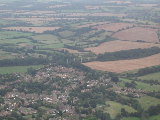
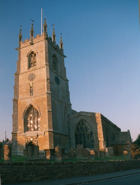
Hook Norton

Hook Norton is a village and civil parish in Oxfordshire, England. It lies 4+1⁄2 miles (7 km) northeast of Chipping Norton, close to the Cotswold Hills...

Hook Norton railway station

Hook Norton railway station served the village of Hook Norton in northern Oxfordshire, England. == History == The station was built for the Banbury and...
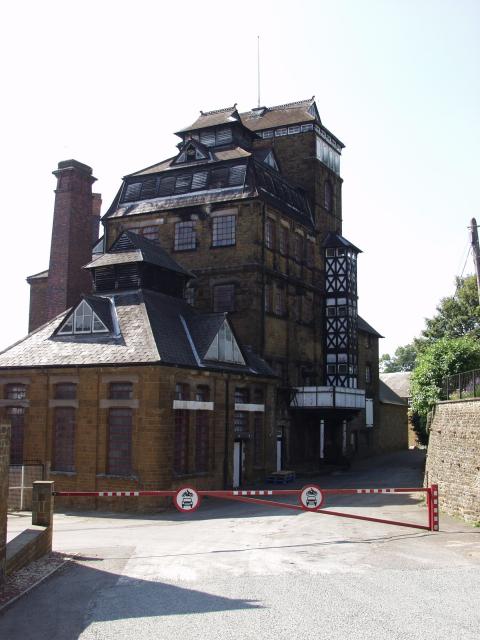
Hook Norton Brewery

Hook Norton Brewery is a regional brewery in Hook Norton, Oxfordshire, England, several miles outside the Cotswold Hills. Founded in 1849, the brewing...

Hook Norton ironstone quarries (Baker)

The Hook Norton ironstone quarries (Baker) were ironstone quarries at Hook Norton, Oxfordshire, England, operating from the 1890s to the end of the First...

Hook Norton ironstone quarries (Brymbo)

The Hook Norton ironstone quarries (Brymbo) were ironstone quarries near Hook Norton in Oxfordshire, England. The quarries were in operation from 1899...

Hook Norton Cutting and Banks

Hook Norton Cutting and Banks is a 6.7-hectare (17-acre) biological and geological Site of Special Scientific Interest south of Hook Norton in Oxfordshire...

Swerford

Swerford is a village and civil parish on the River Swere in the Cotswold Hills in Oxfordshire, England. It is about 4 miles (6.4 km) northeast of Chipping...

Nearby Amenities

Located within 500m of 51.995696,-1.4827013
Bus Stop
Church
Bus: yes
Naptan AtcoCode: 340000408OPP
Naptan Bearing: W
Naptan CommonName: Church
Naptan Indicator: Opposite
Naptan Landmark: Church
Naptan NaptanCode: oxfajwtd
Naptan Street: High Street
Naptan Verified: no
Public Transport: platform
Source: naptan_import
Lat/Long: 51.9952651/-1.4837429
Bus Stop
Church
Bus: yes
Naptan AtcoCode: 340000408OUT
Naptan Bearing: E
Naptan CommonName: Church
Naptan Indicator: Outside
Naptan Landmark: Church
Naptan NaptanCode: oxfajwta
Naptan Street: High Street
Naptan Verified: no
Public Transport: platform
Source: naptan_import
Lat/Long: 51.9953277/-1.4838608
Bus Stop
East End
Bus: yes
Naptan AtcoCode: 340001750EAS
Naptan Bearing: E
Naptan CommonName: East End
Naptan Indicator: Opp The Green
Naptan Landmark: The Green
Naptan NaptanCode: oxfgdjat
Naptan Street: East End
Naptan Verified: no
Public Transport: platform
Source: naptan_import
Lat/Long: 51.9980888/-1.479763
East End
Naptan AtcoCode: 340001750WES
Naptan Bearing: W
Naptan BusStopType: CUS
Naptan CommonName: East End
Naptan Indicator: The Green Corner
Naptan Landmark: The Green
Naptan NaptanCode: oxfgdjap
Naptan Street: East End
Naptan Verified: no
Source: naptan_import
Lat/Long: 51.9980182/-1.4800697
Southrop
Place: locality
Source: OS_OpenData_StreetView
Lat/Long: 51.9922765/-1.4782339
Down End
Is In: Hook Norton
Place: hamlet
Source: OS_OpenData_StreetView
Lat/Long: 51.9953046/-1.4812206
Library
Hook Norton Library
Addr Postcode: OX15 5NH
Addr Street: High Street
Source: local_knowledge
Wikidata: Q55112963
Lat/Long: 51.9953945/-1.4850968
Post Box
Brand: Royal Mail
Brand Wikidata: Q638098
Brand Wikipedia: en:Royal Mail
Operator: Royal Mail
Operator Wikidata: Q638098
Post Box Type: wall
Ref: OX15 1182D
Royal Cypher: EIIR
Royal Cypher Wikidata: Q33102113
Lat/Long: 51.9944919/-1.482521
Post Box
Brand: Royal Mail
Brand Wikidata: Q638098
Brand Wikipedia: en:Royal Mail
Operator: Royal Mail
Operator Wikidata: Q638098
Post Box Type: wall
Ref: OX15 1002D
Royal Cypher: EIIR
Royal Cypher Wikidata: Q33102113
Lat/Long: 51.9953547/-1.4860464
Hook Norton
Place: village
Wikidata: Q2552583
Wikipedia: en:Hook Norton
Lat/Long: 51.9939848/-1.4822644
Fire Station
Lat/Long: 51.997585/-1.4837729
Barrier: bollard
Lat/Long: 51.9948306/-1.4792588
Walton Croft
Landuse: residential
Lat/Long: 51.9973897/-1.4837143
The Hollies
Landuse: residential
Lat/Long: 51.9972732/-1.4836505
Addr Housename: Pemberley
Addr Street: The Bourne
Landuse: residential
Lat/Long: 51.9971086/-1.4865651
Addr Housename: Old Police House
Addr Street: The Bourne
Landuse: residential
Lat/Long: 51.9973069/-1.4888886
Addr Housename: Sunnybank Farmhouse
Addr Street: Netting Street
Landuse: residential
Lat/Long: 51.9961821/-1.4894452
Addr Housename: The Nettings
Addr Street: Netting Street
Landuse: residential
Lat/Long: 51.9955922/-1.4872596
Addr Housename: The Paddocks
Addr Street: Netting Street
Building: residential
Lat/Long: 51.9951746/-1.4855077
Church House
Building: residential
Lat/Long: 51.9954107/-1.4837892
Addr Housename: Moonrakers
Addr Street: The Bourne
Building: house
Lat/Long: 51.9974143/-1.4892527
Addr Housename: Springfields
Addr Street: The Bourne
Building: house
Lat/Long: 51.9973276/-1.48866
Addr Housename: Little Bowden
Addr Street: The Bourne
Building: house
Lat/Long: 51.9972772/-1.4883354
Addr Housename: Linden
Addr Street: The Bourne
Building: house
Lat/Long: 51.9972624/-1.4881141
Addr Housename: Mayfield
Addr Street: The Bourne
Building: house
Lat/Long: 51.997236/-1.4878808
Addr Housename: Milton
Addr Street: The Bourne
Building: house
Lat/Long: 51.9972252/-1.487461
Addr Housename: Hollyberries
Addr Street: The Bourne
Building: house
Lat/Long: 51.9972417/-1.4872491
Four Winds
Building: house
Lat/Long: 51.9972739/-1.484579
Glenavon
Building: house
Lat/Long: 51.9972954/-1.4842196
Haytimisia
Building: house
Lat/Long: 51.9973862/-1.4831655
Eastlyn
Building: house
Lat/Long: 51.9971418/-1.4840881
Cartref
Building: house
Lat/Long: 51.9968859/-1.4839728
The Rookery
Building: house
Lat/Long: 51.9966547/-1.483954
The New House
Building: house
Lat/Long: 51.9963128/-1.4834551
Trinity Orchard
Building: house
Lat/Long: 51.9961377/-1.4833747
Well House
Building: house
Lat/Long: 51.9963128/-1.4841069
Low Beams
Building: house
Lat/Long: 51.9960015/-1.4837824
Talbot House
Building: house
Lat/Long: 51.996018/-1.4840117
The Old Butchers
Building: house
Lat/Long: 51.995568/-1.4834525
The TV Shop
Building: house
Lat/Long: 51.9954293/-1.4830515
Holly House
Building: house
Lat/Long: 51.9969337/-1.4833505
Pigeon Cottage
Building: house
Lat/Long: 51.99707/-1.4830086
Addr Housename: Netting Cottage
Addr Street: Netting Street
Building: house
Wikidata: Q26572542
Lat/Long: 51.9954524/-1.486022
Addr Housename: Rosebank
Addr Street: Netting Street
Building: house
Lat/Long: 51.9956506/-1.4863144
Addr Housename: Penlan
Addr Street: Netting Street
Building: house
Lat/Long: 51.9956762/-1.4864793
Addr Housename: The Cottage
Addr Street: Netting Street
Building: house
Lat/Long: 51.9957744/-1.4871217
The Cottage
Building: house
Lat/Long: 51.9953847/-1.4828704
Addr Housename: Compass House
Addr Street: Netting Street
Building: house
Lat/Long: 51.9957232/-1.487516
Addr Housename: Hare Cottage
Addr Street: Netting Street
Building: house
Lat/Long: 51.9958182/-1.4873122
Addr Housename: Manor Cottage
Addr Street: Netting Street
Building: house
Lat/Long: 51.9960114/-1.4883073
Addr Housename: The Old Sweet Shop
Addr Street: Netting Street
Building: house
Wikidata: Q26298395
Lat/Long: 51.9958504/-1.4874878
Addr Housename: Petra
Addr Street: Netting Street
Building: house
Wikidata: Q26494722
Lat/Long: 51.99589/-1.4876313
Addr Housename: Priory Cottage
Addr Street: Netting Street
Building: house
Lat/Long: 51.9959792/-1.4877802
Addr Housename: The Nook
Addr Street: Netting Street
Building: house
Lat/Long: 51.9960684/-1.4880162
Addr Housename: The Old Police House
Addr Street: Netting Street
Building: house
Lat/Long: 51.9960874/-1.4881289
Addr Housename: Hook Norton Manor
Addr Street: Netting Street
Building: house
Wikidata: Q26298396
Lat/Long: 51.9958661/-1.4885983
Hathaway Cottage
Building: terrace
Lat/Long: 51.9963809/-1.4822917
Thimble Cottage
Addr Housenumber: 5
Addr Street: High Street
Building: terrace
Lat/Long: 51.9965395/-1.4823588
Kilnstone
Building: house
Lat/Long: 51.9966749/-1.4828617
Brambles
Building: house
Lat/Long: 51.9964131/-1.482914
Hilltop
Building: house
Lat/Long: 51.996286/-1.4825613
Corner House
Building: house
Lat/Long: 51.9969342/-1.482399
The Blackbirds
Building: house
Wikidata: Q26298425
Lat/Long: 51.9971621/-1.4826418
Cotswold House
Building: house
Lat/Long: 51.9971422/-1.4817218
Step-A-Side
Building: house
Lat/Long: 51.99766/-1.4818103
Juniper Cottage
Building: house
Lat/Long: 51.9975295/-1.481581
Spring Cottage
Building: house
Lat/Long: 51.997584/-1.4815032
The Old Post Office
Building: house
Wikidata: Q26572647
Lat/Long: 51.9976302/-1.4813717
Springwell
Building: house
Lat/Long: 51.9977706/-1.4815917
The Old Bakehouse
Building: house
Lat/Long: 51.9978846/-1.4813181
The Triangle
Building: house
Lat/Long: 51.9981438/-1.4804464
Hook View
Building: house
Lat/Long: 51.9983858/-1.4804987
The Old Surgery
Building: house
Wikidata: Q26298430
Lat/Long: 51.9981851/-1.479914
Highgrove Cottage
Building: house
Lat/Long: 51.9982115/-1.4798335
Erradale
Building: house
Lat/Long: 51.9982115/-1.4795519
Briarwood
Building: house
Lat/Long: 51.9982091/-1.4793628
East End Farm Bungalow
Building: house
Lat/Long: 51.9976897/-1.4771258
East End Farmhouse
Building: house
Lat/Long: 51.9981091/-1.4771379
The Gate House
Building: house
Lat/Long: 51.9980902/-1.476926
The Hollies
Building: house
Lat/Long: 51.9982726/-1.4774973
The Retreat
Building: house
Lat/Long: 51.9986698/-1.4772264
Malthouse Barn
Building: house
Lat/Long: 51.9995574/-1.4825398
Coopers Barn
Building: house
Lat/Long: 51.9997688/-1.4826981
Alpine Cottages
Building: house
Lat/Long: 51.9984865/-1.4818224
Doolittle Cottage
Building: house
Lat/Long: 51.9964234/-1.4807273
Rose Cottage
Building: house
Lat/Long: 51.9950651/-1.4789738
Highway House
Building: house
Lat/Long: 51.9951072/-1.4783824
Penny Cottage
Building: house
Lat/Long: 51.9944004/-1.4790127
5 Ashburton Lane
Building: house
Lat/Long: 51.9945655/-1.4790986
Michealmas Cottage
Building: house
Lat/Long: 51.9949933/-1.4795371
The Ghyll
Building: house
Lat/Long: 51.9947975/-1.4802492
Martins
Building: house
Lat/Long: 51.9944714/-1.4800226
4 Park Close
Addr Housenumber: 4
Addr Street: Park Close
Building: house
Lat/Long: 51.9942633/-1.4792971
5 Park Close
Addr Housenumber: 5
Addr Street: Park Close
Building: house
Lat/Long: 51.9943046/-1.4795773
House By The Green
Building: house
Lat/Long: 51.9928702/-1.4799488
Beanacre Cottage
Building: house
Lat/Long: 51.9928182/-1.4801929
Southcroft House
Building: house
Lat/Long: 51.99362/-1.4825009
Paramount
Building: house
Lat/Long: 51.9935655/-1.482281
Croft House
Building: house
Lat/Long: 51.9934375/-1.4834263
Bettycroft
Building: house
Lat/Long: 51.9933285/-1.4835309
Woolsthorpe
Building: house
Lat/Long: 51.9933268/-1.4837227
Burycroft House
Building: house
Lat/Long: 51.9931501/-1.4832292
Maybanks
Building: house
Lat/Long: 51.9933235/-1.4838769
Boswells
Building: house
Lat/Long: 51.9932872/-1.4840593
Beechbury House
Building: house
Lat/Long: 51.9930585/-1.4837442
Dentist
Lion House Dental Practise
Healthcare: dentist
Lat/Long: 51.9960147/-1.4822676
Wisteria House
Building: house
Wikidata: Q26651137
Lat/Long: 51.9958842/-1.4822435
Addr Housename: Nettings Close
Addr Street: Netting Street
Building: house
Lat/Long: 51.9957942/-1.4867093
Addr Housenumber: 1 New Cottage
Addr Street: Netting Street
Building: house
Lat/Long: 51.9959429/-1.4869561
Addr Housename: 2 New Cottage
Addr Street: Netting Street
Building: house
Lat/Long: 51.9960007/-1.4870768
Information: route_marker
Tourism: information
Lat/Long: 51.9981387/-1.4797854
Post Box
Brand: Royal Mail
Brand Wikidata: Q638098
Brand Wikipedia: en:Royal Mail
Operator: Royal Mail
Operator Wikidata: Q638098
Post Box Type: lamp
Ref: OX15 1064D
Royal Cypher: EIIR
Royal Cypher Wikidata: Q33102113
Lat/Long: 51.99737/-1.4872044
Post Box
Brand: Royal Mail
Brand Wikidata: Q638098
Brand Wikipedia: en:Royal Mail
Operator: Royal Mail
Operator Wikidata: Q638098
Post Box Type: pillar
Ref: OX15 1082D
Royal Cypher: EIIR
Royal Cypher Wikidata: Q33102113
Lat/Long: 51.997043/-1.4822182
Power: pole
Lat/Long: 51.995533/-1.4759603
Power: pole
Lat/Long: 51.9955804/-1.4770435
Power: pole
Lat/Long: 51.9956226/-1.4780711
Power: pole
Lat/Long: 51.9956463/-1.4787925
Power: pole
Lat/Long: 51.9947619/-1.4762664
Power: pole
Lat/Long: 51.9939921/-1.4765768
Power: pole
Lat/Long: 51.993271/-1.4768487
Power: pole
Lat/Long: 51.9930127/-1.4777778
Power: pole
Lat/Long: 51.9926054/-1.4793298
Power: pole
Lat/Long: 51.9921888/-1.4808604
Power: pole
Lat/Long: 51.9920728/-1.4820721
Power: pole
Lat/Long: 51.991945/-1.4833373
Power: pole
Lat/Long: 51.9923308/-1.4803388
Access: no
Barrier: bollard
Bicycle: yes
Bollard: fixed
Foot: yes
Lat/Long: 51.9950418/-1.4832471
Post Box
Brand: Royal Mail
Brand Wikidata: Q638098
Collection Times: Mo-Fr 16:15; Sa 11:00
Operator: Royal Mail
Operator Wikidata: Q638098
Ref: OX15 1004
Website: https://www.royalmail.com/services-near-you/postbox/hook-norton-village-shop-ox15-5ln/00OX151004
Lat/Long: 51.9956919/-1.4829462
Post Office
Hook Norton Post Office
Addr City: Banbury
Addr Postcode: OX15 5NQ
Brand: Post Office
Brand Wikidata: Q1783168
Check Date: 2023-09-27
Check Date Opening Hours: 2023-09-27
Opening Hours: Mo-Sa 08:00-20:00; Su 09:00-18:00
Ref Pol Id: 134138
Website: https://www.postoffice.co.uk/branch-finder/3981371/hook-norton
Lat/Long: 51.9957317/-1.4829746
The Village Shop
Addr City: Banbury
Addr Postcode: OX15 5NQ
Check Date: 2022-12-04
Shop: convenience
Lat/Long: 51.9957028/-1.4830309
The data included in this document is from www.openstreetmap.org. The data is made available under ODbL.

Have you been to Down End?

Leave your review of Down End below (or comments, questions and feedback).