Delph Greave

Settlement in Yorkshire

England

Delph Greave

Barn at Higher Castleshaw Awaiting renovation?
Barn at Higher Castleshaw Credit: Kevin Waterhouse

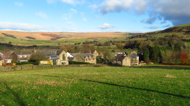
Delph Greave is a quaint village nestled in the picturesque countryside of Yorkshire, England. Located in the Ryedale district, this charming hamlet is renowned for its idyllic landscapes, historical landmarks, and welcoming community.

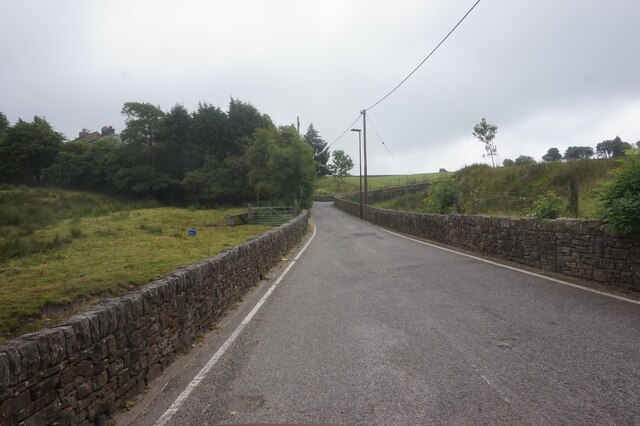
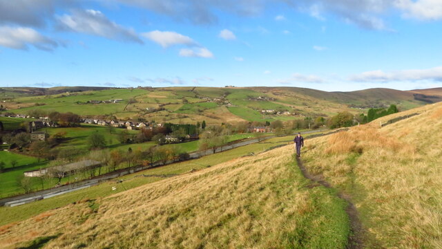
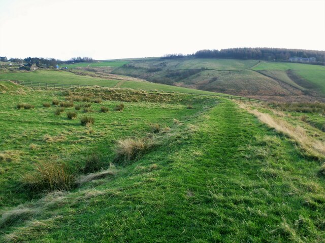
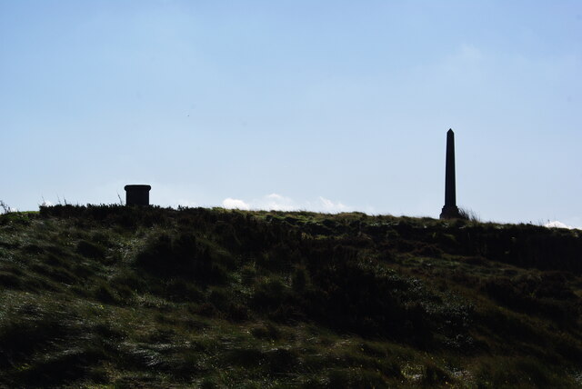
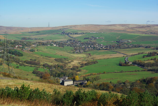
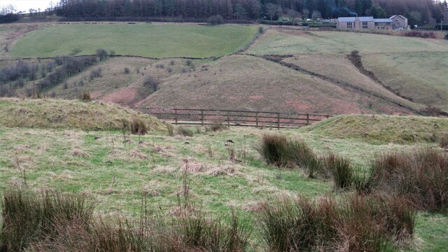
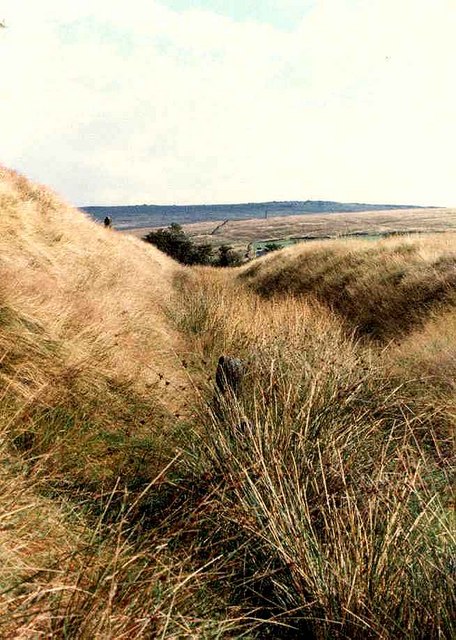
Surrounded by rolling hills and lush green fields, Delph Greave offers a tranquil escape from the hustle and bustle of city life. Visitors are captivated by the unspoiled beauty of the area, with its meandering streams, ancient woodlands, and vibrant wildflowers.

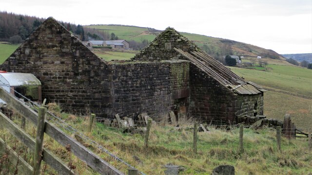
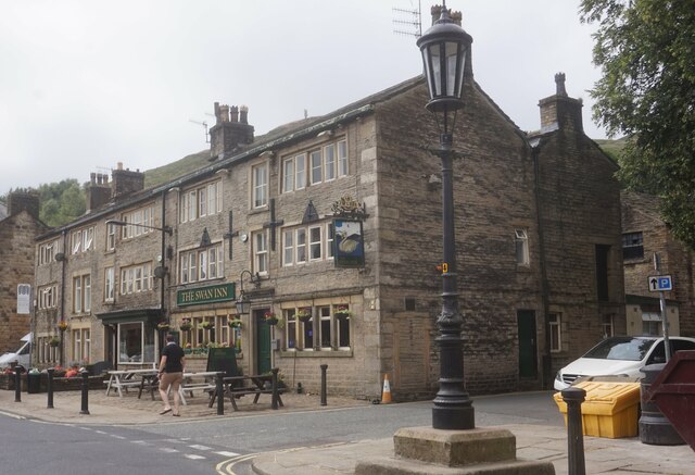
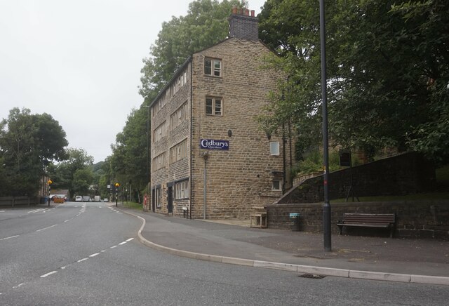
The village itself is characterized by its traditional stone-built houses, many of which date back to the 18th and 19th centuries, giving it a timeless charm. Delph Greave boasts a small but vibrant community, where locals take pride in preserving their heritage and maintaining a close-knit atmosphere.

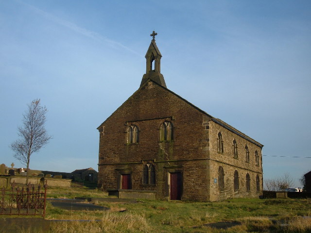
Notable landmarks in Delph Greave include the historic St. Mary's Church, a beautiful medieval structure that stands as a testament to the village's rich history. The church is renowned for its stunning stained-glass windows and intricate stone carvings.

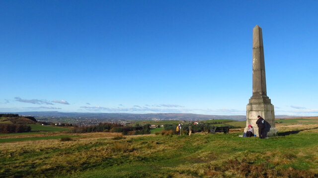
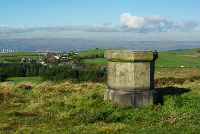
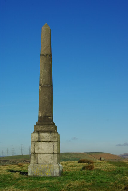
Outdoor enthusiasts are spoiled for choice in Delph Greave, with an abundance of walking trails and cycling routes that offer breathtaking views of the surrounding countryside. The nearby Delph Greave Moor provides an opportunity for nature lovers to explore the diverse flora and fauna native to the area.

Delph Greave truly embodies the essence of rural Yorkshire, offering a serene retreat where visitors can immerse themselves in the natural beauty and rich history of this enchanting village.

If you have any feedback on the listing, please let us know in the comments section below.
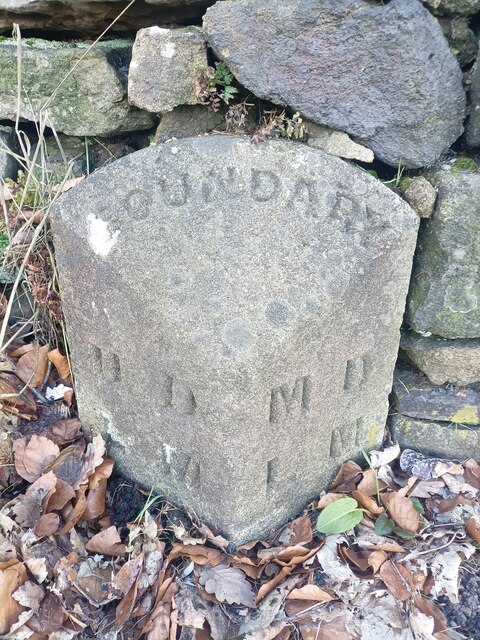
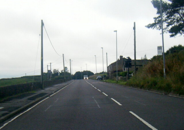
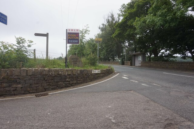
Delph Greave Images

Images are sourced within 2km of 53.573963/-2.0243053 or Grid Reference SD9808. Thanks to Geograph Open Source API. All images are credited.

Barn at Higher Castleshaw Awaiting renovation?
Barn at Higher Castleshaw
Awaiting renovation?
Old Boundary Marker on the A62 Huddersfield Road Municipal Boundary Marker against a stone wall east of the Saddleworth Hotel, on the south side of the A62 Huddersfield Road. Saddleworth parish. Inscribed U D / L M (Upper Division Lords Mere) and M D / L M (Middle Division Lords Mere). Lords Mere was a former sub division of Saddleworth, and was divided into Upper, Middle and Lower Divisions. Reference <span class="nowrap"><a title="https://www.yorkshiremilestones.co.uk/2020/08/12/saddleworth-boundary-stones/" rel="nofollow ugc noopener" href="https://www.yorkshiremilestones.co.uk/2020/08/12/saddleworth-boundary-stones/">Link</a><img style="margin-left:2px;" alt="External link" title="External link - shift click to open in new window" src="https://s1.geograph.org.uk/img/external.png" width="10" height="10"/></span>.

Milestone Society National ID: YW_HUOD12pb
Old Boundary Marker on the A62 Huddersfield Road
Municipal Boundary Marker against a stone wall east of the Saddleworth Hotel, on the south side of the A62 Huddersfield Road. Saddleworth parish. Inscribed U D / L M (Upper Division Lords Mere) and M D / L M (Middle Division Lords Mere). Lords Mere was a former sub division of Saddleworth, and was divided into Upper, Middle and Lower Divisions. Reference LinkExternal link. Milestone Society National ID: YW_HUOD12pb
A672 at Old Tame
A672 at Old Tame
Tame Lane at Denshaw Road
Tame Lane towards Heights Farm
The Swan Inn, Delph
The Swan Inn, Delph
Oldham Road A62, Delph
Houses on Delph New Road
Obelisk at Bishop Park, Grains Bar The obelisk was erected in 1927 by Ellen Ludlaw in memory of William and Anne Bishop when fifty acres of their land was given to the people of Oldham to enjoy as public open space.
Obelisk at Bishop Park, Grains Bar
The obelisk was erected in 1927 by Ellen Ludlaw in memory of William and Anne Bishop when fifty acres of their land was given to the people of Oldham to enjoy as public open space.
Houses on Delph Lane, Upper Dale, Delph
Path leading up from A62 Huddersfield Road to Harrop Edge Lane
Castleshaw Roman Fort Remains View along the inner west rampart. The Saddleworth Hotel on the A62 can just be seen top right.
Castleshaw Roman Fort Remains
View along the inner west rampart. The Saddleworth Hotel on the A62 can just be seen top right.
Wotherhead Hill Obelisk, Grains Bar The Obelisk and what appears to be a damaged panorama table in Bishop Park
Wotherhead Hill Obelisk, Grains Bar
The Obelisk and what appears to be a damaged panorama table in Bishop Park
River Tame Valley The view from Bishop Park up the valley from Slackcote to Denshaw village
River Tame Valley
The view from Bishop Park up the valley from Slackcote to Denshaw village
Panorama Table? What appears to be a panorama table with just the stone plinth remaining in Bishop Park. Grains Bar is beyond
Panorama Table?
What appears to be a panorama table with just the stone plinth remaining in Bishop Park. Grains Bar is beyond
Wotherhead Hill Obelisk At the summit of Bishop Park, Grains Bar
Wotherhead Hill Obelisk
At the summit of Bishop Park, Grains Bar
Castleshaw Roman Fort Entrance The entrance in the inner ramparts on the south of the site
Castleshaw Roman Fort Entrance
The entrance in the inner ramparts on the south of the site
Bishop Park Trig Point Flush Bracket S2769
Show me another place!

Delph Greave is located at Grid Ref: SD9808 (Lat: 53.573963, Lng: -2.0243053)

Division: West Riding

Unitary Authority: Oldham

Police Authority: Greater Manchester

What 3 Words

///roost.grinders.riverboat. Near Delph, Manchester

Related Wikis

Heights, Greater Manchester

Heights is a hamlet in the Saddleworth parish of the Metropolitan Borough of Oldham, in Greater Manchester, England. It is directly north of Delph, and...

St Thomas' Church, Friarmere

St Thomas' Church, Friarmere, also known as Heights Chapel, is a redundant Anglican church standing on a hillside overlooking the village of Delph, Greater...

Delph

Delph (Old English (ge)delf a quarry) is a village in the civil parish of Saddleworth in the Metropolitan Borough of Oldham, in Greater Manchester, England...

Delph railway station

Delph railway station served the village of Delph, Oldham, in what is now Greater Manchester, United Kingdom, between 1851 and 1955. == History == The...

Castleshaw Roman Fort

Castleshaw Roman fort was a castellum in the Roman province of Britannia. Although there is no evidence to substantiate the claim, it has been suggested...

Measurements Halt railway station

Measurements Halt railway station was opened on 18 July 1932 as part of the former London and North Western Railway route from Oldham to Delph. The station...

Castleshaw

Castleshaw is a hamlet in the Saddleworth parish of the Metropolitan Borough of Oldham in Greater Manchester, England. It lies amid the Pennines, 2.4 miles...

Dobcross

Dobcross is a village in the civil parish of Saddleworth in the Metropolitan Borough of Oldham in Greater Manchester, England. It is in a valley in the...

Nearby Amenities

Located within 500m of 53.573963,-2.0243053
Bus Stop
Carrcote, Denshaw Road / near Lodge Lane
Bus: yes
Naptan AtcoCode: 1800ED12311
Naptan Bearing: E
Naptan CommonName: Denshaw Road/Lodge Lane
Naptan Indicator: Opp School
Naptan Landmark: HOUSE 8
Naptan NaptanCode: manamtgw
Naptan PlusbusZoneRef: MNCRPIC
Naptan ShortCommonName: Lodge Lane
Naptan Street: DENSHAW ROAD
Naptan Verified: no
Network: TfGM
Public Transport: platform
Source: naptan_import
Lat/Long: 53.5696453/-2.0255346
Bus Stop
Denshaw Road/Lodge Lane
Bus: yes
Naptan AtcoCode: 1800ED12321
Naptan Bearing: W
Naptan CommonName: Denshaw Road/Lodge Lane
Naptan Indicator: Nr School
Naptan Landmark: SCHOOL
Naptan NaptanCode: manamtja
Naptan PlusbusZoneRef: MNCRPIC
Naptan ShortCommonName: Lodge Lane
Naptan Street: DENSHAW ROAD
Naptan Verified: no
Network: TfGM
Public Transport: platform
Source: naptan_import
Lat/Long: 53.5695734/-2.0257158
Bus Stop
Carrcote, Denshaw Road / near Friarmere Road
Bus: yes
Naptan AtcoCode: 1800ED12331
Naptan Bearing: E
Naptan CommonName: Denshaw Road/Friarmere Road
Naptan Indicator: Opp School
Naptan Landmark: HOUSE 40
Naptan NaptanCode: manamtjd
Naptan PlusbusZoneRef: MNCRPIC
Naptan ShortCommonName: Friarmere Road
Naptan Street: DENSHAW ROAD
Naptan Verified: no
Network: TfGM
Operator: TfGM
Public Transport: platform
Source: naptan_import
Lat/Long: 53.5698696/-2.0274072
Bus Stop
Carrcote, Friarmere Road / opposite Roche Road
Bus: yes
Naptan AtcoCode: 1800ED12351
Naptan Bearing: SW
Naptan CommonName: Friarmere Road/Roche Road
Naptan Indicator: Opp House 3
Naptan Landmark: HOUSE 2
Naptan NaptanCode: manamtjm
Naptan PlusbusZoneRef: MNCRPIC
Naptan ShortCommonName: Roche Road
Naptan Street: FRIARMERE ROAD
Naptan Verified: no
Network: TfGM
Operator: TfGM
Public Transport: platform
Source: naptan_import
Lat/Long: 53.5703242/-2.0274275
Bus Stop
Carrcote, Lodge Lane / near Denshaw Road
Bus: yes
Naptan AtcoCode: 1800ED12361
Naptan Bearing: NW
Naptan CommonName: Lodge Lane/Denshaw Road
Naptan Indicator: Nr Open Land
Naptan Landmark: HOUSE 1
Naptan NaptanCode: manamtjp
Naptan PlusbusZoneRef: MNCRPIC
Naptan ShortCommonName: Denshaw Road
Naptan Street: LODGE LANE
Naptan Verified: no
Network: TfGM
Operator: TfGM
Public Transport: platform
Source: naptan_import
Lat/Long: 53.5698611/-2.0250515
Noexit: yes
Lat/Long: 53.5713531/-2.0257716
Noexit: yes
Lat/Long: 53.5708355/-2.0279881
Noexit: yes
Lat/Long: 53.5708804/-2.0256066
Noexit: yes
Lat/Long: 53.5710557/-2.0274673
Post Box
Operator: Royal Mail
Post Box Type: lamp
Ref: OL3 231
Royal Cypher: EIIR
Royal Cypher Wikidata: Q33102113
Source: survey
Survey Date: 2015-05-19
Lat/Long: 53.5710468/-2.0199139
Power: pole
Lat/Long: 53.5750056/-2.0252901
Generator Method: photovoltaic
Generator Output Electricity: yes
Generator Source: solar
Generator Type: solar_photovoltaic_panel
Location: roof
Power: generator
Lat/Long: 53.5726302/-2.0186648
Material: wood
Power: pole
Lat/Long: 53.5728343/-2.017736
Power: pole
Lat/Long: 53.5723909/-2.020742
Power: pole
Lat/Long: 53.5728293/-2.0225697
Power: pole
Lat/Long: 53.5731098/-2.023697
Power: pole
Lat/Long: 53.5733633/-2.0247932
Power: pole
Lat/Long: 53.5737689/-2.0252323
Power: pole
Lat/Long: 53.5742915/-2.0258217
Power: pole
Lat/Long: 53.5747671/-2.0263807
Power: pole
Lat/Long: 53.5726172/-2.0216431
Power: pole
Lat/Long: 53.5770788/-2.0289539
Power: pole
Lat/Long: 53.5752889/-2.0269257
Power: pole
Lat/Long: 53.5757312/-2.0274269
Power: pole
Lat/Long: 53.5762383/-2.0280015
Power: pole
Lat/Long: 53.5767243/-2.0285522
Ford: yes
Lat/Long: 53.573098/-2.0196111
Bus Stop
Delph Lane
Bus: yes
Naptan AtcoCode: 1800EDH3791
Naptan Bearing: NE
Naptan CommonName: Delph Lane
Naptan Indicator: NE-bound
Naptan Street: Delph Lane
Naptan Verified: no
Network: TfGM
Public Transport: platform
Source: naptan;bing;naptan_compare_tool
Lat/Long: 53.5706217/-2.0210719
The data included in this document is from www.openstreetmap.org. The data is made available under ODbL.

Have you been to Delph Greave?

Leave your review of Delph Greave below (or comments, questions and feedback).