Bridge End

Settlement in Derbyshire Derbyshire Dales

England

Bridge End

Bridges over the River Derwent The bridge on the left carried the old main road from Baslow before it was replaced by a new Calver Bridge. The bridge on the right is a footbridge.
Bridges over the River Derwent Credit: Bill Boaden

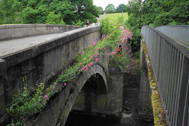
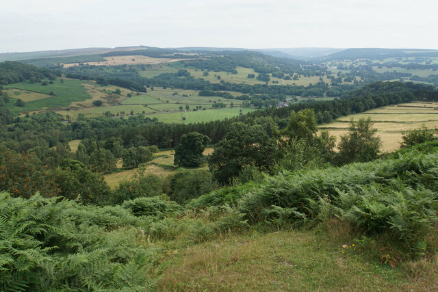
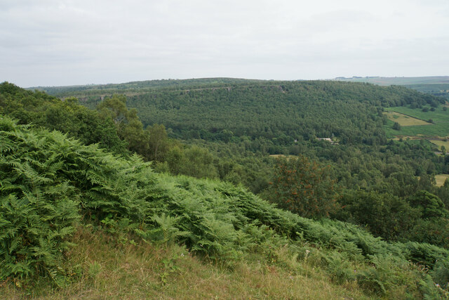
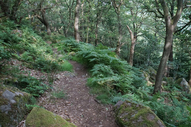
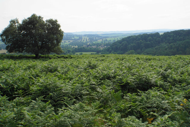
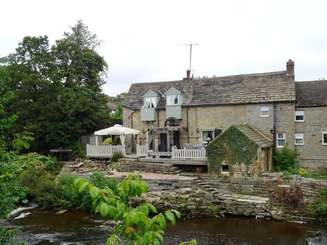
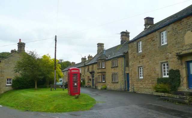
Bridge End is a small village located in Derbyshire, England. Situated on the banks of the River Derwent, it is nestled within the picturesque countryside of the Peak District National Park. The village is known for its idyllic setting, offering stunning views of rolling hills, lush green meadows, and charming stone cottages.

Bridge End is a close-knit community with a population of around 500 residents. The village has a rich history, dating back to medieval times when it served as a crossing point over the river. Today, it retains its traditional character, with many buildings still showcasing their original architectural features.

Despite its small size, Bridge End offers a range of amenities to its residents. The village has a local pub, The Bridge Inn, which serves as a meeting place for locals and visitors alike. There is also a village hall that hosts various community events, including fairs and social gatherings.

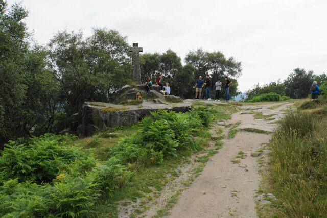
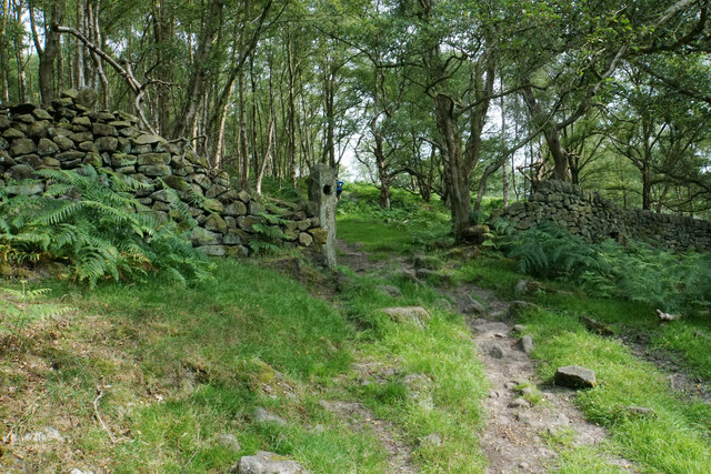
Nature enthusiasts are drawn to Bridge End due to its proximity to the Peak District. The village provides easy access to numerous walking trails and cycling routes, allowing visitors to explore the stunning natural beauty of the area. The nearby river is also popular for fishing and boating activities.

Overall, Bridge End is a tranquil and picturesque village that offers a peaceful retreat for those seeking a rural escape. Its natural beauty, rich history, and close-knit community make it a hidden gem within Derbyshire's stunning countryside.

If you have any feedback on the listing, please let us know in the comments section below.
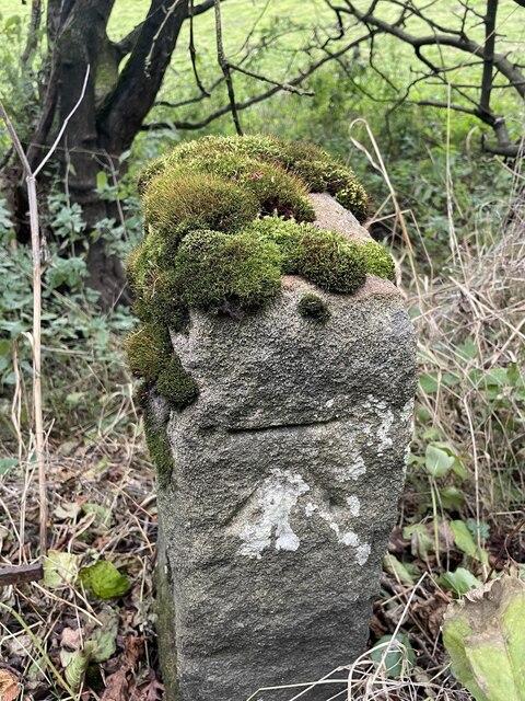
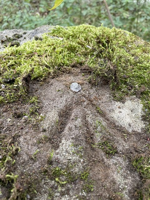
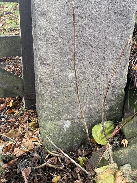
Bridge End Images

Images are sourced within 2km of 53.249922/-1.6214009 or Grid Reference SK2572. Thanks to Geograph Open Source API. All images are credited.

Bridges over the River Derwent The bridge on the left carried the old main road from Baslow before it was replaced by a new Calver Bridge. The bridge on the right is a footbridge.
Bridges over the River Derwent
The bridge on the left carried the old main road from Baslow before it was replaced by a new Calver Bridge. The bridge on the right is a footbridge.
Wellington's Monument Now that the trees have grown up, the monument no longer has the commanding views over the Derwent valley. There are often a lot of people around it.
Wellington's Monument
Now that the trees have grown up, the monument no longer has the commanding views over the Derwent valley. There are often a lot of people around it.
Blackstone Edge The top of the edge near Wellington's Monument with a view down the Derwent valley.
Blackstone Edge
The top of the edge near Wellington's Monument with a view down the Derwent valley.
Blackstone Edge The line of Gardom's Edge is prominent on the other side of Bar Brook, with Birchen Edge above that.
Blackstone Edge
The line of Gardom's Edge is prominent on the other side of Bar Brook, with Birchen Edge above that.
Path below Blackstone Edge Having battled through head-high ferns, this part of the path is a very pleasant descent through woodland.
Path below Blackstone Edge
Having battled through head-high ferns, this part of the path is a very pleasant descent through woodland.
See of ferns below Gardom's Edge Looking down towards Baslow.
See of ferns below Gardom's Edge
Looking down towards Baslow.
Old gateway below Gardom's Edge The path is a steady climb up from Bar Brook.
Old gateway below Gardom's Edge
The path is a steady climb up from Bar Brook.
Lady Wall Well Lady Wall Well is on a corner of Bar Road, an old packhorse way to the top of Baslow Edge. "bar" is an old word for a steeply-climbing horse road. From the top of Baslow Edge, the old road continues on towards Chesterfield, for a way, before disappearing under modern tarmac.
Lady Wall Well
Lady Wall Well is on a corner of Bar Road, an old packhorse way to the top of Baslow Edge. "bar" is an old word for a steeply-climbing horse road. From the top of Baslow Edge, the old road continues on towards Chesterfield, for a way, before disappearing under modern tarmac.
Derwent Aqueduct access gates and discharge well The Derwent Aqueduct was laid to bring water from the Derwent to Derby, Nottingham and Leicester. Its line is marked by these distinctive access gates and, in this case, a discharge well. The building, in the background and in a neighbouring grid square, is a valve house.
Derwent Aqueduct access gates and discharge well
The Derwent Aqueduct was laid to bring water from the Derwent to Derby, Nottingham and Leicester. Its line is marked by these distinctive access gates and, in this case, a discharge well. The building, in the background and in a neighbouring grid square, is a valve house.
Former flour mill Hodgkinson's Corn Mill became disused in the early 20th century.
Former flour mill
Hodgkinson's Corn Mill became disused in the early 20th century.
Plantation Cottage A holiday cottage on the Chatsworth Estate
Plantation Cottage
A holiday cottage on the Chatsworth Estate
Sculpture or horse jumping fence  A permanent feature in the parkland used, I believe, when horse events take place.
Sculpture or horse jumping fence
A permanent feature in the parkland used, I believe, when horse events take place.
An avenue of lime trees in Chatsworth Park
Wellington Monument Probably there’s many similar photos of this monument on the site, but it's worth posting photos taken from this angle to monitor the height of trees behind over time - when I was a wee lad we could see the memorial clearly from the A619 below, and it stood proud on one side of the valley with the Nelson memorial on the other. It isn’t visible from the road now.
Wellington Monument
Probably there’s many similar photos of this monument on the site, but it's worth posting photos taken from this angle to monitor the height of trees behind over time - when I was a wee lad we could see the memorial clearly from the A619 below, and it stood proud on one side of the valley with the Nelson memorial on the other. It isn’t visible from the road now.
Baslow, A619, Thirteen Bends BM on post

SK 2420 7155
Baslow, A619, Thirteen Bends
BM on post SK 2420 7155
Baslow, A619, Thirteen Bends OS Rivet on gatepost 

SK 2392 7152
Baslow, A619, Thirteen Bends
OS Rivet on gatepost SK 2392 7152
Pilsley, Top Road OS BM on gatepost

SK 2436 7093
Pilsley, Top Road
OS BM on gatepost SK 2436 7093
Churchyard and church of St Anne, Baslow A Grade II* listed church dating from the 13th Century.
Churchyard and church of St Anne, Baslow
A Grade II* listed church dating from the 13th Century.
Show me another place!

Bridge End is located at Grid Ref: SK2572 (Lat: 53.249922, Lng: -1.6214009)

Administrative County: Derbyshire

District: Derbyshire Dales

Police Authority: Derbyshire

What 3 Words

///defenders.benched.dribble. Near Baslow, Derbyshire

Related Wikis

Baslow

Baslow is a village in Derbyshire, England, in the Peak District, situated between Sheffield and Bakewell, just over 1 mile (1.6 km) north of Chatsworth...

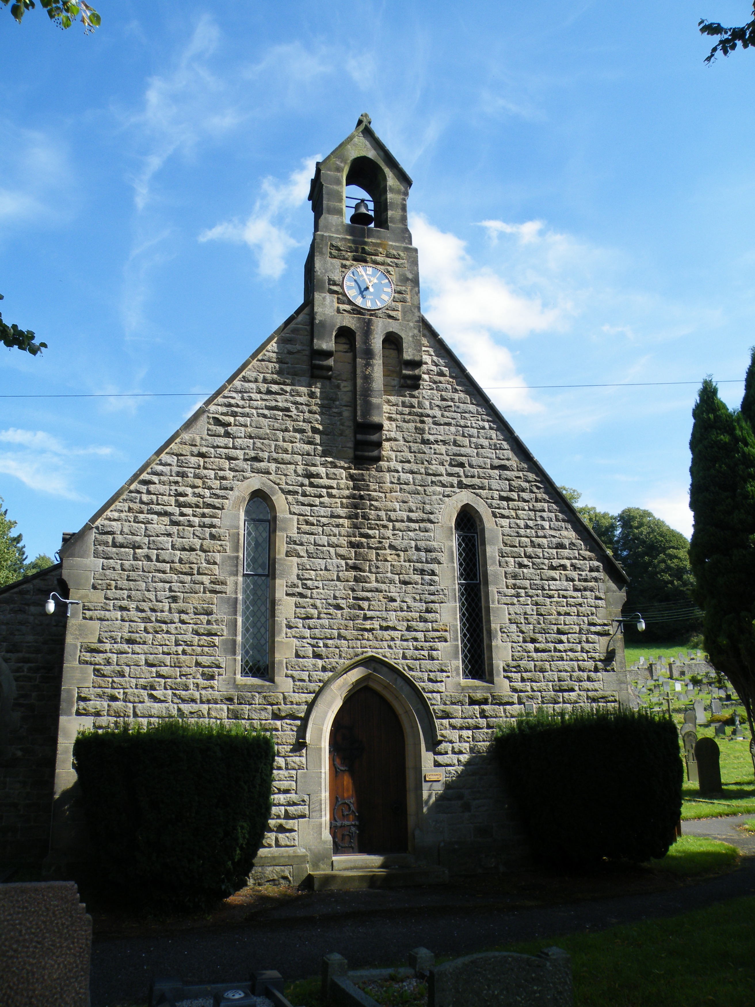
St Anne's Church, Baslow

St. Anne’s Church, Baslow, is a Grade II* listed parish church in Baslow, England. == History == The church dates from the thirteenth century. It was subject...

Baslow Hall

Baslow Hall is a Grade II listed building in Baslow, Derbyshire. == History == Baslow Hall, just off Calver Road, was built in 1907 to the designs of the...

Cliff College

Cliff College is a Christian theological college in Calver, Derbyshire, that teaches Biblical Theology at the undergraduate level and a number of mission...

Gardom's Edge

Gardom's Edge is a rocky outcrop near Baslow in Derbyshire, England. The shelf between Gardom's Edge and Birchen Edge is now moorland used for grazing...

All Saints' Church, Curbar

All Saints’ Church, Curbar is a Church of England parish church in Curbar, Derbyshire. == History == Until the church was built, the nearest parish church...

Curbar

Curbar is a village and civil parish in the Derbyshire Dales district of Derbyshire, England. The population based on the 2011 Census was 417. Curbar is...

Pilsley, Derbyshire Dales

Pilsley is a small village and civil parish in Derbyshire, England. At the 2011 Census the population of the civil parish was 152. It is close to Chatsworth...

Nearby Amenities

Located within 500m of 53.249922,-1.6214009
Crossing
Crossing: marked
Crossing Island: no
Tactile Paving: yes
Lat/Long: 53.2462211/-1.6203742
Baslow (White Lodge Lane)
Bus: yes
Public Transport: stop_position
Lat/Long: 53.2505244/-1.626563
Baslow
Is In: Derbyshire, England, UK
Place: village
Wikidata: Q4867787
Wikipedia: en:Baslow
Lat/Long: 53.2469579/-1.6201639
Bubnell
Created By: Potlatch 0.7b
Place: hamlet
Lat/Long: 53.2474996/-1.625923
Spar
Addr City: Bakewell
Addr Country: GB
Addr Housename: Matlock House
Addr Postcode: DE45 1RZ
Addr Street: School Lane
Addr Village: Baslow
Brand: Spar
Brand Wikidata: Q610492
Brand Wikipedia: en:SPAR (retailer)
Fhrs Id: 1627093
Shop: convenience
Website: https://www.spar.co.uk/store-locator/afb32163-spar-baslow/
Lat/Long: 53.249233/-1.618678
Cafe
Charlie's Cafe and Bistro
Addr City: Bakewell
Addr Postcode: DE45 1RY
Addr Street: Church Street
Addr Village: Baslow
Fhrs Id: 1626145
Lat/Long: 53.248007/-1.623666
Post Box
Brand: Royal Mail
Brand Wikidata: Q638098
Brand Wikipedia: en:Royal Mail
Operator: Royal Mail
Operator Wikidata: Q638098
Post Box Type: pillar
Ref: DE45 1290
Royal Cypher: GVIR
Royal Cypher Wikidata: Q33102169
Lat/Long: 53.2478545/-1.623643
Post Box
Ele: 127.7399902
Post Box Type: wall
Ref: DE45 1264
Lat/Long: 53.249115/-1.6175623
Bench
Ele: 127.7399902
Lat/Long: 53.2490321/-1.6175241
Telephone
Booth: K6
Covered: booth
Ele: 108.5137939
Heritage: yes
Listed Status: Grade II
Phone: +44 1246 582236
Wikidata: Q26619401
Lat/Long: 53.2478367/-1.6249264
Place Of Worship
Baslow Methodist Church
Denomination: methodist
Ele: 116.6848145
Religion: christian
Lat/Long: 53.2483078/-1.6207514
Bench
Ele: 119.0881348
Lat/Long: 53.2485004/-1.6198234
Baslow (Bubnell Lane)
Bus: yes
Public Transport: stop_position
Lat/Long: 53.2468761/-1.6250685
Mini Roundabout
Source: local_knowledge
Lat/Long: 53.2477156/-1.6229835
Fixme: Where does this path go to?
Lat/Long: 53.2495933/-1.6248438
Barrier: stile
Lat/Long: 53.2528389/-1.6158785
Historic: memorial
Memorial: war_memorial
Lat/Long: 53.2476705/-1.6232164
Barrier: stile
Material: stone
Source: survey;gps
Stile: squeezer
Lat/Long: 53.2475497/-1.6256296
Bench
Source: survey;gps
Lat/Long: 53.2476403/-1.6247402
Defibrillator
Access: yes
Check Date: 2023-03-09
Defibrillator Location: On outside wall. Available 24/7.
Emergency: defibrillator
Indoor: no
Opening Hours: 24/7
Ref GB The Circuit: D5C43D20-A10B-446E-B5D4-ADA3017258B1
Lat/Long: 53.2458807/-1.6203157
Defibrillator
Access: yes
Check Date: 2023-03-09
Emergency: defibrillator
Indoor: no
Lat/Long: 53.2492454/-1.618597
Post Office
Baslow Post Office
Addr City: Bakewell
Addr Country: GB
Addr Postcode: DE45 1RZ
Addr Street: School Lane
Addr Village: Baslow
Brand: Post Office
Brand Wikidata: Q1783168
Fhrs Id: 1627093
Opening Hours: Mo-Sa 08:00-20:00; Su 09:00-20:00
Operator: Spar
Ref Pol Id: 125716
Website: https://www.postoffice.co.uk/branch-finder/6084583/baslow
Lat/Long: 53.2491915/-1.6186266
Bus Stop
Baslow (Devonshire Bridge)
Bus: yes
Public Transport: platform
Lat/Long: 53.2459349/-1.6236766
Baslow (Devonshire Bridge)
Bus: yes
Public Transport: stop_position
Lat/Long: 53.2459017/-1.6236152
Bus Stop
Baslow (Church)
Bus: yes
Public Transport: platform
Lat/Long: 53.2478681/-1.6244855
Baslow (Church)
Bus: yes
Public Transport: stop_position
Lat/Long: 53.2479095/-1.6244828
Bus Stop
Baslow (Church)
Bus: yes
Public Transport: platform
Lat/Long: 53.2478781/-1.6239406
Baslow (Church)
Bus: yes
Public Transport: stop_position
Lat/Long: 53.2478426/-1.6239479
Bus Stop
Baslow (Bubnell Bridge)
Bench: no
Bus: yes
Naptan AtcoCode: 1000DBBB3198
Naptan NaptanCode: dbsgwjaw
Public Transport: platform
Shelter: no
Lat/Long: 53.2479058/-1.624963
Baslow (Bubnell Bridge)
Bus: yes
Public Transport: stop_position
Lat/Long: 53.2478931/-1.624927
Bus Stop
Baslow (Bubnell Lane)
Bus: yes
Public Transport: platform
Lat/Long: 53.2468557/-1.6251464
Bus Stop
Baslow (Bubnell Lane)
Bus: yes
Public Transport: platform
Lat/Long: 53.2467444/-1.6249126
Baslow (Bubnell Lane)
Bus: yes
Public Transport: stop_position
Lat/Long: 53.2467378/-1.6249859
Bus Stop
Baslow (White Lodge Lane)
Bus: yes
Naptan AtcoCode: 1000DBCR3199
Naptan NaptanCode: dbsagptm
Public Transport: platform
Lat/Long: 53.2498807/-1.6264898
Baslow (White Lodge Lane)
Bus: yes
Public Transport: stop_position
Lat/Long: 53.2498934/-1.6263926
Bus Stop
Baslow (White Lodge Lane)
Bus: yes
Public Transport: platform
Lat/Long: 53.2505144/-1.6264755
Generator Method: photovoltaic
Generator Output Electricity: yes
Generator Source: solar
Generator Type: solar_photovoltaic_panel
Location: roof
Power: generator
Lat/Long: 53.2526819/-1.6245903
Generator Method: photovoltaic
Generator Output Electricity: yes
Generator Source: solar
Generator Type: solar_photovoltaic_panel
Location: roof
Power: generator
Lat/Long: 53.2515858/-1.6240163
Generator Method: photovoltaic
Generator Output Electricity: yes
Generator Source: solar
Generator Type: solar_photovoltaic_panel
Location: roof
Power: generator
Lat/Long: 53.2516693/-1.6232599
Generator Method: photovoltaic
Generator Output Electricity: yes
Generator Source: solar
Generator Type: solar_photovoltaic_panel
Location: roof
Power: generator
Lat/Long: 53.2514322/-1.6238641
Generator Method: photovoltaic
Generator Output Electricity: yes
Generator Source: solar
Generator Type: solar_photovoltaic_panel
Location: roof
Power: generator
Lat/Long: 53.2495108/-1.6217257
Generator Method: photovoltaic
Generator Output Electricity: yes
Generator Source: solar
Generator Type: solar_photovoltaic_panel
Location: roof
Power: generator
Lat/Long: 53.249417/-1.6160727
Generator Method: photovoltaic
Generator Output Electricity: yes
Generator Source: solar
Generator Type: solar_photovoltaic_panel
Location: roof
Power: generator
Lat/Long: 53.2486936/-1.6162179
Bench
Backrest: yes
Lat/Long: 53.2472833/-1.624252
Bench
Backrest: yes
Lat/Long: 53.2473577/-1.6243146
Entrance: yes
Lat/Long: 53.2472964/-1.6241715
Parking
Capacity: 4
Fee: no
Lat/Long: 53.2478688/-1.6246697
Barrier: stile
Step Count: 1
Stile: stepover
Lat/Long: 53.2460227/-1.6195155
Bench
Backrest: yes
Lat/Long: 53.2477322/-1.6237008
The data included in this document is from www.openstreetmap.org. The data is made available under ODbL.

Have you been to Bridge End?

Leave your review of Bridge End below (or comments, questions and feedback).