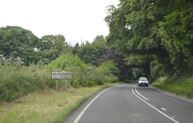
Blounce

Settlement in Hampshire Hart

England

Blounce

Farmland, South Warnborough A clump of trees mark the site of an old pit.
Farmland, South Warnborough Credit: Andrew Smith

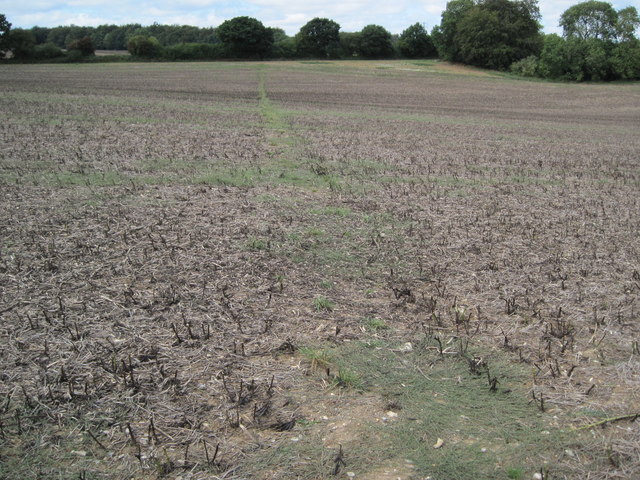
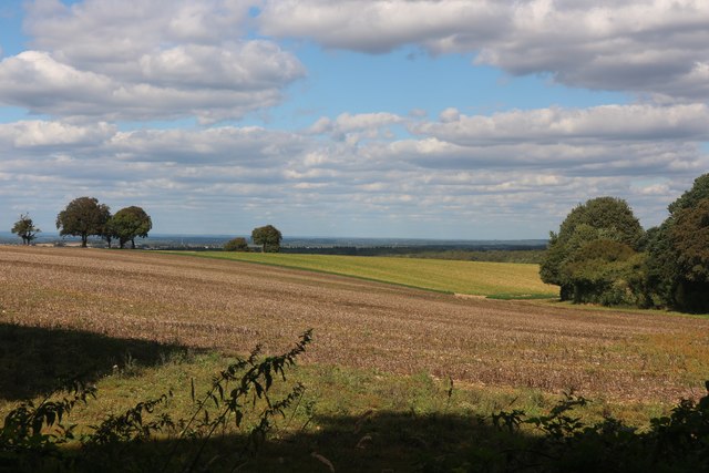
Blounce is a small village located in the county of Hampshire, England. Situated in the rural countryside, it is surrounded by picturesque landscapes and natural beauty. The village is home to a population of approximately 300 residents, creating a close-knit and friendly community.

Blounce boasts a rich history that dates back several centuries. The village is known for its historic buildings and landmarks, including the St. Mary's Church, which was built in the 12th century and still stands as a prominent architectural marvel. The church is a popular tourist attraction, attracting visitors from near and far.

The village is also renowned for its annual summer fair, which has become a beloved tradition amongst both locals and tourists. The fair features various stalls, live music, and entertainment, providing a fun-filled day for all ages.

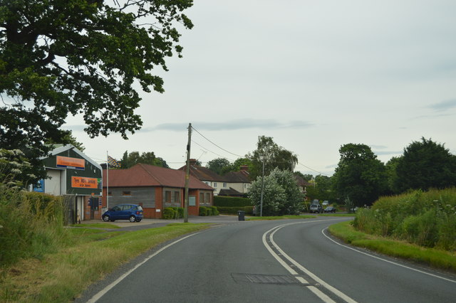
Blounce is well-served by a range of amenities, including a village hall, a primary school, and a local pub, which serves as a social hub for residents. The village also benefits from excellent transport links, with regular bus services connecting it to nearby towns and cities.

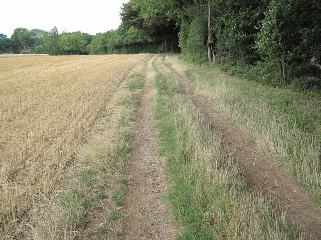
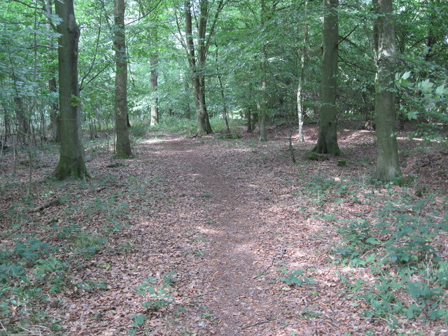
The surrounding countryside offers numerous opportunities for outdoor activities and recreation. There are several walking and cycling trails that allow residents and visitors to explore the beautiful countryside, making it a paradise for nature lovers.

Overall, Blounce is a charming village that combines history, natural beauty, and a strong sense of community. It provides a peaceful and idyllic setting for those looking to escape the hustle and bustle of city life.

If you have any feedback on the listing, please let us know in the comments section below.
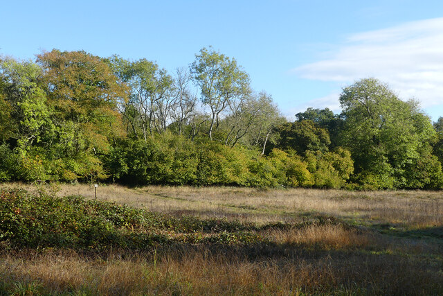
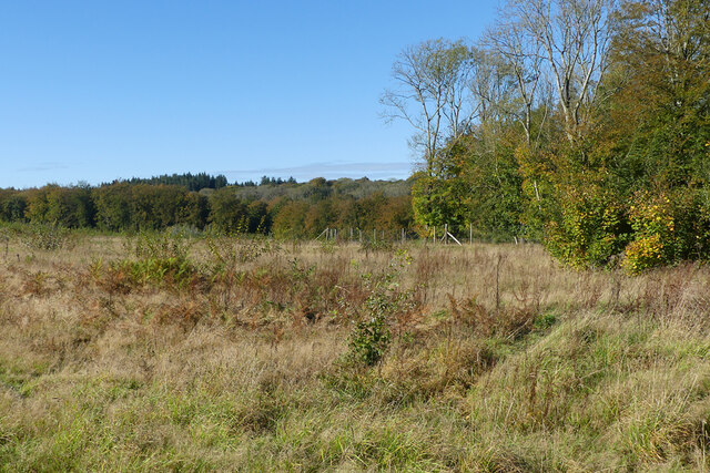
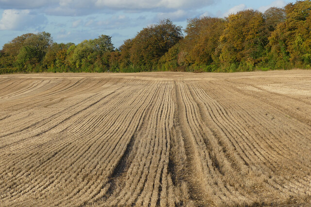
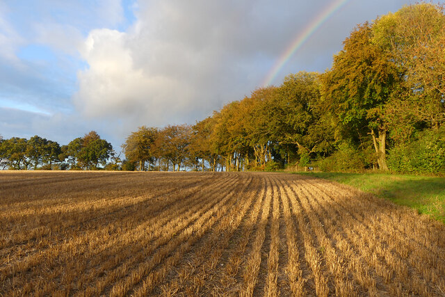
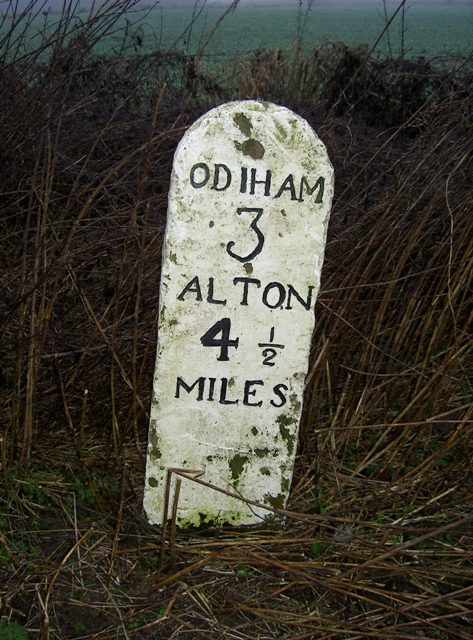
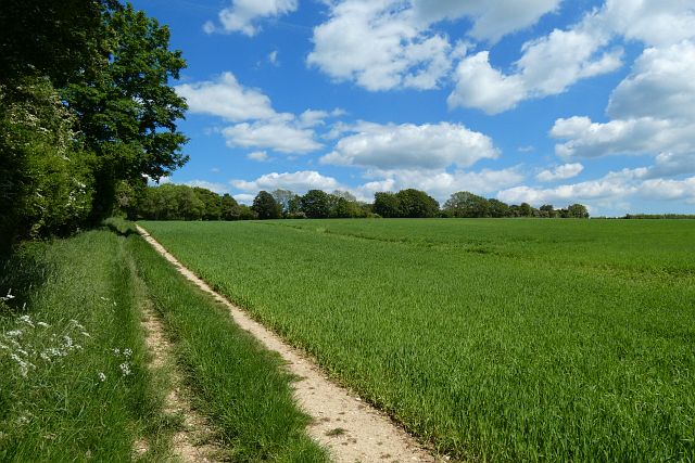
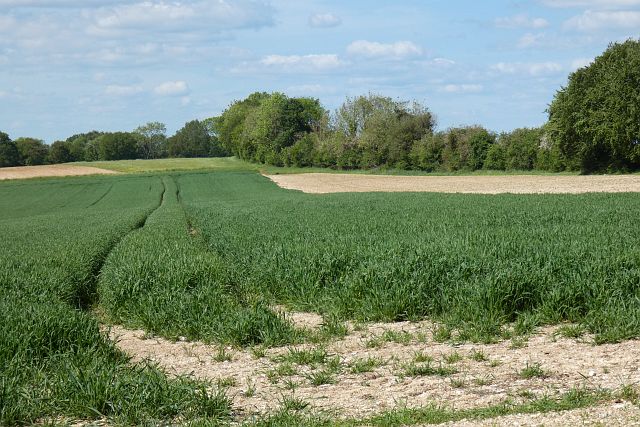
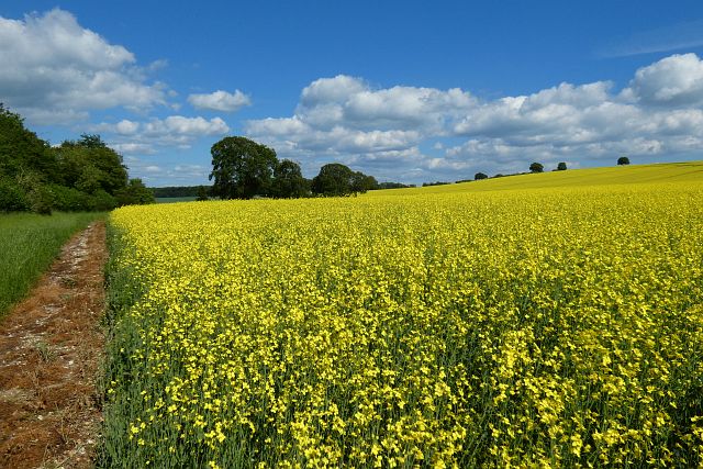
Blounce Images

Images are sourced within 2km of 51.202026/-0.98006467 or Grid Reference SU7145. Thanks to Geograph Open Source API. All images are credited.

Farmland, South Warnborough A clump of trees mark the site of an old pit.
Farmland, South Warnborough
A clump of trees mark the site of an old pit.
Woodland clearing, Upton Grey In woods to the west of Humbly Grove.
Woodland clearing, Upton Grey
In woods to the west of Humbly Grove.
Woodland, Weston Patrick Although there are few trees in the foreground, this clearing has been replanted.
Woodland, Weston Patrick
Although there are few trees in the foreground, this clearing has been replanted.
Farmland, South Warnborough Stubble to the east of Swainshill Farm.
Farmland, South Warnborough
Stubble to the east of Swainshill Farm.
Farmland, South Warnborough Stubble, autumnal beeches and a rainbow to the north-west of Swainshill Farm.
Farmland, South Warnborough
Stubble, autumnal beeches and a rainbow to the north-west of Swainshill Farm.
Entering Blounce, B3349 The B3349 runs 27 miles from Alton <a href="https://www.geograph.org.uk/photo/5212600">SU7038 : Junction of A339 & B3349</a> to Wokingham.
<span class="nowrap"><a title="http://www.sabre-roads.org.uk/wiki/index.php?title=B3349" rel="nofollow ugc noopener" href="http://www.sabre-roads.org.uk/wiki/index.php?title=B3349">Link</a><img style="margin-left:2px;" alt="External link" title="External link - shift click to open in new window" src="https://s1.geograph.org.uk/img/external.png" width="10" height="10"/></span>
Entering Blounce, B3349
The B3349 runs 27 miles from Alton SU7038 : Junction of A339 & B3349 to Wokingham. LinkExternal link
B3349, northbound The B3349 runs 27 miles from Alton <a href="https://www.geograph.org.uk/photo/5212600">SU7038 : Junction of A339 & B3349</a> to Wokingham.
<span class="nowrap"><a title="http://www.sabre-roads.org.uk/wiki/index.php?title=B3349" rel="nofollow ugc noopener" href="http://www.sabre-roads.org.uk/wiki/index.php?title=B3349">Link</a><img style="margin-left:2px;" alt="External link" title="External link - shift click to open in new window" src="https://s1.geograph.org.uk/img/external.png" width="10" height="10"/></span>
B3349, northbound
The B3349 runs 27 miles from Alton SU7038 : Junction of A339 & B3349 to Wokingham. LinkExternal link
Long Lane Bridleway towards Weston Patrick
Path in Closedown Wood
Path towards Weston Common
Field by Sowcroft Lane
Old Milestone by the B3349, Blounce, South Warnborough Parish Carved stone post by the B3349, in parish of SOUTH WARNBOROUGH (HART District), Blounce, on grass verge between road and ditch, on West side of road. Hook pillar, erected by the Basingstoke, Hartfordbridge & Blackwater (and Odiham) turnpike trust in the 19th century. 

Inscription reads:-
ODIHAM
4
ALTON
4
MILES
Carved benchmark.

Milestone Society National ID: HA_ODAL04.
Old Milestone by the B3349, Blounce, South Warnborough Parish
Carved stone post by the B3349, in parish of SOUTH WARNBOROUGH (HART District), Blounce, on grass verge between road and ditch, on West side of road. Hook pillar, erected by the Basingstoke, Hartfordbridge & Blackwater (and Odiham) turnpike trust in the 19th century. Inscription reads:- ODIHAM 4 ALTON 4 MILES Carved benchmark. Milestone Society National ID: HA_ODAL04.
Old Milestone by the B3349, Golden Pot, Shalden Parish Concrete post by the B3349, in parish of SHALDEN (EAST HAMPSHIRE District), Golden Pot, on grass verge between road and ditch, on West side of road. Hook pillar, erected by the Basingstoke, Hartfordbridge & Blackwater (and Odiham) turnpike trust in the 19th century. Plate broken.

Inscription reads:- : 5 / MILES FROM / ODIHAM / 3 TO / Alton : : W.F. Blake. :

Milestone Society National ID: HA_ODAL05.
Old Milestone by the B3349, Golden Pot, Shalden Parish
Concrete post by the B3349, in parish of SHALDEN (EAST HAMPSHIRE District), Golden Pot, on grass verge between road and ditch, on West side of road. Hook pillar, erected by the Basingstoke, Hartfordbridge & Blackwater (and Odiham) turnpike trust in the 19th century. Plate broken. Inscription reads:- : 5 / MILES FROM / ODIHAM / 3 TO / Alton : : W.F. Blake. : Milestone Society National ID: HA_ODAL05.
Old Milestone by the B3349, South Warnborough parish Carved stone post by the B3349, in parish of SOUTH WARNBOROUGH (HART District), near Park Copse, on grass verge between road and ditch, on West side of road, near junction with Westers Lane. Hook pillar, erected by the Basingstoke, Hartfordbridge & Blackwater (and Odiham) turnpike trust in the 19th century. 

Inscription reads:-
ODIHAM
3
ALTON
4½
MILES
Carved benchmark and rivet on top.

Milestone Society National ID: HA_ODAL03.
Old Milestone by the B3349, South Warnborough parish
Carved stone post by the B3349, in parish of SOUTH WARNBOROUGH (HART District), near Park Copse, on grass verge between road and ditch, on West side of road, near junction with Westers Lane. Hook pillar, erected by the Basingstoke, Hartfordbridge & Blackwater (and Odiham) turnpike trust in the 19th century. Inscription reads:- ODIHAM 3 ALTON 4½ MILES Carved benchmark and rivet on top. Milestone Society National ID: HA_ODAL03.
Farmland, Upton Grey With a footpath climbing eastwards from the road to Humbly Grove.
Farmland, Upton Grey
With a footpath climbing eastwards from the road to Humbly Grove.
Farmland, Upton Grey A crop of wheat to the east of Humbly Grove.
Farmland, Upton Grey
A crop of wheat to the east of Humbly Grove.
Farmland, South Warnborough Oil-seed rape still vibrant somewhat later than most in the region.
Farmland, South Warnborough
Oil-seed rape still vibrant somewhat later than most in the region.
Woodland, Weston Patrick An area of beeches in the mixed woodland of Weston Common.
Woodland, Weston Patrick
An area of beeches in the mixed woodland of Weston Common.
Show me another place!

Blounce is located at Grid Ref: SU7145 (Lat: 51.202026, Lng: -0.98006467)

Administrative County: Hampshire

District: Hart

Police Authority: Hampshire

What 3 Words

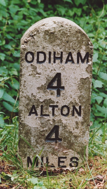
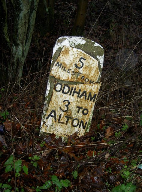
///however.yelled.hothouse. Near Long Sutton, Hampshire

Nearby Locations

Blounce

Related Wikis

Holybourne Hill

Holybourne Hill or Holybourne Down is one of the highest points in the county of Hampshire, England, and in the Hampshire Downs, rising to 225 metres...

Golden Pot

Golden Pot is a hamlet in the East Hampshire district of Hampshire, England. It lies 2.4 miles (3.9 km) north of Alton, on the B3349 road. The nearest...

South Warnborough

South Warnborough (grid reference SU722473) is a small village and civil parish in the English county of Hampshire. In the 2001 census, the population...

Blounce

Blounce is a small hamlet in the civil parish of South Warnborough in the Hart district of Hampshire, England. It lies on the B3349 road in between Alton...

Nearby Amenities

Located within 500m of 51.202026,-0.98006467
HUMBLYGROVEX2
Man Made: petroleum_well
Source: DECC
Lat/Long: 51.1977222/-0.9815833
HUMBLYGROVENO1
Disused: yes
Man Made: petroleum_well
Ref GB Decc: LR/21-1
Source: DECC
Lat/Long: 51.1978611/-0.9815556
HUMBLYGROVEX1;HUMBLYGROVEX3;HUMBLYGROVEX4;HUMBLYGROVEX5
Disused: yes
Man Made: petroleum_well
Ref GB Decc: LR/21-X1;LR/21-X3;LR/21-X4;LR/21-X5
Source: DECC
Lat/Long: 51.1978333/-0.9815833
HUMBLYGROVE-X1R;HUMBLYGROVEX6
Disused: yes
Man Made: petroleum_well
Ref GB Decc: LR/21-X6;LR/21-X7
Source: DECC
Lat/Long: 51.1981389/-0.9815556
Bus Stop
Goodhope Farm
Bus: yes
Naptan AtcoCode: 1900HAA19747
Naptan Bearing: SW
Naptan CommonName: Goodhope Farm
Naptan NaptanCode: hamjgpdj
Naptan Street: B3349
Naptan Verified: no
Public Transport: platform
Source: naptan_import
Lat/Long: 51.2045681/-0.9778254
Bus Stop
Goodhope Farm
Bus: yes
Naptan AtcoCode: 1900HAA19748
Naptan Bearing: NE
Naptan CommonName: Goodhope Farm
Naptan NaptanCode: hamjgpdm
Naptan Street: B3349
Naptan Verified: no
Public Transport: platform
Source: naptan_import
Lat/Long: 51.2047301/-0.9778361
Addr Housenumber: Blounce Farm
Source: NPE
Lat/Long: 51.2031066/-0.9806393
Historic: milestone
Lat/Long: 51.202243/-0.9800555
Blounce
Place: hamlet
Wikidata: Q4928485
Lat/Long: 51.2026493/-0.9811522
Post Box
Fixme: details
Source: seen while cycling
Lat/Long: 51.2019555/-0.9804343
Blounce Cottage
Place: isolated_dwelling
Source: Bing
Wikidata: Q26562111
Lat/Long: 51.2031429/-0.9795087
Hazelfield Kennels
Place: isolated_dwelling
Source: Bing
Lat/Long: 51.1996898/-0.9797154
Pepys Barn
Place: farm
Source: Bing
Lat/Long: 51.2030716/-0.9810817
Man Made: utility_pole
Lat/Long: 51.2001222/-0.978724
Man Made: utility_pole
Lat/Long: 51.2011263/-0.9782713
Man Made: utility_pole
Lat/Long: 51.2021417/-0.9778257
Man Made: utility_pole
Lat/Long: 51.2031903/-0.9773447
Man Made: utility_pole
Lat/Long: 51.2025253/-0.978605
Man Made: utility_pole
Lat/Long: 51.2015616/-0.9767319
Man Made: utility_pole
Lat/Long: 51.2009987/-0.9756666
Man Made: utility_pole
Lat/Long: 51.201105/-0.9748163
Man Made: utility_pole
Lat/Long: 51.2012269/-0.9739565
Man Made: utility_pole
Lat/Long: 51.199196/-0.9830859
Man Made: utility_pole
Lat/Long: 51.1991673/-0.9846391
The data included in this document is from www.openstreetmap.org. The data is made available under ODbL.

Have you been to Blounce?

Leave your review of Blounce below (or comments, questions and feedback).