Blackadder

Settlement in Berwickshire

Scotland

Blackadder

Kelloe Bridge This 3-arch road bridge to the south of Kelloe Mains Farm spans the Blackadder Water. A stone over the central arch is dated 1872.
Kelloe Bridge Credit: Walter Baxter

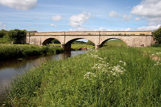
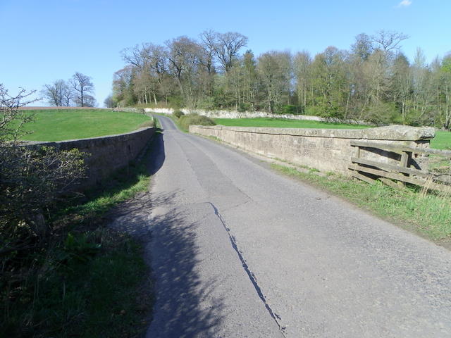
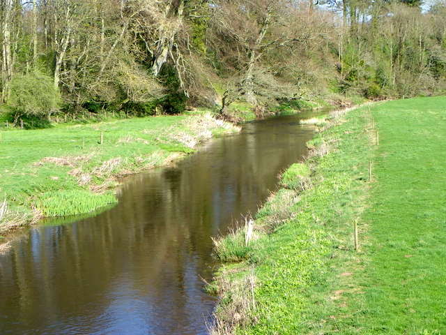
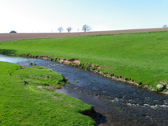
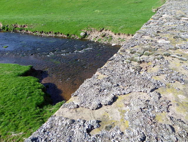
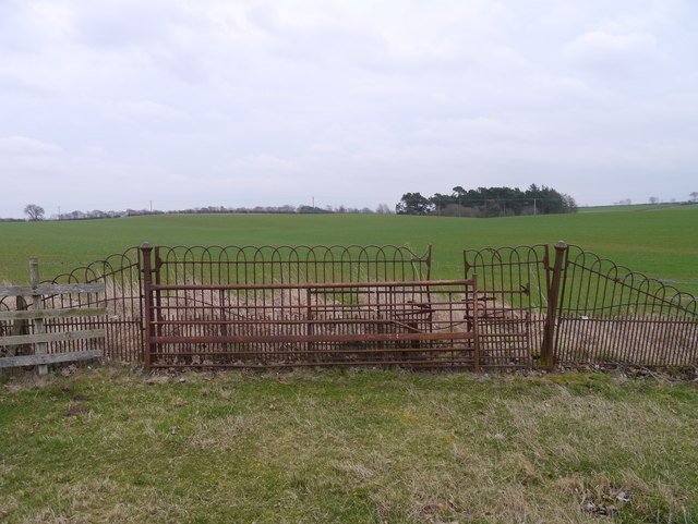
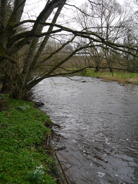
Blackadder is a small village located in the county of Berwickshire, in the southeastern part of Scotland. Situated near the River Blackadder, the village is nestled in a picturesque valley surrounded by stunning countryside and rolling hills. It is situated approximately five miles west of the town of Duns.

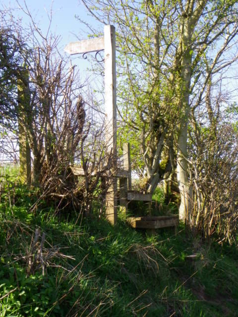
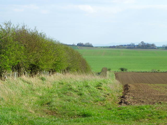
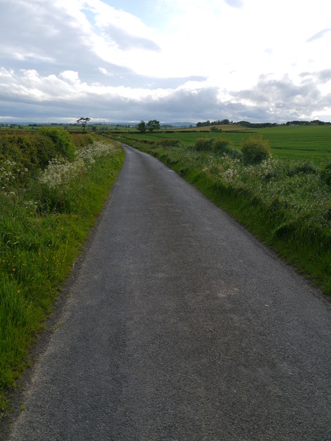
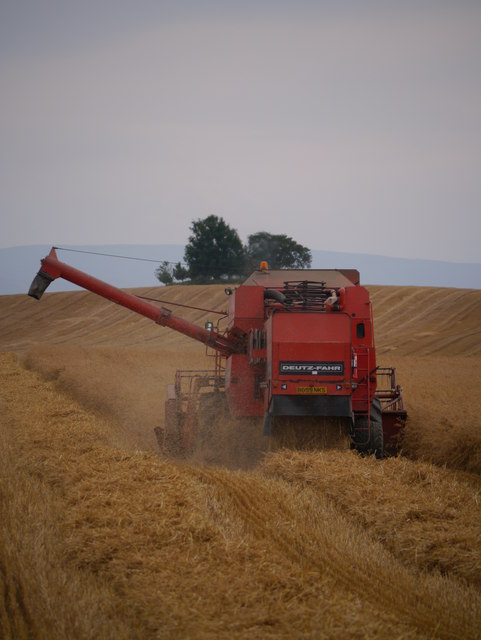
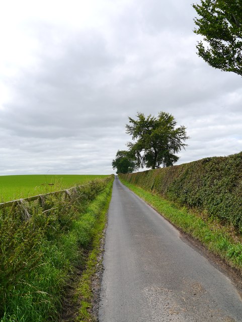
With its quaint charm and peaceful atmosphere, Blackadder is a popular destination for nature lovers and those seeking a tranquil retreat. The village is known for its unspoiled natural beauty, offering visitors a chance to explore the surrounding landscapes through various walking and cycling trails.

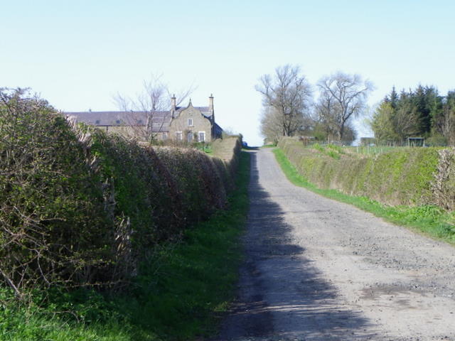
Blackadder is home to a close-knit community that takes pride in preserving its history and heritage. The village is dotted with traditional stone-built houses and cottages, adding to its rustic appeal. The local church, St. Cuthbert's, is a prominent landmark, dating back to the 12th century and showcasing impressive architectural features.

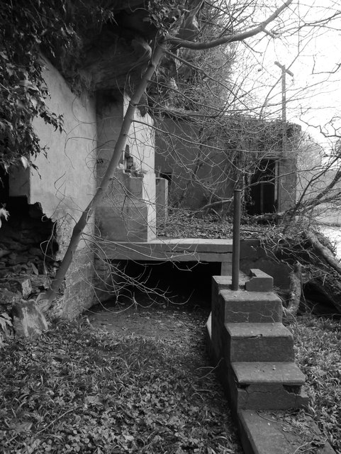
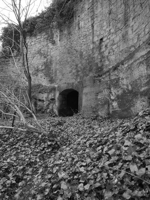
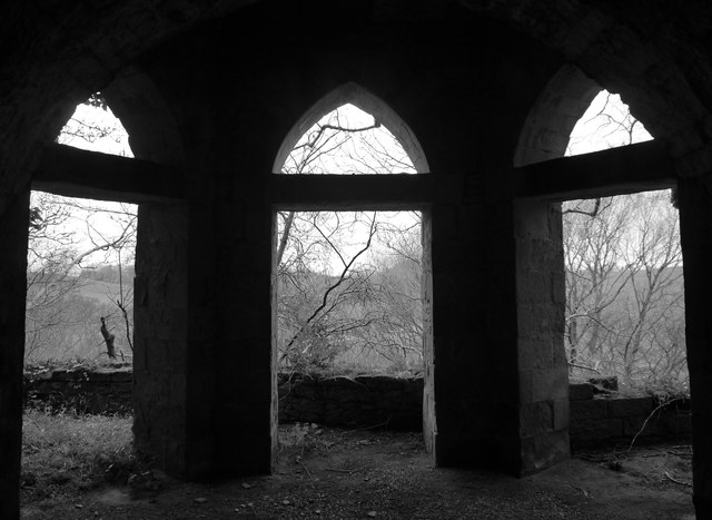
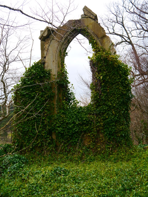
The area surrounding Blackadder is rich in historical significance. Close by, visitors can explore the ruins of Blackadder Castle, a medieval stronghold that played a significant role in Scottish history. The castle's remains offer a glimpse into the region's past, allowing visitors to imagine its former grandeur.

Despite its small size, Blackadder offers a range of amenities for residents and visitors. The village is home to a local pub, providing a warm and friendly environment to enjoy a meal or a drink. Additionally, the nearby town of Duns offers a wider selection of shops, restaurants, and recreational facilities.

In conclusion, Blackadder is a charming village in Berwickshire, Scotland, known for its natural beauty, historical landmarks, and close-knit community. Whether exploring the countryside, learning about its history, or simply enjoying the tranquility, Blackadder offers a delightful experience for all who visit.

If you have any feedback on the listing, please let us know in the comments section below.

Blackadder Images

Images are sourced within 2km of 55.764145/-2.2451737 or Grid Reference NT8452. Thanks to Geograph Open Source API. All images are credited.

Kelloe Bridge This 3-arch road bridge to the south of Kelloe Mains Farm spans the Blackadder Water. A stone over the central arch is dated 1872.
Kelloe Bridge
This 3-arch road bridge to the south of Kelloe Mains Farm spans the Blackadder Water. A stone over the central arch is dated 1872.
Kelloe Bridge Kelloe Bridge dates from 1872 and takes the minor road over Blackadder Water.
Kelloe Bridge
Kelloe Bridge dates from 1872 and takes the minor road over Blackadder Water.
Bench Mark, Kelloe Bridge The Ordnance Survey bench mark is on the east parapet of the bridge.  For a wider view of the bridge <a href="https://www.geograph.org.uk/photo/2607034">NT8353 : Kelloe Bridge</a> and for further information on the cut mark and others in the area <span class="nowrap"><a title="http://www.bench-marks.org.uk/bm39573" rel="nofollow ugc noopener" href="http://www.bench-marks.org.uk/bm39573">Link</a><img style="margin-left:2px;" alt="External link" title="External link - shift click to open in new window" src="https://s1.geograph.org.uk/img/external.png" width="10" height="10"/></span>
Bench Mark, Kelloe Bridge
The Ordnance Survey bench mark is on the east parapet of the bridge. For a wider view of the bridge NT8353 : Kelloe Bridge and for further information on the cut mark and others in the area LinkExternal link
Blackadder Water Looking downstream from Kelloe Bridge.

The Blackadder rises in the Lammermuir Hills and flows into the Whiteadder near Chirnside.
Blackadder Water
Looking downstream from Kelloe Bridge. The Blackadder rises in the Lammermuir Hills and flows into the Whiteadder near Chirnside.
Blackadder Water Looking upstream from Kelloe Bridge
Blackadder Water
Looking upstream from Kelloe Bridge
Lichen, Kelloe Bridge The bridge is covered with many different lichens.

Lichens do not have roots, but absorb water and gases through their upper surface, and are therefore sensitive to atmospheric pollution.  For this reason they are rarely found around cities and grow best on the wetter west side of the British Isles.  Those on trees thrive best on the sunny, south-west aspects of trunks and branches.  Disappearance of lichen species can be used to detect rising levels of air pollution.  

There are three main types.  The encrusting forms, including the bright orange/dark yellow 'Xanthoria' grow on roofs, walls, gravestones, signs and tree trunks.  Leaf-like species develop flat lobes spreading over bark or stones, and shrubby forms which grow vertically from the ground or hang from trees.  Few have common names.

The Blackadder Water can be seen to the left.
Lichen, Kelloe Bridge
The bridge is covered with many different lichens. Lichens do not have roots, but absorb water and gases through their upper surface, and are therefore sensitive to atmospheric pollution. For this reason they are rarely found around cities and grow best on the wetter west side of the British Isles. Those on trees thrive best on the sunny, south-west aspects of trunks and branches. Disappearance of lichen species can be used to detect rising levels of air pollution. There are three main types. The encrusting forms, including the bright orange/dark yellow 'Xanthoria' grow on roofs, walls, gravestones, signs and tree trunks. Leaf-like species develop flat lobes spreading over bark or stones, and shrubby forms which grow vertically from the ground or hang from trees. Few have common names. The Blackadder Water can be seen to the left.
Stile near Kelloe Bridge The stile gives walkers access to the path to Mouth Bridge.
Stile near Kelloe Bridge
The stile gives walkers access to the path to Mouth Bridge.
Hedged drive, Blackadder The drive leads from the B6480 to Blackadder Mains.
Hedged drive, Blackadder
The drive leads from the B6480 to Blackadder Mains.
Hedge, Blackadder The hedge has grown well since this image taken by Richard Webb <a href="https://www.geograph.org.uk/photo/338479">NT8552 : Restored hedge, Blackadder Mains</a> in 2007.
Hedge, Blackadder
The hedge has grown well since this image taken by Richard Webb NT8552 : Restored hedge, Blackadder Mains in 2007.
The Merse West Of Whitsome A minor road passing through rich fertile agricultural land near Whitsome.
The Merse West Of Whitsome
A minor road passing through rich fertile agricultural land near Whitsome.
Harvesting At Blackadder Bank An unusual sight in these parts where Claas and New Holland dominate, this Deutz-Fahr combine is powering through oats near Blackadder Bank.
Harvesting At Blackadder Bank
An unusual sight in these parts where Claas and New Holland dominate, this Deutz-Fahr combine is powering through oats near Blackadder Bank.
Near Kelloe Lodge The minor road through fertile arable land between Kelloe Lodge and Kelloe Dovecot.
Near Kelloe Lodge
The minor road through fertile arable land between Kelloe Lodge and Kelloe Dovecot.
Ornamental Gates The remains of ornamental gates, looking from the former grounds of Blackadder House into the adjacent arable farmland.  A ha-ha is situated to the left of shot.
Ornamental Gates
The remains of ornamental gates, looking from the former grounds of Blackadder House into the adjacent arable farmland. A ha-ha is situated to the left of shot.
Blackadder Water Near Blackadder House Ruins A view upstream adjacent to the hydro-electric powerhouse.
Blackadder Water Near Blackadder House Ruins
A view upstream adjacent to the hydro-electric powerhouse.
Hydro-electric Power House A view of the remains of the hydro-electric power house, looking up the tail race.  Blackadder House was allegedly the first house to have electric lighting in Berwickshire.
Hydro-electric Power House
A view of the remains of the hydro-electric power house, looking up the tail race. Blackadder House was allegedly the first house to have electric lighting in Berwickshire.
Stables And Courtyard Remains Below Blackadder House Remains of stables and associated courtyard under the main remains of Blackadder House.
Stables And Courtyard Remains Below Blackadder House
Remains of stables and associated courtyard under the main remains of Blackadder House.
Looking Out A view from the remains of Blackadder House from high above the Blackadder Water.
Looking Out
A view from the remains of Blackadder House from high above the Blackadder Water.
Ivy Arch Remains of an archway at the north end of the ruins of Blackadder House, festooned with Ivy.
Ivy Arch
Remains of an archway at the north end of the ruins of Blackadder House, festooned with Ivy.
Show me another place!

Blackadder is located at Grid Ref: NT8452 (Lat: 55.764145, Lng: -2.2451737)

Unitary Authority: The Scottish Borders

Police Authority: The Lothians and Scottish Borders

What 3 Words

///looked.thumbnail.drive. Near Allanton, Scottish Borders

Nearby Locations

Blackadder

Related Wikis

Blackadder, Scottish Borders

Blackadder is a hamlet on the B6460, in the Scottish Borders area of Scotland, located at grid reference NT846523. Places nearby include Allanton, Duns...

Evelaw Tower

Evelaw Tower is a ruined 16th century tower house, about 2.5 miles (4.0 km) north west of Westruther, Scottish Borders, Scotland, and about 1.5 miles...

Kelloe House

Kelloe House was a country house in the former Berwickshire, in the Parish of Edrom, in the Scottish Borders. The house has been demolished. Kelloe Mains...

Blackadder House

Blackadder House was an estate and stately house near the village of Allanton, in Berwickshire, Scotland. It was built on the site of the earlier Blackadder...

Nearby Amenities

Located within 500m of 55.764145,-2.2451737
West Blackadder
Place: hamlet
Source: NPE
Lat/Long: 55.763698/-2.2496489
Give Way
Direction: forward
Lat/Long: 55.761322/-2.2496313
Blackadder Mains
Place: hamlet
Lat/Long: 55.7643156/-2.2420239
Give Way
Direction: forward
Lat/Long: 55.7614334/-2.2495042
Power: pole
Lat/Long: 55.7668573/-2.2407199
Power: pole
Lat/Long: 55.7663252/-2.2418916
Power: pole
Lat/Long: 55.7659333/-2.2429299
Power: pole
Lat/Long: 55.7655366/-2.2439683
Power: pole
Lat/Long: 55.7651169/-2.2450346
Power: pole
Lat/Long: 55.7648533/-2.2457483
Power: pole
Lat/Long: 55.7643864/-2.2421603
Power: pole
Lat/Long: 55.7647468/-2.2435835
Power: pole
Lat/Long: 55.7653008/-2.2460063
Power: pole
Lat/Long: 55.7655233/-2.2472209
Power: pole
Lat/Long: 55.7657422/-2.2483625
Power: pole
Lat/Long: 55.7659357/-2.2493299
Power: pole
Lat/Long: 55.7661292/-2.2503747
Power: pole
Lat/Long: 55.76633/-2.2514238
The data included in this document is from www.openstreetmap.org. The data is made available under ODbL.

Have you been to Blackadder?

Leave your review of Blackadder below (or comments, questions and feedback).