Bettiscombe

Settlement in Dorset

England

Bettiscombe

Thorncombe: Racedown By the entrance to the estate: Looking north west from the B3165 Crewkerne – Marshwood road
Thorncombe: Racedown Credit: Martin Bodman

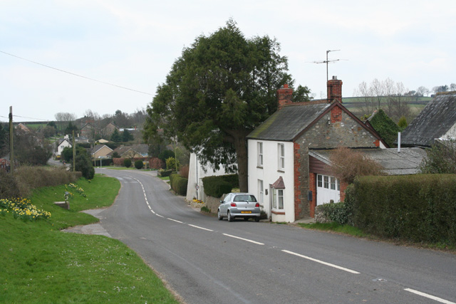
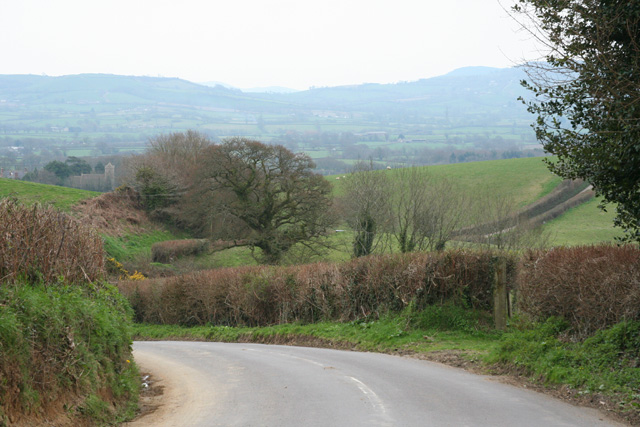
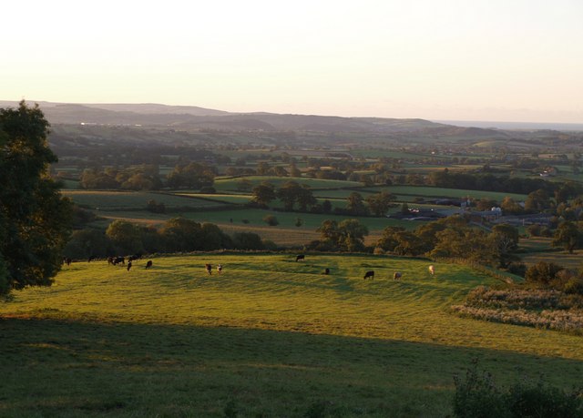
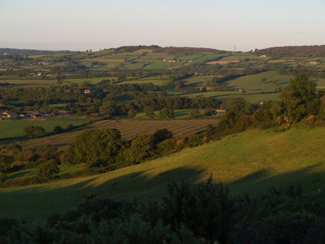
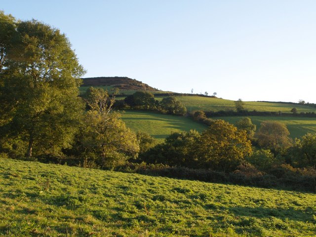
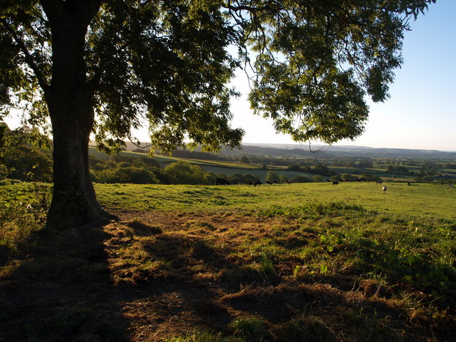
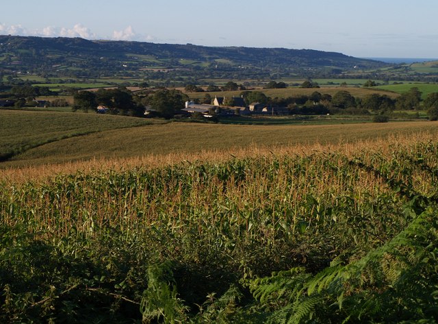
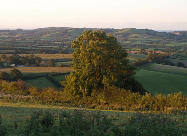
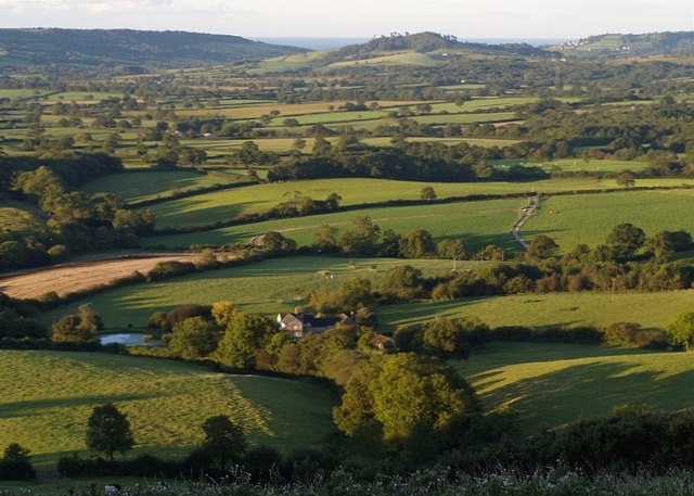
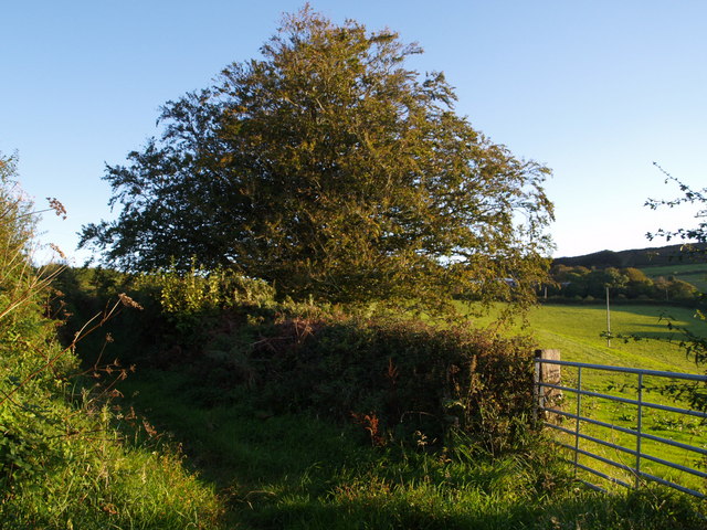
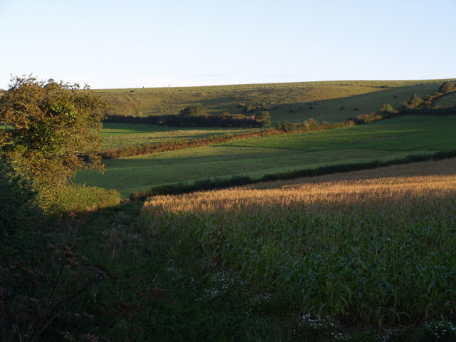
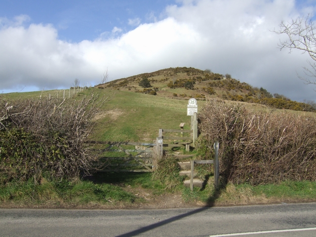
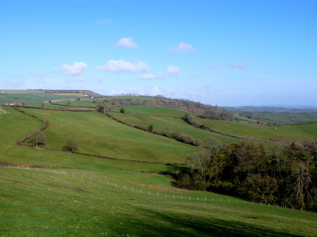
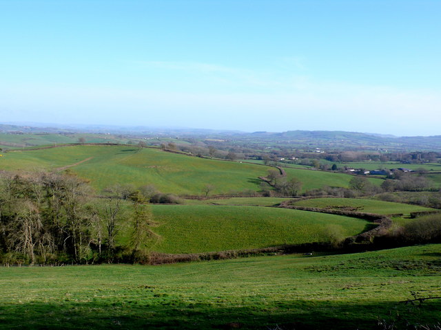
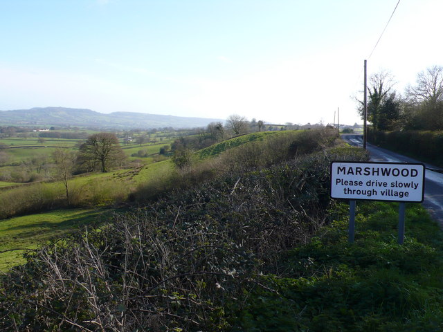
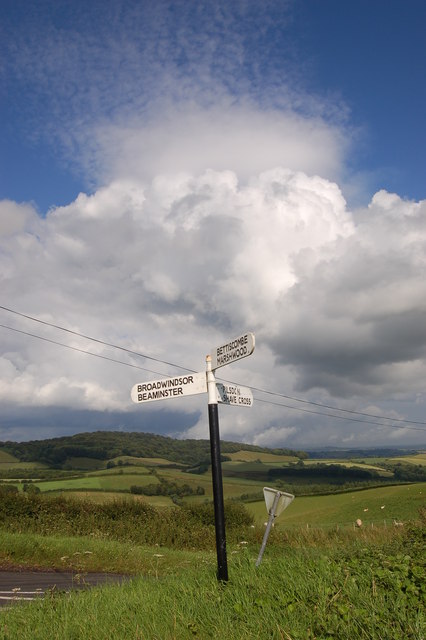
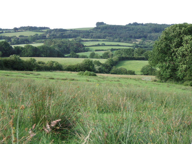
Bettiscombe is a quaint village located in the county of Dorset, England. Situated in the West Dorset administrative district, it is nestled in the picturesque Marshwood Vale, surrounded by rolling hills and lush green countryside. The village is approximately 7 miles northeast of Bridport and 12 miles west of the county town, Dorchester.

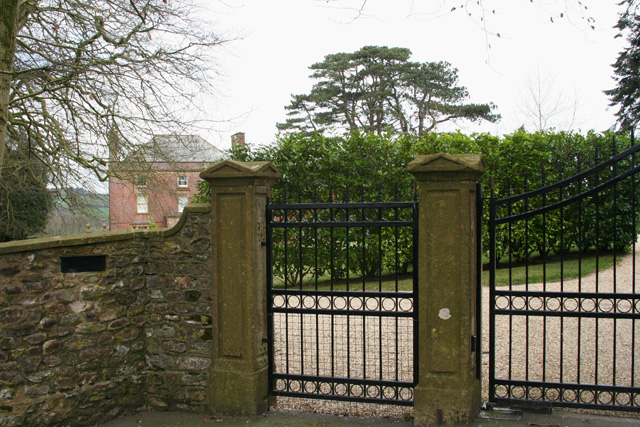
The village is renowned for its historical charm, with many of its buildings dating back several centuries. One notable landmark is the Church of St. Stephen, a beautiful Grade I listed building that dates back to the 13th century. Its unique thatched roof is a testament to the traditional architectural style of the region.

Bettiscombe is also famous for its connection to the paranormal. The village is home to the "Devil's Stone," a large boulder that has been the subject of local legends and folklore for centuries. According to the tales, the stone was dropped by the Devil himself during an attempt to build a bridge across the Marshwood Vale. Today, visitors and locals alike come to see the stone and ponder its mysterious origins.

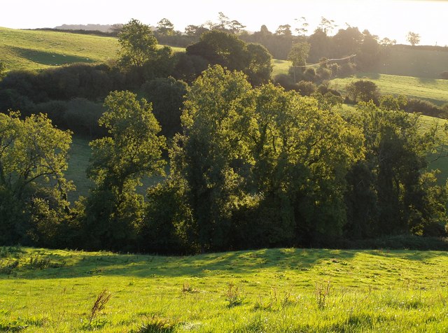
The surrounding countryside offers plenty of opportunities for outdoor activities, such as hiking, cycling, and horseback riding. The tranquil atmosphere and scenic landscapes make Bettiscombe an ideal destination for those seeking a peaceful retreat away from the hustle and bustle of city life.

In terms of amenities, the village has a small community hall, but for more extensive facilities, residents typically rely on nearby towns and villages. Overall, Bettiscombe is a charming and historically significant village that offers a glimpse into rural life in Dorset.

If you have any feedback on the listing, please let us know in the comments section below.

Bettiscombe Images

Images are sourced within 2km of 50.793935/-2.854896 or Grid Reference SY3999. Thanks to Geograph Open Source API. All images are credited.

Thorncombe: Racedown By the entrance to the estate: Looking north west from the B3165 Crewkerne – Marshwood road
Thorncombe: Racedown
By the entrance to the estate: Looking north west from the B3165 Crewkerne – Marshwood road
The B3165 at Marshalsea Looking south west near Tanyard Farm. Here the B3165 provides the boundary between Thorncombe and Bettiscombe parishes
The B3165 at Marshalsea
Looking south west near Tanyard Farm. Here the B3165 provides the boundary between Thorncombe and Bettiscombe parishes
Bettiscombe: by Horse Mill Cross Looking south. Near Birdsmoorgate
Bettiscombe: by Horse Mill Cross
Looking south. Near Birdsmoorgate
Trees near Templeman's Ash The trees catching the morning sunlight are alongside a small tributary of the River Char which drops down from Pilsdon Pen. Taken from the gateway in <a href="https://www.geograph.org.uk/photo/562679">ST4000 : Bridleway to Templeman's Ash</a> on the Wessex Ridgeway Trail a little south of Templeman's Ash.
Trees near Templeman's Ash
The trees catching the morning sunlight are alongside a small tributary of the River Char which drops down from Pilsdon Pen. Taken from the gateway in ST4000 : Bridleway to Templeman's Ash on the Wessex Ridgeway Trail a little south of Templeman's Ash.
First light above Pilsdon Early morning sunlight catching segments of the landscape. The ridge running down the foreground carries the Wessex Ridgeway past the grazing cattle. The farms visible to the right are across a myriad boundary at Pilsdon, in <a href="https://www.geograph.org.uk/gridref/SY4199">SY4199</a>. Beyond is the Marshwood Vale, and past the hills on the far side is the sea.
First light above Pilsdon
Early morning sunlight catching segments of the landscape. The ridge running down the foreground carries the Wessex Ridgeway past the grazing cattle. The farms visible to the right are across a myriad boundary at Pilsdon, in SY4199. Beyond is the Marshwood Vale, and past the hills on the far side is the sea.
Country northeast of Bettiscombe The northern edge of the Marshwood Vale meets the hills - Sliding Hill is to the right. Taken from a similar spot to <a href="https://www.geograph.org.uk/photo/562668">ST4000 : Revelshay Farm</a>, and a few minutes earlier (7:19 am). On the left is Lower House Farm, in <a href="https://www.geograph.org.uk/gridref/SY4099">SY4099</a>. The hill in the distance is Coney's Castle - see <a href="https://www.geograph.org.uk/photo/475785">SY3797 : Northeast from Coney's Castle</a> for a corresponding view in this direction.
Country northeast of Bettiscombe
The northern edge of the Marshwood Vale meets the hills - Sliding Hill is to the right. Taken from a similar spot to ST4000 : Revelshay Farm, and a few minutes earlier (7:19 am). On the left is Lower House Farm, in SY4099. The hill in the distance is Coney's Castle - see SY3797 : Northeast from Coney's Castle for a corresponding view in this direction.
Looking towards Lob Gate Taken from the Wessex Ridgeway as it follows a path from Templeman's Ash to Pilsdon, looking across the southern slopes of Pilsdon Pen. Lob Gate is on the B3164, which runs behind the uppermost hedge where the trees are above the horizon. The intervening valley is of a small tributary of the River Char that flows through Pilsdon.
Looking towards Lob Gate
Taken from the Wessex Ridgeway as it follows a path from Templeman's Ash to Pilsdon, looking across the southern slopes of Pilsdon Pen. Lob Gate is on the B3164, which runs behind the uppermost hedge where the trees are above the horizon. The intervening valley is of a small tributary of the River Char that flows through Pilsdon.
Ash tree by the Wessex Ridgeway This is the tree that appears on the left of <a href="https://www.geograph.org.uk/photo/561156">ST4100 : First light above Pilsdon</a>. The footpath heads out across the field towards Pilsdon.
Ash tree by the Wessex Ridgeway
This is the tree that appears on the left of ST4100 : First light above Pilsdon. The footpath heads out across the field towards Pilsdon.
Farm at Pilsdon A less blurred view of the group of buildings seen in the background of <a href="https://www.geograph.org.uk/photo/561677">ST4100 : Signpost above Pilsdon</a>. This is shown on the 1:25000 map as "Pilsdon Cottages", but larger scale maps identify it as "Gables". The view is across a maize field from the junction of Yard Lane and Pilsdon Lane. Forming the backdrop beyond Marshwood Vale are Stonebarrow Hill and the sea at Charmouth.
Farm at Pilsdon
A less blurred view of the group of buildings seen in the background of ST4100 : Signpost above Pilsdon. This is shown on the 1:25000 map as "Pilsdon Cottages", but larger scale maps identify it as "Gables". The view is across a maize field from the junction of Yard Lane and Pilsdon Lane. Forming the backdrop beyond Marshwood Vale are Stonebarrow Hill and the sea at Charmouth.
Tree above Pilsdon A large tree - an ash, I think - catching the first of the sunlight on the slopes below Templeman's Ash. The buildings on the left are at Pilsdon. The sea can be seen either side of the hills north of Chideock. Taken from roughly the same spot as <a href="https://www.geograph.org.uk/photo/561156">ST4100 : First light above Pilsdon</a>.
Tree above Pilsdon
A large tree - an ash, I think - catching the first of the sunlight on the slopes below Templeman's Ash. The buildings on the left are at Pilsdon. The sea can be seen either side of the hills north of Chideock. Taken from roughly the same spot as ST4100 : First light above Pilsdon.
Revelshay Farm Looking down on the farm from a field close to Farthings Brake Coppice. The field forms a conservation walk adjacent to bridleway W32W22W38/7, which carries the Wessex Ridgeway down from Templeman's Ash into the Marshwood Vale. This forms the backdrop to the picture, with Conegar Hill rising beyond, and the sea visible on either side of it.
Revelshay Farm
Looking down on the farm from a field close to Farthings Brake Coppice. The field forms a conservation walk adjacent to bridleway W32W22W38/7, which carries the Wessex Ridgeway down from Templeman's Ash into the Marshwood Vale. This forms the backdrop to the picture, with Conegar Hill rising beyond, and the sea visible on either side of it.
Bridleway to Templeman's Ash The bridleway which is seen crossing fields in <a href="https://www.geograph.org.uk/photo/561156">ST4100 : First light above Pilsdon</a> is seen here climbing the ridge between hedges. <a href="https://www.geograph.org.uk/photo/559706">ST4100 : Trees near Templeman's Ash</a> was taken from the gateway.
Bridleway to Templeman's Ash
The bridleway which is seen crossing fields in ST4100 : First light above Pilsdon is seen here climbing the ridge between hedges. ST4100 : Trees near Templeman's Ash was taken from the gateway.
Pilsdon Pen from Templeman's Ash Bridleway W23/40 heads alongside this hedge along the foot of Pilsdon Pen, whose distinctive hillfort summit is off to the right in SY4101.
Pilsdon Pen from Templeman's Ash
Bridleway W23/40 heads alongside this hedge along the foot of Pilsdon Pen, whose distinctive hillfort summit is off to the right in SY4101.
Pilsdon Pen The highest iron age hill fort in Dorset.
Pilsdon Pen
The highest iron age hill fort in Dorset.
View east from Marshwood This is the view east from the B3165 just south of Birdsmoorgate across the square towards the B3164 and Horse Mill Cross
View east from Marshwood
This is the view east from the B3165 just south of Birdsmoorgate across the square towards the B3164 and Horse Mill Cross
View south east from Marshwood The view south east across the square towards Bettiscombe
View south east from Marshwood
The view south east across the square towards Bettiscombe
B 3165 entering Marshwood Looking S along the B3165 just south of Birdsmoorgate. Marshwood is the northern end of Marshalsea
B 3165 entering Marshwood
Looking S along the B3165 just south of Birdsmoorgate. Marshwood is the northern end of Marshalsea
Signpost near Pilsdon Pen A view of rural Dorset taken on a July day of brief spells of bright sunshine followed by persistent heavy showers.
Signpost near Pilsdon Pen
A view of rural Dorset taken on a July day of brief spells of bright sunshine followed by persistent heavy showers.
Show me another place!

Bettiscombe is located at Grid Ref: SY3999 (Lat: 50.793935, Lng: -2.854896)

Unitary Authority: Dorset

Police Authority: Dorset

What 3 Words

///grandest.interviewer.hang. Near Charmouth, Dorset

Related Wikis

Bettiscombe

Bettiscombe is a small village and civil parish in west Dorset, England, situated in the Marshwood Vale four miles (6.4 km) west of Beaminster. Dorset...

St Mary's Church, Marshwood

St Mary's Church is a Church of England church in Marshwood, Dorset, England. The earliest part of the church is the tower, which dates to 1840, while...

Marshwood

Marshwood is a village and civil parish in west Dorset, England, situated on the northern edge of the Marshwood Vale approximately 5.5 miles (8.9 km) northeast...

Pilsdon

Pilsdon is a hamlet and civil parish in the Dorset unitary authority area of Dorset, England. Dorset County Council's 2013 mid-year estimate of the parish...

Pilsdon Pen

Pilsdon Pen is a 277-metre (909 ft) hill in Dorset in South West England, situated at the north end of the Marshwood Vale, approximately 4.5 miles (7.2...

Payne's Down

Payne's Down is a prominent hill, 211 metres (692 ft) high, some 10 kilometres east-northeast of Axminster and 1 kilometre northwest of Birdsmoorgate,...

The Bottle Inn

The Bottle Inn is a 16th-century public house at Marshwood in Dorset, England which hosts the World Nettle Eating Championship. It is Grade II listed....

Marshwood Castle

Marshwood Castle was a motte-and-bailey castle in Marshwood, Dorset, within the Vale of Marshwood. It was built by William de Mandeville following his...

Nearby Amenities

Located within 500m of 50.793935,-2.854896
Bettiscombe
Place: hamlet
Source: NPE
Lat/Long: 50.7957469/-2.854917
Crossing
Lat/Long: 50.7898333/-2.8577608
Crossing
Lat/Long: 50.7898225/-2.857762
The data included in this document is from www.openstreetmap.org. The data is made available under ODbL.

Have you been to Bettiscombe?

Leave your review of Bettiscombe below (or comments, questions and feedback).