Coire Àird

Corrie (Glacial Valley) in Ross-shire

Scotland

Coire Àird

Above Gobh-alltan at the head of Loch Mullardoch
Above Gobh-alltan at the head of Loch Mullardoch Credit: Alan Reid

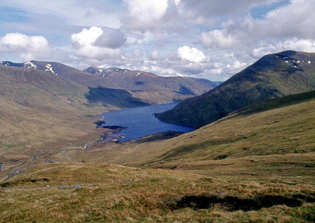
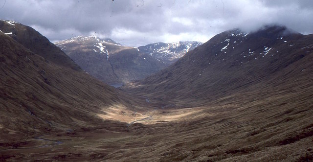
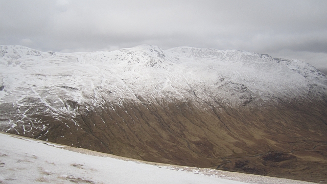
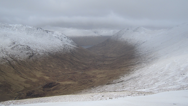
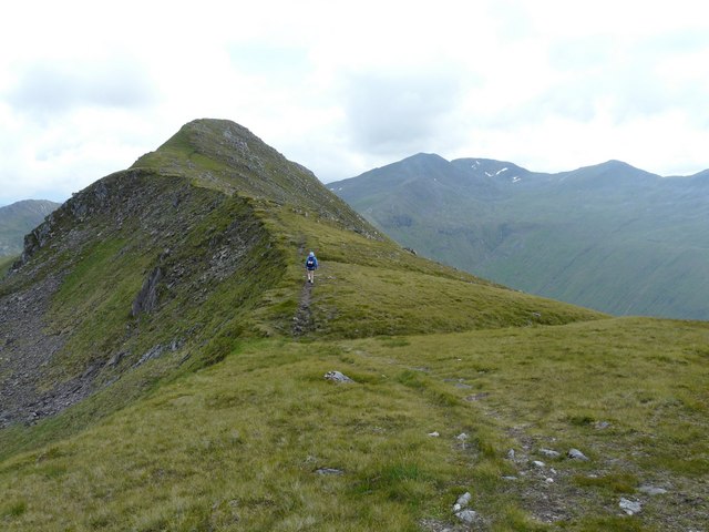
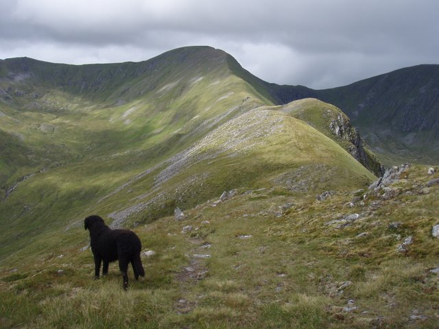
Coire Àird, also known as Corrie, is a glacial valley located in Ross-shire, Scotland. It is situated in the Northwest Highlands, near the village of Achnasheen. The coire is surrounded by majestic, rugged mountains and is known for its stunning natural beauty.

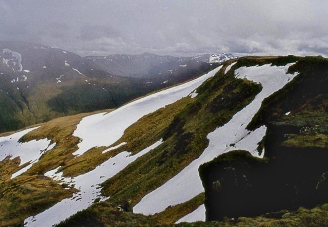
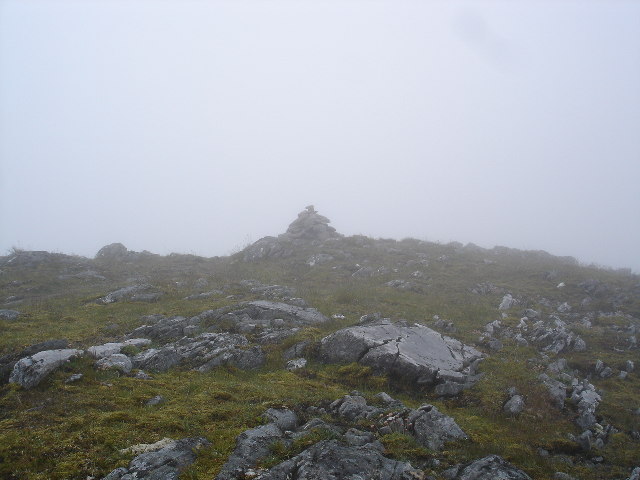
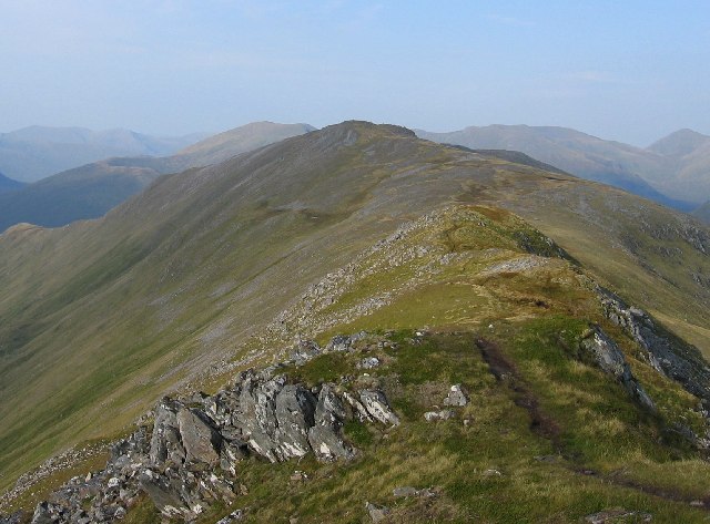
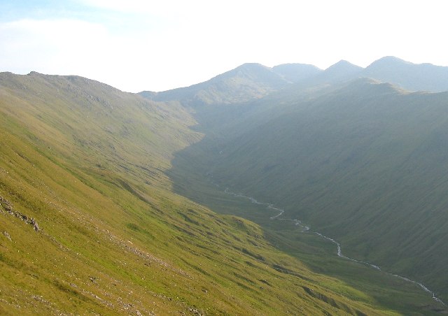
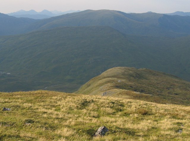
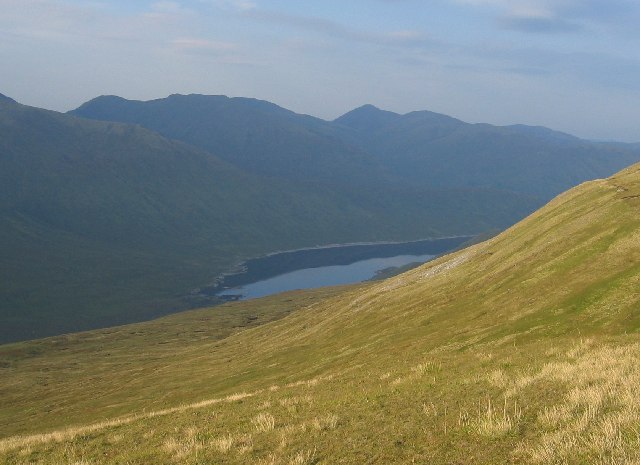
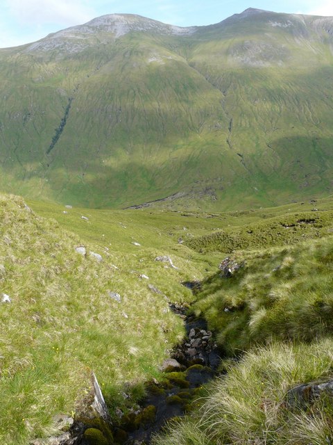
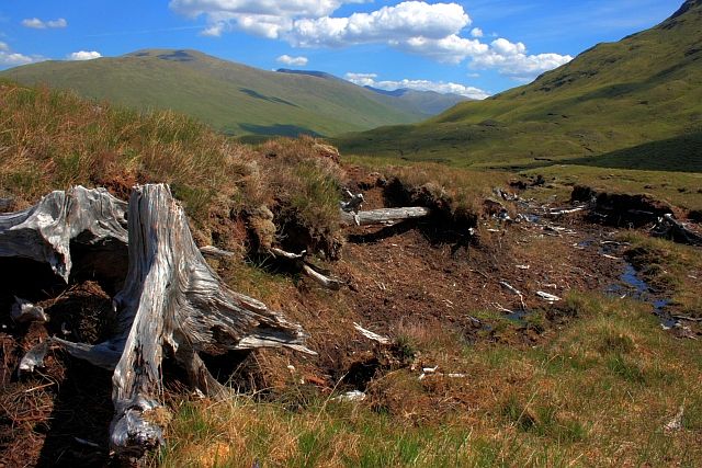
This glacial valley was formed during the last Ice Age, when glaciers carved out the landscape, creating the steep-sided and U-shaped valley that exists today. Coire Àird is characterized by its steep slopes, rocky terrain, and a small loch at its base. The valley is approximately 2 kilometers long and 1 kilometer wide, providing a picturesque setting for outdoor enthusiasts and nature lovers.

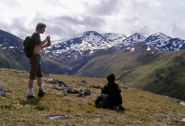
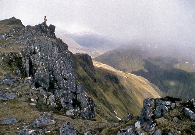
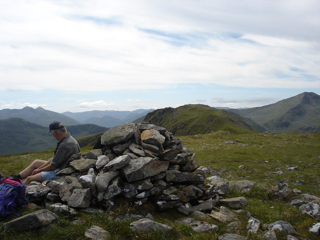
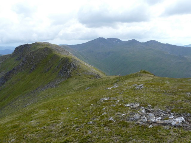
The coire is a popular destination for hikers and mountaineers due to its challenging and rewarding trails. It offers various routes catering to different skill levels, from gentle walks along the valley floor to more demanding ascents to the surrounding peaks. The views from the top are truly breathtaking, with panoramic vistas of the surrounding mountains, lochs, and glens.

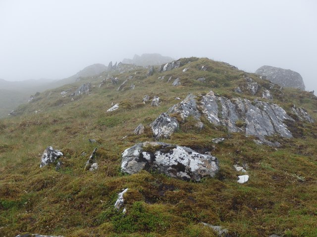
Wildlife is abundant in Coire Àird, with sightings of red deer, golden eagles, and ptarmigans being common. The coire is also home to a diverse range of plant species, including heather, mosses, and alpine flowers, adding to its natural charm.

Visitors to Coire Àird can enjoy the tranquility and beauty of the Scottish Highlands while immersing themselves in the rich geological and glacial history of the area. It is a place where one can reconnect with nature, explore the great outdoors, and appreciate the raw beauty of Scotland's landscapes.

If you have any feedback on the listing, please let us know in the comments section below.

Coire Àird Images

Images are sourced within 2km of 57.291651/-5.1822033 or Grid Reference NH0826. Thanks to Geograph Open Source API. All images are credited.

Above Gobh-alltan at the head of Loch Mullardoch
On Creag a' Choir' Aird Looking up Gleann Sithidh to Sgùrr nan Ceathramhnan.
On Creag a' Choir' Aird
Looking up Gleann Sithidh to Sgùrr nan Ceathramhnan.
Mullach Sithidh drops into Coire na Dheiragainn
Eastern slopes of Mullach na Dheiragain
Gleann a' Choilich View down the glen from the Bealach Coire Ghàidheil.  The glen runs down to Loch Lungard, now the western end of Loch Mullardoch - unless there is a drought.
Gleann a' Choilich
View down the glen from the Bealach Coire Ghàidheil. The glen runs down to Loch Lungard, now the western end of Loch Mullardoch - unless there is a drought.
Ridge leading up Coire Aird Looking up the steep ridge towards the top of the hill.
Ridge leading up Coire Aird
Looking up the steep ridge towards the top of the hill.
Mullach na Dheiragain Mullach na Dheiragain is the highest point in a long ridge running north from Sgùrr nan Ceathreamhnan. Once known to munro baggers as Creag a' Choire Aird, it has a reputation for providing a bit of a long walk.
Mullach na Dheiragain
Mullach na Dheiragain is the highest point in a long ridge running north from Sgùrr nan Ceathreamhnan. Once known to munro baggers as Creag a' Choire Aird, it has a reputation for providing a bit of a long walk.
Gleann a' Choilich A glen near the head of Glen Cannich, between Sgùrr nan Ceathreamhnan and Carn Eige. A path runs down the glen towards the site of Kinlochlungard at the head of the enlarged combined loch of Mullardoch/Lungard.
Gleann a' Choilich
A glen near the head of Glen Cannich, between Sgùrr nan Ceathreamhnan and Carn Eige. A path runs down the glen towards the site of Kinlochlungard at the head of the enlarged combined loch of Mullardoch/Lungard.
Summit of Mullach na Dheiragain Cairn is marked on map.  Fairly typical Scottish mountain conditions.
Summit of Mullach na Dheiragain
Cairn is marked on map. Fairly typical Scottish mountain conditions.
Southern ridge of Mullach na Dheiragain Looking north along one of the ridges of the Big Glens. This grid square covers the steep ground west of Mullach na Dheiragain
Southern ridge of Mullach na Dheiragain
Looking north along one of the ridges of the Big Glens. This grid square covers the steep ground west of Mullach na Dheiragain
The Big Glens The horizon is made up of the complex tops of Sgurr nan Ceathreamhnan
The Big Glens
The horizon is made up of the complex tops of Sgurr nan Ceathreamhnan
Looking down the northern ridge of Mullach na Dheiragain
Looking over the northern slopes of Mullach na Dheiragain The Loch is Loch Mullardoch, the prominent hill just left of centre horizon is "An Riabhachan" with "Sgurr na Lapaich" to its right
Looking over the northern slopes of Mullach na Dheiragain
The Loch is Loch Mullardoch, the prominent hill just left of centre horizon is "An Riabhachan" with "Sgurr na Lapaich" to its right
Summit of Mullach Sithidh, Glen Affric View south over Mullach na Dheiragain in mid distance to Sgurr nan Ceathreamhnan in far distance.
Summit of Mullach Sithidh, Glen Affric
View south over Mullach na Dheiragain in mid distance to Sgurr nan Ceathreamhnan in far distance.
Steep Slopes Heading west up increasingly steep slopes of the munro of Mullach na Dheiragain and looking across to the big Affric munros of Carn Eige and Mam Sodhail, left and right respectively. A 2000 foot re-ascent after descending from the far away ridge - not for the faint hearted (only the foolish!)
Steep Slopes
Heading west up increasingly steep slopes of the munro of Mullach na Dheiragain and looking across to the big Affric munros of Carn Eige and Mam Sodhail, left and right respectively. A 2000 foot re-ascent after descending from the far away ridge - not for the faint hearted (only the foolish!)
Two Munros, Five Tops A motown backing group perhaps? - taken from the subsidiary top of Mullach Sithidh looking across the munro of Mullach na Dheiragain, you can just see its other subsidiary top, before the ridge rears up to the magnificent Sgurr nan Ceathreamhnan and 3 of its 5 tops.
The tiny figures give an idea of the scale of the ridge.
Two Munros, Five Tops
A motown backing group perhaps? - taken from the subsidiary top of Mullach Sithidh looking across the munro of Mullach na Dheiragain, you can just see its other subsidiary top, before the ridge rears up to the magnificent Sgurr nan Ceathreamhnan and 3 of its 5 tops. The tiny figures give an idea of the scale of the ridge.
Another Climb Starting the ascent of Carn na Con Dhu, only a subsidiary top but starting to feel the climb in our legs with still 2 munros to go - a big classic day in Glen Affric. Sgurr nan Ceathreamnan to right.
Another Climb
Starting the ascent of Carn na Con Dhu, only a subsidiary top but starting to feel the climb in our legs with still 2 munros to go - a big classic day in Glen Affric. Sgurr nan Ceathreamnan to right.
Remains of Old Forest, Gleann Sithidh
Show me another place!

Coire Àird is located at Grid Ref: NH0826 (Lat: 57.291651, Lng: -5.1822033)

Unitary Authority: Highland

Police Authority: Highlands and Islands

What 3 Words

///outgoing.divided.overhear. Near Lochcarron, Highland

Related Wikis

Beinn Fhionnlaidh (Mullardoch)

Beinn Fhionnlaidh is a mountain in the Highlands of Scotland. It is situated on the south side of Loch Mullardoch, at the end of Glen Cannich, about 60...

Mam Sodhail

Mam Sodhail, or Màm Sabhail in Gaelic (meaning "rounded mountain of barns"), sometimes anglicised "Mam Soul", is a mountain with a height of 1,181 metres...

Càrn Eighe

Carn Eighe (Scottish Gaelic: Càrn Èite) is a mountain in the Northwest Highlands of Scotland. Rising to 1,183 metres (3,881 ft) above sea level, it is...

Sgùrr nan Ceathramhnan

Sgùrr nan Ceathreamhnan (Scottish Gaelic for 'peak of the quarters') is a mountain in the Northwest Highlands of Scotland. It lies between Glen Affric...

Nearby Amenities

Located within 500m of 57.291651,-5.1822033
Mullach Sithidh
Ele: 974
Natural: peak
Lat/Long: 57.2879714/-5.1838504
Coire Aird
Place: locality
Lat/Long: 57.2908254/-5.1799894
The data included in this document is from www.openstreetmap.org. The data is made available under ODbL.

Have you been to Coire Àird?

Leave your review of Coire Àird below (or comments, questions and feedback).