Innserais

Coastal Marsh, Saltings in Ross-shire

Scotland

Innserais

Mealabost Beach The sea is rather less benign than when <a href="https://www.geograph.org.uk/photo/1345383">NB4057 : Mealabost Beach</a> was taken. Low tide has exposed the rocky zone below the pebble beach.
Mealabost Beach Credit: Anne Burgess

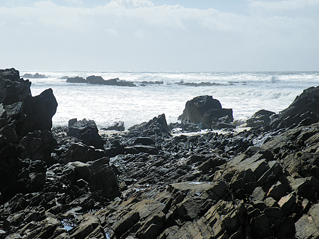
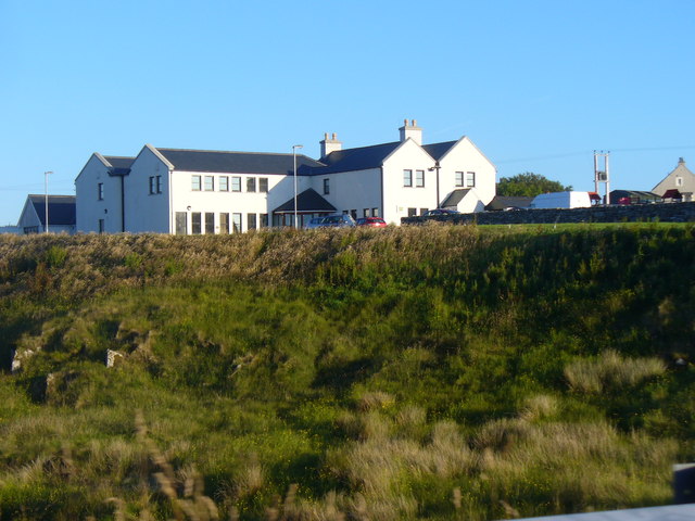
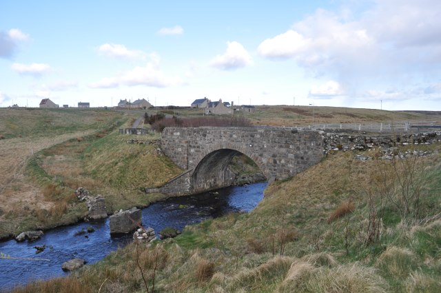
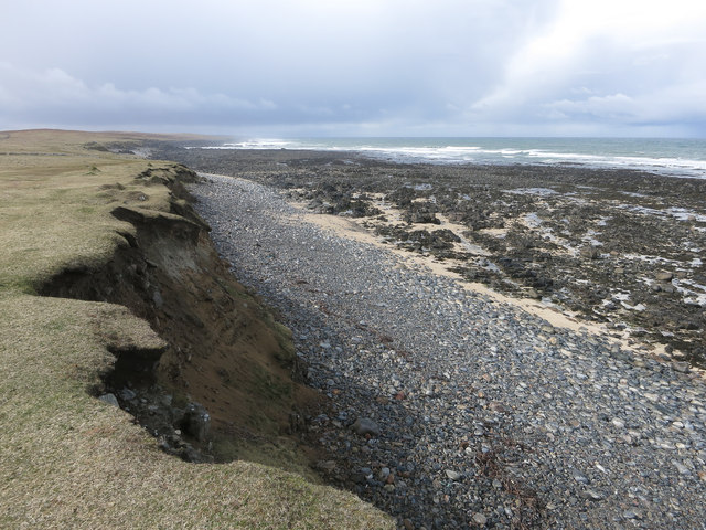
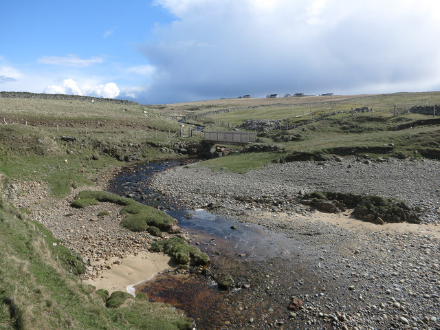
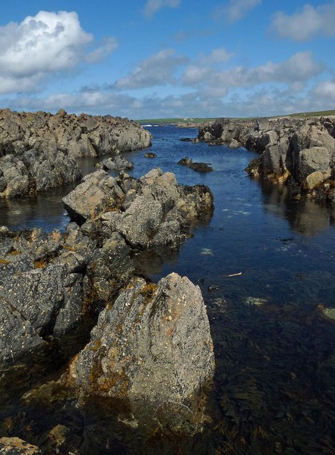
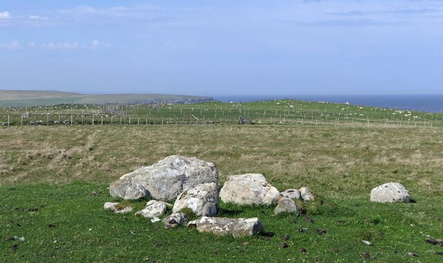
Innserais is a coastal marsh and saltings area located in Ross-shire, Scotland. Situated on the northeastern coast of the country, it covers a stretch of land adjacent to the North Sea. The area is characterized by its diverse and rich ecosystem, making it an important site for wildlife and nature conservation.

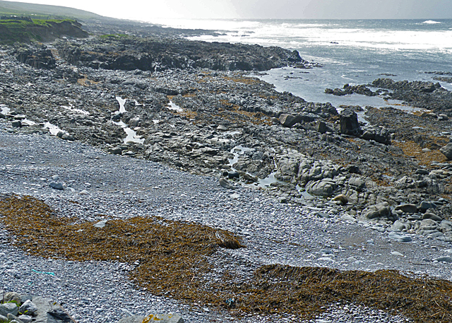
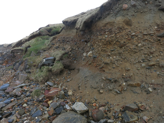
The marshland of Innserais is predominantly made up of wetlands and salt marshes. These habitats are known for their high salt content, which is a result of the tidal activity in the area. The salt marshes are flooded by the sea during high tide, creating a unique ecosystem that supports a wide range of plant and animal species. The marshes are home to various types of grasses, sedges, and herbs, which have adapted to thrive in the saline conditions.

Innserais is renowned for its avian population, attracting numerous species of birds throughout the year. The marshes provide an ideal habitat for breeding, feeding, and roosting for a variety of waterfowl, wading birds, and migratory species. Birdwatchers and nature enthusiasts flock to the area to observe species such as curlews, redshanks, oystercatchers, and terns.

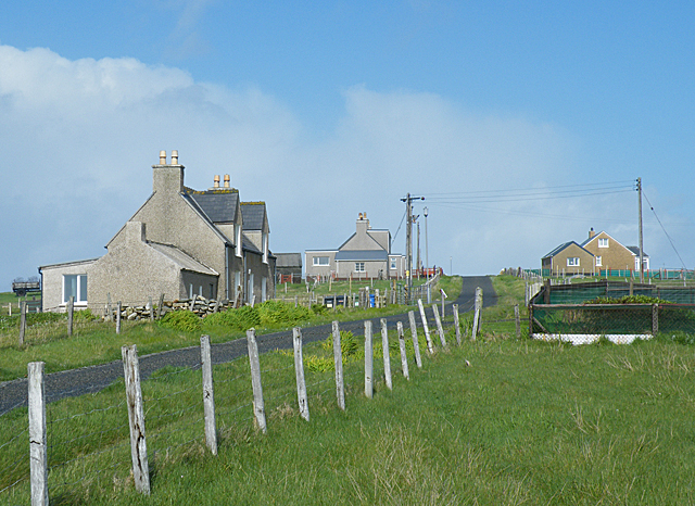
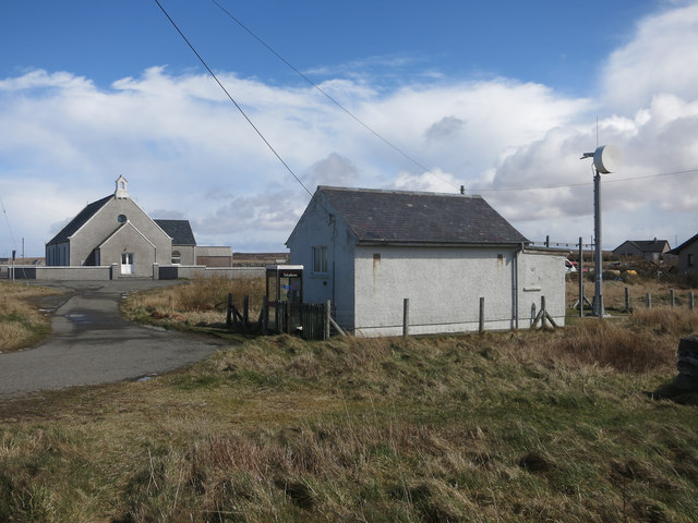
Visitors to Innserais can explore the area via footpaths and observation points, which allow for a closer look at the diverse flora and fauna. The marshes not only provide a haven for wildlife but also offer recreational opportunities for nature lovers. The breathtaking coastal views, serene environment, and abundant wildlife make Innserais a must-visit destination for those interested in the beauty and biodiversity of coastal marshes.

If you have any feedback on the listing, please let us know in the comments section below.
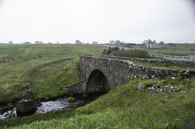
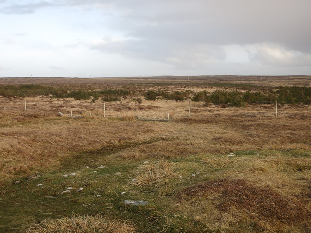
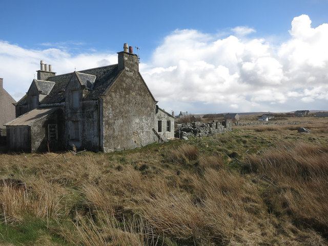
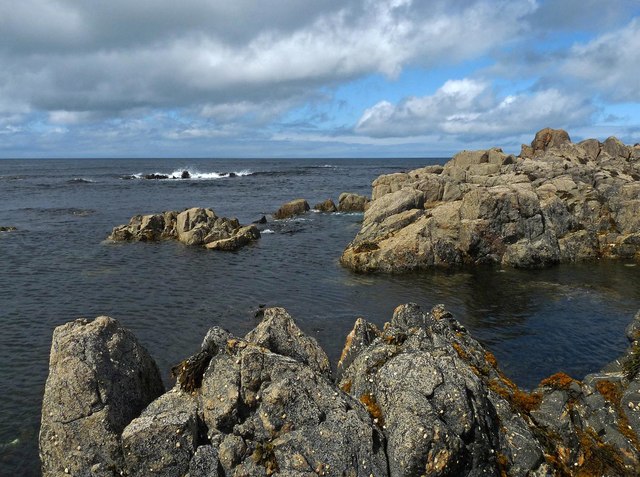
Innserais Images

Images are sourced within 2km of 58.42199/-6.4514842 or Grid Reference NB4056. Thanks to Geograph Open Source API. All images are credited.

Mealabost Beach The sea is rather less benign than when <a href="https://www.geograph.org.uk/photo/1345383">NB4057 : Mealabost Beach</a> was taken. Low tide has exposed the rocky zone below the pebble beach.
Mealabost Beach
The sea is rather less benign than when NB4057 : Mealabost Beach was taken. Low tide has exposed the rocky zone below the pebble beach.
Mealabost Bhuirgh Called Mealabost Buirgh (Mealabost of Borve) to distinguish it from other places named Mealasta, though even that is potentially confusing because there are at least two different places called N Buirgh (Borve).
Mealabost Bhuirgh
Called Mealabost Buirgh (Mealabost of Borve) to distinguish it from other places named Mealasta, though even that is potentially confusing because there are at least two different places called N Buirgh (Borve).
The Eyes Have It In fact, this isn't a boulder with eyes carved into it. This is what happens when a polystyrene (or something similar) float spends too long being buffeted by the waves. The surface has been abraded away, revealing the material of which the float consists.
The Eyes Have It
In fact, this isn't a boulder with eyes carved into it. This is what happens when a polystyrene (or something similar) float spends too long being buffeted by the waves. The surface has been abraded away, revealing the material of which the float consists.
Foreshore at Mealabost Bhuirgh Grey gneiss, blackened by organic matter, breaks the force of the waves at Mealabost.
Foreshore at Mealabost Bhuirgh
Grey gneiss, blackened by organic matter, breaks the force of the waves at Mealabost.
Borve Hotel Large Lewis hotel on a river terrace above the Abhainn Bhuirgh / Borve Water.
Borve Hotel
Large Lewis hotel on a river terrace above the Abhainn Bhuirgh / Borve Water.
Bridge at Borve This bridge carries the A857 over the Abhainn Bhuirgh. There are what looks like the remains of an earlier bridge next to it.
Bridge at Borve
This bridge carries the A857 over the Abhainn Bhuirgh. There are what looks like the remains of an earlier bridge next to it.
Borve Minimarket
Borve Minimarket
Bus stop and community notice board At the junction of the road from Mealabost with the A857. A uniquely typical Lewisian bus stop
Bus stop and community notice board
At the junction of the road from Mealabost with the A857. A uniquely typical Lewisian bus stop
Cliff near Coig Peighinnean Bhuirgh A mix of unconsolidated deposits, not always a match for Atlantic storms.
Cliff near Coig Peighinnean Bhuirgh
A mix of unconsolidated deposits, not always a match for Atlantic storms.
Eroding cliff Interesting deposits revealed by the coastal erosion. Compare to <a href="https://www.geograph.org.uk/photo/71736">SW3530 : Climate history revealed!</a> from Cornwall. Here the raised beach and glacial deposits are the other way around. This is because the raised beach is a recent feature, raised by the isostatic rebound of the ground after the weight of the ice sheet was removed by the end of the last glacial period.
Eroding cliff
Interesting deposits revealed by the coastal erosion. Compare to SW3530 : Climate history revealed! from Cornwall. Here the raised beach and glacial deposits are the other way around. This is because the raised beach is a recent feature, raised by the isostatic rebound of the ground after the weight of the ice sheet was removed by the end of the last glacial period.
Borve Free Church
Borve Free Church
Allt Grunndal
Allt Grunndal
The old bridge at Borve
Woodland near Mealabost Bhuirgh Still small in this exposed location.
Woodland near Mealabost Bhuirgh
Still small in this exposed location.
Empty house, Borve
Empty house, Borve
Cladach Lag na Greine, Isle of Lewis The entry for Cladach Lag na Greine in the OS Name Book of 1848-1852 reads, "A portion of shore between high and low water mark which is composed of shelving rock, boulders and shingle.  Signifies Shore of Sunny Hollow".
Cladach Lag na Greine, Isle of Lewis
The entry for Cladach Lag na Greine in the OS Name Book of 1848-1852 reads, "A portion of shore between high and low water mark which is composed of shelving rock, boulders and shingle. Signifies Shore of Sunny Hollow".
Cladach Lag na Greine, Isle of Lewis The entry for Cladach Lag na Greine in the OS Name Book of 1848-1852 reads, "A portion of shore between high and low water mark which is composed of shelving rock, boulders and shingle. Signifies Shore of Sunny Hollow".
Cladach Lag na Greine, Isle of Lewis
The entry for Cladach Lag na Greine in the OS Name Book of 1848-1852 reads, "A portion of shore between high and low water mark which is composed of shelving rock, boulders and shingle. Signifies Shore of Sunny Hollow".
Clearance cairn, Cuivatotar, Isle of Lewis According to <span class="nowrap"><a title="https://canmore.org.uk/site/335577" rel="nofollow ugc noopener" href="https://canmore.org.uk/site/335577">Link</a><img style="margin-left:2px;" alt="External link" title="External link - shift click to open in new window" src="https://s1.geograph.org.uk/img/external.png" width="10" height="10"/></span> , the clearance cairn was built on a prehistoric kerb cairn.
Clearance cairn, Cuivatotar, Isle of Lewis
According to LinkExternal link , the clearance cairn was built on a prehistoric kerb cairn.
Show me another place!

Innserais is located at Grid Ref: NB4056 (Lat: 58.42199, Lng: -6.4514842)

Unitary Authority: Na h-Eileanan an Iar

Police Authority: Highlands and Islands

What 3 Words

///growth.merely.snack. Near North Tolsta, Na h-Eileanan Siar

Nearby Locations

Borve Innserais Borgh

Related Wikis

Borve, Lewis

Borve (Scottish Gaelic: Borgh) is a village on the west side of the Isle of Lewis in Scotland, 17 miles (27 kilometres) from the island's only town, Stornoway...

Steinacleit

Steinacleit is a prehistoric archeological site on the west coast of Lewis in the Outer Hebrides of Scotland. The site consists of an array of boulders...

Baile an Truiseil

Ballantrushal (Scottish Gaelic: Baile an Truiseil) is a village on the Isle of Lewis in the West Side district, in the Outer Hebrides, Scotland. Ballantrushal...

South Galson

South Galson is a settlement on the northwest coast of the Isle of Lewis in the Western Isles of Scotland. It is 11 km southwest of Port of Ness. The Galson...

Nearby Amenities

Located within 500m of 58.42199,-6.4514842
Created By: dmgroom_coastlines
Lat/Long: 58.4187/-6.45704
The data included in this document is from www.openstreetmap.org. The data is made available under ODbL.

Have you been to Innserais?

Leave your review of Innserais below (or comments, questions and feedback).