Point of Veniver

Coastal Feature, Headland, Point in Orkney

Scotland

Point of Veniver

Shapinsay: picnic bench at the north end A picnic bench occupies a pleasant position, just by the end of the road and with good views across to Eday, which we can just make out in the distance.
Shapinsay: picnic bench at the north end Credit: Chris Downer

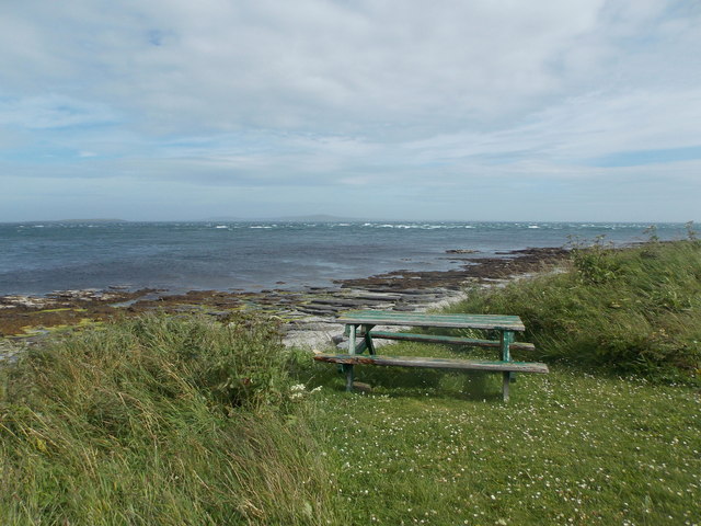
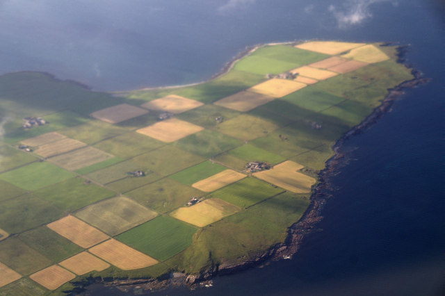
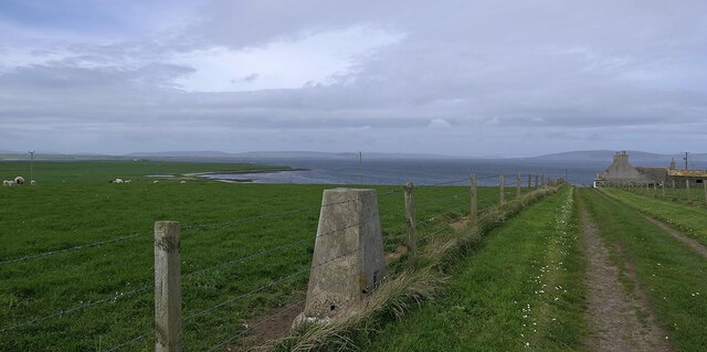
Point of Veniver is a prominent coastal feature located on the northern coast of the Orkney Islands in Scotland. It is recognized as a headland or point, extending into the North Sea. The point is situated on the west side of the island of Westray, one of the largest islands in the Orkney archipelago.

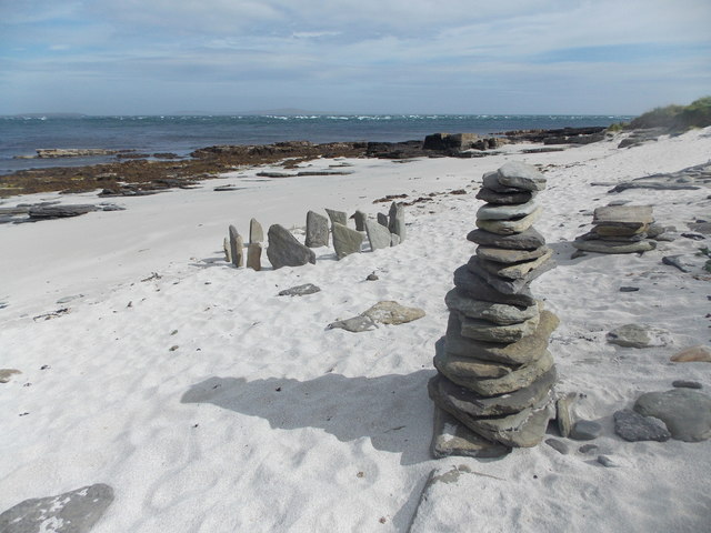
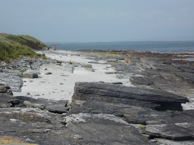
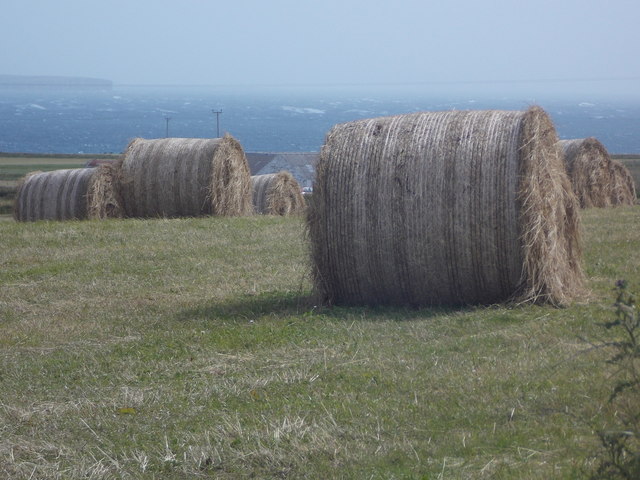
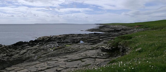
Rising about 30 meters above sea level, Point of Veniver offers stunning panoramic views of the surrounding rugged coastline and the vast expanse of the North Sea. The headland is composed of rugged cliffs, which have been shaped by centuries of erosion from the relentless waves crashing against the shore. The cliffs are predominantly composed of sandstone and shale, displaying beautiful layers of sedimentary rock formations.

The area is rich in biodiversity, with various seabirds nesting on the cliffs, including puffins, guillemots, and kittiwakes. The surrounding waters are also home to a diverse range of marine life, including seals, dolphins, and occasionally even whales.

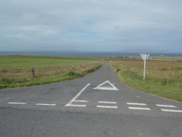
Visitors to Point of Veniver can explore the headland and enjoy invigorating coastal walks, taking in the fresh sea air and the dramatic scenery. The area is a haven for nature lovers, offering opportunities for birdwatching, photography, and enjoying the tranquility of the rugged landscape.

Overall, Point of Veniver is a captivating coastal feature, offering a unique glimpse into the natural beauty and rich biodiversity of the Orkney Islands.

If you have any feedback on the listing, please let us know in the comments section below.

Point of Veniver Images

Images are sourced within 2km of 59.079885/-2.8289575 or Grid Reference HY5221. Thanks to Geograph Open Source API. All images are credited.

Shapinsay: picnic bench at the north end A picnic bench occupies a pleasant position, just by the end of the road and with good views across to Eday, which we can just make out in the distance.
Shapinsay: picnic bench at the north end
A picnic bench occupies a pleasant position, just by the end of the road and with good views across to Eday, which we can just make out in the distance.
Shapinsay: non-antiquities on the beach A small stone circle and a pile of stones have been put up by a visitor to this small but picturesque beach at the northern end of the island.
Shapinsay: non-antiquities on the beach
A small stone circle and a pile of stones have been put up by a visitor to this small but picturesque beach at the northern end of the island.
Shapinsay: sandy and rocky beach A nice beach at the northern end of the island. I wonder if the dad and son in the background were as surprised as we were not to be the only visitors.
Shapinsay: sandy and rocky beach
A nice beach at the northern end of the island. I wonder if the dad and son in the background were as surprised as we were not to be the only visitors.
Shapinsay: Hillock Road Surprisingly named on the 1:25,000 map, this little lane is a continuation of the B9058, at right angles to it. The beach is just behind us.
Shapinsay: Hillock Road
Surprisingly named on the 1:25,000 map, this little lane is a continuation of the B9058, at right angles to it. The beach is just behind us.
Shapinsay: Borroughston Broch One of many brochs, or remains of, in Orkney, the one here was excavated in the 1860s but fell into poor condition again before being properly restored in the 1990s.
Shapinsay: Borroughston Broch
One of many brochs, or remains of, in Orkney, the one here was excavated in the 1860s but fell into poor condition again before being properly restored in the 1990s.
Shapinsay: Borroughston Broch from the north Another view of <a href="https://www.geograph.org.uk/photo/4714329">HY5421 : Shapinsay: Borroughston Broch</a>, from the opposite side.
Shapinsay: Borroughston Broch from the north
Another view of HY5421 : Shapinsay: Borroughston Broch, from the opposite side.
Shapinsay: a line of running cows Maybe 'running' is a bit of an exaggeration, but these cows approached us in line at a bit of a canter before deciding that there was nothing to interest them. A few minutes later they did the same, in similar formation, at the far end of the field.
Shapinsay: a line of running cows
Maybe 'running' is a bit of an exaggeration, but these cows approached us in line at a bit of a canter before deciding that there was nothing to interest them. A few minutes later they did the same, in similar formation, at the far end of the field.
Shapinsay: the B9058 heads north Looking along the last dead-straight mile of the main road across the island.
Shapinsay: the B9058 heads north
Looking along the last dead-straight mile of the main road across the island.
Shapinsay: hay bales and a sea view Looking across one of the square patchwork fields of the island, with Rothiesholm Head on Stronsay in the distance.
Shapinsay: hay bales and a sea view
Looking across one of the square patchwork fields of the island, with Rothiesholm Head on Stronsay in the distance.
Shapinsay: postbox № KW17 57 A standard lamp box dating from post-1994, mounted on an unusually short metal pole. Serving the northern part of the island, it is one of four postboxes on Shapinsay.
Shapinsay: postbox № KW17 57
A standard lamp box dating from post-1994, mounted on an unusually short metal pole. Serving the northern part of the island, it is one of four postboxes on Shapinsay.
Shapinsay: the road to Quholm A road runs at right-angles from the main B9058, and the regular angularity is no accident: David Balfour, who owned the island in the mid-1800s, divided most of the land into fields of 4 hectares - and it is particularly evident from aerial photography or large-scale mapping that this was done in a patchwork of squares. It is therefore natural that the roads will be straight and at right-angles to one another.
Shapinsay: the road to Quholm
A road runs at right-angles from the main B9058, and the regular angularity is no accident: David Balfour, who owned the island in the mid-1800s, divided most of the land into fields of 4 hectares - and it is particularly evident from aerial photography or large-scale mapping that this was done in a patchwork of squares. It is therefore natural that the roads will be straight and at right-angles to one another.
Shapinsay: red phone box on the B9058 The phone box stands alongside the road but far enough onto someone's garden that it is probably the location of the former North Shapinsay post office, which existed from 1935 until closure on 30 June 1975.
Shapinsay: red phone box on the B9058
The phone box stands alongside the road but far enough onto someone's garden that it is probably the location of the former North Shapinsay post office, which existed from 1935 until closure on 30 June 1975.
Ness of Ork, Shapinsay, from the air
Triangulation pillar, Ness of Ork, Shapinsay, Orkney Looking west towards the coast at Noust of Erraby.
Triangulation pillar, Ness of Ork, Shapinsay, Orkney
Looking west towards the coast at Noust of Erraby.
Point of Duresse, Shapinsay, Orkney Mull Head on Orkney Mainland can be seen on the left of the horizon.
Point of Duresse, Shapinsay, Orkney
Mull Head on Orkney Mainland can be seen on the left of the horizon.
Broch of Burroughston This is the entrance passageway to the broch, which is sufficiently well preserved to be readily recognisable as such.  It is a Scheduled Ancient Monument. See <span class="nowrap"><a title="https://portal.historicenvironment.scot/designation/SM1421" rel="nofollow ugc noopener" href="https://portal.historicenvironment.scot/designation/SM1421">Link</a><img style="margin-left:2px;" alt="External link" title="External link - shift click to open in new window" src="https://s1.geograph.org.uk/img/external.png" width="10" height="10"/></span> for details.
Broch of Burroughston
This is the entrance passageway to the broch, which is sufficiently well preserved to be readily recognisable as such. It is a Scheduled Ancient Monument. See LinkExternal link for details.
Broch of Burroughston The broch still stands to about a third of its likely original height, and its internal features, including stairs and the bases of partitions, have survived. It is a Scheduled Ancient Monument. See <span class="nowrap"><a title="https://portal.historicenvironment.scot/designation/SM1421" rel="nofollow ugc noopener" href="https://portal.historicenvironment.scot/designation/SM1421">Link</a><img style="margin-left:2px;" alt="External link" title="External link - shift click to open in new window" src="https://s1.geograph.org.uk/img/external.png" width="10" height="10"/></span> for details.
Broch of Burroughston
The broch still stands to about a third of its likely original height, and its internal features, including stairs and the bases of partitions, have survived. It is a Scheduled Ancient Monument. See LinkExternal link for details.
Broch of Burroughston Looking down from the top of the wall, you get a reasonable idea of the internal layout, including the partitions that create smaller side chambers. The grating is modern, and covers the well. It is a Scheduled Ancient Monument. See <span class="nowrap"><a title="https://portal.historicenvironment.scot/designation/SM1421" rel="nofollow ugc noopener" href="https://portal.historicenvironment.scot/designation/SM1421">Link</a><img style="margin-left:2px;" alt="External link" title="External link - shift click to open in new window" src="https://s1.geograph.org.uk/img/external.png" width="10" height="10"/></span> for details.
Broch of Burroughston
Looking down from the top of the wall, you get a reasonable idea of the internal layout, including the partitions that create smaller side chambers. The grating is modern, and covers the well. It is a Scheduled Ancient Monument. See LinkExternal link for details.
Show me another place!

Point of Veniver is located at Grid Ref: HY5221 (Lat: 59.079885, Lng: -2.8289575)

Unitary Authority: Orkney Islands

Police Authority: Highlands and Islands

What 3 Words

///bulky.plots.flattery. Near Balfour, Orkney Islands

Related Wikis

Quholm

Quholm (grid reference HY5221) is a hamlet in the northeast of Shapinsay, in the islands of Orkney, Scotland. It is located between the Loch of Stenness...
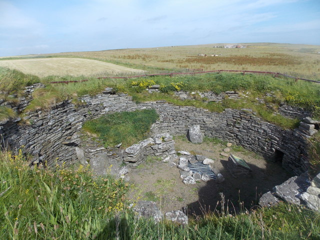
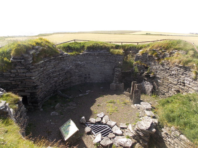
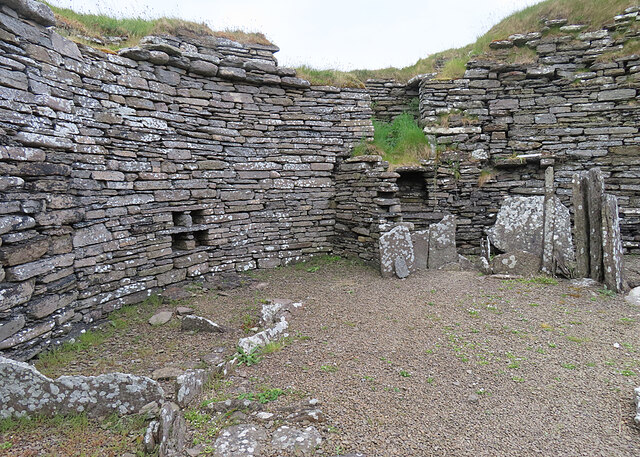
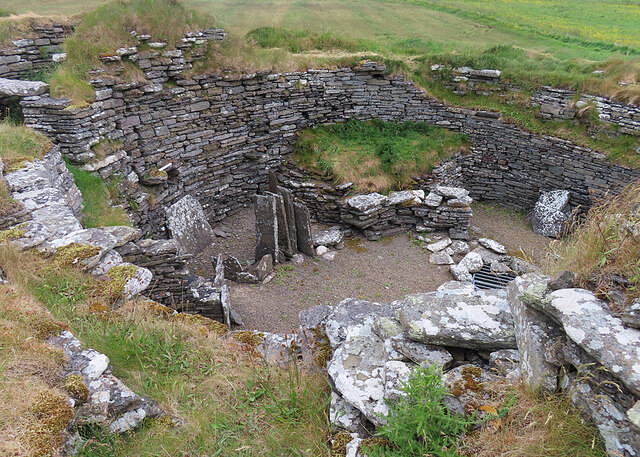
Burroughston Broch

Burroughston Broch is an Iron Age broch located on the island of Shapinsay in the Orkney Islands, in Scotland (grid reference HY54062100). The site overlooks...

Veantro Bay

Veantro Bay is a bay on the northwest coast of Shapinsay in the Orkney Islands, Scotland.At the head of the bay is a large stone, thought to be associated...

Lairo Water

Lairo Water is a surface water body known as an ayre situated on the western coast of Shapinsay in the Orkney Islands. This brackish water body is separated...

Linton Chapel

Linton Chapel is a ruined chapel on the east coast of Shapinsay, Orkney (Grid Reference HY5218). The chapel is thought to date as early as the 12th century...

The Ouse

The Ouse is a tidal estuary in northern Shapinsay, Orkney Islands. This water body has been shown on early maps of the island in a very similar shape to...

Bay of Linton

The Bay of Linton is a bay on the east coast on the island of Shapinsay in the Orkney Islands, Scotland. To the north of Linton Bay are the headlands...

Shapinsay

Shapinsay (, Scots: Shapinsee) is one of the Orkney Islands off the north coast of mainland Scotland. There is one village on the island, Balfour, from...

Have you been to Point of Veniver?

Leave your review of Point of Veniver below (or comments, questions and feedback).