Sand Geo

Coastal Feature, Headland, Point in Orkney

Scotland

Sand Geo

Farm near Croo Taing
Farm near Croo Taing Credit: David Dixon

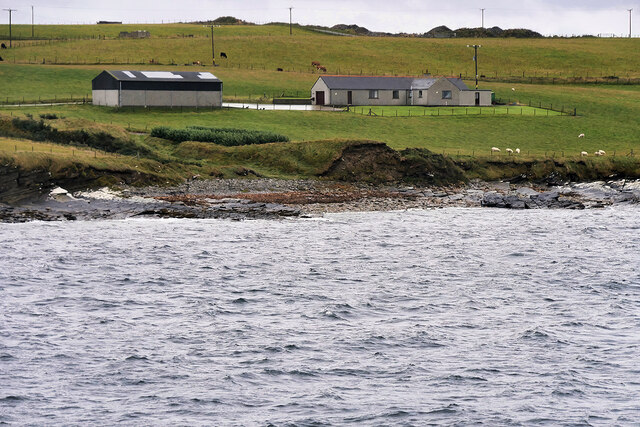
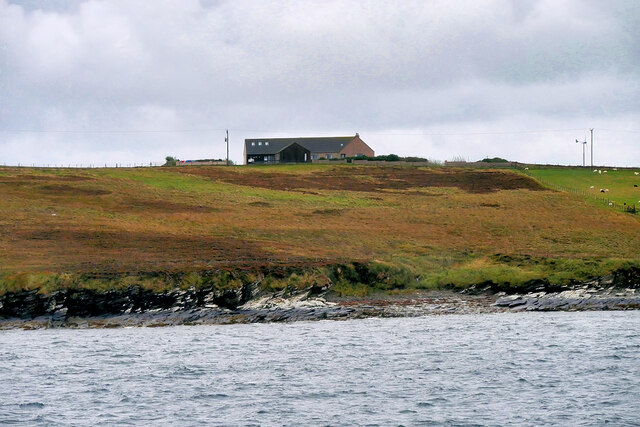
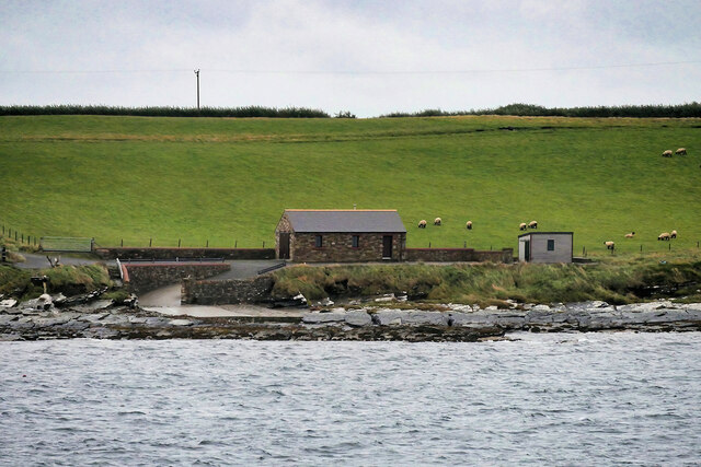
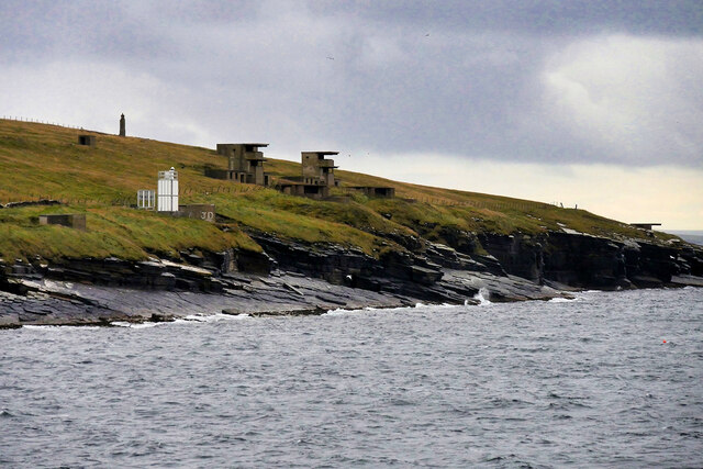
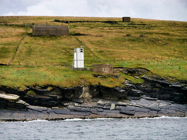
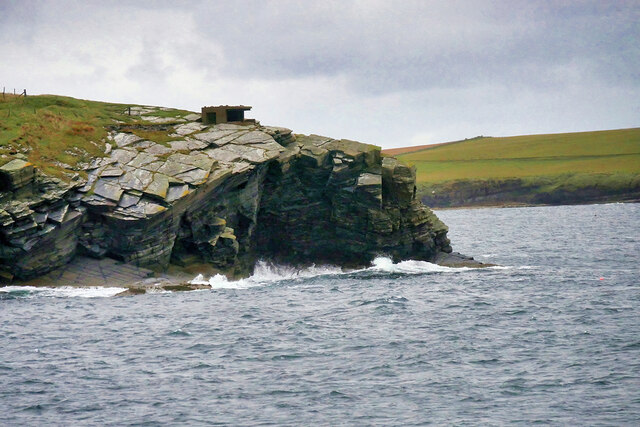
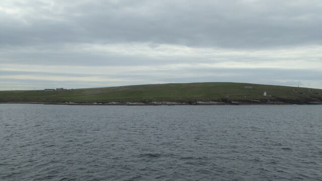
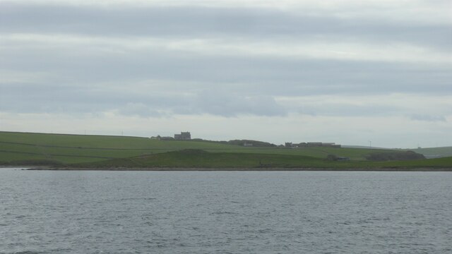
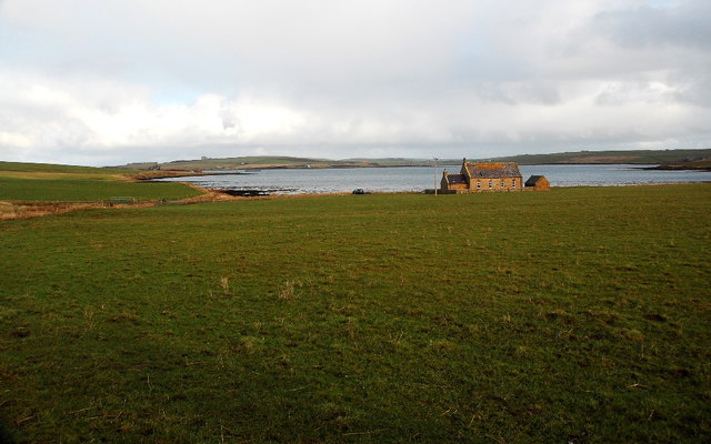
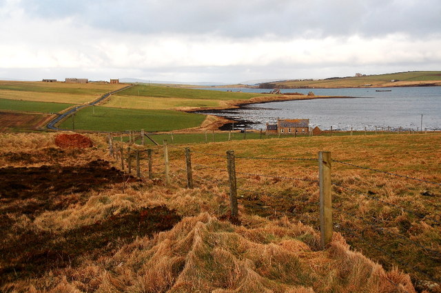
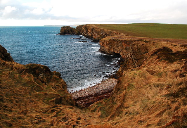
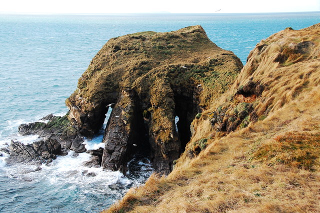
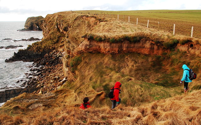
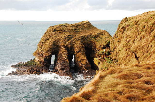
Sand Geo is a prominent coastal feature located on the mainland of Orkney, an archipelago in northern Scotland. It is classified as a headland or point due to its distinctive landform jutting out into the North Atlantic Ocean. The geo is situated on the eastern coast of Orkney, near the village of Sandwick.

Sand Geo is characterized by its sandy beach, which stretches for a considerable distance along the shoreline. The beach is composed of fine-grained sand, creating a picturesque and inviting setting for visitors. The sand is often golden in color, contrasting with the surrounding rugged cliffs and rocky outcrops.

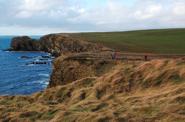
The headland offers stunning panoramic views of the ocean, with the vast expanse of water stretching out to the horizon. The area is also known for its rich biodiversity, attracting a variety of bird species, including gulls, fulmars, and cormorants. Seals can often be spotted lounging on the rocks that surround the geo.

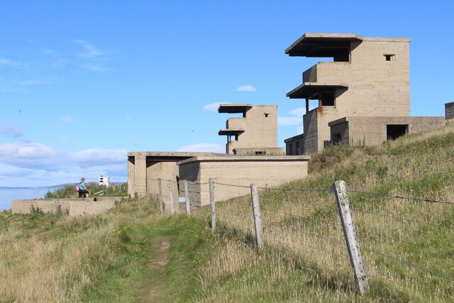
Due to its unique geographical features and natural beauty, Sand Geo is a popular destination for both locals and tourists alike. The beach provides opportunities for recreational activities, such as swimming, sunbathing, and beachcombing. The headland also serves as a starting point for coastal walks and hikes, allowing visitors to explore the surrounding coastal landscape and observe the diverse marine life.

Overall, Sand Geo stands as a captivating coastal feature in Orkney, offering a blend of stunning scenery, sandy beaches, and abundant wildlife for all who venture to its shores.

If you have any feedback on the listing, please let us know in the comments section below.

Sand Geo Images

Images are sourced within 2km of 58.813736/-3.0116176 or Grid Reference ND4192. Thanks to Geograph Open Source API. All images are credited.

Farm near Croo Taing
Uppertown, South Ronaldsay
Coastal Buildings and Slipway, South Ronaldsay
Hoxa Head Lighthouse and Balfour Battery Hoxa Head overlooks the main entrance into Scapa Flow through Hoxa Sound. Hoxa Battery (<span class="nowrap"><a title="https://canmore.org.uk/site/133661/south-ronaldsay-hoxa-head-hoxa-battery" rel="nofollow ugc noopener" href="https://canmore.org.uk/site/133661/south-ronaldsay-hoxa-head-hoxa-battery">Link</a><img style="margin-left:2px;" alt="External link" title="External link - shift click to open in new window" src="https://s1.geograph.org.uk/img/external.png" width="10" height="10"/></span> Canmore ID 133661) was built in the First World War at the southern tip of the peninsula and equipped with 6-inch gun emplacements and magazines. These defences were strengthened in 1940-1 by the addition of another battery to the north, alongside the lighthouse built in 1901. This is the Balfour Battery, which is now the better preserved of the two.

A cast iron, gas-powered lighthouse of 1901 was built to guide ships into Scapa Flow. The superstructure has been removed, leaving a solid concrete plinth, which formed the base. A modern lighthouse, with solar panels, has been built nearby (<span class="nowrap"><a title="https://canmore.org.uk/site/74483/south-ronaldsay-hoxa-head-lighthouse" rel="nofollow ugc noopener" href="https://canmore.org.uk/site/74483/south-ronaldsay-hoxa-head-lighthouse">Link</a><img style="margin-left:2px;" alt="External link" title="External link - shift click to open in new window" src="https://s1.geograph.org.uk/img/external.png" width="10" height="10"/></span> Canmore ID 74483).
Hoxa Head Lighthouse and Balfour Battery
Hoxa Head overlooks the main entrance into Scapa Flow through Hoxa Sound. Hoxa Battery (LinkExternal link Canmore ID 133661) was built in the First World War at the southern tip of the peninsula and equipped with 6-inch gun emplacements and magazines. These defences were strengthened in 1940-1 by the addition of another battery to the north, alongside the lighthouse built in 1901. This is the Balfour Battery, which is now the better preserved of the two. A cast iron, gas-powered lighthouse of 1901 was built to guide ships into Scapa Flow. The superstructure has been removed, leaving a solid concrete plinth, which formed the base. A modern lighthouse, with solar panels, has been built nearby (LinkExternal link Canmore ID 74483).
Hoxa Head Lighthouse A cast iron, gas-powered lighthouse was built in 1901 to guide ships into Scapa Flow. The superstructure has since been removed, leaving just the solid concrete plinth which formed the base. It has been replaced with a modern lighthouse, with solar panels, built nearby (<span class="nowrap"><a title="https://canmore.org.uk/site/74483/south-ronaldsay-hoxa-head-lighthouse" rel="nofollow ugc noopener" href="https://canmore.org.uk/site/74483/south-ronaldsay-hoxa-head-lighthouse">Link</a><img style="margin-left:2px;" alt="External link" title="External link - shift click to open in new window" src="https://s1.geograph.org.uk/img/external.png" width="10" height="10"/></span> Canmore ID 74483).
Hoxa Head Lighthouse
A cast iron, gas-powered lighthouse was built in 1901 to guide ships into Scapa Flow. The superstructure has since been removed, leaving just the solid concrete plinth which formed the base. It has been replaced with a modern lighthouse, with solar panels, built nearby (LinkExternal link Canmore ID 74483).
South Ronaldsay, Hoxa Head Hoxa Head overlooks the main entrance into Scapa Flow through Hoxa Sound. Hoxa Battery was built in the First World War at the southern tip of the peninsula and equipped with 6-inch gun emplacements and magazines. In the Second World War, it was rebuilt with two 6-inch gun emplacements and magazines, an observation post, an engine room and footings for searchlights (<span class="nowrap"><a title="https://canmore.org.uk/site/133661/south-ronaldsay-hoxa-head-hoxa-battery" rel="nofollow ugc noopener" href="https://canmore.org.uk/site/133661/south-ronaldsay-hoxa-head-hoxa-battery">Link</a><img style="margin-left:2px;" alt="External link" title="External link - shift click to open in new window" src="https://s1.geograph.org.uk/img/external.png" width="10" height="10"/></span> Canmore ID 133661)
South Ronaldsay, Hoxa Head
Hoxa Head overlooks the main entrance into Scapa Flow through Hoxa Sound. Hoxa Battery was built in the First World War at the southern tip of the peninsula and equipped with 6-inch gun emplacements and magazines. In the Second World War, it was rebuilt with two 6-inch gun emplacements and magazines, an observation post, an engine room and footings for searchlights (LinkExternal link Canmore ID 133661)
Balfour Coastal Battery
Coastline near Hoxa Head, South Ronaldsay
Howe Taing, South Ronaldsay
Hoxa Head: Coastal battery The interior of a searchlight emplacement at Hoxa Head, overlooking Hoxa Sound. A gun battery defended the Hoxa Sound passage into the Scapa Flow, the base of the Grand (Home) fleet, during during both world wars.

I'm not at all sure what purpose the metal "artificial leg"  served. Perhaps someone knows?
Hoxa Head: Coastal battery
The interior of a searchlight emplacement at Hoxa Head, overlooking Hoxa Sound. A gun battery defended the Hoxa Sound passage into the Scapa Flow, the base of the Grand (Home) fleet, during during both world wars. I'm not at all sure what purpose the metal "artificial leg" served. Perhaps someone knows?
Hoxa Head: Scapa Flow defences During both world wars Scapa Flow was safe anchorage for the Royal Navy's Home Fleet. The main entrances to the flow were heavily defended by booms and metal nets, mine fields and coastal gun batteries. This is part of the complex battery at Hoxa Head. The hillside is covered with concrete; two director towers, with their 6 inch gun houses, magazines and shelters; a fighting searchlight and three dispersed beam lights; several engine houses and lots of hut bases. The battery was designed to cover the Hoxa boom, anchored just north of the battery, with close range and rapid fire against the threat of MTBs.
Hoxa Head: Scapa Flow defences
During both world wars Scapa Flow was safe anchorage for the Royal Navy's Home Fleet. The main entrances to the flow were heavily defended by booms and metal nets, mine fields and coastal gun batteries. This is part of the complex battery at Hoxa Head. The hillside is covered with concrete; two director towers, with their 6 inch gun houses, magazines and shelters; a fighting searchlight and three dispersed beam lights; several engine houses and lots of hut bases. The battery was designed to cover the Hoxa boom, anchored just north of the battery, with close range and rapid fire against the threat of MTBs.
Chapel and the Oyce of Herston I think that the old chapel has been renovated within the last few years.
Chapel and the Oyce of Herston
I think that the old chapel has been renovated within the last few years.
Farmland and the Oyce of Herston Looking northwards toward the old chapel.
Farmland and the Oyce of Herston
Looking northwards toward the old chapel.
Clifftops and pebble beach Looking westwards toward The Altar, Harrabrough Head.
Clifftops and pebble beach
Looking westwards toward The Altar, Harrabrough Head.
The Altar, Cavernous Triptych Unusual geomorphology at Harra Brough with three, almost parallel tunnels, running through the headland.
The Altar, Cavernous Triptych
Unusual geomorphology at Harra Brough with three, almost parallel tunnels, running through the headland.
Looking westwards towards The Altar Coastal scenery en-route to Harrabrough Head.
Looking westwards towards The Altar
Coastal scenery en-route to Harrabrough Head.
Coastal Erosion The cliffs are being undercut and mass-wasting is taking place.
Coastal Erosion
The cliffs are being undercut and mass-wasting is taking place.
The Altar, Harra Brough Two of the three tunnels are clearly visible here. As the third one opens the second one closes making it hard to get a view through all three tunnels simultaneously.
The Altar, Harra Brough
Two of the three tunnels are clearly visible here. As the third one opens the second one closes making it hard to get a view through all three tunnels simultaneously.
Show me another place!

Sand Geo is located at Grid Ref: ND4192 (Lat: 58.813736, Lng: -3.0116176)

Unitary Authority: Orkney Islands

Police Authority: Highlands and Islands

What 3 Words

///harps.shower.croutons. Near St Margaret's Hope, Orkney Islands

Related Wikis

Herston, Orkney

Herston is a village on South Ronaldsay, Orkney, Scotland, United Kingdom. Herston is historically a fishing village but its only industry to speak of...

Hoxa, Orkney

Hoxa is a small settlement on the island of South Ronaldsay in the Orkney Islands north of mainland Scotland. Hoxa is located 1+1⁄4 miles (2.0 km) west...

St Margaret's Hope

St Margaret's Hope is a village in the Orkney Islands, off the north coast of Scotland. It is known locally as The Hope or The Hup. With a population...

Nevi Skerry

Nevi Skerry is a skerry situated in Scapa Flow in the Orkney Islands. The skerry is situated approximately 1 km (0.62 mi) east of Flotta and approximately...

South Ronaldsay

South Ronaldsay (, also , Scots: Sooth Ronalshee) is one of the Orkney Islands off the north coast of Scotland. It is linked to the Orkney Mainland by...

Hunda

Hunda is an uninhabited island in the Orkney archipelago in Scotland. It is 100 hectares (0.39 sq mi) in extent and rises to 42 metres (138 ft) above sea...

Whome

Whome is the largest settlement on the Orkney island of Flotta, Scotland. The village is situated on the B9046, the main road across Flotta. Views from...

Switha

Switha is a small uninhabited island towards the south of Orkney, Scotland, approximately 41 hectares in area. == Geography and geology == Switha lies...

Nearby Amenities

Located within 500m of 58.813736,-3.0116176
Power: pole
Lat/Long: 58.8098442/-3.0074966
Power: pole
Lat/Long: 58.8103012/-3.00832
Power: pole
Lat/Long: 58.8107179/-3.0090952
Power: pole
Lat/Long: 58.8111235/-3.0096665
Power: pole
Lat/Long: 58.8115763/-3.0105677
Herston Taing
Place: locality
Lat/Long: 58.8132794/-3.0099549
Niggle Point
Place: locality
Lat/Long: 58.8126413/-3.0138302
Moi Geo
Place: locality
Lat/Long: 58.8109498/-3.0161119
Widewall Bay
Natural: bay
Lat/Long: 58.8182082/-3.0119276
Leisure: slipway
Lat/Long: 58.8122891/-3.0085183
The data included in this document is from www.openstreetmap.org. The data is made available under ODbL.

Have you been to Sand Geo?

Leave your review of Sand Geo below (or comments, questions and feedback).