Muckle Skerry
Island in Shetland
Scotland
Muckle Skerry
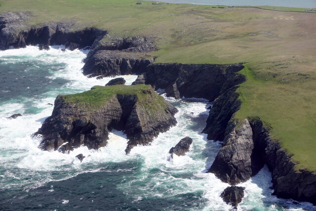
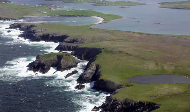
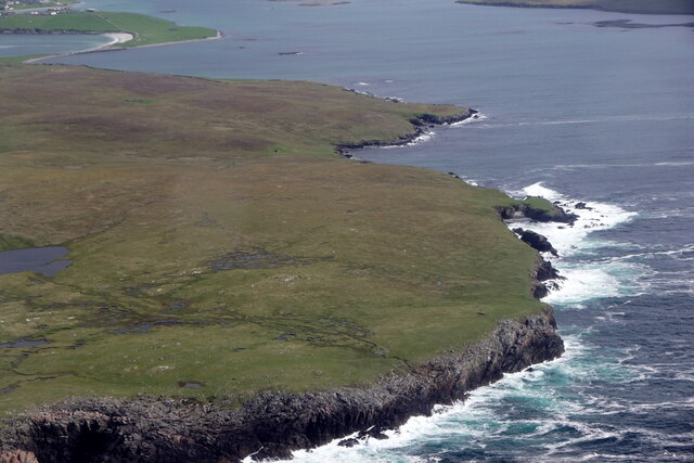
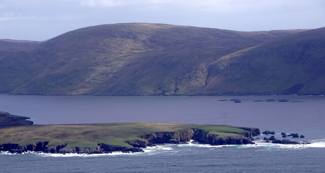
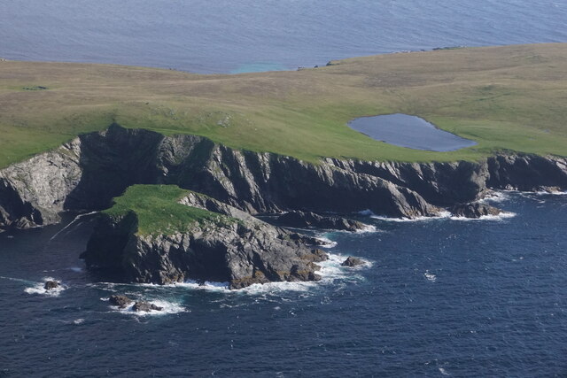
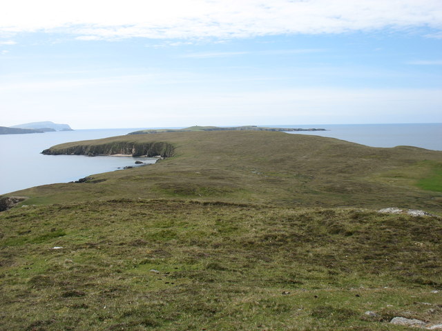
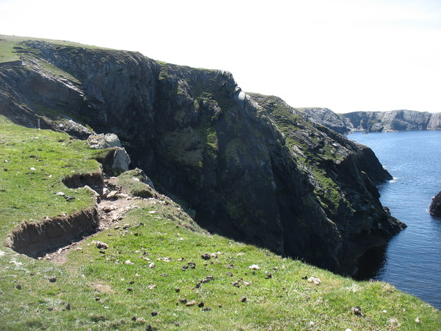
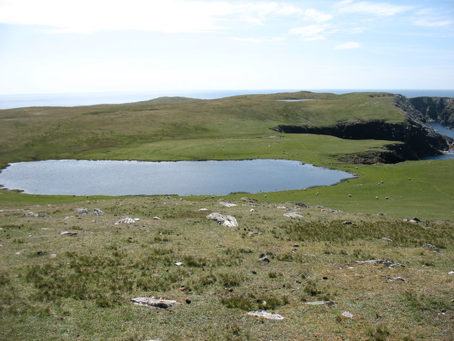
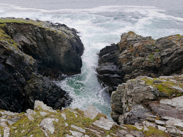
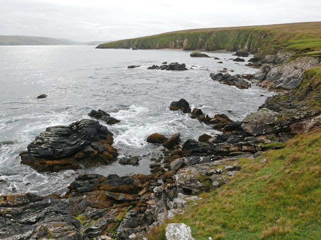
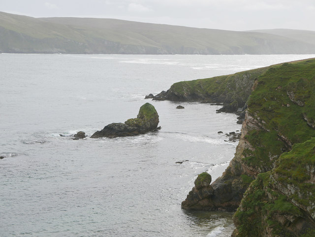
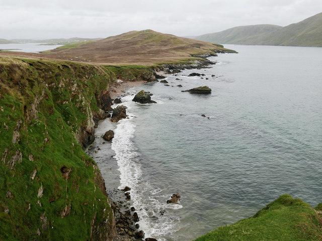
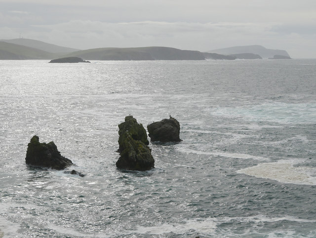
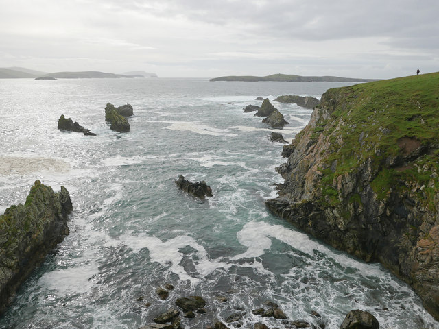
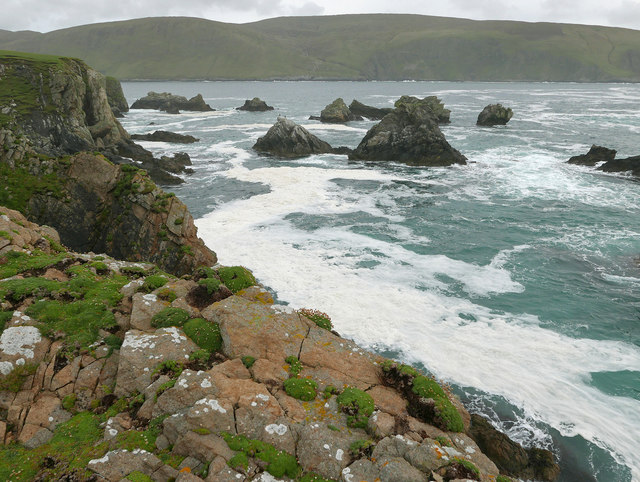
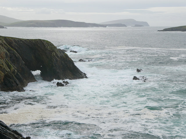
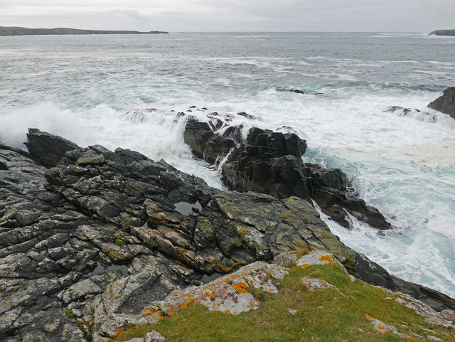
Muckle Skerry is a small uninhabited island located in the Shetland archipelago, in the northernmost part of Scotland. It is situated around 20 miles north of the Shetland mainland and lies between the islands of Yell and Fetlar. The island covers an area of approximately 200 hectares and is mostly composed of low-lying grassy heathland, with some rocky outcrops and cliffs along the coastline.
Muckle Skerry is known for its abundant birdlife, including colonies of seabirds such as puffins, guillemots, and kittiwakes. The island is an important breeding site for these species, as well as for Arctic terns and Arctic skuas. The surrounding waters are also home to seals, dolphins, and various species of whales, making it a popular spot for wildlife enthusiasts and birdwatchers.
Access to Muckle Skerry is limited due to its remote location and lack of infrastructure. There are no permanent residents or facilities on the island, making it a truly untouched and wild place. However, it is possible for visitors to reach the island by boat, either through private charters or organized wildlife tours.
The rugged and isolated nature of Muckle Skerry, combined with its rich biodiversity, makes it a unique and captivating destination for nature lovers seeking an unspoiled wilderness experience. Its picturesque coastal landscapes, teeming bird colonies, and the sense of peace and tranquility it offers, make Muckle Skerry a hidden gem in the Shetland archipelago.
If you have any feedback on the listing, please let us know in the comments section below.
Muckle Skerry Images
Images are sourced within 2km of 60.054953/-1.3442037 or Grid Reference HU3630. Thanks to Geograph Open Source API. All images are credited.

Muckle Skerry is located at Grid Ref: HU3630 (Lat: 60.054953, Lng: -1.3442037)
Unitary Authority: Shetland Islands
Police Authority: Highlands and Islands
What 3 Words
///peach.servicing.mailer. Near Sandwick, Shetland Islands
Nearby Locations
Related Wikis

West Burra
West Burra is one of the Scalloway Islands, a subgroup of the Shetland Islands in Scotland. It is connected by bridge to East Burra. With an area of 743...

Burra, Shetland
Burra (Old Norse: Barrey ) is the collective name for two of the Shetland Islands, West (pop. 753) and East Burra (pop. 66), which are connected by bridge...

Scalloway Islands
The Scalloway Islands are in Shetland opposite Scalloway on south west of the Mainland. They form a mini-archipelago and include: Burra (two islands linked...

South Havra
South Havra (Scots: Sooth Haevra; Old Norse: Hafrey), formerly Hevera, is an uninhabited island in the Scalloway Islands, Shetland, Scotland. == Geography... ==

Little Havra
Little Havra is a small island off the west of South Mainland in Shetland. It is 35 metres (115 ft) at its highest point, upon which there is a cairn....
East Burra
East Burra (Scots: East Burra; Old Norse: "Barrey") is one of the Scalloway Islands, a subgroup of the Shetland Islands in Scotland. It is connected by...

South Mainland
The South Mainland of the Shetland Islands is the southern peninsula of Mainland island. It lies south of Hellister (60° 14′N). The greater southern part...

Bremirehoull
Bremirehoull is a settlement on the island of Mainland, in Shetland, Scotland. Bremirehoull is situated on the A970 in the Cunningsburgh area. == References... ==
Related Videos

Island Of South Havra On History Visit To Shetland Islands Scotland
Tour Scotland travel video clip, with Scottish music, of South Havra, Old Norse: Hafrey, formerly Hevera, an uninhabited island in ...

MINN BEACH,WEST BURRA,SHETLAND-2017
Minnbeach #Bannaminn #Westburra #Shetland Traveling Shetland Banna Minn is a quite simply stunning beach on West Burra.
EAST BURRA,SHETLAND ISLANDS 2017
EastBurra #Shetland #Travel Traveling Shetland East Burra (Scots: East Burra; Old Norse: "Barrey" is one of the Scalloway ...

Minn Beach Burra, Shetland
A wee trip to Minn Beach we the drone. #shetland #beach #sea #cliffs #sand #island #islandlife #tourism #scotland ...
Nearby Amenities
Located within 500m of 60.054953,-1.3442037Have you been to Muckle Skerry?
Leave your review of Muckle Skerry below (or comments, questions and feedback).