Lisgear Mhòr

Island in Ross-shire

Scotland

Lisgear Mhòr

The western end of North Rona
The western end of North Rona Credit: Michael Earnshaw

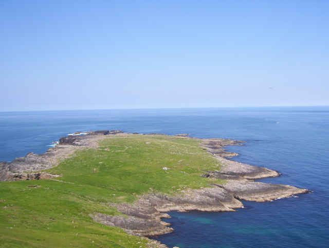
Lisgear Mhòr is a small island located off the coast of Ross-shire in the Scottish Highlands. It is situated in the Inner Hebrides, specifically in the Sound of Sleat, between the Isle of Skye and the mainland. The island covers an area of approximately 100 acres and is surrounded by pristine waters and breathtaking scenery.

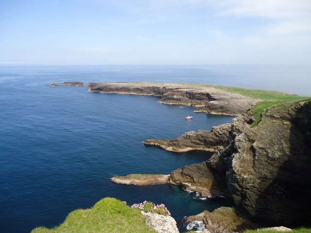
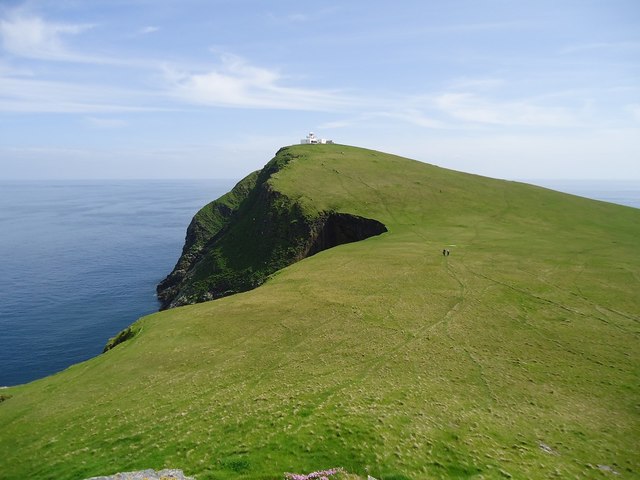
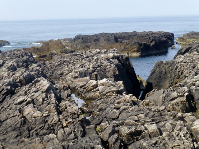
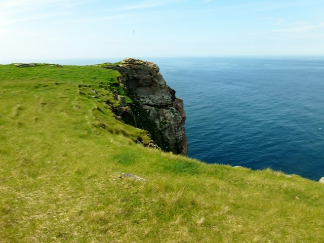
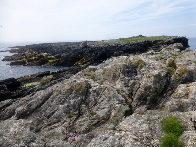
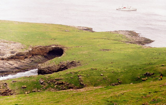
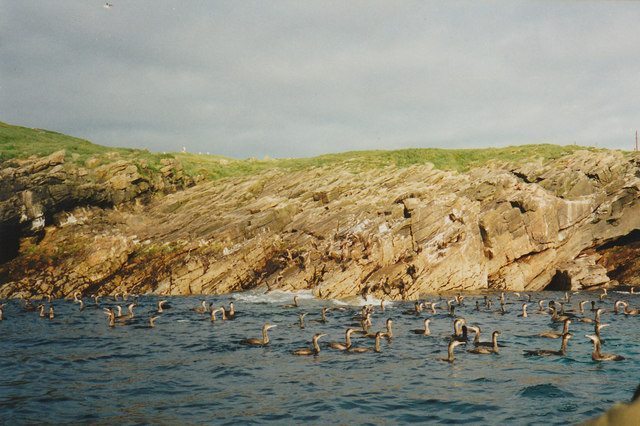
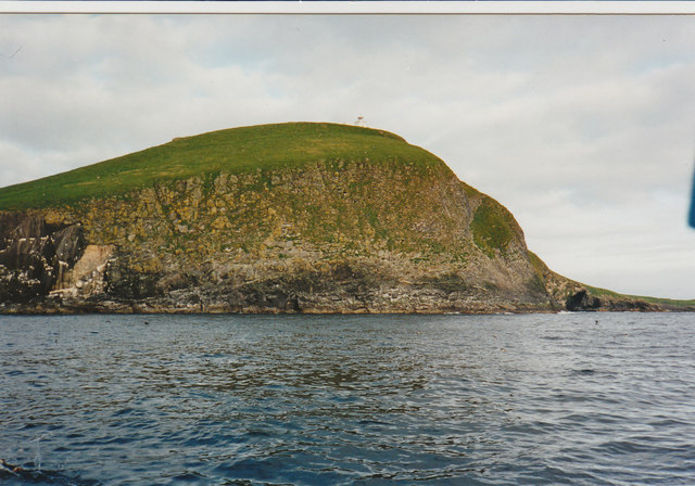
Lisgear Mhòr is known for its rugged landscape, with steep cliffs and rocky shores dominating its coastline. The island is primarily composed of grasslands and heather moorland, providing a habitat for a variety of wildlife, including seabirds, otters, and seals.

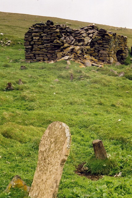
The island has a rich history, with evidence of human settlement dating back to prehistoric times. Ruins of ancient settlements and stone structures can still be found scattered across the island, serving as a reminder of its past inhabitants.

Today, Lisgear Mhòr remains uninhabited, with no permanent residents. However, the island attracts visitors who come to explore its natural beauty and tranquility. It offers opportunities for hiking, birdwatching, and photography, as well as fishing and boating in the surrounding waters.

Access to Lisgear Mhòr is primarily by private boat or charter, as there are no regular ferry services to the island. Visitors are advised to check weather conditions and tides before planning a trip. The island offers a peaceful escape from the mainland, allowing visitors to immerse themselves in the untouched wilderness of the Scottish Highlands.

If you have any feedback on the listing, please let us know in the comments section below.

Lisgear Mhòr Images

Images are sourced within 2km of 59.133398/-5.8258201 or Grid Reference HW8133. Thanks to Geograph Open Source API. All images are credited.

The western end of North Rona
North Rona Looking to the high point of the island.
North Rona
Looking to the high point of the island.
Tobha Rònaigh A view from the 80 metre hillock towards the summit of North Rona with its lighthouse. Visited on a trip with Sea Harris and Seatrek on a lovely day with less than a metre of swell.
Name: Tobha Ronaigh [Toa Rona]
Hill number: 4956
Height: 108m / 354ft
Parent (Ma/M): none
Area: 24A: Lewis and Nearby Islands
Class: Hu,1
Grid ref: HW818322 (est)
Drop: 108m
Col: Sea
Tobha Rònaigh
A view from the 80 metre hillock towards the summit of North Rona with its lighthouse. Visited on a trip with Sea Harris and Seatrek on a lovely day with less than a metre of swell. Name: Tobha Ronaigh [Toa Rona] Hill number: 4956 Height: 108m / 354ft Parent (Ma/M): none Area: 24A: Lewis and Nearby Islands Class: Hu,1 Grid ref: HW818322 (est) Drop: 108m Col: Sea
Rocky North Coast Of Rona/Rònaidh This is a view of the rocky northern coast of North Rona.
Rocky North Coast Of Rona/Rònaidh
This is a view of the rocky northern coast of North Rona.
Coastal View Rona/Rònaidh An upland coastal view on the remote island of North Rona.
Coastal View Rona/Rònaidh
An upland coastal view on the remote island of North Rona.
Lòba Sgeir Lòba Sgeir is a small rocky island of the SW coast of North Rona.
Lòba Sgeir
Lòba Sgeir is a small rocky island of the SW coast of North Rona.
North Rona Looking over the "wing" of North Rona.
North Rona
Looking over the "wing" of North Rona.
Cave on the Island of Rona Rona (Rònaidh, in Gaelic) is a remote outlying island of the Outer Hebrides, some 44 miles NNE of the Butt of Lewis.  It is thus more remote from the main islands of the Outer Hebrides than St Kilda.  It was last inhabited in 1844.  The cave shown in the photo is the result of erosion by the sea.  Eventually, the entire northern peninsula of the island will probably become a separate island as a result of the continuing erosion by Atlantic storms.
Cave on the Island of Rona
Rona (Rònaidh, in Gaelic) is a remote outlying island of the Outer Hebrides, some 44 miles NNE of the Butt of Lewis. It is thus more remote from the main islands of the Outer Hebrides than St Kilda. It was last inhabited in 1844. The cave shown in the photo is the result of erosion by the sea. Eventually, the entire northern peninsula of the island will probably become a separate island as a result of the continuing erosion by Atlantic storms.
The Remains of St Ronan's Church, Rona This photo shows the remains of St Ronan's Church, and part of the graveyard, on the remote island of Rona (Rònaidh, in Gaelic).  It dates from the 8th century, and is one of the three oldest Christian churches in Scotland.  See also <a href="https://www.geograph.org.uk/gridref/HW8132">HW8132</a>.
The Remains of St Ronan's Church, Rona
This photo shows the remains of St Ronan's Church, and part of the graveyard, on the remote island of Rona (Rònaidh, in Gaelic). It dates from the 8th century, and is one of the three oldest Christian churches in Scotland. See also HW8132.
Grounded Fishing Boat North Rona This boat suffered engine failure and drifted unmanned into this inlet on North Rona.
The Boat was a total loss.
Grounded Fishing Boat North Rona
This boat suffered engine failure and drifted unmanned into this inlet on North Rona. The Boat was a total loss.
Fire at North Rona This vessel had grounded and subsequently went on fire.
Fire at North Rona
This vessel had grounded and subsequently went on fire.
North Rona Stornoway fishing boat Calina approaching the 'Toa', North Rona, the steep cliff which has the lighthouse built on top of it.
North Rona
Stornoway fishing boat Calina approaching the 'Toa', North Rona, the steep cliff which has the lighthouse built on top of it.
North Rona This area in known as Loba sgeir, the island of Sulasgeir, approximately 9 miles away is just visible on the horizon.
North Rona
This area in known as Loba sgeir, the island of Sulasgeir, approximately 9 miles away is just visible on the horizon.
Wreck of the Moray Adventurer on North Rona
The wreck Moray Adventurer The wreck of the Moray Adventurer on North Rona.
The wreck Moray Adventurer
The wreck of the Moray Adventurer on North Rona.
Weather Buoy Weather Buoy on North Rona with Sulasgeir in background
Weather Buoy
Weather Buoy on North Rona with Sulasgeir in background
Coming up to Rona Coming up to Rona in early morning
Coming up to Rona
Coming up to Rona in early morning
Cormorants at Geodh a Stoth Cormorants at Geodh a Stoth North Rona
Cormorants at Geodh a Stoth
Cormorants at Geodh a Stoth North Rona
Show me another place!

Lisgear Mhòr is located at Grid Ref: HW8133 (Lat: 59.133398, Lng: -5.8258201)

Unitary Authority: Na h-Eileanan an Iar

Police Authority: Highlands and Islands

What 3 Words

///protected.types.sued. Near Oldshoremore, Highland

Related Wikis

North Rona

Rona (Scottish Gaelic: Rònaigh) is an uninhabited Scottish island in the North Atlantic. It is often referred to as North Rona to distinguish it from the...

Nearby Amenities

Located within 500m of 59.133398,-5.8258201
Geodha an Tuill
Alt Name Gd: Geodh' an Tuill
Name Gd: Geodha an Tuill
Natural: bay
Lat/Long: 59.1311723/-5.8255788
The data included in this document is from www.openstreetmap.org. The data is made available under ODbL.

Have you been to Lisgear Mhòr?

Leave your review of Lisgear Mhòr below (or comments, questions and feedback).