Sgeir na Craoibhe

Island in Argyllshire

Scotland

Sgeir na Craoibhe

Luing - Looking across Black Mill Bay to Ardlarach A view across the semicircular Black Mill Bay from the eponymous settlement of Blackmillbay to the land around Ardlarach with Cnoc Mòr rising behind it to the left (west).
Luing - Looking across Black Mill Bay to Ardlarach Credit: Rob Farrow

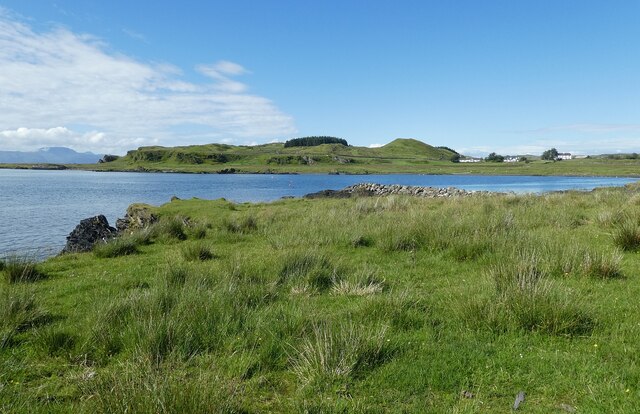
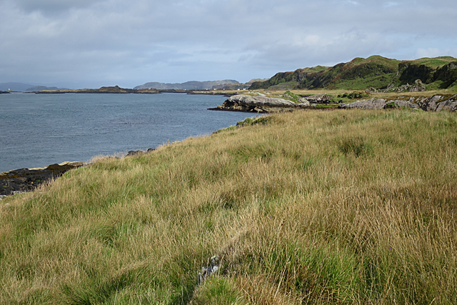
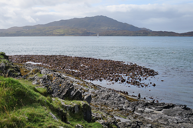
Sgeir na Craoibhe, also known as Sgeir na Creagach, is a small uninhabited island located off the west coast of Scotland in Argyllshire. Situated in the Inner Hebrides, it lies approximately 2 kilometers northwest of the Isle of Luing and 16 kilometers south of Oban.

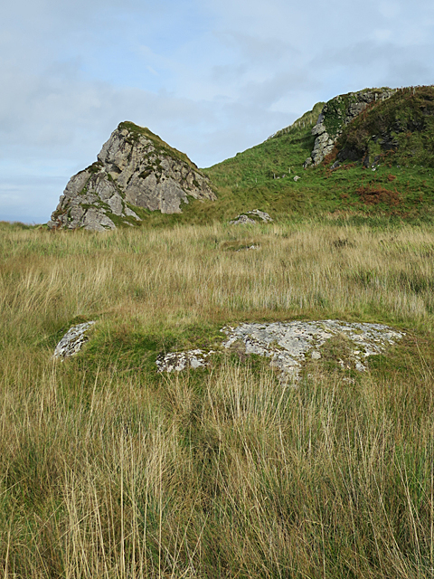
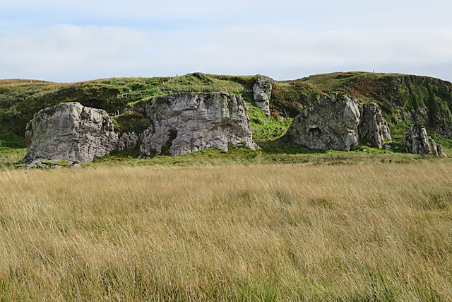
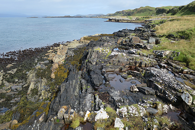
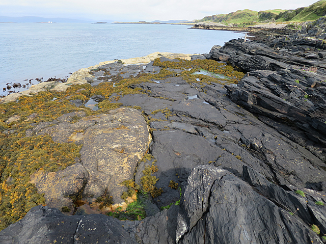
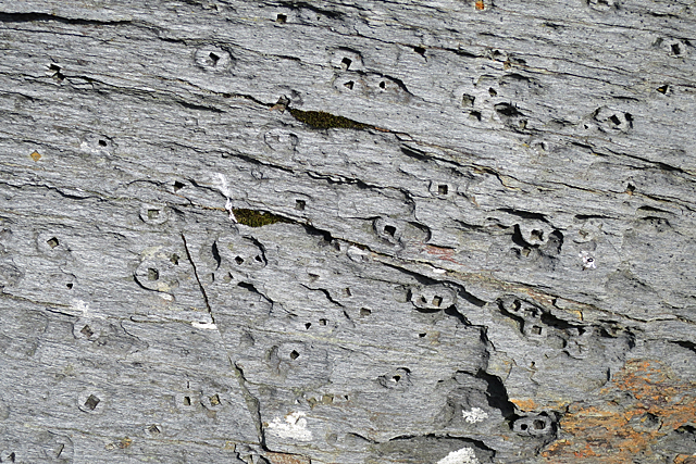
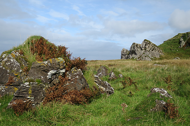
The island is characterized by its rugged and rocky landscape, with steep cliffs rising from the surrounding sea. It measures around 300 meters in length and 100 meters in width, with a highest point of approximately 32 meters above sea level.

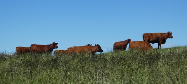
Sgeir na Craoibhe is home to a variety of seabirds, including nesting colonies of common guillemots, razorbills, and kittiwakes. These birds take advantage of the rocky ledges and crevices for breeding, making the island an important site for ornithologists and bird enthusiasts.

The area surrounding the island is known for its rich marine life, with a diverse range of fish species found in the surrounding waters. This makes Sgeir na Craoibhe a popular spot for anglers looking to catch fish such as mackerel, herring, and cod.

Access to Sgeir na Craoibhe is limited, as it is an uninhabited and privately owned island. However, visitors can admire its natural beauty from the sea or nearby vantage points on the Isle of Luing. The island serves as a picturesque example of the rugged and untamed beauty of Scotland's west coast.

If you have any feedback on the listing, please let us know in the comments section below.

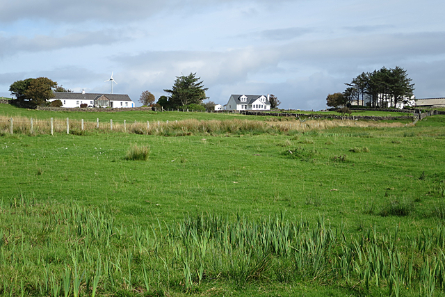
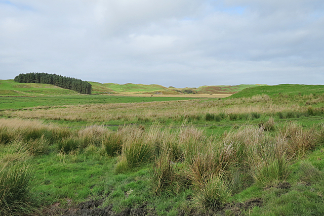
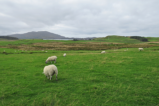
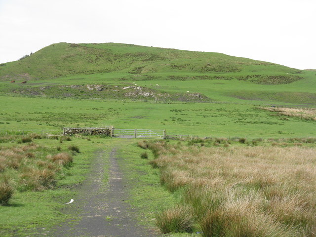
Sgeir na Craoibhe Images

Images are sourced within 2km of 56.236431/-5.6599213 or Grid Reference NM7310. Thanks to Geograph Open Source API. All images are credited.

Luing - Looking across Black Mill Bay to Ardlarach A view across the semicircular Black Mill Bay from the eponymous settlement of Blackmillbay to the land around Ardlarach with Cnoc Mòr rising behind it to the left (west).
Luing - Looking across Black Mill Bay to Ardlarach
A view across the semicircular Black Mill Bay from the eponymous settlement of Blackmillbay to the land around Ardlarach with Cnoc Mòr rising behind it to the left (west).
Luing - Luing Cattle - a small herd A little group of the good-looking Luing Cattle a breed named after the island. The breed is three quarters Beef Shorthorn and one quarter Highland. They are a very hardy beef cow that can raise their calves in harsh conditions.
See Wikipedia article here: <span class="nowrap"><a title="https://en.wikipedia.org/wiki/Luing_cattle" rel="nofollow ugc noopener" href="https://en.wikipedia.org/wiki/Luing_cattle">Link</a><img style="margin-left:2px;" alt="External link" title="External link - shift click to open in new window" src="https://s1.geograph.org.uk/img/external.png" width="10" height="10"/></span>
Luing Cattle Society webpage here: <span class="nowrap"><a title="https://luingcattlesociety.co.uk" rel="nofollow ugc noopener" href="https://luingcattlesociety.co.uk">Link</a><img style="margin-left:2px;" alt="External link" title="External link - shift click to open in new window" src="https://s1.geograph.org.uk/img/external.png" width="10" height="10"/></span>
See also:
<a href="https://www.geograph.org.uk/photo/7259236">NM7409 : Luing - A small herd of Luing cattle on a ridge</a>
<a href="https://www.geograph.org.uk/photo/7259238">NM7409 : Luing - A Luing cow</a>
Luing - Luing Cattle - a small herd
A little group of the good-looking Luing Cattle a breed named after the island. The breed is three quarters Beef Shorthorn and one quarter Highland. They are a very hardy beef cow that can raise their calves in harsh conditions. See Wikipedia article here: LinkExternal link Luing Cattle Society webpage here: LinkExternal link See also: NM7409 : Luing - A small herd of Luing cattle on a ridge NM7409 : Luing - A Luing cow
Luing - A small herd of Luing cattle on a ridge This little group of the Luing Cattle were moving slowly across the ridge north of the lane from Blackmillbay to Toberonochy on the island from which they get their name.
The breed is three quarters Beef Shorthorn and one quarter Highland. They are a very hardy beef cow that can raise their calves in harsh conditions.
See Wikipedia article here: <span class="nowrap"><a title="https://en.wikipedia.org/wiki/Luing_cattle" rel="nofollow ugc noopener" href="https://en.wikipedia.org/wiki/Luing_cattle">Link</a><img style="margin-left:2px;" alt="External link" title="External link - shift click to open in new window" src="https://s1.geograph.org.uk/img/external.png" width="10" height="10"/></span>
Luing Cattle Society webpage here: <span class="nowrap"><a title="https://luingcattlesociety.co.uk" rel="nofollow ugc noopener" href="https://luingcattlesociety.co.uk">Link</a><img style="margin-left:2px;" alt="External link" title="External link - shift click to open in new window" src="https://s1.geograph.org.uk/img/external.png" width="10" height="10"/></span>
See also:
<a href="https://www.geograph.org.uk/photo/7259232">NM7409 : Luing - Luing Cattle - a small herd</a>
<a href="https://www.geograph.org.uk/photo/7259238">NM7409 : Luing - A Luing cow</a>
Luing - A small herd of Luing cattle on a ridge
This little group of the Luing Cattle were moving slowly across the ridge north of the lane from Blackmillbay to Toberonochy on the island from which they get their name. The breed is three quarters Beef Shorthorn and one quarter Highland. They are a very hardy beef cow that can raise their calves in harsh conditions. See Wikipedia article here: LinkExternal link Luing Cattle Society webpage here: LinkExternal link See also: NM7409 : Luing - Luing Cattle - a small herd NM7409 : Luing - A Luing cow
Luing - A Luing cow This fine beast was munching on the grassland of the Isle of Luing from which the breed gets its name.
The breed is three quarters Beef Shorthorn and one quarter Highland. They are a very hardy beef cow that can raise their calves in harsh conditions.
See Wikipedia article here: <span class="nowrap"><a title="https://en.wikipedia.org/wiki/Luing_cattle" rel="nofollow ugc noopener" href="https://en.wikipedia.org/wiki/Luing_cattle">Link</a><img style="margin-left:2px;" alt="External link" title="External link - shift click to open in new window" src="https://s1.geograph.org.uk/img/external.png" width="10" height="10"/></span>
Luing Cattle Society webpage here: <span class="nowrap"><a title="https://luingcattlesociety.co.uk" rel="nofollow ugc noopener" href="https://luingcattlesociety.co.uk">Link</a><img style="margin-left:2px;" alt="External link" title="External link - shift click to open in new window" src="https://s1.geograph.org.uk/img/external.png" width="10" height="10"/></span>
See also:
<a href="https://www.geograph.org.uk/photo/7259232">NM7409 : Luing - Luing Cattle - a small herd</a>
<a href="https://www.geograph.org.uk/photo/7259236">NM7409 : Luing - A small herd of Luing cattle on a ridge</a>
Luing - A Luing cow
This fine beast was munching on the grassland of the Isle of Luing from which the breed gets its name. The breed is three quarters Beef Shorthorn and one quarter Highland. They are a very hardy beef cow that can raise their calves in harsh conditions. See Wikipedia article here: LinkExternal link Luing Cattle Society webpage here: LinkExternal link See also: NM7409 : Luing - Luing Cattle - a small herd NM7409 : Luing - A small herd of Luing cattle on a ridge
Felsic Intrusion Felsic rock is igneous rock that is low in iron and magnesium and high in silica. It is usually pale in colour. Here at Black Mill Bay the Easdale Slates are cut by several sheets of felsic rock, and the outcrop in the foreground is part of the largest of these. It continues beneath the vegetation to form the Cobblers of Lorn, one of which is the conical rock just left of centre a little further north.
Felsic Intrusion
Felsic rock is igneous rock that is low in iron and magnesium and high in silica. It is usually pale in colour. Here at Black Mill Bay the Easdale Slates are cut by several sheets of felsic rock, and the outcrop in the foreground is part of the largest of these. It continues beneath the vegetation to form the Cobblers of Lorn, one of which is the conical rock just left of centre a little further north.
Raised Beach Raised beaches are a feature of much of the coast of Scotland, and especially noticeable in parts of Argyll. They occur when sea level falls fairly rapidly relative to the level of the land, leaving former shores high and dry. You can see that there is a level area between the low cliffs and the present shore right up the length of the coast here.
Raised Beach
Raised beaches are a feature of much of the coast of Scotland, and especially noticeable in parts of Argyll. They occur when sea level falls fairly rapidly relative to the level of the land, leaving former shores high and dry. You can see that there is a level area between the low cliffs and the present shore right up the length of the coast here.
The Cobblers of Lorn The row of rock stacks at the shoreward side of the raised beach is a prominent feature of the west coast of Luing, and a useful landmark for sailors. They are parts of a thick sheet of felsic rock that has been intruded into the Easdale Slates which are the commonest type of rock in this area. Felsic rock is pale-coloured igneous rock which is low in iron and magnesium but high in feldspar and silica. The felsic sheet was eroded into stacks by the action of the sea when the relative level of the sea was higher, and what is now grassland was the shore. Compare with <a href="https://www.geograph.org.uk/photo/168924">NM7209 : The Cobblers of Lorne</a>.
The Cobblers of Lorn
The row of rock stacks at the shoreward side of the raised beach is a prominent feature of the west coast of Luing, and a useful landmark for sailors. They are parts of a thick sheet of felsic rock that has been intruded into the Easdale Slates which are the commonest type of rock in this area. Felsic rock is pale-coloured igneous rock which is low in iron and magnesium but high in feldspar and silica. The felsic sheet was eroded into stacks by the action of the sea when the relative level of the sea was higher, and what is now grassland was the shore. Compare with NM7209 : The Cobblers of Lorne.
Fold on the Foreshore The rock pool occupies the eroded hinge zone of a fold in the Easdale Slate. You can just about make out the curve of the beds round the fold.
Fold on the Foreshore
The rock pool occupies the eroded hinge zone of a fold in the Easdale Slate. You can just about make out the curve of the beds round the fold.
Sound of Luing In the foreground is a forest of kelp, probably Oarweed or Tangle. The hill at the far side of the Sound is the island of Scarba.
Sound of Luing
In the foreground is a forest of kelp, probably Oarweed or Tangle. The hill at the far side of the Sound is the island of Scarba.
Truncated Slate The dark rock here is Easdale Slate, and you can easily make out that it is folded. It has been cut through by the pale rock on the left, which is a felsic sheet. Felsic rock is a pale igneous rock rich in feldspar and silica but low in magnesium and iron.
Truncated Slate
The dark rock here is Easdale Slate, and you can easily make out that it is folded. It has been cut through by the pale rock on the left, which is a felsic sheet. Felsic rock is a pale igneous rock rich in feldspar and silica but low in magnesium and iron.
Pyrite Holes Pyrite is a sulphide of iron, a mineral that forms in anoxic conditions. It crystallises in little cubes a few millimetres across, and its colour when fresh is brassy gold, so that it is commonly called Fool's Gold. When exposed to air, it weathers away quite readily. Each of these square holes once held a pyrite crystal which has weathered out, and most of the holes are surrounded by a ring of chemical alteration. One rusty-looking crystal is still in its hole at the very top of the image.
Pyrite Holes
Pyrite is a sulphide of iron, a mineral that forms in anoxic conditions. It crystallises in little cubes a few millimetres across, and its colour when fresh is brassy gold, so that it is commonly called Fool's Gold. When exposed to air, it weathers away quite readily. Each of these square holes once held a pyrite crystal which has weathered out, and most of the holes are surrounded by a ring of chemical alteration. One rusty-looking crystal is still in its hole at the very top of the image.
The Cobblers of Lorn Looking towards the former sea stacks from the south. The Cobblers are actually just in the next square, but the slate outcrop at left and all of the grassy land are in this square.
The Cobblers of Lorn
Looking towards the former sea stacks from the south. The Cobblers are actually just in the next square, but the slate outcrop at left and all of the grassy land are in this square.
Old Coastline This view is along what was once the shore line. To the right is a line of former sea cliffs, and to the left is a raised beach, a roughly horizontal area left high and dry when the sea level fell relative to the land. This must have occurred after the end of the last Ice Age about 10,000 years ago, but long enough afterwards for the beach to have formed.
Old Coastline
This view is along what was once the shore line. To the right is a line of former sea cliffs, and to the left is a raised beach, a roughly horizontal area left high and dry when the sea level fell relative to the land. This must have occurred after the end of the last Ice Age about 10,000 years ago, but long enough afterwards for the beach to have formed.
Ardlarach Ardlarach is a substantial farm, the home of the Cadzow family who developed the Luing cattle breed.
Ardlarach
Ardlarach is a substantial farm, the home of the Cadzow family who developed the Luing cattle breed.
Isle of Luing This is a rather featureless part of the centre of Luing, with boggy ground used mainly for grazing.
Isle of Luing
This is a rather featureless part of the centre of Luing, with boggy ground used mainly for grazing.
Grazing Land The nearer land has evidently been improved and is providing grazing for sheep. Further away is unimproved rushy, probably quite boggy land. The houses are at Ardlarach Farm, and the hill on the skyline is on the island of Scarba.
Grazing Land
The nearer land has evidently been improved and is providing grazing for sheep. Further away is unimproved rushy, probably quite boggy land. The houses are at Ardlarach Farm, and the hill on the skyline is on the island of Scarba.
Cnoc Mòr, Luing Grass pasture at Ardlarach.
Cnoc Mòr, Luing
Grass pasture at Ardlarach.
Wind turbine at Ardlarach Rough pasture on Luing.
Wind turbine at Ardlarach
Rough pasture on Luing.
Show me another place!

Sgeir na Craoibhe is located at Grid Ref: NM7310 (Lat: 56.236431, Lng: -5.6599213)

Unitary Authority: Argyll and Bute

Police Authority: Argyll and West Dunbartonshire

What 3 Words

///repaying.pelt.angle. Near Lochbuie, Argyll & Bute

Related Wikis

Luing

Luing ( LING; Scottish Gaelic: Luinn) is one of the Slate Islands, Firth of Lorn, in the west of Argyll in Scotland, about 16 miles (26 km) south of Oban...

Slate Islands

The Slate Islands are an island group in the Inner Hebrides, lying immediately off the west coast of Scotland, north of Jura and southwest of Oban. The...

Fladda, Slate Islands

Fladda is one of the Slate Islands, off the west coast of Argyll and Bute, Scotland. Fladda is an islet in the Sound of Luing, between Luing and Belnahua...

Ardinamir

Ardinamir is an anchorage and small settlement on the island of Luing in Argyll and Bute, Scotland. == References ==

Nearby Amenities

Located within 500m of 56.236431,-5.6599213
Source: PGS
Lat/Long: 56.2353828/-5.6634588
Source: PGS
Lat/Long: 56.2345308/-5.6636117
Source: PGS
Lat/Long: 56.2348723/-5.6633816
Source: PGS
Lat/Long: 56.2338271/-5.6638984
Source: PGS
Lat/Long: 56.2344122/-5.6636231
Source: PGS
Lat/Long: 56.2338796/-5.6640554
Source: PGS
Lat/Long: 56.2339331/-5.6644181
Source: PGS
Lat/Long: 56.2342299/-5.6646882
Source: PGS
Lat/Long: 56.2345614/-5.6650818
Source: PGS
Lat/Long: 56.2348057/-5.6652149
Source: PGS
Lat/Long: 56.2348663/-5.6651792
Source: PGS
Lat/Long: 56.2352839/-5.6642601
Source: PGS
Lat/Long: 56.2358439/-5.664274
Source: PGS
Lat/Long: 56.2360497/-5.6657468
Source: PGS
Lat/Long: 56.2363244/-5.6662439
Source: PGS
Lat/Long: 56.2366243/-5.6666222
Source: PGS
Lat/Long: 56.236571/-5.6668144
Source: PGS
Lat/Long: 56.2369907/-5.6669771
Source: PGS
Lat/Long: 56.237502/-5.6670053
Source: PGS
Lat/Long: 56.2384973/-5.6659933
Source: PGS
Lat/Long: 56.2385682/-5.6663146
Source: PGS
Lat/Long: 56.2387848/-5.6663374
Source: PGS
Lat/Long: 56.2388794/-5.6663079
Source: PGS
Lat/Long: 56.2389692/-5.6662985
Source: PGS
Lat/Long: 56.2391692/-5.6661177
Source: PGS
Lat/Long: 56.2397343/-5.6650775
Source: PGS
Lat/Long: 56.2397414/-5.6647479
Source: PGS
Lat/Long: 56.2392494/-5.6642268
Source: PGS
Lat/Long: 56.2394509/-5.6638023
Source: PGS
Lat/Long: 56.2392285/-5.6623355
Source: PGS
Lat/Long: 56.2390735/-5.6621954
Source: PGS
Lat/Long: 56.2369631/-5.6621047
Source: PGS
Lat/Long: 56.2365861/-5.6628441
Source: PGS
Lat/Long: 56.2358984/-5.663116
Source: PGS
Lat/Long: 56.2356728/-5.6632827
Source: PGS
Lat/Long: 56.2322124/-5.6616824
Source: PGS
Lat/Long: 56.23236/-5.6611419
Source: PGS
Lat/Long: 56.2325083/-5.6606009
Source: PGS
Lat/Long: 56.2327303/-5.6600409
Source: PGS
Lat/Long: 56.2329785/-5.6597992
Source: PGS
Lat/Long: 56.2330979/-5.6599792
Source: PGS
Lat/Long: 56.2334697/-5.6597893
Source: PGS
Lat/Long: 56.233982/-5.6597383
Source: PGS
Lat/Long: 56.2341333/-5.6596493
Source: PGS
Lat/Long: 56.2344749/-5.6595157
Source: PGS
Lat/Long: 56.2346058/-5.659218
Source: PGS
Lat/Long: 56.2349788/-5.6590222
Source: PGS
Lat/Long: 56.2354223/-5.6587701
Source: PGS
Lat/Long: 56.2355958/-5.6586134
Source: PGS
Lat/Long: 56.2363923/-5.6584544
Source: PGS
Lat/Long: 56.236713/-5.6585179
Source: PGS
Lat/Long: 56.2371137/-5.6582958
Source: PGS
Lat/Long: 56.2372788/-5.6577793
Source: PGS
Lat/Long: 56.2369284/-5.6575384
Source: PGS
Lat/Long: 56.2358072/-5.6577197
Source: PGS
Lat/Long: 56.2373131/-5.6565961
Source: PGS
Lat/Long: 56.2380829/-5.6559151
Source: PGS
Lat/Long: 56.2386677/-5.6554374
Source: PGS
Lat/Long: 56.2385733/-5.6551577
Source: PGS
Lat/Long: 56.2380475/-5.6551196
Source: PGS
Lat/Long: 56.2388099/-5.6546078
Source: PGS
Lat/Long: 56.2389917/-5.6545353
Source: PGS
Lat/Long: 56.2391864/-5.6544693
Source: PGS
Lat/Long: 56.2394288/-5.6543311
The data included in this document is from www.openstreetmap.org. The data is made available under ODbL.

Have you been to Sgeir na Craoibhe?

Leave your review of Sgeir na Craoibhe below (or comments, questions and feedback).