The Steeple

Island in Cornwall

England

The Steeple

Kynance Cove beach
Kynance Cove beach Credit: Tom Page

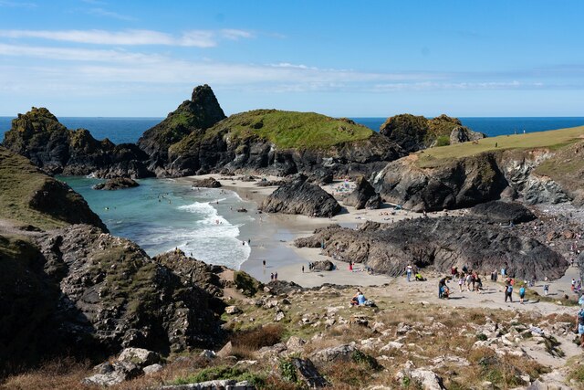
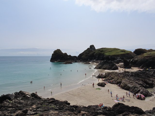
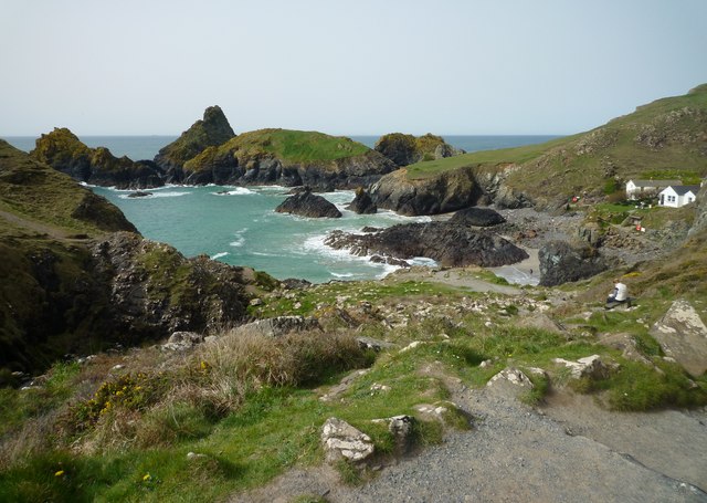
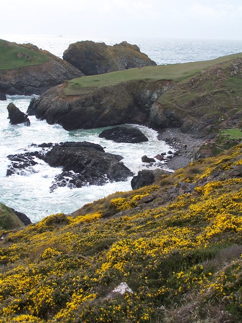
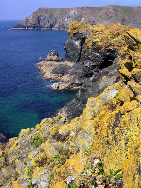
The Steeple is a small island located off the coast of Cornwall, England. With an area of only 0.1 square kilometers, it is one of the smallest islands in the region. The island gets its name from the distinctive steeple-shaped rock formation that rises from the center, giving it a unique and picturesque appearance.

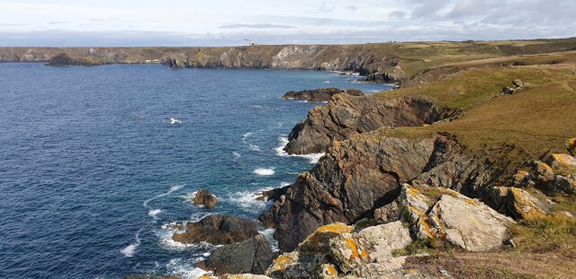
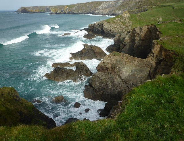
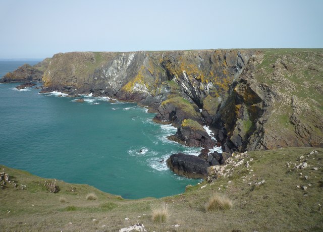
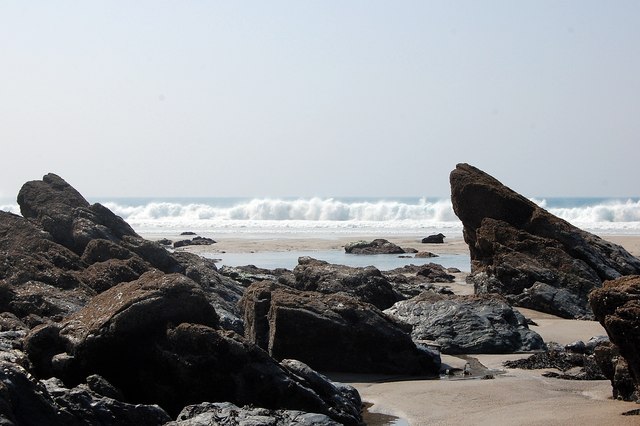
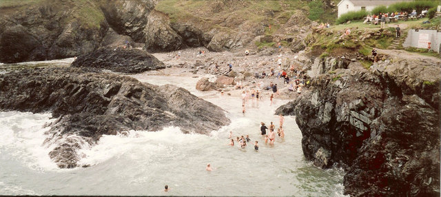
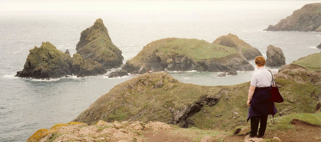
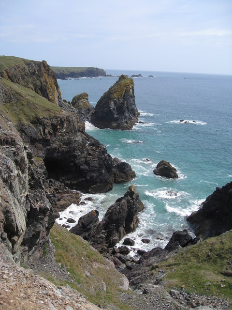
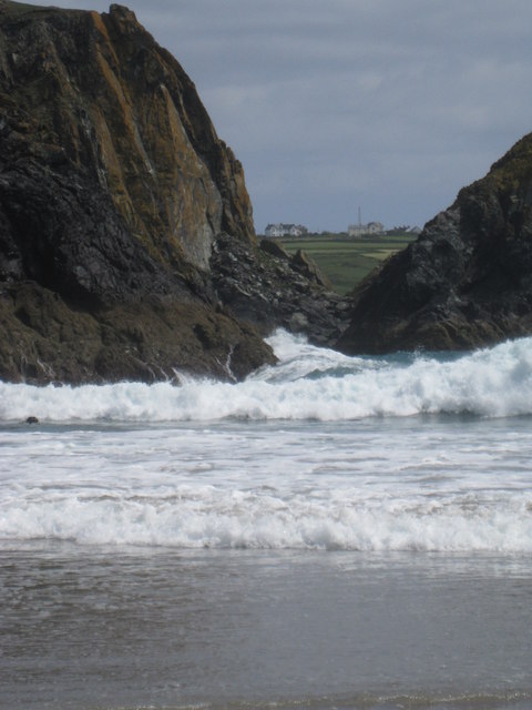
The Steeple is primarily known for its rugged and dramatic coastline, featuring towering cliffs and rocky coves. The island is a popular destination for nature enthusiasts and hikers, offering breathtaking views of the surrounding sea and the nearby mainland. The coastal path provides an opportunity to explore the diverse flora and fauna that inhabit the area, including various seabirds and marine life.

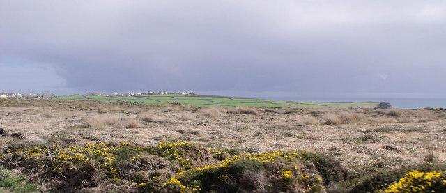
Access to The Steeple is limited, as it can only be reached by boat during low tide. However, this adds to the island's allure, as it remains relatively untouched and undisturbed by human activity. Visitors can enjoy the tranquility and solitude that the island offers, away from the bustling tourist crowds.

The Steeple also has a rich history, with evidence of human settlement dating back thousands of years. Archaeological finds suggest that the island was inhabited during the Neolithic and Bronze Age periods, and remnants of ancient structures can still be seen today. The island's isolation and natural defenses made it an ideal location for a fortified settlement in medieval times, and the ruins of a small castle can be found near the steeple.

In conclusion, The Steeple is a small and secluded island off the coast of Cornwall, known for its stunning coastline, distinctive steeple-shaped rock formation, and rich history. It offers visitors a unique opportunity to experience the beauty and serenity of a remote natural environment.

If you have any feedback on the listing, please let us know in the comments section below.

The Steeple Images

Images are sourced within 2km of 49.974524/-5.2313455 or Grid Reference SW6813. Thanks to Geograph Open Source API. All images are credited.

Kynance Cove beach
Kynance Cove beach
Cliffs below Pistil Meadow A view of the cliffs below Pistil Meadow, from the S W Coastal Path.
Cliffs below Pistil Meadow
A view of the cliffs below Pistil Meadow, from the S W Coastal Path.
Kynance Cove from Pistil Meadow headland Asparagus Island and Kynance Cove from Pistil Meadow headland.
Kynance Cove from Pistil Meadow headland
Asparagus Island and Kynance Cove from Pistil Meadow headland.
Cliffs near Pentreath Beach Some cliffs on the S W Coastal Path between Pentreath Beach and Lizard Point.
Cliffs near Pentreath Beach
Some cliffs on the S W Coastal Path between Pentreath Beach and Lizard Point.
Crane Ledges
Crane Ledges
Fields near Lizard village
Kynance Cove
Kynance Cove
Coast between Lizard Point and Pentreath Beach
Kynance Cove
Kynance Cove
Heathland at Holestrow near Lizard
On Pentreath Beach Rocks - many of serpentine.
On Pentreath Beach
Rocks - many of serpentine.
Kynance Cove
Kynance Cove
Asparagus Island and Bishop Rock at Kynance Cove
Lion Rock - south-east of Kynance Cove This stretch of coast of rocky coast with the prominent Lion Rock shown here in the middle distance is a favourite view for artists. Chatting to artist Michael Richardson, the skill he told me was to be able to capture the violent swells and movements in the water. To see the coast path which passed this scene and the artist working on painting this scene, follow this link. <a href="https://www.geograph.org.uk/photo/2423977">SW6813 : Cliff path to Tor Balk near Kynance Cove</a>

Note that the Lion Rock only looks like a squatting lion when viewed from the south.
Lion Rock - south-east of Kynance Cove
This stretch of coast of rocky coast with the prominent Lion Rock shown here in the middle distance is a favourite view for artists. Chatting to artist Michael Richardson, the skill he told me was to be able to capture the violent swells and movements in the water. To see the coast path which passed this scene and the artist working on painting this scene, follow this link. SW6813 : Cliff path to Tor Balk near Kynance Cove Note that the Lion Rock only looks like a squatting lion when viewed from the south.
Cliff path to Tor Balk near Kynance Cove This steep and rugged cliff path leads up to Tor Balk which can be seen in the distance. The path passes through locations often favoured by artists as in this case. So the polite thing to do is to stop for a chat, admire the artist's work and walk around them. This artist was capturing the view to his right which was a coastal scene featuring the impressive Lion Rock.

To see the scene the artist was painting in oils, follow the link. <a href="https://www.geograph.org.uk/photo/2423964">SW6813 : Lion Rock - south-east of Kynance Cove</a>
Cliff path to Tor Balk near Kynance Cove
This steep and rugged cliff path leads up to Tor Balk which can be seen in the distance. The path passes through locations often favoured by artists as in this case. So the polite thing to do is to stop for a chat, admire the artist's work and walk around them. This artist was capturing the view to his right which was a coastal scene featuring the impressive Lion Rock. To see the scene the artist was painting in oils, follow the link. SW6813 : Lion Rock - south-east of Kynance Cove
Kynance Cove - violent waves and currents This telephoto view from the beach at Kynance Cove at low tide shows the waves coming into the cove at two angles. Firstly the wave comes straight in towards the rocks, then the wave bounces of those rocks to approach the beach from a totally different angle. No wonder there are signs warning of the danger of the treacherous currents in the sea.

For an alternative view at high tide follow the link. <a href="https://www.geograph.org.uk/photo/2031936">SW6813 : High tide at Kynance Cove</a>
Kynance Cove - violent waves and currents
This telephoto view from the beach at Kynance Cove at low tide shows the waves coming into the cove at two angles. Firstly the wave comes straight in towards the rocks, then the wave bounces of those rocks to approach the beach from a totally different angle. No wonder there are signs warning of the danger of the treacherous currents in the sea. For an alternative view at high tide follow the link. SW6813 : High tide at Kynance Cove
Kynance Cove
Kynance Cove
Show me another place!

The Steeple is located at Grid Ref: SW6813 (Lat: 49.974524, Lng: -5.2313455)

Unitary Authority: Cornwall

Police Authority: Devon and Cornwall

What 3 Words

///magically.remotes.exits. Near Landewednack, Cornwall

Related Wikis

Kynance Cove

Kynance Cove (Cornish: Porth Keynans, meaning ravine cove) is a cove on the eastern side of Mount's Bay, Cornwall, England. It is situated on the Lizard...

Asparagus Island

Asparagus Island (Cornish: Enys Merlosowen) is a small tidal island on the eastern side of Mount's Bay, within the parish of Mullion, Cornwall, United...

Rill Cove Wreck

The Rill Cove Wreck is an underwater wreck of a 16th-century Spanish cargo ship lying off the coast of Rill Cove, west of Kynance Cove, in Cornwall, England...

Pentreath

Higher Pentreath and Lower Pentreath (Cornish: Penntreth, representing penn an treth, meaning head (of) the beach) are hamlets to the west of Praa Sands...

Nearby Amenities

Located within 500m of 49.974524,-5.2313455
Kynance Cove
Name Kw: Ben Kewnans
Natural: bay
Source: NPE
Wikidata: Q3817686
Wikipedia: en:Kynance Cove
Lat/Long: 49.9737987/-5.2301373
Bench
Backrest: yes
Source: survey
Lat/Long: 49.9753123/-5.2309135
Bench
Backrest: yes
Source: survey
Lat/Long: 49.9745585/-5.2278843
Life Ring
Emergency: life_ring
Source: survey
Lat/Long: 49.975321/-5.2309002
Life Ring
Emergency: life_ring
Source: survey
Lat/Long: 49.9751615/-5.2313304
Barrier: cattle_grid
Source: survey
Lat/Long: 49.9763189/-5.2310657
Kynance Cove Substation
Brand: National Grid
Brand Wikidata: Q1465461
Operator: National Grid Electricity Distribution Plc
Operator Old: Western Power Distribution
Operator Wikidata: Q7988183
Owner: National Grid Electricity Distribution (South West) Plc
Owner Wikidata: Q114397866
Power: substation
Ref: 415614
Source: survey
Voltage: 11000
Lat/Long: 49.9758753/-5.2312141
Kynance Cove. ****
Tourism: viewpoint
Lat/Long: 49.9745312/-5.227806
Phone
Emergency: phone
Source: rescued from previous object, John Smith tagfiddling reomoved
Lat/Long: 49.9754403/-5.2310888
Check Date: 2022-05-07
Information: map
Tourism: information
Lat/Long: 49.9751711/-5.2254795
Bench
Backrest: yes
Lat/Long: 49.9757315/-5.2312634
Bench
Backrest: yes
Lat/Long: 49.9757215/-5.2312377
Shower
Lat/Long: 49.9756084/-5.2311778
Bench
Backrest: yes
Lat/Long: 49.9752786/-5.231233
Lizard Point and Kynance Cove
Contact Email: lizard@nationaltrust.org.uk
Tourism: viewpoint
Website: https://www.nationaltrust.org.uk/lizard-point-and-kynance-cove/%20Lizard%20Point%20and%20Kynance%20Cove
Lat/Long: 49.9739252/-5.2264084
Natural: cave_entrance
Lat/Long: 49.9745948/-5.2321723
Natural: cave_entrance
Lat/Long: 49.9748541/-5.232466
Direction: ESE-NW
Tourism: viewpoint
Lat/Long: 49.9736932/-5.2259906
Parking Space
Access: disabled
Lat/Long: 49.9739022/-5.2249287
Parking Space
Access: disabled
Lat/Long: 49.9738975/-5.2249751
Parking Space
Access: disabled
Lat/Long: 49.9738897/-5.225024
Natural: cave_entrance
Lat/Long: 49.9750313/-5.2328717
Tourism: viewpoint
Lat/Long: 49.9741035/-5.2285577
Vending Machine
Check Date: 2022-05-07
Lat/Long: 49.9742565/-5.2253225
Barrier: swing_gate
Swing Gate Type: single
Vehicle: private
Lat/Long: 49.9743638/-5.2246962
Bicycle Parking
Bicycle Parking: stands
Capacity: 4
Lat/Long: 49.9741989/-5.2247489
Life Ring
Emergency: life_ring
Lat/Long: 49.9753735/-5.2313873
Defibrillator
Emergency: defibrillator
Lat/Long: 49.9754375/-5.2310839
The data included in this document is from www.openstreetmap.org. The data is made available under ODbL.

Have you been to The Steeple?

Leave your review of The Steeple below (or comments, questions and feedback).