Stac a' Mheadais

Island in Inverness-shire

Scotland

Stac a' Mheadais

Waterfall Start of a 200m plunge off the edge of Skye.
Waterfall Credit: Richard Webb

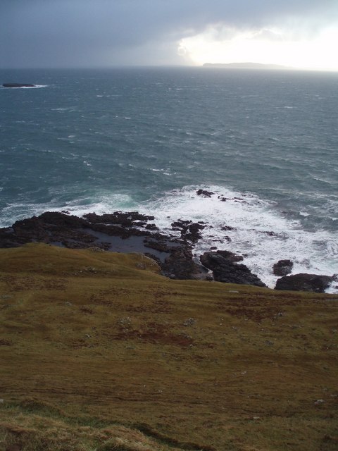
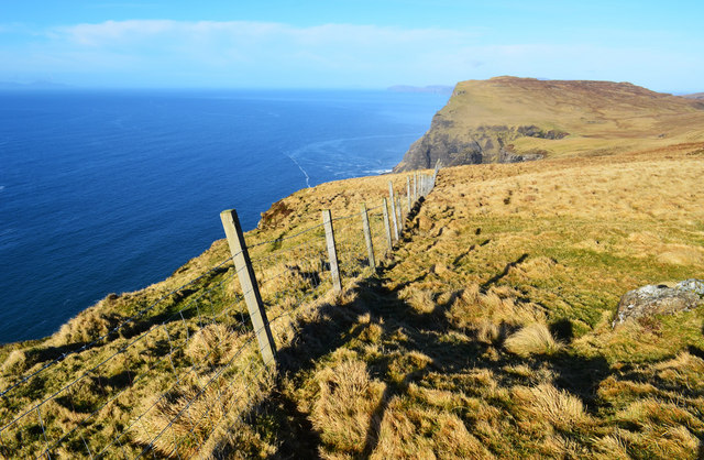
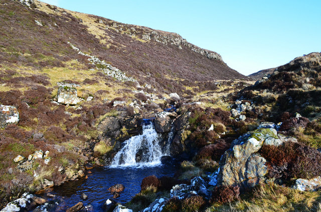
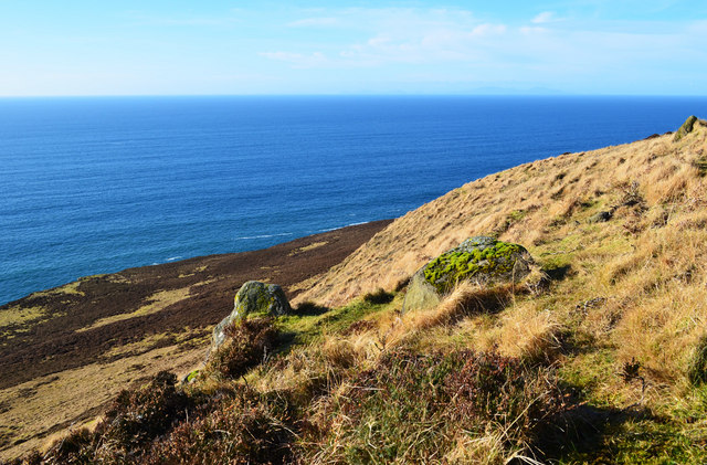
Stac a' Mheadais is a small island located in Inverness-shire, Scotland. It is situated off the northwest coast of the mainland, near the village of Gairloch. The island is part of the Inner Hebrides archipelago and is known for its stunning natural beauty and rich wildlife.

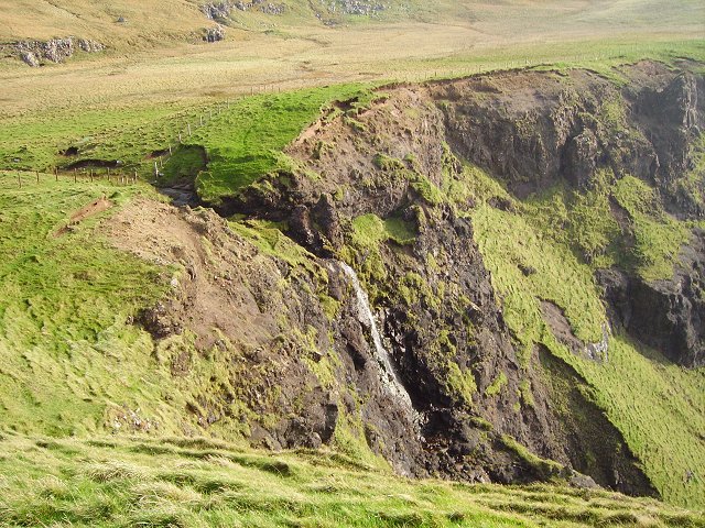
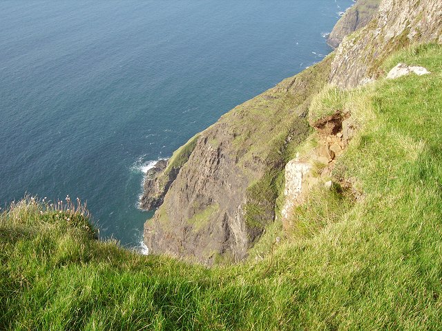
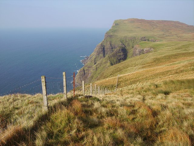
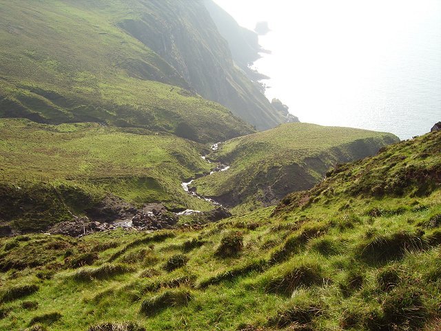
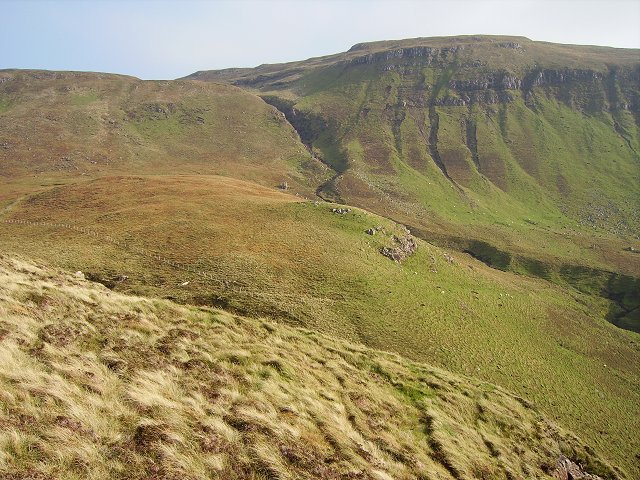
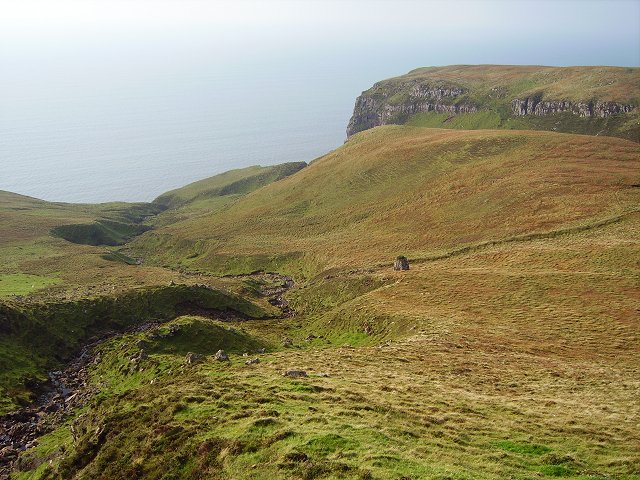
With an area of approximately 126 hectares, Stac a' Mheadais is relatively small in size. It is characterized by its rugged and rocky terrain, with steep cliffs rising from the sea. The island boasts dramatic landscapes, featuring picturesque views of the surrounding ocean and nearby islands.

Despite its size, Stac a' Mheadais is an important habitat for various species of birds. It is particularly renowned for its large seabird colonies, including puffins, razorbills, and guillemots. These birds flock to the island during the breeding season, creating a spectacle for visitors and nature enthusiasts.

Access to Stac a' Mheadais is limited, as it is primarily a conservation area. However, boat trips and guided tours are available, allowing visitors to experience the island's natural wonders and observe its wildlife up close. The waters surrounding the island also offer opportunities for activities such as kayaking and fishing.

Stac a' Mheadais is a hidden gem in the Scottish Highlands, offering a peaceful retreat and a chance to immerse oneself in nature. Its untouched landscapes and abundant wildlife make it a must-visit destination for those seeking a unique and unspoiled island experience in Inverness-shire.

If you have any feedback on the listing, please let us know in the comments section below.

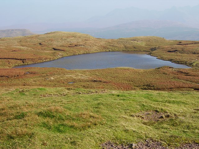
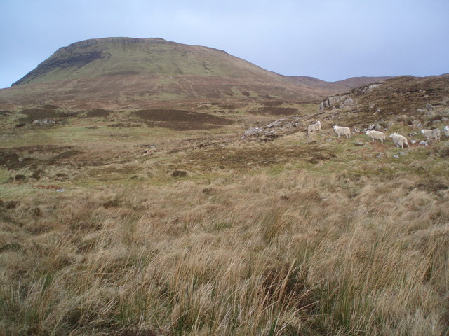
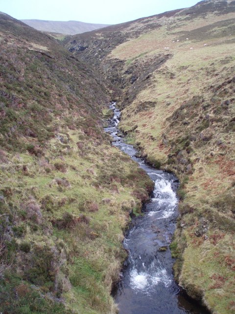
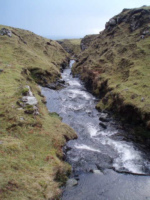
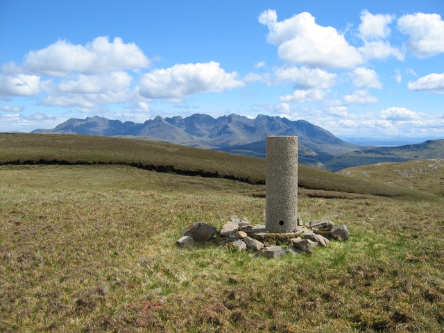
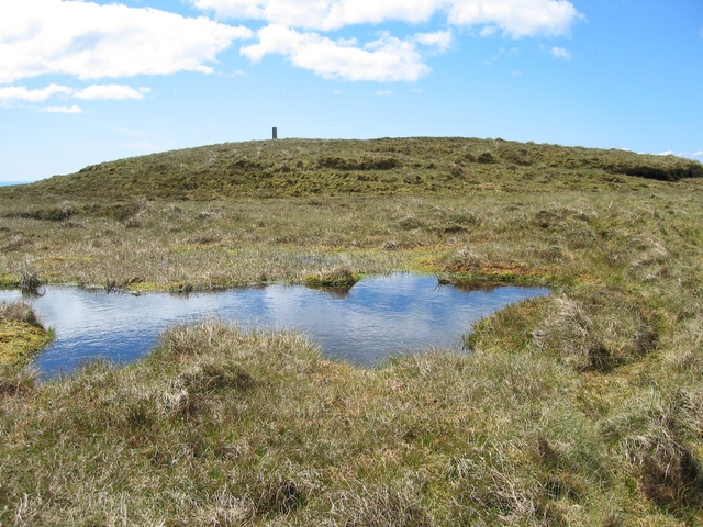
Stac a' Mheadais Images

Images are sourced within 2km of 57.241031/-6.4268425 or Grid Reference NG3325. Thanks to Geograph Open Source API. All images are credited.

Waterfall Start of a 200m plunge off the edge of Skye.
Waterfall
Start of a 200m plunge off the edge of Skye.
Sgùrr nam Fiadh Shame there is not a "down" in the view direction box.  Looking down the crags at Sgùrr nam Fiadh, still in excess of 200m drop.
Sgùrr nam Fiadh
Shame there is not a "down" in the view direction box. Looking down the crags at Sgùrr nam Fiadh, still in excess of 200m drop.
Sgùrr nam Fiadh The fence is an attempt to deter base jumping sheep. Not successful, I had to take a big detour inland so as not to fatally frighten a ewe and lamb on the wrong side of the fence. View along the coast towards Biod Ruadh
Sgùrr nam Fiadh
The fence is an attempt to deter base jumping sheep. Not successful, I had to take a big detour inland so as not to fatally frighten a ewe and lamb on the wrong side of the fence. View along the coast towards Biod Ruadh
Over you go A burn before its 200m leap off the crags beneath Sgùrr nam Fiadh. As you descend into this fertile glen beneath Beinn Bhreac, it's easy to forget how high up you still are.
Over you go
A burn before its 200m leap off the crags beneath Sgùrr nam Fiadh. As you descend into this fertile glen beneath Beinn Bhreac, it's easy to forget how high up you still are.
Beinn Bhreac The western side from Sgùrr nam Fiadh
Beinn Bhreac
The western side from Sgùrr nam Fiadh
Sgùrr nam Fiadh Sgùrr nam Fiadh as seen from the gorge in the west side of Beinn Bhreac.
Sgùrr nam Fiadh
Sgùrr nam Fiadh as seen from the gorge in the west side of Beinn Bhreac.
Beinn Bhreac The trig point, with one of the summit candidates beyond.
Beinn Bhreac
The trig point, with one of the summit candidates beyond.
Beinn Bhreac The southernmost of the two 448m summits.
Beinn Bhreac
The southernmost of the two 448m summits.
Lochan on Beinn Bhreac Lochan at the head of the Tusdale Burn.
Lochan on Beinn Bhreac
Lochan at the head of the Tusdale Burn.
Curious Sheep Looking towards Ben Scaalaan from the Minginish Coast these sheep seemed quite curious as to our presence.
Curious Sheep
Looking towards Ben Scaalaan from the Minginish Coast these sheep seemed quite curious as to our presence.
Glen Caladale Lovely little steep sided glen in the Minginish peninsula, Isle of Skye.
Glen Caladale
Lovely little steep sided glen in the Minginish peninsula, Isle of Skye.
Waterfall Ahead Burn in Glen Caladale just before it plunges to the sea - Minginish peninsula, Isle of Skye
Waterfall Ahead
Burn in Glen Caladale just before it plunges to the sea - Minginish peninsula, Isle of Skye
Coastline and Canna Coastal scenery of the Minginish peninsula with a dramatic sky above Canna. You can just see An Dubh-sgeir at left.
Coastline and Canna
Coastal scenery of the Minginish peninsula with a dramatic sky above Canna. You can just see An Dubh-sgeir at left.
Beinn Bhreac Trig At 445m, the trig, known by the OS as Skridan, is a little below the true summit of Beinn Bhreac. It has a view of the whole length of the Western Isles, and as far south as Coll and Tiree, some 70 Km away.
This is a view with the Cuillin as a backdrop.
Beinn Bhreac Trig
At 445m, the trig, known by the OS as Skridan, is a little below the true summit of Beinn Bhreac. It has a view of the whole length of the Western Isles, and as far south as Coll and Tiree, some 70 Km away. This is a view with the Cuillin as a backdrop.
Beinn Breac Trig Viewed from a low point on the large and complex summit plateau.
Beinn Breac Trig
Viewed from a low point on the large and complex summit plateau.
Fence on Sgùrr nam Fiadh The fence protects a drop of around 250m down the sea cliff.
Fence on Sgùrr nam Fiadh
The fence protects a drop of around 250m down the sea cliff.
Waterfall on a burn south of Sgùrr nam Fiadh A small fall in comparison to the 200m drop that the water is about to encounter as it falls over the sea cliff behind the photographer.
Waterfall on a burn south of Sgùrr nam Fiadh
A small fall in comparison to the 200m drop that the water is about to encounter as it falls over the sea cliff behind the photographer.
Above Sgùrr Beag Looking out across the Minch from the slopes above Sgùrr Beag. The hills of South Uist are just visible towards the right end of the horizon.
Above Sgùrr Beag
Looking out across the Minch from the slopes above Sgùrr Beag. The hills of South Uist are just visible towards the right end of the horizon.
Show me another place!

Stac a' Mheadais is located at Grid Ref: NG3325 (Lat: 57.241031, Lng: -6.4268425)

Unitary Authority: Highland

Police Authority: Highlands and Islands

What 3 Words

///circus.shimmered.moped. Near Carbost, Highland

Related Wikis

Talisker

Talisker (Scottish Gaelic: Talasgair) is a settlement on the Minginish peninsula in the Isle of Skye, Scotland. == History == Talisker was for centuries...

Eynort

Eynort (Scottish Gaelic: Aoineart) is a small remote hamlet, situated at the head of Loch Eynort, on the west coast of the Isle of Skye, Scottish Highlands...

Minginish

Minginish (Scottish Gaelic: Minginis) is a peninsula on the Isle of Skye in Scotland. It is situated on the west coast of the island and runs from Loch...

Glen Brittle

Glen Brittle (Gleann Breadail in Scottish Gaelic) is a large glen in the south of the Isle of Skye, in Scotland. It runs roughly south to north, along...

Nearby Amenities

Located within 500m of 57.241031,-6.4268425
Source: PGS
Lat/Long: 57.2408984/-6.4274882
Source: PGS
Lat/Long: 57.2412442/-6.4273843
Source: PGS
Lat/Long: 57.2413874/-6.4268641
Source: PGS
Lat/Long: 57.2411592/-6.4266444
Source: PGS
Lat/Long: 57.240802/-6.4264471
Source: PGS
Lat/Long: 57.2407422/-6.4266972
Source: PGS
Lat/Long: 57.2407333/-6.4270686
Created By: dmgroom_coastlines
Source: PGS
Lat/Long: 57.24524/-6.42622
Created By: dmgroom_coastlines
Source: PGS
Lat/Long: 57.24447/-6.42627
Created By: dmgroom_coastlines
Source: PGS
Lat/Long: 57.24396/-6.4263
Created By: dmgroom_coastlines
Source: PGS
Lat/Long: 57.24319/-6.42635
Created By: dmgroom_coastlines
Source: PGS
Lat/Long: 57.24269/-6.42663
Created By: dmgroom_coastlines
Source: PGS
Lat/Long: 57.24267/-6.42568
Created By: dmgroom_coastlines
Source: PGS
Lat/Long: 57.24242/-6.42594
Created By: dmgroom_coastlines
Source: PGS
Lat/Long: 57.24191/-6.42622
Created By: dmgroom_coastlines
Source: PGS
Lat/Long: 57.24189/-6.42527
Created By: dmgroom_coastlines
Source: PGS
Lat/Long: 57.24138/-6.4253
Created By: dmgroom_coastlines
Source: PGS
Lat/Long: 57.24148/-6.42389
Created By: dmgroom_coastlines
Source: PGS
Lat/Long: 57.24147/-6.42341
Created By: dmgroom_coastlines
Source: PGS
Lat/Long: 57.24134/-6.42318
Created By: dmgroom_coastlines
Source: PGS
Lat/Long: 57.2412/-6.42295
Created By: dmgroom_coastlines
Source: PGS
Lat/Long: 57.2409/-6.42061
Created By: dmgroom_coastlines
Source: PGS
Lat/Long: 57.24077/-6.42038
Created By: dmgroom_coastlines
Source: PGS
Lat/Long: 57.24063/-6.42016
Created By: dmgroom_coastlines
Source: PGS
Lat/Long: 57.24049/-6.41923
Created By: dmgroom_coastlines
Source: PGS
Lat/Long: 57.23997/-6.41902
The data included in this document is from www.openstreetmap.org. The data is made available under ODbL.

Have you been to Stac a' Mheadais?

Leave your review of Stac a' Mheadais below (or comments, questions and feedback).