Càiream

Island in Inverness-shire

Scotland

Càiream

Loch Chliuthair This inlet opens in to Loch Cluer, another of the eastern Harris sea-lochs.
Loch Chliuthair Credit: Anne Burgess

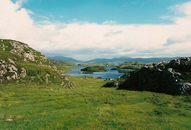
Càiream is a small island located in the county of Inverness-shire in Scotland. Situated in the Inner Hebrides, it is one of the many islands that dot the scenic landscape of the region. The island is approximately 2 miles long and 1 mile wide, with a total area of around 1.5 square miles.

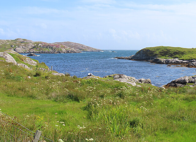
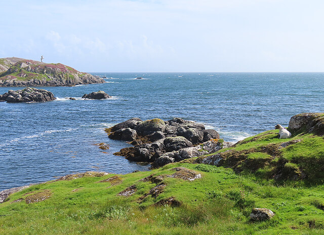
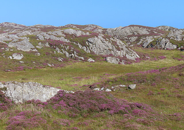
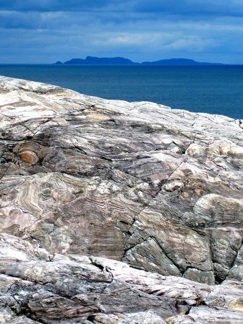
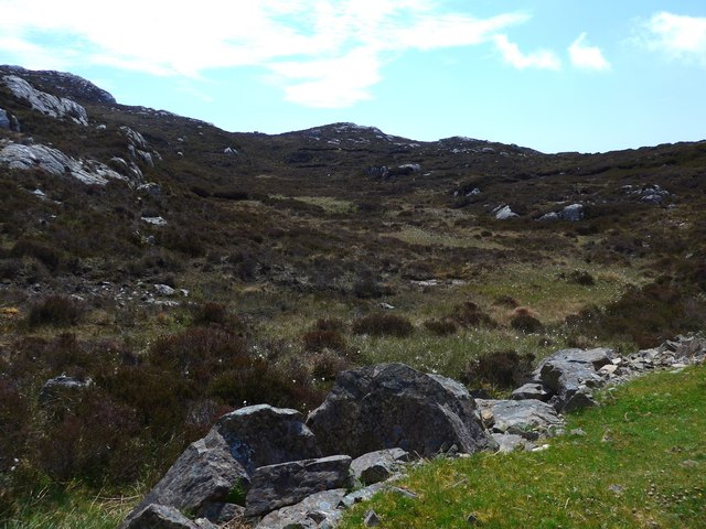
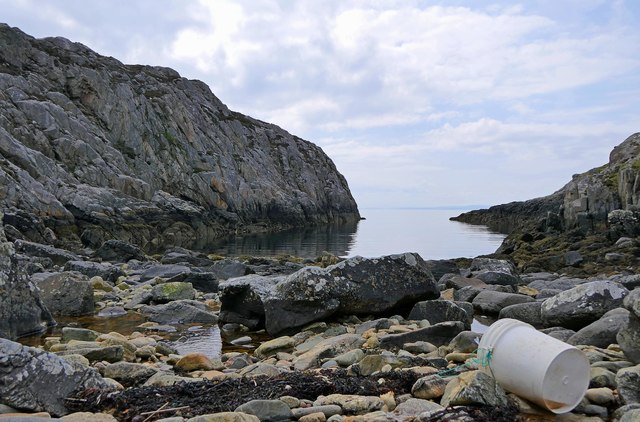
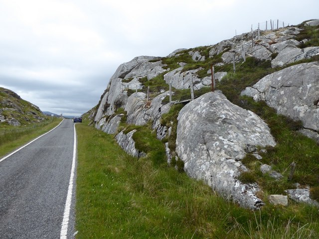
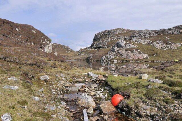
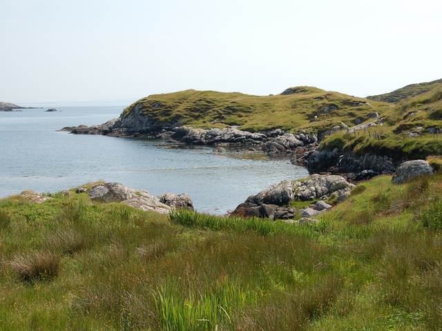
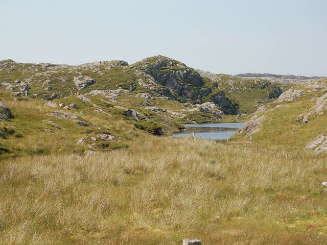
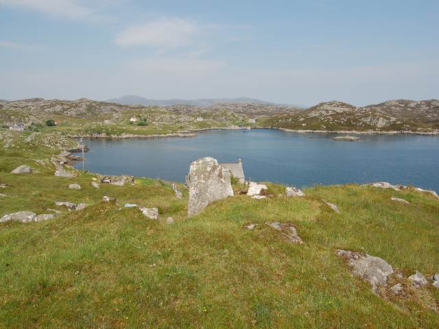
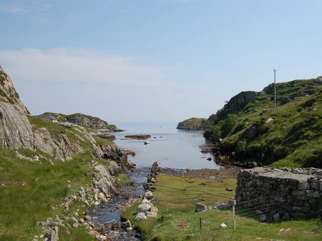
Càiream boasts stunning natural beauty, with its rugged coastline, rolling hills, and picturesque views of the surrounding sea. The island is predominantly covered in grassland and heather, with scattered patches of woodland. Its diverse ecosystem supports a variety of wildlife, including birds, seals, and occasional sightings of dolphins and whales.

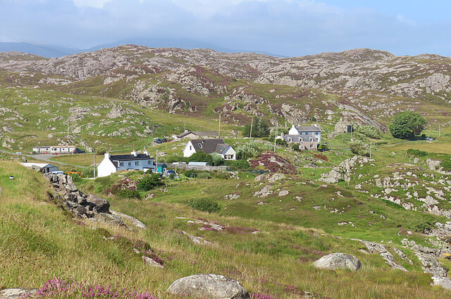
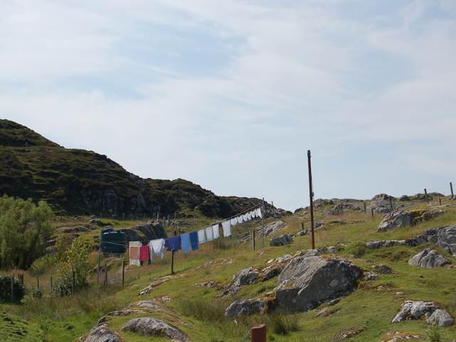
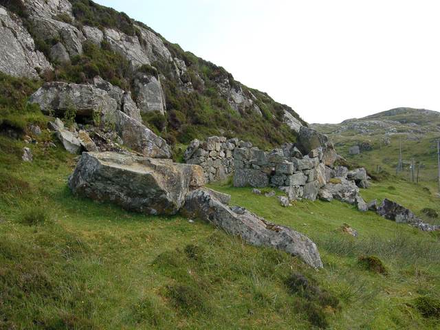
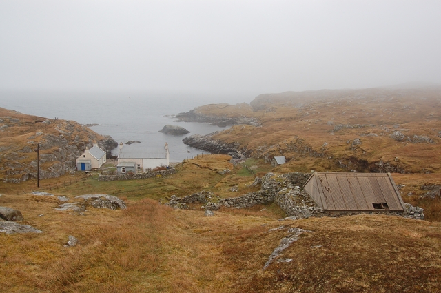
The island has a rich history, with evidence of human occupation dating back thousands of years. Ancient ruins, including standing stones and burial mounds, can be found on the island, providing a glimpse into its past. Càiream was once home to a small community of farmers and fishermen, but today it is largely uninhabited, with only a few holiday cottages and a small lighthouse.

Access to Càiream is mainly by boat, with regular ferry services operating from nearby towns on the mainland. The island offers a peaceful and secluded retreat for visitors, who can explore its scenic trails, go birdwatching, or simply enjoy the tranquility of its unspoiled landscapes.

Overall, Càiream is a hidden gem in the Inner Hebrides, offering a unique blend of natural beauty, rich history, and serenity for those seeking a peaceful getaway.

If you have any feedback on the listing, please let us know in the comments section below.

Càiream Images

Images are sourced within 2km of 57.818082/-6.7789545 or Grid Reference NG1690. Thanks to Geograph Open Source API. All images are credited.

Loch Chliuthair This inlet opens in to Loch Cluer, another of the eastern Harris sea-lochs.
Loch Chliuthair
This inlet opens in to Loch Cluer, another of the eastern Harris sea-lochs.
Loch Cluer Loch Chliuthair in Gaelic takes its name from the village of Cliuthar, anglicised as Cluer.
Loch Cluer
Loch Chliuthair in Gaelic takes its name from the village of Cliuthar, anglicised as Cluer.
Collam A handful of houses beside Loch Ghreosabhaigh.
Collam
A handful of houses beside Loch Ghreosabhaigh.
Fish Farm In the outer part of Loch Ghreosabhagh. I take it that the poles and nets are to discourage birds form taking the fish.
Fish Farm
In the outer part of Loch Ghreosabhagh. I take it that the poles and nets are to discourage birds form taking the fish.
Lewisian Gneiss This is classic Lewisian Gneiss, in irregular outcrops smoothed by the glaciers of the last (and no doubt previous) Ice Ages.
Lewisian Gneiss
This is classic Lewisian Gneiss, in irregular outcrops smoothed by the glaciers of the last (and no doubt previous) Ice Ages.
Lewisian Gneiss with the Shiant Isles behind Magnificent swirls of Lewisian Gneiss just south of Mol Ban in South Harris.
Lewisian Gneiss with the Shiant Isles behind
Magnificent swirls of Lewisian Gneiss just south of Mol Ban in South Harris.
Rough ground at Druim nan-Uidhean
Mol Bhi, Harris Mol Bhi (or Mol Vee) is an inlet on Loch Ghreosabhagh.
Mol Bhi, Harris
Mol Bhi (or Mol Vee) is an inlet on Loch Ghreosabhagh.
Ice-sculpted rock next to minor road at Scadabay
Outflow from Loch Chumain, Harris The buoy is from a boat called Spindrift, possibly SY128, a Stornoway registered potter (boat used to catch shellfish).
Outflow from Loch Chumain, Harris
The buoy is from a boat called Spindrift, possibly SY128, a Stornoway registered potter (boat used to catch shellfish).
The head of Loch Cliuthair
Loch na Buaile A small loch in a marshy hollow near Cliuthar.
Loch na Buaile
A small loch in a marshy hollow near Cliuthar.
Ghreosabhagh A view of the settlement of Ghreosabhagh looking across the top of Loch Ghreosabhagh.
Ghreosabhagh
A view of the settlement of Ghreosabhagh looking across the top of Loch Ghreosabhagh.
The head of Loch Chollaim The burn entering the sea here has been canalised to the left side of the head of the loch to provide some flat dry ground for sheep fanks, the edge of which can be seen on the right.
The head of Loch Chollaim
The burn entering the sea here has been canalised to the left side of the head of the loch to provide some flat dry ground for sheep fanks, the edge of which can be seen on the right.
Washing at Scadabhagh Taking advantage of a good drying day.
Washing at Scadabhagh
Taking advantage of a good drying day.
Old building at Scadabhagh A drystone construction of partly dressed gneiss using a small cliff for support. I would think agricultural rather than residential, and probably relatively recent.
Old building at Scadabhagh
A drystone construction of partly dressed gneiss using a small cliff for support. I would think agricultural rather than residential, and probably relatively recent.
Southern end of Loch Plocrapool
Mol Ban Amazingly, in my opinion, the only access to this house is along a kilometre of ancient cart track. It is possible to use a wheelbarrow of the type with a ball for a wheel, but that apart no vehicles can get here - not even quads.
The photograph is taken from, and looking along, the end of the grassy track.
Mol Ban
Amazingly, in my opinion, the only access to this house is along a kilometre of ancient cart track. It is possible to use a wheelbarrow of the type with a ball for a wheel, but that apart no vehicles can get here - not even quads. The photograph is taken from, and looking along, the end of the grassy track.
Show me another place!

Càiream is located at Grid Ref: NG1690 (Lat: 57.818082, Lng: -6.7789545)

Unitary Authority: Na h-Eileanan an Iar

Police Authority: Highlands and Islands

What 3 Words

///complain.stocky.amaze. Near Tarbert, Na h-Eileanan Siar

Related Wikis

Stockinish Island

Stockinish Island (Scottish Gaelic: Eilean Stocainis) is an uninhabited island off Harris, in the Outer Hebrides. == Geography and geology == Stockinish...

East Loch Tarbert

East Loch Tarbert (Scottish Gaelic: Loch an Tairbeairt) is a sea loch that lies to the east of Harris in the Outer Hebrides of Scotland. The loch contains...

Sgeotasaigh

Scotasay (Scottish Gaelic: Sgeotasaigh) is small island in the Outer Hebrides of Scotland. It lies 1 kilometre (0.6 miles) off the east coast of Harris...

Scalpay, Outer Hebrides

Scalpay (; Scottish Gaelic: Sgalpaigh or Sgalpaigh na Hearadh; i.e. "Scalpay of Harris" to distinguish it from Scalpay off Skye) is an island in the Outer...

Harris distillery

Harris distillery is a Scotch whisky and Gin distillery in Tarbert on the Isle of Harris, Scotland. The distillery was the first legal distillery ever...

Tarbert, Harris

Tarbert (Scottish Gaelic: An Tairbeart [ən̪ˠ ˈt̪ɛrʲɛbərˠʃt̪]) is the main community on Harris in the Western Isles of Scotland. The name means "isthmus...

Eilean Glas, Scalpay

Eilean Glas is a peninsula of Scalpay in the Outer Hebrides, Scotland. Eilean Glas is home to a historic lighthouse. Eilean Glas means Grey/Green Island...

Eilean Glas Lighthouse

Eilean Glas Lighthouse is situated on the east coast of the island of Scalpay in the Outer Hebrides of Scotland. It was one of the original four lights...

Have you been to Càiream?

Leave your review of Càiream below (or comments, questions and feedback).