Moor Park

Range Of Mountains, Range Of Hills in Stirlingshire

Scotland

Moor Park

Path giving access to Muir Park Reservoir Looking westward.
Path giving access to Muir Park Reservoir Credit: Peter Wood

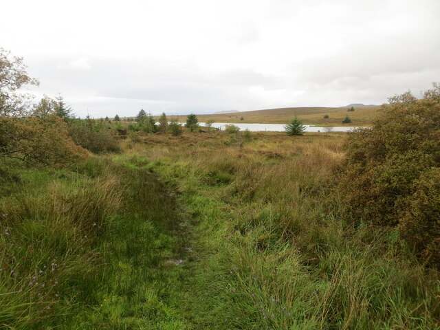
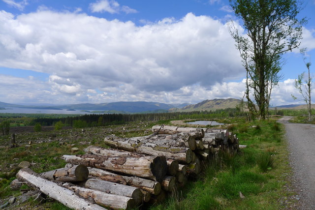
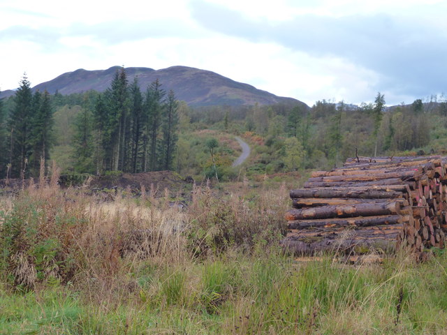
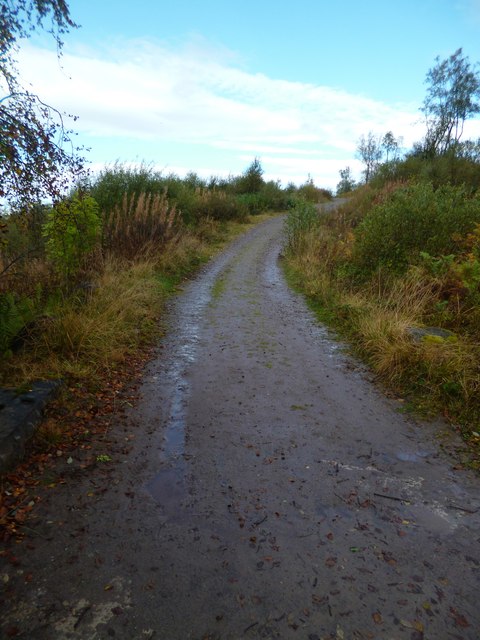
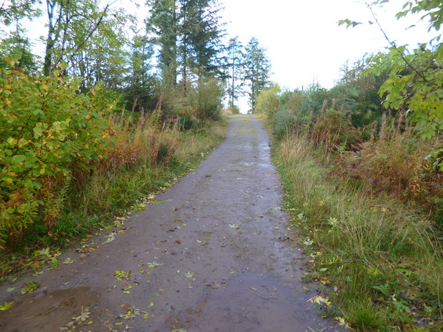
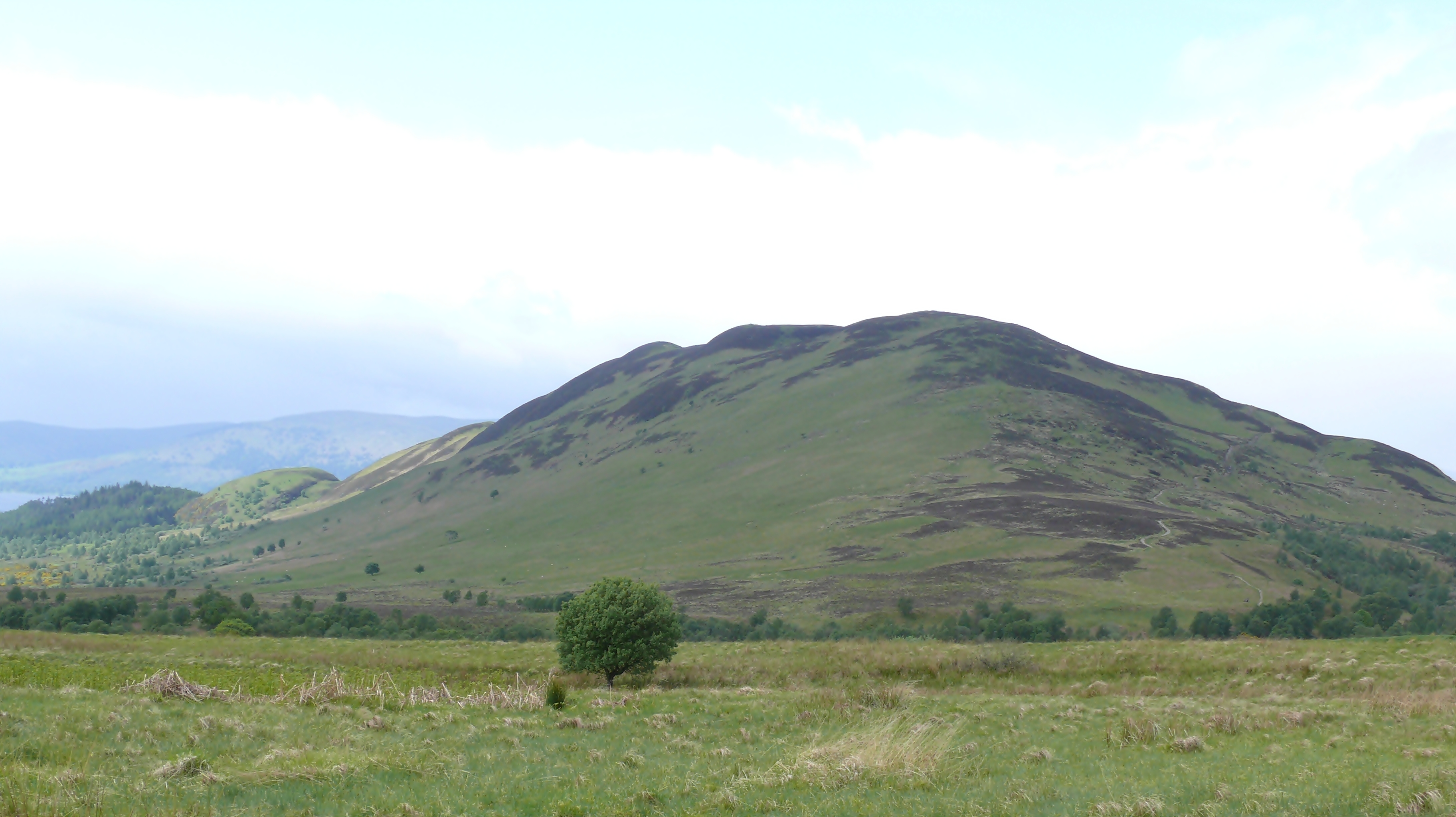
Moor Park is a picturesque area located in Stirlingshire, Scotland. It is known for its stunning range of mountains and hills, making it a popular destination for outdoor enthusiasts and nature lovers.

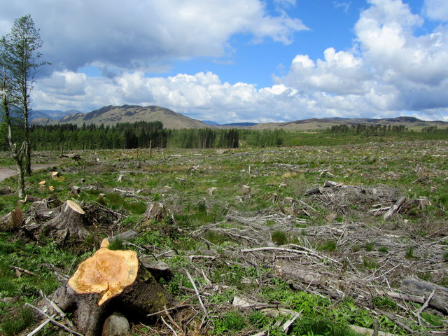
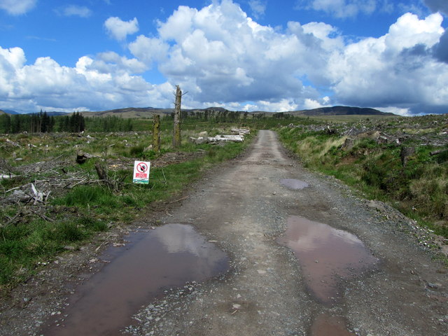
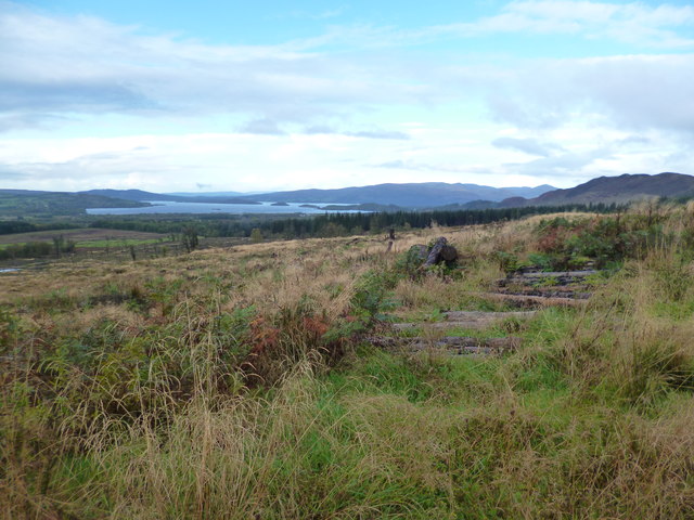
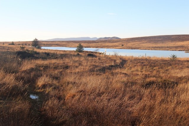
The area is characterized by its diverse topography, with a range of mountains and hills that provide breathtaking views and ample opportunities for exploration. The mountains in Moor Park are part of the larger Grampian Mountains, which stretch across the Scottish Highlands. These mountains are known for their rugged beauty and are a favorite among hikers and climbers.

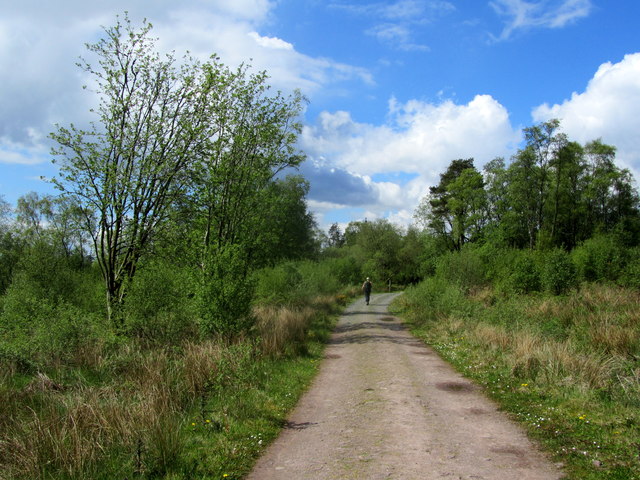
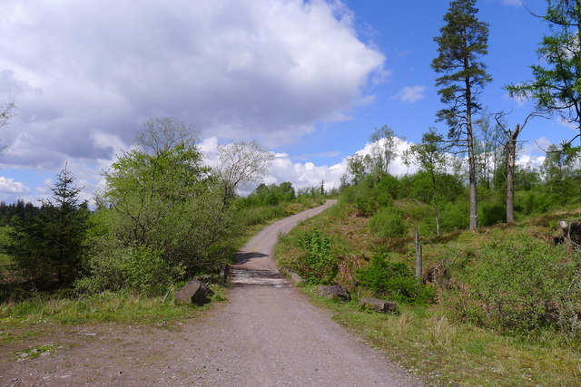
The hills in Moor Park are equally impressive, offering a more gentle and rolling landscape. They are covered in lush greenery and dotted with small streams and lochs, adding to the charm of the area. The hills provide excellent terrain for walking, cycling, and horseback riding, allowing visitors to immerse themselves in the tranquil surroundings.

In addition to its natural beauty, Moor Park is home to a variety of wildlife, including deer, red squirrels, and a wide range of bird species. It is a haven for birdwatchers, who can observe rare and migratory birds in their natural habitat.

Moor Park is also rich in history and cultural heritage, with several ancient sites and ruins scattered throughout the area. These include ancient burial mounds, standing stones, and castles, providing a glimpse into the region's past.

Overall, Moor Park in Stirlingshire offers a diverse and captivating landscape, making it an ideal destination for those seeking to immerse themselves in nature and explore the rich history of the area.

If you have any feedback on the listing, please let us know in the comments section below.

Moor Park Images

Images are sourced within 2km of 56.103054/-4.4601032 or Grid Reference NS4792. Thanks to Geograph Open Source API. All images are credited.

Path giving access to Muir Park Reservoir Looking westward.
Path giving access to Muir Park Reservoir
Looking westward.
Cleared Garadhban Forest Much of this forest has been harvested recently. Strangely there are one or two isolated survivors.
Cleared Garadhban Forest
Much of this forest has been harvested recently. Strangely there are one or two isolated survivors.
In Garadhban Forest The road in the foreground climbs north through the forest from close to the car park. This is a well engineered road, as shown by the deep ditch in the foreground. In the distance is the south end of Loch Lomond.
In Garadhban Forest
The road in the foreground climbs north through the forest from close to the car park. This is a well engineered road, as shown by the deep ditch in the foreground. In the distance is the south end of Loch Lomond.
Muir Park Reservoir Looking closely in the foreground one sees the wee path worn by the feet of anglers.
Muir Park Reservoir
Looking closely in the foreground one sees the wee path worn by the feet of anglers.
Part of Garadhban Forest One or two trees seemed to have escaped the cull - otherwise this area has been laid waste until new growth takes hold
Part of Garadhban Forest
One or two trees seemed to have escaped the cull - otherwise this area has been laid waste until new growth takes hold
West Highland Way in White's Plantation The National Trail continues through what is left of White's Plantation - part of the Queen Elizabeth Forest Park
West Highland Way in White's Plantation
The National Trail continues through what is left of White's Plantation - part of the Queen Elizabeth Forest Park
West Highland Way in the Queen Elizabeth Forest Park
More clear felling in the Queen Elizabeth Forest Park On the West Highland Way through Garadhban Forest. The felling allows a first view of our future route on the Way today - over Conic Hill (behind the logs in the middle distance) and thence to the shore of Loch Lomond
More clear felling in the Queen Elizabeth Forest Park
On the West Highland Way through Garadhban Forest. The felling allows a first view of our future route on the Way today - over Conic Hill (behind the logs in the middle distance) and thence to the shore of Loch Lomond
The West Highland Way crossing Alltana Chaoruinn
Looking towards Gualann from the West Highland Way
Loch Lomond First view of the loch after leaving Drymen on the West Highland Way.  A freshwater loch situated on the Highland Boundary Fault between the lowlands and the highlands.
Loch Lomond
First view of the loch after leaving Drymen on the West Highland Way. A freshwater loch situated on the Highland Boundary Fault between the lowlands and the highlands.
View from the West Highland Way in Garadhban forest
West Highland Way forest track in Garadhban forest
West Highland Way in Garadhban Forest The path may be seen in the distance to the left of the log pile which is also by the side of the path.
West Highland Way in Garadhban Forest
The path may be seen in the distance to the left of the log pile which is also by the side of the path.
West Highland Way near White's Plantation
Stream in Garadh Ban Wood by West Highland Way
West Highland Way in Garadh Ban Wood
Muir Park Reservoir The lumpy ridge of Conic Hill lies beyond.
Muir Park Reservoir
The lumpy ridge of Conic Hill lies beyond.
Show me another place!

Moor Park is located at Grid Ref: NS4792 (Lat: 56.103054, Lng: -4.4601032)

Unitary Authority: Stirling

Police Authority: Forth Valley

What 3 Words

///shunning.rooms.ranged. Near Balfron, Stirling

Nearby Locations

Moor Park

Related Wikis

Buchanan Smithy

Buchanan Smithy is a hamlet in Buchanan in the far west of Stirling, Scotland. The current settlement was mostly purpose-built in the 18th century for...

Milton of Buchanan

Milton of Buchanan is a small village in Stirling, Scotland, within the parish of Buchanan. Historically, the village was in the Registration County of...

Conic Hill

Conic Hill (from Gaelic "còinneach" meaning moss) is a prominent hill in Stirling, Scotland. == Location and description == It is on the east bank of Loch...

Buchanan Auld House

Buchanan Auld House (or Buchanan Old House) is a ruined house in Stirlingshire, Scotland, located 1.5 miles (2.4 km) west of the village of Drymen. Historic...

Buchanan Castle

Buchanan Castle is a ruined castle in Stirlingshire, Scotland, located 1 mile (1.6 km) west of the village of Drymen. The house was commissioned by The...

Drymen

Drymen (; from Scottish Gaelic: Druiminn [ˈt̪ɾɯmɪɲ]) is a village in the Stirling district of central Scotland. Once a popular stopping place for cattle...

Buchanan, Stirling

Buchanan is a historic parish in Stirlingshire in Scotland. It includes a large part of the eastern shore of Loch Lomond. The most populated village in...

Dalmary

Dalmary is a small hamlet in Stirling, Scotland, situated in the civil parish of Drymen. Unlike other settlements in the Drymen civil parish, Dalmary has...

Have you been to Moor Park?

Leave your review of Moor Park below (or comments, questions and feedback).