Caburn Bottom

Valley in Sussex Lewes

England

Caburn Bottom

View of the River Ouse meandering alongside the A26 near Lewes from the footpath leading from Chapel Hill to Lewes Golf Club Looking south-southeast.
View of the River Ouse meandering alongside the A26 near Lewes from the footpath leading from Chapel Hill to Lewes Golf Club Credit: Robert Lamb

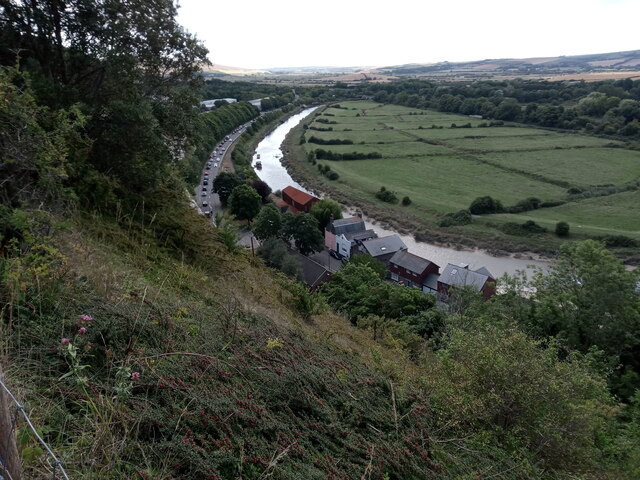
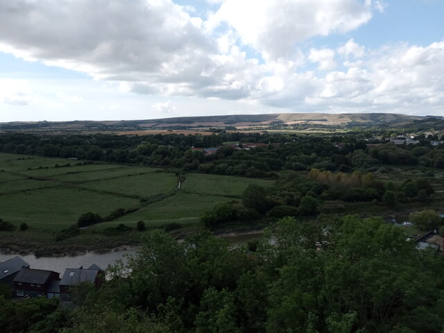
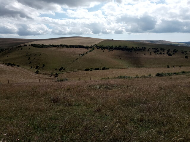
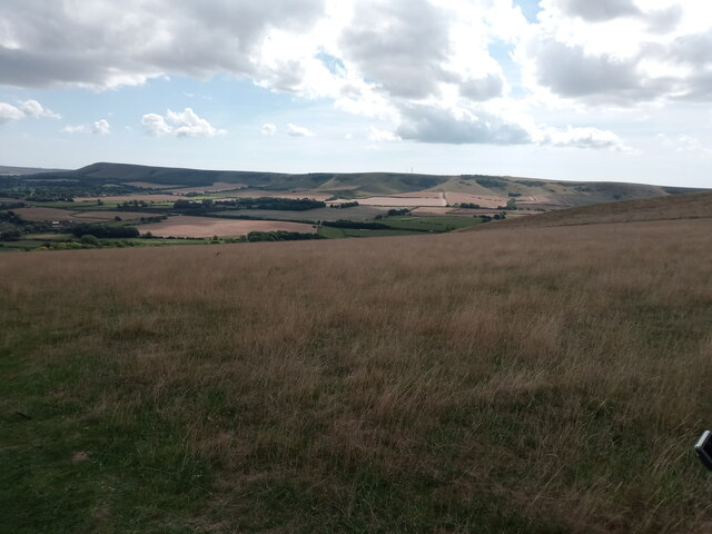
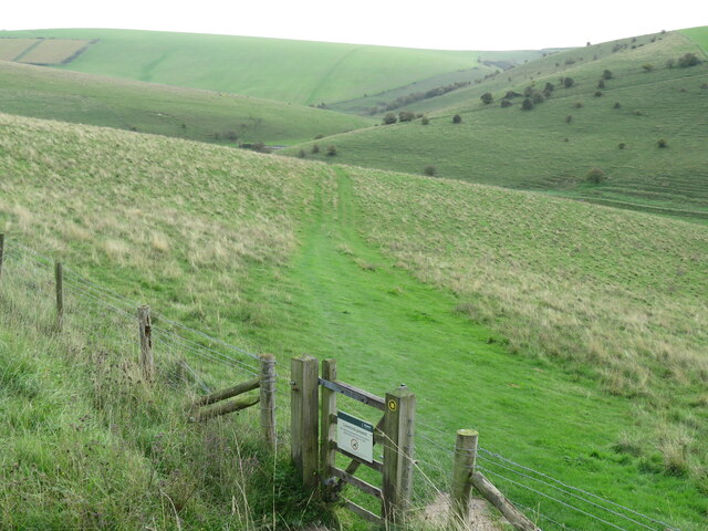
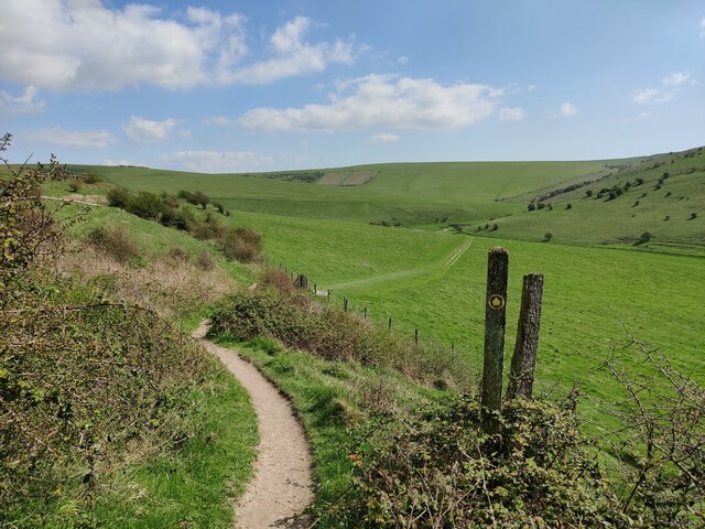
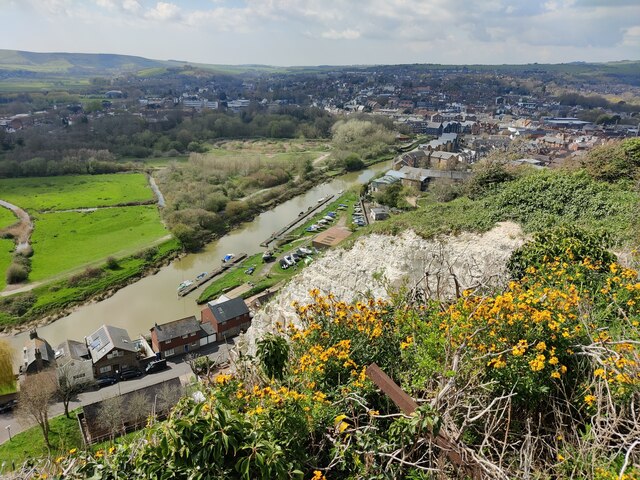
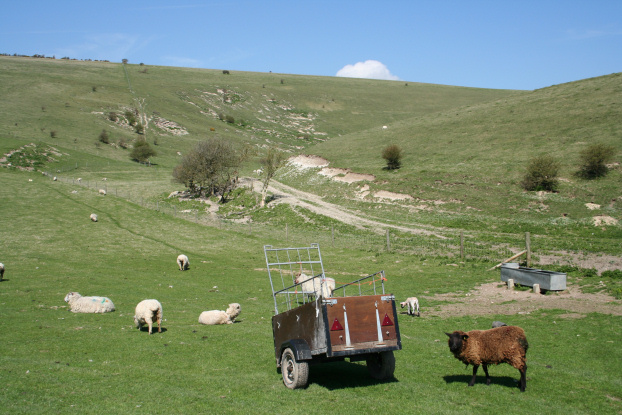
Caburn Bottom is a picturesque valley located in Sussex, England. Situated on the South Downs, it is nestled between the villages of Lewes and Glynde. The valley is known for its natural beauty and rich historical significance.

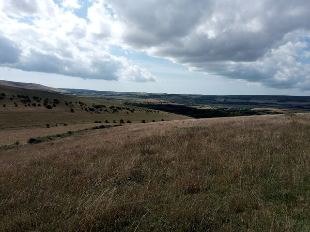
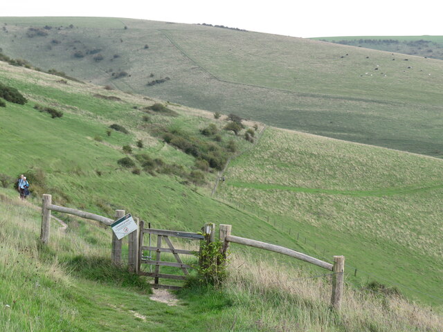
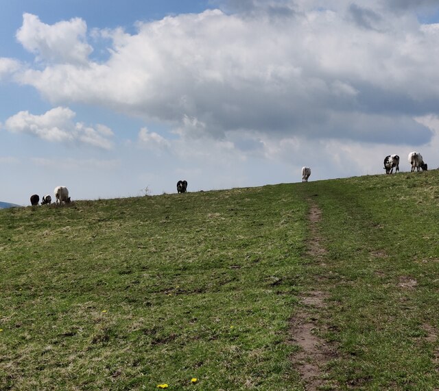
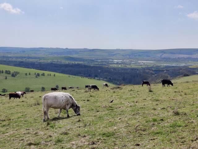
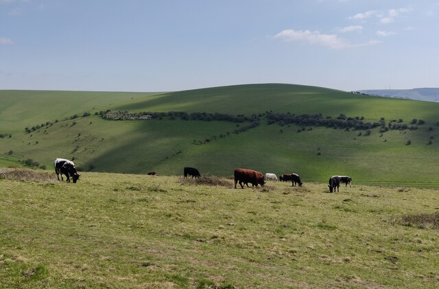
The landscape of Caburn Bottom is characterized by rolling hills, lush green meadows, and dense woodlands. It is traversed by a small river, providing a serene and tranquil atmosphere. The valley is home to a diverse range of flora and fauna, including wildflowers, butterflies, and various bird species.

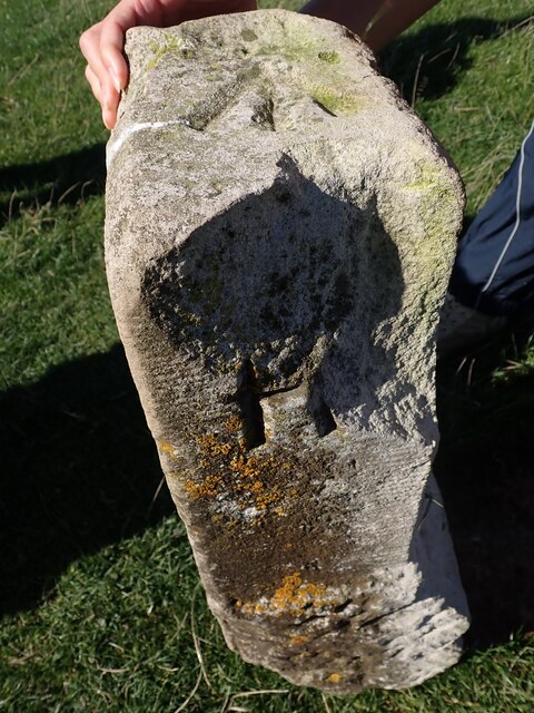
Historically, Caburn Bottom has been inhabited for thousands of years. Evidence of human activity dates back to the Neolithic period, with the discovery of ancient burial mounds and flint tools. The valley also played a significant role during the Roman era, serving as a route for the Roman road between London and the south coast.

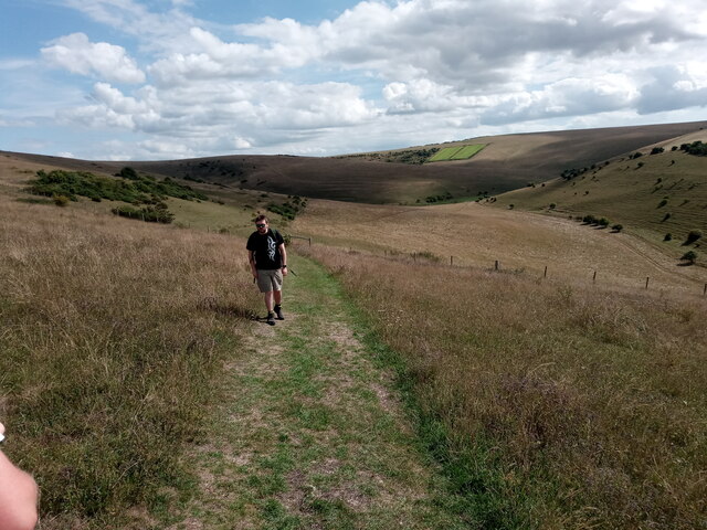
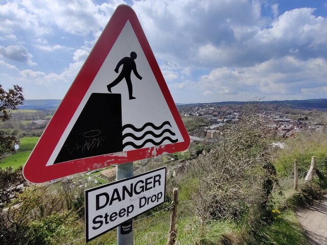
Today, Caburn Bottom is a popular destination for outdoor enthusiasts and nature lovers. The valley offers numerous walking and hiking trails, allowing visitors to explore the scenic surroundings and take in breathtaking views of the surrounding countryside. It is also a haven for wildlife enthusiasts, with opportunities for birdwatching and nature photography.

In addition to its natural beauty, Caburn Bottom is steeped in local folklore and legends. The valley is said to be the dwelling place of mythical creatures and has inspired many tales and stories passed down through generations.

Overall, Caburn Bottom is a hidden gem in Sussex, offering a perfect blend of natural beauty, historical significance, and recreational opportunities for visitors to enjoy.

If you have any feedback on the listing, please let us know in the comments section below.

Caburn Bottom Images

Images are sourced within 2km of 50.864912/0.046925432 or Grid Reference TQ4409. Thanks to Geograph Open Source API. All images are credited.

View of the River Ouse meandering alongside the A26 near Lewes from the footpath leading from Chapel Hill to Lewes Golf Club Looking south-southeast.
View of the River Ouse meandering alongside the A26 near Lewes from the footpath leading from Chapel Hill to Lewes Golf Club
Looking south-southeast.
View over the South Downs from the footpath leading from Chapel Hill to Lewes Golf Club Looking south.
View over the South Downs from the footpath leading from Chapel Hill to Lewes Golf Club
Looking south.
View over the South Downs from the footpath leading from Chapel Hill to Lewes Golf Club #2 Looking south-southwest.
View over the South Downs from the footpath leading from Chapel Hill to Lewes Golf Club #2
Looking south-southwest.
View over the South Downs from the footpath leading from Chapel Hill to Lewes Golf Club #3 Looking south-southeast.
View over the South Downs from the footpath leading from Chapel Hill to Lewes Golf Club #3
Looking south-southeast.
View over Bible Bottom from the path leading from Chapel Hill to Lewes Golf Club Looking south.
View over Bible Bottom from the path leading from Chapel Hill to Lewes Golf Club
Looking south.
View over the South Downs from the footpath leading from Chapel Hill to Lewes Golf Club #4 Looking south-southwest.
View over the South Downs from the footpath leading from Chapel Hill to Lewes Golf Club #4
Looking south-southwest.
View over Glynde from the footpath from Lewes Looking south-southeast.
View over Glynde from the footpath from Lewes
Looking south-southeast.
View over Glynde from the footpath from Lewes #2 Looking south-southeast.
View over Glynde from the footpath from Lewes #2
Looking south-southeast.
Old Boundary Marker at Saxon Cross Parish Boundary Marker at Saxon Cross, found fallen beside a footpath on Saxon Down between the opera house and a golf club. Inscribed G, M and R on three faces. On the former boundary of Glynde, South Malling and Ringmer parishes, then Glynde, South Malling Without and Ringmer parishes from 1894, but since 1984 just Glynd and Ringmer parishes. See also <a title="https://www.geograph.org.uk/photo/3134471" href="https://www.geograph.org.uk/photo/3134471">Link</a>.

Milestone Society National ID: SX_GLYRIN01pb
Old Boundary Marker at Saxon Cross
Parish Boundary Marker at Saxon Cross, found fallen beside a footpath on Saxon Down between the opera house and a golf club. Inscribed G, M and R on three faces. On the former boundary of Glynde, South Malling and Ringmer parishes, then Glynde, South Malling Without and Ringmer parishes from 1894, but since 1984 just Glynd and Ringmer parishes. See also Link. Milestone Society National ID: SX_GLYRIN01pb
On the way to Oxteddle The path from Lewes leads through the Southerham reserve managed by the Sussex Wildlife Trust.
On the way to Oxteddle
The path from Lewes leads through the Southerham reserve managed by the Sussex Wildlife Trust.
The descent to Oxteddle Bottom Not a house in sight! On the path from Lewes to Glynde that passes Oxteddle Bottom.
The descent to Oxteddle Bottom
Not a house in sight! On the path from Lewes to Glynde that passes Oxteddle Bottom.
Path towards Oxteddle Bottom
Cows along the footpath to Lewes
Cows at the Southerham Farm Nature Reserve
Path across the Southerham Farm Nature Reserve
Cattle at the Southerham Farm Nature Reserve
The River Ouse and Lewes The Ouse rises at Lower Beeding and flows generally southwards to reach the English Channel at Newhaven, a distance of approximately 33 miles. The Sussex Ouse Valley Way follows its route from source to mouth. The River is one of four rivers to cut through the South Downs, an example of Superimposed drainage.
Wikipedia: <span class="nowrap"><a title="http://en.wikipedia.org/wiki/River_Ouse,_Sussex" rel="nofollow ugc noopener" href="http://en.wikipedia.org/wiki/River_Ouse,_Sussex">Link</a><img style="margin-left:2px;" alt="External link" title="External link - shift click to open in new window" src="https://s1.geograph.org.uk/img/external.png" width="10" height="10"/></span>
The River Ouse and Lewes
The Ouse rises at Lower Beeding and flows generally southwards to reach the English Channel at Newhaven, a distance of approximately 33 miles. The Sussex Ouse Valley Way follows its route from source to mouth. The River is one of four rivers to cut through the South Downs, an example of Superimposed drainage. Wikipedia: LinkExternal link
Sign overlooking Lewes
Show me another place!

Caburn Bottom is located at Grid Ref: TQ4409 (Lat: 50.864912, Lng: 0.046925432)

Administrative County: East Sussex

District: Lewes

Police Authority: Sussex

What 3 Words

///warp.internet.increased. Near Lewes, East Sussex

Related Wikis

Mount Caburn

Mount Caburn is a 150-metre (492 ft) prominent landmark in East Sussex, England, about one mile (1.6 km) east of Lewes overlooking the village of Glynde...

Lewes Downs

Lewes Downs is a 165-hectare (410-acre) biological Site of Special Scientific Interest east of Lewes in East Sussex. It is a Nature Conservation Review...

Southerham Machine Bottom Pit

Southerham Machine Bottom Pit is a 1.8-hectare (4.4-acre) geological Site of Special Scientific Interest in Lewes in the East Sussex. It is a Geological...

Southerham Grey Pit

Southerham Grey Pit is a 8.5-hectare (21-acre) geological Site of Special Scientific Interest south-east of Lewes in East Sussex. It is a Geological Conservation...

Southerham Farm

Southerham Farm is a 131-hectare (320-acre) nature reserve on the eastern outskirts of Lewes in East Sussex. It is managed by the Sussex Wildlife Trust...

Glynde Place

Glynde Place is an Elizabethan Manor House at Glynde in East Sussex, England. Situated in the South Downs National Park, it is the family home of the Viscounts...

Beddingham

Beddingham is an English village and civil parish in the Lewes district of East Sussex, at the junction between the London–Newhaven (A26) and south coast...

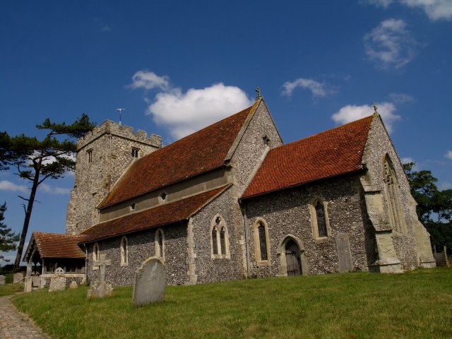
St Mary's Church, Glynde

The Church of St Mary the Virgin is a Grade II* listed Anglican church in the village of Glynde in East Sussex. It was built in the 1760s by Richard Trevor...

Nearby Amenities

Located within 500m of 50.864912,0.046925432
The Caburn
Historic: archaeological_site
Natural: peak
Source: Bing
Wikidata: Q12062109
Wikipedia: en:Mount Caburn
Lat/Long: 50.8616232/0.0509574
Barrier: kissing_gate
Source: gps
Lat/Long: 50.8691149/0.04485
Created By: Potlatch 0.10f
Ele NPE: 491 ft
Man Made: survey_point
Source: NPE
Lat/Long: 50.861428/0.0509017
Caburn Bottom
Place: locality
Lat/Long: 50.8654913/0.0454858
Barrier: kissing_gate
Lat/Long: 50.868835/0.0445761
Barrier: kissing_gate
Source: gps
Lat/Long: 50.8649766/0.0524395
Barrier: stile
Lat/Long: 50.862597/0.0496734
Barrier: stile
Lat/Long: 50.8627211/0.0488501
Bench
Backrest: no
Material: wood
Seats: 3
Lat/Long: 50.861537/0.0510097
The data included in this document is from www.openstreetmap.org. The data is made available under ODbL.

Have you been to Caburn Bottom?

Leave your review of Caburn Bottom below (or comments, questions and feedback).