Limb Valley

Valley in Derbyshire

England

Limb Valley

A Trig with Neighbours According to this site there are 244,282 grid-squares containing land in Britain.
An accurate figure of the number of trig points still standing, though, isn't so easy to come by. This is mostly because the serious trig-bagging websites include in their lists the sites of now-destroyed ones, and also often list more minor structures involved in triangulation. (Though I'm sure if I got the hang of various filters in the complicated looking searchboxes it could be done). Online articles celebrating Rob Woodall's completion of all Britain's trig points in 2016 put the figure at 6,190.
Since this impressive feat took over a decade though - including a two-year wait for a landowner to grant access to one pillar - it is likely the figure is slightly lower now, due to them being destroyed or moved by landowners (they are not protected structures as a lot of people think), and general effects of the weather.
If 6,190 is taken as the figure, though, it means that there is a trig point for every 39 grid-squares, on average. Which makes this tiny part of Britain something of an anomaly I'm sure. Not only is there a trig point in the grid-square immediately West of this one; there is another two squares South of that one. This means that a 3x2 block contains three trig points. Since none of them sit on particularly difficult terrain, there is the very unusual possibility of visiting three trig points on a leisurely two to three hour circular walk.
This one's official name is 'Ringinglow', and it first got used in calculations in 1948. There is a moderate steady incline from the North, but on the opposite side the field dips down quite steeply.
A Trig with Neighbours Credit: Ian Dodds

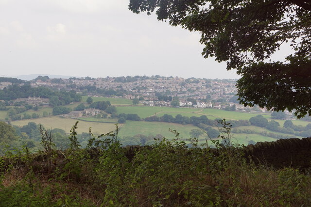
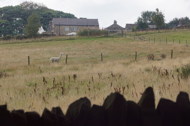
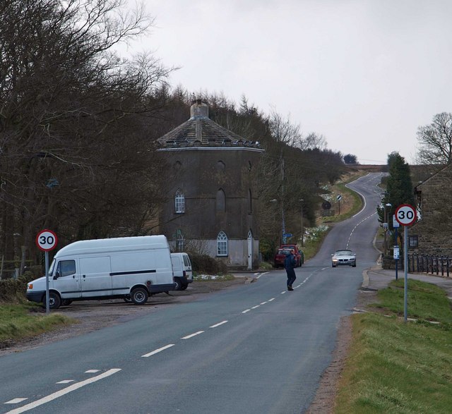
Limb Valley, located in Derbyshire, England, is a picturesque and serene valley renowned for its natural beauty and tranquil ambiance. Spanning approximately 6 kilometers, the valley is nestled between the villages of Dore and Totley on the outskirts of Sheffield.

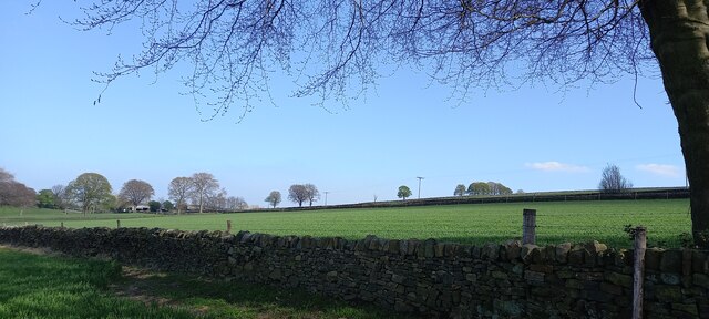
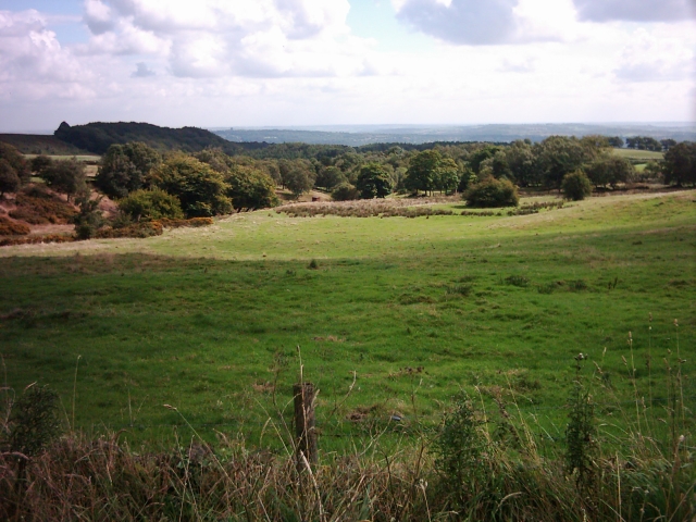
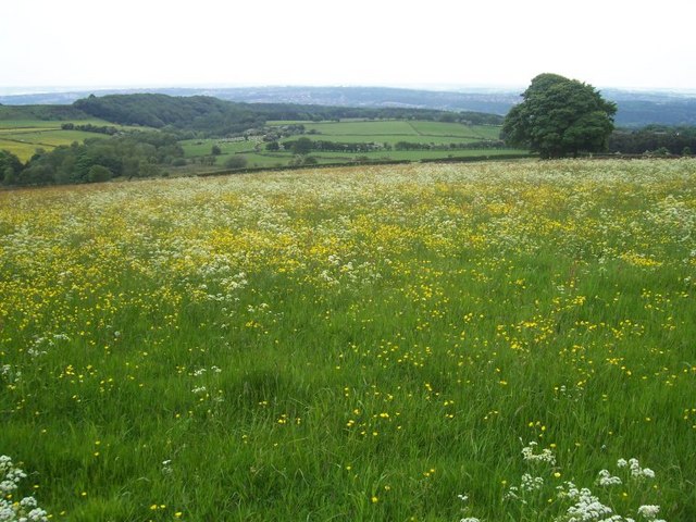
This idyllic valley is characterized by its rolling landscapes, lush green meadows, and dense woodlands, making it a haven for nature lovers and outdoor enthusiasts. The Limb Brook meanders through the valley, adding to its charm and providing a soothing soundtrack to the surroundings.

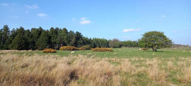
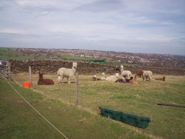
Limb Valley offers a diverse range of flora and fauna, with an abundance of wildflowers, ancient trees, and various bird species. The valley is a popular destination for birdwatching, with sightings of buzzards, kingfishers, and woodpeckers being common amongst visitors.

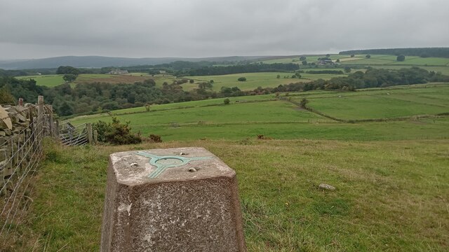
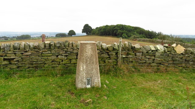
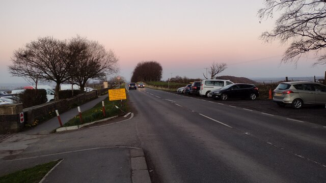
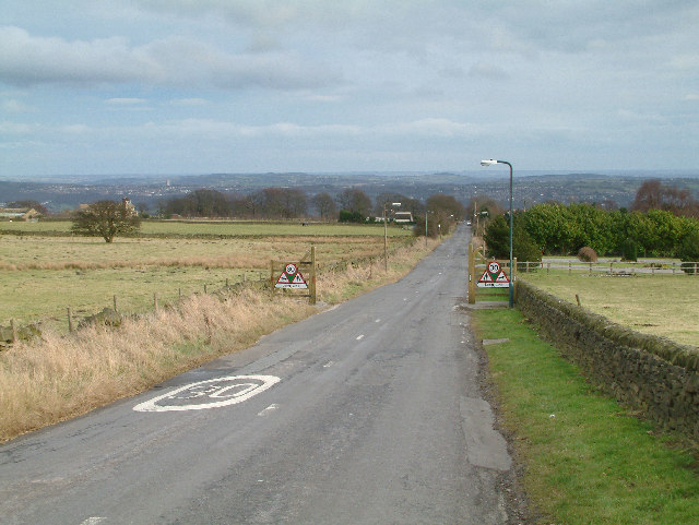
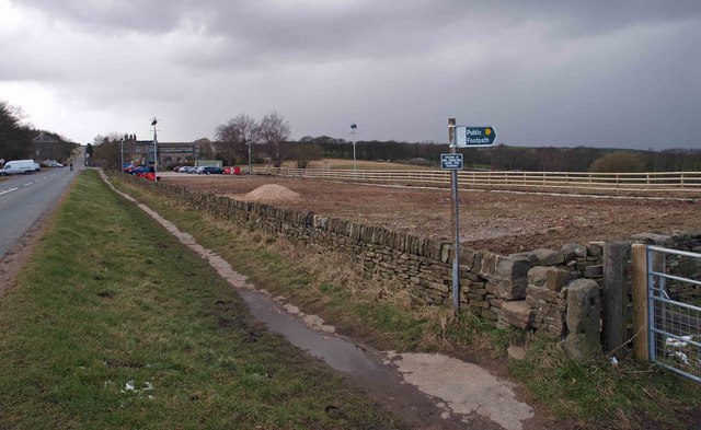
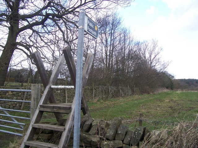
There are several well-maintained footpaths and trails crisscrossing the valley, allowing visitors to explore its beauty on foot or by bicycle. These trails provide breathtaking views of the surrounding countryside, including the stunning vistas of the Peak District National Park.

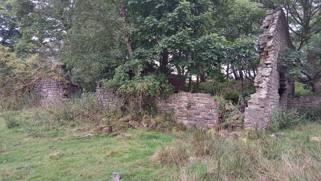
Alongside its natural wonders, Limb Valley also holds historical significance. Ruins of ancient settlements and remnants of old millstones can still be found scattered throughout the valley, offering insight into its past.

Overall, Limb Valley offers a tranquil escape from the hustle and bustle of city life, providing visitors with a chance to reconnect with nature and immerse themselves in the rich history and beauty of Derbyshire's countryside.

If you have any feedback on the listing, please let us know in the comments section below.
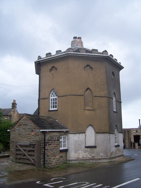
Limb Valley Images

Images are sourced within 2km of 53.34335/-1.5392265 or Grid Reference SK3083. Thanks to Geograph Open Source API. All images are credited.

A Trig with Neighbours According to this site there are 244,282 grid-squares containing land in Britain.
An accurate figure of the number of trig points still standing, though, isn't so easy to come by. This is mostly because the serious trig-bagging websites include in their lists the sites of now-destroyed ones, and also often list more minor structures involved in triangulation. (Though I'm sure if I got the hang of various filters in the complicated looking searchboxes it could be done). Online articles celebrating Rob Woodall's completion of all Britain's trig points in 2016 put the figure at 6,190.
Since this impressive feat took over a decade though - including a two-year wait for a landowner to grant access to one pillar - it is likely the figure is slightly lower now, due to them being destroyed or moved by landowners (they are not protected structures as a lot of people think), and general effects of the weather.
If 6,190 is taken as the figure, though, it means that there is a trig point for every 39 grid-squares, on average. Which makes this tiny part of Britain something of an anomaly I'm sure. Not only is there a trig point in the grid-square immediately West of this one; there is another two squares South of that one. This means that a 3x2 block contains three trig points. Since none of them sit on particularly difficult terrain, there is the very unusual possibility of visiting three trig points on a leisurely two to three hour circular walk.
This one's official name is 'Ringinglow', and it first got used in calculations in 1948. There is a moderate steady incline from the North, but on the opposite side the field dips down quite steeply.
A Trig with Neighbours
According to this site there are 244,282 grid-squares containing land in Britain. An accurate figure of the number of trig points still standing, though, isn't so easy to come by. This is mostly because the serious trig-bagging websites include in their lists the sites of now-destroyed ones, and also often list more minor structures involved in triangulation. (Though I'm sure if I got the hang of various filters in the complicated looking searchboxes it could be done). Online articles celebrating Rob Woodall's completion of all Britain's trig points in 2016 put the figure at 6,190. Since this impressive feat took over a decade though - including a two-year wait for a landowner to grant access to one pillar - it is likely the figure is slightly lower now, due to them being destroyed or moved by landowners (they are not protected structures as a lot of people think), and general effects of the weather. If 6,190 is taken as the figure, though, it means that there is a trig point for every 39 grid-squares, on average. Which makes this tiny part of Britain something of an anomaly I'm sure. Not only is there a trig point in the grid-square immediately West of this one; there is another two squares South of that one. This means that a 3x2 block contains three trig points. Since none of them sit on particularly difficult terrain, there is the very unusual possibility of visiting three trig points on a leisurely two to three hour circular walk. This one's official name is 'Ringinglow', and it first got used in calculations in 1948. There is a moderate steady incline from the North, but on the opposite side the field dips down quite steeply.
Ruins of Barberfields Copperas Works / Copperas House or Farm This building was rejuvenated once before - hence the title - but it seems unlikely it will be put to any use again. Its original purpose seems to have been as an office, or works building, of a copperas chemical plant - this operated between the 1810s and 1870s. It definitely fell into disrepair shortly thereafter, as it is shown without a roof on a late 19th Century OS map. It then became a farmhouse, which was referred to as both Copperas House and Copperas Farm subsequently, but only as Copperas House on maps. The farm was abandoned in the late 1940s.
Not having a chemistry degree, I have been more than a bit out of my depth researching copperas, which is an actual proper substance (completely unrelated to copper it seems) that I had never heard of! The manufacturing of it, though, was a huge industry in Britain from the 1600s to the late 1800s. It was a used to produce sulphuric acid, which seems even to this day to be something of a wonder chemical. Back then it was mainly used for pen ink, and dying fabric. I can't figure out if it was actually black, or as close as they could get to it, but dark marking was its thing, and it was either used on its own to colour things, or in conjunction with other colours which enabled them to bind to the fabric faster.
The chemical stuff, as previously mentioned, is a bit confusing to the layman, but basically they got poor quality coal (for coal purposes anyway) known as pyrite out of the ground, and chucked it in a pit exposed to the elements for a couple of years. This stuff turned into green crystals when boiled, and when bolied again and then condensed was ready for action. Copperas was the legally required
dye for dark silk in Britain for several hundred years.
Ruins of Barberfields Copperas Works / Copperas House or Farm
This building was rejuvenated once before - hence the title - but it seems unlikely it will be put to any use again. Its original purpose seems to have been as an office, or works building, of a copperas chemical plant - this operated between the 1810s and 1870s. It definitely fell into disrepair shortly thereafter, as it is shown without a roof on a late 19th Century OS map. It then became a farmhouse, which was referred to as both Copperas House and Copperas Farm subsequently, but only as Copperas House on maps. The farm was abandoned in the late 1940s. Not having a chemistry degree, I have been more than a bit out of my depth researching copperas, which is an actual proper substance (completely unrelated to copper it seems) that I had never heard of! The manufacturing of it, though, was a huge industry in Britain from the 1600s to the late 1800s. It was a used to produce sulphuric acid, which seems even to this day to be something of a wonder chemical. Back then it was mainly used for pen ink, and dying fabric. I can't figure out if it was actually black, or as close as they could get to it, but dark marking was its thing, and it was either used on its own to colour things, or in conjunction with other colours which enabled them to bind to the fabric faster. The chemical stuff, as previously mentioned, is a bit confusing to the layman, but basically they got poor quality coal (for coal purposes anyway) known as pyrite out of the ground, and chucked it in a pit exposed to the elements for a couple of years. This stuff turned into green crystals when boiled, and when bolied again and then condensed was ready for action. Copperas was the legally required dye for dark silk in Britain for several hundred years.
The Round House, Ringinglow People correctly  assume that this curious building was a toll house on the Sheffield-Buxton turnpike road that came into being in the middle of the eighteenth century. However, before that it was a farm and by 1785 it had become an inn under the instructions of Lord John Murray of Banner Cross who drove the turnpike project and was a significant landowner in the local region.
The Round House, Ringinglow
People correctly assume that this curious building was a toll house on the Sheffield-Buxton turnpike road that came into being in the middle of the eighteenth century. However, before that it was a farm and by 1785 it had become an inn under the instructions of Lord John Murray of Banner Cross who drove the turnpike project and was a significant landowner in the local region.
Trig Point above Firs Farm near Ringinglow
Old milestone At Ringinglow near the entrance to the Norfolk Arms PH car-park on the north side of the road is the 5 miles from Sheffield stone on the route of the Sheffield to Chapel-en-Le Frith of 1758.
Clearly a replacement as it is unlike the other stones on this route.  Sheffield Town Hall was built in the 1890s so perhaps this stone dates from the late 19C or early 20C.
Old milestone
At Ringinglow near the entrance to the Norfolk Arms PH car-park on the north side of the road is the 5 miles from Sheffield stone on the route of the Sheffield to Chapel-en-Le Frith of 1758. Clearly a replacement as it is unlike the other stones on this route. Sheffield Town Hall was built in the 1890s so perhaps this stone dates from the late 19C or early 20C.
Fields beside Hangram Lane
Fields at Long Line, Dore
View to Fulwood from Ringinglow
Mayfield Alpacas, Ringinglow
Ringinglow Road Ringinglow Road passing the Norfolk Arms
Ringinglow Road
Ringinglow Road passing the Norfolk Arms
Limb Valley and Copperas House. A popular spot, Copperas House is a ruin in the trees in the middle of the picture.
Limb Valley and Copperas House.
A popular spot, Copperas House is a ruin in the trees in the middle of the picture.
Long Line. The road with the unusual name of Long Line disappearing into the distance.
Long Line.
The road with the unusual name of Long Line disappearing into the distance.
Footpath off Ringinglow Road
Ringinglow Road
Ringinglow Road
Alpacas near Ringinglow
Footpath to Limb Valley Public footpath from Long Line to Limb Valley.
Footpath to Limb Valley
Public footpath from Long Line to Limb Valley.
The Roundhouse, Ringinglow The Roundhouse, a toll house at the end of the Houndkirk turnpike road. Some older maps show this section of the road as Houndkirk Road, but the modern street sign on the building shows it as Sheephill Road.
The Roundhouse, Ringinglow
The Roundhouse, a toll house at the end of the Houndkirk turnpike road. Some older maps show this section of the road as Houndkirk Road, but the modern street sign on the building shows it as Sheephill Road.
Field near Sheephill Farm
Show me another place!

Limb Valley is located at Grid Ref: SK3083 (Lat: 53.34335, Lng: -1.5392265)

Unitary Authority: Sheffield

Police Authority: South Yorkshire

What 3 Words

///backed.fakes.colleague. Near Dronfield, Derbyshire

Related Wikis

Whirlow Brook Park

Whirlow Brook Park is a landscaped garden of 39 acres in Whirlow, Sheffield, which are open to the public, containing Whirlow Brook Hall. It stretches...

Whirlow Hall Farm

Whirlow Hall Farm is a working farm situated on Broad Elms Lane at Whirlow in the City of Sheffield, England. Since 1979 it has been the site of the Whirlow...

Whinfell Quarry Garden

Whinfell Quarry Garden is an early 20th century ornamental garden in Whirlow, Sheffield, built in an old quarry, containing rare trees and including a...

Hollis Hospital

Hollis Hospital is an almshouse dating from 1703 in Sheffield, England. == Thomas Hollis == Thomas Hollis (1634–1718) was apprenticed to a John Ramsker...

Nearby Amenities

Located within 500m of 53.34335,-1.5392265
Whirlow Hall Farm Trust
Created By: Potlatch 0.10f
Tourism: attraction
Lat/Long: 53.3439726/-1.5338949
Whirlow Bridge 235
Power: substation
Ref: 235
Lat/Long: 53.3402952/-1.5350405
Barrier: entrance
Source: survey;gps
Lat/Long: 53.3408657/-1.5351101
Bench
Lat/Long: 53.3407276/-1.5341453
Bench
Lat/Long: 53.3406998/-1.534571
Barrier: stile
Material: wood
Source: survey;gps
Stile: stepover
Lat/Long: 53.3426599/-1.5348612
Recycling
Lat/Long: 53.3444773/-1.5319583
Bench
Lat/Long: 53.3462383/-1.5424936
Barrier: stile
Lat/Long: 53.347063/-1.542347
Barrier: stile
Foot: designated
Lat/Long: 53.3466718/-1.5425089
Barrier: stile
Lat/Long: 53.3409183/-1.5436704
Turning Circle
Source: Bing
Lat/Long: 53.3413305/-1.5342346
Barrier: stile
Lat/Long: 53.3405834/-1.5433991
Barrier: stile
Lat/Long: 53.3428441/-1.5370039
Bench
Source: survey;gps
Lat/Long: 53.3406458/-1.5365163
Information: guidepost
Operator: Peak & Northern Footpaths Society
Ref: 475
Source: survey;gps
Tourism: information
Lat/Long: 53.3450607/-1.5413953
Information: guidepost
Operator: Peak & Northern Footpaths Society
Ref: 476
Source: survey;gps
Tourism: information
Lat/Long: 53.3453362/-1.5421382
Barrier: stile
Dog Gate: yes
Lat/Long: 53.3465473/-1.5375571
Leisure: picnic_table
Lat/Long: 53.3450543/-1.5413015
Bench
Backrest: no
Source: survey;gps
Lat/Long: 53.3460441/-1.5444937
Bench
Backrest: no
Source: survey;gps
Lat/Long: 53.3455979/-1.5433306
Bench
Backrest: no
Source: survey;gps
Lat/Long: 53.3452411/-1.5418277
Bench
Backrest: yes
Source: survey;gps
Lat/Long: 53.3421874/-1.5390033
Bench
Backrest: yes
Source: survey;gps
Lat/Long: 53.3423027/-1.5390864
Cafe
Whirlow Hall Farm
Check Date Opening Hours: 2021-09-21
Opening Hours: We-Su 10:00-16:00
Lat/Long: 53.3441466/-1.5330756
Board Title: The Archaeology of Whirlow Hall Farm
Board Type: history
Information: board
Tourism: information
Lat/Long: 53.3442411/-1.5327785
Man Made: cairn
Lat/Long: 53.3428088/-1.5365081
Whirlow Hall Farm Shop
Shop: deli
Lat/Long: 53.3439438/-1.532918
Information: guidepost
Operator: Peak & Northern Footpaths Society
Ref: 480
Source: survey;gps
Tourism: information
Lat/Long: 53.3444361/-1.5462852
Waterway: weir
Lat/Long: 53.3430786/-1.5383819
Bench
Lat/Long: 53.3408321/-1.5348544
Noexit: yes
Lat/Long: 53.3406681/-1.5353701
Entrance: yes
Lat/Long: 53.3466514/-1.5375143
Bench
Backrest: yes
Lat/Long: 53.3403765/-1.5339601
Communication Mobile Phone: yes
Man Made: mast
Tower Type: communication
Lat/Long: 53.3468405/-1.538282
Defibrillator
Access: yes
Colour: yellow
Defibrillator Location: wall
Description: Whirlow Hall Farm
Emergency: defibrillator
Indoor: no
Opening Hours: 24/7
Ref: none
Ref GB The Circuit: B01FF15F-84A9-4DAA-9121-ADA200F86262
Source: survey
Support: wall
Survey Date: 2022-01-01
Lat/Long: 53.3441657/-1.5327905
Bench
Backrest: yes
Lat/Long: 53.3420076/-1.5404106
The data included in this document is from www.openstreetmap.org. The data is made available under ODbL.

Have you been to Limb Valley?

Leave your review of Limb Valley below (or comments, questions and feedback).