Green Gill Bottom

Valley in Yorkshire Richmondshire

England

Green Gill Bottom

West Arn Gill from North Gan Scar
West Arn Gill from North Gan Scar Credit: Chris Holifield

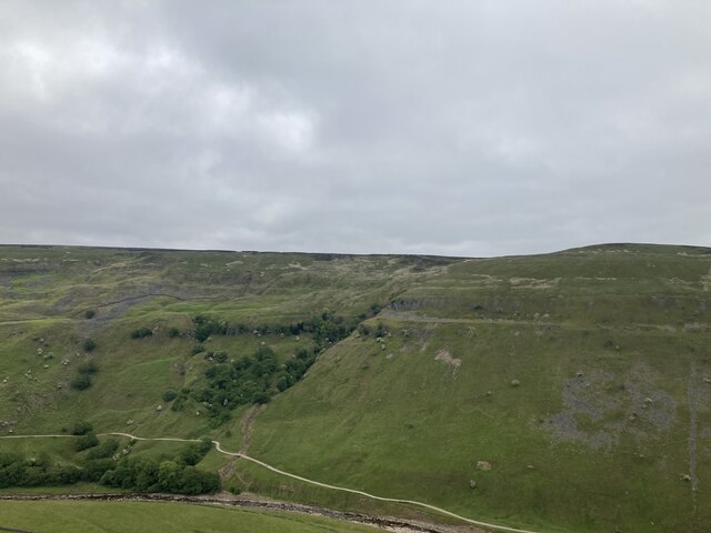
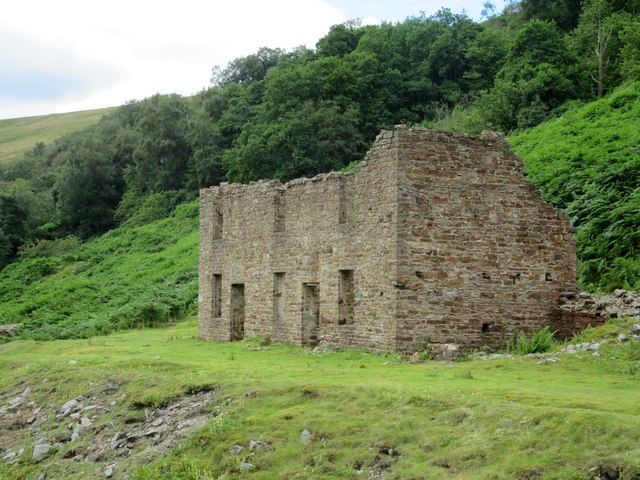
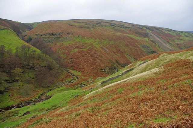
Green Gill Bottom is a picturesque valley located in the county of Yorkshire, England. Nestled amidst the rolling hills and lush green landscapes, this hidden gem offers a tranquil and idyllic retreat for nature enthusiasts and adventurers alike.

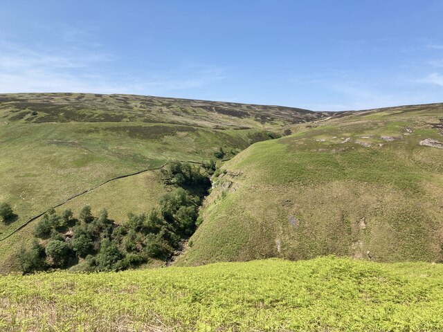
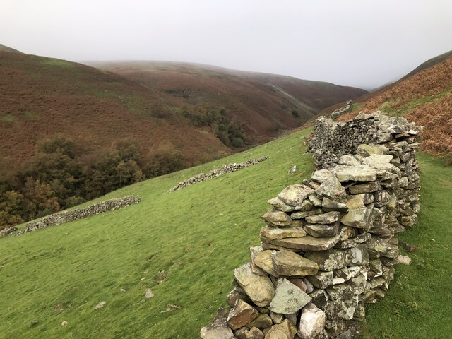
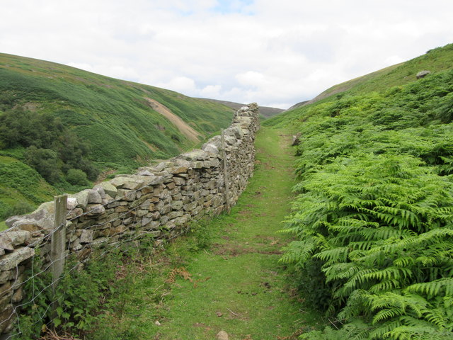
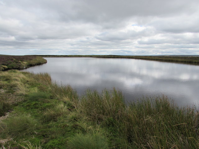
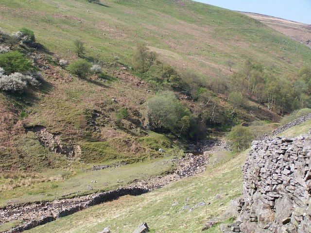
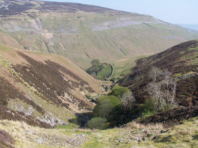
The valley is renowned for its stunning natural beauty, characterized by its meandering streams, cascading waterfalls, and dense woodlands. The gill, or ravine, which runs through the heart of the valley, adds to the charm and serenity of the area. Its crystal-clear waters are home to a diverse range of flora and fauna, making it a perfect spot for wildlife enthusiasts and birdwatchers.

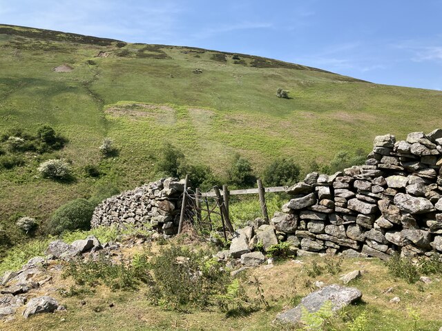
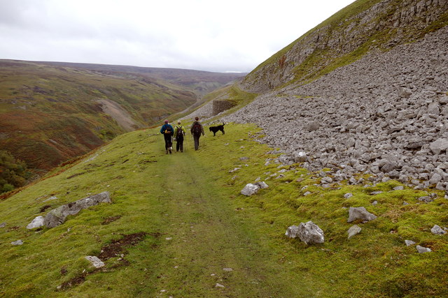
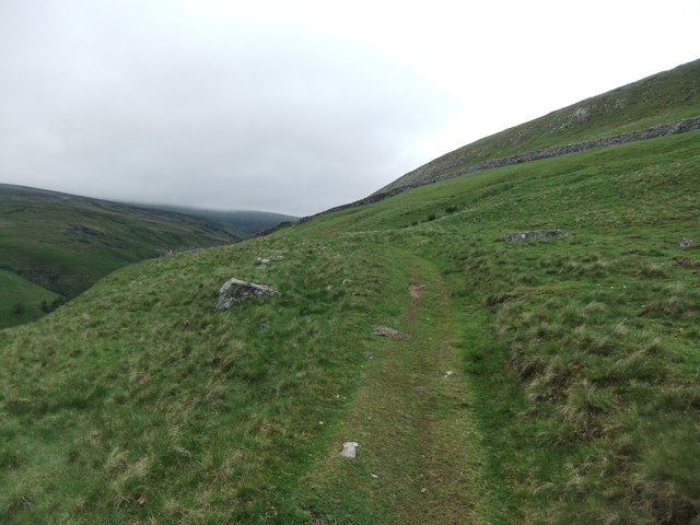
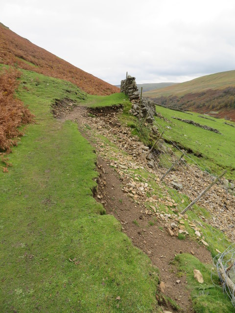
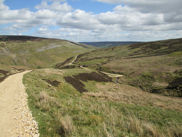
The landscape of Green Gill Bottom is a haven for outdoor activities, with numerous hiking trails and footpaths crisscrossing the valley. The trails cater to all levels of fitness, from leisurely strolls along the riverbanks to more challenging hikes up the surrounding hills, providing breathtaking panoramic views of the valley and the surrounding countryside.

Throughout the year, the valley transforms with the changing seasons. In spring, vibrant wildflowers carpet the meadows, while summer brings an explosion of greenery and the soothing sound of birdsong. Autumn paints the valley with a kaleidoscope of colors as the leaves turn golden and red, creating a mesmerizing backdrop for leisurely walks. Winter casts a magical spell over Green Gill Bottom, with frost-kissed trees and the occasional dusting of snow.

Green Gill Bottom truly encapsulates the natural beauty and charm that Yorkshire is renowned for. It offers a peaceful escape from the hustle and bustle of everyday life, inviting visitors to immerse themselves in the splendor of this untouched paradise.

If you have any feedback on the listing, please let us know in the comments section below.

Green Gill Bottom Images

Images are sourced within 2km of 54.386417/-2.1123727 or Grid Reference SD9298. Thanks to Geograph Open Source API. All images are credited.

West Arn Gill from North Gan Scar
Old limekiln at Middle Bank
Botcher Gill
Botcher Gill
Drystone wall at Middle Bank
Formerly enclosed pasture at Middle Bank
Gunnerside Gill track below Winterings Scar This bridleway from Blades into Gunnerside Gill is excellent going for a mountain bike, as well as on foot, but if one is doing a round trip over Melbecks Moor by bike, the track that ascends behind the lime kiln (technically only a public footpath) is a far safer option than the bridleway in the steep and rocky Bunton Hush that would be the legal way of doing it.
Gunnerside Gill track below Winterings Scar
This bridleway from Blades into Gunnerside Gill is excellent going for a mountain bike, as well as on foot, but if one is doing a round trip over Melbecks Moor by bike, the track that ascends behind the lime kiln (technically only a public footpath) is a far safer option than the bridleway in the steep and rocky Bunton Hush that would be the legal way of doing it.
Wall, footpath and bracken Above Gunnerside Beck
Wall, footpath and bracken
Above Gunnerside Beck
Ruined mine building Adjacent to Gunnerside Beck.
Ruined mine building
Adjacent to Gunnerside Beck.
Middle Pond, Moss Dams The Moss Dams is thought to have been built around 1842 by Messrs Tomlin to supply water to a hydraulic engine installed in the west workings of Blakethwaite Level, which had previously been supplied from Sun Hush Dam (1km east). The dam, which was fed by a leat carrying water from East Gill Head (4km north-north west), is also thought to have supplied water to the Blakethwaite Dams, via the Long Leat, and in turn to the Blakethwite dressing floors and smelt mill.
It lies across the watershed of Gunnerside and Swinner Gill, at approximately 560m, above the head of Botcher Gill.
Middle Pond, Moss Dams
The Moss Dams is thought to have been built around 1842 by Messrs Tomlin to supply water to a hydraulic engine installed in the west workings of Blakethwaite Level, which had previously been supplied from Sun Hush Dam (1km east). The dam, which was fed by a leat carrying water from East Gill Head (4km north-north west), is also thought to have supplied water to the Blakethwaite Dams, via the Long Leat, and in turn to the Blakethwite dressing floors and smelt mill. It lies across the watershed of Gunnerside and Swinner Gill, at approximately 560m, above the head of Botcher Gill.
Path on Winterings Pasture
Path erosion at Middle Bank At this point a minor landslip has taken out the wall and part of the path above it. Over the last five years this has developed from a minor gap of no more than a couple of metres to one that is now nearer 15m in length. The farmer has plugged the gap with mesh fencing, whilst the walked path is gradually moving uphill. Just one of several path problems in and around Gunnerside Gill.
Path erosion at Middle Bank
At this point a minor landslip has taken out the wall and part of the path above it. Over the last five years this has developed from a minor gap of no more than a couple of metres to one that is now nearer 15m in length. The farmer has plugged the gap with mesh fencing, whilst the walked path is gradually moving uphill. Just one of several path problems in and around Gunnerside Gill.
Botcher Gill Looking towards Gunnerside.
Botcher Gill
Looking towards Gunnerside.
Gunnerside Beck
Gunnerside Beck
View down Botcher Gill
Restoration at the Sir Francis Mine The masonry at the air tank near the Sir Francis Mine remains seems to have been recently consolidated. This appears to be an ongoing project at Gunnerside Gill.
Restoration at the Sir Francis Mine
The masonry at the air tank near the Sir Francis Mine remains seems to have been recently consolidated. This appears to be an ongoing project at Gunnerside Gill.
Moss Dam An entirely man-made tarn.
Moss Dam
An entirely man-made tarn.
Wall on Black Brae
Wall on Black Brae
Gunnerside Gill View from the east side of the gill, just south of the Barbara Level. 
Across the gill, Botcher Gill is on the left and the spoil from Dolly Lead Level can be seen on the right.
Gunnerside Gill
View from the east side of the gill, just south of the Barbara Level. Across the gill, Botcher Gill is on the left and the spoil from Dolly Lead Level can be seen on the right.
Show me another place!

Green Gill Bottom is located at Grid Ref: SD9298 (Lat: 54.386417, Lng: -2.1123727)

Division: North Riding

Administrative County: North Yorkshire

District: Richmondshire

Police Authority: North Yorkshire

What 3 Words

///resort.globe.officials. Near Bowes, Co. Durham

Related Wikis

Ivelet

Ivelet is a hamlet in the Yorkshire Dales, North Yorkshire, England about a mile west of Gunnerside in Swaledale. Ivelet Bridge crosses the River Swale...

Satron

Satron is a hamlet in Swaledale, North Yorkshire, England. It lies 0.6 miles (1 km) south west of Gunnerside on the opposite bank of the River Swale. It...

Gunnerside Gill

Gunnerside Gill (or Ghyll) is a small valley in the Yorkshire Dales, England, which branches off Swaledale into moorland to the north of Gunnerside. The...

Arn Gill (North Yorkshire)

Arn Gill is a ravine or gully containing a beck of the same name, near the village of Muker in Swaledale, North Yorkshire, England. The ravine and beck...

Nearby Amenities

Located within 500m of 54.386417,-2.1123727
The data included in this document is from www.openstreetmap.org. The data is made available under ODbL.

Have you been to Green Gill Bottom?

Leave your review of Green Gill Bottom below (or comments, questions and feedback).