Shot Cleugh

Valley in Northumberland

England

Shot Cleugh

The Yoke Burn in Kidland Forest Labelled as a ford on the 1:25k map, the Yoke Burn is now conveyed under the forestry track in a culvert.

This photograph was taken during the Coronavirus (COVID-19) pandemic of 2020/21/22.
The Yoke Burn in Kidland Forest Credit: James T M Towill

Shot Cleugh is a picturesque valley located in Northumberland, England. Nestled between the stunning North Pennines and the Cheviot Hills, this idyllic area is renowned for its natural beauty and tranquility. The valley is situated around 7 miles southwest of the market town of Hexham and is easily accessible by road.

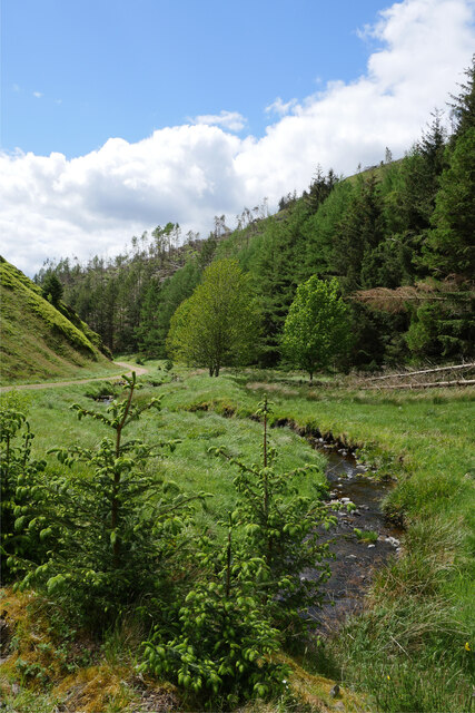
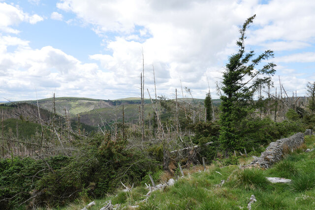
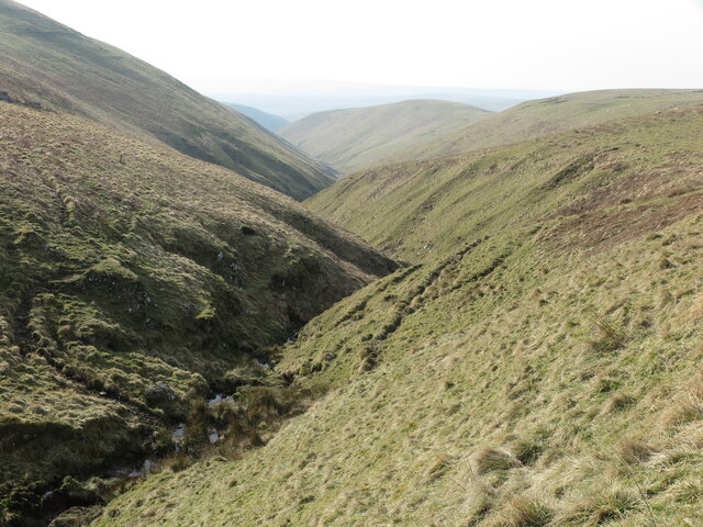
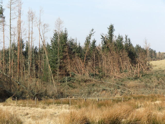
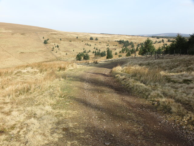
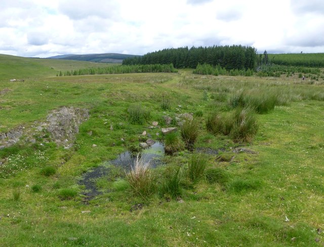
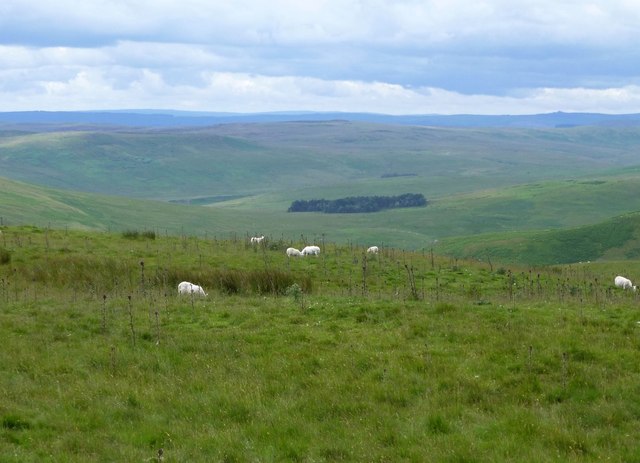
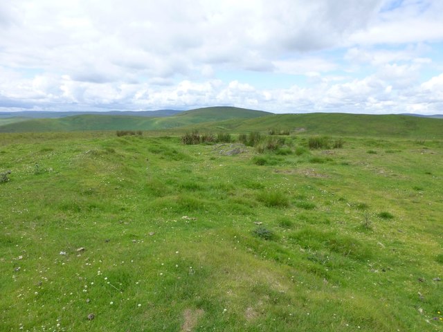
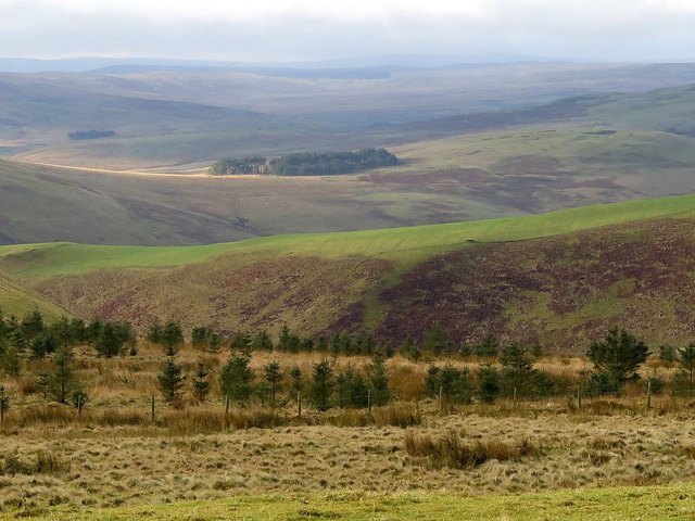
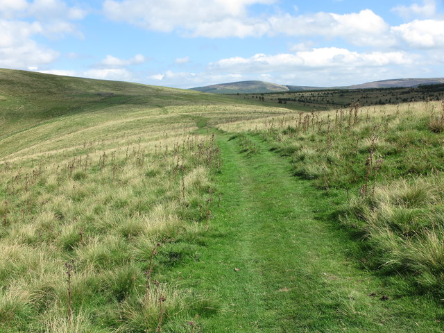
The landscape of Shot Cleugh is characterized by rolling hills, lush meadows, and dense woodlands. The valley is crisscrossed by a meandering stream that adds to its charm. The area is home to a diverse range of flora and fauna, making it a haven for nature lovers and wildlife enthusiasts.

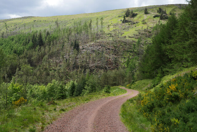
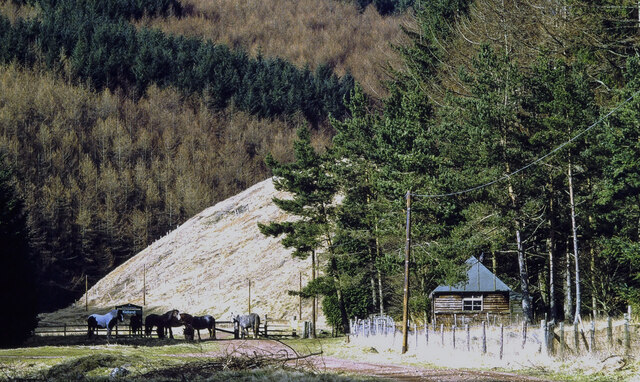
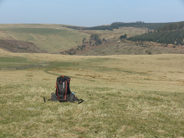
Visitors to Shot Cleugh can enjoy a variety of outdoor activities. The valley offers numerous walking trails, allowing visitors to explore its scenic beauty at their own pace. The trail network provides panoramic views of the surrounding countryside, making it a popular spot for photography enthusiasts. The valley is also a fantastic location for birdwatching, with several species of birds calling it home.

In addition to its natural attractions, Shot Cleugh boasts a rich history. The valley is dotted with remnants of old settlements, including ancient stone circles and burial mounds, providing a glimpse into its past. The area has also been a site of archaeological interest, with artifacts dating back to the Roman era being discovered.

Overall, Shot Cleugh is a hidden gem in Northumberland, offering visitors a peaceful retreat amidst stunning natural surroundings. Whether it's hiking, wildlife spotting, or exploring its historical significance, this valley has something to offer for everyone.

If you have any feedback on the listing, please let us know in the comments section below.
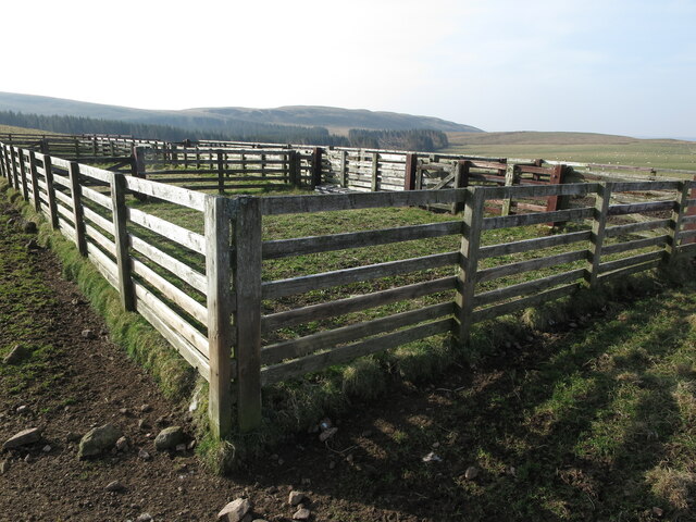
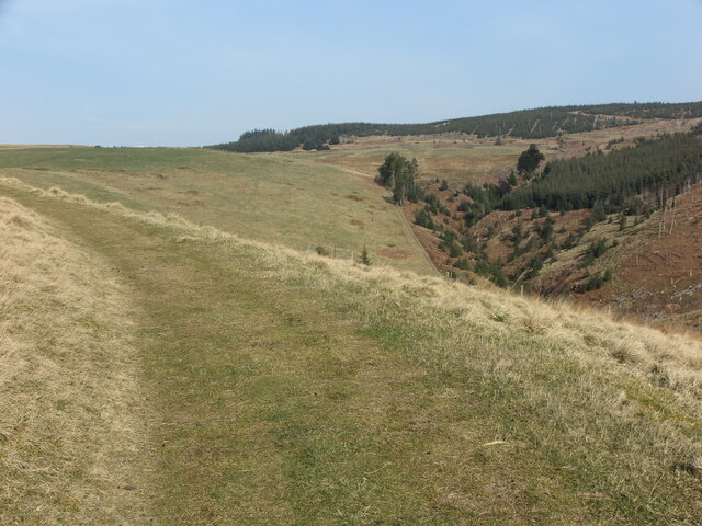
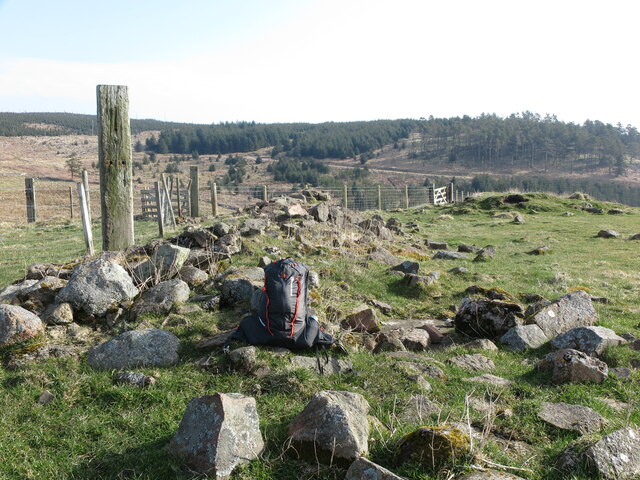
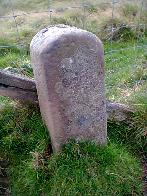
Shot Cleugh Images

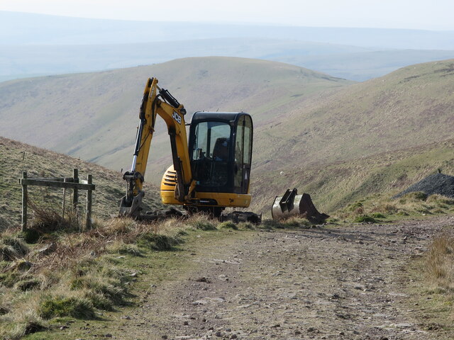
Images are sourced within 2km of 55.388047/-2.1422258 or Grid Reference NT9110. Thanks to Geograph Open Source API. All images are credited.

The Yoke Burn in Kidland Forest Labelled as a ford on the 1:25k map, the Yoke Burn is now conveyed under the forestry track in a culvert.

This photograph was taken during the Coronavirus (COVID-19) pandemic of 2020/21/22.
The Yoke Burn in Kidland Forest
Labelled as a ford on the 1:25k map, the Yoke Burn is now conveyed under the forestry track in a culvert. This photograph was taken during the Coronavirus (COVID-19) pandemic of 2020/21/22.
Devastation on Dryhope Hill Storm Arwen (26/27 November 2021) has resulted in destruction of numerous areas within Kidland Forest.

This photograph was taken during the Coronavirus (COVID-19) pandemic of 2020/21/22.
Devastation on Dryhope Hill
Storm Arwen (26/27 November 2021) has resulted in destruction of numerous areas within Kidland Forest. This photograph was taken during the Coronavirus (COVID-19) pandemic of 2020/21/22.
A track between Meadow Sike and Milkhope Heading back down to the valley floor track after a cycle to Sting Head.  Storm Arwen (26/27 November 2021) has resulted in destruction of numerous areas within Kidland Forest as seen on the hillside in the background.

This photograph was taken during the Coronavirus (COVID-19) pandemic of 2020/21/22.
A track between Meadow Sike and Milkhope
Heading back down to the valley floor track after a cycle to Sting Head. Storm Arwen (26/27 November 2021) has resulted in destruction of numerous areas within Kidland Forest as seen on the hillside in the background. This photograph was taken during the Coronavirus (COVID-19) pandemic of 2020/21/22.
Hut and ponies beside bridleway This is in the valley of the Yoke Beck in the Kidland Forest as the sign close to the animals tells. The image was made in 1995 and the building, may no longer be there.
Geoff Holland has a more recent image taken from a little further north and so probably beyond the hut's location - <a title="https://www.geograph.org.uk/photo/6856451" href="https://www.geograph.org.uk/photo/6856451">Link</a> .
Hut and ponies beside bridleway
This is in the valley of the Yoke Beck in the Kidland Forest as the sign close to the animals tells. The image was made in 1995 and the building, may no longer be there. Geoff Holland has a more recent image taken from a little further north and so probably beyond the hut's location - Link .
JCB Mini Digger above the Wholehope Burn This digger, which was lying idle when I passed by, had been used for digging drainage ditches alongside the track referred to at <a title="https://www.geograph.org.uk/photo/7126230" href="https://www.geograph.org.uk/photo/7126230">Link</a>. The hill in the middle distance is Inner Hill on Shillhope Law. For a selection of detailed free to download walking routes in the area visit <span class="nowrap"><a title="www.cheviotwalks.co.uk" rel="nofollow ugc noopener" href="http://www.cheviotwalks.co.uk">Link</a><img style="margin-left:2px;" alt="External link" title="External link - shift click to open in new window" src="https://s1.geograph.org.uk/img/external.png" width="10" height="10"/></span>
JCB Mini Digger above the Wholehope Burn
This digger, which was lying idle when I passed by, had been used for digging drainage ditches alongside the track referred to at Link. The hill in the middle distance is Inner Hill on Shillhope Law. For a selection of detailed free to download walking routes in the area visit LinkExternal link
Wholehope Burn This quiet almost linear steep-sided valley stretches from the saddle between Saughy Hill and Wholehope Knowe to the River Coquet between Shillmoor and The Knocks. Hidden in its depths lie the remains of an illicit whisky still as shown at <a title="https://www.geograph.org.uk/photo/2541394" href="https://www.geograph.org.uk/photo/2541394">Link</a>. For a selection of detailed free to download walking routes in the area visit <span class="nowrap"><a title="www.cheviotwalks.co.uk" rel="nofollow ugc noopener" href="http://www.cheviotwalks.co.uk">Link</a><img style="margin-left:2px;" alt="External link" title="External link - shift click to open in new window" src="https://s1.geograph.org.uk/img/external.png" width="10" height="10"/></span>
Wholehope Burn
This quiet almost linear steep-sided valley stretches from the saddle between Saughy Hill and Wholehope Knowe to the River Coquet between Shillmoor and The Knocks. Hidden in its depths lie the remains of an illicit whisky still as shown at Link. For a selection of detailed free to download walking routes in the area visit LinkExternal link
Plantation near Uplaw Knowe This photo shows some of the devastation to this plantation caused by Storm Arwen in November 2021. The damage caused by the storm was compounded by the fact that "sustained winds with gusts in excess of 90 mph were, unusually, from the north-east, affecting trees that do not normally have to yield to those winds." For a selection of detailed free to download walking routes in the area visit <span class="nowrap"><a title="www.cheviotwalks.co.uk" rel="nofollow ugc noopener" href="http://www.cheviotwalks.co.uk">Link</a><img style="margin-left:2px;" alt="External link" title="External link - shift click to open in new window" src="https://s1.geograph.org.uk/img/external.png" width="10" height="10"/></span>
Plantation near Uplaw Knowe
This photo shows some of the devastation to this plantation caused by Storm Arwen in November 2021. The damage caused by the storm was compounded by the fact that "sustained winds with gusts in excess of 90 mph were, unusually, from the north-east, affecting trees that do not normally have to yield to those winds." For a selection of detailed free to download walking routes in the area visit LinkExternal link
Uplaw Knowe The sac marks the 371 metre high top of Uplaw Knowe with the ancient cross-border of track of Clennell Street visible slightly downhill. The white square just left of centre in the distance is the corrugated shed which stands beside the scant remains of Wholehope, once an isolated shepherds cottage and, more latterly, a basic Youth Hostel. The trees form part of the vast Kidland Forest. For a selection of detailed free to download walking routes in the area visit <span class="nowrap"><a title="www.cheviotwalks.co.uk" rel="nofollow ugc noopener" href="http://www.cheviotwalks.co.uk">Link</a><img style="margin-left:2px;" alt="External link" title="External link - shift click to open in new window" src="https://s1.geograph.org.uk/img/external.png" width="10" height="10"/></span>
Uplaw Knowe
The sac marks the 371 metre high top of Uplaw Knowe with the ancient cross-border of track of Clennell Street visible slightly downhill. The white square just left of centre in the distance is the corrugated shed which stands beside the scant remains of Wholehope, once an isolated shepherds cottage and, more latterly, a basic Youth Hostel. The trees form part of the vast Kidland Forest. For a selection of detailed free to download walking routes in the area visit LinkExternal link
Fenced Sheepfold near Uplaw Knowe This is the same sheepfold as is shown in the photo at <a title="https://www.geograph.org.uk/photo/5034825" href="https://www.geograph.org.uk/photo/5034825">Link</a> although these days it appears to be more regularly utilised. The long-backed hill in the distance is Green Side. For a selection of detailed free to download walking routes in the area visit <span class="nowrap"><a title="www.cheviotwalks.co.uk" rel="nofollow ugc noopener" href="http://www.cheviotwalks.co.uk">Link</a><img style="margin-left:2px;" alt="External link" title="External link - shift click to open in new window" src="https://s1.geograph.org.uk/img/external.png" width="10" height="10"/></span>
Fenced Sheepfold near Uplaw Knowe
This is the same sheepfold as is shown in the photo at Link although these days it appears to be more regularly utilised. The long-backed hill in the distance is Green Side. For a selection of detailed free to download walking routes in the area visit LinkExternal link
Clennell Street at Hare Sheds Identified on William Roy's 18th century map as the 'Road from Morpeth to Kelso', the origins of this cross-border track are far more ancient, with evidence of Iron Age and Bronze Age activity along the route. At this point, the track is contouring the slopes of Hare Sheds as it makes its uphill way to Wholehope with the head of Kidlandlee Dean right of centre. For a selection of detailed free to download walking routes in the area visit <span class="nowrap"><a title="www.cheviotwalks.co.uk" rel="nofollow ugc noopener" href="http://www.cheviotwalks.co.uk">Link</a><img style="margin-left:2px;" alt="External link" title="External link - shift click to open in new window" src="https://s1.geograph.org.uk/img/external.png" width="10" height="10"/></span>
Clennell Street at Hare Sheds
Identified on William Roy's 18th century map as the 'Road from Morpeth to Kelso', the origins of this cross-border track are far more ancient, with evidence of Iron Age and Bronze Age activity along the route. At this point, the track is contouring the slopes of Hare Sheds as it makes its uphill way to Wholehope with the head of Kidlandlee Dean right of centre. For a selection of detailed free to download walking routes in the area visit LinkExternal link
Scant remains of Wholehope This is all that remains of Wholehope (pronounced locally as, 'Woollup'), once a lonely shepherd's cottage where generations of children spent their formative years and then, after the last occupant had packed their bags for pastures new, underwent something of a renaissance as an isolated Youth Hostel. The photo is taken from the same position as the one shown at <a title="https://www.geograph.org.uk/photo/1221920" href="https://www.geograph.org.uk/photo/1221920">Link</a> but since then (2009) sections of the Kidland Forest seen in the background have been harvested and, in parts, replanted. For a selection of detailed free to download walking routes in the area visit <span class="nowrap"><a title="www.cheviotwalks.co.uk" rel="nofollow ugc noopener" href="http://www.cheviotwalks.co.uk">Link</a><img style="margin-left:2px;" alt="External link" title="External link - shift click to open in new window" src="https://s1.geograph.org.uk/img/external.png" width="10" height="10"/></span>
Scant remains of Wholehope
This is all that remains of Wholehope (pronounced locally as, 'Woollup'), once a lonely shepherd's cottage where generations of children spent their formative years and then, after the last occupant had packed their bags for pastures new, underwent something of a renaissance as an isolated Youth Hostel. The photo is taken from the same position as the one shown at Link but since then (2009) sections of the Kidland Forest seen in the background have been harvested and, in parts, replanted. For a selection of detailed free to download walking routes in the area visit LinkExternal link
Old Boundary Marker by Clennel Street, Wholehope Parish Boundary Marker in parish of Alwinton (Alnwick District), Wholehope, 200m south of Wholehope, beside Clennel Street.

Surveyed

Milestone Society National ID: NB_ALWBID01pb
Old Boundary Marker by Clennel Street, Wholehope
Parish Boundary Marker in parish of Alwinton (Alnwick District), Wholehope, 200m south of Wholehope, beside Clennel Street. Surveyed Milestone Society National ID: NB_ALWBID01pb
Track near Wholehope Knowe This track, which was originally constructed by the MoD, runs from Shillmoor in Upper Coquetdale to the edge of the Kidland Forest on Wholehope Knowe. Along the way it winds around the head of the beautiful Wholehope Burn. For a selection of detailed free to download walking routes in the area visit <span class="nowrap"><a title="www.cheviotwalks.co.uk" rel="nofollow ugc noopener" href="http://www.cheviotwalks.co.uk">Link</a><img style="margin-left:2px;" alt="External link" title="External link - shift click to open in new window" src="https://s1.geograph.org.uk/img/external.png" width="10" height="10"/></span>
Track near Wholehope Knowe
This track, which was originally constructed by the MoD, runs from Shillmoor in Upper Coquetdale to the edge of the Kidland Forest on Wholehope Knowe. Along the way it winds around the head of the beautiful Wholehope Burn. For a selection of detailed free to download walking routes in the area visit LinkExternal link
A pond on summit of Wholehope Knowe A surprising find on the top of the hill.
A pond on summit of Wholehope Knowe
A surprising find on the top of the hill.
View from Wholehope Knowe Across Upper Coquetdale and into the Otterburn Ranges.
View from Wholehope Knowe
Across Upper Coquetdale and into the Otterburn Ranges.
On Wholehope Knowe A circular enclosure with low 'rampart' encloses a pond but is not marked on the map as anything significant.
On Wholehope Knowe
A circular enclosure with low 'rampart' encloses a pond but is not marked on the map as anything significant.
New plantation from Hare Sheds View south-west over the ridge of Copper Snout into Upper Coquetdale.
New plantation from Hare Sheds
View south-west over the ridge of Copper Snout into Upper Coquetdale.
Public Footpath near Saughy Hill This public footpath links Shillmoor in Upper Coquetdale with Clennell Street just beyond Saughy Hill. Along the way the path crosses Copper Snout. For a selection of detailed free to download walking routes in the area visit <span class="nowrap"><a title="www.cheviotwalks.co.uk" rel="nofollow ugc noopener" href="http://www.cheviotwalks.co.uk">Link</a><img style="margin-left:2px;" alt="External link" title="External link - shift click to open in new window" src="https://s1.geograph.org.uk/img/external.png" width="10" height="10"/></span>
Public Footpath near Saughy Hill
This public footpath links Shillmoor in Upper Coquetdale with Clennell Street just beyond Saughy Hill. Along the way the path crosses Copper Snout. For a selection of detailed free to download walking routes in the area visit LinkExternal link
Show me another place!

Shot Cleugh is located at Grid Ref: NT9110 (Lat: 55.388047, Lng: -2.1422258)

Unitary Authority: Northumberland

Police Authority: Northumbria

What 3 Words

///clutches.offstage.bits. Near Rochester, Northumberland

Related Wikis

Kidland

Kidland is a former civil parish, now in the parish of Alwinton in Northumberland, England, about 2 miles (3 km) northwest of Alwinton village. In 1951...

Clennell, Northumberland

Clennell is a small village and as Clennel, a former civil parish, now in the parish of Alwinton, in Northumberland, England. It is about 1 mile (1.6 km...

Usway Burn

The Usway Burn is an upland river on the southern flanks of the Cheviot Hills, in the Northumberland National Park, England. It is a tributary of the River...

Clennell Hall

Clennell Hall is an historic manor house, now operated as a country hotel, situated at Clennell, near Alwinton, Northumberland, England. It is a Grade...

Nearby Amenities

Located within 500m of 55.388047,-2.1422258
Ford: yes
Lat/Long: 55.3903753/-2.1428229
Ford: yes
Lat/Long: 55.3921697/-2.1447785
Ford: yes
Lat/Long: 55.3884479/-2.1402714
Ford: yes
Lat/Long: 55.3836265/-2.1418782
Direction: SSE
Generator Method: photovoltaic
Generator Output Electricity: yes
Generator Solar Modules: 12
Generator Source: solar
Generator Type: solar_photovoltaic_panel
Location: roof
Power: generator
Lat/Long: 55.3853567/-2.1402968
The data included in this document is from www.openstreetmap.org. The data is made available under ODbL.

Have you been to Shot Cleugh?

Leave your review of Shot Cleugh below (or comments, questions and feedback).