Maggie's Cleuch

Valley in Dumfriesshire

Scotland

Maggie's Cleuch

McMurdoston
McMurdoston Credit: Rab McMurdo

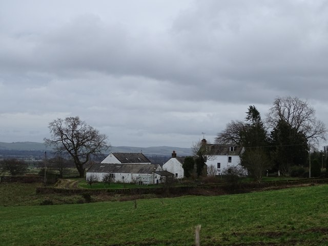
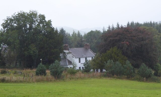
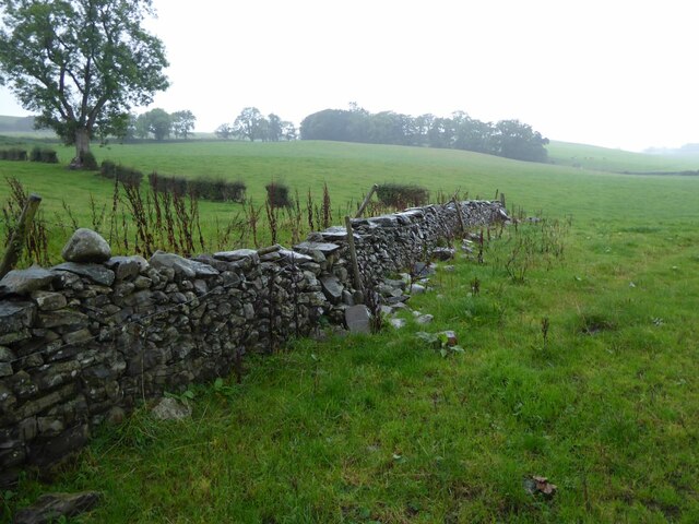
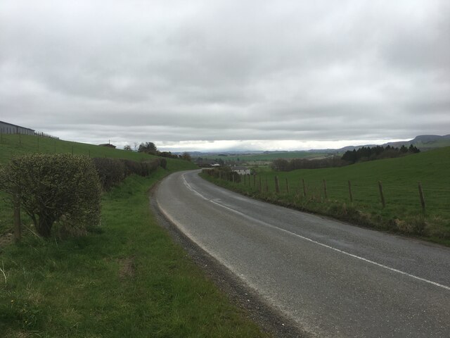
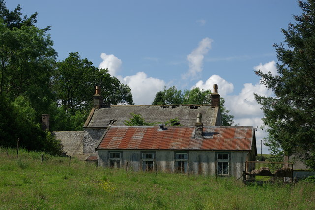
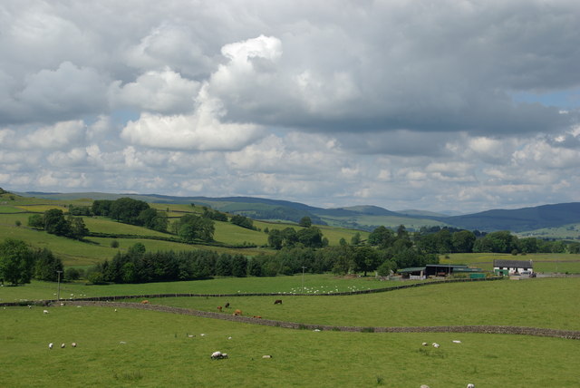
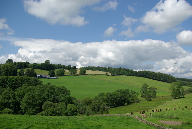
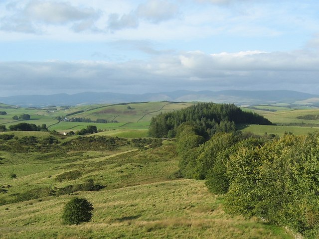
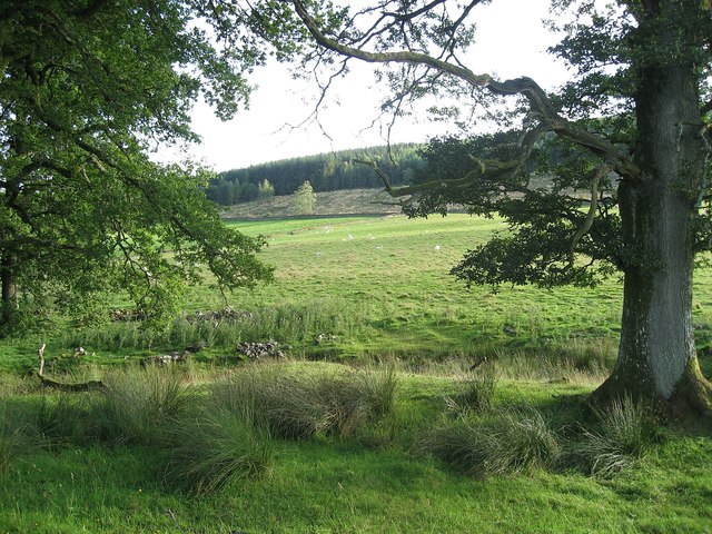
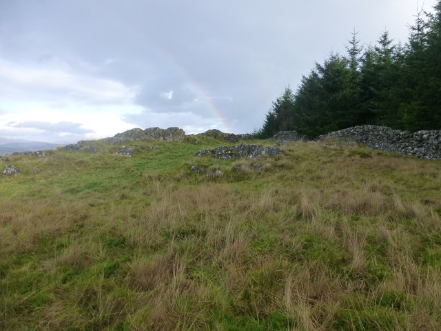
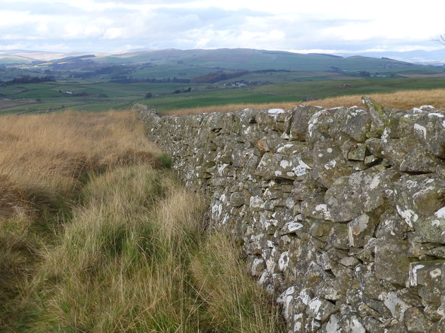
Maggie's Cleuch is a picturesque valley located in Dumfriesshire, Scotland. Nestled within the rolling hills of the Southern Uplands, this valley offers breathtaking views and a tranquil escape from the hustle and bustle of city life.

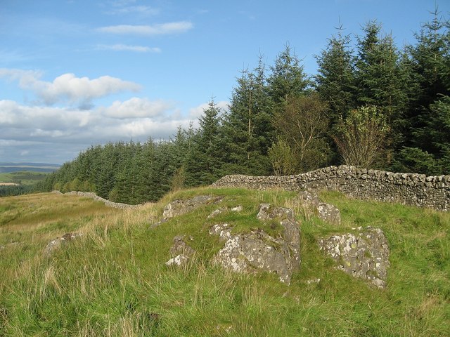
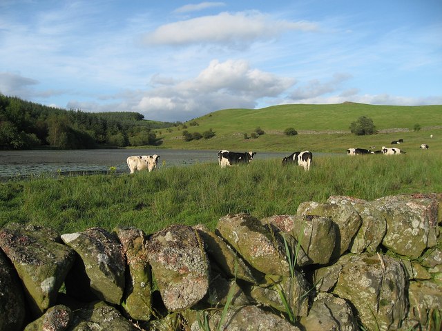
The valley is named after Maggie, a local woman who was known for her love of the area and her dedication to preserving its natural beauty. Maggie's Cleuch is characterized by its lush green meadows, meandering streams, and dense woodlands, which provide a haven for various flora and fauna.

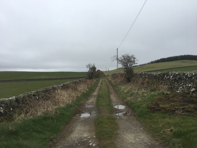
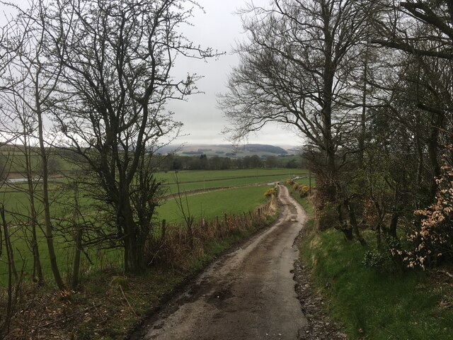
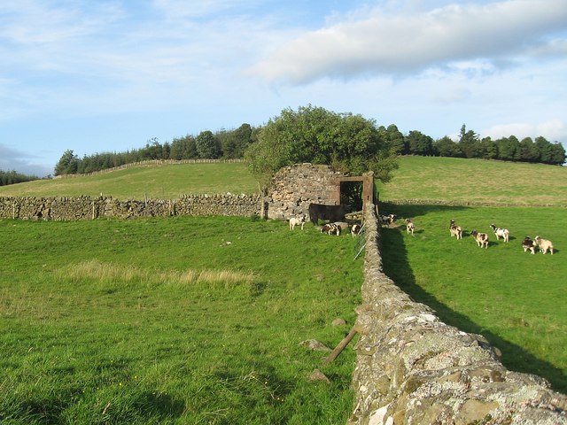
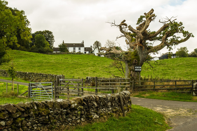
The valley is a popular destination for outdoor enthusiasts, offering numerous walking trails and hiking routes. Visitors can explore the scenic countryside, taking in panoramic views of the surrounding hills and valleys. Wildlife enthusiasts will have the opportunity to spot an array of bird species, including buzzards, peregrine falcons, and red kites, as well as deer, foxes, and other small mammals.

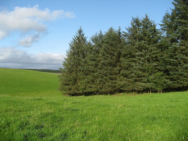
Maggie's Cleuch is also home to a diverse range of plant life, with wildflowers adorning the meadows during the spring and summer months. The valley's woodlands are dominated by native trees such as oak, birch, and rowan, creating a rich and varied habitat for many species.

For those seeking tranquility and a connection with nature, Maggie's Cleuch is a true gem. Its unspoiled landscapes and serene atmosphere make it an ideal destination for anyone looking to escape the stresses of modern life and immerse themselves in the beauty of the Scottish countryside.

If you have any feedback on the listing, please let us know in the comments section below.

Maggie's Cleuch Images

Images are sourced within 2km of 55.128297/-3.7408456 or Grid Reference NX8982. Thanks to Geograph Open Source API. All images are credited.

McMurdoston
McMurdoston
Coldside Road
Coldside Road
Coldside Road
Coldside Road
Mc Murdoston House on eastern slopes of Rosehill.
Mc Murdoston
House on eastern slopes of Rosehill.
Collapsing stone wall Near Dinning.
Collapsing stone wall
Near Dinning.
B729 near Newhouse Farm
Lower Linburn
Lower Linburn
Upper Linburn
Upper Linburn
Farmland below Greenhead View towards the farm of Townhead
Farmland below Greenhead
View towards the farm of Townhead
Forest edge The edge of Townhead Wood on the North side of Killyleoch Hill.
Forest edge
The edge of Townhead Wood on the North side of Killyleoch Hill.
Killyleoch Hill The forest boundary at the top of Killyleoch Hill.
Killyleoch Hill
The forest boundary at the top of Killyleoch Hill.
Cattle by Loweberry Loch
Field near Berryland Sheep grazing in a field near Berryland.
Field near Berryland
Sheep grazing in a field near Berryland.
Guarded ruin This ruin was guarded by a black cow and a herd of goats.
Guarded ruin
This ruin was guarded by a black cow and a herd of goats.
Forest edge The boundary between the forest and well tended pasture.
Forest edge
The boundary between the forest and well tended pasture.
A view of Laggan
A view of Laggan
Killyleoch Hill Climbed with Phil Coper and Chris Watson. The ascent is fairly easy with no tree or access problems. The 1:25000 map is useful as it shows the track starting at NX881801, which is not marked on the Landranger map. This track avoids the farms, houses, notices and quarry which may impede other approaches, and there is room to park at the track entrance. Follow the track to NX877811, turn left through a gate, over the burn and through a broad gap in the trees, then follow the western edge of the trees all the way to the summit, which is a large rock a few metres away from the tree line. There are four walls to cross on the way, all of which have reasonable crossing places near the edge of the trees. The first wall has a fence in the corner, after which there is some rough bracken and vegetation but nothing too bad but better when it's dry or in winter.
Name: Killyleoch Hill
Hill number: 1799
Height: 239.7m / 786ft
Area: 27C: The Glenkens to Annandale
Class: Ma,2
Grid ref: NX 87859 82034
Summit feature: large rock
Drop: 151.6m
Col: 88.1m  NX 8725 8621
Killyleoch Hill
Climbed with Phil Coper and Chris Watson. The ascent is fairly easy with no tree or access problems. The 1:25000 map is useful as it shows the track starting at NX881801, which is not marked on the Landranger map. This track avoids the farms, houses, notices and quarry which may impede other approaches, and there is room to park at the track entrance. Follow the track to NX877811, turn left through a gate, over the burn and through a broad gap in the trees, then follow the western edge of the trees all the way to the summit, which is a large rock a few metres away from the tree line. There are four walls to cross on the way, all of which have reasonable crossing places near the edge of the trees. The first wall has a fence in the corner, after which there is some rough bracken and vegetation but nothing too bad but better when it's dry or in winter. Name: Killyleoch Hill Hill number: 1799 Height: 239.7m / 786ft Area: 27C: The Glenkens to Annandale Class: Ma,2 Grid ref: NX 87859 82034 Summit feature: large rock Drop: 151.6m Col: 88.1m NX 8725 8621
Dry Stone Wall This is the third of four dry stone walls that you need to cross to bag Killyleoch Hill.
Dry Stone Wall
This is the third of four dry stone walls that you need to cross to bag Killyleoch Hill.
Show me another place!

Maggie's Cleuch is located at Grid Ref: NX8982 (Lat: 55.128297, Lng: -3.7408456)

Unitary Authority: Dumfries and Galloway

Police Authority: Dumfries and Galloway

What 3 Words

///buffoon.yelled.choice. Near Locharbriggs, Dumfries & Galloway

Related Wikis

Nithsdale

Nithsdale (Srath Nid in Scottish Gaelic), also known as Strathnith, Stranith or Stranit, is the strath or dale of the River Nith in southern Scotland....

Dunscore

Dunscore (['dʌnskər] / 'DUN-skur', less commonly ['dunskɔ:r] / 'DUN-score') is a small village which lies 9 miles (14 km) northwest of Dumfries on the...

Stepford railway station

Stepford (NX864815) was one of the minor request stop stations on the Cairn Valley Light Railway branch from Dumfries. It served a very rural area in...

Newtonairds railway station

Newtonairds (NX877801) was one of the principal stations on the now closed Cairn Valley Light Railway branch from Dumfries. It served a very rural area...
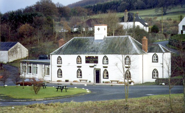
Auldgirth

Auldgirth is a village on the A76 road in Dumfries and Galloway, Scotland. Auldgirth village features 'The Auldgirth Inn' and the former Auldgirth Primary...

Carse Loch

Carse Loch is situated (NX 926 849) in a low-lying area, surrounded by woodland, close to the A76 at Friar's Carse, in Dumfries and Galloway, Parish of...

Dunscore railway station

Dunscore (NX858840) was one of the four principal stations on the Cairn Valley Light Railway (CVR) branch, from Dumfries. It served the rural area of...

Irongray railway station

Irongray was one of the principal stations on the Cairn Valley Light Railway branch, from Dumfries. It served a rural area in Dumfries and Galloway The...

Have you been to Maggie's Cleuch?

Leave your review of Maggie's Cleuch below (or comments, questions and feedback).