Cnoc Mhic Neil

Hill, Mountain in Ross-shire

Scotland

Cnoc Mhic Neil

Up above the old road This is not country in which to venture without navigations skills. It's boggy, and many of the ups and downs are not pronounced enough to generate contours. We were able to park on the old road - visible on the 1:25000 OS map - and it was a slightly boggy walk up onto rock. One of little lochans in the square can be seen, as can a typical "knock" of Lewisian gneiss. The (somewhat dilapidated) fence to my west could not be seen from where I took the photo.
Up above the old road Credit: Neville Goodman

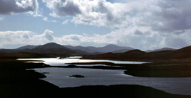
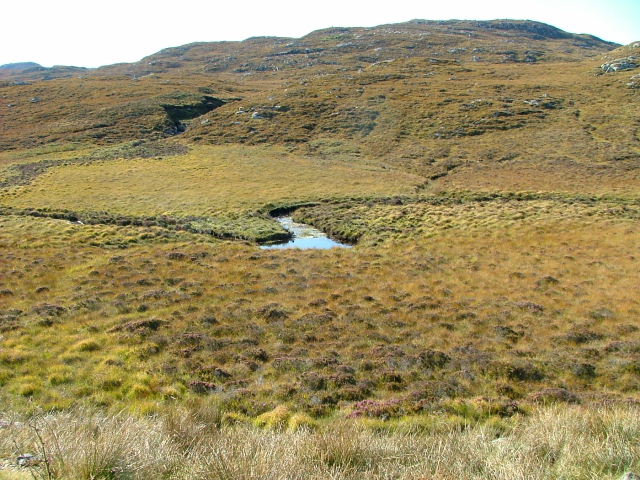
Cnoc Mhic Neil is a prominent hill located in Ross-shire, Scotland. Situated in the Scottish Highlands, it offers breathtaking views of the surrounding countryside and is a popular destination for hikers and outdoor enthusiasts.

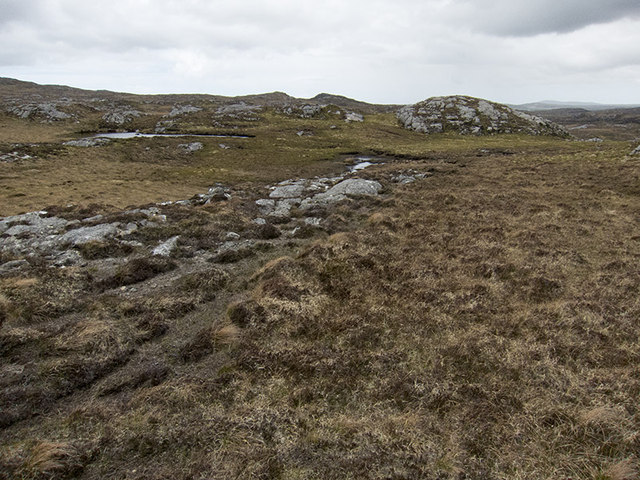
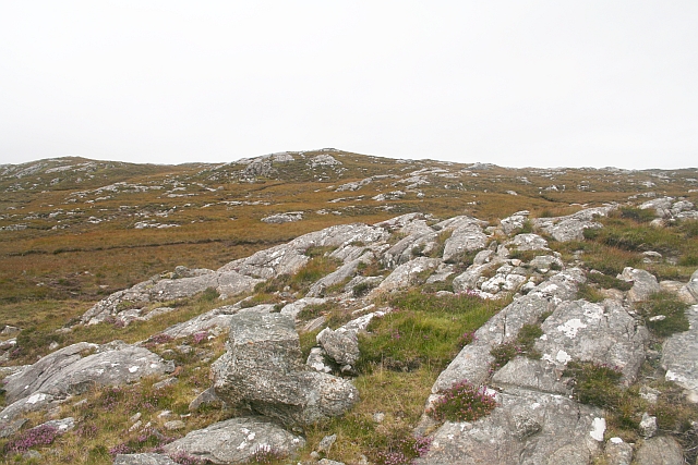
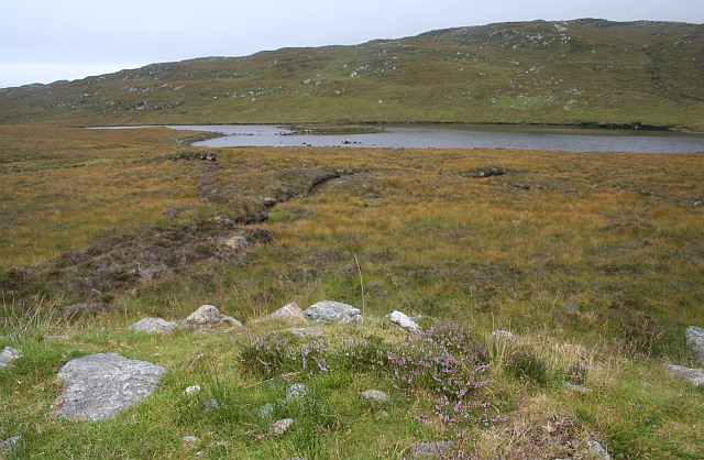
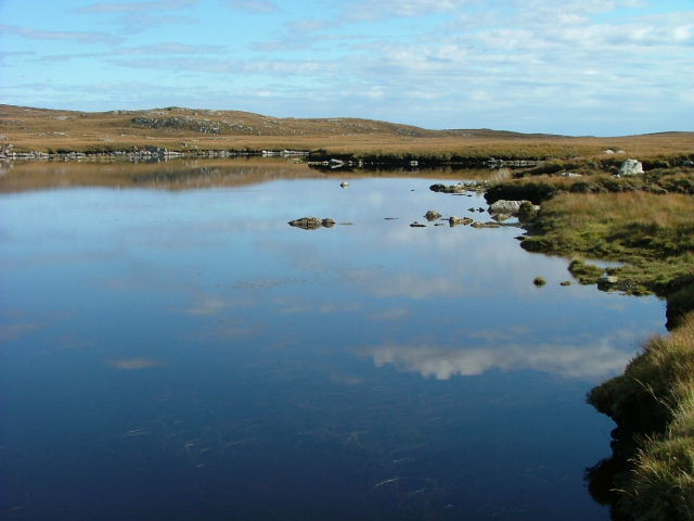
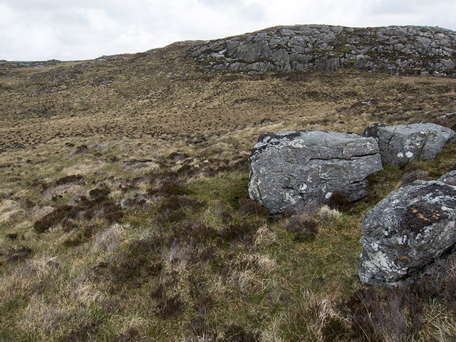
Rising to an elevation of approximately 600 meters (1,969 feet), Cnoc Mhic Neil is known for its distinctive conical shape, which stands out against the rolling hills and rugged terrain in the area. The hill is composed of a mixture of rocks and vegetation, with heather and grass covering the lower slopes, gradually giving way to craggy outcrops and scree higher up.

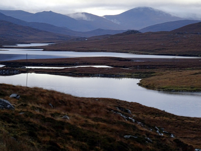
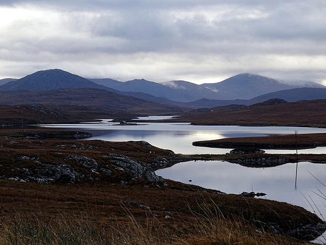
The ascent of Cnoc Mhic Neil is moderately challenging, with a variety of paths and trails available to choose from. The most common route starts from a nearby car park and follows a well-marked path up the hillside. As hikers ascend, they will encounter stunning panoramic vistas of the surrounding countryside, including the nearby lochs and glens.

The summit of Cnoc Mhic Neil offers a rewarding view, with a 360-degree panorama of the surrounding landscape. On a clear day, one can see the peak of nearby Munros, such as Slioch and An Teallach. Additionally, the summit provides an ideal spot for a picnic or simply to enjoy the tranquility of the Scottish Highlands.

Overall, Cnoc Mhic Neil is a beautiful and accessible hill in Ross-shire, offering stunning views and a memorable hiking experience for visitors of all skill levels.

If you have any feedback on the listing, please let us know in the comments section below.

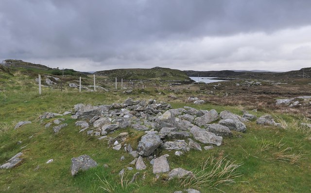
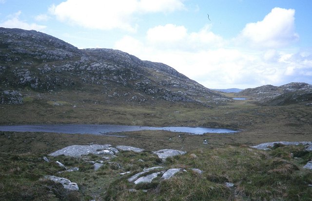
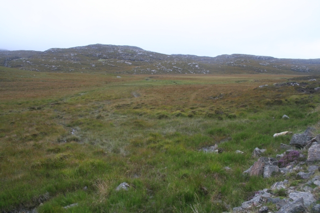
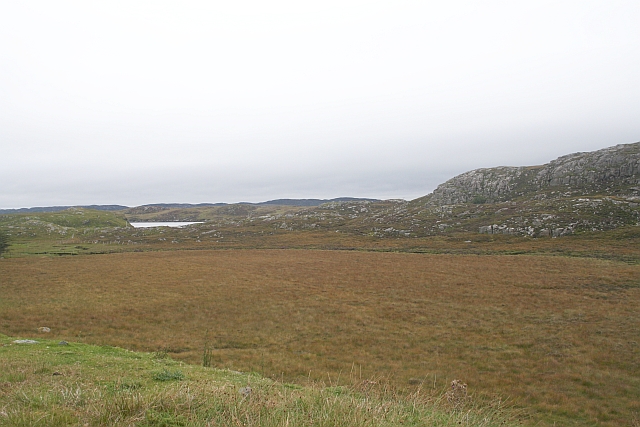
Cnoc Mhic Neil Images

Images are sourced within 2km of 58.170974/-6.7823823 or Grid Reference NB1830. Thanks to Geograph Open Source API. All images are credited.

Up above the old road This is not country in which to venture without navigations skills. It's boggy, and many of the ups and downs are not pronounced enough to generate contours. We were able to park on the old road - visible on the 1:25000 OS map - and it was a slightly boggy walk up onto rock. One of little lochans in the square can be seen, as can a typical "knock" of Lewisian gneiss. The (somewhat dilapidated) fence to my west could not be seen from where I took the photo.
Up above the old road
This is not country in which to venture without navigations skills. It's boggy, and many of the ups and downs are not pronounced enough to generate contours. We were able to park on the old road - visible on the 1:25000 OS map - and it was a slightly boggy walk up onto rock. One of little lochans in the square can be seen, as can a typical "knock" of Lewisian gneiss. The (somewhat dilapidated) fence to my west could not be seen from where I took the photo.
Cycling the B8059 The hills of Harris on the skyline
Cycling the B8059
The hills of Harris on the skyline
B8059 and the lochs leading in to the Lewis-Harris borderlands This string of linked lochs have 'Faoghail' in their names; this is the Gaelic word for ford.
B8059 and the lochs leading in to the Lewis-Harris borderlands
This string of linked lochs have 'Faoghail' in their names; this is the Gaelic word for ford.
Lewis bus shelter
Lewis bus shelter
Loch Speireag Viewed from the B8059 road. The hills of North Harris in view.
Loch Speireag
Viewed from the B8059 road. The hills of North Harris in view.
Loch Sgàire Viewed from the B8059 road from Great Bernera.
Loch Sgàire
Viewed from the B8059 road from Great Bernera.
Aird na Faoghalach Rocky landscape interspersed with peat bog.
Aird na Faoghalach
Rocky landscape interspersed with peat bog.
View southwards from above Loch Sgaire The main road south of Garynahine crosses Loch Sgaire on a causeway.  The line of the road can be seen by the telegraph wires.  Loch Sgaire is one extremity of the complex of interlocking lochs that feed into Loch Langavat.  This view is taken from the side road to Great Bernera.
View southwards from above Loch Sgaire
The main road south of Garynahine crosses Loch Sgaire on a causeway. The line of the road can be seen by the telegraph wires. Loch Sgaire is one extremity of the complex of interlocking lochs that feed into Loch Langavat. This view is taken from the side road to Great Bernera.
Loch Speireig The loch has a very interesting small circular island that could well be a man-made, iron age, dun or crannog.
Loch Speireig
The loch has a very interesting small circular island that could well be a man-made, iron age, dun or crannog.
Loch Sgaire Nice reflections on a calm and sunny day.
Loch Sgaire
Nice reflections on a calm and sunny day.
Boggy and rocky Often in this type of country, getting up onto a bit of high ground reveals a lochan or just a little pool to add a bit of interest. Not here. The high ground is on the lower slopes of Beinn Sgarastaigh, but with a summit height of 98 m, and difficult navigation through peat hags, no one is likely to get excited about it.
Boggy and rocky
Often in this type of country, getting up onto a bit of high ground reveals a lochan or just a little pool to add a bit of interest. Not here. The high ground is on the lower slopes of Beinn Sgarastaigh, but with a summit height of 98 m, and difficult navigation through peat hags, no one is likely to get excited about it.
Abandoned croft house near Lundal
Beinn Scarastaigh from near Lundale A large rocky hill about 1km to the southeast,
Beinn Scarastaigh from near Lundale
A large rocky hill about 1km to the southeast,
Building remains, Lundal, Isle of Lewis Looking towards the head of Tòb Lundale, an inlet on Loch Ròg.
Building remains, Lundal, Isle of Lewis
Looking towards the head of Tòb Lundale, an inlet on Loch Ròg.
Loch Ruadh Under the small but very rocky peak of Teathabhal.
Loch Ruadh
Under the small but very rocky peak of Teathabhal.
Peat Bogs at the Source of the Lundale River The various streams form the river Lundale which flows north to Tob Lundale and into Loch Rog. Beyond the valley is the hill of Cnoc Mhi Neil.
Peat Bogs at the Source of the Lundale River
The various streams form the river Lundale which flows north to Tob Lundale and into Loch Rog. Beyond the valley is the hill of Cnoc Mhi Neil.
Druim a Chruidh The flat peat bog hides the small Lundale river and several tributaries which flow into Tob Lundale.
Druim a Chruidh
The flat peat bog hides the small Lundale river and several tributaries which flow into Tob Lundale.
Lundale River Beneath Cleite na Cloich Ard.
Lundale River
Beneath Cleite na Cloich Ard.
Show me another place!

Cnoc Mhic Neil is located at Grid Ref: NB1830 (Lat: 58.170974, Lng: -6.7823823)

Unitary Authority: Na h-Eileanan an Iar

Police Authority: Highlands and Islands

What 3 Words

///presented.shorter.pranced. Near Carloway, Na h-Eileanan Siar

Nearby Locations

Cnoc Mhic Neil

Related Wikis

Eilean Chearstaidh

Eilean Kearstay (Scottish Gaelic: Eilean Chearstaigh) is an uninhabited island in Loch Roag in the Outer Hebrides of Scotland. It lies south east of Great...

Callanish Stones

The Callanish Stones (or "Callanish I": Scottish Gaelic: Clachan Chalanais or Tursachan Chalanais) are an arrangement of standing stones placed in a cruciform...

Callanish

Callanish (Scottish Gaelic: Calanais) is a village (township) on the west side of the Isle of Lewis, in the Outer Hebrides (Western Isles), Scotland. Callanish...

Callanish II

The Callanish II stone circle (Scottish Gaelic: Cnoc Ceann a' Gharaidh) is one of many megalithic structures around the better-known (and larger) Calanais...

Callanish IV

The Callanish IV stone circle (Scottish Gaelic: Ceann Hulavig) is one of many megalithic structures around the better-known (and larger) Calanais I on...

Callanish III

The Callanish III stone circle (Scottish Gaelic: Cnoc Fillibhir Bheag) is one of many megalithic structures around the better-known (and larger) Calanais...

Callanish VIII

The Callanish VIII stone setting is one of many megalithic structures around the better-known (and larger) Calanais I on the west coast of the Isle of...

Ceabhaigh

Ceabhaigh is a small island in an arm of Loch Ròg on the west coast of Lewis in the Outer Hebrides of Scotland. It is about 25 hectares (62 acres) in extent...

Nearby Amenities

Located within 500m of 58.170974,-6.7823823
Passing Place
Lat/Long: 58.1744698/-6.7789521
Passing Place
Lat/Long: 58.1731415/-6.7772406
Passing Place
Lat/Long: 58.1720078/-6.7749614
Passing Place
Lat/Long: 58.172436/-6.7756507
Gearraidh Creag Ni Mhurchaidh
Place: locality
Lat/Long: 58.1731904/-6.7752975
The data included in this document is from www.openstreetmap.org. The data is made available under ODbL.

Have you been to Cnoc Mhic Neil?

Leave your review of Cnoc Mhic Neil below (or comments, questions and feedback).