Cnoc Beag na h-Uidhe

Hill, Mountain in Ross-shire

Scotland

Cnoc Beag na h-Uidhe

Rocks in Loch Langabhat, Isle of Lewis Looking towards the mountains of North Harris.

The headland on the left also lies within the grid square.

There are several lochs with this name on Lewis.  This one is the longest freshwater loch on the island and is over seven miles long.
Rocks in Loch Langabhat, Isle of Lewis Credit: Claire Pegrum

Cnoc Beag na h-Uidhe is a prominent hill located in Ross-shire, Scotland. It is situated in the Northwest Highlands, approximately 5 miles northeast of the town of Ullapool. With an elevation of 561 meters (1,841 feet), it is considered a significant landmark in the area.

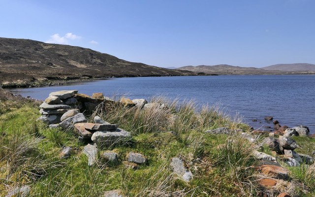
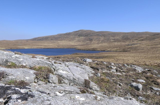
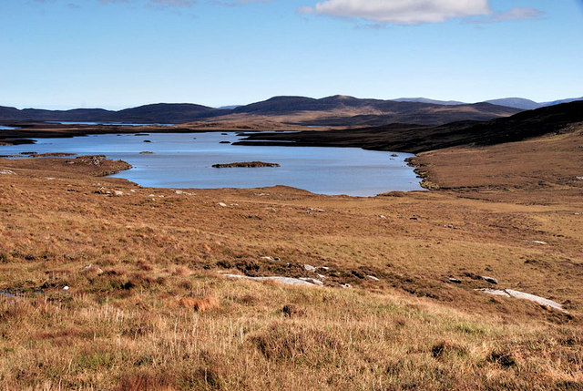
The hill is characterized by its rugged and rocky terrain, typical of the Scottish Highlands. It is composed mainly of Torridonian sandstone, which gives it a distinct reddish-brown color. Cnoc Beag na h-Uidhe is part of a larger mountain range known as the Beinn Dearg group, which includes several other notable peaks.

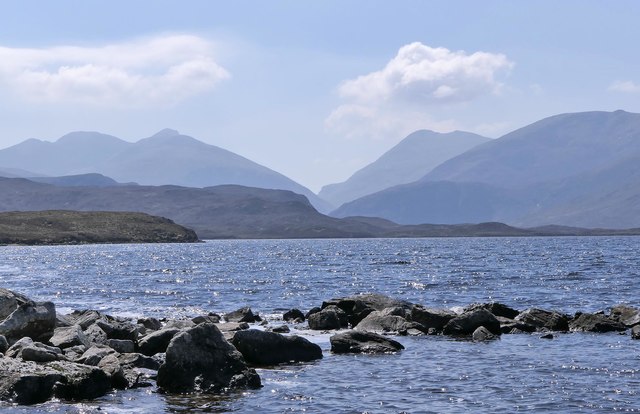
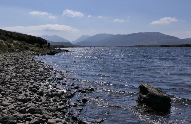
The ascent to the summit of Cnoc Beag na h-Uidhe can be challenging, as it involves steep slopes and rough terrain. However, the effort is rewarded with breathtaking panoramic views of the surrounding landscape. On a clear day, visitors can see the vast expanse of Loch Broom to the west, as well as the peaks of the nearby mountains such as Beinn Dearg and Cona' Mheall.

The hill is a popular destination for hikers and mountaineers, attracting outdoor enthusiasts from both the local area and beyond. It offers a range of routes and trails suitable for different skill levels, providing opportunities for both leisurely walks and more adventurous climbs.

Cnoc Beag na h-Uidhe is not only a natural attraction but also holds historical and cultural significance. It stands as a testament to the rich heritage of the Scottish Highlands, providing a glimpse into the region's geological past and offering a connection to the land's ancient roots.

If you have any feedback on the listing, please let us know in the comments section below.

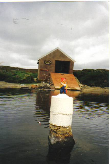
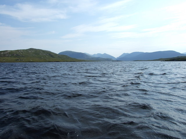
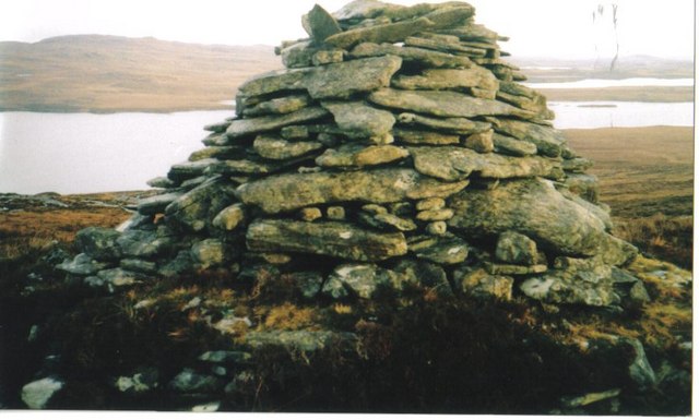
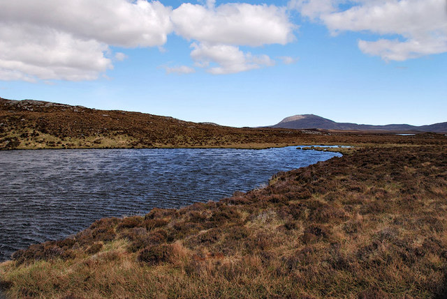
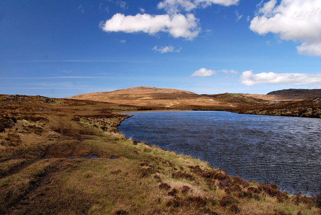
Cnoc Beag na h-Uidhe Images

Images are sourced within 2km of 58.082187/-6.7821735 or Grid Reference NB1820. Thanks to Geograph Open Source API. All images are credited.

Rocks in Loch Langabhat, Isle of Lewis Looking towards the mountains of North Harris.

The headland on the left also lies within the grid square.

There are several lochs with this name on Lewis.  This one is the longest freshwater loch on the island and is over seven miles long.
Rocks in Loch Langabhat, Isle of Lewis
Looking towards the mountains of North Harris. The headland on the left also lies within the grid square. There are several lochs with this name on Lewis. This one is the longest freshwater loch on the island and is over seven miles long.
Shieling hut by Loch Langabhat, Isle of Lewis Shielings were moorland summer grazings for cattle.  Shieling huts (often also referred to as shielings) were dwellings located within the shieling.  They were usually occupied from May until the “flitting” in September.  In early May the men of a village would go onto the moor to check and repair the shieling huts.  They would be joined by the women and children for one night before the men returned to the village to tend to crops or to travel away for summer work such as fishing.  The women and children would spend the summer at the shielings tending the cattle and making cheese and butter, some of which was for immediate use but most was salted to preserve it for the winter.  Peat cutting for fuel would also be done.  Evenings would be spent making music and story telling.  Visits were made between the shielings of different villages.

The shieling huts were made from materials available in the immediate vicinity.  They usually had walls made of stone or turf, turf roofs and compacted earth or clay floors.  In coastal areas and on the islands rafters would be made from locally collected driftwood.  Usually there would be a single doorway, facing away from the prevailing wind (although some shieling huts have two doors opposite each other), and often no windows.  Furniture built into shieling huts included stone or turf beds covered with heather, turf seats and cupboards and niches built into the stone wall, often one above the door.  Other furniture would be carried out onto the moor for the season.  In places where the practice of using shielings continued into the 20th century, shieling huts can be found which are constructed making more extensive use of timber than in the traditional type, along with other materials such as tin and bitumen.  There are also examples of buses and caravans used as shieling huts.

The Clearances and ongoing changes in agricultural methods meant that the shieling tradition had generally ended by the close of the nineteenth century.  In places it continued for longer and, particularly on Lewis, some shieling huts are still used today during the peat cutting season and as summer retreats.

The remains of shieling huts can be seen as

changes in vegetation: <a href="https://www.geograph.org.uk/photo/1962348">ND1340 : Shieling site by the Allt a' Cheracher</a> ;
shieling mounds where successive shieling huts have been built on the same site: <a href="https://www.geograph.org.uk/photo/5238987">NB5059 : Shieling mounds by the Abhainn Dhail, Isle of Lewis</a> ;
footings: <a href="https://www.geograph.org.uk/photo/5027765">NB5357 : Shieling footings beside the Feadan Mòr, Isle of Lewis</a> ; and
more substantial remains: <a href="https://www.geograph.org.uk/photo/5238993">NB3040 : Shieling above Gleann Leitir, Isle of Lewis</a> .

Examples of modern shielings are shown at:

<a href="https://www.geograph.org.uk/photo/5238999">NB5458 : Shieling, Airigh A' Bhealaich, Isle of Lewis</a> and <a href="https://www.geograph.org.uk/photo/5048077">NB5458 : Disused shieling, Airigh A' Bhealaich, Isle of Lewis</a> .
Shieling hut by Loch Langabhat, Isle of Lewis
Shielings were moorland summer grazings for cattle. Shieling huts (often also referred to as shielings) were dwellings located within the shieling. They were usually occupied from May until the “flitting” in September. In early May the men of a village would go onto the moor to check and repair the shieling huts. They would be joined by the women and children for one night before the men returned to the village to tend to crops or to travel away for summer work such as fishing. The women and children would spend the summer at the shielings tending the cattle and making cheese and butter, some of which was for immediate use but most was salted to preserve it for the winter. Peat cutting for fuel would also be done. Evenings would be spent making music and story telling. Visits were made between the shielings of different villages. The shieling huts were made from materials available in the immediate vicinity. They usually had walls made of stone or turf, turf roofs and compacted earth or clay floors. In coastal areas and on the islands rafters would be made from locally collected driftwood. Usually there would be a single doorway, facing away from the prevailing wind (although some shieling huts have two doors opposite each other), and often no windows. Furniture built into shieling huts included stone or turf beds covered with heather, turf seats and cupboards and niches built into the stone wall, often one above the door. Other furniture would be carried out onto the moor for the season. In places where the practice of using shielings continued into the 20th century, shieling huts can be found which are constructed making more extensive use of timber than in the traditional type, along with other materials such as tin and bitumen. There are also examples of buses and caravans used as shieling huts. The Clearances and ongoing changes in agricultural methods meant that the shieling tradition had generally ended by the close of the nineteenth century. In places it continued for longer and, particularly on Lewis, some shieling huts are still used today during the peat cutting season and as summer retreats. The remains of shieling huts can be seen as changes in vegetation: ND1340 : Shieling site by the Allt a' Cheracher ; shieling mounds where successive shieling huts have been built on the same site: NB5059 : Shieling mounds by the Abhainn Dhail, Isle of Lewis ; footings: NB5357 : Shieling footings beside the Feadan Mòr, Isle of Lewis ; and more substantial remains: NB3040 : Shieling above Gleann Leitir, Isle of Lewis . Examples of modern shielings are shown at: NB5458 : Shieling, Airigh A' Bhealaich, Isle of Lewis and NB5458 : Disused shieling, Airigh A' Bhealaich, Isle of Lewis .
Rocks above Loch Moglabhat, Isle of Lewis Looking towards Slèiteachal Mhòr.
Rocks above Loch Moglabhat, Isle of Lewis
Looking towards Slèiteachal Mhòr.
Loch Langabhat, Isle of Lewis Looking towards the mountains of North Harris.

There are several lochs with this name on Lewis. This one is the longest freshwater loch on the island and is over seven miles long.
Loch Langabhat, Isle of Lewis
Looking towards the mountains of North Harris. There are several lochs with this name on Lewis. This one is the longest freshwater loch on the island and is over seven miles long.
Boat House Loch Langabhat The gnome, marking an underwater rock, left home in a winter storm.
Boat House Loch Langabhat
The gnome, marking an underwater rock, left home in a winter storm.
Loch Langavat This image shows Loch Langavat and the hills of North harris, on the left is Cleit Faof, behind that in the distance is Liuthaid, on the right is the Rapaire and behind is Stulaval.
Loch Langavat
This image shows Loch Langavat and the hills of North harris, on the left is Cleit Faof, behind that in the distance is Liuthaid, on the right is the Rapaire and behind is Stulaval.
Beehive Dwelling A number of these ancient dwellings are found near the summit of Ascleit.
Loch Coirigerod in background.
The structures have survived amazingly well and some say they are over 2000 years old.
Beehive Dwelling
A number of these ancient dwellings are found near the summit of Ascleit. Loch Coirigerod in background. The structures have survived amazingly well and some say they are over 2000 years old.
Loch Coire Geurad This is the view of the NW corner of Loch Coire Geurad. This loch eventually runs into the much larger Loch Langabhat.
Loch Coire Geurad
This is the view of the NW corner of Loch Coire Geurad. This loch eventually runs into the much larger Loch Langabhat.
Loch Cul Làimhe Bige Loch Cul Làimhe Bige south east corner, this runs into a larger area of water, Loch Bruaiche Bheibheat.
Loch Cul Làimhe Bige
Loch Cul Làimhe Bige south east corner, this runs into a larger area of water, Loch Bruaiche Bheibheat.
Loch Cul Làimhe Bige Looking towards the northern shore of this very pretty little loch.
Loch Cul Làimhe Bige
Looking towards the northern shore of this very pretty little loch.
Show me another place!

Cnoc Beag na h-Uidhe is located at Grid Ref: NB1820 (Lat: 58.082187, Lng: -6.7821735)

Unitary Authority: Na h-Eileanan an Iar

Police Authority: Highlands and Islands

What 3 Words

///skinning.skate.hero. Near Leurbost, Na h-Eileanan Siar

Related Wikis

Eilean Mòr, Loch Langavat

Eilean Mòr is an island in Loch Langavat on the Isle of Lewis in the Outer Hebrides of Scotland. == Footnotes ==

Airidh a' Bhruaich

Airidh a' Bhruaich (Arivruaich - anglicised) is a scattered crofting township in the South Lochs district of the Isle of Lewis in the Outer Hebrides of...

Gisla Hydro-Electric Scheme

Gisla Hydro-Electric Scheme was a small scheme promoted by the North of Scotland Hydro-Electric Board on the Isle of Lewis, Outer Hebrides, Scotland. It...

Seaforth Island

There is also a Seaforth Island in the Whitsunday Islands of Queensland, AustraliaSeaforth Island (Scottish Gaelic: Eilean Shìphoirt/Shìophoirt or Mulag...

Ardvourlie Castle

Ardvourlie Castle is a 19th-century country house on Harris, one of the Western Isles off the north-west coast of Scotland. The house was built beside...

Nearby Amenities

Located within 500m of 58.082187,-6.7821735
Tòb na Creige Ruaidhe
Natural: bay
Lat/Long: 58.0828904/-6.7897912
The data included in this document is from www.openstreetmap.org. The data is made available under ODbL.

Have you been to Cnoc Beag na h-Uidhe?

Leave your review of Cnoc Beag na h-Uidhe below (or comments, questions and feedback).