Cnoc nan Uan
Hill, Mountain in Ross-shire
Scotland
Cnoc nan Uan
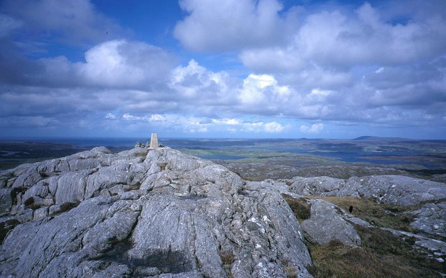
Cnoc nan Uan is a prominent hill located in the county of Ross-shire, Scotland. It is situated in the beautiful region of the Highlands, near the village of Rosskeen. Rising to an elevation of 330 meters (1,083 feet), Cnoc nan Uan is classified as a hill rather than a mountain, but it offers stunning panoramic views of the surrounding landscape.
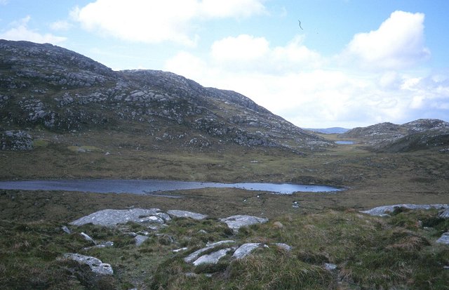
The hill is a popular destination for hikers and outdoor enthusiasts due to its accessibility and breathtaking scenery. The ascent to the summit is relatively straightforward, with well-defined paths and trails leading to the top. As visitors make their way up, they are treated to sweeping vistas of the Scottish Highlands, including rolling green hills, shimmering lochs, and distant mountains.
Cnoc nan Uan is rich in natural beauty and biodiversity. The hill is covered in heather, providing a vibrant display of purple hues during the summer months. It is also home to a variety of wildlife, including red deer, mountain hares, and various bird species. Nature lovers can spot these creatures while exploring the hill’s diverse ecosystems.
Additionally, Cnoc nan Uan has historical significance as it is home to an ancient burial site. Archaeological remains dating back thousands of years have been discovered in the area, adding to its allure for history enthusiasts.
Overall, Cnoc nan Uan offers a wonderful opportunity to experience the splendor of the Scottish Highlands, combining natural beauty, wildlife, and cultural heritage in one captivating location.
If you have any feedback on the listing, please let us know in the comments section below.
Cnoc nan Uan Images
Images are sourced within 2km of 58.177345/-6.8169212 or Grid Reference NB1631. Thanks to Geograph Open Source API. All images are credited.
Cnoc nan Uan is located at Grid Ref: NB1631 (Lat: 58.177345, Lng: -6.8169212)
Unitary Authority: Na h-Eileanan an Iar
Police Authority: Highlands and Islands
What 3 Words
///toast.parked.crinkled. Near Carloway, Na h-Eileanan Siar
Nearby Locations
Related Wikis

Callanish VIII
The Callanish VIII stone setting is one of many megalithic structures around the better-known (and larger) Calanais I on the west coast of the Isle of...

Eilean Chearstaidh
Eilean Kearstay (Scottish Gaelic: Eilean Chearstaigh) is an uninhabited island in Loch Roag in the Outer Hebrides of Scotland. It lies south east of Great...

Dun Bharabhat, Great Bernera
Dun Bharabhat (or Dun Baravat) is an Iron Age galleried dun or "semi-broch" situated on the island of Great Bernera near Lewis in Scotland (grid reference...

Callanish Stones
The Callanish Stones (or "Callanish I": Scottish Gaelic: Clachan Chalanais or Tursachan Chalanais) are an arrangement of standing stones placed in a cruciform...
Nearby Amenities
Located within 500m of 58.177345,-6.8169212Have you been to Cnoc nan Uan?
Leave your review of Cnoc nan Uan below (or comments, questions and feedback).