Cnoc Beag Iònail

Hill, Mountain in Ross-shire

Scotland

Cnoc Beag Iònail

West coast of Great Bernera This is the west side of a spit of land extending south of Tobson. The ground is rocky with a thin covering of grass.

In the distance, on the left is the tip of the island of Pabaigh Mor .. and on the right Geodha Mor (west of Tobson).
West coast of Great Bernera Credit: Rob Burke

Cnoc Beag Iònail is a prominent hill located in Ross-shire, Scotland. Situated in the Scottish Highlands, it is part of the expansive mountainous region that characterizes the area. With a height of approximately 600 meters (1,968 feet), Cnoc Beag Iònail offers stunning panoramic views of the surrounding landscape.

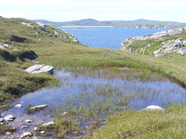
The hill is known for its rugged and rocky terrain, typical of the Scottish Highlands. Its slopes are covered in heather, creating a vibrant purple hue during the blooming season. The hilltop is marked by a cairn, a traditional stone pile used as a navigation landmark by hikers and mountaineers.

The ascent to Cnoc Beag Iònail can be challenging, with steep gradients and uneven paths. However, it is a popular destination for outdoor enthusiasts, offering a rewarding and invigorating experience. The hill provides various hiking and walking routes, allowing visitors to explore the natural beauty of the region.

The surrounding area is rich in wildlife, including red deer, mountain hares, and various bird species. Nature lovers can often spot these animals during their hike up Cnoc Beag Iònail. The hill is also a great spot for birdwatching, with the chance to observe species such as golden eagles and peregrine falcons.

Cnoc Beag Iònail is a picturesque and tranquil location, providing a peaceful retreat away from the hustle and bustle of everyday life. Its natural beauty and breathtaking views make it a must-visit destination for those seeking a true Scottish Highland experience.

If you have any feedback on the listing, please let us know in the comments section below.

Cnoc Beag Iònail Images

Images are sourced within 2km of 58.22359/-6.8508897 or Grid Reference NB1536. Thanks to Geograph Open Source API. All images are credited.

West coast of Great Bernera This is the west side of a spit of land extending south of Tobson. The ground is rocky with a thin covering of grass.

In the distance, on the left is the tip of the island of Pabaigh Mor .. and on the right Geodha Mor (west of Tobson).
West coast of Great Bernera
This is the west side of a spit of land extending south of Tobson. The ground is rocky with a thin covering of grass. In the distance, on the left is the tip of the island of Pabaigh Mor .. and on the right Geodha Mor (west of Tobson).
Beach north of Bhalasaigh
Sea loch west of Loch Veiravat Although it isn't obvious from here, this is the start of a long channel that leads out to the sea.
Sea loch west of Loch Veiravat
Although it isn't obvious from here, this is the start of a long channel that leads out to the sea.
Moorland and loch on Great Bernera The loch is unnamed on the map, but the Allt Loch an Fheoir flows into it, so this must be Loch an Fheoir.

The houses in the distance are on the road south of Bhalasaigh.
Moorland and loch on Great Bernera
The loch is unnamed on the map, but the Allt Loch an Fheoir flows into it, so this must be Loch an Fheoir. The houses in the distance are on the road south of Bhalasaigh.
Waymarked coastal walk There are clear waymarks on the route from the community centre to Bosta on Great Bernera. Return by the same route or on the road.
Waymarked coastal walk
There are clear waymarks on the route from the community centre to Bosta on Great Bernera. Return by the same route or on the road.
Bridge at Bhalasaigh Looking back to the road end on the main island of Great Bernera.
Bridge at Bhalasaigh
Looking back to the road end on the main island of Great Bernera.
West coast of Great Bernera A complicated coastline with many interesting features.
West coast of Great Bernera
A complicated coastline with many interesting features.
War Memorial, Breacleit The memorial stands on a mound at the crossroads in the centre of Breacleit / Breaclete, the capital of Great Bernera / Bearnaraigh. On the skyline is the Bernera Community Centre.
<span class="nowrap"><a title="http://www.uigandbernera.com/" rel="nofollow ugc noopener" href="http://www.uigandbernera.com/">Link</a><img style="margin-left:2px;" alt="External link" title="External link - shift click to open in new window" src="https://s1.geograph.org.uk/img/external.png" width="10" height="10"/></span>
War Memorial, Breacleit
The memorial stands on a mound at the crossroads in the centre of Breacleit / Breaclete, the capital of Great Bernera / Bearnaraigh. On the skyline is the Bernera Community Centre. LinkExternal link
Breacleit, Bernera Summer flowers, church and school in the village centre.
<span class="nowrap"><a title="http://www.uigandbernera.com/" rel="nofollow ugc noopener" href="http://www.uigandbernera.com/">Link</a><img style="margin-left:2px;" alt="External link" title="External link - shift click to open in new window" src="https://s1.geograph.org.uk/img/external.png" width="10" height="10"/></span>
Breacleit, Bernera
Summer flowers, church and school in the village centre. LinkExternal link
Loch Ionail Freshwater loch on the island of Great Bernera / Bearnaraigh.
<span class="nowrap"><a title="http://www.uigandbernera.com/" rel="nofollow ugc noopener" href="http://www.uigandbernera.com/">Link</a><img style="margin-left:2px;" alt="External link" title="External link - shift click to open in new window" src="https://s1.geograph.org.uk/img/external.png" width="10" height="10"/></span>
Loch Ionail
Freshwater loch on the island of Great Bernera / Bearnaraigh. LinkExternal link
Tob Bhalasaigh Tidal lagoon with a mix of rare seaweeds on Great Bernera / Bearnaraigh.
<span class="nowrap"><a title="http://www.uigandbernera.com/" rel="nofollow ugc noopener" href="http://www.uigandbernera.com/">Link</a><img style="margin-left:2px;" alt="External link" title="External link - shift click to open in new window" src="https://s1.geograph.org.uk/img/external.png" width="10" height="10"/></span>
Tob Bhalasaigh
Tidal lagoon with a mix of rare seaweeds on Great Bernera / Bearnaraigh. LinkExternal link
Valasay Bridge Carrying the single track road across an outlet of the tidal lagoon, Tob Bhalasaigh on Great Bernera / Bearnaraigh.
<span class="nowrap"><a title="http://www.uigandbernera.com/" rel="nofollow ugc noopener" href="http://www.uigandbernera.com/">Link</a><img style="margin-left:2px;" alt="External link" title="External link - shift click to open in new window" src="https://s1.geograph.org.uk/img/external.png" width="10" height="10"/></span>
Valasay Bridge
Carrying the single track road across an outlet of the tidal lagoon, Tob Bhalasaigh on Great Bernera / Bearnaraigh. LinkExternal link
Shoreline at Tob Bhalasaigh Rocks and heather at the edge of the tidal lagoon in Valasay.
<span class="nowrap"><a title="http://www.uigandbernera.com/" rel="nofollow ugc noopener" href="http://www.uigandbernera.com/">Link</a><img style="margin-left:2px;" alt="External link" title="External link - shift click to open in new window" src="https://s1.geograph.org.uk/img/external.png" width="10" height="10"/></span>
Shoreline at Tob Bhalasaigh
Rocks and heather at the edge of the tidal lagoon in Valasay. LinkExternal link
Valasay Footbridge The bridge across the tidal Tob Bhalasaigh was built in 1898.
<span class="nowrap"><a title="http://www.uigandbernera.com/" rel="nofollow ugc noopener" href="http://www.uigandbernera.com/">Link</a><img style="margin-left:2px;" alt="External link" title="External link - shift click to open in new window" src="https://s1.geograph.org.uk/img/external.png" width="10" height="10"/></span>
Valasay Footbridge
The bridge across the tidal Tob Bhalasaigh was built in 1898. LinkExternal link
Tidal Lagoon, Valasay Tob Bhalasaigh, on the island of Great Bernera / Bearnaraigh.
<span class="nowrap"><a title="http://www.uigandbernera.com/" rel="nofollow ugc noopener" href="http://www.uigandbernera.com/">Link</a><img style="margin-left:2px;" alt="External link" title="External link - shift click to open in new window" src="https://s1.geograph.org.uk/img/external.png" width="10" height="10"/></span>
Tidal Lagoon, Valasay
Tob Bhalasaigh, on the island of Great Bernera / Bearnaraigh. LinkExternal link
Tob Bhalasaigh from the Footbridge View northwards, along the narrow tidal lagoon, to Tobson 2 kilometres away in the distance.
Tob Bhalasaigh from the Footbridge
View northwards, along the narrow tidal lagoon, to Tobson 2 kilometres away in the distance.
Poll Ula On the indistinct coastal path along the west coast of great Bernera / Bearnaraigh. Well placed wooden marker posts are easy to follow.
<span class="nowrap"><a title="http://www.uigandbernera.com/" rel="nofollow ugc noopener" href="http://www.uigandbernera.com/">Link</a><img style="margin-left:2px;" alt="External link" title="External link - shift click to open in new window" src="https://s1.geograph.org.uk/img/external.png" width="10" height="10"/></span>
Poll Ula
On the indistinct coastal path along the west coast of great Bernera / Bearnaraigh. Well placed wooden marker posts are easy to follow. LinkExternal link
Above Geodha nan Uan On the Bernera coastal path with view across the sound to Traigh na Beirigh at Valtos.
<span class="nowrap"><a title="http://www.uigandbernera.com/" rel="nofollow ugc noopener" href="http://www.uigandbernera.com/">Link</a><img style="margin-left:2px;" alt="External link" title="External link - shift click to open in new window" src="https://s1.geograph.org.uk/img/external.png" width="10" height="10"/></span>
Above Geodha nan Uan
On the Bernera coastal path with view across the sound to Traigh na Beirigh at Valtos. LinkExternal link
Show me another place!

Cnoc Beag Iònail is located at Grid Ref: NB1536 (Lat: 58.22359, Lng: -6.8508897)

Unitary Authority: Na h-Eileanan an Iar

Police Authority: Highlands and Islands

What 3 Words

///twit.travels.makeovers. Near Carloway, Na h-Eileanan Siar

Related Wikis

Great Bernera

Great Bernera (; Scottish Gaelic: Beàrnaraigh Mòr), often known just as Bernera (Scottish Gaelic: Beàrnaraigh), is an island and community in the Outer...

Dun Bharabhat, Great Bernera

Dun Bharabhat (or Dun Baravat) is an Iron Age galleried dun or "semi-broch" situated on the island of Great Bernera near Lewis in Scotland (grid reference...

Breaclete

Breacleit (or Roulanish; Scottish Gaelic: Breacleit; Old Norse: Breiðiklettr) is the central village on Great Bernera in the Outer Hebrides, Scotland....

Callanish VIII

The Callanish VIII stone setting is one of many megalithic structures around the better-known (and larger) Calanais I on the west coast of the Isle of...

Nearby Amenities

Located within 500m of 58.22359,-6.8508897
Barrier: cattle_grid
Source: OS_OpenData_StreetView
Lat/Long: 58.2243959/-6.8498775
Passing Place
Lat/Long: 58.2246093/-6.8483755
Passing Place
Lat/Long: 58.2258039/-6.8460364
Passing Place
Lat/Long: 58.2241946/-6.8518696
Passing Place
Lat/Long: 58.2225704/-6.8535942
Passing Place
Lat/Long: 58.2239613/-6.8527617
Passing Place
Lat/Long: 58.2226617/-6.8550771
Passing Place
Lat/Long: 58.2224113/-6.8560578
Passing Place
Lat/Long: 58.2238421/-6.8581214
Passing Place
Lat/Long: 58.2234516/-6.8576332
Passing Place
Lat/Long: 58.2229602/-6.8574263
Power: pole
Lat/Long: 58.2264994/-6.8449419
Power: pole
Lat/Long: 58.2262618/-6.8451992
Power: pole
Lat/Long: 58.225715/-6.8458221
Power: pole
Lat/Long: 58.2251317/-6.8466947
Power: pole
Lat/Long: 58.2245177/-6.8476623
Power: pole
Lat/Long: 58.2244323/-6.8484827
Power: pole
Lat/Long: 58.2243004/-6.8496837
Power: pole
Lat/Long: 58.2240919/-6.8516596
Power: pole
Lat/Long: 58.223776/-6.8522527
Power: pole
Lat/Long: 58.2231078/-6.8528271
Power: pole
Lat/Long: 58.22261/-6.8531705
Power: pole
Lat/Long: 58.2219503/-6.8536506
Power: pole
Lat/Long: 58.2223982/-6.8548447
Power: pole
Lat/Long: 58.2225733/-6.8552731
Power: pole
Lat/Long: 58.2229362/-6.8562134
Power: pole
Lat/Long: 58.2234302/-6.857483
Power: pole
Lat/Long: 58.2237701/-6.8580641
Power: pole
Lat/Long: 58.2242073/-6.8588164
Power: pole
Lat/Long: 58.2220899/-6.8556178
Power: pole
Lat/Long: 58.2217965/-6.8565014
Power: pole
Lat/Long: 58.2210462/-6.8566064
Power: pole
Lat/Long: 58.2203651/-6.8566628
The data included in this document is from www.openstreetmap.org. The data is made available under ODbL.

Have you been to Cnoc Beag Iònail?

Leave your review of Cnoc Beag Iònail below (or comments, questions and feedback).