Uisgneabhal Mòr

Hill, Mountain in Inverness-shire

Scotland

Uisgneabhal Mòr

Mulla bho Thuath Looking towards Teileasbhal.
Mulla bho Thuath Credit: Alan Reid

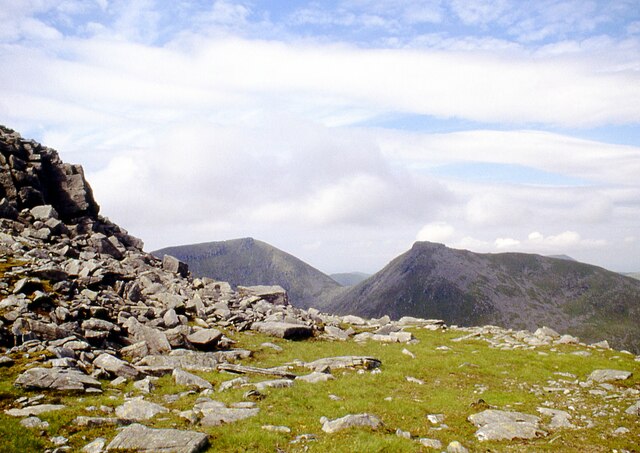
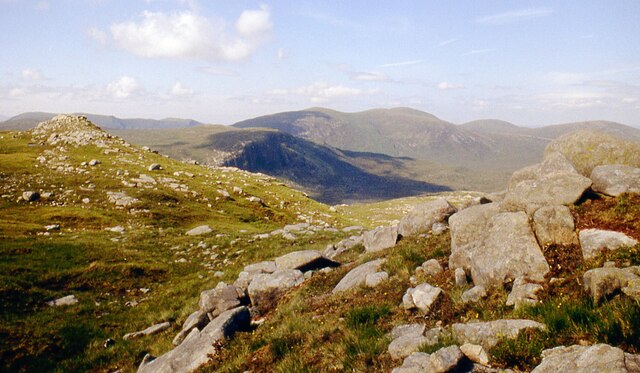
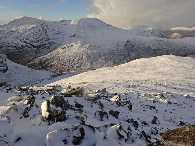
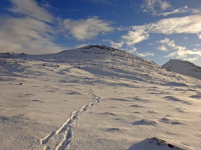
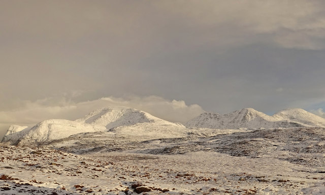
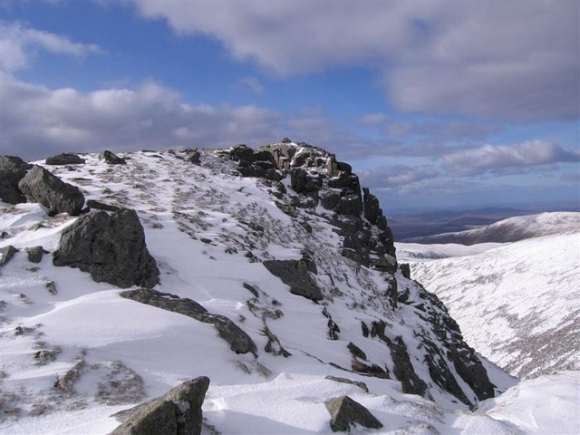
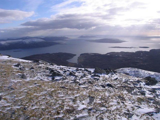
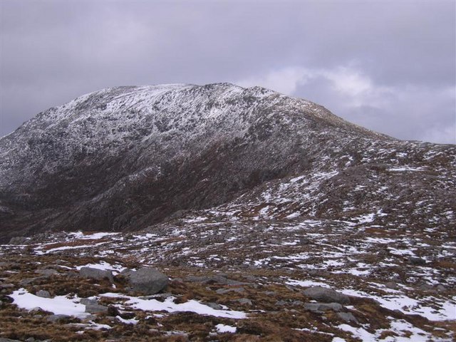
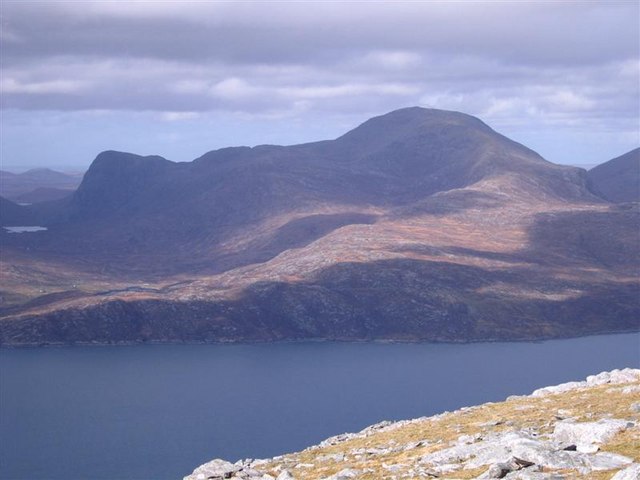
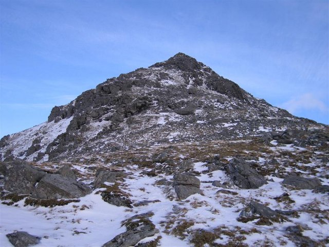
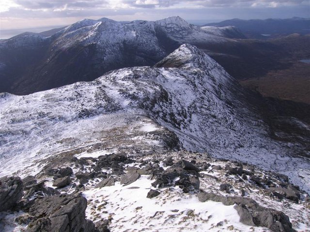
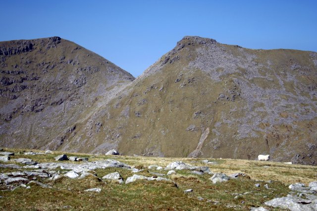
Uisgneabhal Mòr, also known as Uiskenaval More, is a prominent hill located in Inverness-shire, Scotland. Standing at an elevation of 729 meters (2,392 feet), it is a part of the North Harris range in the Western Isles.

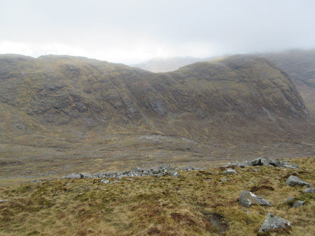
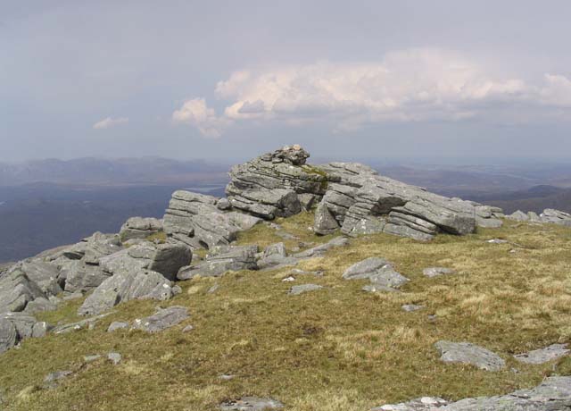
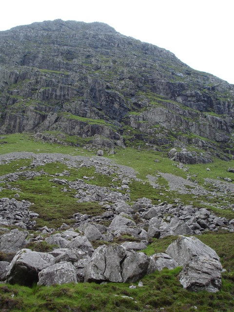
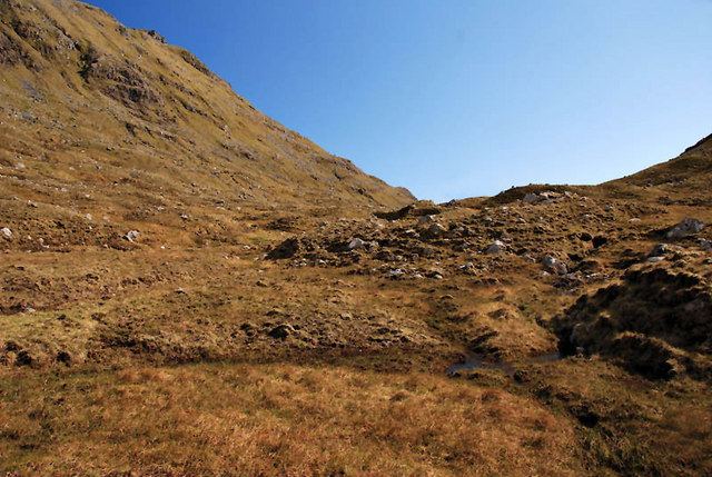
Uisgneabhal Mòr is a majestic mountain that offers breathtaking panoramic views of the surrounding landscape. Its rugged and rocky terrain makes it a popular destination for hikers and mountaineers looking for a challenging adventure. The ascent to the summit is steep and requires a moderate level of fitness, but the rewarding vistas make it well worth the effort.

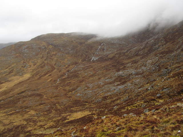
The hill is covered in heather and grasses, providing a haven for wildlife and wildflowers. Visitors may spot a variety of bird species, including golden eagles and peregrine falcons, soaring above the mountain slopes. The hillside also supports a diverse range of plant life, including mountain avens, heath spotted orchids, and bog cotton.

Uisgneabhal Mòr holds historical significance as well. It is believed to have been an important site for the Neolithic and Bronze Age peoples, as evidenced by the presence of ancient cairns and standing stones in the vicinity.

Whether it is for its natural beauty, challenging hiking trails, or historical significance, Uisgneabhal Mòr is a must-visit destination for outdoor enthusiasts and history buffs alike. Its remote location and rugged charm make it an idyllic escape for those seeking solitude and connection with nature.

If you have any feedback on the listing, please let us know in the comments section below.

Uisgneabhal Mòr Images

Images are sourced within 2km of 57.972957/-6.8712507 or Grid Reference NB1208. Thanks to Geograph Open Source API. All images are credited.

Mulla bho Thuath Looking towards Teileasbhal.
Mulla bho Thuath
Looking towards Teileasbhal.
Mulla bho Thuath
Mulla bho Thuath
Above Gleann Mhiabhaig Descending the peak of Teileasbhal on a fine winters day looking across Gleann Mhiabhaig to the peaks of Oireabhal and Ulabhal.
Above Gleann Mhiabhaig
Descending the peak of Teileasbhal on a fine winters day looking across Gleann Mhiabhaig to the peaks of Oireabhal and Ulabhal.
Teileasbhal Looking back up our descent route from the fine peak of Teileasbhal. The Graham of Uisgneabhal Mor can be seen at the right.
Teileasbhal
Looking back up our descent route from the fine peak of Teileasbhal. The Graham of Uisgneabhal Mor can be seen at the right.
Across The Moor From the high moorland above the B887 in west Harris looking towards on the left the Graham of Uisgneabhal Mor and on right the horseshoe of the Corbett of Clisham. A fine day to be out in the wilds of Harris.
Across The Moor
From the high moorland above the B887 in west Harris looking towards on the left the Graham of Uisgneabhal Mor and on right the horseshoe of the Corbett of Clisham. A fine day to be out in the wilds of Harris.
Uisgneabhal Beag Uisgneabhal Beag is a spur on the western side of the "graham" Uisgneabhal Mor (in the clouds to the right). The stream, Abhainn Unasta, can be seen splitting into two for a short section.
Uisgneabhal Beag
Uisgneabhal Beag is a spur on the western side of the "graham" Uisgneabhal Mor (in the clouds to the right). The stream, Abhainn Unasta, can be seen splitting into two for a short section.
Gleann Uislaitir Looking across the steep sided Gleann Uislaitir to the north western ridge of Uisgneabhal Mor, leading to the top of Sron Scourst.
Gleann Uislaitir
Looking across the steep sided Gleann Uislaitir to the north western ridge of Uisgneabhal Mor, leading to the top of Sron Scourst.
Summit of Uisgneabhal Mor, North Harris A 3 hour blizzard in the morning was followed by a brilliantly cold sunny afternoon. Uisgneabhal Mor has only modest height at 729 metres but is part of a small rugged group of hills culminating in the near vertical face of Sron Scourst which dominates the eastern side of Gleinn Miabhaig.
Summit of Uisgneabhal Mor, North Harris
A 3 hour blizzard in the morning was followed by a brilliantly cold sunny afternoon. Uisgneabhal Mor has only modest height at 729 metres but is part of a small rugged group of hills culminating in the near vertical face of Sron Scourst which dominates the eastern side of Gleinn Miabhaig.
View south-west from the Summit of Uisgneabhal Mor This view was taken from close to the summit looking south-west down the west coast of South Harris. The view leads out over Loch Mhiabhaig and the larger island is Taransay of "Castaway fame".
View south-west from the Summit of Uisgneabhal Mor
This view was taken from close to the summit looking south-west down the west coast of South Harris. The view leads out over Loch Mhiabhaig and the larger island is Taransay of "Castaway fame".
The south-eastern ridge of Uisgneabhal Mor, North Harris Climbing up the eastern side of Gleinn Mhiabhaig, through heathery bog, you eventually emerge on a plateau from which the south-eastern ridge provides an easy  route onto the summit.
The south-eastern ridge of Uisgneabhal Mor, North Harris
Climbing up the eastern side of Gleinn Mhiabhaig, through heathery bog, you eventually emerge on a plateau from which the south-eastern ridge provides an easy route onto the summit.
The Uisgneabheal Mòr Hills, North Harris This Supplemental image of Uisgneabhal Mòr and its neighbouring ridges was taken from the summit of Beinn Dhubh. Note the steep cliffs of Sròn Scourst on the left, falling near vertically for almost 1500 feet.
The Uisgneabheal Mòr Hills, North Harris
This Supplemental image of Uisgneabhal Mòr and its neighbouring ridges was taken from the summit of Beinn Dhubh. Note the steep cliffs of Sròn Scourst on the left, falling near vertically for almost 1500 feet.
North-west face of Uisgneabheal Mòr, North Harris The steep, rocky slopes of the north-west face contrast with the easy south-east ridge which is the usual ascent. Descending these slopes takes you down to a bealach from which it is possible to escape down to Gleann Miabhaig, via steep heathery slopes. But continuation of this route also takes you to the top of Sròn Scourst.
North-west face of Uisgneabheal Mòr, North Harris
The steep, rocky slopes of the north-west face contrast with the easy south-east ridge which is the usual ascent. Descending these slopes takes you down to a bealach from which it is possible to escape down to Gleann Miabhaig, via steep heathery slopes. But continuation of this route also takes you to the top of Sròn Scourst.
Sron Scourst, North Harris This is the view of the pointed summit of Sron Scourst after descending the north-western slopes of Uisgnabheal Mor. An escape route down to Gleinn Miabhaig can be taken on the left on the easier ground, but is very steep and slippery in places, especially after wet weather.
Sron Scourst, North Harris
This is the view of the pointed summit of Sron Scourst after descending the north-western slopes of Uisgnabheal Mor. An escape route down to Gleinn Miabhaig can be taken on the left on the easier ground, but is very steep and slippery in places, especially after wet weather.
The summit of Teilesval in North Harris This hill at 697m is part of a small group of hills to the West of Clisham. It forms a twin summit with the nearby Uisgnaval Mor to the Southwest.
The summit of Teilesval in North Harris
This hill at 697m is part of a small group of hills to the West of Clisham. It forms a twin summit with the nearby Uisgnaval Mor to the Southwest.
The summit of Uisgnaval Mor This cairn marks the 729m summit of Uisgnaval Mor in North Harris.
The summit of Uisgnaval Mor
This cairn marks the 729m summit of Uisgnaval Mor in North Harris.
Sron Scourst The cliffs of Sron Scourst from the track below.
Sron Scourst
The cliffs of Sron Scourst from the track below.
Summits of Uisgneabhal Mor and Teileasbhal from the An Clisham Horseshoe Two peaks that are strangely symmetrical from certain angles  - taken from the An Clisham Horseshoe, - where perhaps it's not the case
Summits of Uisgneabhal Mor and Teileasbhal from the An Clisham Horseshoe
Two peaks that are strangely symmetrical from certain angles - taken from the An Clisham Horseshoe, - where perhaps it's not the case
Valley and Stream A valley with a small stream running through the hills of North Harris.
Valley and Stream
A valley with a small stream running through the hills of North Harris.
Show me another place!

Uisgneabhal Mòr is located at Grid Ref: NB1208 (Lat: 57.972957, Lng: -6.8712507)

Unitary Authority: Na h-Eileanan an Iar

Police Authority: Highlands and Islands

What 3 Words

///tearfully.dragons.music. Near Tarbert, Na h-Eileanan Siar

Nearby Locations

Uisgneabhal Mòr

Related Wikis

Uisgneabhal Mor

Uisgnabhal Mor (729 m) is a mountain in Harris, in the Outer Hebrides of Scotland. A complex mountain of several ridges and summits, it lies in the centre...

Oireabhal

Oireabhal (662 m) is a mountain in Harris, in the Outer Hebrides of Scotland. The peak is the highest point on a complex ridge that runs from north to...

Bun Abhainn Eadarra

Bun Abhainn Eadarra or Bunavoneadar is a hamlet adjacent to the Loch Bun Abhainn Eadarra, on the south shore of North Harris, in the Outer Hebrides, Scotland...

Ardhasaig

Ardhasaig (Scottish Gaelic: Àird Àsaig) is a settlement on the western coast of north Harris, in the Outer Hebrides, Scotland. Ardhasaig is also within...

Chliostair Hydro-Electric Scheme

Chliostair Hydro-Electric Scheme is a small scheme promoted by the North of Scotland Hydro-Electric Board on Harris, Outer Hebrides. It consists of a single...

Uladail

Uladail is a location near Amhuinnsuidhe, on Harris in the Outer Hebrides, Scotland. Sron Ulladail is a sheer cliff which at 370 metres (1,210 ft) is one...

Soay Sound

Soay Sound (Scottish Gaelic: Caolas Shòdhaigh) is a strait separating the islands of Soay Mòr and Soay Beag from the northern part of Harris. The sound...

West Loch Tarbert

West Loch Tarbert (Scottish Gaelic: Loch A Siar) is a sea loch that separates the northern and southern parts of Harris in the Outer Hebrides of Scotland...

Nearby Amenities

Located within 500m of 57.972957,-6.8712507
Uisgneabhal Mòr
Corbett: no
Ele: 729
Graham: yes
Marilyn: yes
Munro: no
Name En: Uisgnaval Mòr
Name Gd: Uisgneabhal Mòr
Natural: peak
Prominence: 482
Source: OS7
Lat/Long: 57.9729891/-6.8712384
The data included in this document is from www.openstreetmap.org. The data is made available under ODbL.

Have you been to Uisgneabhal Mòr?

Leave your review of Uisgneabhal Mòr below (or comments, questions and feedback).