Creag Stulabhal

Hill, Mountain in Inverness-shire

Scotland

Creag Stulabhal

Cairn an Duine (The Cairn of the man) On the pass leading down to Loch Langabhat, just visible in the distance. Oral tradition is that a man was murdered and buried nearby in times gone by. I'm surprised the cairn does not feature on the map of the area.
Cairn an Duine (The Cairn of the man) Credit: JJM

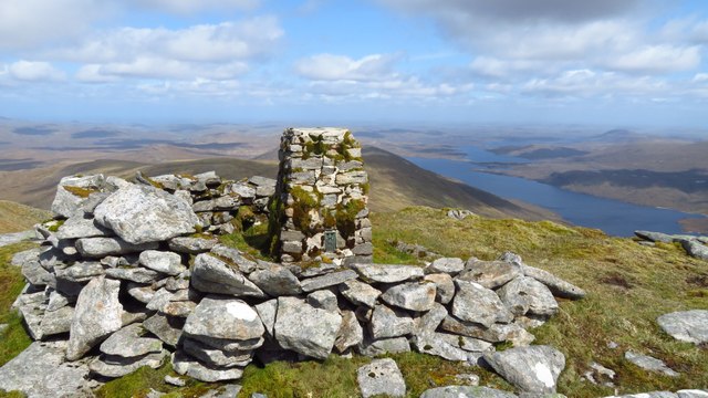
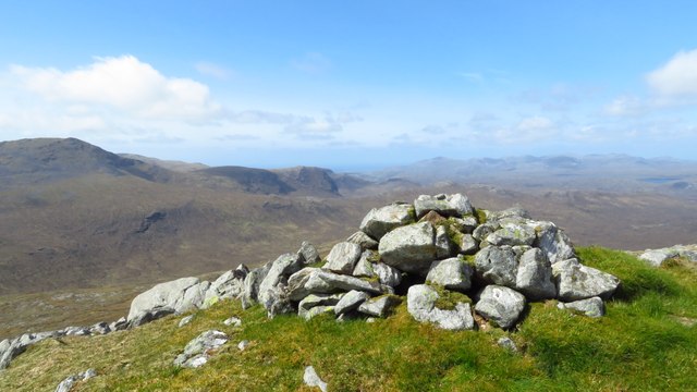
Creag Stulabhal is a prominent hill located in Inverness-shire, Scotland. It is positioned approximately 10 kilometers northwest of the village of Gairloch and lies within the stunning Wester Ross area. With an elevation of 720 meters (2,362 feet), Creag Stulabhal stands tall and offers breathtaking views of the surrounding landscape.

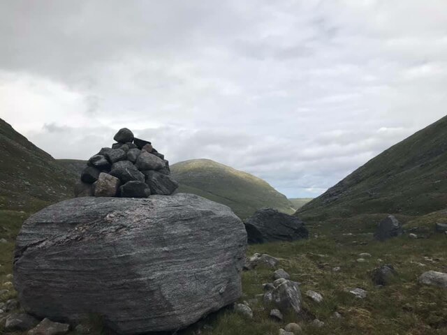
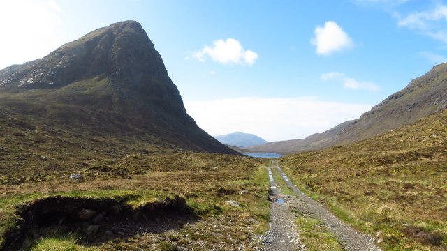
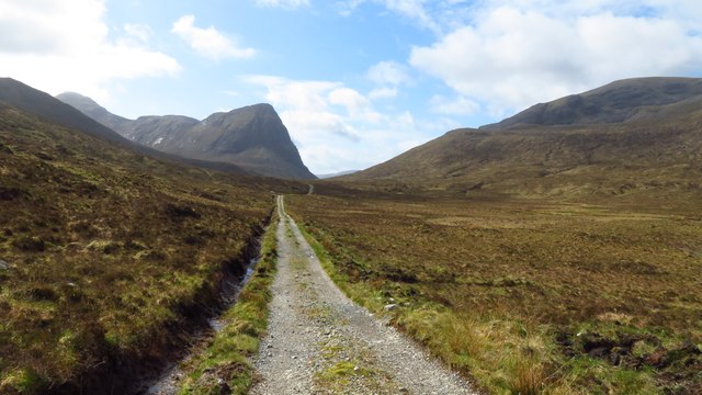
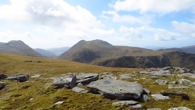
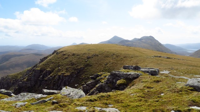
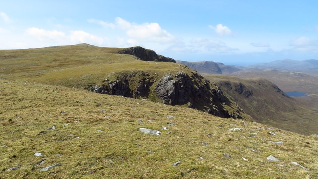
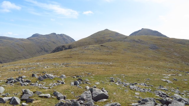
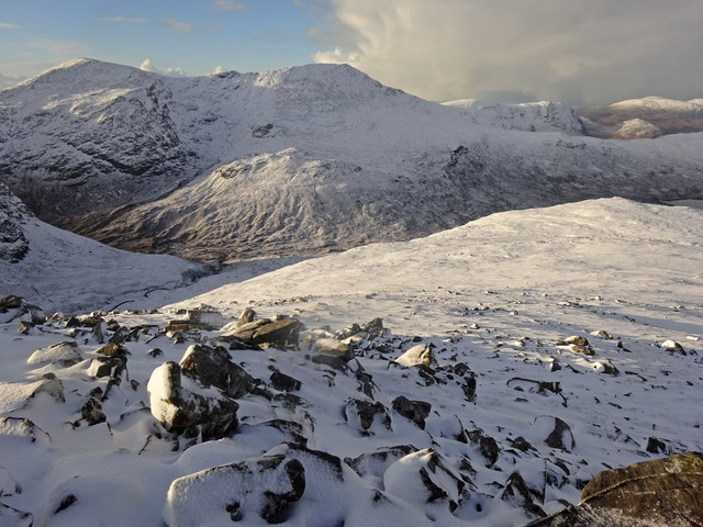
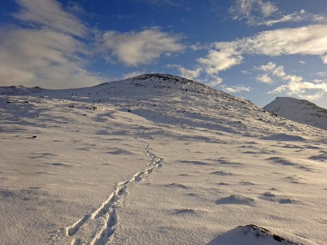
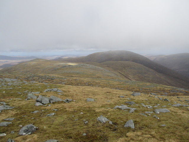
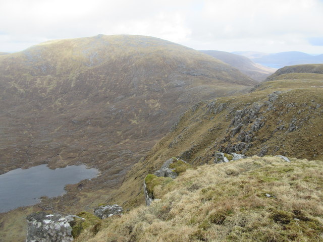
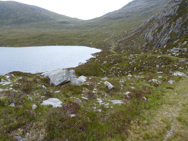
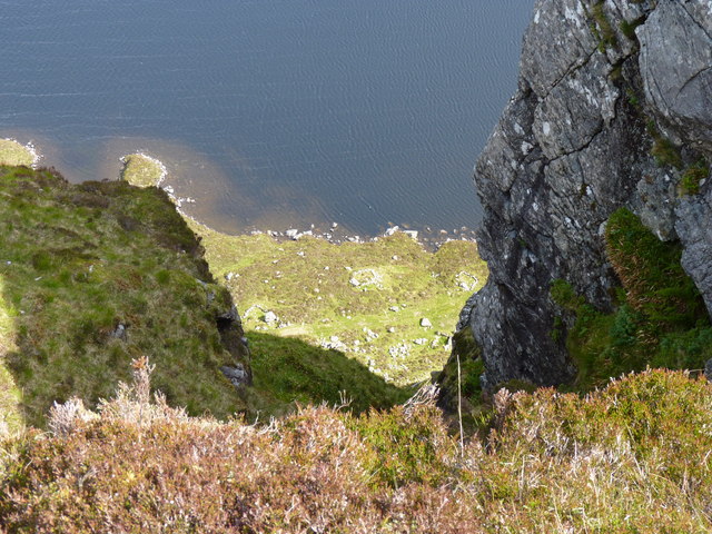
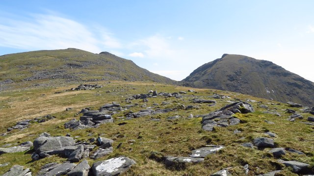
The hill is known for its rugged terrain and is a popular destination for hikers and nature enthusiasts. It boasts a distinctive conical shape, with steep slopes covered in heather and scattered rocky outcrops. As visitors ascend, they are treated to panoramic vistas of the surrounding mountains, lochs, and the vast expanse of the Atlantic Ocean.

Creag Stulabhal is also home to an abundance of wildlife, making it a haven for nature lovers. Birdwatchers can spot various species, including golden eagles and red-throated divers, soaring above the hill. The surrounding moorland provides a habitat for grouse, while hares and deer can be seen roaming freely.

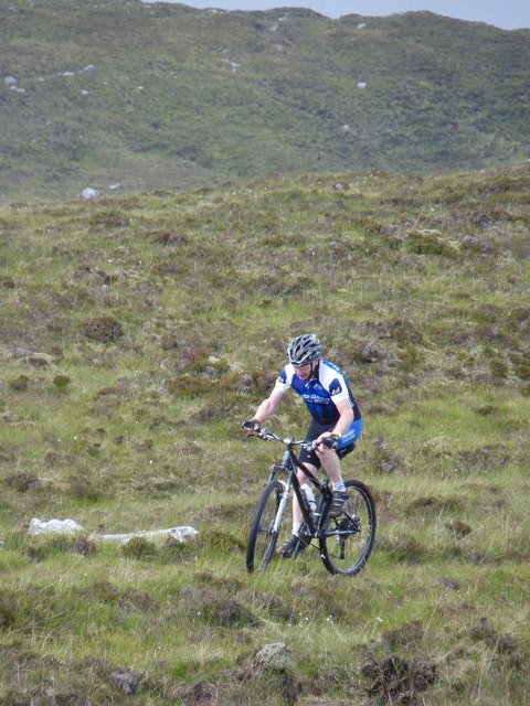
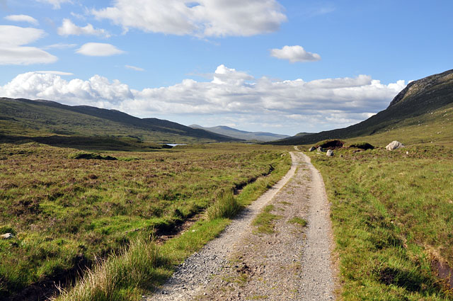
The hill offers several routes for climbers and hillwalkers, catering to different levels of experience and fitness. The most common ascent begins from the north and follows a well-defined path that gradually steepens. However, caution is advised as the weather conditions can change rapidly, and the terrain can be challenging, especially during the winter months.

Overall, Creag Stulabhal is a captivating and picturesque hill in Inverness-shire, offering a rewarding outdoor experience for those seeking adventure and natural beauty.

If you have any feedback on the listing, please let us know in the comments section below.

Creag Stulabhal Images

Images are sourced within 2km of 57.995178/-6.8742918 or Grid Reference NB1211. Thanks to Geograph Open Source API. All images are credited.

Cairn an Duine (The Cairn of the man) On the pass leading down to Loch Langabhat, just visible in the distance. Oral tradition is that a man was murdered and buried nearby in times gone by. I'm surprised the cairn does not feature on the map of the area.
Cairn an Duine (The Cairn of the man)
On the pass leading down to Loch Langabhat, just visible in the distance. Oral tradition is that a man was murdered and buried nearby in times gone by. I'm surprised the cairn does not feature on the map of the area.
View south along track towards Sron Scourst
Summit trig point on Stulabhal with view towards Loch Langabhat
Summit plateau on Stulabhal with view towards Teileasbhal
Summit plateau on Stulabhal with view towards An Cliseam & Mulla bho Thuath
Crags leading towards Creag Stulabhal
Summit of Creag Stulabhal
Broad ridge leading south from Creag Stulabhal towards Teileasbhal
Above Gleann Mhiabhaig Descending the peak of Teileasbhal on a fine winters day looking across Gleann Mhiabhaig to the peaks of Oireabhal and Ulabhal.
Above Gleann Mhiabhaig
Descending the peak of Teileasbhal on a fine winters day looking across Gleann Mhiabhaig to the peaks of Oireabhal and Ulabhal.
Teileasbhal Looking back up our descent route from the fine peak of Teileasbhal. The Graham of Uisgneabhal Mor can be seen at the right.
Teileasbhal
Looking back up our descent route from the fine peak of Teileasbhal. The Graham of Uisgneabhal Mor can be seen at the right.
North ridge of Teileasbhal The ridge opens out into a plateau with nice walking conditions. Rare for Harris!
North ridge of Teileasbhal
The ridge opens out into a plateau with nice walking conditions. Rare for Harris!
Loch Stuladail Gleann Stuladail is another steep sided glen. Across the glen is the hill of Stulabhal.
Loch Stuladail
Gleann Stuladail is another steep sided glen. Across the glen is the hill of Stulabhal.
Cyclist on the track above Gleann Stulidail
Loch Chleistir and the path from Loch Bhoisimid
Rock face above Loch Stulabhal
Ridge running southeast towards Teileasbhal with Uisgneabhal Mor beyond
Track in Glen Meavaig The estate track just after crossing the watershed, leading to the fishing lochs.
Track in Glen Meavaig
The estate track just after crossing the watershed, leading to the fishing lochs.
Show me another place!

Creag Stulabhal is located at Grid Ref: NB1211 (Lat: 57.995178, Lng: -6.8742918)

Unitary Authority: Na h-Eileanan an Iar

Police Authority: Highlands and Islands

What 3 Words

///position.proposals.enough. Near Tarbert, Na h-Eileanan Siar

Related Wikis

Uisgneabhal Mor

Uisgnabhal Mor (729 m) is a mountain in Harris, in the Outer Hebrides of Scotland. A complex mountain of several ridges and summits, it lies in the centre...

Oireabhal

Oireabhal (662 m) is a mountain in Harris, in the Outer Hebrides of Scotland. The peak is the highest point on a complex ridge that runs from north to...

Uladail

Uladail is a location near Amhuinnsuidhe, on Harris in the Outer Hebrides, Scotland. Sron Ulladail is a sheer cliff which at 370 metres (1,210 ft) is one...

Chliostair Hydro-Electric Scheme

Chliostair Hydro-Electric Scheme is a small scheme promoted by the North of Scotland Hydro-Electric Board on Harris, Outer Hebrides. It consists of a single...

Nearby Amenities

Located within 500m of 57.995178,-6.8742918
Creag Stulabhal
Name En: Craig Stulaval
Name Gd: Creag Stulabhal
Natural: peak
Source: OS7
Lat/Long: 57.9952699/-6.8752153
The data included in this document is from www.openstreetmap.org. The data is made available under ODbL.

Have you been to Creag Stulabhal?

Leave your review of Creag Stulabhal below (or comments, questions and feedback).