New Park

Downs, Moorland in Oxfordshire West Oxfordshire

England

New Park

Pintle Stripe near Charlbury Pintle Stripe is a thin lengthy copse on the Hundley Way track near Charlbury in Oxfordshire.
Pintle Stripe near Charlbury Credit: SA Mathieson

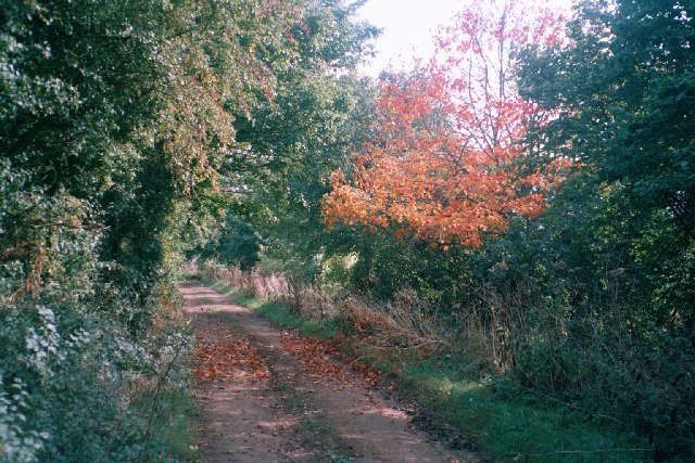
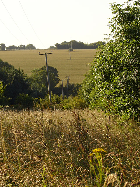
New Park, located in Oxfordshire, England, is a picturesque area known for its stunning downs and moorland landscapes. Covering an expansive area, this region is a haven for nature lovers and outdoor enthusiasts.

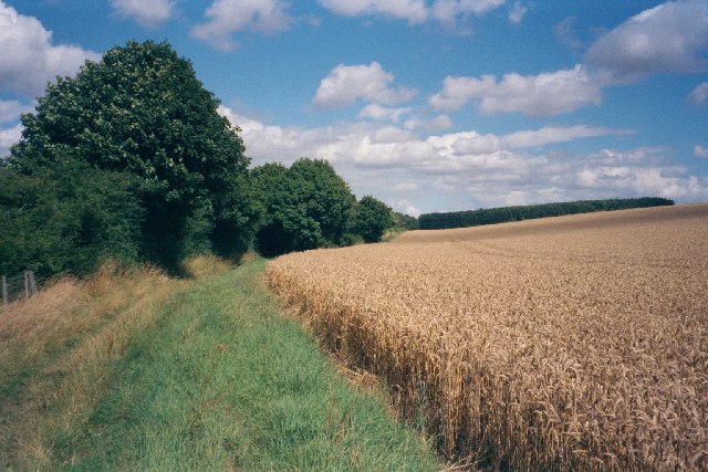
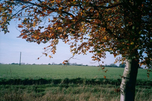
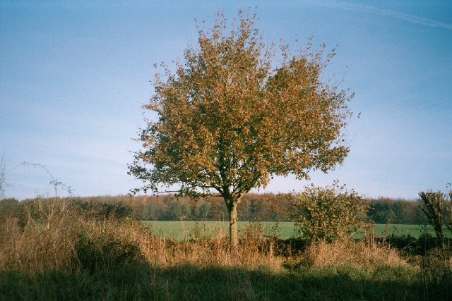
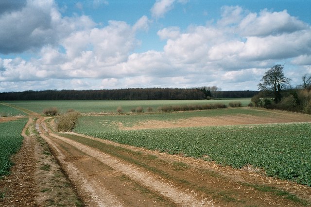
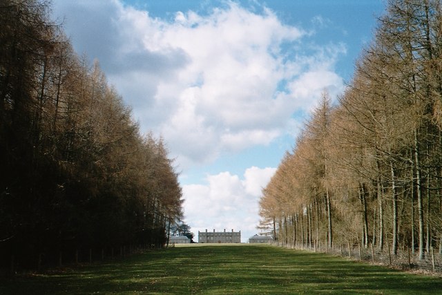
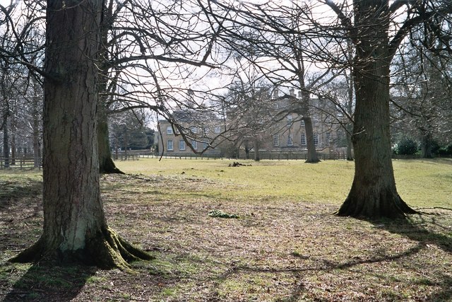
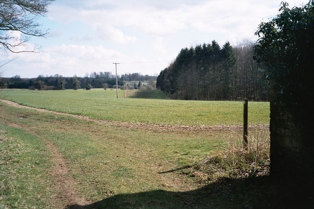
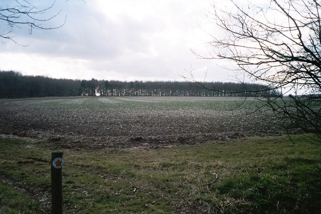
The downs of New Park offer breathtaking panoramic views, with rolling hills covered in lush green grass and dotted with vibrant wildflowers. This landscape is perfect for leisurely walks, picnics, and even kite flying, as the open space allows for uninterrupted enjoyment of the surroundings.

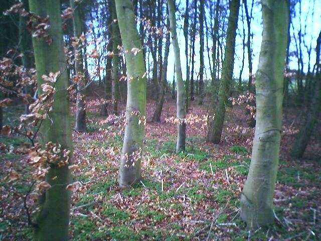
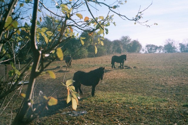
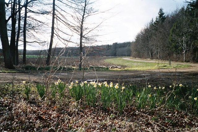
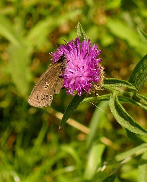
In contrast, the moorland of New Park presents a more rugged and untamed experience. Here, visitors can explore the vast expanse of heather-covered terrain, which transforms into a beautiful purple carpet during the blooming season. This area is home to a diverse array of wildlife, including birds of prey, deer, and various species of plants and insects.

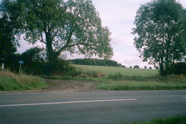
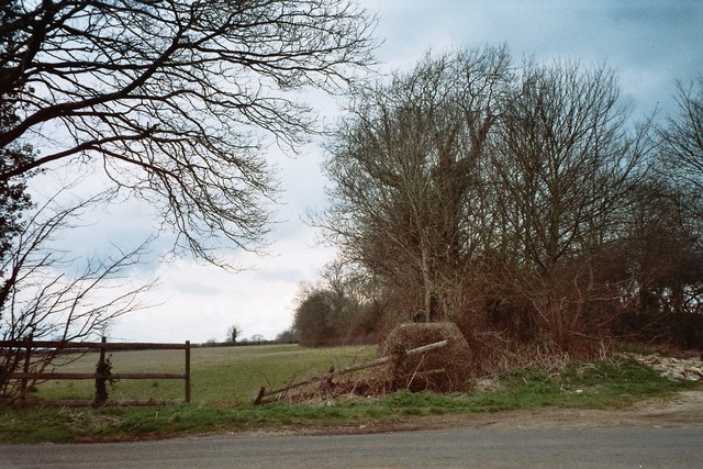
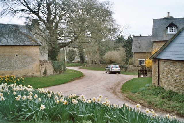
New Park is also known for its rich historical and cultural significance. It is home to several ancient archaeological sites, such as burial mounds and stone circles, providing a glimpse into the region's past. Furthermore, the park boasts a network of well-maintained footpaths and trails, allowing visitors to easily navigate the area and discover its hidden treasures.

With its stunning natural beauty, diverse ecosystems, and historical significance, New Park in Oxfordshire offers a unique and enriching experience for visitors of all ages. Whether you are seeking a peaceful retreat or an adventurous exploration, this area is sure to captivate and inspire.

If you have any feedback on the listing, please let us know in the comments section below.

New Park Images

Images are sourced within 2km of 51.890573/-1.4485114 or Grid Reference SP3821. Thanks to Geograph Open Source API. All images are credited.

Pintle Stripe near Charlbury Pintle Stripe is a thin lengthy copse on the Hundley Way track near Charlbury in Oxfordshire.
Pintle Stripe near Charlbury
Pintle Stripe is a thin lengthy copse on the Hundley Way track near Charlbury in Oxfordshire.
Hundley Way This track goes from the edge of Charlbury to another path on the edge of the Ditchley estate. On the horizon is Pintle Barn, a small line of woodland.
Hundley Way
This track goes from the edge of Charlbury to another path on the edge of the Ditchley estate. On the horizon is Pintle Barn, a small line of woodland.
Paddock near Charlbury This small paddock is surrounded by much larger open fields. It is on a path from Charlbury to Dustfield Farm.
Paddock near Charlbury
This small paddock is surrounded by much larger open fields. It is on a path from Charlbury to Dustfield Farm.
Unsuitable for motors This image is taken facing east across the B4022 from Charlbury to Enstone, up a minor road marked 'Unsuitable for motors' (the blue sign on the left of the image) which becomes a track going south-east towards Stonesfield: <a href="https://www.geograph.org.uk/photo/85427">SP3721 : Track near Norman's Grove</a> is about half a mile away in this direction. Going west, another minor road runs this crossroads to Taston <a href="https://www.geograph.org.uk/gridref/SP3522">SP3522</a>: this is suitable for motors, although only just.
Unsuitable for motors
This image is taken facing east across the B4022 from Charlbury to Enstone, up a minor road marked 'Unsuitable for motors' (the blue sign on the left of the image) which becomes a track going south-east towards Stonesfield: SP3721 : Track near Norman's Grove is about half a mile away in this direction. Going west, another minor road runs this crossroads to Taston SP3522: this is suitable for motors, although only just.
Track near Norman's Grove This wide track leads east to a junction with the B4022 <a href="https://www.geograph.org.uk/photo/85424">SP3621 : Unsuitable for motors</a> and south-east towards Stonesfield: <a href="https://www.geograph.org.uk/photo/85434">SP3820 : Tree, track and field</a> is taken about a mile in this direction.
Track near Norman's Grove
This wide track leads east to a junction with the B4022 SP3621 : Unsuitable for motors and south-east towards Stonesfield: SP3820 : Tree, track and field is taken about a mile in this direction.
Tree, track and field This image is taken facing west from the side of a track that runs from the B4022 <a href="https://www.geograph.org.uk/photo/85424">SP3621 : Unsuitable for motors</a>, south-east to <a href="https://www.geograph.org.uk/photo/85427">SP3721 : Track near Norman's Grove</a>, then past an entrance to Ditchley Park, which is a few hundred yards north of this point. It then continues towards Stonesfield. The next image, just south of Dustfield Farm, is <a href="https://www.geograph.org.uk/photo/85436">SP3819 : Tree and Ash Copse</a>.
Tree, track and field
This image is taken facing west from the side of a track that runs from the B4022 SP3621 : Unsuitable for motors, south-east to SP3721 : Track near Norman's Grove, then past an entrance to Ditchley Park, which is a few hundred yards north of this point. It then continues towards Stonesfield. The next image, just south of Dustfield Farm, is SP3819 : Tree and Ash Copse.
Tree and Ash Copse This image is taken facing north-east from a track that runs south-east from the B4022 <a href="https://www.geograph.org.uk/photo/85424">SP3621 : Unsuitable for motors</a> to near Stonesfield: an image a few hundred yards north of this one is at <a href="https://www.geograph.org.uk/photo/85434">SP3820 : Tree, track and field</a>. At this stage, the track runs through large open fields, but is lined with hedgerow and trees such as this one. Ash Copse, which is also within this grid-square, is visible in the background.
Tree and Ash Copse
This image is taken facing north-east from a track that runs south-east from the B4022 SP3621 : Unsuitable for motors to near Stonesfield: an image a few hundred yards north of this one is at SP3820 : Tree, track and field. At this stage, the track runs through large open fields, but is lined with hedgerow and trees such as this one. Ash Copse, which is also within this grid-square, is visible in the background.
Track in Ditchley Park On the horizon is Shilcott Wood. These fields are almost entirely enclosed by woodland on the Ditchley Park estate. The main buildings of Ditchley <a href="https://www.geograph.org.uk/photo/151540">SP3921 : Ditchley</a> are just a few hundred yards east, but hidden by woods and the lie of the land.
Track in Ditchley Park
On the horizon is Shilcott Wood. These fields are almost entirely enclosed by woodland on the Ditchley Park estate. The main buildings of Ditchley SP3921 : Ditchley are just a few hundred yards east, but hidden by woods and the lie of the land.
Avenue of trees leading to Ditchley This half-mile avenue of trees points towards Ditchley <a href="https://www.geograph.org.uk/photo/151540">SP3921 : Ditchley</a>, which is visible on the horizon. The path is part of Shakespeare's Way, officially opened on 19 April 2006, which goes from the Globe theatre in London to the Royal Shakespeare Theatre in Stratford-upon-Avon. More information from its official web-site <span class="nowrap"><a title="http://www.shakespearesway.org/" rel="nofollow ugc noopener" href="http://www.shakespearesway.org/">Link</a><img style="margin-left:2px;" alt="External link" title="External link - shift click to open in new window" src="https://s1.geograph.org.uk/img/external.png" width="10" height="10"/></span> or from this Telegraph article: <span class="nowrap"><a title="http://www.telegraph.co.uk/news/main.jhtml?xml=/news/2006/04/19/nwalk19.xml&sSheet=/news/2006/04/19/ixhome.html" rel="nofollow ugc noopener" href="http://www.telegraph.co.uk/news/main.jhtml?xml=/news/2006/04/19/nwalk19.xml&sSheet=/news/2006/04/19/ixhome.html">Link</a><img style="margin-left:2px;" alt="External link" title="External link - shift click to open in new window" src="https://s1.geograph.org.uk/img/external.png" width="10" height="10"/></span>
Avenue of trees leading to Ditchley
This half-mile avenue of trees points towards Ditchley SP3921 : Ditchley, which is visible on the horizon. The path is part of Shakespeare's Way, officially opened on 19 April 2006, which goes from the Globe theatre in London to the Royal Shakespeare Theatre in Stratford-upon-Avon. More information from its official web-site LinkExternal link or from this Telegraph article: LinkExternal link
Ditchley Work on Ditchley started around 1720, replacing a timber house which had once hosted an entertainment for Queen Elizabeth I in 1592. The current mansion was designed by James Gibb in the Palladian style, and takes up three pages of the Pevsner guide to Oxfordshire. It is home to the Ditchley Foundations <span class="nowrap"><a title="http://www.ditchley.co.uk/" rel="nofollow ugc noopener" href="http://www.ditchley.co.uk/">Link</a><img style="margin-left:2px;" alt="External link" title="External link - shift click to open in new window" src="https://s1.geograph.org.uk/img/external.png" width="10" height="10"/></span> and hosts high-powered conferences on international affairs. At other times, the house is open to bookings for groups of visitors. Rights of way go near, but not right up, to the house. Its grounds, Ditchley Park, are mostly woodland and fields rather than formal gardens, but one exception is the avenue of trees to the south-east: <a href="https://www.geograph.org.uk/photo/151536">SP3920 : Avenue of trees leading to Ditchley</a>
Ditchley
Work on Ditchley started around 1720, replacing a timber house which had once hosted an entertainment for Queen Elizabeth I in 1592. The current mansion was designed by James Gibb in the Palladian style, and takes up three pages of the Pevsner guide to Oxfordshire. It is home to the Ditchley Foundations LinkExternal link and hosts high-powered conferences on international affairs. At other times, the house is open to bookings for groups of visitors. Rights of way go near, but not right up, to the house. Its grounds, Ditchley Park, are mostly woodland and fields rather than formal gardens, but one exception is the avenue of trees to the south-east: SP3920 : Avenue of trees leading to Ditchley
Eastern edge of Deadman's Riding Wood This is taken from a collection of buildings on a path leading eventually to Cleveley. Deadman's Riding Wood is within Ditchley Park.
Eastern edge of Deadman's Riding Wood
This is taken from a collection of buildings on a path leading eventually to Cleveley. Deadman's Riding Wood is within Ditchley Park.
Daffodils on edge of Deadman's Riding Wood This is within Ditchley Park.
Daffodils on edge of Deadman's Riding Wood
This is within Ditchley Park.
David's Plantation This line of trees is within Ditchley Park. It is relatively new, not appearing on the 1940s maps available within Geograph. This image is taken from the very short stretch of right of way within this grid-square.
David's Plantation
This line of trees is within Ditchley Park. It is relatively new, not appearing on the 1940s maps available within Geograph. This image is taken from the very short stretch of right of way within this grid-square.
Track-road junction near Taston This tree-lined track (the track is visible on the right, the trees are visible for some distance) crosses a dead-straight stretch of road between the village of Taston and the B4022. This path goes north-west to <a href="https://www.geograph.org.uk/photo/62336">SP3523 : Sharp right turn</a> and south-east, across the B4022, to run along the southern edge of Ditchley Park, including <a href="https://www.geograph.org.uk/photo/85434">SP3820 : Tree, track and field</a>.
Track-road junction near Taston
This tree-lined track (the track is visible on the right, the trees are visible for some distance) crosses a dead-straight stretch of road between the village of Taston and the B4022. This path goes north-west to SP3523 : Sharp right turn and south-east, across the B4022, to run along the southern edge of Ditchley Park, including SP3820 : Tree, track and field.
B4022 facing north-east This is the main road between Charlbury and the A44 at Enstone. To the south, it is joined by a minor road from Taston <a href="https://www.geograph.org.uk/photo/158929">SP3622 : Track-road junction near Taston</a> and then crosses another minor road at <a href="https://www.geograph.org.uk/photo/85424">SP3621 : Unsuitable for motors</a>.
B4022 facing north-east
This is the main road between Charlbury and the A44 at Enstone. To the south, it is joined by a minor road from Taston SP3622 : Track-road junction near Taston and then crosses another minor road at SP3621 : Unsuitable for motors.
Daffodils in Fulwell The road leads through this tiny Cotswold stone village into Ditchley Park, with one track leading to <a href="https://www.geograph.org.uk/photo/151544">SP3822 : Daffodils on edge of Deadman's Riding Wood</a>, where the daffodil theme is continued.
Daffodils in Fulwell
The road leads through this tiny Cotswold stone village into Ditchley Park, with one track leading to SP3822 : Daffodils on edge of Deadman's Riding Wood, where the daffodil theme is continued.
Ringlet Butterfly on a flower This butterfly was seen on a walk in Widdows Wood, which looks to be a fairly recent plantation (last 15 years at a guess). There were many of these Ringlet butterflies along side the grass walk through the young woodland. For more information on the butterfly: <span class="nowrap"><a title="http://www.butterfly-conservation.org/species/bdata/butterfly.php?code=rin" rel="nofollow ugc noopener" href="http://www.butterfly-conservation.org/species/bdata/butterfly.php?code=rin">Link</a><img style="margin-left:2px;" alt="External link" title="External link - shift click to open in new window" src="https://s1.geograph.org.uk/img/external.png" width="10" height="10"/></span>

The plant is knapweed, and there were plenty of these growing beside the walk.
Ringlet Butterfly on a flower
This butterfly was seen on a walk in Widdows Wood, which looks to be a fairly recent plantation (last 15 years at a guess). There were many of these Ringlet butterflies along side the grass walk through the young woodland. For more information on the butterfly: LinkExternal link The plant is knapweed, and there were plenty of these growing beside the walk.
Clearing in Widdows Wood Looking through the gap in the woodland across the valley (Clarke's Bottom is down in the valley).
Taken on 7/7/07 at 7:07 am.
Clearing in Widdows Wood
Looking through the gap in the woodland across the valley (Clarke's Bottom is down in the valley). Taken on 7/7/07 at 7:07 am.
Show me another place!

New Park is located at Grid Ref: SP3821 (Lat: 51.890573, Lng: -1.4485114)

Administrative County: Oxfordshire

District: West Oxfordshire

Police Authority: Thames Valley

What 3 Words

///vocally.scaffold.pointed. Near Charlbury, Oxfordshire

Related Wikis

Ditchley Park

Ditchley Park is a country house near Charlbury in Oxfordshire, England. The estate was once the site of a Roman villa. Later it became a royal hunting...

Fulwell, Oxfordshire

Fulwell is a hamlet in the civil parish of Enstone in Oxfordshire, England. It lies about 4.5 miles (7 km) southeast of Chipping Norton. Fulwell's toponym...

Pheleley Priory

Pheleley Priory was a small 12th-century Benedictine monastic community located in a detached part of Bloxham, near Charlbury, in the English county of...

Salt Way, Ditchley

Salt Way, Ditchley is a 2-hectare (4.9-acre) biological Site of Special Scientific Interest (SSSI) east of Charlbury in Oxfordshire. It is also a Local...

Have you been to New Park?

Leave your review of New Park below (or comments, questions and feedback).